Amherst County’s Cole Mountain Loop is a moderate 6 mile hike with serious payoffs at the summit. Situated in George Washington National Forest’s Pedlar Ranger District, this trail (also know as “Cold Mountain”) is one of Central Virginia’s only hikes to cross a bald, pasture-like summit. Views of the valley from the saddle and summit are open in every direction.

Christine Says…
Despite the busyness of our weekend, Adam and I made time to hike the Cole Mountain loop on Sunday morning. We had read a description of the trail on another hiking site. Their reviewer compared the summit to Scotland or Switzerland. I don’t know about that, but it was definitely some of the prettiest Virginia summit scenery I’ve ever seen.
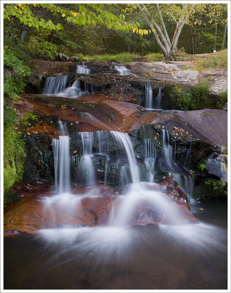
We started out from home at 5:30 in the morning. It was still dark, but we wanted to hike before the crowds and heat got too bad. We made a short detour before the hike to visit Statons Creek Falls. It was just a couple miles from the trailhead, and was well worth a look.

The forest service road to the Cole Mountain trailhead is unpaved and bumpy. There is only room for five or six cars at the parking area, which is located right at an Appalachian Trail crossing.
The hike starts out downhill along the forest service road for a couple tenths of a mile. You’ll soon pick up the blue-blazed Hotel Trail on the right side of the road. The route follows the Hotel Trail for about 3.5 miles until a junction with the Appalachian Trail (AT). The AT takes you up a series of switchbacks, across the Cole Mountain summit and eventually back down to the parking lot where you started out.


The thing I loved about this hike was the ever-changing landscape along the way. It was a perfect sampling of Virginia’s varied scenery. The trail started off winding its way down through lush, green beds of ferns sheltered by old hardwoods. After passing through a short tunnel of pines, the forest gave way to a wide meadow-like clearing filled with shoulder high wildflowers in every shade of pink, purple, yellow and white. Descending back into the forest, we saw numerous remnants from a bygone mountain farm. Crumbling stone “hog walls” and errant apple trees were easily spotted along the trail.


We took a snack break along a small stream just before the 3 mile mark. There was a fire pit and log seats that made a perfect place to enjoy some trail mix and water. We ended up taking another break a few tenths of a mile down the trail when we arrived at the Cow Camp Gap Shelter. This shelter is just one of many three-sided huts located along (or near) the Appalachian Trail. This one was especially nice. There was a checkerboard painted on the floor, with acorn cap and twig game pieces. The shelter had a newer log book, so there weren’t many entries to enjoy this time. The site also had the biggest picnic table I’ve ever seen. It made Adam look like he was hobbit-sized.
The shelter marks the beginning of the only serious uphill climb on this hike. About a half mile after leaving the shelter, you meet up with the Appalachian Trail and head north. Along the way, the forest begins to thin out, giving you glimpses of a view from rocky ledges along the trail.
Upon reaching the saddle of Cole Mountain, the terrain changes radically and instantly. The trees disappear and a wide, pasture-like alley appears across the summit. The field is dotted with giant boulders and speckled with wildflowers. It’s a great place for a picnic lunch. You certainly can’t beat the sweeping views in every direction.
Adam Says…
This truly was a wonderful hike! I don’t think this hike is very well known to those that don’t live in Central Virginia, but it is a true gem and definitely worth a trip no matter where you live. We had absolutely perfect hiking weather with beautiful blue skies, dappled with an occasional cloud. We plan on coming back down to this area soon to try the nearby hike of Mount Pleasant.
Cole Mountain is also commonly known as Cold Mountain (and is listed as such on Hiking Upward), but when we saw its official name through the USGS was Cole Mountain, we are sticking with their name. I know when I told my family about hiking Cold Mountain, they thought about the movie with Nicole Kidman and Jude Law. That Cold Mountain is actually in North Carolina, along the Blue Ridge Parkway.

To begin the circuit that we chose, we took the Hotel Trail. The origin of the name is supposedly derived from the landowner Joseph Richeson, whose house was known as The Hotel, due to the number of frequent guests.
Once you start the Hotel Trail, you will almost immediately come to a horse gate. Go through the horse gate and continue to follow the blue blazes. You will follow these blue blazes until you reach the junction with the Appalachian Trail. At .9 miles, you will reach the beautiful field of wildflowers on your left that Christine mentioned. At around 1.3 miles, you will reach a gorgeous spot for an overnight camp. I would highly recommend this to anyone that is planning on doing a backpacking trip. There is a large firepit formed with logs to sit and enjoy some S’mores over an open fire.
From the firepit, look to the northeast and you will see the blue blazes continue. At 1.7 miles, you will come across the “hog wall”, which is neat to think about people that used this area in the past. Continue down the trail until you reach the bottom of Cow Camp Gap at 2.9 miles. On our way down, I heard some strong howling off in the distant which sounded like coyotes. Since we’ve heard of this from other hikers, there must be some nearby. You will see on the other side of a small stream, the Cow Camp Gap Shelter. This is a great spot for any thru-hikers or people that just want to have a packed lunch, rest, or fill up water from the spring. We always enjoy reading the logs that thru-hikers and backpackers leave during their trips there. Once you see the shelter on the right, just stay on the trail until you reach the junction just ahead. The path to the right will take you to the shelter and the spring, but after your stop, you will take the path to the left. I imagine that during rainier times, this would be a nice spot to hear a trickling stream, but it was dried out when we were there.
From the junction at the shelter, you will have another .5 miles to reach the junction with the Appalachian Trail. At 3.5 miles, take a right (North) on the Appalachian trail. You will continue your ascent through a few switchbacks. At 3.7 miles, you will reach the first of two nice spots for an overlook at the edge of the switchback. Continue on the trail until you reach the large meadow with the summit. You will see a few vertical 4 foot high rocks sticking out of the ground. On the ground in the rock, you will see the USGS benchmark which marks the summit of Cole Mountain at 4,033 feet. Take a moment to enjoy the views at the summit and continue to follow the AT white blazes going north. You will see many gorgeous panoramic 360 degree views as you cross along the highlands for a few tenths of a mile. The scenery was truly breathtaking as we trekked across the highlands of the saddle, across the bald summit. (Note: camping and/or fires are not allowed on the bald of Cold Mountain.) At the end of the meadow at 5.2 miles, you will begin your descent into the woods and back to your vehicle. You will cross over a fire road, but stay on the white-blazed trail until you reach your vehicle.


If you are into geocaching, there are a two that you can find along the way. The first is at the “hog wall” and the second is near the summit. There was also another at Statons Creek Falls, which I feel is one of the prettiest waterfalls in Virginia. Here are links to the sites for those that are interested:
As a slightly humorous aside, we did see a couple of guys hiking that came over from another mountain. They had already hiked for about 8 miles, making this hike their second summit. They were planning on going back the way they came and making it a 17 mile hike to do in one day. We saw them around noon and they were hoping to make it back to their car around dinner time. They had a poor map and we tried to show them directions, but they were off quickly. However, they ended up going the opposite way away from their vehicle. We thought we should probably check the news to see if they became lost. I hope they got back safely, but I’m sure they had to reheat their dinner.
I would definitely say that this hike is one of my favorites in Virginia. The views were exceptional and the scenery along the entire trail was magnificent. Make this a “must-do” hike in your future planning! You won’t regret it.
Trail Notes
- Distance – 6 miles loop
(Check out the stats from Map My Hike)*
Note – the MapMyHike stats show the loop in reverse. When we rehiked the route on 6/25/16, we did it the opposite way so we hit the meadow views first. - Elevation Change – 1490 feet – The trail starts out both up and down, but the ascent to the summit is about 1.5 miles uphill.
- Difficulty – 3. The trail starts with some ascents and descents. Once you meet the AT, you have about a steady uphill for 1.5 miles, but it wasn’t too tough.
- Trail Conditions – 4. The trail is well-maintained and not too hard on the feet. There are some downhill portions that have some loose rock.
- Views – 5. It doesn’t get better than panoramic 360 degree mountain views. We felt the scenery throughout the trail was gorgeous.
- Waterfalls/streams – 0.5. There is a stream near the Cow Camp Gap shelter, but it was down to a trickle for us.
- Wildlife – 1.5. We only saw a deer around here.
- Ease to Navigate – 3. There aren’t a lot of turns here, but you may feel a little confused starting off.
- Solitude –3.5. We did encounter a few people, but we had a lot of beauty to ourselves. Expect to see a few people along the highlands at the top, but there is a ton of room to enjoy the scenery privately.
* MapMyHike is not necessarily accurate, as the GPS signal fades in and out – but it still provides some fun and interesting information.
Directions to trailhead: Take Exit 188A off of Interstate-81, merging on to US-60 towards Buena Vista. After going through Buena Vista, take a left at Coffeytown Road/Rte 634. After 1.6 miles, take a right on to Wiggins Spring Road/Rte 755. While four-wheel drive isn’t necessary, I would recommend it since it is a rough gravel road. Stay on this for about 2.5 miles until you reach parking on the left side of the road. (GPS Coordinates for parking: 37.759652, -79.195336) Park your vehicle and then proceed further down the road for .2 miles. Before the road splits, you will see two posts marked with blue blazes which will begin the Hotel Trail.

I am thinking of doing an overnight trip this weekend to Cole Mtn. I was wondering once you reach the summit of Cole Mtn, how far (milage wise) are you to the summit of Mt. Pleasant? Also, do you know if the summit of Mt. Pleas has camping?
LikeLike
The trails are not connected. You would have to either backtrack from the summit of Cole or finish the loop, then start the separate Mt. Pleasant trail. There is beautiful camping in the meadow between the two hikes.
LikeLike
To do this as a shorter out-and-back, am I thinking correctly that you would look for the AT from the parking area and head south to get to the summit? Any idea about how far it is from the parking area to the summit? I tried to look at your mapmyhike but it says I do not have permission to view the route.
LikeLike
Yes, to do this as a short out-and-back, pick up the AT headed south (it’s well-marked and hard to miss!). It’s only about .6 of a mile to get to the open grassy area. From the edge of the meadow, the bald goes on for about a half mile… explore freely – lots of great views!
LikeLike
Trying to do both cold mountain and mt pleasant tomorrow! I’m thinking we want to summit cold mountain and then try and camp at the top of mt. pleasant. kind of confused on the trail entrances to these separate hikes…are they accessible from the same parking lot?
LikeLike
There are separate parking areas, but they are very close to one another. It’s maybe a five minute walk between the two.
LikeLike
You mentioned you did the hike bckawards to hit the meadow views first – do you have the address to that trail head?
LikeLike
The parking area/trailhead/address is the same regardless of which direction you hike the loop.
LikeLike
I love all of your posts! We use them to decide which trails to tackle and you’ve never let us down 🙂 I am not familiar with this area, do you hike to Staton Creek Falls from this trail or was this somewhere that you stopped on the drive in? Thank you so much!
LikeLike
Hi Nikki! Thanks for the nice feedback. Staton Creek Falls is a drive-up stop we did before the hike. It’s right next to the road.
LikeLike
nice post! I will add this to one of my trips. Just one question, are you allowed to camp on Bald Summit?
LikeLike
Camping and/or fires are not allowed on the bald of Cold Mountain! Sorry – there are lots of other nice spots in the vicinity though.
LikeLike
Amazing views for a large portion of the hike. This trail has lots of options. We started from Rt60 and ended up at the base of Mt. Pleasants. The Cole Mountain Bald was an amazing view.
LikeLike
Thanks for the visit! Cole Mountain really is unique for our part of the Blue Ridge – not many grassy, open mountaintops!
LikeLike
Is there water available at the campsite you referenced at 1.3 miles? I a taking Scouts up there soon and do not want to bother anyone that might be at the shelter.
Thanks
LikeLike
Hi Stacy – it’s been almost six years since we hiked past that site, but if I remember correctly, there was NOT a water source at the large group site at 1.3 miles.
LikeLike
is there a place I can purchase trail maps for this general area? I cannot seem to find any.
LikeLike
This is a great map of this area: http://www.natgeomaps.com/ti_789
LikeLike
The Three Amigos traversed this loop today despite some snowy descents- we have been following your good recommendations since we started several years ago and find your descriptions to be quite accurate. We found this summit to be one of the best thus far- We even have a furry black terrier named Dexter that tags along- we thank you for your time and dedication in posting these Adventures!
LikeLike
Thanks for visiting Three Amigos!
LikeLike
How long approx would it take to hike the 5.8 mile trail. Going to be there to visit my son at vmi this weekend and wondering if we have time to fit this on on sun morning before I drive back to Syracuse NY
LikeLike
There is nothing terribly steep, technical or difficult about Cold Mountain, so I would estimate a hiking time of about 3 hours for folks going at an average pace.
LikeLike
Thanks for the recommendation. This is a beautiful and varied hike in any season. We hiked the Hotel Trail to Cole Mountain on New Years Day. It is a great mix of natural wonder, long forgotten rock walls and other traces of times long past. It is hard to understand how people made a home of this area in civil war times.
It is very possible to lose you way on this trail. A good map and a GPS would be useful. The Hotel trail trailhead is apparently between the two major parking areas (marked by two posts and a blue blaze) although it is possible to miss it as I did. The Hotel Trail is not directly accessible from the upper parking area. Once you are on the Hotel Trail it is very well marked with blue blazes until it ends at an intersection with the Appalachian Trail.
Love your blog. Thanks again.
LikeLike
I’m glad you enjoyed the hike! Cole Mountain is one of the hidden treasures in Virginia that doesn’t get the huge draw that some of the more popular hikes get, but it is worth a trip.
LikeLike
Wow this looks like a killer hike, great post too! Someone was just telling me about this hike, it is on my to do list ASAP!!!!
LikeLike
You’ll love the hike, Michelle! The views are spectacular!
LikeLike
reference the photo caption “the sumacs were heavy with berries”: Those are actually Mountain Ash trees, Sorbus americana.
LikeLike
Thanks for letting us know.
LikeLike
Please help us. My son-in-law was hiking and camping on Cole Mountain on Friday, April 9th and his 9 month old dog got free of his leash and took off. He has not returned after many many hours of searching. He is a Shibu Ina breed with golden/blonde/orange coloring. He looks like a fox. My daughter and son-in-law are devastated and scared for his safety. No one spotted him and he is still missing. If you can get the word out for other hikers to look for him, we would really appreciate it. I live in NJ and am trying all I can do to find him.
Adam’s phone is 434-229-4450 and they live in Forest VA. The dogs name is Colden and he did have a collar on and tags with name, address and phone.
Thank you,
Cindy Morrow
LikeLike
Hi Cindy,
I hope Colden will make his way home safe and sound! I posted a link on Twitter about him.
Christine
LikeLike
Colden is home! Adam & Katie searched again last night and camped overnight and when they came down today to their car, Colden was sleeping by the tire waiting for them. He found them!
Thanks for posting the announcement.
LikeLike
That is such a relief! We have three dogs, so I can really sympathize with how worried they were.
LikeLike
Glad you enjoyed them Christine…and another thanks for the work you do on the blog!!!
LikeLike
Thanks for sharing another experience with us. I love that area…sadly I rarely make it there…we backpacked the Mt Pleasent Trail years ago…it was awesome…
Thanks again…This trip description gives me good reason to return…
I just checked out my pics from the trip…and good grief it’s been 21 years…Don’t want to hijack your post..but here’s a link for them if you care…we used to have TOO much fun in thos days!
http://picasaweb.google.com/WVKayaker729/1988031988HailTripMtPleasantTrail#
LikeLike
The views from Mt. Pleasant look great! We’re planning on doing that hike sometime later in the fall (hopefully). I like that you have a photo of the same AT sign in your Picasa album. The sign hasn’t changed at all – even after 20 years.
LikeLike