This 19.1 mile overnight backpacking trip has amazing views and pretty stream scenery. The terrain is relatively easy, so it’s a great stretch if you’re looking to cover higher miles without a ton of uphill climbing. Since this is a longer post, Adam is going to cover day one, and Christine will cover day two.
View the Full Album of Photos From This Hike

Day One (10.4 miles)…
This hike had a very rough start and almost became the hike that never happened. The morning of our trip, we loaded up our cars and headed out. We needed to take two cars since we were doing a shuttle. About ten minutes into the drive, I looked in the rearview mirror and saw Christine turning back around and heading home. She had forgotten her hiking shoes and was only wearing flip-flops in the car – not the best idea for a backpacking trip. We made a quick return home. When I pulled into the driveway, black metallic smoke started rolling out from underneath our hood. Not good at all! But we didn’t want to throw in the towel yet. We took the smoking car to Bob Wade Auto World (the Subaru dealership where we bought the car), but found they weren’t open yet. So, we decided to fill up on a big breakfast at Cracker Barrel and stop by again when they opened at 9:00. We got to the dealership and explained the problem. They have great customer service! We ended up with a free loaner car to use while our Outback was in the shop. They were so quick with the paperwork and processing that we were back on the road in less than 15 minutes. Saved!!

We dropped our first car at our finish line where the Appalachian Trail crosses VA Route 56. We then headed to the starting point. It took us about 50 minutes to get to Hog Camp Gap, since there is no direct road that parallels the AT. The last piece of road to get to Hog Camp Gap is very rocky and filled with potholes, but we made it there safely. The parking lot was already crowded as this is a great starting point for many hikes, whether you’re going to Mt. Pleasant, Cole Mountain, Spy Rock, or camping near Cow Camp Gap shelter. We got all of our gear together quickly and walked through the large break in the fence to start our hike on the white-blazed Appalachian Trail, heading north. The trail began to climb up a hillside and within 1 mile, we were blessed with astonishing views, looking over the Tar Jacket Ridge to catch views of the bald on Cole Mountain, Mount Pleasant, and Pompey Mountain. I knew at this point our luck was turning for the best. I found it hard to pry myself away from the views, but knowing that we had a lot of distance to cover, we pressed on. The trail then begins to gradually descend from the ridgeline and we crossed USFS 62 and Salt Log Gap at 2.2 miles.

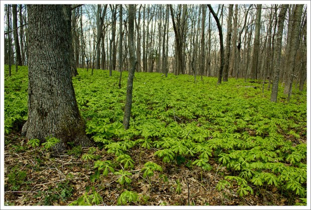
The trail was relatively flat for a good stretch of the trail going forward. There were some views through the trees occasionally as we walked on, but the true treat was all the trillium that was on the trail. This is by far Christine’s favorite wildflower. She was hoping to see some along the trail and we were pleased to find entire hillsides filled with these flowers in perfect bloom. We crossed USFS 246 at mile 3.6, Greasy Spring/USFS 1176A at mile 4.1 and reached the crossing of the North Fork of Piney River at mile 5.9. We stopped and ate our lunch on the side of the trail. The only excitement along this piece of trail was Christine swore she saw a bear, but it was just a person (dressed all in black) taking a lunch break far uphill from the trail (which we thought was an odd place to stop). We pressed on along the trail and finally reached the Seely-Woodworth Shelter at mile 7.4. When we arrived at the shelter there were several backpacks at the shelter, but no sign of people anywhere. We took a long break and rested our feet. We were joined shortly by Christine’s “bear man” who was doing a longer section hike and covering a lot of Virginia. We shared some hiking stories (like how he never purifies water but has only got sick once). Knowing that we had more miles to cover today, we strapped our heavy packs back on and continued.
We reached a junction with Porters Field (a fire road that used to be a railroad trail) at mile 8.4. We had read on the hiking blog of a friend (thanks, Wandering Virginia), about a water source near this junction. We took this short side trail past a campsite and then headed downhill towards the sound of water. Water was coming out steadily from under a large rock. We decided to cook some dinner here. While we both weren’t overly starving since we had eaten lunch not too long ago, this seemed like the best place to cook some dinner and refill water. We were shooting to camp at Spy Rock, which is a dry camp, so we needed to carry enough water for breakfast After dinner, we made our way back to the AT. Christine typically doesn’t like hiking with a full stomach, but because we needed to get to our camp site for the night, we pushed on. We crossed over the Fish Hatchery Road at Montebello at 9.6 miles. On the other side of the road, we saw the steep ascent up to Spy Rock. The trail climbed up about 400 feet in .5 miles, but when we reached the top of the hill, we found our perfect campsite at the base of Spy Rock.
NOTE: Hikers are no longer allowed to camp at the base of Spy Rock. Usage rules for this area were changed in 2019. We camped there long before the rule change, and we’re thankful we had that opportunity!

We took off our packs and began to set up camp. There were already a few campsites already claimed, but we found a nice flat spot with no rocks or protruding roots. We had just bought a new two-person tent, the Big Agnes Copper Spur UL2, which was much lighter than our 3-person tent, and we were excited to try it out. We set the tent and fly up and then made our way to check out the views from the summit of Spy Rock. There is a little rock scramble up to the top of Spy Rock, but the 360-degree views from this spot are not to be missed. We stayed up there a while to soak in as many views as we could, before making our way back to camp. We had a long, tiring, day that started off stressful, so we were ready to go to sleep before the sun fully set. We both read books for a while and then went to sleep. Or rather, tried to go to sleep. Right after sunset, the wind started to pick up. At first it was an occasional rustle across the treetops, but by midnight it was moaning and howling over the mountains.

Day Two (8.7 miles)…
That was a rough night to spend in a tent! Even with it staked and guylined, it rattled and shook all night long. The wind continually caught under the fly and funneled through the tent’s mesh. Even in long pants, a hat, and layers of fleece, I was cold in my 35 degree bag. It wasn’t even that cold outside – the wind was just really brutal! Neither Adam nor I got much sleep. I found myself wide awake when the first hints of dawn light started to brighten the tent.
NOTE: Hikers are no longer allowed to camp at the base of Spy Rock. Usage rules for this area were changed in 2019. We camped there long before the rule change, and we’re thankful we had that opportunity!

I told Adam I wanted to climb Spy Rock again to watch the sun come up. He decided to stay back. I grabbed my camera, scaled the rock and found a perch facing east. It was a beautiful, though cloudless, sunrise. I thought I was alone on the top of the rock, but suddenly a huge white dog we had met the night before came bounding across the rock and decked me. He was friendly, and I was fine, but his owner was embarrassed and came chasing after the dog. I stayed on Spy Rock watching the sun come up until I couldn’t take the wind and cold anymore.
When I came down, Adam was already in the process of breaking down camp. We had a quick breakfast of oatmeal and coffee, and were back on the trail by around 7:30. Day two of this trip had a bit more climbing than the first day. Our first ascent was that of Maintop Mountain. It was a moderate ascent with one nice view near the summit. I started the morning in a fleece jacket and gloves. By the time we reached the summit, I had stripped them off. Climbing really warms you up!

From there, we descended into Cash Hollow. We passed a southbound section hiker and a group of Boy Scouts. We crossed a couple gravel roads – 826 and 526. Off-roaders really enjoy these roads – they’re very rugged and tough to drive unless you have a serious 4WD vehicle. After the second road crossing, signs and an informational board informed us that we had just entered The Priest Wilderness.
We had about a mile of climbing to reach the Priest shelter and the ridgeline of the mountain. The climbing is really pretty moderate, but it seemed tough to my tired legs and sleepy mind. We stopped at The Priest shelter for a snack and rest. I changed into shorts – the day was warming very quickly! Adam and I both made our ‘confessions’ in the Priest journal. It’s one of the funniest we’ve seen along the AT – reading everyone’s confessions is definitely worth a stop!

From there, we completed our last couple hundred feet of ascent to the top of the Priest. Near the top, we enjoyed amazing views of the valley and had a chance to see an adult bald eagle soar by on the wind. The rest of our hike was a long, 4-mile, 4,000 foot descent to the Tye River.
We took it slowly, enjoying wildflowers along the way! The trail was abundantly lined with trillium, wild violets, and wild geraniums. Both of us remarked that we were glad to not be climbing up this side of the mountain! Southbound AT hikers experience one of Virginia’s toughest climbs when they encounter the Priest!
The first mile of the descent was the steepest. As the grade moderated, we came to another outstanding overlook. The opening in the trees revealed lush Virginia countryside – farms and ponds. At this elevation, the trail was much greener. Leaves were opening in the canopy and the ground cover was brilliant green. We crossed Cripple Creek in several places. The rain a couple days earlier had filled the stream and created several beautiful waterfalls. We enjoyed walking through the woods and listening to the sounds of falling water. We saw even more wild flowers – a hillside of scarlet catchfly was especially beautiful!

Eventually, we could see the sunlight catching on car windshields through the trees. We were both pretty tired and happy to be back at the car! We had covered almost 20 miles in roughly 24 hours. It’s the furthest we’ve ever hiked in that time period, so we felt pretty accomplished.
We had a long car shuttle to get back to Hog Camp Gap. After picking up the other car, we drove along the Blue Ridge Parkway to Reed’s Gap so we could have lunch at Devil’s Backbone. It’s always great to eat a HUGE plate of food after a big hike – fries, a grilled brat and beer for me!
Trail Notes
- Distance – 19.1 miles [Day One] [Day Two]
- Elevation Change – About 3172 ft.
- Difficulty – 4. Mostly for distance. This section of the AT has little climbing uphill overall, but the hike down The Priest is quite steep.
- Trail Conditions – 3.5. The trail is well maintained and in good shape. We did feel the hike down from The Priest was really rocky and hard on the feet and ankles.
- Views – 5. This hike has AMAZING views from Tar Jacket Ridge, Spy Rock, and The Priest.
- Streams/Waterfalls – 3.5. The best views are along Cripple Creek, near the end of the hike, where you can see a small waterfall and a scenic creek surrounded by wildflowers. There are options for filling up water near Greasy Spring, Porters Field, the Seeley-Woodworth Shelter, and Cripple Creek.
- Wildlife – 2. We didn’t see much wildlife other than birds along the trail. We did have a great encounter with a male black-headed grosbeak, who was singing beautifully along the side of trail.
- Ease to Navigate – 4. Just keep following the white-blazes and pay attention to junctions to stay on the Appalachian Trail.
- Solitude – 3. We didn’t run into too many people on our trip. Spy Rock had a decent number camping at the top.
Download a Trail Map (PDF)
Directions to trailhead: Requires a shuttle. Park one car at the finish. From the Blue Ridge Parkway, head east on VA-56/Crabtree Falls Highway for 11.2 miles. Park car in large parking lot where the AT crosses the road. From this point to reach Hog Camp Gap with your second car to start the route, continue east on VA-56/Crabtree Falls Highway for 6.9 miles. Turn right on to VA-151S/VA-56E. In 10.5 miles, take a right on to US-29 South. In 3.1 miles, take the US-60 exit towards Amherst. Take a right at the exit ramp to go on US-60 heading west. In 18 miles, take a right on to State Route 634. In 1.6 miles, take a right on to State Route 755/Wiggins Spring Road. This road turns to gravel with large pot holes. Follow this for 2.7 miles until you reach the parking lot where the Appalachian Trail crosses. Park your second car here. Go through the wooden fence and pick up the Appalachian Trail, heading north.


Just curious — would you recommend to do this trip as a hike in, camp, hike out (along the same trail taken in)? Reason being we have one car, and can’t leave two vehicles at the start and end points. If we were to adjust the trip, would you suggest that we start at hog camp gap or the Tye river as the hike-in/hike-out point?
LikeLike
Hi Alicia – if you only have one car, I would probably suggest starting out at Hog Camp Gap – enjoy the views along Tar Jacket Ridge, camp at Spy Rock, and then hike back out along the same route the next day. If you park on the Tye River and go up the Priest, you’ll have over 3,000 feet of elevation gain in just a few miles. It’s a tough climb – even without a backpack. Have you considered hiring a shuttle service?
LikeLike
Great photographs! I will have to do this hike one day! I would love to go visit Spy Rock again. How safe is it to leave your car in those parking spots along the trail? Obviously I would never leave valuable items in my car if it is staying there overnight.
LikeLike
We felt safe leaving our cars – I guess because so many people do!
LikeLike
Great photos, as always, and glad I could be of service with the spring location. I have re-hiked much of this section in the past 6 months – quite a few years after first hiking it – while collecting data for an upcoming update of the PATC Map 13. I believe the woods around the S-W Shelter still hold many mysteries.
LikeLike
Maybe the five abandoned backpacks we found at S-W belonged to people exploring those mysteries! Now… if only someone could find a spring close to Spy Rock! I’d love to not haul water to that campsite.
LikeLike
Great write up and great section to hike, especially in the Fall as you come up Tar Jacket Ridge with all the apple trees. Looking forward to finally hooking up with you guys for a hike at the end of June.
LikeLike
Thanks, Bryce! It really was a nice section. We’re looking forward to hanging out, too.
LikeLike