Double Bear Rocks

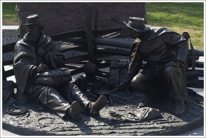
This 8.3 mile hike follows the Pass Mountain Trail from the route 211 trailhead up to the Pass Mountain Hut.  From there, you’ll follow the Appalachian Trail north to the beautiful viewpoint at Double Bear Rocks.

View the Full Album of Photos From This Hike

Double Bear Rocks
The view from Double Bear Rocks looks in the direction of Strickler Knob, Kennedy Peak, and Duncan Knob.

Christine Says…

The first weekend in April, we met up with Tony & Linda (of Hiking Upward fame) for a day of exploring a new trail and a new brewery. When we were discussing route options, Tony tossed out the idea of climbing the Pass Mountain trail for a visit to the same-named Appalachian Trail shelter.  The route was about five miles with 1,300 feet of climbing – perfectly moderate for my recovering ankle injury.

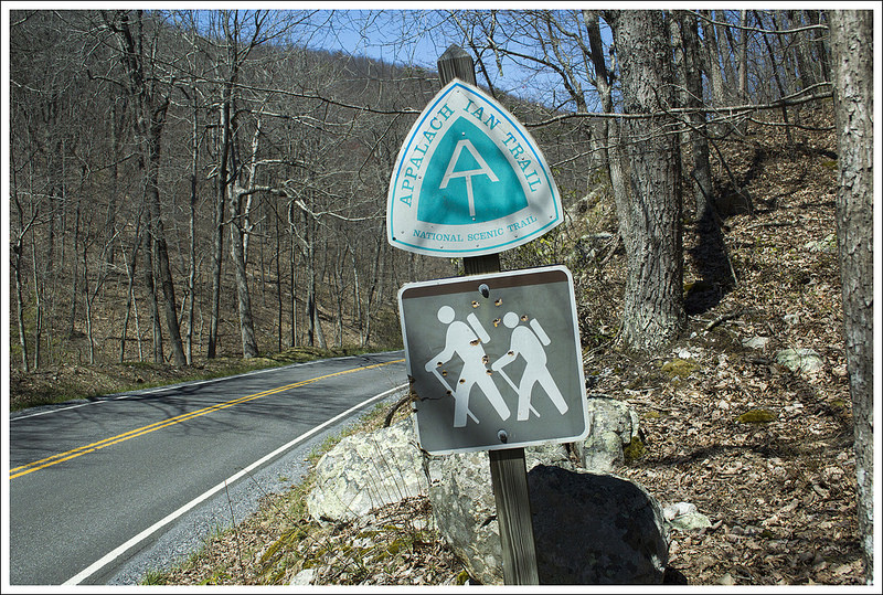
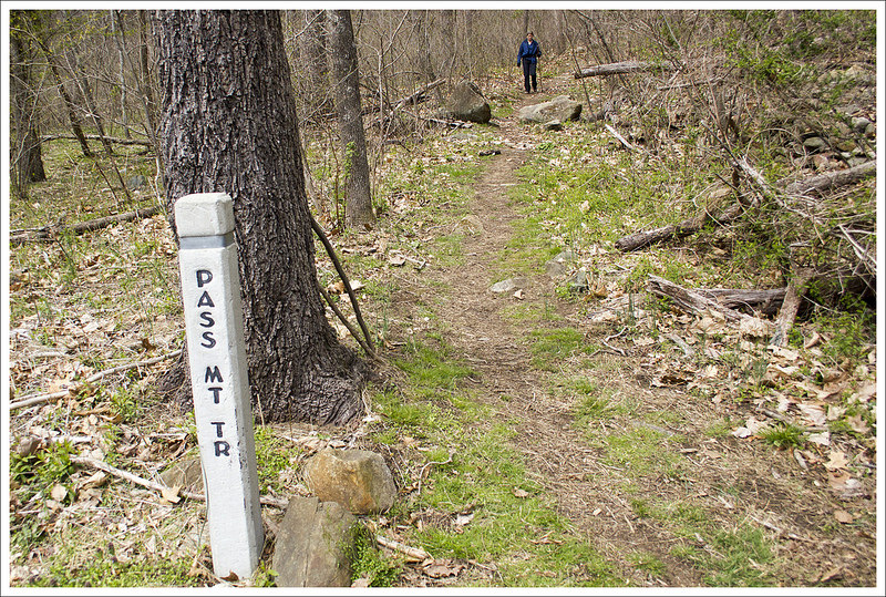
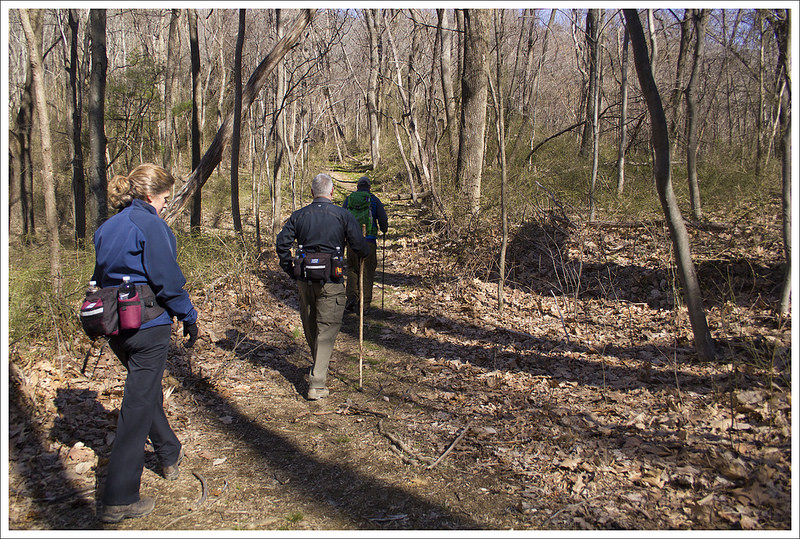
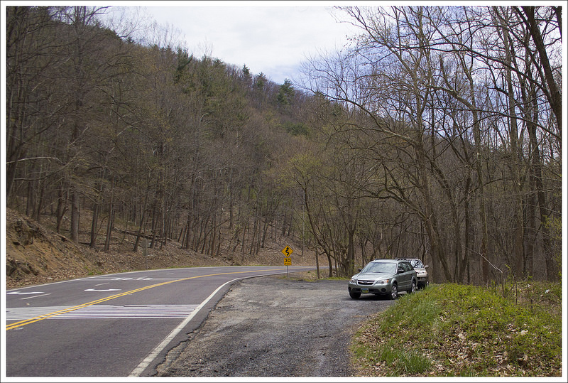
We initially planned to hike on Saturday, but sleet, rain, and high winds compelled us to postpone for Sunday’s more pleasant forecast.  We met at the trailhead along Route 211, just a little bit west of Sperryville.  The trail begins at the cement marker post across the road.  211 can be very busy and its twists and turns are often traveled at speed, so be extremely careful crossing the road from your car to the Pass Mountain trail.

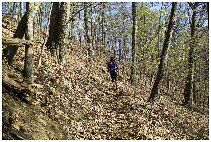
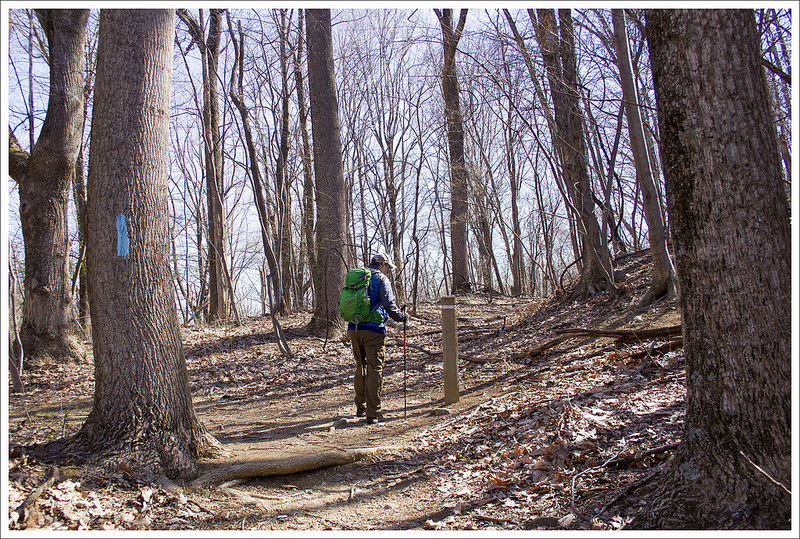
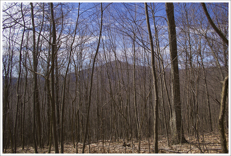
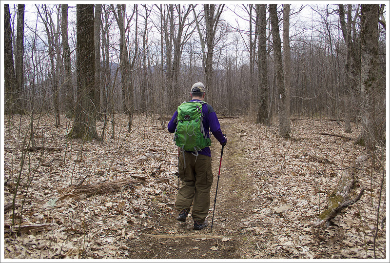
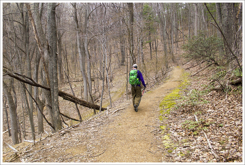
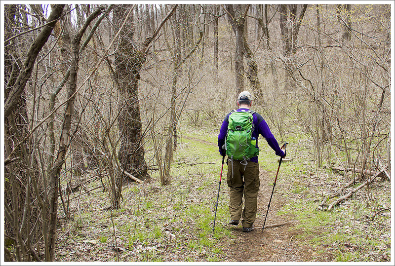
The Pass Mountain trail was beautifully maintained – blowdowns were cleared, branches were trimmed back, and it looked like someone had put a lot of time installing new water bars.  The hike began with a meandering series of switchbacks that climbed steadily but gently uphill. At about the one mile mark, we reached another cement marker.  At the marker, you’ll notice a defunct, unlabeled fire road; stay to the left and follow the blue-blazed Pass Mountain trail uphill.  The trail continues uphill for almost a mile before leveling out on the ridge.  If you happen to hike this trail in winter or early spring, you’ll get great views of Marys Rock through the trees.

Pass Mountain Trail
Our hike started from a trailhead on route 211 near Sperryville. Below: A trailmarker in the middle of the woods.  It appears there used to be another trail or fireroad at the marker that is no longer maintained; Our hiking entourage; A view of Marys Rock through the trees.

Trail Junction Hiking Entourage Mary's Rock Through the Trees

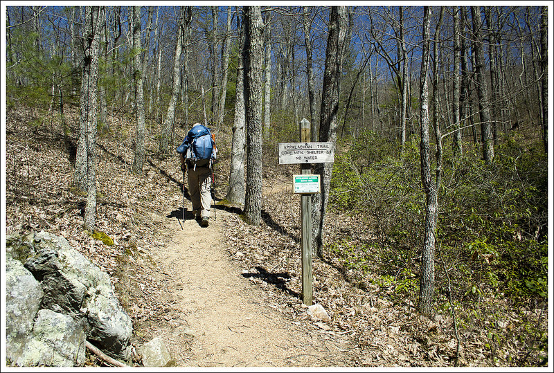
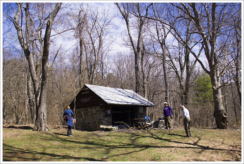
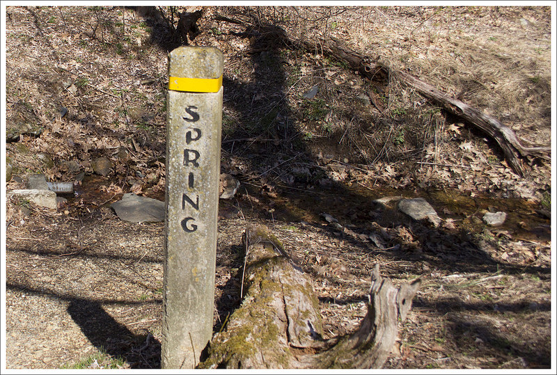
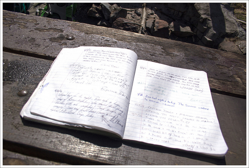
At 2.8 miles, the trail ends at Pass Mountain Hut – one of the park’s nine Appalachian Trail shelters.  The shelter is a typical structure with a nearby spring and privy.  The unusual thing about Pass Mountain Hut that sets it apart from other AT shelters in the park is that it has a fairly new bear locker instead of a bear pole.  A couple years ago, the Pass Mountain Hut was closed due to aggressive bear activity.  In late summer, a young, extremely thin black bear destroyed the tent of an ATC Ridgerunner.  She was out on patrol and came back to a flattened, saliva-covered tent.  Park authorities closed the shelter area until the bear could be trapped and relocated to a less populated part of the park.

We spent a few minutes at the shelter debating the rest of our hike.  I mentioned to Tony and Linda that I remembered a nice vista just north of the Pass Mountain summit.  My ankle felt OK and even though I wasn’t sure exactly how far it was to the viewpoint, I thought I would be OK pressing on.  We all agreed that a view always makes extra miles worthwhile.  We followed the blue-blazed spur trail from the hut to its junction with the Appalachian Trail.

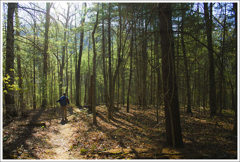
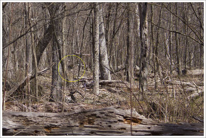
We headed north on the AT for about a mile, reaching the rocky but viewless summit of Pass Mountain.  This summit does not have a cement marker.  You’ll know you crossed the summit only because you start descending again.  When we crossed the summit, we were still vaguely guessing about how much further we needed to hike to reach the view.  We explored off-trail a little on rocky outcroppings, but they all turned out to be closed in by trees.  Adam jogged ahead to scout for the view. Tony, Linda, and I were all several hundred yards back when we heard Adam shouting ‘BEAR, BEAR, BEAR(S)’.  We all raced ahead, too – because who wants to miss a bear sighting?

Pass Mountain Hut
Shortly before reaching the junction with the Applachian Trail, we passed the Pass Mountain Hut. Below: The hut’s water source; Shelter log; Adam hiking the AT.

Water Source at Pass Mountain Shelter Log Walking the AT

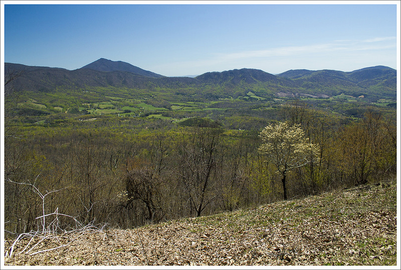
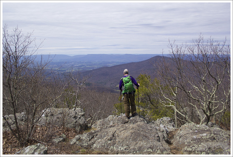
We got there just in time to see two big, furry rear ends disappearing into the brush.  Adam, however, got a great close-up view of the bears.  Lucky!  Just a couple tenths of a mile past the bears, we spotted the side path to the view – Double Bear Rocks, named for the high population of bears in this area.  The view itself is quite nice, but what I remember most about this rocky outcropping is its seasonal abundance in blueberries!  Last time we hiked by this spot, it was July and there were berries everywhere!  In the short time we sat and enjoyed the view, clouds moved in, so we decided to be on our way.

The hike back simply retraced our steps coming up.  Since it was mostly downhill, it went by really quickly.  Before we knew it, we were back at our cars for a total hike of 8.3 miles with 1,750 feet of climbing.  We were all quite ready to make our way into Sperryville for some post-hike refreshments.  We decided to pick up a  to-go order from the Creekside Deli.  It’s a humble-looking building painted bright yellow, but there is nothing humble about their baked goods.  They make top-notch sandwiches on homemade bread, cookies, brownies, and other pastries.   We took our food over to Pen Druid brewery to enjoy a couple beers with lunch.  The brewery doesn’t have a kitchen, so they follow picnic rules. The guys at Pen Druid do small batches of interesting beers – most featuring wild yeast strains.   We had great conversation and agreed that we really must get out together more often.  Great day with friends!

Adam Says…

We always enjoy hiking with Tony and Linda.  When you get people together that have done a lot of hiking, our conversations always quickly go through talking about different trail systems.  We can all talk through different routes as if we were following a map along in our heads.  I’m not sure if it is dull conversation for others, but we enjoy talking about the places we have been or have been hoping to go.  Both Hiking Upward and our site were created to share our experiences.  We may have different approaches to the content, but we do this because of our love of nature and the ability to share hiking ideas with others.  We consider ourselves lucky to live where we live and to be able to have all of these experiences so close by – and we hope you enjoy it as well.

With Christine nursing an ankle injury, we picked a route that she thought would be a decent test with a little elevation but not overly challenging.  This route isn’t well-traveled and is accessed from outside of Shenandoah National Park on US-211, in between Luray and Sperryville, VA.  We arrived a few minutes before Tony and Linda, so we parked where we felt was the correct spot – a gravel pull-off at the bottom of a steep curve.  I consulted a map of the area and felt we were correct, but we didn’t see a signpost to designate the beginning of the trail.  I got out of the car and crossed the road near the sharp curve in the road and found the trail marker.

Two Bears on the AT
We saw a mama bear and her yearling cub not far from the viewpoint. Below: Tony scales a rocky lump near the summit of Pass Mountain.

Rocky Portion

The trail starts as the Pass Mountain trail.  While we felt this isn’t a heavily-traversed trail, we were surprised at how well this small section has been maintained.  The hike on the Pass Mountain Trail is a steady uphill climb, but the conditions of the trail made for easy footing.  On the way up, we caught up with what was going on with our lives  – from aging parents to worrisome dogs to trail sections to hiker rescues to beer.  Around the 2.75 mile mark, we reached the Pass Mountain Shelter.  We stopped and ate a snack and checked out the hiking log.   Christine’s ankle was feeling decent, so we decided to press further up the trail.  At the shelter, there is a junction with the fire road (Pass Mountain Hut Road), but the trail ascends up to the left of the shelter as you are facing it.  We continued up the trail until we reached the junction with the Appalachian Trail at 3.0 miles.

We remembered we found a nice overlook on Pass Mountain that was off the trail and we didn’t think it was too terribly far so we decided to try and find it again together.  We took a right, heading north on the white-blazed AT.  The trail continued to go slightly uphill, but the grade wasn’t as steep as most of the Pass Mountain Trail.  When we carried onward for about a mile, I decided to scout ahead a bit since I didn’t want Christine to put a lot of undue pressure on her ankle.  Trekking up ahead at a brisk speed, I came across a mother bear and a yearling bear cub ambling close to the trail.  They were both curious about me, so I said a few “Hey, bears” to let them know I wasn’t a threat.  They slowly were walking away, paying me little mind so I shouted back at the rest of the group “BEAR, BEAR” to let them know I spotted one.  I wondered if the group thought I was shouting for beer instead, but they understood.  When they caught up, they were able to see the bears not too far off but they had moved away from their comfy spot.

The Descent of Pass Mountain
The trail down is nicely graded with switchbacks. Below: Green plants were just beginning to reappear; Parking area – the road crossing can be very treacherous.

Descent of Pass Mountain Parking

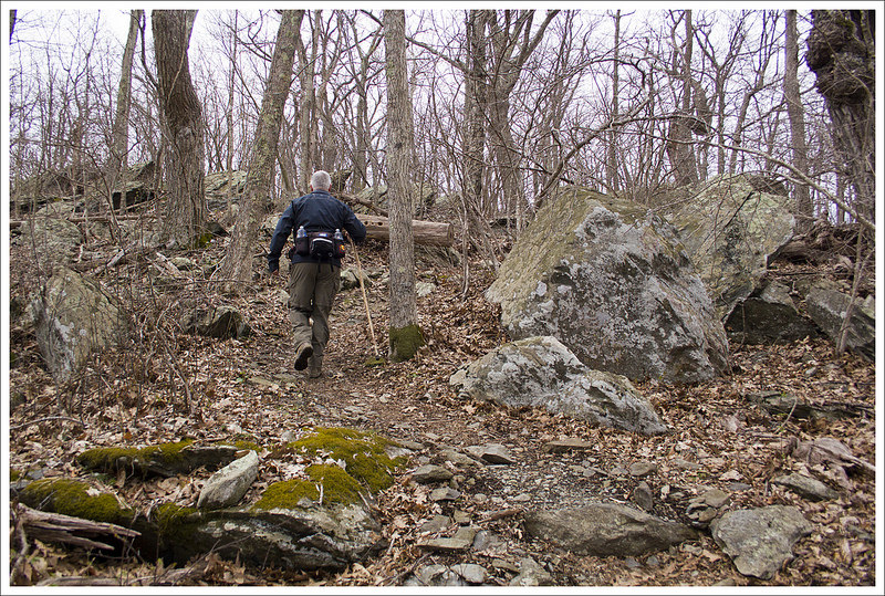
Right around the corner from where we spotted the bear, we saw the jumbled rocks on the left of the trail that we remembered as being the viewpoint.  We cut off the trail and out onto the rocks to enjoy a nice view to the west.  There are nicer views in the park, but on a clear day you can see ridges of mountains for miles.

After taking in the view for a few minutes, we made our way back to our cars.  We continued our trip to Creekside Deli and then Pen Druid Brewery for some delicious food and drink before parting ways.  We look forward to our next adventure with them!

Trail Notes

  • Distance – 8.3 miles roundtrip
    (Check out the stats from Map My Hike)*
  • Elevation Change – 1730 ft.
  • Difficulty –  3.  This was a nice, moderate hike with steady but well-graded climbing.
  • Trail Conditions – 4.5.  The trail was in fantastic shape – very well maintained and tended to by the PATC. 
  • Views  3.5.  There’s a beautiful, but not quite panoramic view on the northern flank of Pass Mountain.
  • Streams/Waterfalls – 0.  There isn’t any stream scenery, but there is a spring behind the Pass Mountain Hut.
  • Wildlife – 4.  We saw bears – a yearling cub and mama!
  • Ease to Navigate – 4.  The trail is well marked and easy to follow.
  • Solitude – 4.  We saw one couple at the hut, but no one else at all during the entirety of the 8+ mile hike.

MapMyHike is not necessarily accurate, as the GPS signal fades in and out – but it still provides some fun and interesting information.

Download a Trail Map (PDF)

Directions to trailhead: The trail is located off of US-211 about 12 miles east of Luray, VA and 2.8 miles east of where US-211 crosses Skyline Drive.  The gravel lot is located at 38.66855, -78.28999.   Cross the road (be careful as this is a blind curve and cars may not see you easily) and at the bottom of the steep, sharp curve you will see the signpost for the Pass Mountain Trail.

Appalachian Trail – Black Horse Gap to Jennings Creek

This 14.6 mile stretch of Appalachian Trail offers many splendid views as you closely follow the Blue Ridge Parkway.

View the Full Album of Photos From This Hike

Blackhorse Gap to Jennings Creek
Our first overnight backpacking trip of the season allowed us to watch the green of spring creeping its way up the mountainsides.

Day One…

When you are gifted a sunny 75-degree weekend in April, you must snatch it up and go backpacking!  At least, that is my belief on the matter. We had just such a weekend in mid-April this year, so we decided to get out there and work on completing some more Virginia Appalachian Trail miles.

We’ve already completed all the miles between Jennings Creek, VA and Harpers Ferry, WV, so we decided to pick up the next section south – Black Horse Gap northbound to Jennings Creek.  It was a relatively short route for an overnighter – twelve miles the first day and just three miles the second day.  We always try to do about 20 miles on a one-night trip, but access to road crossings for our shuttle drop-off made fifteen miles the best logistical option for this trip.

We looked up shuttle options in our AWOL Guide, and ended up hiring Homer Witcher to give us a ride to our start point.  Homer is a great trail ambassador – he’s in his 70s and still finds the time and energy to run on the AT most days.  He, his wife, and children are all avid, lifelong hikers – completing multiple section and thru hikes.  He told us he and his wife are planning another thru in 2017.  We greatly enjoyed talking to him on the ride over to Black Horse Gap.

Walking the Appalachian Trail
The signage for the AT along the Blue Ridge Parkway is nice. Below: Our start point at Black Horse Gap; Adam hikes through a rhododendron thicket; We had nice views through the trees for most of this hike.

Our Start Point Rhododendron Thicket Views Through the Trees

About a half hour later, we found ourselves standing along the Blue Ridge Parkway at Black Horse Gap.  We found the trail easily and started our northbound walk.  Over the first few miles of hiking, the AT crosses the Blue Ridge Parkway a couple times – at Taylors Mountain and Harveys Knob.  Both crossings offer panoramic vistas of the valley below.  Most of the views in this section include a nice look at Sharp Top, one of the areas most popular mountains for day hiking. The terrain along this stretch of trail could best be described as rolling – there were lots of ups and downs, none dramatic.  We passed a large group of Boy Scouts hiking along the trail.  They turned out to be pretty much the only people we saw on our hike.

By 12:30, we reached our lunch stop at Bobblets Gap shelter. We ate and assessed our water supply.  We knew we’d have another chance to resupply water at around the 8 mile mark, but read that the water source at Bearwallow Gap was iffy and seasonal.  I still had over two liters of water, some in my Camelbak and a full Smartwater bottle.  Adam filled his Camelbak to three liters and also had a full Smartwater.  Our planned campsite at the Cove Mountain Shelter is dry (no spring, no stream) and the closest water source to camp is three miles away in either direction, so we tried to guess how much water we would need to cook and hike the next day.  It’s a delicate balance between carrying too much heavy water and not enough, risking dehydration.

After lunch, we leapfrogged the same group of scouts again.  They had decided to skip the shelter since they had moms and lunch waiting for them at a road crossing ahead.  The post-lunch hiking was decidedly more uphill than the morning hiking.  We gradually climbed, crossing the parkway two more times at Peaks of Otter and Mills Gap.  At Mills Gap, we were able to get rid of our lunch trash at a roadside trashcan – being able to get rid of garbage is a real treat for any backpacker!  We took a rest at Mills Gap, reclining on a picnic table in dappled shade.  The temperatures weren’t that hot – maybe high 60’s, but the sun was incredibly strong and relentless through the mostly leafless trees.  We both got sunburned despite using sunscreen.

Beautiful Views from the Blue Ridge Parkway
The trail crossed the parkway numerous times – usually near vistas. Below: One of many road crossings with a view;  Blooming columbines; A huge retaining wall under the parkway; Bobblets Gap Shelter; Lunch and shelter log; A very dank water source.

Vistas along the BRP Columbine Retaining Wall
Bobblets Gap Shelter Lunch at Bobblets Gap Dank Water Source

After a little more climbing from Mills Gap, we started a nice descent to Bearwallow Gap and the VA43 road crossing.  We passed a murky, dank wildlife pond along the way – maybe it’s the bear wallow!  At the road crossing, we sat like a pair of hobos under the Blue Ridge Parkway road sign.  People driving past looked at us like we were a novelty.  There turned out to be plenty of water in the seasonal stream at the crossing, but neither of us had drunk much more water so we decided not to resupply again. That wasn’t the best idea – more about that later!

We crossed VA43 and immediately began the climb up Cove Mountain.   Within the first hundred feet there was a sign reminding us about the dry conditions at Cove Mountain Shelter.  We still were certain we had plenty of water.  As we ascended, I said to Adam “This isn’t bad!  The trail looked WAY steeper on the map!”  Adam replied, “I hope you’re not jinxing us.”  Well, I totally jinxed us.  The trail got much steeper and due to past forest fires, we were climbing in direct, unrelenting sunshine at the hottest part of the day.  We both went through much more water than we had planned for.  I chewed gum to try and preserve what water I had left.  We passed a couple small campsites along the ridge of Cove Mountain. We contemplated stopping for the day, but decided to press on to our planned stop.

Climbing Cove Mountain
Cove Mountain (one of several mountains by this name in the Blue Ridge) was the only tough part of the day. Below: Sitting like a hobo at the road crossing; It’s not nice to shoot at hikers; Beginning the climb up Cove Mountain; Campsites along the top of Cove Mountain; Adam gets nice views as we begin the descent to the shelter; Evidence of an old forest fire.

Hobo Gunshots at AT Sign Climbing Cove
Campsite on Cove Mountain Beginning the Descent Burnt Out

The descent of Cove Mountain was incredibly beautiful.  I think the area burned in 2011 or 2012, leaving spectacular open views along the ridgeline.  I was thankful for such beautiful, distracting views the last couple miles because my feet were killing me.  In addition to not refilling water when we should have, I made the mistake of trying out new gear on a long(ish) hike.  For many years, I have hiked in Thorlo thick-cushion hiker socks with a pair of silk sock liners.  I don’t get blisters -ever- with that combo.  This time, I decided to wear my Darn Tough wool socks.  They’re super popular with hikers and were always comfortable for me on day hikes – even long day hikes, but apparently I do need the extra cushioning I get from Thorlos when I’m carrying a heavier pack.  Lesson learned – don’t mess with the tried and true, especially when it comes to your feet!

We hobbled into camp around 3:30 – almost 12 miles in about 6 hours included stops for lunch, rest, and photography – not a bad pace for our first trip of the season.  We set up camp and spent the remainder of the afternoon reading and napping.   Despite being dry, Cove Mountain Shelter is an idyllic spot.  The shelter is typical, the privy is new, and there was space for a good number of tents both around and on the ridge above the shelter. Recently, I learned an interesting piece of trivia about the Cove Mountain Shelter from my friend Jeff Monroe (of Wandering Virginia). Apparently, this shelter used to sit at Marble Springs (where we camped on the second night of our Jennings Creek to the James River section).  When the area around Marble Springs became designated wilderness, the shelter was moved to its current location on Cove Mountain.

Road Around Mountain
It was neat to see Rt. 43 wrapping around the mountain. Below: The Cove Mountain Shelter; Tents and bear bags.

Cove Mountain Shelter Bear Hangs and Tents

Before dinner, Adam found a good tree and slung the rope for our bear hang.  As we prepared dinner, we rationed out our water, so we’d have enough for breakfast and our second day of hiking.  We were both pretty thirsty and wished we had filled up to the maximum at Bearwallow.  We even ended up drinking our dishwashing water.  Lots of ‘Leave No Trace’ folks always drink their wash water, but it’s also acceptable to broadcast water away from camp.  We usually broadcast.  But this time, we enjoyed a lovely ‘tea’ flecked with a mélange of buffalo chicken, macaroni and cheese, and crème brulee.  Mmmm! Even after conserving water, we really didn’t have much left for both breakfast and tomorrow’s hiking.

As we were finishing dinner, Boy Scouts started rolling into camp – first two, then five more, then another four, then the final three an hour later.  We were sure they had come off the trail at VA43. They’d been hiking since 9:30 a.m. – many of them were first time backpackers, a few were first time hikers!  The troop was from Roanoke Rapids, NC.  They were nice folks, but clearly new to backpacking, as they took the time to remove our bear hang from the tree, thinking it was litter!  Adam was not happy about having to get the rope back over the precarious branch, but in the end he agreed it was a little bit funny.

Good Night
We got to watch sunset from the hillside above the shelter. Below: The sun goes down over the Blue Ridge; Enjoying our view!

Pretty Sunset Happy Place

After dinner, we hiked up the hill behind the shelter to catch sunset.  The view was lovely! As soon as the sun went down, it got cold pretty quickly.  The dry, breezy conditions precluded a campfire, so we crawled into our tent a little after 8:00 p.m.  I fell asleep but was woken several times during the night to sounds of foxes, whippoorwills, and owls! Despite the interruptions, it was a peaceful night and I was so glad to be out in the woods again!

Day Two…

We knew our next day on the trail was going to be quite easy.  We woke up early before the Boy Scouts were even stirring.  It was quite chilly, so we were probably moving a little faster in the morning to get the blood flowing.  We packed away all of our stuff and enjoyed a breakfast of Little Debbie Peanut Butter Pies and coffee.  The plan was to have hot granola with Nido, but we didn’t have enough water left to make both hot cereal and coffee, so coffee and cookies won.  We left the shelter area and were on our way in a little over an hour.   Just about .2 miles away from the shelter, we came to a nice western morning view from the top of Cove Mountain.  The trail continued to ascend, but it was hardly noticeable.  From camp, the trail ascends about 200 feet in .8 miles.  At this point, the trail descends the rest of the way.  We were impressed with the views through the trees along the way.

View from Cove Mountain
A couple tenths of a mile past camp, we got a nice view from Cove Mountain. Below: Tents in the morning sun; Adam hikes along the Appalachian Trail; Christine descends toward Jennings Creek.

Tents in the Morning Walking the AT Descending to Jennings Creek

The trail on the descent was easy walking for the most part.  The trail had just a few longer switchbacks on it, but it was a nice, peaceful walk in the woods.  It was just a short amount of time before we could hear the sound of water from Jennings Creek and around 3.2 miles we were back at Jennings Creek Road.  We took a right and crossed over the creek for some picturesque creek scenes before getting to our car on the left side of the road.

Descending to Jennings Creek
Adam makes his way downhill through the evergreens. Below: Pretty Jennings Creek; The parking area at the AT crossing; We saw zebras on the way home.

Jennings Creek Parking at Jennings Creek Zebras

We had previously planned to get to Sonic in Waynesboro for a celebratory lunch and a stop at Rockfish Gap Outfitter’s Anniversary Sale (where I got a new Osprey Atmos pack), but arriving at the car around 9 a.m., we knew we had some time to kill.  We decided to stop on our way at the Virginia Safari Park near Lexington.  If you are a fan of animals, this is a must-see place to visit.  We drove through the loop (we could even see rhinos through the window) with a bucket of feed while zebras, emus, alpacas, elk, and yaks tried to rip it from our hands.  After driving through the loop, we also walked through their other exhibits, where we could see giraffes at eye level, walk among kangaroos, and see other animals through cages – tigers, hyenas, and monkeys.  I believe this was our third time visiting and there are always new additions every time we visit.

This section of the Appalachian Trail has some wonderful scenery on it.  If you are looking for a shorter, overnight trip with lots of views along the way, this hike won’t disappoint – just plan for water.

Trail Notes

  • Distance – 14.6 miles
    Check out the stats from Map My Hike [Day 1] [Day 2]*
  • Elevation Change – 1650 ft.
  • Difficulty –  3.  This was a pretty easy backpacking route.  It was perfect for our first outing of the season and gentle injury recovery.
  • Trail Conditions – 4.  The trail was in typical Appalachian Trail shape for this part of Virginia – well maintained and nicely graded.
  • Views  5.  There are many fantastic viewpoints along this route.  Most of them come from overlooks along the Blue Ridge Parkway – which you’ll cross multiple times on this route.
  • Streams/Waterfalls – 0.  This is a quite dry stretch of trail. There is a small, low-flow spring at Bobblets Gap and a seasonal stream at Bearwallow Gap. There is NO WATER SOURCE at the Cove Mountain Shelter, so plan ahead.
  • Wildlife – 3.  We saw several deer and had a barred owl and a whippoorwill in camp.
  • Ease to Navigate – 4.  The trail is well marked and easy to follow. There are road crossings and several other trail junctions, but the white blazes are easy to follow in most places.
  • Solitude – 3.  We actually saw very few people on this hike considering the beautiful weather and its proximity to the parkway.  

MapMyHike is not necessarily accurate, as the GPS signal fades in and out – but it still provides some fun and interesting information.

Download a Trail Map (PDF)

Directions to trailhead: To drop off first car: Take exit 168 off of I-81 toward Arcadia, VA.  Turn on to State Route 614/Arcadia Road off the exit.  Arcadia Road becomes Jennings Creek Road.  After 4.5 miles, you will see a large gravel parking lot after crossing Jennings Creek and you will see a sign for where the Appalachian Trail crosses.  Park in this lot. Coordinates 37.529352, -79.622693  To drop off second car and start your hike:  Continue down Jennings Creek Road from where you parked (not arriving the way you came).  In 1.8 miles, turn right on to State Route 618/McFalls Creek Road.  Go 4.1 miles and then turn right on to the Blue Ridge Parkway.  Follow this for 8.6 miles until you reach the small pulloff on the right side for Black Horse Gap.  With not much space here for a vehicle, you will likely want to park along the side of the road.  Just a few feet on the fire road, you will see the sign for the Appalachian Trail junction. Coordinates: 37.424611, -79.757202. Head right and start on the trail.

Pamplin Historical Park Trails

Pamplin Historical Park, located in Petersburg, Va is a hike that demonstrates a pivotal piece of civil war history that takes you through battlefields that led to the folding of the Confederate troops.

View the Full Album of Photos From This Hike

Pamplin Historical Park
If you’re interested in history, but still want to get some vigorous walking in, Pamplin Historical Park is a great place to visit.

Adam Says…

We are always looking for new and interesting places to hike in Virginia.  We were contacted a couple of months ago by Diane Willard, Director of Administration, Marketing, & Membership Services for Pamplin Historical Park about visiting their park and telling others about the trails they had on their property.  As I was visiting the area in late March, I was able to squeeze in a visit.  Please note, there is an entrance fee -as of 2016 adults $12.50, seniors 62+ $11.50, and children (6-12) $7.50.  The park is open seven days a week from Spring to Fall from 9AM-5PM daily, so plan accordingly. 

The focus of the park is to bring visitors into the history of the Civil War from one dramatic date – April 2, 1865.  On this day, the Sixth Corps Union troops under General Horatio Wright broke through the Confederate line at Petersburg.  The Confederate forces were working on maintaining a line of defense that stretched for 40 miles from north of Richmond, the Confederate capital, to southwest of Petersburg.   A rough winter and desertion had dwindled General Lee’s troops to 60,000 while Grant’s troops were double that size.  The day before, General Grant had cut through the Confederate supply lines and killed about 5,000 troops at Five Forks.  This line on April 2nd tried to hold off the Union troops, but in the early morning Union forces got to the Confederate trenches but nearly 4,000 Union troops were killed.   The battle raged on throughout the day, but by the end of the day, the Confederate troops decided to retreat and abandon the line.  Petersburg and Richmond were evacuated and a mere week later, General Lee surrendered to General Grant at the Appomattox Court House.

Pamplin Historical
Civil War Trench from the Fortification Exhibit; Below: National Museum of the Civil War Soldier, views of the battlefield, trail views go from woods to open fields

Pamplin Historical Park Pamplin Historical Park Pamplin Historical Park

There are several miles of hiking trails through this park and it also connects to the Petersburg Battlefields Trail if you want a longer hike.  I would recommend printing this map of the area, so you can get an idea of the landscape to start the hike.  The main entrance is known as The National Museum of the Civil War Soldier.  Leaving the building through the side entrance, you walk past a demonstration and then pass by the Tudor Hall plantation on the right.  Continuing ahead, you walk past a Fortification Exhibit which gives you a closeup view of a trench and the defense systems around them.  You then pass the Battlefield Center on the left and and begin the real hike on the Breakthrough Trail.  The Breakthrough Trail has a Main Loop, Short Loop, and Intermediate Loop.  Knowing I was going on a bit further, I started in .2 miles on the Main Loop.  The main loop is mostly wooded as you go through an area known as Arthur’s Swamp.  At .4 miles, you reach a junction where you can break off and take the Short Loop, but I continued on the Main Loop.  At .85 miles, you come to a junction where you can continue on the Main Loop or begin the Headwaters Trail.  I picked up a brochure at the junction and saw that The Headwaters Trail would actually connect as a large loop, so I decided to take the longer Headwaters Loop.  Along the way, you get to see several Confederate rifle pits, small dugouts that formed strategic encampments.  At 1.35 miles, you reach a short path that has a sign explaining an original logging bridge.  From here you can break off the Headwaters Trail and make your way on to the Petersburg Battlefields Trail.  The idea of checking out how these trails connected intrigued me, so I took this trail.  From here, you are leaving the Pamplin Historical Park boundary.  You go through some woods but then are left with great farmland views where you can imagine the feelings of the soldiers that were crossing this field.  You can only begin to think about how many people lost their lives on that fateful day to stand up for their beliefs.

Pamplin Historical Park
Battlefield Center.  Below: historic placards along the trails, wooded walkways, school trips learning about trench warfare and getting into formations

Pamplin Historical Park Pamplin Historical Park Pamplin Historical Park

Continuing on this trail allows you to get some open scenery, which is great for spotting birds in the fields.  I walked on an open path and then at 1.65 miles, followed the sign pointing towards the parking lot.  This trail continued to skirt around some open fields of farmland.  At 2.4 miles, the trail takes a sharp turn to the left where you come across some large earthworks, serving as barriers protecting the Union line.  I walked along these for a short distance and saw the trail continued further, but decided to make my way back.  On my way back, at 3.25 miles, I came to the junction of the sign (one way leading to the parking lot, the other pointing to the Petersburg Battlefield Trail).  Instead of taking a right, I decided to take a left to walk along the farmland and get more views, but I turned around after just .2 miles to get back to the trail I knew.  From the junction sign follow the sign pointing to the Petersburg Battlefield Trail and at 3.6 miles, you finally rejoin the Headwaters Trail.  At 4.0 miles, you reach a junction with the Woodlands Trail, which also leads back to the start, but I continued on the main Headwaters Trail.  In a short distance, you begin to see the large Confederate Earthworks, forming that historic line the Confederates tried to maintain.  The trail crosses over a break in the earthworks and then takes a sharp left turn to parallel the earthworks.  At 4.4 miles, you reach another junction where you have an option on which side of the earthworks that you like to walk along the Intermediate Loop.  At 4.5 miles, you reach a junction with the Woodlands Trail again and at 4.6 miles, you meet a junction with the Main Loop.  Staying straight on the Intermediate Loop, it joins the Short Loop in a short distance.  I took a right here and reached the Battlefield Center at 4.8 miles.  I explored inside the Battlefield Center and then took in the Tudor Hall Plantation before returning to the main entrance at the National Museum of the Civil War Soldier.

If you are a civil war history buff, this would be a great place to hike and explore.  I was thoroughly impressed with how much has been put into the care of the trails and the exhibits themselves.  You could easily spend most of the day exploring the trails and grounds here.  This would be a great hike to go as a family to learn about the history and if you have children, they may enjoy reading about the civil war on the placards along the way.  I must say that I was pleasantly surprised at how great the trails were maintained here.  I went in expecting that I could walk along some short, easy trails, but with adding the spur to the Petersburg Battlefield Trail, you can get a more serious hike into your day.

Pamplin Historical Park
The Tudor Hall Plantation.  Below: Open field views, statue at the entrance station.

Pamplin Historical Park Pamplin Historical Park

Trail Notes

  • Distance –5.0 miles.
    (Check out the stats from Map My Hike)*
  • Elevation Change –  100 ft.
  • Difficulty –  1.  Very easy walking on this one with very little elevation gain. 
  • Trail Conditions – 4.5  Trails are well-maintained and easy footing. 
  • Views – 2.5.  Not high views, but vast views of open, picturesque fields.
  • Waterfalls/streams 0. Non-existent.
  • Wildlife – 2.  Some decent bird-watching over boggy areas and expansive fields.
  • Ease to Navigate – 3.  When you leave Pamplin, things can get a bit confusing.
  • Solitude –  3.5.  You will see people at Pamplin Historical Park, but hardly anyone on the trail system. 

MapMyHike is not necessarily accurate, as the GPS signal fades in and out – but it still provides some fun and interesting information.

Download a trail map (PDF)

Directions to trailhead: From Richmond, take I-95 south to I-85 south, to Exit 63-A (U.S. 1 south). Proceed one mile to Park entrance on the left. The Park is 30 minutes south of Richmond, VA. Coordinates: 37.182980, -77.480095