Great Channels

The Great Channels Natural Area Preserve is one of Virginia’s most geologically fascinating areas.  This 6.6 mile out-and-back takes you down into a network of maze-like crevices formed in soft sandstone.  You won’t find any other hike in Virginia like this one!

View the Full Album of Photos From This Hike

Adam Explores Virginia's Great Channels
Adam explores Virginia’s Great Channels.

Adam Says…

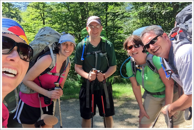
Who would have thought there were slot canyons in Virginia?  I have read about the slot canyons in the southwest of the US and thought it would be so cool to actually go hiking through these formations.  It wasn’t until recently that we had heard about the Great Channels in the southwest of Virginia and we just had to take a trip and explore them.  We decided to take a four-day trip down to Abingdon, Virginia and rented a house that served as a great launchpoint for some of those interesting hikes we have heard about in the area.

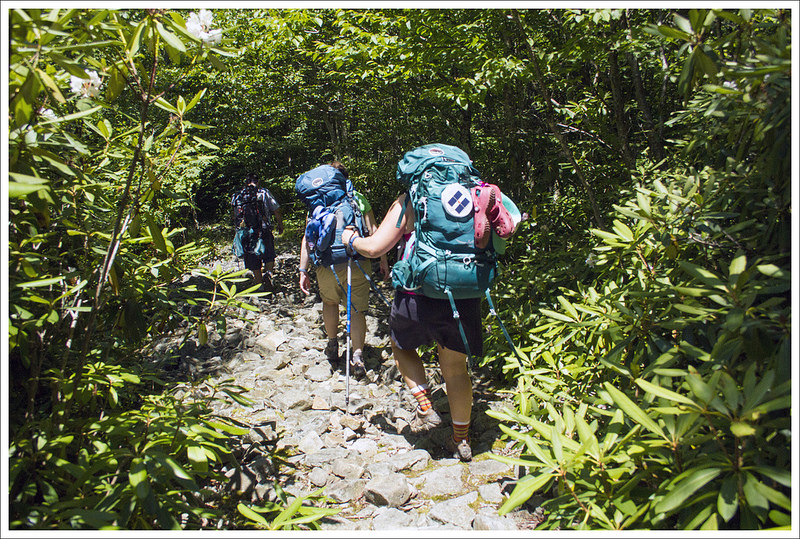
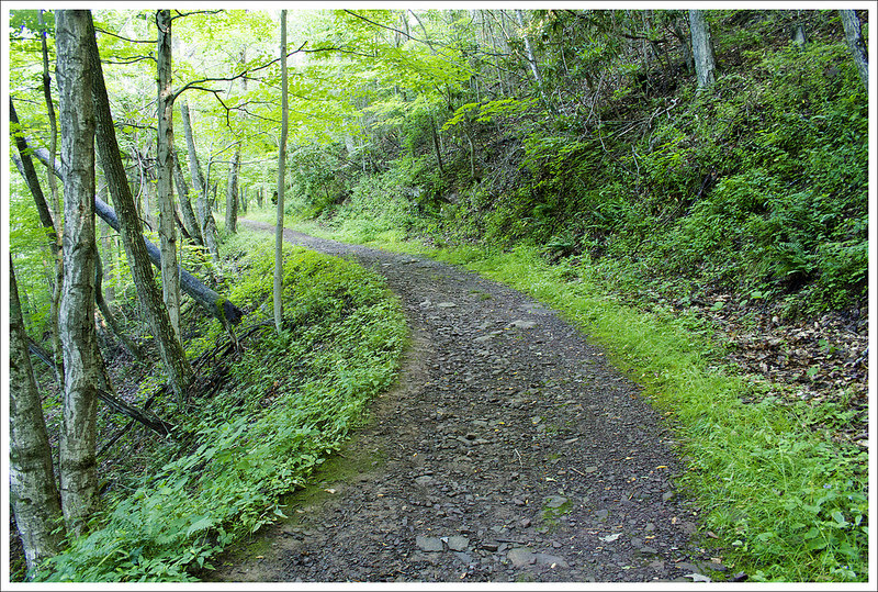
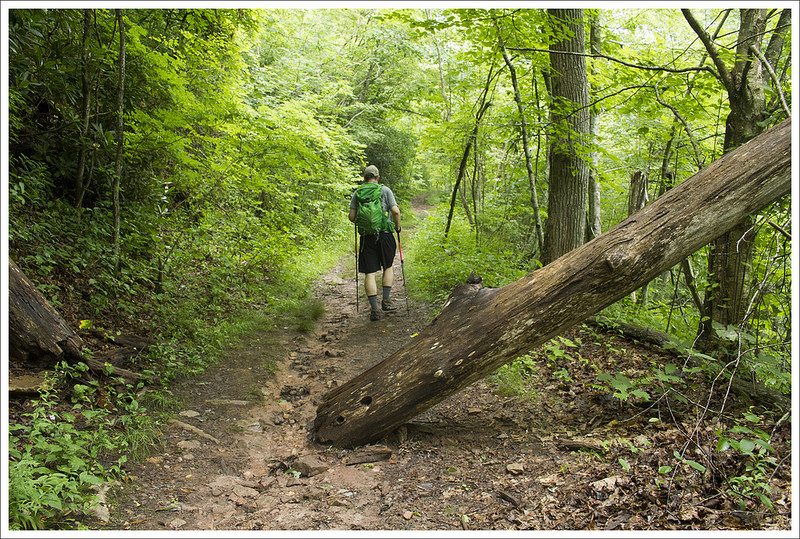
We left our car in the parking lot and then followed the Brumley Mountain Road up the fire road (blocked from cars by a gate) that went up the hill to the right of the parking lot.  The initial part of the hike follows this wide fire road, making it nice to walk side-by-side with your hiking partner.  The trail is mostly a gradual uphill climb to the top, with the first 1.5 miles being very little climbing at all.  At about .6 miles, you reach a set of power lines that are cut in that may give you an obstructed view to the left of the trail of the valley below.  At .75 miles, you reach a junction where the fire road takes a sharp turn to the right and goes uphill.  Stay straight instead of veering to the right to stay on the trail.  The trail continues along and at 1.0 miles, a cabin and picnic area appears to the right of the trail.  This is private property, so stay on the trail.  Continuing along the trail, at 1.5 miles, you reach Shallow Gap, which provides some obstructed ridgeline views to the right of the trail.

Easy Footing at Great Channels
The trail to Great Channels climbs a bit, but the footing is all easy.  Below: The trail follows an old road bed most of the way; A pretty cabin along the trail; Blooming rosebay rhododendron.

Easy Footing at Great Channels Cute Cabin Along the Trail Blooming Rhododendron

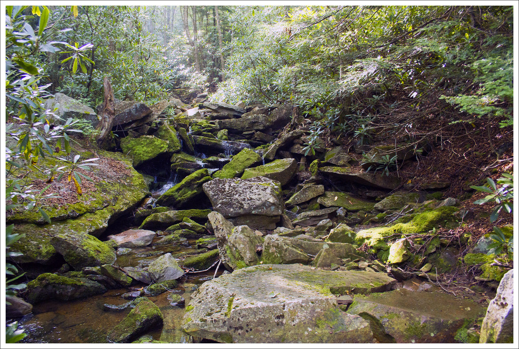
The trail becomes slightly steeper from this point and at 2.25 miles, you reach an outcrop of sandstone, which is what you will later see that forms the Great Channels themselves.  You hit a few switchbacks shortly after that take away the steepness of the terrain.   At 2.8 miles, you reach the junction where the Great Channels trail breaks off to the left of the Brumley Mountain Road.  Take this trail to reach the summit of Middle Knob, which you should reach around 3.0 miles.

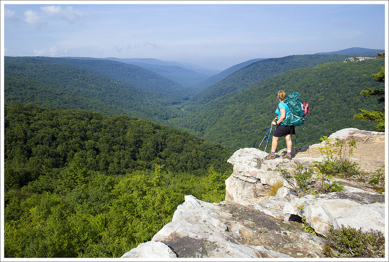
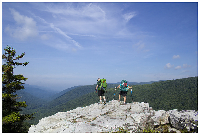
At the summit, you will find a shelter with rotted boards and exposed nails (it looks like quite the danger, so don’t explore).  Behind the shelter you will see some exposed boulders that allow for some obstructed views around you.  Straight ahead also is the incredibly tall fire tower that was once used to spot fires from a long distance.  The rocks that you walk across near the fire tower will show you exposed cracks that travel deep below.  Shortly past and to the right of the fire tower, you will see a blaze that enters into the woods.  Take this trail as it leads down a steep, hillside.  We found another rock on the way down that we could hoist ourselves up which gave us some nice views.  While the views are nice, you do need to be extremely careful here, since there are gaps in the rocks below where you are looking from the top of the Great Channels down below.  One slip could spell catastrophe here.

Rhododendron Tunnels on the Great Channels Trail
Rhododendron tunnel on the Great Channels Trail. Below: Hiking along the Brumley Mountain Trail; The junction of the Brumley Trail and the Channels Trail.

More Scenes from Great Channels More Scenes from Great Channels More Scenes from Great Channels

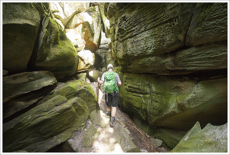
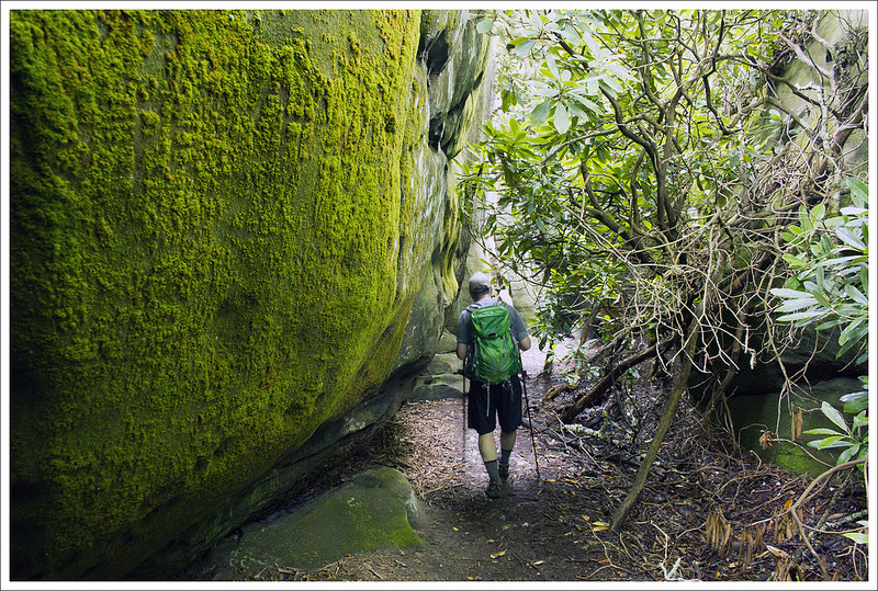
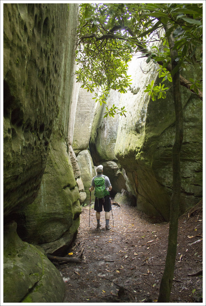
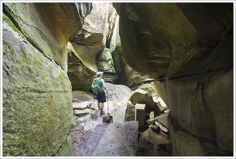
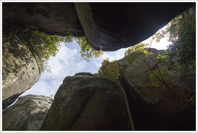
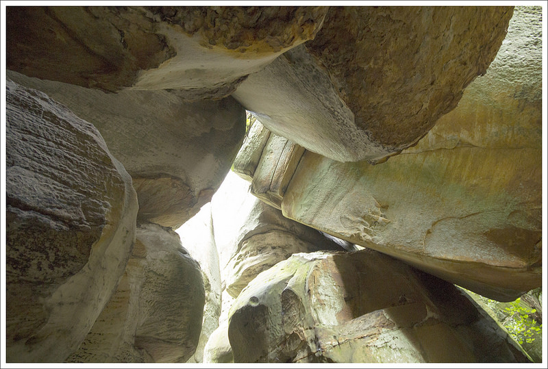
The trail descended the hillside until it led to the entrance of the Great Channels.  I will say this is one of the most unique things I have ever seen.  You walk down a path in between these sandstone formations that creates a maze of trails and rocks.  You will feel like a kid again with your desire to explore this maze.  Most of the paths between the rocks are passable (I did squeeze my body through one tight area just to see what was on the other side), but get your bearings early so you can remember the proper way back.  We found you can get a little turned around as you explore these channels, which could create some panic from anyone claustrophobic.  It was much darker in the Channels, but occasionally you would find a spot where the sun shined down to the bottom.  The formations were so unique that you will want to take some time to explore down all the channels.  The only real exit to the Channels is going back the way you came.

After we were done exploring, we climbed back to the top and ate a snack underneath the fire tower before finishing up our trip.  We came across a few other families at the top, but we enjoyed having the Great Channels to ourselves.  We made our way back the way we came, giving us about a 6.6 mile hike total.  We were so glad we were given this hike recommendation.  This is a true geological treasure that is surprisingly not as well known beyond the local community.

Arriving at the Entrance to Great Channels
Look for the fire tower when you’re seeking the entrance to the Great Channels. Below: There is an old, burned out watcher’s hut; The descent into the maze; Moss covered walls.

Burnt Out Shelter at Great Channels Entering Great Channels Entering Great Channels

Christine Says…

The idea to hike the Great Channels came from one of our readers (thanks, Dj!)  We had never heard of the area and were excited to add this hike to our itinerary on a recent visit to Abingdon, Va.  Since Adam has covered all the details and distances, I’d like to use my part of the post to share some of the fascinating history of this area.

The Channels has only been accessible to the public for a little over a decade. It’s really one of Virginia’s newer hikes!  In 2004, The Nature Conservancy purchased the 5,000 acre tract land from a private owner.  Then in 2008, through a partnership with the state, Channels State Forest was established.

In the early years of the new state forest, the route to the Channels formation was traversed only by the rugged Channels Trail.  Marked in green on this map, the hike required an 11-mile round trip effort with about 2,600 feet of climbing.

Inside Virginia's Great Channels
There is nothing else in Virginia like the Great Channels. Below: As seen inside the Channels.

Inside Virginia's Great Channels Inside Virginia's Great ChannelsInside Virginia's Great Channels

In 2012, the non-profit group Mountain Heritage opened the Brumley Mountain Trail.  The trail was built over several years with the assistance of volunteers and labor supplied by inmates from the Appalachian Detention Center.  All in all, the Brumley Mountain Trail covers 14 miles along the spine of Clinch Mountain from Hayters Gap on VA80 to Hidden Valley Lake.  If you park in the new lot at Hayters  Gap and follow the Brumley Trail, you can access the Channels formation via a moderate, well-graded trail – totaling six miles, round trip.  The establishment of this trail made the Channels infinitely more accessible for hikers of all abilities!

The sandstone maze at the heart of Channels State Forest sits hidden at the top of Middle Knob – elevation 4208’.  Formed 400 million years ago, the deep crevices and slots likely formed due to permafrost and ice wedging during the last ice age.  The expanding ice fractured the sandstone and water slowly spread and smoothed the breaks over millions of years.  What we’re left with now is a labyrinth of slots and crevices through the rocks. The pathways range from 20 to nearly 40 feet deep and wind their way through damp, moss-covered walls of stone.  It stays shady and cool in the Channels – even on a hot mid-summer day.

Inside Virginia's Great Channels
The rock walls of the channels had lots of interesting textures. Below: More scenes from the Channels.

A Look Up from the Bottom of Great Channels Jumbles of Boulders in the Great Channels A Look Up from the Bottom of Great Channels

The entrance to the maze is located near one of the tallest and most rickety fire towers I’ve ever seen.  You could not pay me a million dollars to climb that tower! However, when doing research for this post, I stumbled across the blog of another hiker who DID climb the tower in 2013 (despite the bottom two flights of stairs being removed and posted signs saying NOT to climb the tower.)  We implore our readers to stay safe and stay off the tower.  I will add that photos shared by this particular hiker showcased 360 degree views all the way to Mt. Rogers, Roan Mountain, and Grandfather Mountain.  From the tower’s top, you can also down into the maze from above.  His photos were pretty cool – but again – do not attempt to climb the tower.  An article from the June 3, 2012 issue of the Bristol Herald Courier says that funding is being sought to renovate the old tower and turn it into an observation platform.  Clearly, nothing has happened between 2012 and 2016!

I enjoyed exploring the labyrinth of passageways that make up Great Channels.  The scale and size of the formation exceeded what I pictured before visiting. The maze covers about 20 acres.  Some pathways loop around and connect to other paths and some just reach a dead end.  There was plenty to explore, but the area is not so expansive that you feel you’ll get lost and not find your way out.  I will add that after a suitable amount of exploration, I was ready to see the land from back ‘on top’.   After a while, the maze started feeling eerie and close.  I guess I’m more claustrophobic than I thought!

The Precarious Fire Tower
The fire tower is closed to climbing. It is very tall and rickety. Below: You do not want to climb this fire tower: Atop the maze

Elevation at the top of Channels The Great Channels from the Top Leaving the Great Channels

Another couple things I wanted to note about this hike!  The first one is a big plus — there were TONS of sweet, ripe, juicy blueberries around the fire tower when we visited in late July.  It was a treat to enjoy them with our packed lunch.  The negative I wanted to remark on is the amount of litter left in the Channels.  There were so many plastic water bottles, candy wrappers, and beer cans tucked into crevices in the rocks.  It’s always a bummer to visit a beautiful, unique place and find it covered with garbage, and unfortunately that was the case with the Channels.  If you think about it when you visit, bring a trash bag and try to carry some of the trash out with you.

Trail Notes

  • Distance – 6.6 miles
    (Check out the stats from Map My Hike)*
  • Elevation Change – 1200 ft
  • Difficulty –  3.  The hike isn’t as tough to approach the Middle Knob fire tower, but the climb down to the Channels may be a little steep for some.
  • Trail Conditions – 4.  The trail mostly follows a large fire road, so footing is easy. 
  • Views –  2.  There were some obstructed views along the way, but nothing overly dramatic. 
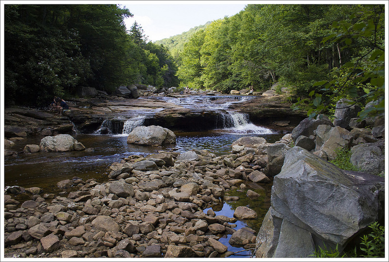
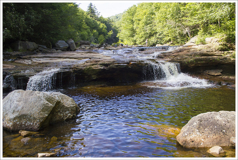
  • Waterfalls/streams 0. non-existent. 
  • Wildlife – 3.  This area is not as well populated and black bears have been spotted.  We saw several deer along the trail.
  • Ease to Navigate – 4.  There are only a few junctions that could lead to any confusion.  Finding the trail down to the Great Channels was a little tough since there was no sign, but with our directions, you should have no trouble.
  • Solitude – 3.  This is a popular spot for locals on nice days, but overall isn’t used heavily. 

Download a trail map (PDF)

Directions to trailhead: GPS coordinates:  36.864640, -81.946982.  Take exit 24 on I-81 and get on VA-80 W.  In .2 miles, take a left on VA-80/609/Hillman Highway.  Take a right shortly after the light to stay on VA-80/Lindell Road.  Continue to follow VA-80 for 13.5 miles until you reach the parking lot on the left of the road.  You will find the name for this road changes from Lindell Road to Hayters Gap Road.  It takes a sharp left turn about 10.5 miles in on your 13.5 mile trip and the road winds up very steeply until you reach the crest and the parking lot on the left.

MapMyHike is not necessarily accurate, as the GPS signal fades in and out – but it still provides some fun and interesting information.


Dolly Sods – Rohrbaugh Plains to Red Creek (WV)

This 10 mile (round-trip) hike takes you past some of Dolly Sods most beautiful scenery.  The dense rhododendron thickets, unblazed trails, and rugged terrain will have you feeling like you’re truly in the wild.  Camping along Red Creek is popular and can be crowded with weekend backpackers, but it’s still one of West Virginia’s most spectacular places.

View the Full Album of Photos From This Hike

Beautiful Red Creek
Beautiful Red Creek was our destination for this short overnighter. Below: Our excellent hiking crew (Maia the dog not included in the photo!);  Making our way onto the Rohrbaugh Plains Trail; The trail is only lightly maintained so you have to climb blowdowns and navigate without the help of blazes.

Our Hiking Crew Start of the Rohrbaugh Plains Trai Rohrbaugh Plains Trail

Day One…

Back in early June, we were at happy hour with our friends Christy and Brian.  Over beers, we cooked up a vague plan for a weekend backpacking trip in late July.  In the weeks to come, we added our mutual friend, Kris, into the mix and settled on a route.  The plan was to take two cars, and do a trans-navigation of Dolly Sods starting at the picnic area and ending at Bear Rocks.  It was about a 16 mile route with tons of camping options along Red Creek.

As it turned out, a heat wave settled over the mid-Atlantic that weekend.  It was the hottest, most humid weekend of the summer.  We still thought we could make the full 16 miles, so we met at Bear Rocks and shuttled in our car to the start point at the Dolly Sods Picnic area.  On the ride, we learned that you really can fit five adults, five big backpacks, and one German Shepherd in a Subaru Forester. It was like a clown car!

We parked at a small pullout near the picnic area, and picked up the Rohrbaugh Plains Trail on the opposite side of the road.  The trail meandered through dense rhododendron forest.  A lot of the rhododendron was Rosebay near the peak of its bloom.  So pretty! The air was thick, still, and heavy with humidity. It felt like walking through the jungle.  At one point, Kris said, “I feel like we might see monkeys!’

Meadows on the Rohrbaugh Trail
Walking through meadows. Below: Maia enjoys a shady pool under the rhododendrons; Walking across Rohrbaugh Cliffs; A nice spot for lunch!

Maia Enjoys a Shady Pool Arriving at Rohrbaugh Cliffs Lunch Stop

The trails in Dolly Sods are well-traveled but very lightly maintained.  There are no blazes.  The only wayfinding signs are at trail junctions.  There are lots of rocks, blowdowns, and mud pits to navigate. Even though the area is complete wilderness, the high traffic through the area keeps the trails apparent and fairly easy to follow.

We walked the Rohrbaugh Plains trail for about 2.5 miles before reaching the spectacular viewpoint off Rohrbaugh Cliffs.  The area is near and dear to my heart because it was one of the first places I ever camped in the backcountry. The cliffs offer great views across the valley to the Lions Head (another popular rocky outcropping in Dolly Sods) and down into the Red Creek basin.  Just past the cliffs, there is a patch of open forest with space for many tents.  It’s still one of the most beautiful campsites I’ve ever had the pleasure of staying at.

We decided to take a lunch break at the cliffs.  At first, the breeze across the open terrain felt nice.  Maybe the heat wasn’t so bad?  But after a few minutes of sitting in the direct sun, we were all pretty hot.  I could feel my shoulders starting to burn.  After lunch, we packed up and continued another .6 mile down the Rohrbaugh Plains Trail.  At 3.1 miles, we passed the junction with the Wildlife Trail.  We stayed to the left, continuing on the Rohrbaugh Plains trail.

We passed a small (mostly dry) waterfall and crossed over some extremely rocky footing. At 3.5 miles the Rohrbaugh Trail meets the Fisher Spring Run Trail.  We followed the Fisher Spring Trail to the left, beginning to descend for 1.2 miles.  At first the descent is smooth a gradual, but it becomes steeper and follows a couple switchbacks down to a rocky crossing of Fisher Spring Run.

Setting Up Camp
We set up camp at a large site along Red Creek. Below: Most of the trails in Dolly Sods are rocky; Crossing Fisher Springs Run before arriving at camp; Our campsite had a private swimming hole nearby.

Rocky Trail Crossing Fisher Spring Run Our Private Swimming Hole

After the crossing , the trail follows the stream on high ground.  There are several nice campsites at the bottom of extremely steep spur trails.  A few sections of this trail are quite eroded, leaving the trail narrow and precipitous.  Take your time and watch your footing, especially if you’re carrying a heavy pack.

At 4.7 miles the Fisher Spring Run Trail ends at the Red Creek Trail.  We took a right, following the trail down toward Red Creek.  In about three tenths of a mile, we passed the first of many stellar campsites.  At the very first one, I thought to myself, “That’s a really sweet campsite.  I wouldn’t mind sleeping here!’

Our group decided to take a break and discuss camping plans and how much of the route we wanted to cover on day one of our trip.  We all agreed that we were pretty hot, the campsite was ideal, and Red Creek looked really inviting.  We figured on day two, we could either hike 11 miles or hike out the way we came in and make our trip a short 10-mile out-and-back.

Adam and I explored several more campsites along the stream before agreeing that the very first site was the prettiest and most private.  There was easily space for four tents.  The ground was flat and clear.  We had easy access to water.  We even had a large fire pit with a stone couch someone had constructed. We all unpacked and set up camp. Maia, our friends’ German Shepherd, supervised the operations.  She was on her first backpacking trip ever, and she took to it like a pro!

Red Creek
Red Creek is a beautiful place to camp and swim.  Below:  Fun in the water and fun at camp!

Swimming in Red Creek Swimming in Red Creek Swimming in Red Creek
Swimming in Red Creek Enjoying Red Creek red creek 18

It was only around 2:30, so most of us spent the entire afternoon swimming and playing in Red Creek. The water was so cold and refreshing. The small rapids and waterfalls felt like hydrotherapy for our hot, tired muscles. Adam opted to restock everyone’s water and read a book at camp, but even he enjoyed splashing in the cold water near camp.

Around 5:00 we decided to get dinner started.  Everyone brought their own dinner, but Christy and Brian brought a shared dessert – Rocky Road pudding.  Kris contributed a two-bottle capacity bag of wine to the feast.  After dinner we played cards and sat around our campfire.  Even at 9:00 p.m., it was still 75 degrees.  That’s unusually warm for Dolly Sods at night!

Around 10:00 we let the fire die down, and everyone started retreating to their tents.  Adam and I opted to leave the rain fly off in hopes that it would keep us cooler.  Honestly, it didn’t really cool off until sometime around 3:00 a.m.  It was a steamy night and I was very glad to have left my sleeping bag home in favor of a light summer quilt.  I enjoyed falling asleep to the sound of the running stream.  Any time I woke up during the night, I took a moment to marvel at the brilliance and magnitude of the stars in the sky.  It’s such a gift to be able to visit places like this and have good friends to share the experience. I felt so fortunate that night in my tent.

Day Two…

The next morning we awoke at daybreak.  We thought Maia would have woken up the group, but she was a perfect camp companion and let us get up when we wanted.  We enjoyed some of Christine’s homemade granola with Nido and then made our way back to the car.  With a warm night and temperatures climbing quickly in the morning, we decided to get an early start to get back to our cars before the temperatures peaked in the afternoon.  It is always uncomfortable when you feel like you never had a chance to cool down, so everyone felt hot within a few minutes back on the trail.

Camp Dog
Maia did great on her first backpacking trip. Below: Hiking back out the way we came in!

Hiking Out Hot and Humid More Rocks to Cross

We climbed back up the steep Red Creek Trail and Fisher Spring Run trail very slowly as we were all quickly drenched with sweat.  We got back to the junction with the Rohrbaugh Trail in about 1.5 miles and we knew our toughest work was behind us.  In another .4 miles, we reached the junction with the Wildlife Trail and took a right to make our way to the Rohrbaugh Cliffs again.  We paused for a snack and some more pictures from Rohrbaugh Cliffs, which is probably my favorite spot in Dolly Sods.  Looking over the creek and seeing nothing but mountains around you is a scene that begs you to pause and appreciate nature.

Rohrbaugh Cliffs
Taking in the view from Rohrbaugh Cliffs. Below: The small waterfall along the Rohrbaugh Trail was running very low; Climbing on the rocks of Rohrbaugh Cliffs; Back to the Forest Road.

Small Waterfall Rohrbaugh Cliffs The End

With the strong sun beating down, we decided to press on and continue our journey back to the car.  We made our way back fairly quickly, passing by a group of about 10 women that were enjoying the weekend as well.  We got back to our car just a bit before lunch and carpooled Christy, Brian, and Maia back to their car.  We had a great adventure together and we were really glad to share this amazing piece of wilderness.  We parted ways with Christy and Brian, and Christine, Kris, and I headed to Lost River Brewing Company in Wardensville, WV for some celebratory beers and food.  It was a great trip, but we vowed to return when it isn’t the hottest weekend of the year to do the traverse across Dolly Sods like we originally planned.

If you are looking for a hike or overnight trip that combines majestic views, creeks with a waterfall and swimming possibilities, and great overnight camping, this may be a perfect one to experience.

Trail Notes

  • Distance – 10 miles
    (Check out the stats from Map My Hike [Day One] [Day Two])*
  • Elevation Change –  1480 feet
  • Difficulty – 3.  The elevation gain/loss is moderate, but the rugged nature of the footing adds difficulty to this route.
  • Trail Conditions –  2.  Trails are unblazed.  Be prepared for mud, blowdowns, and lots of rocks.
  • Views – 5.  The view from Rohrbaugh Cliffs is pretty spectacular!
  • Waterfalls/streams – 5.  You will want to spend all day enjoying the beautiful rapids and waterfalls along Red Creek.  This is some of the best stream swimming in West Virginia.
  • Wildlife – 2.  We saw a white tail doe with two fawns on the drive in, but generally the woods were quiet and we didn’t feel like there was much wildlife in the camping area.
  • Ease to Navigate – 2.  There are no blazes, but junctions were marked, and the trail was generally easy to follow.  Navigation gets trickier near Red Creek where you depend on cairns to mark stream crossings.
  • Solitude – 3.  This is tough to call!  We saw almost nobody on the trail when we were hiking, but there were many people camped along Red Creek.

MapMyHike is not necessarily accurate, as the GPS signal fades in and out – but it still provides some fun and interesting information.

Download a trail map (PDF)

Directions to trailhead:  GPS Coordinates for Parking are 38.962019, -79.355024. From Seneca Rocks, go North on WV 28 for 12 miles.  Take a left on Jordan Run Road.  Go one mile up Jordan Run Road and take a left on to Forest Road 19.  In 6 miles, Forest Road 19 comes to a T on to Forest Road 75.  Take a right, heading north on Forest Road 75.  Drive for about eight miles until you reach the Dolly Sods Picnic Area. The Rohrbaugh Plains Trailhead will be across the road from the picnic area.