This nine mile hike is not very well-known, but it’s truly one of the park’s most scenic summits. Past fire damage has left the summit open, with views in every direction. We hope sharing this post won’t spoil the solitude we enjoyed on this hike.
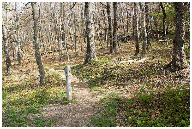
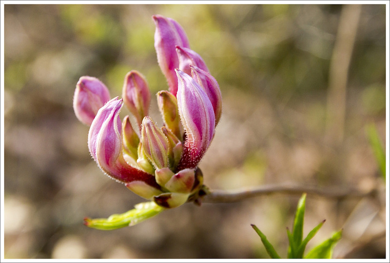
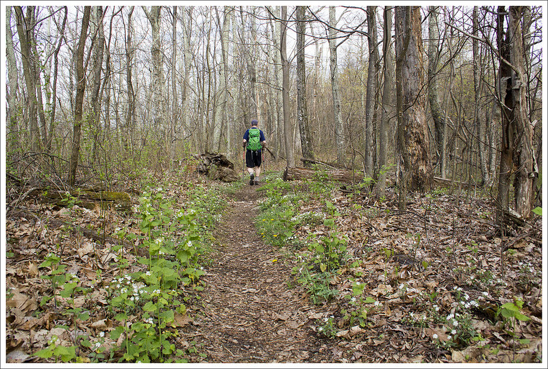
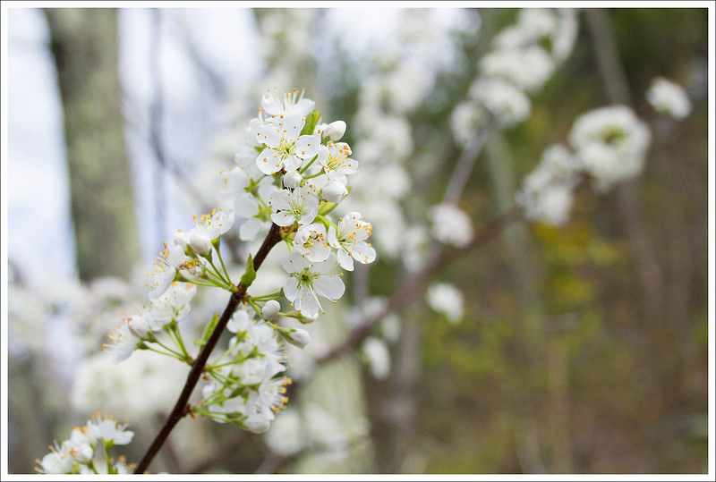
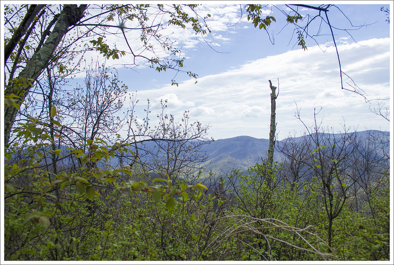
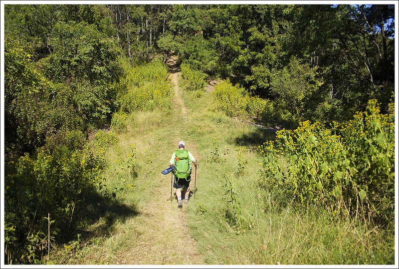
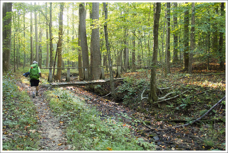
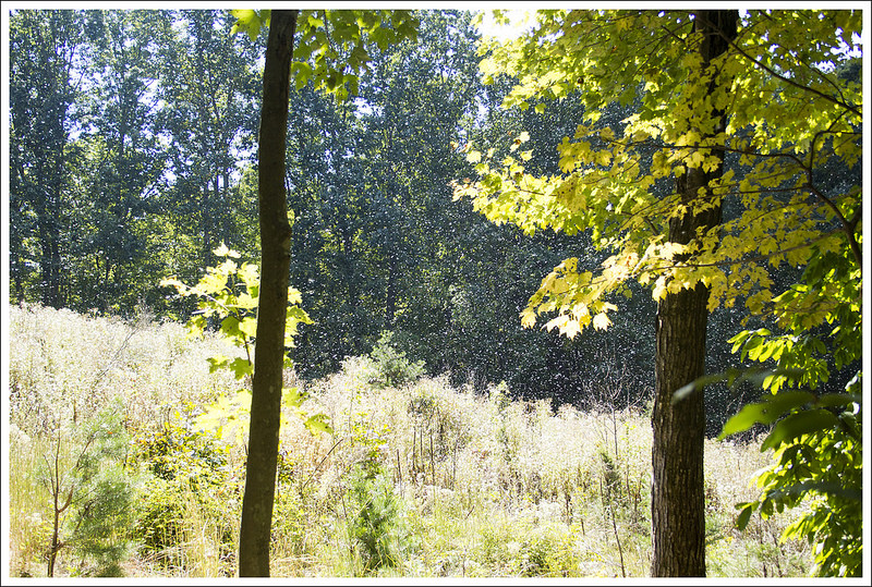
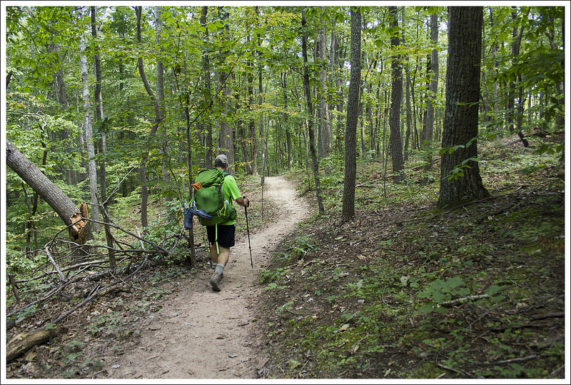
This beautiful view is about half a mile from the true summit, but it was too beautiful to pass up! Below: The hike starts northbound on the AT at Browns Gap; Pink azaleas were just starting to bloom; Adam hiking on the Big Run Trail.
Adam Says…
How has this hike escaped us before? We’ve covered most of what Shenandoah National Park has to offer, but this was a hidden gem that we are so glad we did. While this hike is about 9 miles, the elevation gain feels fairly minimal considering the distance you are covering. We were getting ready to do a multi-day backpacking trip in a couple of weeks and we wanted to get some training in before we hit some bigger miles with heavy packs. Christine had seen a few photos from the viewpoint and mapped out this possibility of a hike.
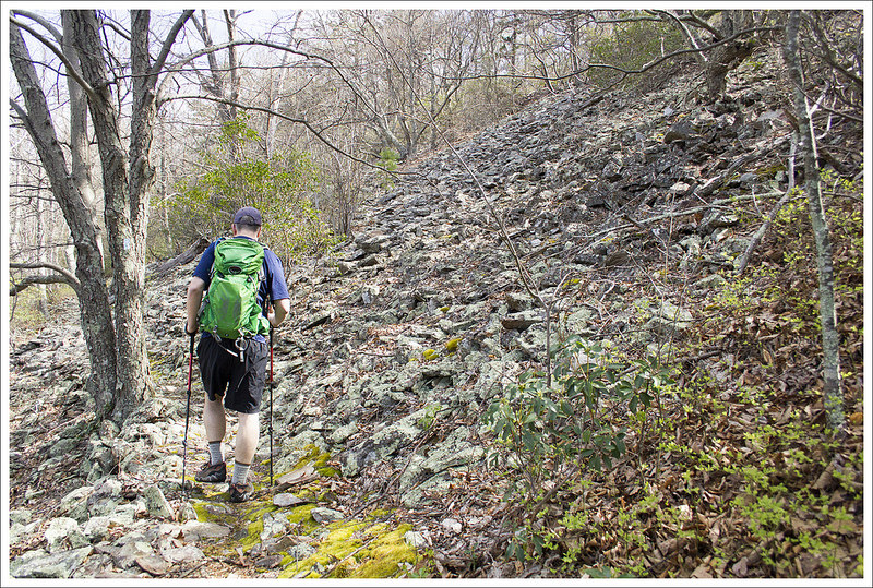
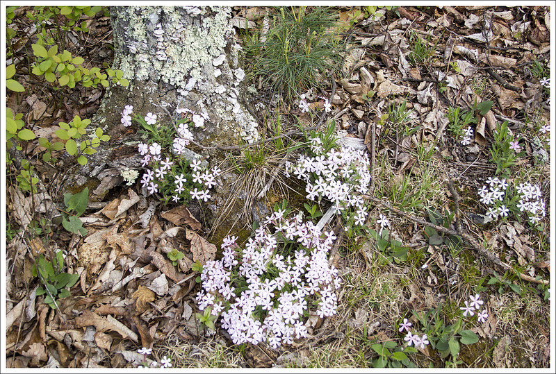
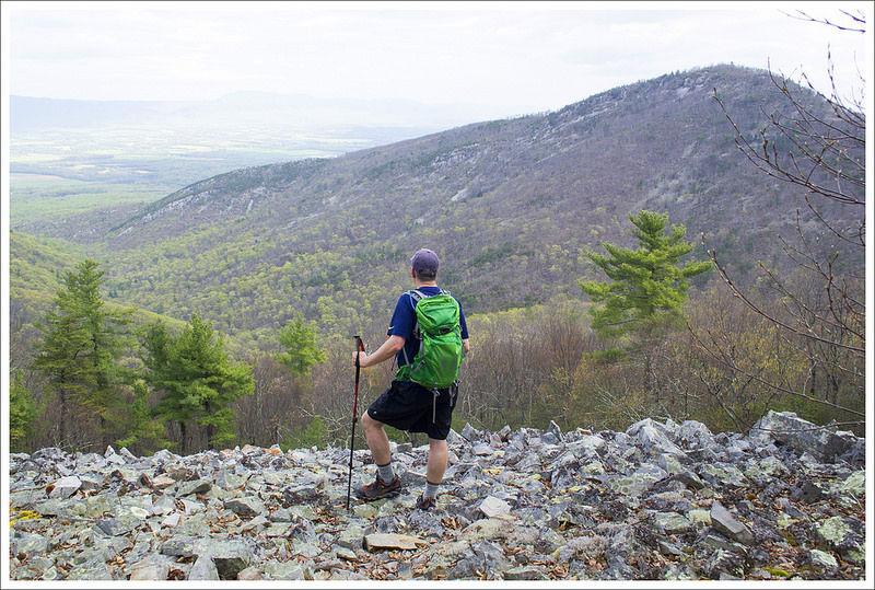
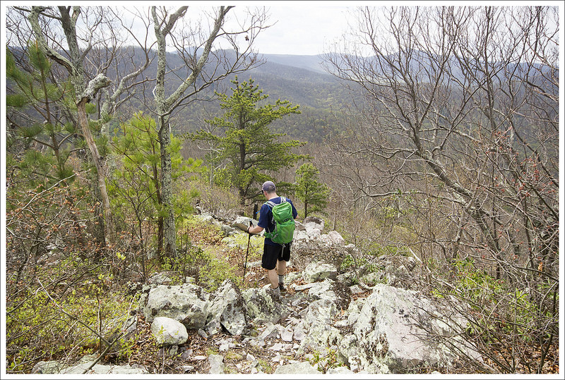
We saw a ton of these Dwarf Irises on the hike. Below: Early spring on the Rockytop Trail; Adam crossing talus slopes on Rockytop; Everything in bloom!
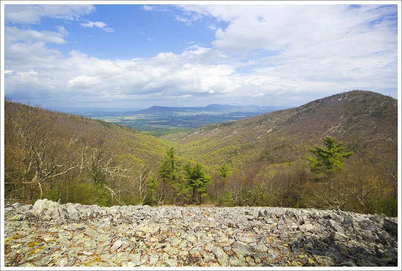
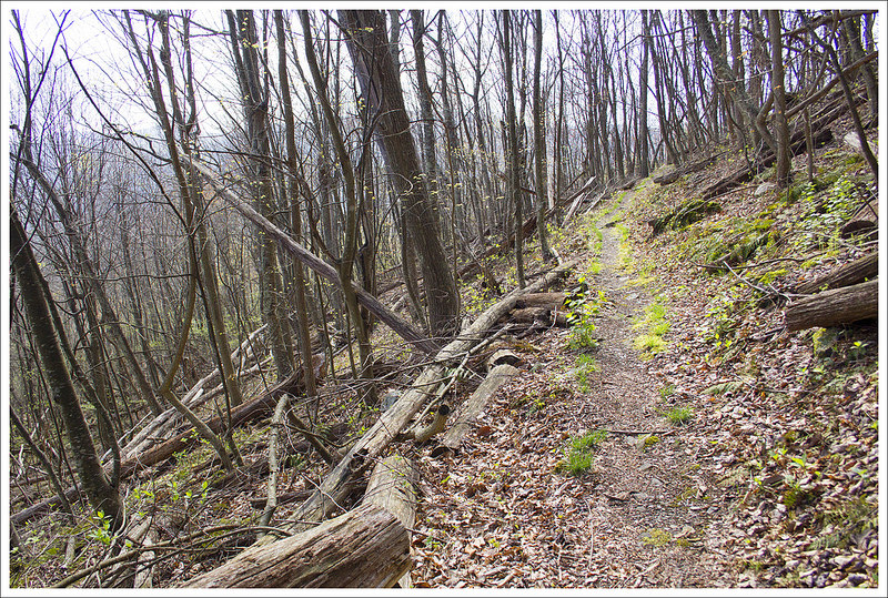
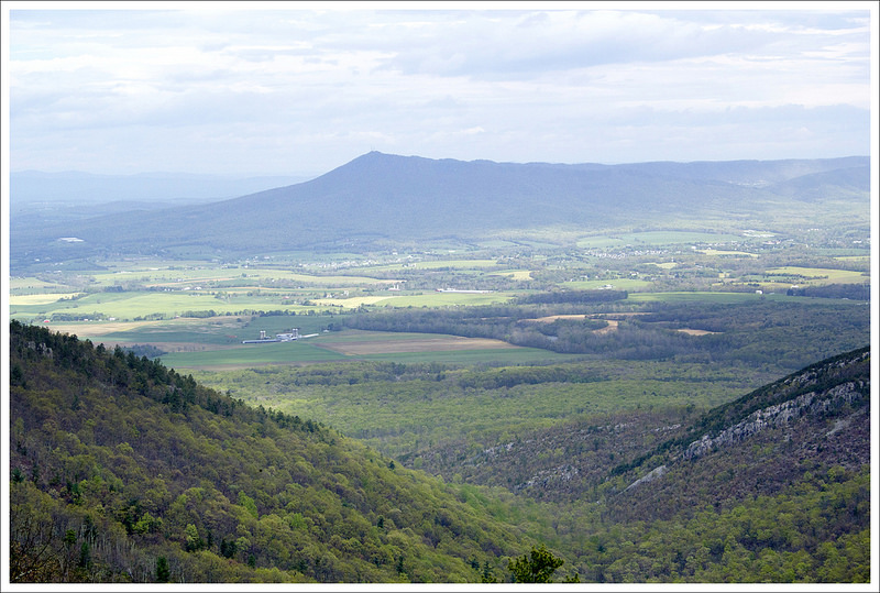
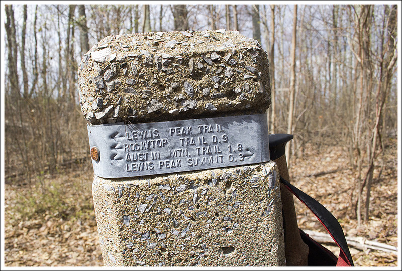
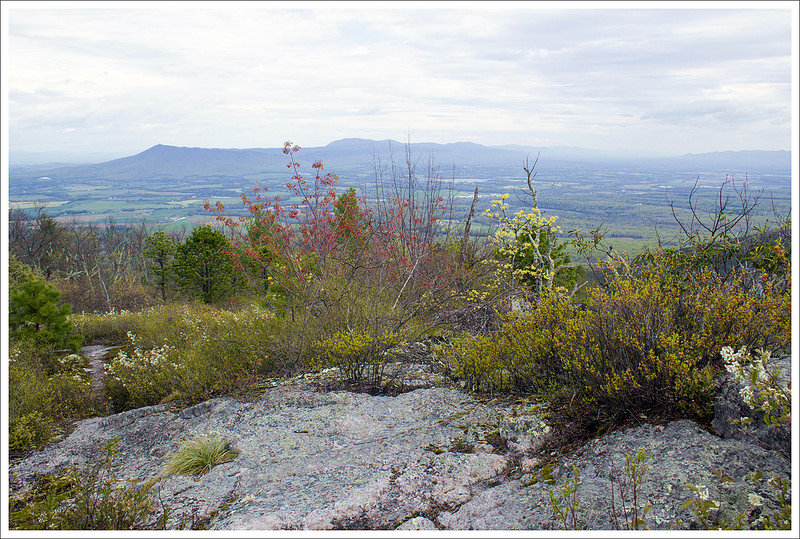
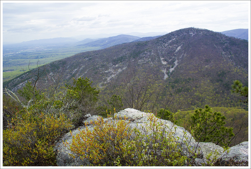
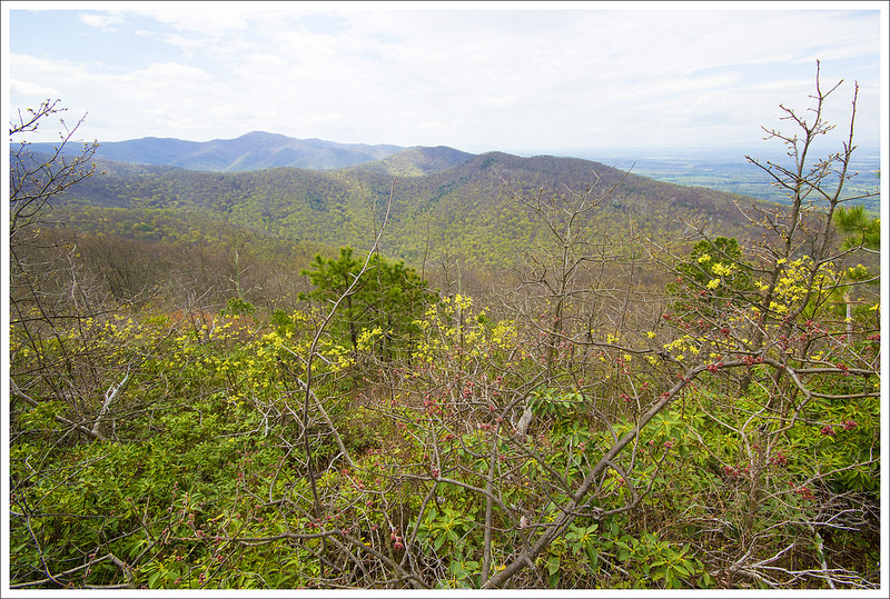
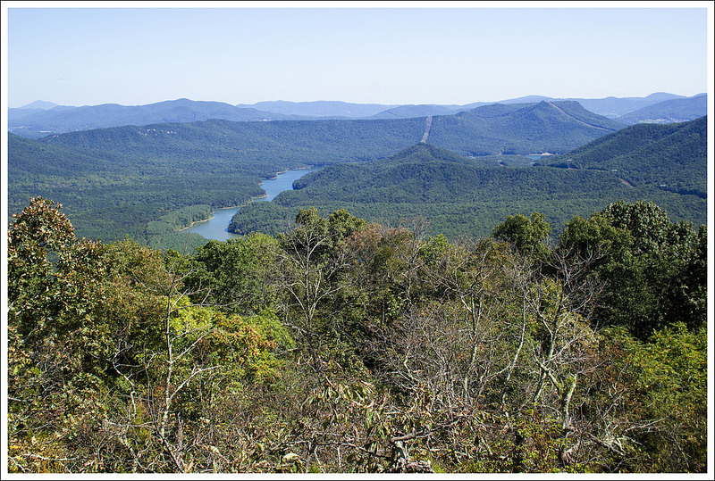
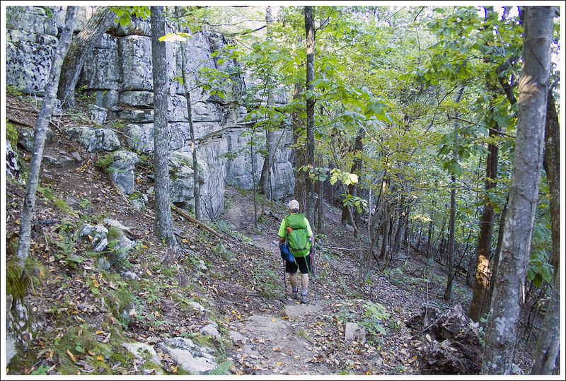
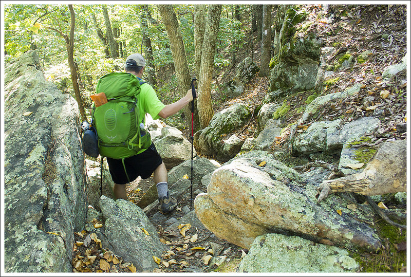
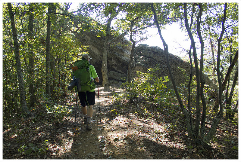
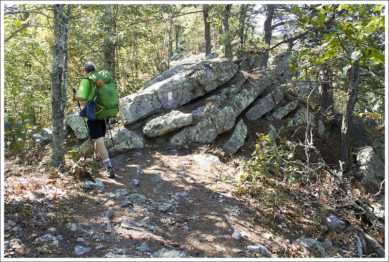
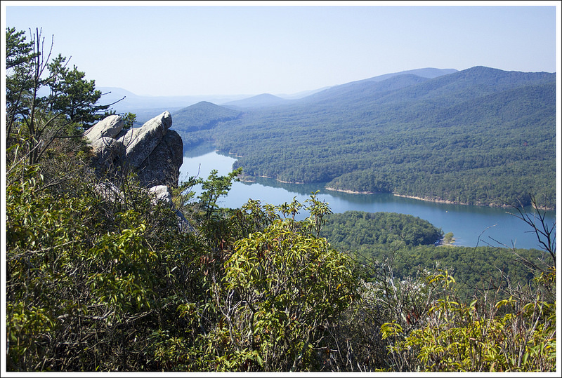
The hike starts at Browns Gap (the sign reads “Brown Gap”, but maps of the area show “Browns Gap”), at mile marker 83 of Skyline Drive. We parked our car and found the Appalachian Trail post from the parking lot and headed north on the white-blazed AT. The trail climbs a bit from the beginning and parallels Skyline Drive. At .5 miles, you come to the junction with the Big Run Loop Trail. Take a left here to join the blue-blazed Big Run Loop Trail. At 1.1 miles, you come to a four-way junction where the Big Run Loop Trail breaks off to the right and the Madison Run Spur Trail heads to the left. You will just stay straight. At 1.5 miles, the trail reaches another junction with the Austin Mountain trail bearing to the left; bear to the right to join the Rockytop Trail. Around 2.3 miles, you will pass along a rockier section of trail as it passes through some large talus slopes. At 3.4 miles, you reach the Lewis Peak Trail junction. Take a left at this junction to make your way to Lewis Peak. The trail descends at this point, At 3.6 miles, you reach a great viewpoint off the trail to the right. There is a large talus slope here that opens up into views of a valley between two mountains and Massanutten Mountain perfectly framed at the center in the distance.
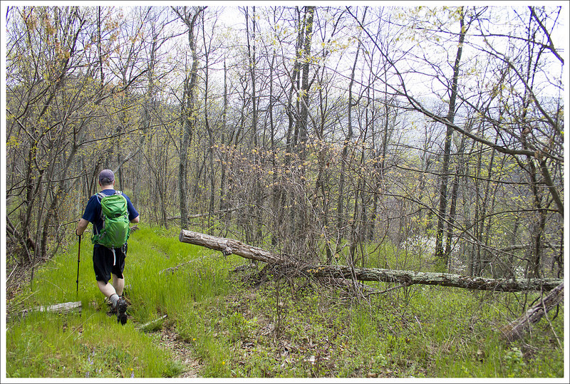
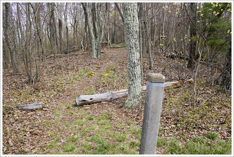
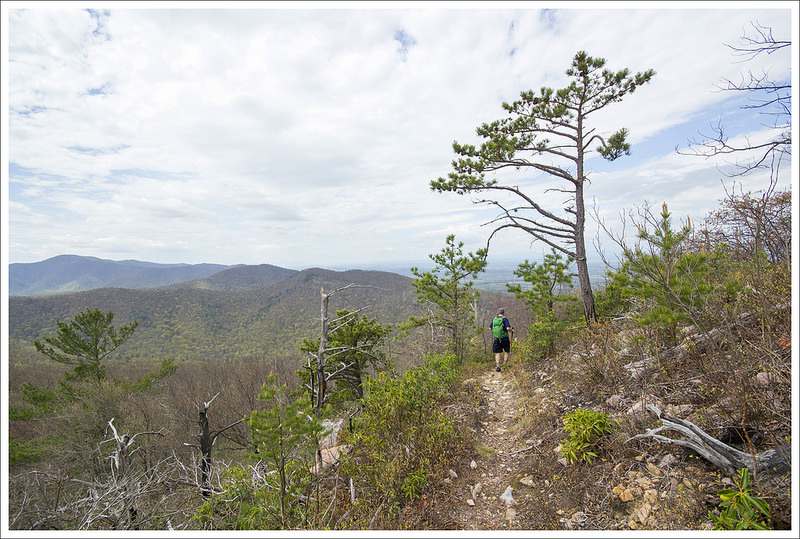
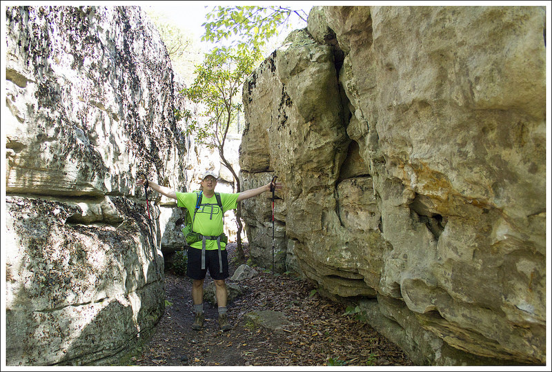
The ridgeline on the Rockytop Trail provided nice views. Below: Mountain view from the ridgeline; Spring blooms; Junction of the Rockytop and Lewis Peak trails.
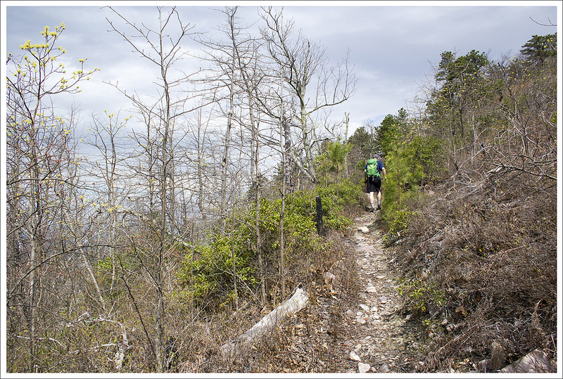
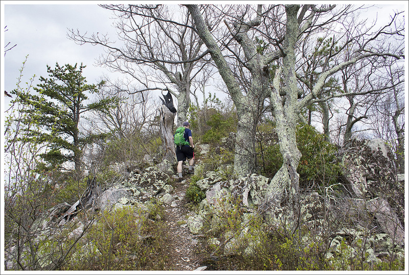
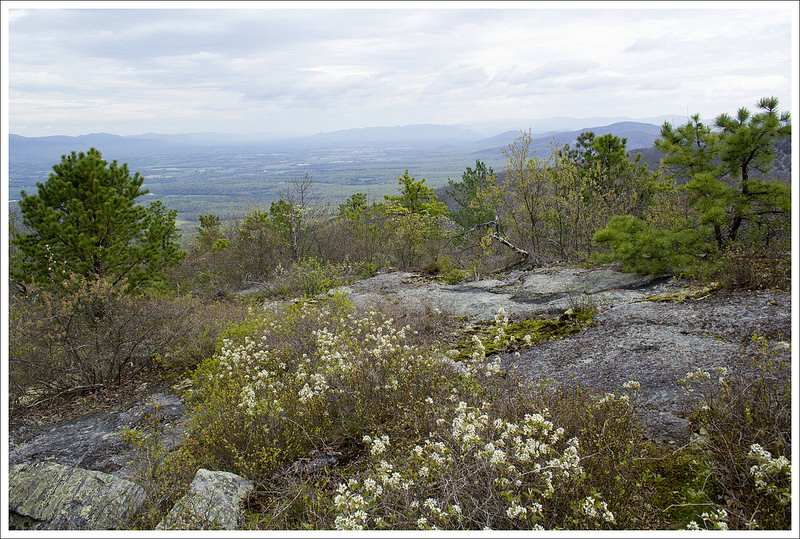
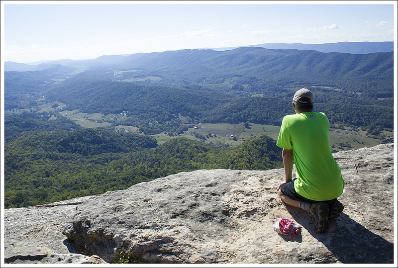
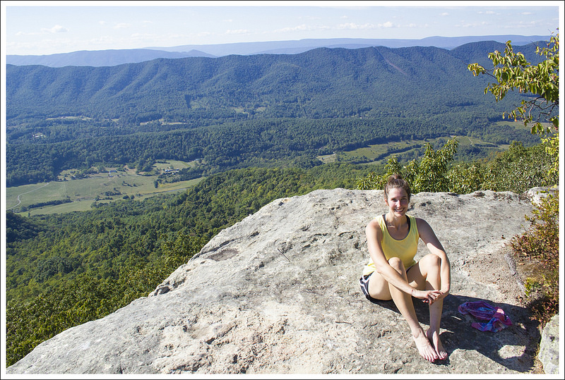
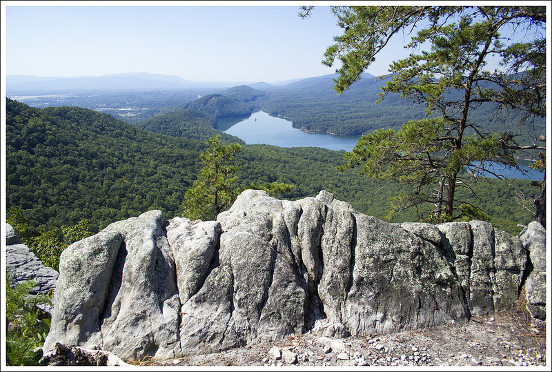
The trail continues to descend from this viewpoint until you reach 4.0 miles and then the trail begins to climb again. At 4.2 miles, you reach the junction with the Lewis Peak Summit Trail. Take this trail to the right and you will climb rather steeply to the summit through a series of switchbacks that will eventually wind around until the trail reaches its end and the summit at 4.5 miles. A forest fire from 2006 has destroyed a lot of the taller trees in the area, but it has created a very nice viewpoint from the summit.
We stopped here and ate a snack while enjoying the expansive views all around us. Clouds were starting to roll in, but we had the stunning panoramic views all to ourselves. When reflecting upon this hike, Christine and I both think that it may arguably have the best views from the southern district of Shenandoah National Park. We made our way back the way we came. There is some steep climbing on the way back, but most of the steep stretches are short-lived. If you can handle the distance, put this on your upcoming hiking agenda.
Christine Says…
For the last week of March and the first three weeks of April, I was bed-ridden from a severe allergic reaction to antibiotics. I burned with fever, my skin blistered and peeled, I itched all over, and struggled with excruciating nerve pain. As the weeks passed, I thought I would never be well enough to hike again. When I finally started feeling better, I went for short, easy walks around my neighborhood. But pretty soon, I felt a strong draw to get back to the ‘real’ trail. I don’t know what made me think a nine mile hike with 1500′ of climbing was a good idea for a ‘first hike back’.
This spectacular view is just a short distance from the junction of the Rockytop and Lewis Peak trails.
I’m not going to lie – I really struggled on this hike. My endurance definitely took a hit from spending a month in bed. On top of that, it was a hot, humid day. My doctor had directed me to fully cover up with long sleeved Capilene, long pants, a hat, and sunscreen to protect my healing skin. I felt like I was sealed in plastic wrap. I just couldn’t cool off. The whole hike, I had a mantra… ‘just take the next ten steps.’ Fortunately, taking ten steps over and over again eventually adds up to a nine mile hike.
Despite the physical challenge, there were some memorable high points on this hike. When we first set out we met a neat retired couple – Swallow and Blind Pig. They were section hiking Virginia’s Appalachian Trail. They were from Oregon and had previously finished hiking the Pacific Crest Trail. We talked to them about the park, the AT, gear, food, and wildlife. I hope when Adam and I are retired we’ll still be having adventures like Swallow and Blind Pig.
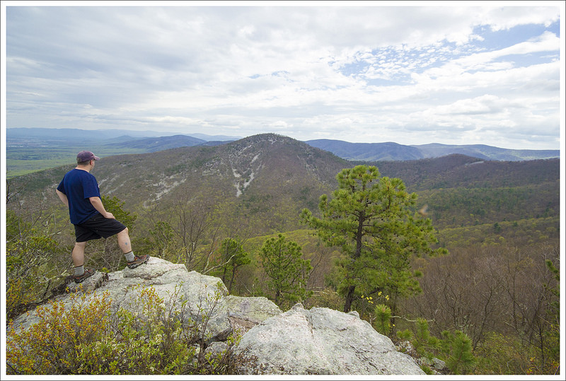
Lewis Peak is steeper, rockier, and pointier than most mountains in Shenandoah. This are was burned out by a forest fire in 2006. Below: Views from the Lewis Peak summit are amazing! Clouds moved in on our hike, but on a clear day, you can see for miles!
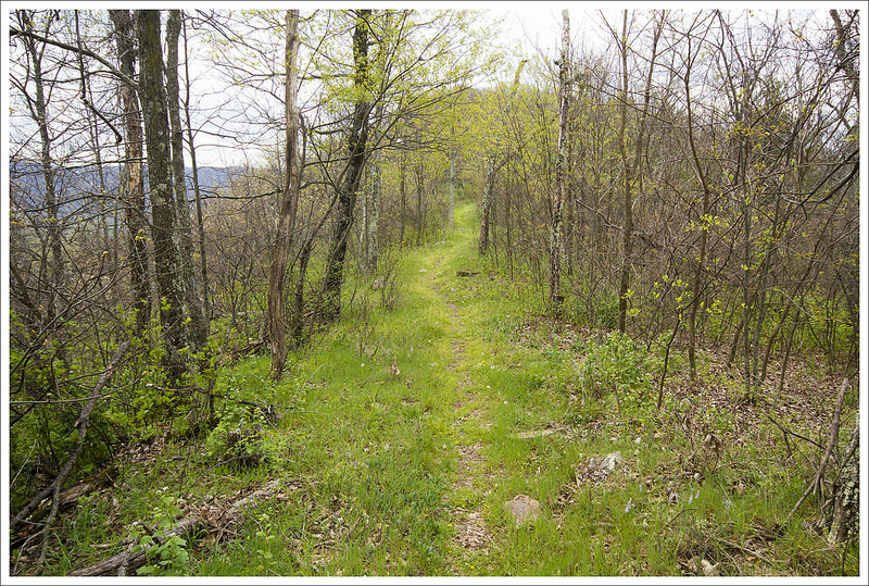
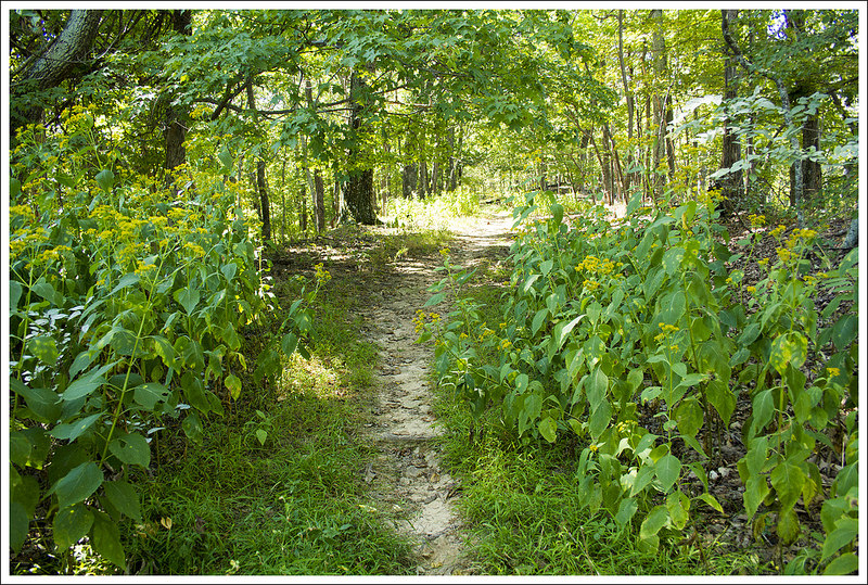
I also really enjoyed all the signs of spring emerging in the park. Most of the high elevation trees were still leafless, but we could see the brilliant green of emerging leaves creeping up the mountainsides. There were a few azaleas starting to bloom, spring beauties were abundant, and we passed several large patches of dwarf irises. Spring is my favorite season. I love seeing color and life waking back up after dull winter.
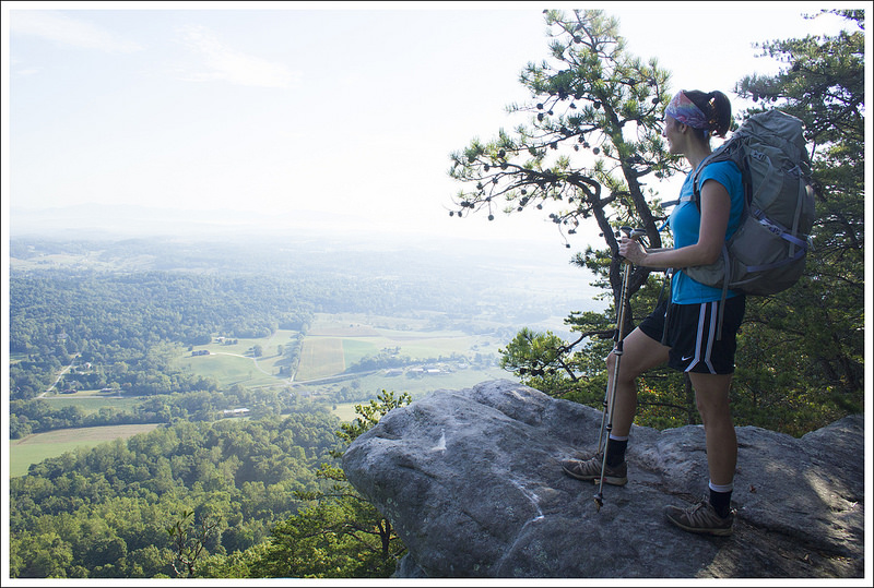
A significant part of this hike followed a ridge, so we enjoyed views through the trees. The open vista of Massanutten from the Lewis Peak trail was simply spectacular. The mountains in the foreground perfectly framed the distinct peak of Massanutten.
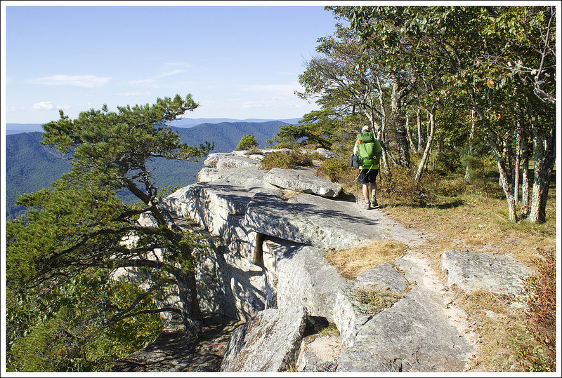
A great view from the Lewis Peak summit. Below: The views descending Lewis Peak were excellent, too! The area is so cleared out that you can see views in almost every direction.
When we started making switchbacks toward the summit of Lewis Peak, I knew we were going to have even more amazing views. The entire summit climb was open and there were wide open looks at mountains and the valley in every direction. The summit itself is sharper and pointier than almost any other peak in Shenandoah. The end of the trail has a wide sweep of rock to sit upon while you enjoy the view. There were berry bushes growing all over the place. In mid to late summer, this would be a good place to pick wild blueberries.
We enjoyed the view and a couple snacks before heading back the way we came. The hike back had a couple steep climbs that challenged me. I hadn’t remembered any of the downhills feeling steep on the outward hike, so the uphill climbs surprised me on the way back!
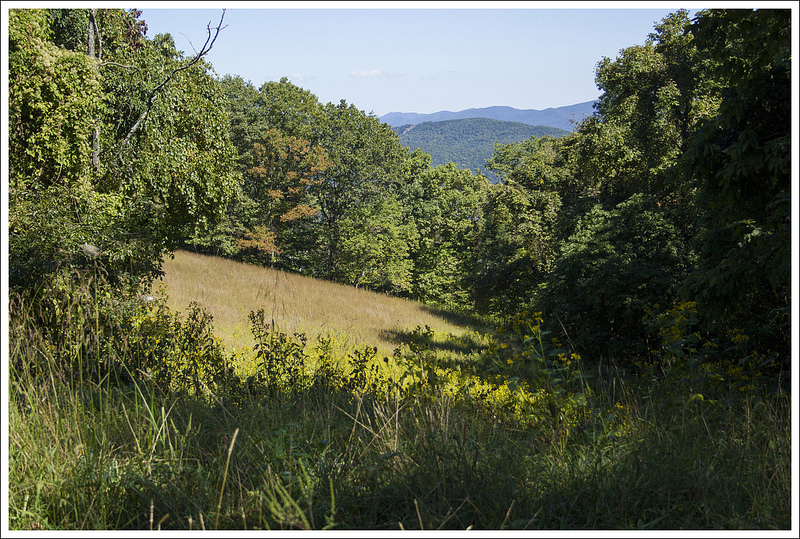
The hike back was beautiful!
I was quite glad when we got back to the Appalachian Trail and the final gentle descent back to the parking area. After our hike, we stopped for lunch at the Loft Mountain wayside – grilled cheese sandwiches and our first blackberry milkshakes of the season. It was great to be back on the trail!
Trail Notes
Distance – 9.1 miles roundtrip
Elevation Change – 1527 ft.
Difficulty – 3. The mileage is a little long for most people for a day hike, but with moderate climbs if you take your time it should be doable by most.
Trail Conditions – 4. The trail was in great shape. There was one larger blowdown on the Rockytop Trail we encountered, but otherwise was well maintained.
Views – 4.5. Amazing views from the summit and the viewpoint over the talus slopes just .5 miles from the summit.
Streams/Waterfalls – 0. non-existent.
Wildlife – 3.5. This area is a bit remote, so you may see some deer and bears on your hike. Watch out for rattlesnakes, especially if you venture onto any of the talus slopes.
Ease to Navigate – 3. There are a number of turns to get to Lewis Peak on this hike, but all of the junctions are marked with concrete posts.
Directions to trailhead: Located in Shenandoah National Park (fees apply). You will park at MM 83 on Skyline Drive at the parking lot marked “Brown Gap”. Parking coordinates are: 38.240652, -78.710379
This 20.5 mile Appalachian Trail segment crosses the most photographed spot on the entire trail – McAfee Knob. Even though the view from McAfee is fantastic, there are great views all along the section. In fact, we think the view from Tinker Cliffs rivals the majesty of McAfee.
Last fall, I told Adam I wanted to backpack McAfee Knob and Tinker Cliffs for my birthday. We planned our mileage, picked our meals, and hired a shuttle driver. When the Friday of our hike arrived, it was forecast to be blazing hot. The area was also experiencing a prolonged drought. The water sources along this stretch are typically reliable and we thought being on a high mountain ridge would cool things off a bit, so we loaded up and headed out.
On the way to our start point at Catawba, our shuttle driver (Homer Witcher – we’ve used him before and he’s a fantastic part of the Appalachian Trail community) told us that just a few days earlier, a woman and her daughter were crushed under a falling tree at one of the campsites along the route. He had assisted EMTs with the rescue operation. Fortunately, the daughter escaped with minor injuries and the mother recovered after a hospital stay. Scary!
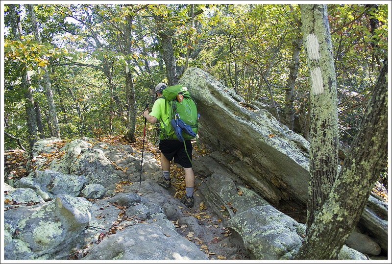
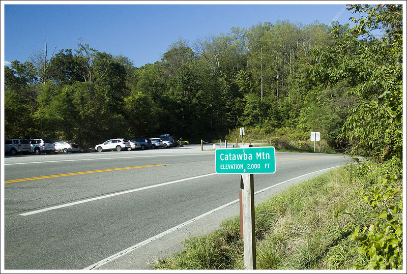
The climb was a little steep and rocky in the beginning. Below: Parking on Route 311; Johns Spring Shelter; Catawba Mountain Shelter.
Homer dropped us off at Catawba parking around 9:30 a.m. Despite it being early(ish) on a Friday, there were already numerous cars in the lot. This is an extremely popular area for hiking and the lot frequently fills and overflows by mid-morning, especially on the weekends. There are strict regulations for where you can park, and cars are frequently towed from this area. Take these rules seriously! You can read more about parking issues in the Roanoke Times article.
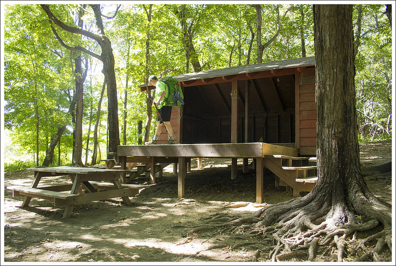
The northbound Appalachian Trail starts on the other side of route 311. We crossed and immediately began an ascent over dry, dusty terrain. Just a mile into the hike, we passed Johns Spring Shelter. It’s a typical AT shelter and has space for six people. There are a few tent sites and a privy nearby. The water source near this shelter is usually small, but it was bone dry on the day we hiked.
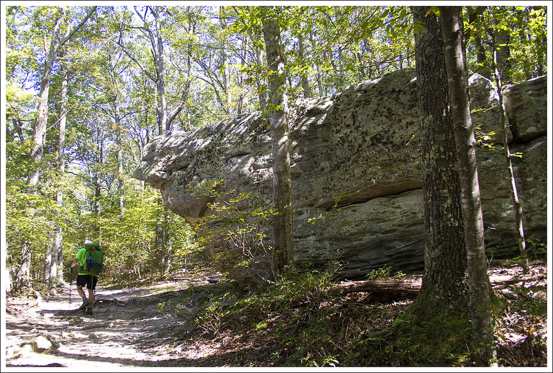
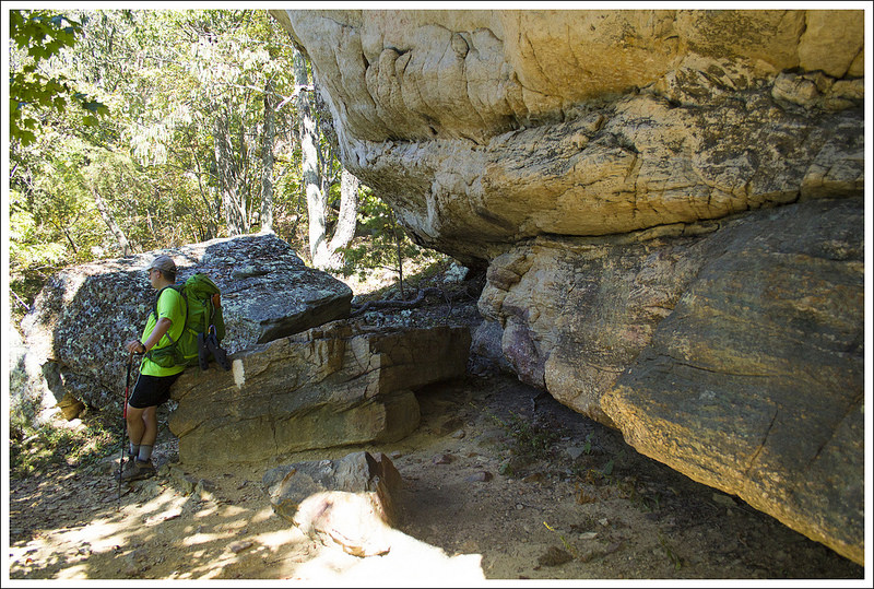
In another mile, we passed the Catawba Mountain Shelter. It’s a similar set-up to Johns Spring in terms of space. There are also several nice campsites with metal fire pits just north of this shelter. After passing this shelter, there is a steady 1.7 mile climb to the view at McAfee Knob. On the way to the top, you’ll cross a fire road. Stay on the white-blazed Appalachian Trail. Near the top, you’ll pass through an impressive jumble of truck to cabin sized boulders. The overlook is a couple hundred feet to the left of the trail and is marked by a small sign.
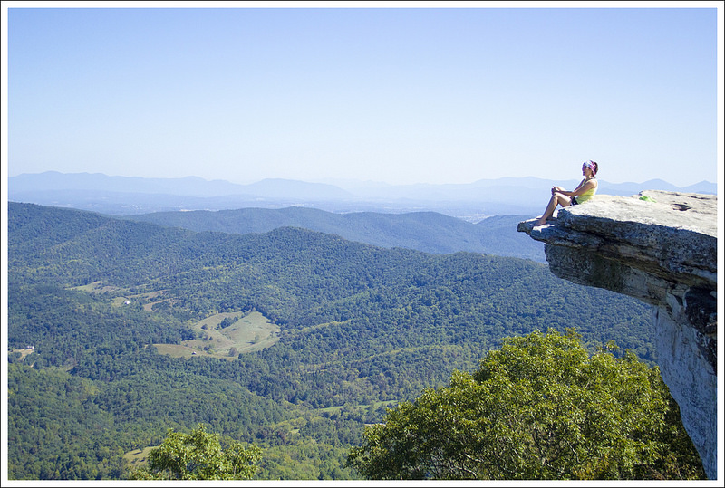
The view from McAfee Knob is gorgeous! Below: Before you reach the knob you pass under powerlines; Rock formations before McAfee Knob; It’s a tradition to sit on the edge of the overhanging rock.
Views from the overlook are majestic and expansive. The long ridge on the the right carries the Appalachian Trail over to Tinker Cliffs. On a clear day, you’ll see the cliffs shimmering in the distance. When you’re at McAfee, don’t miss the opportunity to sit on the ledge with your feet dangling into the abyss. It’s a tradition and isn’t as scary as it looks.
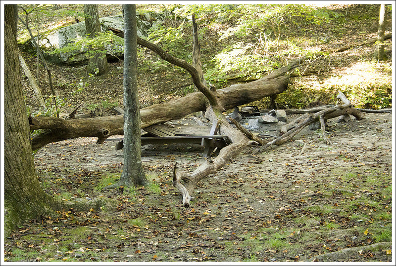
After leaving the viewpoint, you’ll descend steeply into a maze of giant boulders. There are narrow openings in the maze, making it a fun place to explore. A half mile later, there is an open meadow under powerlines and a nice view of the distant mountains. The descent continues for about 1.2 miles. At the bottom, you’ll reach the Pig Farm Campsite and shortly after that – Campbell Shelter. The shelter is on an elevated platform and there is a privy, picnic table, and bear locker at the site. The water source, located about 150 yards to the left of the shelter, was also dry!
After leaving McAfee, you descend through a maze of boulders. There are many interesting rock formations on this section. Below: An eastern fence lizard; Campbell Shelter; The weeds were hip to shoulder high along the trail; A nice shady spot to rest; We got one distant look at the reservoir on the first day; After descending into this grassy area, you begin the tough climb to Tinker Cliffs.
After the shelter, the trail follows rolling terrain for 3.1 miles until you reach a grassy opening at Brickeys Gap. There is a trail to the left, but you’ll stay on the white-blazed Appalachian Trail and begin a steep uphill climb toward Tinker Cliffs. The ascent goes on for 1.8 miles. On this particular day, the climb was especially rough. We were both tired from the heat and running low on water.
Navigating the trail as it heads up Tinker Cliffs is a bit tricky. Look carefully for white blazes and arrows. There will be openings in the rocks that look like trail, but they’re not. Most of these openings are blocked by branches dragged across the ground, but if you’re not paying attention you might head the wrong way. When we finally made it to the top of the cliffs, the views made all the effort worthwhile. We had the entire overlook all to ourselves! I thought the views from Tinker Cliffs were even better than McAfee Knob. I took off my shoes and socks and let myself bake for a few minutes in the late afternoon sun. It was probably still in the low 90s – such a hot day for late September!
It was clear that many people had camped at the top of Tinker Cliffs, camping is strictly prohibited on top Tinker Cliffs. We made our way along the open cliffside for about half a mile before descending back into the trees.
The view from Tinker Cliffs was as nice as McAfee. Below: On the climb up you get a nice meadow view; The trail is a little tricky so pay attention to signage and look for logs blocking the wrong way; It was still around 90 degrees when we got to the top of Tinker (notice the beet red face); Adam walks along the cliffside; Descending beneath Tinker Cliffs; the final mile into camp was easy terrain.
The trail passes beneath the cliffs and then rambles downhill for about a mile until it reaches Scorched Earth Gap and the junction with the Andy Layne Trail. From there, we had an easy .6 mile stroll to our campsite at Lamberts Meadow Shelter. When we arrived, there was one other section hiker already there. We picked a campsite across the ‘stream’ from the shelter. Note, I put stream in quotes because when we visited it was nothing but a series of shallow muddy pools.
We got the tent set up and changed into camp clothes. It took us a full hour to filter four liters of water! First, we had to scoop water into our bucket. It was full of mud, pebbles, mosquito larvae, and algae, so we had to filter that water through a bandanna into our Sawyer bags. The we squeezed the water through the Sawyer into our Camelbaks. It was the color of weak tea, so I chose to treat it with Aquamira on top of the filtering. It was nasty!
We made it to camp at Lamberts Meadow Shelter! Below: We set up camp on the opposite side of the stream; The lousy, dank water source.
We set aside a couple cups of the water to make dinner, leaving us each with just under two liters of water for the next day. It took so long to deal with water, that it was almost dark when we headed up to the shelter to cook. By then, a couple other section hikers had arrived at the shelter. They were former military and had done a lot of the trail. We chatted about gear and favorite spots along the AT. They told us a tale about finding a body near Tinker Cliffs on a hike fifteen years earlier. They had become lost on the trail headed up the cliffs and found a body from the 1940s or 50s in the woods under the cliffs. It was a crazy story!
After dinner, we headed back down to the tent. It was still too hot to make a fire and we were both pretty tired, so we turned in early. It was a stuffy, fitful night in the tent. It’s hard to get comfortable when you’re sweaty and stuck to your sleeping pad. Still… it had been a beautiful day with lots of amazing scenery.
Day Two (9.5 miles)…
We woke up at daybreak and knew it was going to be a hot day. The temperature was already in the mid-70s. We didn’t have much water to drink or cook with, so we opted to eat some Little Debbie Peanut Butter Pies for breakfast. They are good calorie bombs for some fast energy and didn’t require any water. This was definitely the scariest water source we have had to use, so conserving water until we found something else was our plan. We packed up camp quickly and then made our way back on the Appalachian Trail, heading north to make our way back to our car.
In .3 miles, we came across the Lamberts Meadow Campsite, which also had no water in the stream next to the campsite. We saw the fallen tree that had smashed through the picnic table. Homer had told us that if that picnic table hadn’t been there, it would have likely fallen directly on the tent. He was planning in another week to build and bring another table down there to replace the one that had been smashed. Since there isn’t great access to this area except for a long hike, I can’t imagine hauling a big table through the woods like this, especially at Homer’s age (in his 70’s). Homer is the true definition of a trail angel and has helped so many AT thru-hikers and others along the way.
We set off early. The morning was already hot and humid. Below: This huge tree fell and injured two hikers the weekend before we hiked; A beautiful farmland view on day two; There was not a lot of climbing on day two, but the terrain was rockier.
From the campsite, we continued on the AT. At 2.5 miles, we reached a junction with a blue-blazed trail that led to a nice viewpoint to the west. The trail began to slope downwards and at 4.3 miles we reached Angels Gap. The heat continued to increase and we were already extremely thirsty. We drank when we felt we needed to, but we both were already running low on water. The sun was beating down since the area was more open. At 4.7 miles, we first heard the buzzing of a powerline and soon it came into view. At 5.5 miles, we reached Hay Rock. We skipped climbing up the rock, since we were already getting good views of Carvins Cove Reservoir all along the trail. Many people do Hay Rock as a day hike coming from Daleville.
The trail stayed relatively flat, but was rocky and exposed us to the sun for a bit. We crossed over an open field with tiny little seed pods that were blowing in the hot wind. It looked like snow that was coming down, but the temperature told us otherwise. We had just watched Stranger Things on Netflix and it reminded us of something supernatural or alien that was happening in this area. We came to another powerline at 6.7 miles, but this one gave us wonderful views. We didn’t stay long since we wanted to get out of the direct sun. Christine had run out of water, but I had saved a bit for her to have.
Christine enjoys a view on day two. Below: Adam approaches Hay Rock. There’s a nice view of the reservoir from the top, but we skipped climbing it; More rocky terrain; Carvins Cove reservoir.
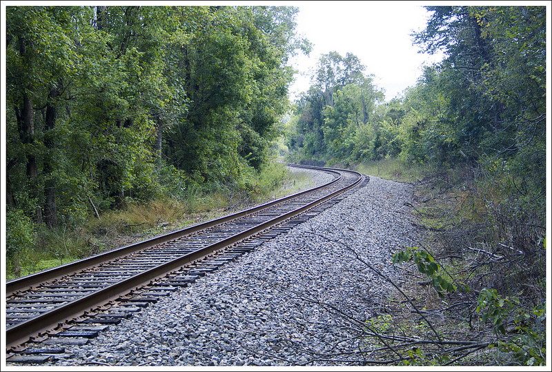
Shortly after we left these views from the power lines, the trail finally ducked back into the woods and began a descent. We ran into a Ridge Runner on the trail that was talking to hikers and seeing if they were alright with the heat and lack of water. Ridge Runners are paid to monitor the trail and assist hikers. I would have loved some water, but we knew we could make it just a few more miles. We told him about the lack of water on the trail, so hopefully they came across others that were in bigger need. We crossed powerlines again at 7.5 miles, 8.3 miles, and 8.9 miles. Shortly after this last powerline, we crossed over some railroad tracks and a bridge. It was only a few more tenths of a mile and at 9.5 miles we made it back to our car exhausted and thirsty.
A beautiful view of the Carvins Cove Reservoir. Below: A lot of day two was unshaded; We passed through a meadow with seed pods flying everywhere in the breeze – it was like being in a snowglobe; The descent was welcome as the day got hotter; We crossed railroad tracks; A pretty section of pines; We met this blacksnake.
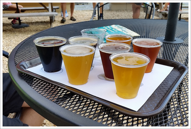
When we got back to our car, our first order of business was to get something to drink. We hopped in our car and jumped into a gas station across the street and downed some Gatorades in record time. We decided we wanted to eat some barbecue and drink some beer to celebrate. Since we had made an early start to our day, it was just a little after noon when we got off the trail. We made our way to Flying Mouse Brewery (this brewery closed at the end of 2018) and our Maps app on our phones said that it would be closed when we arrived. We thought we would give it a shot anyway in the off chance it was open. As we were driving up, I saw signs for Virginia Momentum and saw runners. Virginia Momentum is a company started by a friend of mine that holds races across Virginia that helps support local charities. When we got to Flying Mouse Brewery, they were hosting a brewery-to-brewery race there, so it was open. We felt that someone was looking out for us and went inside to get a flight of beer samples and enjoyed talking to our friends that were participating. While running these long races is impressive, we did earn some props by just having come off the trail carrying some heavy weight. After some tasty beverages, we made our way to Three Li’l Pigs BBQ, which always has amazing food and is perfect for a post-hike stop.
This backpacking trip had some other significance to us as well. While it was Christine’s birthday, McAfee Knob was one of the first posts that started Virginia Trail Guide. We’ve learned a lot along the way about how to tell our story of the trails. If you’re looking for one of Virginia’s most famous hikes to serve as a backpacking route, try this one out. McAfee Knob is the most photographed spot on the entire Appalachian Trail. We enjoyed taking the ceremonial pictures at the top. We even mimicked the A Walk in the Woods movie poster shot of Robert Redford and Nick Nolte to show how the scale was wrong for that poster. While we had hiked McAfee Knob before, this was our first trip to Tinker Cliffs and we both thought this was something not to be missed. This route makes up two-thirds of Virginia’s Triple Crown (with the other third being nearby Dragon’s Tooth) and it is definitely worth the hype. Just go on a cooler day and pray for better water sources.
You have to finish with a cold beverage!
Trail Notes
Distance – 20.5 miles Check out the stats from Map My Hike [Day 1] [Day 2]*
Elevation Change – 3400 ft.
Difficulty – 4. Day one is the tougher day with about 2500 feet of climbing. Day two is significantly easier with just over 900 feet of elevation gain.
Trail Conditions – 4. The trail was in great shape and beautifully maintained by the RATC (Roanoke Appalachian Trail Club).
Views – 5. The views here are iconic, magnificent, and they just keep coming!
Streams/Waterfalls – 1. There are small springs and streams adequate for a water source for cooking/filtering, but there was nothing really scenic.
Wildlife – 4. A yearling bear hung out between Lamberts Meadow shelter and Lamberts Meadow campsite for much of the evening. We also saw fence lizards and deer in a couple places.
Ease to Navigate – 4. The trail is well-marked and easy to follow.
Solitude – 1. This is one of the most popular stretches of trail in the area, so expect to see many people – especially if you go in fair weather. Campsites can be crowded and parking is an issue on the Catawba side. Note: Parking regulations were recently changed. Do not park along the road, or you will be towed.
Special regulations for this area:
Maximum group size, day hikes: 25
Maximum group size, backpacking/camping: 10
No alcohol
Dogs must be kept on leash at all times
No camping or campfires outside of seven designated areas (north of Va 624/Newport Rd, the only legal campsites are Johns Spring Shelter, Catawba Shelter and campsites, Pig Farm campsite, Campbell Shelter and Lambert’s Meadow Shelter and campsites)
No camping or campfires on McAfee Knob or Tinker Cliffs
* MapMyHike is not necessarily accurate, as the GPS signal fades in and out – but it still provides some fun and interesting information.
Directions to trailhead: GPS coordinates for the parking area to start this hike are 37.380125, -80.089694. You will park at the McAfee Knob trailhead parking area on Rt. 311 in Catawba. You must park in the lot. Roadside parking is prohibited and cars will be towed.