Knob Mountain – Jeremy’s Run Loop

The Knob Mountain – Jeremy’s Run Loop takes hikers along a 12.4 mile route through one of Shenandoah’s most popular backcountry camping areas.  This hike could be done as a long dayhike, but the campsites in the area are too inviting to pass up.

Pool on Jeremys Run
The Knob Mountain – Jeremy’s Run Loop offers beautiful stream scenery. Below: Mountain vistas can be seen along the descent on the Knob Mountain Trail; Blue Blazes mark the way across streams on the Jeremy’s Run Trail; Adam negotiates one of the many stream crossings.

View from the Knob Mountain Trail Water Crossing Adam Crossing the Stream

Adam Says…

Since the weather looked like it was going to be a cooler, we decided to take off and go on an overnight backpacking trip.  Our first overnight trip was the Hazel Mountain-Catlett Mountain trail which we did with a group from the PATC.  This trip was our first non-group outing, so we felt it would be a good chance to put into practice what we learned from our Backpacking 101 course.

To do this trail as a loop, leave from the Elkwallow picnic grounds.  You will see the entrance to the trail next to the pit toilet, which provides a last chance to “take care of business” before embarking on the hike.  You will begin the trail on a short spur trail to the white-blazed Appalachian Trail.  Turn left on the AT.  In .2 miles, you will reach the junction with the blue-blazed Jeremy’s Run Trail.  Continue straight on the Jeremy’s Run Trail.  Around 1.2 miles, you will reach the junction with the Knob Mountain Connector Trail.  Take a right at the post to join this trail.  As soon as you cross Jeremy’s Run with a little rock-hopping, you will begin this steep connector trail.   There are lots of switchbacks and this is definitely the steepest part of the entire trip.  Around 1.7 miles, you will reach a junction with the yellow-blazed Knob Mountain Trail.  Take a left at the trail junction and continue to follow this slowly ascending ridge trail.  We would probably name this portion of the loop the Bear Scat Boulevard, because there was a ton of bear evidence in the area.  You will see a few views through the trees, but nothing remarkable from the trail.  At mile 3.9 you will reach the summit of Knob Mountain, marked by a concrete post.  After the summit, you will begin your steep descent down the mountain.  This is broken up by several switchbacks.  The trail does open up at times to give you views of mountains along the way, including Strickler Knob and the Three Sisters.  At 6.8 miles, you will cross Jeremy’s Run and reach the junction with the blue-blazed Jeremy’s Run Trail.  Since we were fairly exhausted from our trip, we picked a campsite near the junction of the trail, which gave us great access to water.  From the junction, you just continue on the Jeremy’s Run Trail until you reach the parking lot, crossing over Jeremy’s Run fourteen times.   In some areas, it was necessary to rock hop across, but most of the time the traversing was quite easy.  I imagine during heavy rain seasons, this would be more of a challenge.

Filling Out Paperwork for a Backcountry Permit
The overnight trip started with a brief stop to fill out paperwork for our backcountry permit. Below:  Adam makes his way down the Jeremy’s Run Trail; Snacks on the Knob Mountain summit; A view through the trees from the Knob Mountain Trail.

Adam Hiking Snacks on the Knob Mountain Summit Views from Knob Mountain Trail

Jeremy’s Run truly provided a great opportunity for camping in the backcountry.  We saw several previously-used campsite areas, so we decided to use our Leave No Trace principles and use an existing campsite rather than creating our own.   The campsite was short walking distance to a reliable water source.  After starting our trip around 9:30AM, we arrived at camp around 1:00PM.  We were very hungry, so Christine worked on getting some lunch together and I began working on getting our tent set.  The ground was very hard and rocky, so it took an effort to find a good place to get stakes into the ground.  After lunch, we finished getting our sleeping pads/bags ready, hung our bear-bag rope, and prepared our kitchen area.  We got some water to use for the trip at the nearby stream and I dug a few preemptive catholes.  With every thing set, we decided to relax a little in our tents to stretch out our backs.  I like to bring a book along the trip so we took turns reading aloud a few chapters from A Walk for Sunshine by Jeff Alt, an entertaining read about hiking the Appalachian Trail.  We took a short nap and then played a few hands of the Monopoly card game we also brought.  We then broke in our new JetBoil and prepared a great dinner.  After cleaning up dishes, we went down to a place along Jeremy’s Run and stretched out on a large rock.   We watched several brook trout jump out of the water, catching mosquitoes that were lightly dancing on top of the water.  We retired to our tents to the sweet chorus of whippoorwills and the “who cooks for you” hoots of nearby barred owls.

Neighbor Mountain
On the hike down from the summit of Knob Mountain, hikers get a few decent views of adjacent Neighbor Mountain. Below: A scenic spot on Jeremy’s Run; Our campsite.

Jeremy's Run Camp

There were so many things I enjoyed about our trip.  We saw tons of wildlife – three black bears, a wild turkey, scarlet tanagers in glorious color, and heard lots of birds at night.  The temperature was perfect and the bugs were not out as much as we expected.  The trip also helped affirm our ability to handle a backpacking trip by ourselves. I think we really learned a lot of great skills in the last few months to help us feel well-prepared.   I was a little more apprehensive wondering if we could handle the 12+ mile hike with 35 pounds on my back, since our previous trip was about 8 miles total with a little less weight each.  The hike was more strenuous the first day, but we were able to complete the hike without much trouble.  I think we’re both looking forward to going on another backpacking trip, but we are now getting into the hot summer months.  Hopefully, we’ll be able to find a cooler weekend in the near future.

Christine Says…

When Mother Nature gives you the gift of a sunny, dry, 70-degree day in the midst of a long string of 90+ degree scorchers, you must take advantage of that gift!  We chose to make the most of the pleasant weather and go on an overnight backpacking trip.  One of the leaders on our last trip recommended Jeremy’s Run as one of his favorite places in the park.  As dayhikers (until recently), the Jeremy’s Run hike had always been a little out of reach.  At 12.4 miles with well over 2,500 feet of elevation gain, it was always more than we were willing to tackle on a day hike.  It seemed like a perfect candidate for this little weekend getaway.

After filling out all the requisite paperwork, we set out from the Elkwallow Picnic Area along the Appalachian Trail.  Right away, I was struck by how much heavier my pack was compared to our last trip.  On that trip, we had seven people to split the weight of group gear.  But this time, we had to carry our own stove, fuel, collapsible bucket, water filter, food and rope.  I also chose to carry my old dSLR camera, a couple card games, extra batteries, a fleece and my iPod.  In the end, my pack weighed in about nine pound heavier than our last outing.

I brought my iPod along this time for a couple reasons 1) I wanted to be able to listen to my “workout mix” when climbing a couple of the big hills on the route and 2) my iPod is loaded with audio books, which I thought would be pleasant to listen to after sunset in the tent.  The first big hill we hit was on the Knob Mountain Cut-Off Trail.  It was really steep, so I put in my earbuds and started chugging up the hill.  Listening to mindless pop music with a beat – anything from Tupac to Lady Gaga to Gnarls Barkley – makes climbing hills so much less painful.  I had worked up a pretty good rhythm, listening to the early 90’s party song, “Rump Shaker”, when I rounded a curve a spotted two black bears about 50 yards up the hill.  I’m not sure if they were a mom and a yearling or two adults.  We looked at them, they looked at us, then they quickly decided to leave the area.  I didn’t have time to free myself from my trekking poles and iPod cord to get a photo, but it was still a great treat to see the bears. Backpacking seems to involve an inordinate number of straps and buckles.  Sometimes, it makes me feel like a horse pulling a cart.

Christine On the Rocks
After camp was set up, Christine spent some time relaxing on the rocks in Jeremy’s Run. Below:  Adam collects water in a collapsible bucket to use for cooking later; Crocs and Socks – they might not be high fashion, but they’re functional; Playing Monopoly at camp.

Collecting Water Crocs and Socks Cards

After the cut-off trail met the Knob Mountain Trail, the tough climbing was over for the day.  I listened to my iPod a bit more, but eventually put it away in favor of listening to the birds and the breeze in the trees.  We took a snack break on the top of Knob Mountain.  There weren’t any views at the summit – just shade and a ton of poison ivy.  It felt really good to throw the pack off for a while and have a good stretch.  I could really feel the heavier pack weight bruising my hip bones.

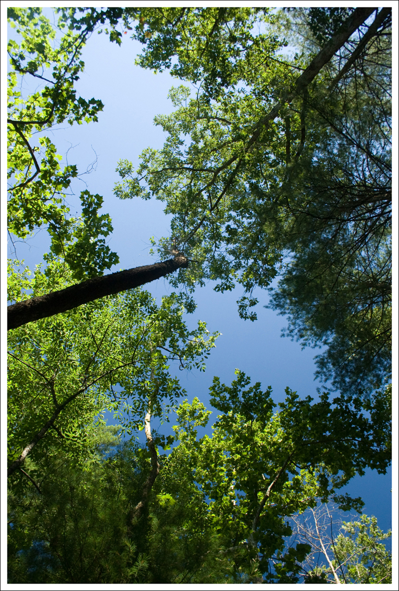
The walk from the summit to Jeremy’s Run was all downhill.  The woods along the trail are pretty and occasionally open to views of the valley below.  You also get nice views of Neighbor Mountain, which lies parallel to Knob Mountain.  Another slightly longer loop hike option approaches Jeremy’s Run from Neighbor Mountain.

The downhill walk lasted a little over 3 miles.  We soon arrived at the stream, where the Knob Mountain Trail converges with both the Neighbor Mountain and Jeremy’s Run Trails.  We crossed the stream a couple times and decided it was high time to find a campsite.  We were both completely knackered after walking about 7 miles with our packs.  I honestly don’t know how thru-hikers cover 20-30 miles a day with even heavier packs.  I’m convinced I wouldn’t last a week!

We found a beautiful place for camp under the shade of pines and hardwoods.  It was clearly a place others have camped before.  Stones were arranged like seats in a semi-circle in one of the clearings.  It was also about 30 yards from a gorgeous spot along Jeremy’s Run – so we had great access to water.

We designated separate sleeping and kitchen areas right away.  Adam pitched the tent while I fixed lunch.  I made Buffalo Chicken Wraps – which were delicious. We found a place for our bear hang and dug a couple catholes for future use.  With camp all set up, we settled into our tent for a nap.

Post-nap, we collected water for cooking in our collapsible bucket.   On our water run, we also took some time to stretch out and lounge on one of enormous boulders in the middle of the stream.  The sky above was so blue and it was very soothing to watch the trees swaying above in the breeze. I actually tried out my Crocs again, and found them more comfortable, albeit considerably dorkier, with socks.  I may keep them as my camp shoes after all.

Filtering Water for Dinner
We filtered water for our dessert and boiled water for our entree. Below:  We had Pad Thai for dinner; Dark Chocolate Cheesecake for dessert.

Pad Thai Dark Chocolate Cheesecake

Around 5:30, we started getting things together for dinner.  Because this trip was rather impromptu, we brought pre-packaged dehydrated meals instead of taking the time to make homemade food.  But it was still delicious.  The Backpacker’s Pantry Pad Thai was filling and tasty.  It had a yummy, spicy peanut sauce with noodles and vegetables.  For dessert, we ended up having Dark Chocolate Cheesecake (instead of Tiramisu, as originally planned).  It was really tasty, too!  I was stuffed from dinner, so we decided to take a short walk down to a deep pool I had seen along the trail a way back.  We sat on a rock and just enjoyed the quiet of the evening.

It got dark quickly down in the hollow, so we retired to our tent a little before nine.  I listened to a book on my iPod and Adam read.  I started to doze off well before 10:00.  All through the night, I could hear a couple barred owls hooting, over and over and over again.  Pretty soon, a whippoorwill joined in and sang through almost the entire night.  I haven’t heard a whippoorwill since I was a child, so it delighted me to hear the song in the night again.  I slept pretty soundly, until the roar of a train whistle woke me up around 2:00 in the morning.  I could hear the wheels on the track so clearly; it seemed like the train was rolling through camp.  I guess some distant sounds really carry on the quiet night air.  When I awoke, I found I was drenched with sweat in my sleeping bag.  It was in the mid-50’s outside, so the down bag was a bit too warm.  However, if I slept outside my bag, I got cold quickly.  I want to get a blanket and sheet for my sleeping pad to make summer camping more comfortable.  Despite being hot or cold, I eventually fell back to sleep and stayed so until 6:30 a.m.

I got up before Adam and got the bear bag down, so I could start breakfast.  We ended up leaving the bacon home because we didn’t want to carry a pan.  Instead we had oatmeal, boxes of apple juice and hot chocolate.  It was a satisfying breakfast on the cool morning.

Bear on the Appalachian Trail
We saw three bears, including one on the Appalachian Trail.  Below: Another scenic pool on Jeremy’s Run; We encountered this loose dog on the trail (one of many).  He apparently lives on the border of the park and runs the trail often.;  Rocks in the stream bed were covered with moss.

Pool on Jeremys Run Loose Dog Mossy Rocks

We broke camp down quickly and were back on the trail around 8:00.  The second day of hiking was substantially shorter and easier than the first day.  With about 5.5 miles to cover, we knew we’d be back at the car by mid-morning.

The trail climbs ever so gradually along Jeremy’s Run.  We passed lots of fantastic campsites along the stream.  It’s no wonder this area is so popular with backpackers!  We crossed the stream 14 times over the course of the morning. Because of all the dry weather we’ve had lately, none of the crossings were challenging at all.  Most of them were bone dry, and the ones with water were still easily rock-hopped.

We took a snack break where the Jeremy’s Run trail crosses the Knob Mountain Cut-Off.  From this point, the trail follows the same route as we’d used hiking out the day before.  The grade becomes steeper for the last mile and eventually meets back up with the Appalachian Trail.  For this section, I put my iPod back on again to help endure the uphill.  “Rump Shaker” came up in the shuffle again, and after the first few moments, I spotted another bear.  There must be something about that song that conjures bears!  I did manage to get a few distant photos of this bear before he disappeared deeper into the woods.

About ten minutes later, we were back at our car and on our way.  We stopped by the Elkwallow wayside, where I rinsed my face and used  a flushing toilet!  Plumbing is so exciting after being without it.  On our way home, we stopped at McDonald’s for lunch.  Coke and salty French fries taste absolutely amazing after a long hike.  As luck would have it, their credit card machine was broken and they gave us our lunch for free!  It was a fitting bonus for a perfect trip.

Trail Notes

  • Distance – 12.4 miles
  • Elevation Change – 2600 ft
  • Difficulty – 3. If you were going to do this in one day without stopping, I would up the difficulty slightly due to the length.
  • Trail Conditions – 3.5. The trail was very well-maintained.  We saw evidence that the Knob Mountain trail had been cut back, but I can imagine in late spring, much of the trail could have some overgrown areas.  The ground was well-traveled and there were only a few rocky spots around the streams.
  • Views1.5. The best chance of views are on the descent from the Knob Mountain summit down to Jeremy’s Run.  After leaves fall, this may be slightly better.
  • Waterfalls/streams – 3.5. You do get lots of chances to cross Jeremy’s Run.  There was only a small fall near the base.  If you want to photograph streams, you should have plenty of opportunities.  You’ll also have a reliable water source.
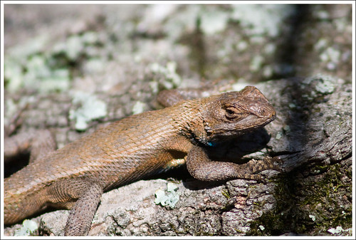
  • Wildlife – 4. We saw black bears, a turkey, and scarlet tanagers; we heard whippoorwills and barred owls at night.
  • Ease to Navigate – 4. The trails are well-marked and just stick to the signs on the cement posts.
  • Solitude –3. This is a popular spot for backpacking and trail running.  However, we felt that we were able to find our own peace in the woods.  We also came across a dog that belongs to a nearby family that evidently roams the trails frequently, so we had a companion during part of the hike up from Jeremy’s Run.

Directions to trailhead:

Located in the northern section of Shenandoah National Park.  Park at the Elkwallow Gap picnic grounds around mile 24.3 of Skyline Drive.  The Jeremy’s Run trail begins next to the pit toilet at the parking lot.

Hazel Mountain – Catlett Mountain Loop

This nearly 8-mile loop takes hikers deep into a beautiful, remote section of Shenandoah National Park.  The trail passes bubbling streams, stands of hemlocks that haven’t yet fallen and crumbling stone walls left behind by families that used to live in the park.  This post could also be called part four of the Backpacking 101 series, because we did this trail as a backpacking trip with the great folks from the Potomac Appalachian Trail Club.

On the Hazel Mountain Trail
Walking the Hazel Mountain Trail was peaceful and green.

Adam Says…

This was our first overnight backpacking trip together and served as our graduation trip from the Backpacking 101 course we took through PATC.  We were unable to go on our previously-scheduled trip due to Christine’s sprained ankle she suffered on our Buzzard Rock hike. We were thrilled that our instructors gave us the opportunity for a make-up trip.  You can read our other sections of the review of this class in Part One, Part Two, and Part Three.

The outing leaders, John and Jeanne, chose the Hazel Mountain – Catlett Mountain loop for the trip. The hike winds around the mountains and through pretty forest, but doesn’t lead to any summit views.  The trail starts off from the Meadow Spring  parking lot around mile 33.7 on Skyline Drive.  Like many trails in Shenandoah National Park, the Hazel Mountain trail descends from the road.  You will stay on this trail until you reach the Catlett Mountain Trail.  The Hazel Mountain Trail is also marked on maps as a horse trail, so you may encounter horses on many of the trails around this area.

Day One Hiking: Shortly after leaving the parking lot, you will see a junction with the Buck Hollow Trail (a tough loop hike).  At .3 miles, you reach a trail junction with the Buck Ridge Trail (that is the loop back from the Buck Hollow Trail).  At 1.6 miles, you come to the first junction with the White Rocks Trail (another loop trail).  At 2.2 miles, you will see a post marking the junction with the Catlett Spur Trail, marking where you will rejoin the trail after you complete the loop.  While you just descended about 1000 feet, the trail begins to ascend from this point, gaining about 400 feet over the next .6 miles.  Around 2.8 miles, you will see the other junction with the White Rocks Trail.  Around 3.1 miles, you will reach the top of the climb and take a right to continue on the Hazel Mountain trail.  At mile 3.7, you will take a right on to the Catlett Mountain Trail.  We picked a campsite near the top of this trail, as it does provide a close proximity below to a spur of Runyon Run, a reliable water source on the trail.

Day Two Hiking: Upon leaving camp, you descend down to the stream we used as the water source.  Once you rockhop across Runyon Run, the trail ascends fairly steeply up 300 feet.  At mile 4.7, you will take a right onto Catlett Spur Trail.  The trail descends crossing over Runyon Run in a few spots.  You will eventually pass an old stone perimeter wall, marking land that may have marked a boundary for a settler’s house or farm.  At mile 5.6, you will come back to the junction with the Hazel Mountain Trail.  Take a left on the trail and ascend for the final 2.2 miles back to the parking lot.

Our Tent
Our tent set-up at camp. Below: The backpacking group at the beginning of the trip;  We took our packs off and enjoyed lunch at a boulder jumble near a stream; There were many different kinds of tents at camp… one of the group used a hammock.

Backpacking Group Backpacks Hammock

Christine and I had a great time on the trip.  We met up with our group at 9:30AM, reintroduced ourselves to each other, and got our packs ready for the trail.  We divided up some group gear that we needed to share for the trip and weighed our packs for curiosity.  I ended up with a little over 34 pounds in my pack and Christine had about 28 pounds.  I would say that our average for the group was a little under 30 pounds, so it was manageable for an overnight trip.  We hiked fairly fast, but we did take a few breaks to get a breather and eat some lunch.  We hiked onto the Catlett Mountain trail and found our campsite around 12:30.  We set up our tents and our kitchen area.  We put up a tarp and brought all of our dishes, utensils and food to the kitchen site.  Most of the group then decided to go down to Runyon Run, to load up some collapsible buckets for water for camp.  This was a chance for us to try out our new Katadyn Hiker Pro water filter to refill some water bottles.  When we hiked back up to the campsite, we happened to see an adult bear running from the direction of our campsite.  Unfortunately (or maybe fortunately?), we never saw him again.

Shortly after getting back to camp, we experienced a scary moment.  We thought two people had stayed back at camp when we went on the water run, but came back to see only John.  We started to hear shouts from the woods, but we couldn’t distinguish if the voice was shouting “Help” or “Hello”.  Our instructor grabbed his first aid kit and we continued to call back to the person.  We shouted “Are you hurt?” and “What’s your name?”, but we couldn’t distinguish the response.  We kept calling out and eventually we saw one of our group members emerge from the dense underbrush.  He had spotted a timber rattler that rose up against him.  He ran out of the way, but in his haste to get away from the snake, he got turned around and lost.  He had lost his whistle along the way, so he resorted to shouting to try and find his way back to the group.  It really shows that you can quickly get turned around and lost without your bearing in the woods.

We then learned how to hang a bear bag, tying a rock to a roop and throwing it over a branch (after dinner we substituted the rock with the actual bags to hang and tied the other end of the rope to a tree).  Since we had some time to kill in camp, Christine and I decided to take a quick siesta in our tent before dinner.  A storm quickly rolled in with loud thunder, high winds, and heavy rain.  It rained for close to an hour.  After it slowed to a light sprinkle, we made it back to the kitchen site, to find the rest of our group huddled under the tarp. Later, we ate an amazing dinner (which Christine will talk about) and cleaned up. After watching a nice sunset through the trees and hanging out with the group, Christine and I retired for the night.

Friendly Buck
This friendly buck visited our camp all weekend. Every time we were in our kitchen area, he came over to hang out.  Below:  Night falls at camp (notice all the rain on the tent!)

Night Falls at Camp

The next morning we got up early and worked on packing our gear.  We ate a wonderful breakfast and then broke  camp around 8:45AM.  We finished our hike, arriving back at our cars shortly after noon.  I think everyone was planning a victory meal after the trip, so we made a trip to McDonald’s in Luray.

We really enjoyed our first backpacking trip.  It was great to have this experience with the Potomac Appalachian Trail Club.  Our instructors were absolutely wonderful and really shared a lot of their experience with us.  It was also great to meet a lot of nice people through the Backpacking 101 class that share a common interest and experience level.  This trip really affirmed to us that we could handle doing an overnight backpacking trip and we are excited to try it again sometime in the very near future.

Christine Says…

On the eve of our backpacking trip, I was feeling exceedingly fretful.  I wondered if I’d be able to bear the heat/humidity without passing out. I worried that I’d be such a sluggish hiker that I’d slow the whole group down. I had concerns about the storms forecast for the day.  At one point when we were loading our backpacks. I looked and Adam and said “I don’t know if I’m cut out for this.”

But, wow… it turns out that I LOVE backpacking.  It was simultaneously fun, challenging and relaxing.   I was amazed at how comfortable my pack was – the 28 pounds felt balanced and easy on my back.  I may have sweated like crazy in the heat, but I managed to stay hydrated and felt really strong the entire hike.  I had such a sense of tranquility falling asleep in our tent after dinner, listening to the sounds of evening birds and the wind rustling in the trees.

I can’t say enough great things about our PATC (Potomac Appalachian Trail Club) trip leaders – John and Jeanne.  Their expertise made me feel really safe and confident on my “maiden voyage” overnight in the woods.  Actually, I have nothing but great things to say about our entire backpacking group.  Our fellow adventurers, Anthony, Suzanne and Ed were all friendly and fun people.

Adam Throws the Rope Over the Limb
Adam throws a rope over the fallen tree to create a bear hang.  He used a rock to make the throw easier.  Below:  A lot of planning went into picking the right spot for the hang; three waterproof bags were hung. The bags contained anything with a scent.

Planning the Bear Hang Bear Bags

Adam already did a thorough job describing the terrain and features along the route, so that leaves me to talk about FOOD (and maybe a few other things, too).  When I think of backpacking, I think of tuna pouches, power bars, beef jerky and freeze-dried, pre-packaged meals.  But, Jeanne is a true backcountry gourmand (she brought a lobster roll for her packed lunch!).   For dinner, we feasted on Chicken with Thai Peanut Sauce and Rice and Curried Couscous with Peas and Cashews.  We even had banana pudding, replete with fresh banana slices and Nilla Wafers for dessert.  Cleaning up was super-easy, since we did most of the cooking using Ziploc freezer bags.  You can pour boiling water right into the bags, and avoid dirtying a pot.  Individual utensils and bowls were cleaned by thorough eating (not a crumb left behind) and then sanitized with more boiling water.  People either drank the water or broadcast it into the woods – away from camp.  Either method is acceptable for Leave No Trace practices.  The main goal is not to send any food particles into the woods.

Breakfast the next morning exceeded all my expectations!  Of course… there was instant oatmeal and hot chocolate, but there was also real BACON and cheesy hashbrowns!  Jeanne brought Boar’s Head shelf-stable bacon, cheddar cheese, butter and dehydrated potatoes.  I decreed to Adam that we shall always have bacon when we go backpacking.  I’m totally spoiled for backcountry breakfast now!

Bacon at Camp
How cool is this… nice, crispy bacon in the backcountry.  Below: We also had cheesy hashbrowns for breakfast.  Below: On the hike out we passed several sections of old, stone walls; The group post-hike… all a lot sweatier than when we started.

Hashbrowns Stone Wall Backpacking Group, Post-Hike

Over breakfast, Adam and I spent some time talking to our trip leader, John, about everything from gear to favorite backpacking spots.  He’s like a walking encyclopedia of backpacking expertise.

I have so many fantastic memories from our first real backpacking trip… the outgoing buck that hung out with us all weekend, Adam sitting straight up in his sleeping bag (twice) to accuse me of being a bear, the feeling of being away from complications and civilization, but most of all, making new friends who might become future outing companions.

It was a rewarding experience, and I can’t wait to get out there again!

Trail Notes

  • Distance – 7.8 miles loop
  • Elevation Change – About 1000 feet, but there are also some ups and downs of about 400 feet on the Catlett Mountain-Catlett Spur Trail loop.
  • Difficulty – 3
  • Trail Conditions –3.  The trail isn’t too rocky, but is overgrown, especially the Catlett Mountain-Catlett Spur Trails.
  • Views0.  There were really no views of anything from this trail, since it is through a thick wooded area.
  • Waterfalls/streams – 2. Good water sources, but nothing too scenic.
  • Wildlife –4. With people in our group seeing deer, a bear, and a timber rattler, there should be a decent chance to see wildlife here. We also saw an American Redstart and a few red-spotted newts on the trail.
  • Ease to Navigate –3. There are lots of spurs off of the trails, but everything loops back at some point.  Pay attention to the cement posts and you shouldn’t have any difficulty.
  • Solitude – 2.5. The first section down to the White Rocks Trail seemed to include all the traffic that we saw.  This is popular with many day-trippers, since it is one of the first parking lots in the northern portion of the Central District of Shenandoah National Park.

Directions to trailhead:
On Skyline Drive, park at the Meadow Spring parking lot between mile markers 33 and 34.  The trail starts at the southern end of the parking lot.

Appalachian Trail – Skyland to Big Meadows

This pleasant section 7.9 mile hike along the Appalachian Trail takes you between Shenandoah National Park’s two large, historic lodges.  You can eat breakfast at Skyland, do the hike, and then have lunch at Big Meadows.

View from Timber Ridge
This hike offers a great mix of open views and passages through deep, fern-carpeted woods. Below: Hikers pass three talus slopes on Hawksbill Mountain; The forest floor was covered with abundant ferns; The trail is clear and well-maintained, but can be rocky.

Talus Slope on Hawksbill Ferns Christine on the Trail

Christine Says…

Most popular hikes in Shenandoah National Park lead away from the Appalachian Trail – down into the hollows or up to Shenandoah’s taller peaks.  The AT is usually relegated to being used as a connector trail or the return arm of a loop hike.  Many hikes on our blog include segments along the AT, but we’ve never posted a hike exclusively along the trail.  We decided it was time to change that.

On Saturday, we decided to do a “lodge-to-lodge” section hike – taking the Appalachian Trail from Skyland to Big Meadows.  It’s a 7.9 mile section, with an optional .2 mile spur trail to visit the Rock Spring Cabin and Hut.  Our original plan was to eat breakfast at Skyland, do our hike, and then eat lunch at the Big Meadows Wayside. But, we woke up hungry and ended up having bagels and fruit before we left the house in the morning.

We left one car parked at the Big Meadows amphitheater and proceeded to the Stony Man parking area at the north entrance of Skyland to set out on our hike. The trail initially cuts through the patch of forest between Skyline Drive and the lodge.  Recently, we’ve been seeing a bear with three new cubs along the road running parallel to this patch, so we were hoping we would come across the family.  No such luck.

After about a half-mile, we crossed the road at the south entrance of Skyland (you could also park here and cut a small amount of distance off the hike).  The trail passes the Skyland Stables and descends into the woods.

The terrain along the Appalachian Trail is varied and diverse.  Some sections are smooth dirt, others are jagged and rocky.  The vegetation along the trail is beautiful – alternating between lush expanses of fern, thick stands of mountain laurel and majestic groves of trees.  Occasionally, the trail passes beneath a scenic overlook on Skyline Drive.   Uphill from the trail, you can see families taking in park scenery from the comfort of their cars.  Most of them never even notice us hiking below.  I always wonder how many people visit the park and never leave the scenic byway.  The best of Shenandoah is off the road, and so many people miss that.

Rock Spring Hut
We took the short spur trail off the Appalachian Trail that leads to the Rock Spring Hut and the Rock Spring Cabin. Below: The view of the valley from the front porch of the Rock Spring Cabin; We checked out the journal in the hut and found entries from the thru-hikers we met a couple weeks ago;  Although we didn’t see any fawns on the hike, we saw a few on the ride back to pick up our second car.

View from the Rock Spring Cabin Rock Spring Hut Trail Journal Newborn Fawn

The trail skirts around the western side of Hawksbill Mountain – Shenandoah’s tallest.  Shortly after passing Hawksbill, a spur trail leads .1 miles down to two structures maintained by the Potomac Appalachian Trail Club (PATC).  The Rock Spring Cabin is rented out by the PATC and is available to the general public.  The cabin has a beautiful view of the valley beyond.  We were lucky to run into a woman renting the cabin for the weekend, and she was kind enough to let us take a peek inside.  The cabin was quite cozy and well equipped.  The other structure in the area is the Rock Spring Hut.  It’s a three-sided building with an elevated sleeping platform.  A spring for fresh water and a privy are located close by.  The hut was put in place to provide shelter to thru-hikers and section hikers along the Appalachian Trail.  We took a few minutes to check out the journal at the shelter, and were able to find entries from the thru-hikers we met a few weeks ago.

After leaving the Rock Spring area, we saw a HUGE increase in traffic along the trail – Boy Scout troops, a busload of day hikers out for a leg-stretcher and various other parties. There are lots of easy access points to the trail in this area, so the traffic wasn’t completely surprising.  This stretch of trail passes several nice overlooks from rocky ledges.  By this point of the trail, clouds had really started to roll in.  The weather was really odd on this hike.  Skies went from perfect blue to stormy very quickly and the winds varied from dead calm to very brisk.  The temperature stayed pleasantly cool – in the low 70’s, even though it was close to 90 in the valley below.

After walking across the Fisher’s Gap Overlook, the trail takes a distinct uphill turn toward the Big Meadows area.  In the last mile, hikers ascend almost 700 feet in elevation.  It’s the only tougher climb on the entire hike – most other ascents and descents are 200 feet or less.  Near the end of the climb, the trail passes very close to the Big Meadows Campground.  We were literally 25 feet or less from people’s tents and campers.  After passing the campground, the trail levels out for the last few tenths of a mile before arriving back at the amphitheater.

It was a fun hike, and really quite easy for an 8-miler!  We were also lucky to finish our hike before the thunderstorms roared across the mountains.

Adam Says…

Since Saturday was National Trails Day, we felt it was absolutely necessary to do a hike in one of our favorite places to hike – Shenandoah National Park.  Since we’ve recently met a few thru-hikers, Christine suggested hiking the Appalachian Trail from Skyland to Big Meadows.  June is a heavy month to encounter Appalachian Trail thru-hikers in Shenandoah National Park, since most start their trip in March or April.  We ended up seeing nine thru-hikers on their way North to Maine.  The few that we spoke to were looking forward to a big breakfast at the Skyland Lodge.  Christine mentioned how crowded the trail was this day.  This was mostly due to thru-hikers, boy scout groups, and tour groups.  The boy scout group consisted of several parents that were along for the trip.  The parents looked much more miserable than the scouts did themselves.  In the bus group, one lady whispered to us as she passed, “I envy your freedom”, meaning that she wasn’t enjoying hiking in such a large group.  As you near the Big Meadows Lodge and campground, you will likely see lots of people that are going for a hike, so travel on the AT nearby is one of the closest options for a hike.  There was another pair of couples that were doing the lodge-to-lodge hike heading northwards, but I feel going from Skyland to Big Meadows does save you a little on the elevation gain (though the southbound route does save your largest uphill climb for last).

One of my highlights on the trail was walking along the talus slopes near the Hawksbill parking lot.  We had completed a hike through the same area almost exactly one year ago to Hawksbill summit.  It is impressive to view the talus slopes and watch out for peregrine falcons.  We saw several swooping overhead from this point and we also saw some from the Franklin Cliffs overlook.  If you are a bird lover, you will likely see some of the closest views of peregrine falcons in Virginia from here.

Due to the big storms we have had in the last few days, there was running water in a few spots on the trail.  I wouldn’t expect this normally, but it could give some people an opportunity to fill up water bottles and treat the water if you are running low.

Mountain Laurel
Mountain Laurel was still abundant all along the trail.  Below: The Appalachian Trail passes right by the Skyland Stables; Adam enjoys the view from Timber Hollow; There is quite a bit of construction going on along Skyline Drive and the AT has been marked with warning signs; There are several nice rocky ledges along the trail a couple miles north of Big Meadows.

Timber Ridge Construction Along the Trail View Along the Trail

We ended the trip by stopping at the Big Meadows wayside for lunch.  It was the most crowded I have seen the dining room in a while.  We topped our lunch off with a dish of blackberry ice cream.  This is something most thru-hikers have heard about and they can’t wait to try (especially the blackberry milkshakes).  We then went over to talk to the volunteers at National Trails Day.  There was an exhibition on two-person lumber sawing, information on safety, gear demonstrations and sign-ups for guided hikes.  We talked to a few of the leaders from the Backpacking 101 course that were there on behalf of the Potomac Appalachian Trail Club.  We had signed up to join the PATC last year at Trails Day.  We were able to talk to our leaders for next weekend’s backpacking trip, so we were able to find out where we are going next week for our first backpacking trip.  We’re quite excited! (more about that later)

On our way home, we saw a few fawns with their mothers.  Most of the deer give birth in late May/early June, so they are quite tiny at this point in their lives.  You will likely see hordes of photographers in Big Meadows trying to get pictures of the fawns, but I encourage people not to harass the wildlife by approaching too closely.

While this wasn’t the entire Appalachian Trail distance of 2175 miles, we enjoyed our small portion of the trail.  We are hoping that we can hike the entire 105 miles of the AT that runs through Shenandoah National Park next summer.

Trail Notes

  • Distance – 7.9 miles as a shuttle trail.
  • Elevation Change – Constant ups and downs, but the longest uphill climb is about 650 vertical feet at the very end of the hike.
  • Difficulty – 2. This is an easy hike for eight miles.  The Appalachian Trail in Shenandoah is never very steep.
  • Trail Conditions – 3. There are some rocky sections, but overall the trail is in great shape.
  • Views3.5 – There are nice views from Timber Hollow, Hawksbill, Spitler Knob, and Franklin Cliffs.
  • Waterfalls/streams – 0.
  • Wildlife – 2. We know there is a lot of wildlife in this area, but we only saw the peregrine falcons soaring over Hawksbill Mountain.
  • Ease to Navigate – 4.5.  As long as you’re following the white blazes, you can’t go wrong.
  • Solitude –1. We hiked this trail on a pleasant June morning.  We saw *many* people – literally dozens and dozens.

Directions to trailhead:
On Skyline Drive, park at the Stony Man trailhead (located at the northern entrance to Skyland – near mile marker 42).  You will see an Appalachian trail marker near the parking lot.  You will see two AT cement posts, but the one that starts the trail is further away from Skyline Drive.  Follow the trail south from this point.

Riprap Trail

This 9.8 mile circuit hike offers all the best of Shenandoah – panoramic views,  bubbling streams, a swimming hole and even a nice final stretch along the Appalachian Trail.  It comes close to our 10 mile limit for a day hike, but it’s definitely well worth the effort.

Chimney Rock View
The view from Chimney Rock is very pretty on a clear day.

Christine Says…

The Riprap trail has long been on my list of hikes to tackle in Shenandoah National Park.  Last Friday, we finally got around to it. I have to admit, the nearly ten-mile length and over 2,300 feet of elevation gain intimidated me just a little. The hikes we’ve completed that are close to that length (i.e. McAfee Knob or Mount Rogers) both have substantially less elevation gain. But, we had a free day and beautiful weather, so we decided to go for it. I’m so glad we went because the scenery on this trail showcased everything I love about Shenandoah. And, honestly… hiking 9.8 miles really wasn’t that hard.

We started the hike from the Riprap parking area at mile marker 90. We turned right at the end of the parking lot and followed the Appalachian Trail uphill for about a third of a mile. At the intersection with the Riprap trail, we turned left. The trail went alternately downhill and uphill for about three-quarters of a mile. We passed around a talus slope and came out to a viewpoint near Calvary Rocks. This was a great place to pause and take in the panoramic scene of the valley below. About a third of a mile downhill past Calvary Rocks, we arrived at Chimney Rock. I found this to be the prettier of the two views – but they were both very nice. The trail was especially pretty in late May because of all the blooming mountain laurel, wild azaleas and rhododendron. There were some sections that were so lush, I felt like I was walking through a tunnel of flowers.

Wild Azaleas, Rhododendron and Mountain Laurel
Wild Azaleas, Rhododendron and Mountain Laurel.  Below: The view near Calvary Rocks; Adam taking in the view from Chimney Rock.

View Near Calvary Rock Adam Takes in the Chimney Rock View

From Chimney Rock, the trail follows a ridge for a while, with many nice views between the trees. There is still quite a bit of evidence of forest fire damage from the late 1990’s in this area. The mountainside is still rather barren and charred stumps are visible. Slowly, the trail descends into Cold Springs Hollow. We passed through some of the densest mountain laurel along this section. We saw and heard so many beautiful birds – everything from American Redstarts to Rose-Breasted Grosbeaks.

Near the bottom of the hollow, we started to pick up the stream. It started off as a trickle, gaining volume and speed as we climbed continually downward. There were a few small, unremarkable waterfalls in the gorge, but we didn’t stop walking until the first stream crossing. Adam and I sat on a couple big boulders in the middle of the stream and ate a few handfuls of trail mix.

Swimming Hole with Fish and Rhododendron Reflection
The swimming hole displayed beautiful rhododendron reflections and was full of brook trout. Below: The trout were hard to photograph through the water, but you get the point.

Brook Trout

We stopped again just a couple tenths of a mile later at my very favorite spot along the trail – a wide, green swimming hole shaded by the forest canopy. We sat along the pool for a long while. We watched colorful brook trout lolling in the water. Every now and then, one would splash up and break the quiet surface of the water. The water was so clear. We could see reflections of the rhododendron on the surface and big, round stones at the bottom of the pool. The spot is made even more beautiful by the gentle slide waterfall that cascades down and fills the pool.

After leaving the pool, we had almost about three-quarters of a mile of level walking and a couple more stream crossings. A post marks the intersection with the Wildcat Ridge Trail. We turned left, and enjoyed our last little bit of flat walking for a while. We decided to stop and eat lunch before the big uphill climb began. We had ham and cheese on crackers, chips and some candy – perfect to give us lots of energy!

Climbing along Wildcat Ridge is a steady uphill for almost three miles, but the grade is generally moderate. There were several more decent views through the trees along this section of trail. And of course, more mountain laurel! I think I must have said “This is SO PRETTY!” to Adam a dozen times as we walked through the flowers. This section is where we saw our only other hikers of the day – a young couple hiking the loop in the opposite direction. We got to the junction with the Appalachian Trail faster than we thought we would. We were anticipating another .7 miles of uphill climbing when we reached the marker post. It’s always such a pleasant surprise when an uphill climb ends earlier than you thought it would.

Adam on the AT
Adam and I both enjoyed the more level terrain along the Appalachian Trail.

We took a left onto the AT for the final 2.8 miles of the hike. This section was typical Appalachian Trail in Shenandoah – rolling hills, nothing too steep. We saw a brief glimpse of a bear diving into the mountain laurel about a mile into this stretch. After about an hour of walking on the AT, we arrived back at our car. My feet were a little sore and tired, but other than that I still felt pretty energetic. Riprap now claims the spot for the longest hike I’ve ever done in a day! The 9.8 mile circuit took us just under six hours – including our very frequent snack and photography stops. On the way home, we stopped and rewarded ourselves with Lime Cream Slushes from Sonic – my favorite post-hike treat.

Adam Says…

This may also be the longest hike I have done but it was well worth it!  This hike really does have it all and we hit it at a great time of year.  The mountain laurel and rhododendron were at peak on this trail and we often felt like we were in some type of fantasy land while being surrounded by pink flowers.

The views from Calvary Rocks and Chimney Rock give you some great 180 degree views to the north of the mountains.  I was a little worried that the payoff for this hike was going to be over in the first couple of miles of the hike, but I was glad to be wrong.  After we continued the descent from Chimney Rock, there were still some open views along the way.  Once we reached the bottom of Cold Springs Hollow, we saw a glimpse of a waterfall along the way.  Shortly after the falls and after crossing the stream you come to the beautiful swimming hole that Christine mentioned above.  This was a great spot to relax and enjoy seeing the fish, or you could take a quick, refreshing dip.

View Along the Riprap Ridge
View Along the Riprap Ridge. Below:  The swimming hole is such a beautiful place – even though we constantly had to bat the bugs away.  Note the slide falls coming down to the pool.

Swimming Hole

Once we were done with relaxing, we took the hike up the Wildcat Ridge Trail.  This is a constant uphill for about three miles and does include a couple of switchbacks on the trail.  However, we felt that the terrain wasn’t too steep.  You continue to observe nice views as it hugs closely to the side of the mountain.  Once we met up with the AT, the trail didn’t have a lot of elevation gain/loss.  I do suffer from plantar fasciitis, so my feet were quite sore on the rocks of this section of the trail.

Butterfly on Mountain Laurel
Butterfly on Mountain Laurel.  Below: Adam hikes through the mountain laurel along the Appalachian Trail.

Adam hiking the AT

For those interested in geocaching, I did place an earthcache at the overlook for Calvary Rocks.  This is a way to learn about the geology of the area and there are a few steps to get credit for the cache:

I definitely enjoyed my first trip of the Riprap trail, but I know it won’t be my last.  This would also be a great place to do a backpacking trip, since there is a reliable water source at the bottom of the trail.  We really felt like it was one of the prettiest trails we have done in all of Shenandoah National Park.  Part of that largely is due to the abundance of blooming wildflowers, but another part was the views.  The Riprap trail really has it all!

Trail Notes

  • Distance – 9.8 miles
  • Elevation Change – Around 2300 feet.  The hike is a mix of uphill and downhill, with one long, steady uphill stretch of about three miles.
  • Difficulty – 4.5 While the elevation gain is substantial, the trail is rarely steep.  Grades are moderate.  We scored the hike a 4.5 mainly due to the length.
  • Trail Conditions – 4 Nice trail to walk along!  The stream crossings are easy.
  • Views4.  You get the best views from the Chimney Rocks and Calvary Rocks overlooks.
  • Waterfalls/streams – 3 The stream was on the low side when we hiked, but was still pretty.  The swimming hole at the bottom of the hollow is very beautiful.
  • Wildlife – 4 We saw lots of brook trout, a little toad, many bird species and we even caught a glimpse of a black bear’s rear end diving into the laurel thicket.
  • Ease to Navigate – 2 A few turns to make along the way.  There are a few false trails leading away from the main trail and also one tricky turn after a creek crossing.
  • Solitude – 3 We saw only two other people on the entire loop.  We hiked it on a beautiful Friday in late spring.  I imagine the trail is much more crowded on weekends.  It’s a very popular short backpack loop.

Directions to trailhead:
From Skyline Drive, park on the western side at mile marker 90.  There is a parking lot specifically for Riprap hikers.

Beards Mountain

Beards Mountain is a hike within Douthat State Park that provides lake and mountain views at various stages of the trail.

View of Douthat Lake from Beards Mountain
A view of Douthat Lake from the trail. Below: The trails in Douthat State Park are clear and well-marked.

Trail Signs

Adam Says…

This was our first trip to Douthat State Park and we were quite impressed.  The park contains over 40 miles of hiking trails.  The origin of the name “Douthat” is from a land patent given to Robert Douthat from the Governor Robert Brooke.  Part of this land makes up the park today.  The best guess as to how to pronounce the name I found was “dow-thut”.

Like most state parks, you have to pay $3 on the weekends to enter.  We went to the park office first to talk to someone about the two hikes we were contemplating – this one and Blue Suck Falls.  The Blue Suck Falls hike is close to 10 miles, so we opted for the shorter hike on this particular day.  Before we started, I wanted to check out two new programs that state parks are now offering.  The Trail Quest Program is something created to replace the state park passport program.  This program allows you to track the state parks you have visited online and there are some pins given as rewards based on how many you visit.  I started the passport system a while ago, which I have enjoyed, but I think this program is also a great idea.  The second opportunity is now all of the Virginia state parks are sponsoring geocaches.  Each park has a multi-stage geocache that leads you to a wildlife card for each park.  When you collect a number of these cards, you can also get some prizes.

View from the Trail
Most of the views along the hike were peeks through the trees. Below: Another glimpse through the trees; the stream along the Beards Gap Trail was made up of interesting terraced rocks; another view of Douthat Lake

Due to the tricky network of trails, I would recommend picking up a map at the park office.  The hike up Beards Mountain starts to the right of the park office entrance by taking the blue-blazed Beard’s Gap Trail.  This trail starts off relatively flat and crosses a creek a few times (it was dry when we crossed) before it starts an uphill climb with several switchbacks.  While I normally don’t enjoy switchbacks, this trail was well planned and it really takes the difficulty out of the elevation gain.  At 1.2 miles you will reach a trail junction and a hut that was created as an eagle scout project.  Take a left on this trail to join the yellow-blazed Mountain Top Trail.  At 1.7 miles, you will reach a junction of three trails.  You will see the Buck Hollow Trail and the Mountain Side Trail to the left, but you will just head straight continuing on the yellow-blazed Mountain Top Trail for the toughest climb of the trip.  At 1.8 miles, you will take a sharp right on a switchback and be able to see Douthat Lake below through the trees.  There are better views ahead.  The hike continues to climb up, leveling off around 2.0 miles, until you see a marker for the forest boundary around 2.5 miles.  At the marker, you will take a left to stay on the yellow-blazed Mountain Top Trail.  Around 2.7 miles, the trail begins to descend steeply.  Around mile 3.1 the woods will open up to reveal a very nice view of Douthat Lake below.  Around mile 3.4, as you are descending, you will come to another junction of trails.  Take a left on to the Mountain Side Trail.  This will continue be a fairly level trail that will eventually give you a third lower view of Douthat Lake around the 3.7 mile marker.  After the view, you will have a slight ascent back up to the familiar junction with the Mountain Top Trail.  At this junction, you will take a right down the blue-blazed Buck Hollow Trail.  Around the 4.7 mile marker, you will see a branched path that is marked as an Overlook Trail.  We did not go down that path this time, but it adds an extra .5 mile on to your trip.  Around the 5.4 marker, you will reach a junction and take a left on the white-blazed Wilson Creek Trail and you will cross a small bridge.  Shortly after rounding the corner, you will see a water tower that is on a gravel road.  Just cross the road and stay on the white-blazed trail.  The trail will eventually pass a few staff houses and a stone chimney around 6.9 miles.  Just travel the last .1 miles to reach the park office and your vehicle.

While we felt the views weren’t exceptional, we did really enjoy this hike.  We had a perfect hiking weather day with a cool breeze to keep from sweating profusely and to keep the bugs away.  We definitely plan on returning to visit and explore this park some more.  Most of the people that come here seem to come for fishing, picnics, and camping but I do think the trails we saw were very enjoyable.  While it was a longer hike, it wasn’t too tough to handle if you’re in decent shape.

Christine Says…

Beards Mountain was an enjoyable hike for a blustery spring day.  For a seven-mile hike, it was relatively easygoing. Most of the steep climbing was in the first third of the loop, which allowed for very pleasant downhill or level walking for the last two-thirds of the hike.

This was by far the windiest day I’ve ever been out in the woods – gusts were easily 45-50 mph.  The wind was really roaring through the mountains, catching on all the newly leafy trees.  Any time I looked up, I could see the treetops swaying and swirling dramatically above our heads.  Every now and then, we would hear branches snap – but thankfully none fell close to the trail.  It was nearly impossible to talk over the wind, so Adam and I hiked in silence most of the way.

Hiking Upward gave this trail a five-star rating for views, so I was really hoping there would be a pretty overlook to stop and eat our picnic lunch along the way.  Unfortunately, all of the views were merely small openings in the trees along the trail.  None of the viewpoints really had an off-the-trail space to sit and take in the view.  We ended up eating lunch along the ridge of Beards Mountain, near the National Forest border marker.  We love Hiking Upward, but have found that our opinions sometimes differ on what makes a five-star view.  For me, a top rated view has to be panoramic, unobstructed, offer a deep view into the landscape beyond and have a nice place for a couple people to sit and enjoy the vista. The views on this hike were nice, but I wouldn’t give them top marks.

Snake Along the Trail
We saw so many reptiles along the hike. Below:  The Visitor’s Center is both the start and end point of the hike.

Visitor Center

The descent on this hike was long and followed a (usually) gentle grade.  The one thing that made it tricky was the dryness/looseness of the soil and the narrowness of the trail.  There were a couple spots along the Mountain Side Trail that had precipitous drops on the downhill side.  For some stretches, the trail was only 12-18 inches wide – not even wide enough to use trekking poles.  Every now and then, a rock would slip off the edge of the trail, and bounce endlessly down the steep mountainside.   It made me think that someone could get hurt pretty badly if they took a wrong step.  On these sections, I just kept my eyes straight ahead on the trail and my feet.  If I looked downhill, I felt dizzy.

I think in early June, a lot of this loop hike will be extremely gorgeous!  I noticed a lot of the trail was lined with mountain laurel.  When it blooms in a few weeks, it should be amazing.

All in all, I was really impressed with Douthat State Park.  The trail system there is pretty expansive and well-maintained.  I’ll look forward to visiting the area again sometime.

Trail Notes

  • Distance – 7 miles loop
  • Elevation Change – around 1400 feet
  • Difficulty – 3.  Some sections are tougher than others, but we still felt it was fairly challenging.  The first couple of miles are the toughest.
  • Trail Conditions – 3.  The trails were in decent shape, but some were a little overgrown and there were some areas affected by landslides that made for a narrow trail and careful footing.
  • Views3.  The views are nice, but they are obstructed.  You won’t find overlooks with expansive views on the trail, but you do see pretty mountainous scenery through the trees throughout your hike.
  • Waterfalls/streams – 1.5 There are some streams that might be really beautiful in times with lots of rain.  The water was down to a trickle when we visited.
  • Wildlife – 2. We saw a couple of snakes on the trail, a few fence lizards, and some different bird species.
  • Ease to Navigate – 3.  The trail is well-marked, but there are a lot of intersections and different trails to make this a loop.
  • Solitude – 3.  We were surprised since it was a state park, but we only saw one hiker and a couple of mountain bikers on the trail.

Directions to trailhead: Take I-64 to exit 27 near Clifton Forge, VA heading north on state route 629.  Continue on this road until you enter the park.  Pay your fee at the gate and park at the park office just ahead on your right.  The trail starts to the right of the park office entrance.

Mount Rogers

The summit of Mount Rogers, Virginia’s highest peak, can be reached via a nine mile (total, out-and-back) hike starting from Grayson Highlands State Park.  The hike follows the Appalachian Trail for most of the way and crosses into Jefferson National Forest.

Mt. Rogers is beautiful, rugged and home to several herds of wild ponies.
Mount Rogers has beautiful and rugged terrain.  The area is home to several herds of wild ponies.

Christine Says…

Mount Rogers has long been on my list of must-do hikes.  The peak’s status as the state’s highest point was one draw, but personally, I wanted a chance to see the feral highland ponies that roam the area.

Our trip started under rather inauspicious conditions.  We missed a turn on our way to the park, and ended up an hour out of the way.  The weather had been forecast to be sunny, but the morning dawned with a thick, wet, windy cloud of bleakness blanketing the entire area.  But when you have driven almost four hours to do a long-anticipated hike, you’re going to do it regardless of minor complications like gloominess and getting lost.

The trail starts out from Massie Gap in Grayson Highlands State Park.

We parked at Massie Gap in Grayson Highlands State Park.  From there, we walked across a wide pasture, passed a sign warning of extremely erratic weather in the area and went through a horse gate.  The trail climbed upward along a wide, gravel path.

We almost immediately saw our first small group of wild ponies, clustered under the trees on a hillside next to the trail.  The fog was so thick; they looked like silhouettes in the mist.  I quickly got my camera out and started snapping shots.  The ponies were so small and rugged looking.  Their coats were thick and their manes long and wavy.  Some were solid colored and some were spotted.  They also turned out to be incredibly inquisitive and gentle.  While I was squatting down to take photos, a dark brown pony walked up to me and nuzzled her soft nose onto the back of my hand.  I know she was looking for food, but I had nothing to offer. We lingered with the ponies for a while, and then moved on.

(note:  The park rules prohibit feeding the ponies.)

The ponies are very friendly.
The ponies are very friendly.  They come right up to you, especially if they think you have food.  Although it may look like Adam is feeding the pony, he’s actually just unzipping his backpack.  Pictured Below:  More ponies; State park rules!

Grayson Highlands Pony in the Mist. This Mt. Rogers pony was especially friendly
Grayson Highlands Pony in the Fog. Mt. Rogers ponies have long beautiful manes
Adam laughs at the misspelled sign in Grayson Highlands State Park The sign at Grayson Highlands State Park misspelled the word Alcoholic

We soon reached the junction with the Appalachian Trail, followed the white blazes and headed south. The fog was such a transformative element on the morning of our hike.  Instead of the amazing mountain views we’d heard about, the thick mist made the scenery feel closer and more intimate. I told Adam several times that I didn’t feel like I was in Virginia at all.  I felt like I was walking through some storybook version of the Scottish Highlands.  It was so quiet and mysterious-feeling – no people, no tall trees rustling in the wind, no birds chirping. The terrain was open, studded with rocks and covered with scrubby low-lying brush.

The Wilburn Rock scramble was slippery, but fun.

The Appalachian Trail exits Grayson Highlands State Park at around the 1.5 mile mark.  The trail becomes increasingly rugged and rocky at this point.   There are a couple route options for the middle section of the trail.  Hikers can continue along the AT, or choose to branch off on the Wilburn Ridge Trail for a short rock scramble (and nice views on a clear day).  We chose to scramble.  In retrospect, we probably should have stuck to the AT.  The boulders on Wilburn Ridge were quite slippery.  After we finished scrambling, we passed through a thick tunnel of rhododendron that spilled us back out into another open pasture area.

When we rejoined the AT, we started to see signs of the sun burning through the cloud layer.  We soon reached a horse camp next to an enormous rock outcropping .  When we climbed to the top of the rocks, we both gasped in awe at the view.    The valley below us had been mostly cleared of clouds and fog, and a blanket of fall color spread out before us, as far as the eye could see.  Only a few wisps of mist were left hanging on the ridges below.  We sat on the rocks and took a break from walking.  A couple backpackers passed below, and we overheard them talking about hearing coyotes howling in the night before.  Instead of coyotes, we heard the distant squeal of ponies whinnying ahead on the trail.

We got our first view with clearning clouds atop a huge rocky outcropping.
We got our first clear view from atop a huge rocky outcropping. Pictured Below: fog and clouds lift off the colorful mountainside;  the ferns along the trail were turning gold; one of the pony stallions we saw along the way.

The clouds and fog begin to lift off Mt. Rogers The ferns on Mt. Rogers turn gold in the fall Pony Stallion on Mt. Rogers

After a short break atop the rocks, we continued along, passing through another thicket of rhododendron.  The area was completely shaded and nearly ankle deep in mud.  My trekking poles came in very handy traversing the sloppy footing.  This section of the trail runs almost parallel to the Mount Rogers horse trail.  There are many beautiful backcountry campgrounds nestled into the trees along this stretch.    We saw about a dozen more wild ponies near the campsites, including a couple stallions.

This gorgeous gray was hanging out near the campsites.
This gorgeous gray was hanging out near the campsites. Pictured Below: More ponies – they are everywhere along the trail through Rhododendron Gap.

Ponies at rest on Mt. Rogers Beautiful spotted pony on Mt. Rogers Adam watches the red pony on the Mt. Rogers hike

By this point in the hike, all the fog and clouds had blown off the mountain, giving us a great look at the gentle rolling terrain and spectacular open views.  You can’t help but feel like you’re on top of the world walking along this ridge.  The fall color was amazing!   We stopped for lunch at the Thomas Knob Appalachian Trail hut.  We shared the picnic table with several groups of day hikers and backpackers.  We read the logbook, stretched a bit and then made our final push for the summit.

The spur to the summit departs the AT and heads into a dense, rainforest-like grove of spruce-fir trees.  It was damp and green and draped with moss.  It reminded Adam and I of the forests in the Pacific Northwest.  The summit of Mt. Rogers is rather anticlimactic after passing by so many sweeping panoramic views and rocky pinnacles.  The marker lays set in stone, tucked into a shady spot in the woods.  There is no view to speak of, just a quiet little spot under the trees.

We only stayed at the summit for a few minutes, as there were quite a few people there.  We hiked the return trip to Massie Gap fairly quickly, stopping briefly along the way to admire ponies and take in views that had been obscured by fog earlier in the day.  The hike almost felt like a loop because the weather changed so dramatically between the hike up and the hike down.   My final treat along the hike came less than a mile from the end, when a young foal came bounding out of the brush, nickering loudly for his mother.  The foal was absolutely adorable.  I wanted to pack him up and take him home with me!  (Incidentally, the wild ponies are periodically rounded up and sold to keep the herd at a sustainable size.  Although, I don’t think our property owners association would appreciate me bringing a miniature horse home, so I’ll just have to keep the pony ownership idea in the realm of fantasy for now.)

We had beautiful autumn views hiking back down Mt. Rogers
We had beautiful autumn views hiking back down Mount Rogers. Pictured Below: A foal is curious; View from the trail on our return.

A wild Mt. Rogers foal stays close to his mother We had awesome views on the hike back.

We got back to our car, tired and happy.  The entire hike took around six hours – even with lots of breaks and dawdling along the way.  For its nine mile length, it’s a surprisingly easy hike.

I really can’t fully put into words how much I loved this hike. I went to sleep that night dreaming of wild ponies and gorgeous fall views.  I know I’ll revisit Mt. Rogers often in my mind until I have a chance to hike it again.

Adam Says…

We had such a great hike up Mount Rogers!  A co-worker that had previously hiked the mountain had described the scenery as God’s country and I couldn’t agree more.  While walking across the highlands, you can’t help but feel reflective about the beauty before you.  The land around you is vast and I guarantee you will be humbled by the nature.

The trail along the top of Mt. Rogers is surprisingly level.

Mount Rogers was originally named Balsam Mountain, but the name was changed to honor Virginia’s first state geologist and first president of MIT, William B. Rogers.  With the peak being the highest in Virginia at 5,729 feet, this is quite an honor.

One thing that does make this a special hike is the ponies.  Another co-worker of mine didn’t believe that there were wild ponies here (even with photographic evidence).  The ponies were originally placed here by the park service in 1974, but are currently maintained by the Wilburn Ridge Pony Association.  The ponies help protect the area from wildfires by eating grasses and underbrush.  The Wilburn Ridge Pony Association takes care of their veterinary needs and provides supplements of salt and hay in winter months.  There are close to 150 ponies, that are separated into three herds – some are in Grayson Highlands State Park, more are  in the Scales area of Pine Mountain, and the most are near Rhododendron Gap on the Mount Rogers trail.  The proceeds from the sale of the ponies at the end of September supports the vet and winter feed costs.

Adam points out the only sign of humans he can see for miles from Mt. Rogers
Adam points out the only sign of humans he can see for miles from Mt. Rogers. Picture Below: a pair of palominos; beautiful clouds and blue skies over the rocky vista.

Pair of palomino ponies on Mt. Rogers Rocky views and blue skies on the hike down Mt. Rogers

The geology of Mount Rogers provides an interesting tale of how things were formed over the years.  Geologists will be able to see evidence of gneiss, sandstone, rhyolite, and shale on their hike along the trail.

For people that like a little more direction for the route that we took, here are some points of interest along the way:

  • Cross the field at the Massie Gap parking lot and go through the gate to start the trail.
  • You will now be on the Rhododendron Trail for .8 mile until it intersects the Virginia Highlands Connector Trail.  Take a left on this trail for just .2 miles.
  • When you reach the junction with the Appalachian trail, head south.  You will shortly leave Grayson Highlands State Park and enter Mount Rogers National Recreation Area through a gate – continue straight on the AT at this point.  After another .25 mile, you will have the option to stay straight on the Appalachian Trail or turn left and proceed on the Wilburn Ridge Trail.  The distance is about 1 mile either way.  The Wilburn Ridge Trail does join back to the AT.  It is a tougher rock scramble, but I would recommend doing it on the way up rather than the way down.
  • Once you are back on the AT, proceed for another mile until you reach a junction of trails.  This area is known as Rhododendron Gap and comes to an elevation of 5526 feet.  At this junction, there is a large pinnacle rock.  Climbing up the rock will give you gorgeous panoramic views that are a must-see of the hike.  This area joins the AT with the Pine Mountain Trail and Crest Trail.  Once you enjoy the view, make sure you follow the white blazes to stay on the AT.
  • You will then proceed on the AT for about 1.5 miles, walking through the bald area known as the Crest Zone, until you reach the Thomas Knob Shelter, protected by gates on both sides.  This is a great place to grab a snack.  There are also great views behind the cabin.  This cabin sleeps plenty, since there is a ladder that goes to a second floor, allowing a little light through two small windows on the side.
  • Once you leave the shelter through the gate, you will be entering Lewis Fork Wilderness.  Shortly after this point, to reach the summit you will need to leave the AT and proceed to the summit by taking the Mount Rogers Spur Trail for .5 mile straight ahead.  The summit is marked by a simple USGS benchmark in the stone.  There are two within 100 feet of each other, so make sure you find the correct one for any of you peakbaggers.
The Summit of Mt. Rogers resembles a rainforest. Pictured Below: the Thomas Knob Appalachian Trail Shelter; Adam on the summit.

The Thomas Knob Applachian Trail Hut Adam claims a geocache on the summit of Mount Rogers.

Overall, the trail was really quite manageable for a 9-mile hike.  The terrain is very nice in some points walking across flat lands, but there are some rocky parts, especially around the Wilburn Ridge Trail.  My back and feet were in pain from having too much weight on my pack, but my muscles didn’t feel sore at all the next day.

There are just a few geocaches that you can find along the way.  A couple of them are earthcaches, which do not have you finding a physical cache, but it teaches you about the geology of the area.

Christine told me that this hike has been her favorite ever.  While there are a lot of contenders for me, this would definitely be a strong candidate for me as well.  I feel that anyone interested in hiking in Virginia should make this a trail you must do.  It is a day you will remember forever.

Trail Notes

  • Distance – 9 miles the way we went making a partial loop in the middle with the Wilburn Ridge Trail.
  • Elevation Change –About 1100 feet
  • Difficulty – 4. The actual trail wasn’t too tough, but due to the length we upped the difficulty.  The Wilburn Ridge Trail does include a few rock scrambles, but is also manageable for most people that are the slightest bit nimble.
  • Trail Conditions – 3.5 The trail is well-maintained and traveled.  There are muddy spots, especially through the Mount Rogers Spur Trail.  The hike on the AT and Wilburn Ridge before the Rhododendron Gap area is quite rocky, causing you to watch your feet.
  • Views –5. Great views walking along the trail in all directions.  The views from Rhododendron Gap are especially beautiful.
  • Waterfalls/streams –0. Non-existent.
  • Wildlife – 5. It doesn’t get much better than wild ponies.  Bears and coyotes have been spotted also.  Lots of bird-watching available also.
  • Ease to Navigate – 3. It is easy to get a little confused at Rhododendron Gap, but overall things are very well-maintained.  Make sure you grab a map to have a backup plan.
  • Solitude – 2. You will get good spacing due to the length, but you will see other people due to the backpackers, AT hikers, and day visitors.  It is the highest summit, which is going to draw crowds, especially at the shelter and summit.

Directions to trailhead:
From Abingdon, take 58 East until you reachGrayson Highlands State Park on the left through SR 362.  Continue for three miles to reach the Massie Gap parking area.  The start of the trail at the gate is across the field to the north.

Mary’s Rock

This hike to Mary’s Rock starts from Jewell Hollow.  The route follows the Appalachian Trail for roughly three miles to Mary’s Rock.  After spending some time enjoying the views, simply retrace your steps back to Jewell Hollow for a total hike of roughly six miles.  There are other ways to reach the summit, but in our opinion, this route offers the best scenery and the most pleasant trail conditions.

Adam enjoys the view from Mary's Rock.
Adam enjoys the view from Mary’s Rock. Below: Check out this photo from one of our website visitors, Martine Zimmer.  She spotted a rock on the Mary’s Rock summit that looked like a bear!  It really does!

Adam Says…

Mary’s Rock is a great view hike on the Appalachian Trail.  There are many theories on how the summit got its name, but my favorite one is that Francis Thornton’s daughter Mary climbed up to the rock and came back down carrying a bear cub under each arm.   Francis Thornton III owned a lot of land to the east of the Blue Ridge Mountains and Thornton Gap is named for him.

The trail is rocky and passes many large boulders.

We have hiked to Mary’s Rock numerous times in the traditional way, from the trailhead at Panorama, but the trail from Jewell Hollow is not one to be missed.  In my opinion, this is definitely one of the best hikes to do in the park for scenery.  In the fall, you will be able to see great colorful views looking into the western valley below.

The trail is probably roughest during the first .75 miles, but then the rocks tend to give way to easier footing.  There are great places to take in the views at .85 miles at the Pinnacle and at another overlook at 2.0 miles.  You will also pass a AT hiker hut (Byrd’s Nest #3) about halfway through the trip.

The columbine is starting to bloom all over the park. We saw tons of it along the trail.

Despite the fact that we had to rush to make it back to the car by sunset, we really enjoyed this trail.  We saw a bear on the trail going up and probably the same one again coming back.   On the way back, I was probably only 75 feet away when the bear crossed our path, but he quickly took off as soon as he realized we were nearby.  We also encountered two large bucks on the trail, too.  When we saw the first one, we were coming downhill and it appeared that the buck wanted to stand his ground and approach us.  So, we yelled at him and shooed him back into the forest.

The Byrd's Nest #3 Shelter is a popular camping spot for backpackers.
The Byrd’s Nest #3 Shelter is a popular camping spot for backpackers.  The shelter was day-use only until 2008.  It has since been remodeled for overnighters.

There is a geocache at the top of Mary’s Rock requiring you to identify dates on the USGS markers.  You will have to climb up on the steep rocks to find them, but if you feel comfortable scrambling on rocks, this isn’t too tough.

Christine Says…

What can I say… we didn’t do a very good job using the distance scale on our map for this hike! I would have sworn that our PATC map made the hike look like 3.5 – 4 miles total, rather than the 6 miles it actually turned out to be. Normally, that wouldn’t be a big deal, but we didn’t start walking until 5:45 p.m.

This was the first time we’ve accessed Mary’s Rock via the Appalachian Trail. In the past, we’ve always gone by-the-book, and followed the designated Mary’s Rock trail. That trail begins at the Panorama parking lot, and makes its way up the mountain via a series of switchbacks. The Mary’s Rock trail is fine, but it’s really quite boring in way of scenery and views. The hike we did along the AT is longer, but it’s also flatter and tremendously more scenic.

The Pinnacle offers spectacular views.

The trail we hiked primarily follows the ridgeline, making one dip down through a saddle between the mountains. The trail is lined with ferns, mountain laurels and rhododendrons. There are many truck-sized boulders along the trail. They kind of look like graveyard headstones for giants. At the .85 mile mark, hikers are treated to an absolutely spectacular view from the Pinnacles, which is the highest point in Rappahannock County. The craggy, boulder-strewn mountains sweep down into the valley, hawks soar below and you get a nice look at Mary’s Rock way off in the distance. As I was enjoying the Pinnacles view, I said to Adam “You know… Mary’s Rock still looks pretty far off. Are you sure we got the distance right? We’re not going to be hiking back in the dark, are we?” He responded “Nah, we’re fine! You need to trust my map reading skills.”

A while later, we passed the Byrd’s Nest #3 Shelter, which was close to the halfway point of the walk up to Mary’s Rock. Time was passing quickly, and I was getting the distinct feeling that the hike was longer than the mileage we estimated. I started to get a bit squirrely at this point. We didn’t have headlamps or a flashlight, and I seriously did not want to get stuck out on the trail after sun down. A lot of the trail’s footing is made up of loose rocky terrain that twists its way through dense mountain laurel thickets. Also, there was a bear lurking in the area – we had heard him crashing through the woods and seen his rounded ears peeking up through the brush.

A back view of Mary's Rock.
A back view of Mary’s Rock.

After passing the shelter, we started almost jogging the trail to make sure we’d have ample daylight for the return trip. We got to the summit around 7:20, just a little over an hour before sunset. Mary’s Rock is an impressive rock outcropping that overlooks both the Shenandoah Valley and a little bit of the eastern Piedmont. In the late afternoon, the light is so warm and lovely on the rock. We enjoyed the vista for a couple minutes, and then promptly began our return trip. Along the way back, we crossed paths with about a half dozen thru-hikers. Many of them were setting up camp at the Byrd’s Nest shelter. We hiked the entire return trip very quickly, and made it back to our car just about ten minutes before the sun set.  As we stepped off the trail onto Skyline Drive, I noticed a bear with cubs in the woods on the other side of the road.  It was nice to see the bear family as a grand finale for our hike.

We saw this adorable cub and his mother right as we finished the hike.

Under normal, non-rushed circumstances, I’d have to say this is one of the prettiest and most pleasant hikes I’ve ever done in the park. I’d love to go back and re-hike it in the fall. I think the views along the way would offer some amazing places to photograph the fall foliage. And from now on, we’re not hiking anything over three miles in the evening.

Trail Notes

  • Distance – 6 miles total,  out-and-back
    (Check out the stats from MapMyHike)*
  • Elevation Change – About 800 ft.
  • Difficulty – 2. Nice and mostly level, with only a few very moderate climbs.
  • Trail Conditions – 3. There are some loose and pointy rocks along several sections of the trail.  If you don’t pay attention, this trail can be an ankle-turner.  But overall the trail is smooth and well-maintained.
  • Views – 4. On a clear day – the views are amazing!
  • Waterfalls/streams – 0. Non-existent
  • Wildlife – 5. Bears, bucks, chipmunks, rabbits, squirrels and many species of birds.  It was a great trail to see animals.
  • Ease to Navigate – 4. After a very brief walk on the Leading Ridge trail, you follow the AT all the way up to Mary’s Rock.  You will not see signs for Mary’s Rock until the cement marker post at the Meadow Springs trail junction.
  • Solitude – 3. You probably won’t see many hikers between Jewell Hollow and the Meadow Springs Trail junction (with the exception of AT hikers in June).  However, the officially designated Mary’s Rock is very popular.  It is likely you will see many people in the last mile before reaching Mary’s Rock.

Directions to trailhead: The trail is located on Skyline Drive at mile marker 37.  Park at the Jewell Hollow Overlook.  Walk 50 yards north on Skyline Drive.  You’ll see a cement marker for the Leading Ridge trail on the west side of the drive.  Follow the Leading Ridge trail for .1 of a mile to a junction with the AT.  Turn right and proceed from there.

* MapMyHike is not necessarily accurate, as the GPS signal fades in and out – but it still provides some fun and interesting information.

McAfee Knob

IMPORTANT: Please read these important regulations and helpful tips before hiking in this area

McAfee Knob is an 8.3 mile hike along the Appalachian Trail near Roanoke.  The summit offers truly magnificent views of the Catawba valley below.  On a clear day, you can also get great views of the Peaks of Otter (Sharp Top and Flat Top) along the Blue Ridge Parkway.

McAfee Knob's View of the Catawba Valley
McAfee Knob’s View of the Catawba Valley

Christine says…

We picked a perfect day in April to hike McAfee Knob.  The trees were still mostly bare of leaves, but the skies were crystal clear and completely free of the milky haze that dominates the Virginia summer.  We got to the trailhead right at 9:00 a.m. and the parking lot on 311 was already about halfway full.  From what I’ve been told, this trail rivals Old Rag in popularity for folks in the southern part of the Shenandoah Valley.

The trail is meticulously maintained.  I believe the Roanoke Appalachian Trail Club and local Boy Scouts do most of the trail work.  There are many wooden bridges and walkways in the first two miles of the trail that were built as Eagle Scout projects. I think the hike, despite its eight+ mile length, qualifies as a solidly moderate hike.  It’s not steep and the trail is smooth and pleasant.  It feels a lot shorter than eight miles.

The first few miles of the hike make their way through beautiful, classic Virginia mountains.  The trees are a mix of hardwoods and pines that smell delicious as they warm in the sun.  There are also expansive stands of mountain laurel along the way.  I’m certain they’re a site to behold when they bloom in June.

The view finally opens up when you complete the toughest part of the climb and walk along the ridge of the mountain.  The gnats were something else on the day we hiked.  If we so much as paused for a few seconds, the bugs swarmed us like mad.  The walk along the ridge is brief and leads you past a very cool series of rock formations nicknamed the Devil’s Kitchen.  After walking past the giant boulders, you come to a short spur trail to McAfee knob.

The hike is an out-and-back, so the return trip simply retraces your steps.

I think this is a hike I’ll return to time and again.  I thought it was one of the most spectacular views I’ve seen in the state.

Adam says…

This was a truly wonderful hike.  The views are spectacular and  are likely the best views I can remember in Virginia. I grew up in Lynchburg, VA and we used to always hike up Sharp Top at the Peaks of Otter on the Blue Ridge Parkway.  I think the views here are better than Sharp Top and well worth the mileage.  You can continue the trek on to Tinker Cliffs, but that adds several miles onto the trek and would work better as an overnight backpack trip.  The views of the ridgeline and Tinker Cliffs are breathtaking.  There is a lot of space at the top to chill out on some rocks and eat a snack.  You will often see pictures like the one below when you see pictures for the Appalachian Trail.

I do a lot of geocaching and there is a geocache here if you approach it from the fire road and not the hike on the AT.  However, I left my notes in the car, so I just tried to go from my memory and GPS.  I tried hiking off the trail and up the mountainside and it took away all my energy.

This View of McAfee is an Appalachian Trail Icon
This View of McAfee Knob is an Appalachian Trail Icon

Trail Notes

  • Distance – 8.3 miles round-trip
  • Elevation Change – 1,740 feet
  • Difficulty – 4.  The trail is fairly easy walking, but because the length, we scored it a 4.
  • Trail Conditions – 5.   The trail is well maintained.
  • Views – 5.  One of the finest views in Virginia.
  • Waterfalls/streams – 0.
  • Wildlife – 2.  We saw a lot of Eastern Fence Lizards, but nothing else.
  • Ease to Navigate – 5.   It would be nearly impossible to get lost.
  • Solitude – 1.  The trail is exceedingly popular.  Parking can be a challenge if you arrive mid-day.

Special regulations for this area:

  • Maximum group size, day hikes: 25
  • Maximum group size, backpacking/camping: 10
  • No alcohol
  • Dogs must be kept on leash at all times
  • No camping or campfires outside of seven designated areas (north of Va 624/Newport Rd, the only legal campsites are Johns Spring Shelter, Catawba Shelter and campsites, Pig Farm campsite, Campbell Shelter and Lambert’s Meadow Shelter and campsites)
  • No camping or campfires on McAfee Knob or Tinker Cliffs

Directions to trailhead:

Take I-81 to exit 141.  Follow signs to VA-311.  The parking lot is located about 5.5 miles down 311.  Park ONLY in the designated lot.  Roadside parking is prohibited and will result in towing.