
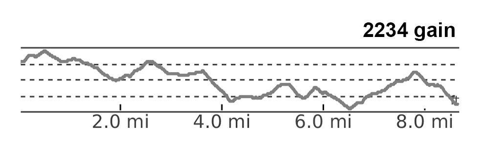
We tackled this 24.5 mile section of Vermont’s Appalachian Trail during a spell of very hot, dry weather – especially by New England standards. The route has quite a bit of road-walking and traversing open fields in full sun. We’ll admit… it wasn’t one of our favorites.
View the Full Album of Photos From This Hike
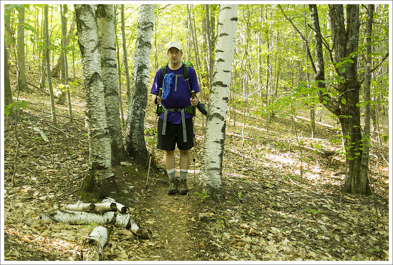
Adam Says: Day One – Hanover to Happy Hill Shelter (6.2 miles)
Download a Trail Map (PDF)
Map My Hike Stats

This is the first section of Vermont’s Appalachian Trail that we have attempted. We looked at a few different routes but decided on this short three-day trip. We were staying with Christine’s parents in central New Hampshire and wanted to start tackling some miles nearby since they could watch our dog, Wookie, while we were backpacking. Another great thing about staying with them is they offered to provide the shuttle for us. Probably like most family members, they don’t quite understand what we were doing since they have never done a backpacking trip. We are often riddled with questions about where we are going, preparations, how we use different equipment, etc. They tried on our weighted packs and didn’t understand how we could walk for miles with these strapped to our backs and make decent time. They followed us in their car and we parked at our end destination. We then shuttled back in their car to Hanover, NH.


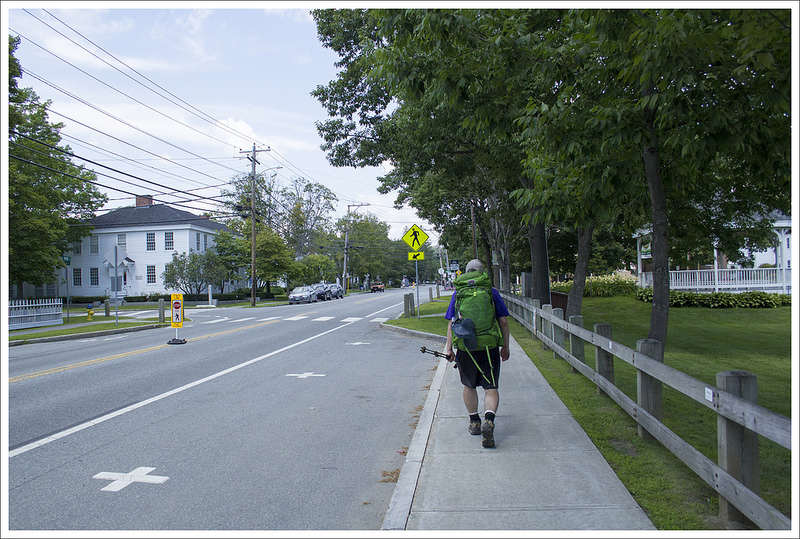
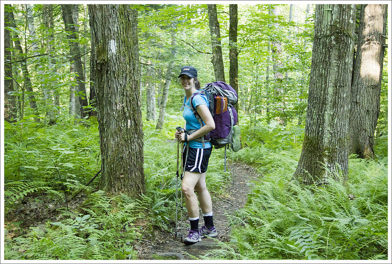
Before we began our trek, we had lunch with her parents at Molly’s in the heart of Hanover. They have great American fare and a trip to Molly’s has been an annual tradition for us for the last several years. We ate an early lunch, got our backpacks out of the car and started walking towards Dartmouth College on Main Street. The Appalachian Trail cuts right through the heart of Hanover, NH. It may be a rarity in most small towns to see people walking through your downtown with large backpacks, but Hanover is a classic hiker-friendly town. People would whisper as we walk by and take photos, making you feel like a celebrity more than anything. Of course, we had not walked all the way from Georgia to this point, but people are fascinated with long-distance backpacking. We took a few pictures on Dartmouth College’s quad lawn called The Green, walking by an admissions tour group, before turning down Wheelock Street/SR10 after just a few tenths from Molly’s to keep south on the Appalachian Trail. The white blazes that signify the AT trail markers through towns typically are blazes painted on lampposts or backs of signs.
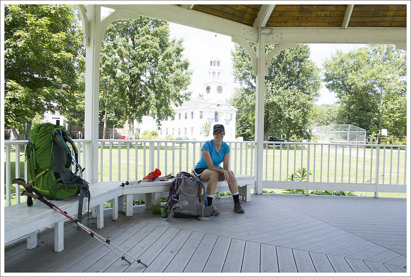
The day was hot – abnormally hot for the summer in Vermont. The day was approaching 90 and we were walking on open road with no shade so we quickly got overheated. SR10 crossed over the Connecticut River and you see a sign halfway across the bridge that signifies the state border between New Hampshire and Vermont at .8 miles. With more road walking, we reached Norwich, VT and began to climb up a steeper section of sidewalk. With the sun beating down and the uphill climb, it was quite unbearable. At 2.7 miles, we rested at a gazebo in front of a church. Christine couldn’t take much more sun, so we threw our backpacks off and I went searching for places to buy some cold drinks in fear of losing all of our water in just a short amount of time. I found a nearby deli shop and got some cold drinks. We had trouble finding the blazes at this point so I also looked around for blazes (which ended up being on the opposite side of the road). Luckily, the road that I found the deli was also where the AT turned down Elm Street.
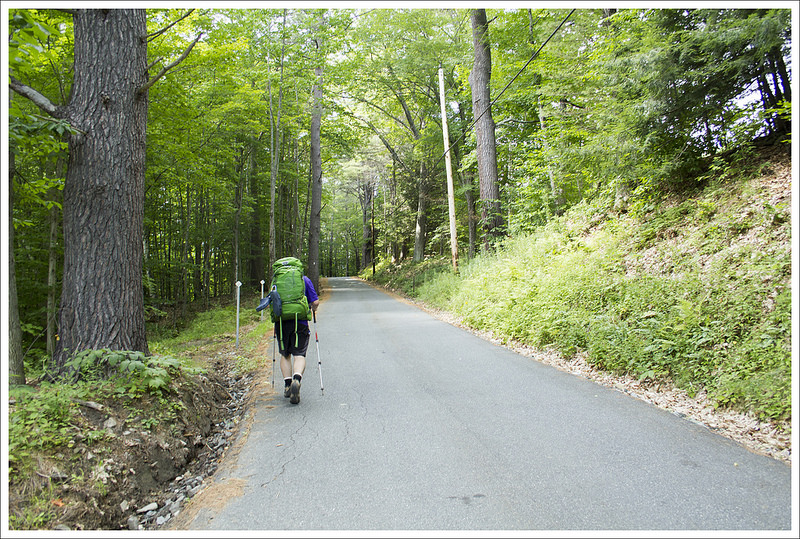
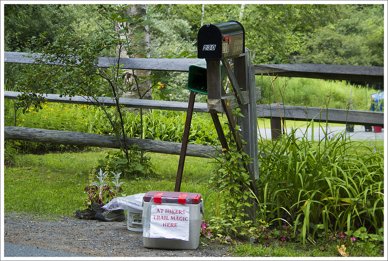
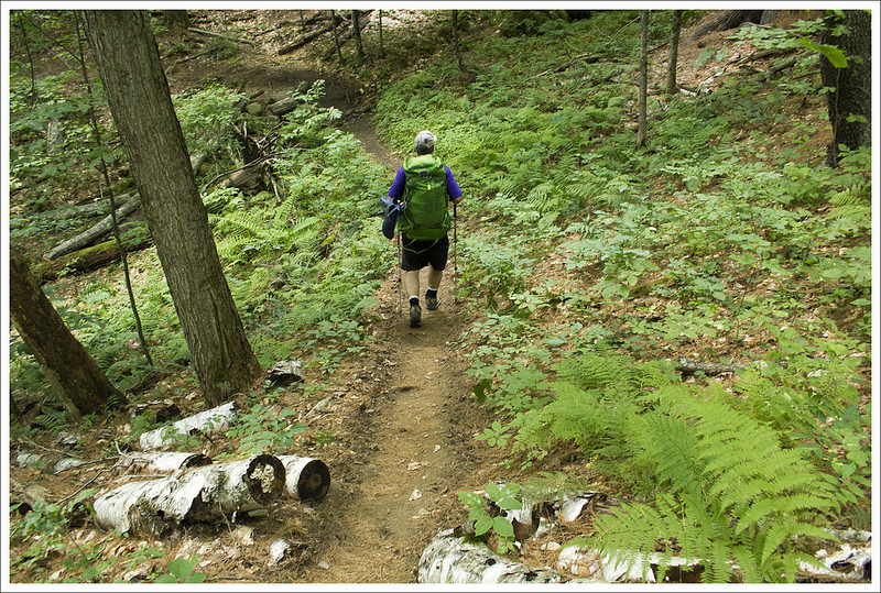
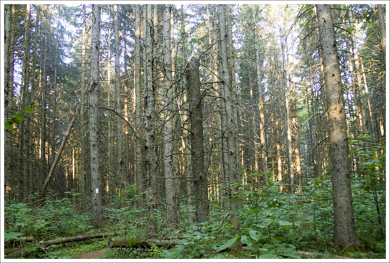
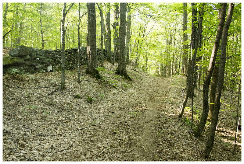
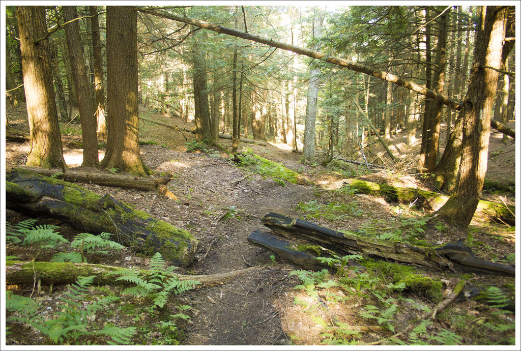
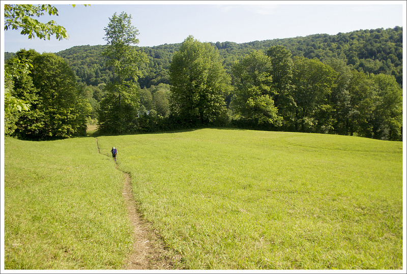
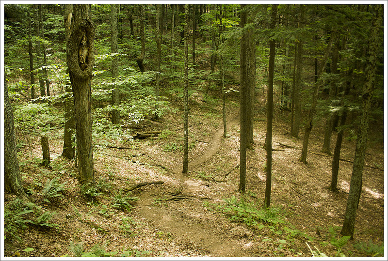
We continued on Elm Street going steeply uphill. There were several houses along the way that had trail magic – cold drinks and snacks in coolers or places to get a new paperback to read for the trail. I stopped again on our climb and took advantage of some ice cold water to drink and poor over my head to keep my body as cool as possible. We eventually came to a large kiosk (adorned with Uber business cards to avoid the road walking and get right into Hanover) where the AT finally entered into the woods and we had a bit of shade from the trees. The trail passed by a small stream (which was dry) and continued uphill. Overall the trail to our first shelter was mostly non-descript but serene. There was a brown path cutting through the sea of fern around us with pine, oak, and birch trees around us.
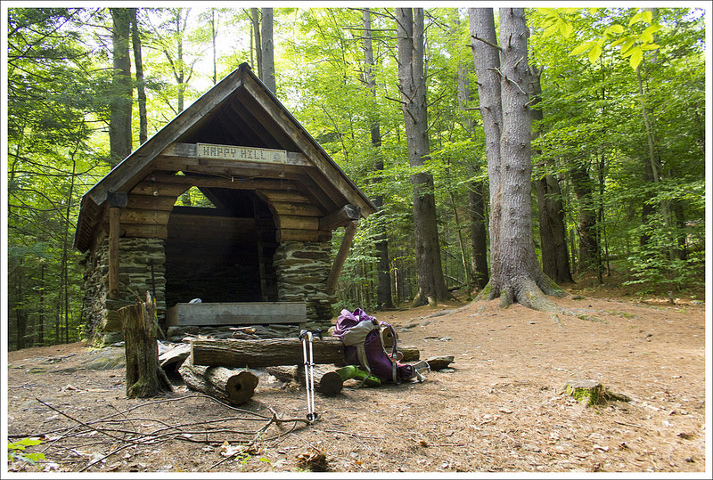
The trail crossed over a woods road at 4.5 miles and continued slightly up and down until we reached a junction with the blue-blazed Tucker Trail at 5.9 miles (a trail that also leads to Norwich, VT in 3 miles). From this point, it was just another .3 miles until we reached the sign that marked the side trail to the Happy Hill Shelter which was just less than a tenth off the main trail. We stopped for the night and were soon joined by some other hikers, including one of our favorites, Hobbes the dog, who had been suffering like all of us in the heat. He collapsed on the soft ground telling his owner, trail-named Calvin, that he was done for the day. He rolled onto his side while Calvin peeled off his doggy pack with no help from Hobbes. We talked while eating some dinner about things we had seen on the trail. We learned a bit about porcupines from one thru-hiker that told us that they mostly climb in trees during the day and are active at night. They gave us a warning to hang our poles because they like nibbling on the cork handles. We set up camp and tried to go to sleep but it was too hot of a night and everything felt clammy and sticky.
Christine Says: Day Two – Happy Hill Shelter to Thistle Hill Shelter (9.6 miles)
Download a Trail Map (PDF)
Map My Hike Stats
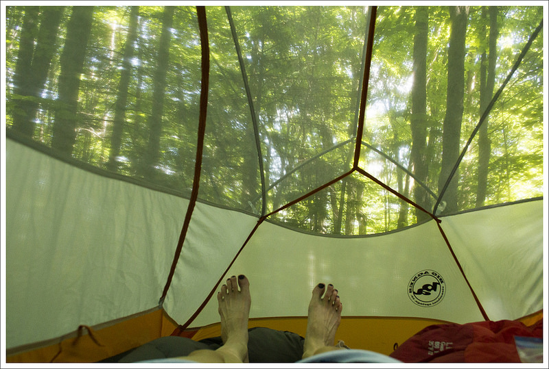
Our night at Happy Hill was kind of hot and fitful. Neither of us slept well. The tent was stuffy and I kept thinking I heard animals walking around the tent (porcupines!) The sun comes up so early in the New England summer that we were awake and packing up our gear before 6:00 a.m. We knew we had another hot day ahead of us, so getting an early start was important.
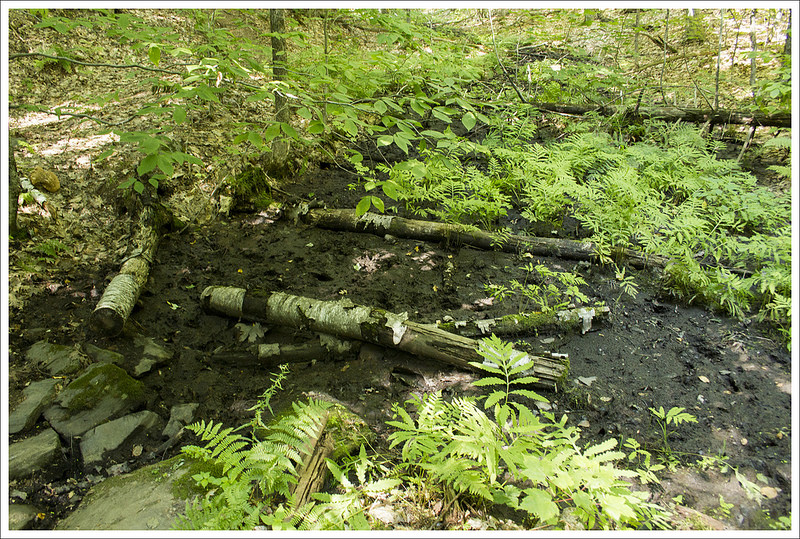
Our first stop of the day was 1.7 miles into the hike. We stopped to filter water from a unnamed small stream along the trail. Since the water source at the shelter had been dry, it was nice to replenish our Camelbaks.


Our first four miles of the day were mostly downhill and under the shade of the forest canopy. We walked through beds of fern, small meadows, and across a couple small streams. It was how I imagined Vermont would be.
At 3.4 miles into the day, we came out onto pavement and crossed under I-89. It’s always strange to step out of the woods and see 18-wheelers zipping by on a four-lane highway. The next mile of ‘hiking’ was over paved town roads heading into West Hartford. It was still pretty early, but the sun was already high in the sky and beating down full force on the asphalt. We were both red-faced and drenched with sweat.
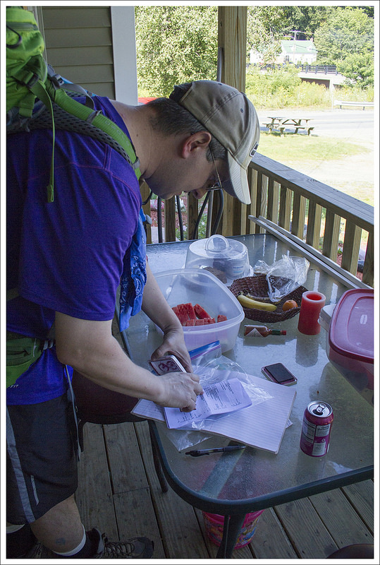


We arrived to the main part of town right at 9:00 a.m. – which happened to be the same time the community library opened. The library door had a ‘hikers welcome’ sign, so we figured we’d go in and make use of their facilities. Even after one night in the woods, it’s wonderful to be able to wash your hands with soap and running water. The library attendant told us to make ourselves comfortable and to help ourselves to coffee or water from their cooler. We sat in the air conditioning and chugged a couple bottles full of chilled spring water. After about 45 minutes, we decided we should probably move on because the day was only going to get hotter.
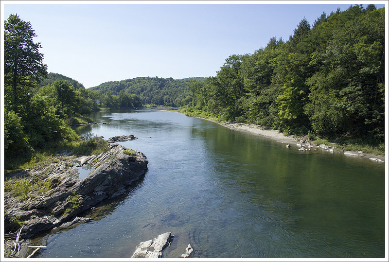
We had only been walking about 50 feet when a woman starting waving and shouting to us from her front porch – “Hello hikers!! Come on over!” Adam and I always stop to chat with people and explore towns along the trail, so we made our way over to the house. It turned out we were at the Hart’s residence. The Hart’s are a well-known and valued provider of trail magic. She offered to cook us breakfast – there were eggs, pastries, muffins, watermelon, and cold sodas. We weren’t hungry, but we gratefully accepted a cold soda and stayed to chat for a while. People along the Appalachian Trail are always so kind and generous. Finally, we said farewell and made our way across the bridge over the White River and back into the woods.
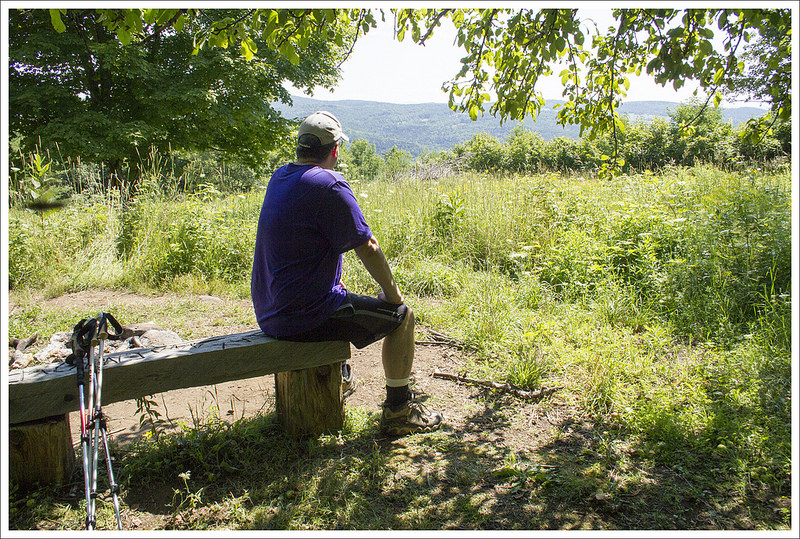
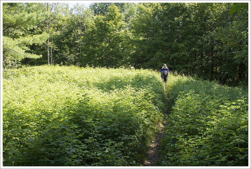
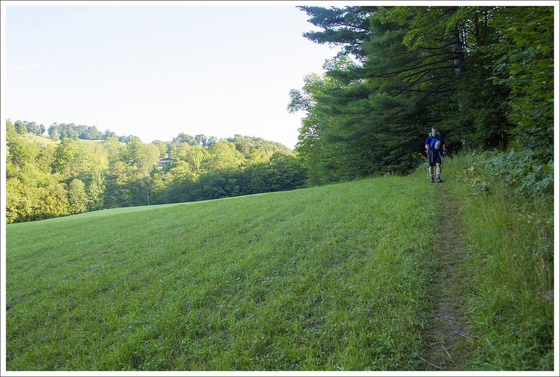
The shade of the woods was short-lived and all the remaining miles of the day were uphill and mostly crossing open fields and forest with thin canopy. It was blazing hot. We took lots of breaks to cool off. We came to a partially obstructed view at 5.2 miles into the day. There was a bench shaded by an apple tree at the vista.
We took our lunch break at a forest road crossing at 7.5 miles into our day. We sat in the dirt and ate crackers and cheese, candy, and nuts. We were both running low on water, but figured we could make it a couple more miles to the water source at the shelter. While we ate, we checked out the large sugaring operation in the woods around us. It looked like there were miles of tubes to collect sap from the maple trees. It was neat and something we never see in Virginia.
After lunch, we made the final push to Thistle Hill shelter. There were so many open fields to climb across. It was in the mid-90s, breezeless, and the sun was unrelenting. I could feel my skin burning despite multiple applications of sunscreen. We both ran out of water and were so totally ready to be done for the day. As it so often goes, you reach camp just when you think you can’t take another step. We were so thankful to reach the spur trail to the shelter.


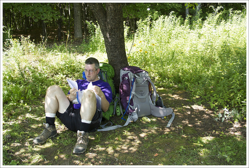
Adam probably had heat exhaustion and was badly dehydrated. He collapsed into the shade of the shelter to rest. I went about setting up camp while he took a break. After some time resting, we went to collect water. The source was really nice – a lacy little waterfall pouring over mossy rocks. I mixed electrolyte drinks and tried to get Adam to drink more. Several southbound thru-hikers we’d met the night before (and Rosco the dog) rolled into camp over the next hour.
We had an early dinner at the shelter. Everyone talked about the heat and the brutality of the five+ mile uphill climb. We retreated to our tent a little before sundown. Adam still didn’t feel well and I started to worry that it might be more than dehydration. At one point, I said to him, ‘We have cell service, we can call for help if you need it.’ He refused and fortunately started to feel better as the day cooled and the fluids started to rehydrate him.
More and more hikers arrived at camp as nightfall approached. I think there were probably close to 25 people camped at Thistle Hill by the time it was dark. A few more even stumbled in by headlamp as late at 10:00 p.m. We left our rainfly off the tent to catch the cross breeze, so every headlamp at camp woke us up. It was still a cooler, more comfortable night than we’d had at Happy Hill. We both got a decent night of rest in advance of our final day of hiking.
Adam Says: Day Three – Thistle Hill Shelter to Woodstock (8.7 miles)
Download a Trail Map (PDF)
Map My Hike Stats
With our last day ahead of us, we got up with the sunrise, used the neat screen-porch privy at the shelter, quickly packed up camp, and were on our way. I think only one thru-hiker made it out of camp before us. The heat was tough on a lot of us.
From the shelter, the trail descended. At 1.8 miles, we came to a junction marking a trail to the Cloudland Shelter (.5 miles west of the trail). This shelter used to be maintained by AT volunteers but was now on private land. Hikers can still stay there and it is owned by the owners of Cloudland Market. For the past two days we had been asking northbound hikers about Cloudland Market. It had been closed on Sunday and Monday when we started our hike but this was Tuesday and we had read in our AWOL thru-hiking guide that it was open on Tuesday. One guy had told us it was also closed Tuesday, but we had heard how great the shop was and thought a cold soda or snacking on some Vermont cheese could be nice. When we reached Cloudland Road at 2.3 miles, we saw a note taped to a sign stating that is was closed on Tuesday also, so we missed out.

We crossed Cloudland Road and had a very steep climb up an open field of grass and wildflowers to reach a hilly summit at 2.9 miles. This was probably the nicest view on the trail and gave us a glimpse of Vermont farms and mountains in the distance. We stopped for just a short time because the sun was beating down again, whipping us to push on for shade. The trail descended from this point and then we had another short uphill to reach another small view at 3.7 miles. We could see ski slopes off in the hazy distance. From this second viewpoint, it was a steep downhill until we reached the paved Pomfret Road at 4.1 miles.


On the other side of the road, was a small brook and we filled up water while talking with a bunch of northbound thru-hikers. They were having a debate on who would win in a fight between a horse and a cow and asked us for an opinion. We debated with them on why we felt a horse would win (because it had more speed and agility and could also pull off a painful kick or bite). It was a fun conversation and reminded me that when you don’t have the depressing world news to hear every day that these common topics were more enjoyable than the nightly newscast. Conversation with hikers that are going the opposite way are your version of the internet. You get information about trail conditions, water sources, sights to see, and how much uphill is ahead (its always stated that its not too bad even if it is). We also heard from other hikers that this section of Vermont that we had picked was probably the least beautiful of any of the sections of Vermont. While it was disheartening to hear, it at least renewed our opinion that the rest of Vermont would have nice streams, views, and farmlands fit for a postcard and we should do more of it another year.
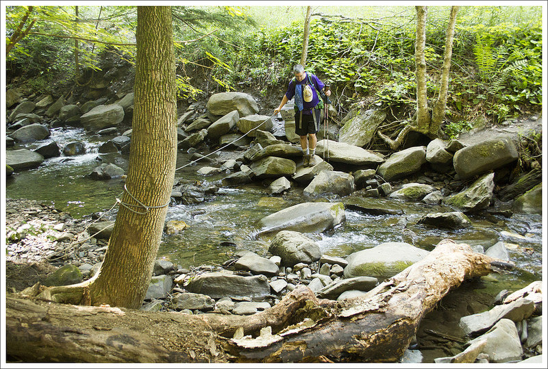

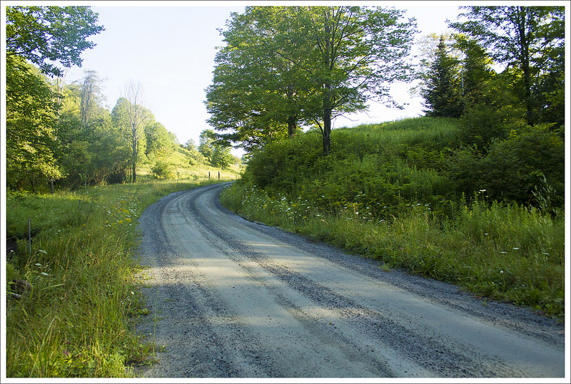
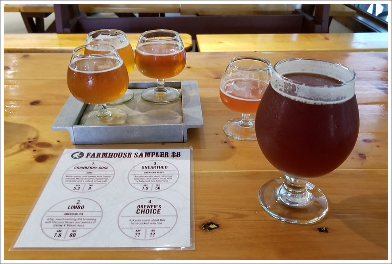
After taking a short break and filling up with water we pressed on. We crossed another small stream and reached the gravel Bartlett Brook Road at 5.7 miles. At 6.5 miles, we crossed Totman Hill Road and reached another stream at 7.0 miles (where was all this water earlier in the trip?). At 7.3 miles, we reached Woodstock Stage Road and Barnard Brook. We had one less-steep climb up, a one mile climb up Dana Hill before descending again. On our final descent, we saw a black bear foraging off to the side that took off running when we got close. It was very exciting to finally see some wildlife and was a reward for the end of our journey! We finally reached our final road crossing at 8.7 miles, Barnard Gulf Road, and got back to where we had parked our car. We made it! We had been so hot and miserable for most of the trip we wondered if we would make the entire section. Filled with pride it was now time to fill our stomachs. We drove to nearby Long Trail Brewery for some cold beers and amazing food to toast our accomplishment.

Trail Notes
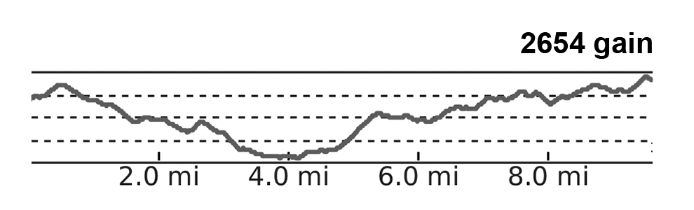
- Distance – 24.5 miles
- Elevation Change – 6,341 ft
- Difficulty – 4. This section had tons of steep, unrelenting ups-and-downs (most without a view payoff). It was similar to a bigger, badder version of Virginia’s roller coaster.
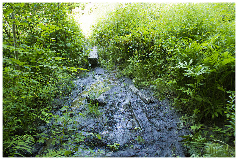
- Trail Conditions – 3.5. The trail was generally well maintained, but there were some very overgrown sections. There was also a bit of mud and erosion in places.
- Views – 2.5. There were a couple nice views from high meadows. They were pretty, but not spectacular. Many were partly obstructed.
- Waterfalls/streams – 3. There were streams for water sources and several larger rivers to cross (on bridges).
- Wildlife – 4. Other hikers near us saw porcupines and we saw a bear!
- Ease to Navigate – 4. The trail was easy to follow with adequate blazing and signage.
- Solitude – 3. Surprisingly, we saw very few people on the trail, but campsites were moderately crowded.
Directions to trailhead: The parking lot that we left our car was at 43.6552N 72.5662W on Barnard Gulf Road on VT 12. From here, we made our way to Hanover, NH by heading south on VT 12 for 3.7 miles. We turned left when reaching to town of Woodstock to stay on VT 12 for .6 miles before turning left on to US-4 east. Stay on US-4 East for 9.4 miles and then merge on to I-89 South. Stay on this for 3 miles before taking the I-91 exit towards Brattleboro/White River. Keep left at the fork and follow signs for I-91 North. Stay on I-91 North for a little over 5 miles before taking exit 13 for Norwich. Take a right to merge on to 10A/W. Wheelock Street. Follow this for .8 miles before turning right on to Main Street. Parking is available hourly behind a lot of the restaurants/shops but is a good dropoff point for a shuttle.
* MapMyHike is not necessarily accurate, as the GPS signal fades in and out – but it still provides some fun and interesting information.
