Appalachian Trail – Elkwallow to Jenkins Gap

This 12.6 mile hike gives you several breathtaking views to the west and a visit to an AT overnight shelter.  Instead of doing our normal ‘Adam Says‘ and ‘Christine Says‘ segments, Adam is going to cover the first day and Christine will cover the second.

Christine Taking in the View
Christine enjoys the view from one of the Marshalls on the second day of the trip. Below: The Gravel Springs Hut; Views on the first day; Adam relaxes by the campfire.

Views on Day One Beautiful Mountain Views
The Gravel Springs Hut
Relaxing by the Campfire

From the Elkwallow Wayside, follow the short spur trail at the northern parking lot for .1 miles until it reaches the junction with the white-blazed Appalachian Trail.  Turn right, heading north and you will almost immediately cross Skyline Drive.  The trail begins to climb.  At 1.4 miles, the trail crosses Skyline Drive again and continues to climb.  At 2.5 miles, the climbing reaches an end as you reach the junction with the Tuscarora Trail.  At mile 2.9 and mile 3.2 you will cross Skyline Drive a few more points crossing over Hogback Mountain.  At the cross at mile 3.2, you are on a fire road for a very short while (that is used for people bringing in hang gliders) and the AT goes into the woods.  At mile 3.4 you reach some nice views and where the hang gliders take off for a descent over the mountains.  At mile 3.6, you will reach a junction with a side trail that leads to a spring.  The trail begins to descend at this point.  At mile 4.3, the trail begins to slightly ascend until you reach a nice viewpoint at mile 4.4.  The trail descends again and crosses Skyline Drive again at mile 5.0.  At mile 6.0, you reach the side trail which leads .2 miles to the Gravel Springs Hut.  For the start of our second day, from the Gravel Springs Hut, rejoin the AT at 6.4 miles.  At mile 6.6, the trail crosses Skyline Drive again and continues to ascend.  At mile 7.4, you reach a great viewpoint on South Marshall Mountain.  The trail continues to climb up and crosses Skyline Drive at mile 8.2.  The trail then ascends steeply up North Marshall Mountain and leads to another nice view at 9.4.  The trail ascends for another quarter of a mile and then descends steeply down the trail. The trail crosses Skyline Drive again at mile 11.0.  The trail ascends over a short bubble of a hill and then reaches the Jenkins Gap Trail junction at mile 12.5.  Take a right at this junction and reach the Jenkins Gap Trail parking lot at mile 12.6.

Day One – Adam Says…

I noticed the weather forecast was saying that we had a 0% chance of rain on Friday and only a 10% chance of rain on Saturday.  Since we have opted to cancel a few backpacking trips recently due to rain, we felt we couldn’t resist these odds and decided to take the day off work to work on this section of the Appalachian Trail.  We had bought two annual park passes last year, with one expiring at the end of May.  We felt the pressure of getting this hike in since it required two vehicles for the shuttle.

Adam Climbing Up from Elkwallow
Adam climbs uphill from the Elkwallow Wayside. Below: A nice view of the valley below.  For some reason, Christine likes to wear backpacking clothes that don’t match; The Appalachian Trail in Shenandoah often runs within sight (or earshot) of Skyline Drive; The trail crosses and briefly follows fire roads in several spots.

Great View of the Valley Above Skyline Drive Crossing a Fire Road on Day One

It took us a while to get our act together to make sure we were ready for the trip.   We started loading our packs, made sure we had instructions for our dog sitter, and picked up some lunch along the way from Subway.  We drove up to drop a car off at the Jenkins Gap parking lot and then made our way back down to the Elkwallow Wayside.  We ate our lunch outside and saw a few thru-hikers that we wondered if we would see later that evening.  Christine was really cold sitting in the wind outside the wayside. Her legs were covered with goosebumps and she kept pulling her jacket tighter and tighter around her ribs.  She told me that she was really worried about the cooler temperatures, and hoped she would warm up once we started hiking.

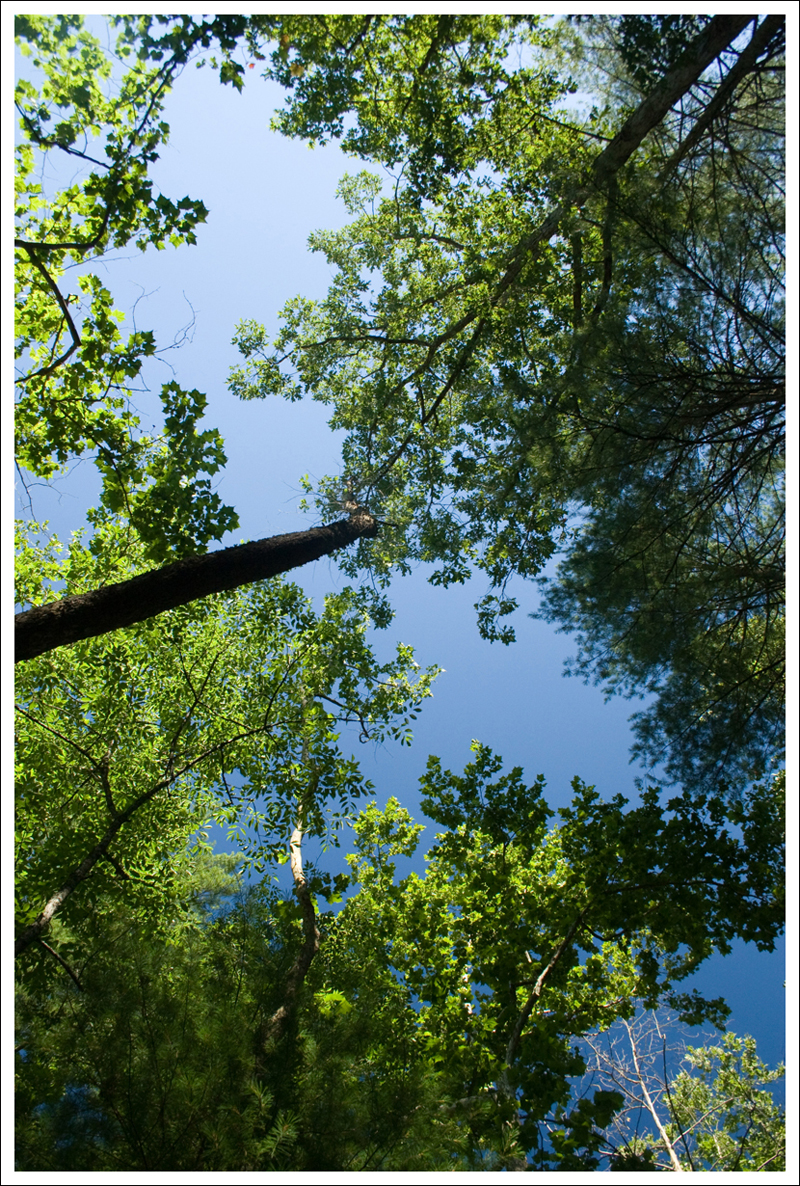
We finally started off on our hike around 1:30PM.  We strapped on our 30 lb. packs on to our backs and started climbing up the hill.  While we had been hearing the loud screams of the seventeen-year cicadas near our house, we were pleasantly surprised to hear they were not out in Shenandoah National Park.  We stopped at a few points on the uphill climb to take in the views from Hogback Mountain.  One nice thing about this hike is that the views were mostly on the uphill climbs, so it gives you a reason to take off your heavy pack and enjoy the scenery.  A couple of thru-hikers we had seen at Elkwallow passed us near the hang glider launch.  We’re always amazed at how fast they hike.  I guess hiking every day has its pay-offs!

Hangglider Launch Site
The hang-glider launch site offers a beautiful view! Below: Adam hikes uphill again near Hogback Mountain; Wildflowers blooming along the trail; Our tent site at the hut.

Hiking Past Hogback Wildflowers Along the Trail Our Tent Site at Gravel Spring

We made our way down the mountain at this point.  Backpacking uphill seems to be where you feel the weight the most, but going downhill has its own challenges – you feel the weight differently in your legs and have to be extra careful of your footing.  We made it to the Gravel Springs Hut around 4:30PM and checked out the nearby area.  There weren’t any other hikers there yet, so we were wondering if we were going to have this all to ourselves that night.  We scouted out some of the campsites near the shelter.  There were five campsites.  We started to pitch our tent at the first campsite, but we realized we wouldn’t have enough of room to put up the fly.  And with the night forecast to go into the upper 30’s, we definitely wanted the extra layer of insulation on our tent.  We ending up moving to the largest of the sites, but this site was more sloped.  We pitched our tent so that our feet were on the lowest, downhill part of the slope.  We filtered some water and I began to work on cooking dinner while Christine gathered some kindling for a campfire.  In most places in Shenandoah National Park, you can’t set fires in the backcountry, but this shelter had a large stone fireplace.  We ate a dinner of Backpacker’s Pantry Sweet and Sour Chicken (which was delicious and definitely something we would have again) and Natural High’s Banana Cream Pie (which we didn’t like the taste or consistency).

One of the highlights of staying at an AT shelter, is the people that you get to meet.  Around 5:30, we met our first group of hikers that were planning on staying at the shelter.   There was a gentleman named Don from Indiana, who had suffered a knee injury from hiking the AT previously, but was returning for a hike through Shenandoah to Harper’s Ferry to test his knee on an extended trip.  He was accompanied by two brothers from Florida. The older brother, Adam had decided to introduce backpacking to his younger brother (who wasn’t enjoying it as much).  The original plan was to hike the AT through SNP and return back.  However, they had recently decided they would stop at Front Royal and then find a way back to Waynesboro that didn’t involve hiking.  Next, two women came along and set up tents at two more of the campsites.  They were out on a two night trip and had parked a car nearby so they could slackpack most of the trail.  Shortly afterwards, Standing Bear arrived.  Standing Bear was a thru-hiker that had started his trip from Georgia around the end of February.  He told us a lot that night about how he has been attracting a lot of recent trail magic, from margaritas at a campsite to meals and lodging along the way.  He told everyone that he was very good at  ‘Yogi-ing‘.  We then had another thru-hiker join us named Mountain Goat.  When you looked at Mountain Goat’s legs, he just looked like a tough beast and he was working on trying to do over 25 miles a day to finish the trail quickly.  As dusk approached, the last group of thru-hikers joined us – Rat Bucket and Sketch.  They had purchased a couple of bottles of wine and were making their 6-mile trip from Elkwallow to the hut drinking wine instead of water.  They were of course a little happier than most of the hikers when they arrived at the cabin.  We hung out for a while, sitting around the campfire and talking about what areas the hikers had enjoyed the most (Grayson Highlands was the unanimous vote) along the way and food (which seems to be a constant discussion with thru-hikers).

Christine Works on the Fire
Christine works on getting a fire going. She still hates her lime green Crocs. Below: Adam filters water from the spring at the shelter; Everyone congregates and cooks dinner at the picnic table in front of the shelter; Relaxing by the campfire after dinner.  Everyone is usually in bed by 9:00 or so.

Adam Filtering Water from Gravel Spring Hikers at the Shelter Relaxing by the Fire

Around 9:00, we headed back to our tent.  I continued to read my book that I have been only reading while backpacking – a book of John Muir’s writings and Christine listened to her iPod.  We fell asleep to the sound of nearby owls.  The slope really affected my sleeping as my fitted sheet for my air mattress kept coming off and I would wake up in fetal position at the bottom of the tent and would have to fight back up to the top.

Day Two – Christine Says…

I woke up as soon as the birds started chirping and the first hints of light filtered through the trees.  It was cold, so I pulled my sleeping bag tighter around me and cinched its hood around my head.  I had slept really well despite the fact I had repeatedly slid downhill to the bottom of the tent. I heard others nearby starting to stir as well – tent zippers sliding, the privy door slamming and the whoosh of camp stoves firing up.  I didn’t want to leave the warmth of the tent, but I did.  There’s always so much that needs done to break down camp before eating breakfast.

Breakfast Time
The table got really crowded at breakfast time, so we cooked on the little stone bench on the side of the shelter. Below: Adam checks out the trail sign showing hike options in the vicinity of Gravel Springs; Adam tucks his pants into his socks to avoid ticks; Christine and Adam on South Marshall Mountain.

Leaving Gravel Springs Tucking Socks Adam and Christine on South Marshall

Adam and I are usually pretty efficient and can have our whole campsite broken down and backpacks repacked within about half an hour.  The first step is always to shove our sleeping bags back into their stuff sacks.  Then we repack our sheets, crunch down our pillows and let the air out of the sleeping pads. Once the bedding is stowed away, we pack up the tent and any clothing that was left strewn about the site.  Yes… we really carry all this stuff!  As you might have guess, we are not lightweight backpackers.  We carry a lot of creature comforts and luxury items (pillows, sheets, chairs, books, card games, etc).   When we go on longer trips, we’re really going to have to reevaluate our gear and make some sacrifices. 🙂

When we walked down to breakfast, our backpacks were pretty much fully loaded and ready to go for the day.  The only things left to pack were our food, dishes, stove and water filter – and we always keep those items near the top of our packs.  When we got down to the hut, almost everyone was already up and working on breakfast.  We got our two bags (trash and food/other stuff that has a scent) down from the bear hang and joined the rest of the group at the picnic table. Breakfast was coffee and instant apple cinnamon oatmeal.  You see a lot of oatmeal and granola at backpacker breakfasts.  Clif bars and bagels are pretty popular too.  Although, this particular morning, one pair of hikers even had a container of fresh berries!

Adam and I were the first to leave the hut.  We climbed up the short, but steep, access trail back to the AT and headed north.  The early part of the morning’s hike took us past several gorgeous views from the Marshalls. We spent time at each of them, taking photos and enjoying the cool, crystal-clear morning.  While we were at the first view, Rat Bucket caught up with us.  We took a photo of him and he returned the favor for us before heading quickly down the trail.  Once again, I marveled at the speed and distance covered by thru-hikers.  Most of these folks are covering 20-28 miles a day through Shenandoah National Park.

Christine on North Marshall
Christine on North Marshall Mountain. Below: Views from both Marshalls were excellent;  You can see Skyline Drive off in the distance; Christine scrambling around on the cliffside; Another excellent view; Adam takes in the scenery from a high perch; Checking out mileage on the trail marker.

Another Great View Distant Skyline Drive Scrambling on the Cliffs
Great Views on Day 2 Adam Checks Out the View Consulting a Trail Marker

At the next view, Mountain Goat caught up and passed us.  He only briefly stopped to check out the vista.  I guess when you hike big miles, you don’t have time to meander and pause at every pretty spot along the trail. While we were stopped at this spot, we had a quick snack of PowerBar Energy Blasts.  They’re basically caffeinated gummy candy, but the website makes them sound like they magically give you Lance Armstrong-like endurance and help your muscles recover.  Maybe they don’t do all that, but they sure do taste good!  And they have sugar and caffeine – both of which seem to help me hike stronger.

At the third viewpoint, Standing Bear passed us, but we ended up leapfrogging him a little further down the trail and didn’t see him again.  Nor did we see any of the other folks from the hut.  All but two people staying at Gravel Springs had been northbound, so I suppose they just stayed at camp a bit later.

The trail was so beautiful and lush and green!  Even when there wasn’t a view to enjoy, the hike itself was so lovely.  The climbs were never too hard and the descents were never too steep.  We crossed Skyline Drive several times.  We saw lots of dayhikers… two of them were even dressed in their ‘Sunday Best’ clothing.  They were walking south along the trail, not in the vicinity of any views or special attractions.  Neither of them looked in the least bit happy and both of them looked hot and uncomfortable.  I see people like that and wonder if this hike was a spontaneous decision.  I wonder if they know where they’re going, or if they just set out on a trail thinking ‘Hmmm… if I walk on a trail, eventually I’ll see something!’

Dayhikers
We saw a lot of dayhikers as we approached Jenkins Gap. Below: An old foundation along the trail; The only bear we saw on this trip came in the form of Adam in a mask at the Skyland gift shop.

Old Foundation The Only Bear We Saw

We made it back to our car at Jenkins Gap around 10:30 or so.  We had plans to meet my parents at Skyland for a Mother’s Day lunch at noon, so I brushed my hair and changed into my less-dirty clothes.  We had plenty of time to kill, so we stopped by the Elkwallow wayside for more snacks and drinks.  When we got to Skyland, it wasn’t even 11:30, so we relaxed in the lobby until they arrived.  We had a nice lunch together and then headed home.  It was a fun trip, and I can’t believe we only have several more miles of Appalachian Trail to hike in Shenandoah!

Trail Notes

  • Distance 12.6 miles
  • Elevation Change – 1900 feet.
  • Difficulty – 3.  Despite the two big climbs of elevation, we didn’t feel that it was overly difficult.
  • Trail Conditions – 4.  The trail was in great condition and was well-maintained.  There were only a few rocky areas that you had to worry about footing.
  • Views – 4.5.  We were impressed with the views along this section.  The best views were from South Marshall Mountain, but there were probably 4-5 areas to take in the expansive views.
  • Streams/Waterfalls – 0.  There were no streams or rivers nearby, but there was a reliable water source at Gravel Springs Hut.
  • Wildlife – 3.  Someone had written in the hut trail journal they had seen a few bears on the way down to the hut that day.  We did see a deer and the woods were filled with pileated woodpeckers, owls, and other birds.
  • Ease to Navigate – 4.  There are some side trails, but just consult the cement posts to keep following the Appalachian Trail.
  • Solitude – 3.  We ran into most of the people around the Jenkins Gap to North Marshall mountain.  I would imagine this would be fairly popular since it is closer to the northern end of Shenandoah National Park.

Directions to trailhead:  Park one vehicle at the Jenkins Gap lot at mile 12 on Skyline Drive.  Then travel down south to mile 24 at Elkwallow Gap Wayside.  The spur trail to the Appalachian Trail starts from the northern parking lot.

Appalachian Trail – Powell Gap to Loft Mountain

This post covers the ten miles from Powell Gap to Loft Mountain, with an overnight stop at the Pinefield Hut. Sleeping inside a hut is typically something reserved for people out on multi-night trips, so we tented in a spot uphill from the hut.  Hut sites offer the convenience of a spring-fed water source or stream (usually), a picnic table to cook on, a place to have a campfire (the only permissible place in Shenandoah’s backcountry) and access to a privy (no catholes to dig).

The Pinefield Hut
There was a nice group of eight people camping in or around the Pinefield Hut – our stop for the night.  Below: Pretty mountain layers as seen from the Ivy Creek overlook; Our tent site was on a hill above the hut. You can see the roof of the hut through the trees; Adam climbing the trail upwards from Simmons Gap.

Ivy Creek Overlook Our Tent Site Climbing Up From Simmons Gap

Adam and Christine Say …

We’ve found that with our backpacking trips, it’s usually easier to combine our thoughts into one large post.  Here we go!

Even though this backpacking trip was scheduled weeks ago, we weren’t sure until the last minute that we were actually going to pull it off.  It rained all week, Adam was having back spasms, our friends couldn’t make the trip and we were both coming off a particularly busy week at work.  Sitting in the air-conditioned house, pajama-clad, and watching TV from the couch seemed quite a bit more appealing than heading out into the damp, buggy woods with 30+ pounds of gear strapped to our backs.

The thing that ultimately tipped the scale in favor of hitting the trail for an overnighter was actually all the 9/11 anniversary coverage.  When Friday morning rolled around, Christine was feeling overwhelmingly sad.  All week long, virtually every news outlet had been covering 9/11 – bringing all the horrific imagery and stories back to the forefront.  Remembering and paying tribute is important to her, and she felt drawn to having a quiet, peaceful place to reflect without seeing any more images of people dying or cities burning.  We both wanted to be in the woods – away from the TV, away from the internet, away from the radio.

Powell Gap View
Adam takes in the view after the first climb out of Powell Gap. Below: There is not a paved parking lot at Powell Gap.  Instead, you can leave a car in the grassy field next to the trail entrance.

Powell Gap Parking

We had a leisurely Saturday morning.  Christine made a big breakfast with eggs and biscuits (for Adam), blueberry pancakes (for herself) and bacon (for both of us).  After cleaning up dishes, Christine packed our camp food into Ziploc bags and put together bathroom kits.  Adam worked on loading our backpacks.  We decided to eat lunch at home and then headed off to the park around 1:00.  We chose to hike south along the Appalachian Trail from Powell Gap to Loft Mountain, with an overnight stop at the Pinefield Hut.  We brought two cars into the park to make the trip logistically easier, parking the return car at the Loft Mountain wayside.

We left one car in the grassy field next to the trail entrance at Powell Gap.  After doing last minute pack checks, we headed off.  The trail climbs immediately upward from the gap.  You gain about 300 feet in just a few tenths of a mile. Within the first half mile, you pass a pretty eastern-facing view of the valley below.  We stopped and made some pack adjustments.  Adam insisted on taking over the burden of carrying our extra water.  The south district of Shenandoah is famously dry, so we hauled a 3 liter Nalgene canteen so we’d have plenty of water for cooking and hiking on Sunday. Even with all the rain, we weren’t sure if the spring at the hut would be running.  Christine bickered with Adam over the extra weight of the water, because she didn’t want him to make his back pain worse.  In the end, he won and we headed down the trail with the extra 6.6 pounds of water hooked and freely swinging from a carabiner on the back of his pack.  He was definitely carrying too much and it did slow his pace down a bit!

Young Bear
We spotted a young bear on a hillside before the descent to Simmons Gap.  Below: Stopping for a snack and map break at the Simmons Gap crossing; Our trekking poles make backpacking trips so much easier; Monarch butterflies were everywhere!

Snack Break at Simmons Gap Trekking Poles Monarch

The Appalachian Trail between Powell Gap and Pinefield Hut is pretty uneventful.  There are a few road crossings, several climbs and descents, and just the one open view.  Most of the trail is just typical walking along a forest trail – pretty, but not remarkable.

On the descent toward Simmons Gap, a black shape caught Christine’s eye.  She turned back and mouthed ‘BEAR!’ to Adam.  Sure enough, a handsome yearling bear was perched on the hillside, quietly watching us pass.  She managed to get an OK photo of the bear, but he was really too far up the hillside for our pocket camera’s zoom capabilities.  We stood still and had a little stare-down with the bear for a few moments before he turned and lumbered up the hill.  We’ve decided the park has two kinds of bears: 1) indifferent bears and 2) scared bears.  The scared bears run as soon as a human comes into view.  Indifferent bears may cast you a sidelong glance, but otherwise ignore you and continue along with whatever they were doing before you spotted them.  We like the indifferent bears; they’re easier to photograph!  We’ve never come across an aggressive bear in Shenandoah – thankfully.

At the trail crossing near the Simmons Gap Ranger Station, we stopped and had a snack of cashews.  The cement post indicated that we had 2.2 miles to cover before reaching Pinefield Hut.  We figured we’d make it there well before dinner time.  As we were sitting on the grass eating cashews, another backpacker came up to us and asked which way it was to reach Brown Gap.  We pointed the way (12 miles to the south), rested for a few more minutes and then continued.  The trail climbing out of Simmons Gap was probably the hardest climbing of the day, but still fairly moderate. Christine noticed that Adam was really struggling with his pack weight, so we made some more adjustments and she took the big Nalgene canteen back.

Timber Rattlesnake
We saw this timber rattler after climbing out of Simmons Gap. Below: A good look at the rattle.

Rattle on the Trail

As we continued climbing, we spotted the hiker headed toward Brown Gap stopped in the middle of the trail.  We didn’t see anything, so we continued climbing until we were right behind him.  He turned and said ‘There’s a rattlesnake on the trail!’  Christine replied ‘Ooooh, where?’  But as soon as she peered over his shoulder, she immediately saw the large snake laid out, almost completely spanning the trail.  He wasn’t moving or rattling.  We speculated that maybe he was dead or in a state of torpor.  We stood and looked at him for a good five minutes.  Finally Adam climbed off the side of the trail, making a wide arc around the snake (since he is definitely more fearful of snakes than Christine).  Christine followed suit, as did the other hiker.  As soon as we all passed, the snake slowly slithered off the trail and coiled up in the leaves about a foot off the path.  We got a few exciting photos of the snake before we headed off to finish our climb uphill.

Eventually the trail leveled off for a while before gently descending to Pinefield Gap.  Climbing downhill, we both noticed how much bear scat there was along the trail.  This area obviously has a pretty healthy population of black bears.  After one final road crossing, we had just two tenths of a mile left until we got to the shelter.

Pinefield Shelter lies just a couple hundred yards off the AT.  As we were walking down the side path to the shelter, we heard voices and laughter.  We were greeted at the shelter by six other hikers – a mix of thru-hikers, section hikers and weekenders. Peak use of AT shelters happens May- June, so we were a little surprised to see so many people at Pinefield.  Everyone was really friendly and they already had a great campfire going.  We chose a tent site up the steep hill behind the shelter.

We quickly set up the tent, inflated our sleeping pads and fluffed our bags before heading back down to the shelter to socialize and cook dinner.  We had a repeat favorite dinner from Backpacker’s Pantry – Pad Thai and Chocolate Cheesecake for dessert.  Two of the others hikers in for the night, Brendan and Ayla, had purchased a bag of marshmallows and were roasting them over the fire.  Talk centered heavily on food for much of the evening.  If there is one thing hikers have in common, it’s hunger!  We set our camp chairs near the fire and enjoyed an evening of conversation and a little music.  Ayla had a flute and Brendan carried a small guitar.  It was a pleasant evening, and you really can’t beat a good campfire!

Adam By the Fire
Adam relaxes by the fire.  Below:  A comparison – the first photo is the park’s representation of Appalachian Trail backpackers.  The second and third photos are what backpackers really look like!  Sometime soon, I think Adam and I are going to pose to recreate the park’s image – spacy expressions and all!

Funny Backpackers Real Backpackers 1 Ayla and Brendan

Sometime after dark, we climbed back up the hill to our tent by the light of Adam’s headlamp.  Christine listened to the new book in the Game of Thrones series on her iPod and Adam continued to read his John Muir book.  As we relaxed in the tent, we began to notice that our tent site wasn’t quite flat.  It was on just enough of a slope that you can feel, even if you can’t see it!

Christine had a decent night of sleep – occasionally waking to the hoot of an owl or the sound of Adam thrashing around next to her.  He didn’t sleep well at all!   He still hasn’t figured out the best way to get comfortable with his sleeping set-up.   In the morning, everything had shifted to the downhill side of the tent.  Adam was crammed up along the tent wall and Christine was practically on top of him!

Almost everyone was up early, cooking breakfast and packing up their gear.  We took down our tent and shoved everything back into our packs.  We fired up our JetBoil and made oatmeal and coffee.  We didn’t even use all the extra water we had hauled down to camp, so we shared with everyone else.  Incidentally, the spring was running at Pinefield so we didn’t even need to carry all that extra water.  Oh well… better safe than sorry.

Our second day of hiking was a little tougher, but a little more rewarding in terms of views and scenery.  Ivy Creek, which we passed near the end of the hike, was actually running much more than usual  Our packs were lighter, since most of the food and water were gone.  The forest was beautiful and misty, with golden sunrays cutting down between the trees.  Spider webs covered with dew glistened in the morning sun.  We crossed paths with the hiker we had met at Simmons Gap the day before.  He was headed north, and looking for water.  We were kind of surprised, because he must have passed at least three decent water sources that morning returning from Brown Gap.

View of Skyline Drive
We got a great view of Skyline Drive and the mountains beyond on our second day.  This view looks to the west.  Below: Morning fog created some nice sunrays in the forest; Ivy Creek was running nicely; Spider webs glistening in the morning light.

Sunrays  Ivy Creek Spider Web with Dew

We reached the junction of the AT and the trail down to the Ivy Creek maintenance building around 10:15 a.m.  It was a quick downhill walk of .6 miles back to Skyline Drive.  We got to the Loft Mountain Wayside around 10:30.  Even though it was still on the early side, we wanted lunch!  The cook behind the counter was nice enough to make us fries and grilled ham and cheese sandwiches even though they were technically still serving breakfast.  It really hit the spot!

After lunch we passed through the gift shop and picked up a couple 75th Anniversary Shenandoah souvenirs – a magnet and a Christmas ornament.  We’d been meaning to get something from the anniversary all season.  Park shops are only open for a few more weeks, so we figured it was now or never.

Lunch at the Loft Mountain Wayside
Lunch at the Loft Mountain Wayside. Below: Our hike down to Skyline Drive from the Appalachian Trail took us past the PATC’s Ivy Creek trail maintenance building; Adam crosses Skyline Drive and heads toward the Loft Mountain Wayside where we left our car.  Unfortunately, someone whacked our car pretty hard while we were away.  We have a huge dent and a paintless streak on the passenger side now.  Boo!

Ivy Creek Maintenance Finishing at Loft Mountain

We were back home before 1:00, which was perfect!  We had the rest of the day to relax and clean up before heading back to work on Monday.

Trail Notes

  • Distance 10 miles
  • Elevation Change – 2500 feet over five different climbs
  • Difficulty – 3.  Mostly uphill climbing on this hike.
  • Trail Conditions – 4.  The trail was in pretty good shape.  Some areas were slightly overgrown and there were a few tree blowdowns, but otherwise, it was fine.
  • Views – 3.5.  Some nice eastern views on the climb up from Powell Gap and nice western views near the Rockytop overlook.
  • Wildlife – 4.  We saw many signs of bears along the trail (and saw one), we saw our first timber rattlesnake, and several pileated woodpeckers.
  • Ease to Navigate – 4.  Not many turns on the Appalachian Trail, but a few turns to make it to the Loft Mountain wayside.
  • Solitude – 4.  You will likely see people near Powell Gap and Loft Mountain, but not a lot in between.

Directions to trailhead:  Mile 70 on Skyline Drive, park in the large field.  You’ll see the post for the Appalachian Trail from the lot and head south.

Fisher Springs Run/Rohrbaugh Plains – Dolly Sods (WV)

The Fisher Springs Run – Rohrbaugh Plains hike is a five mile out-and-back that leads to spectacular wilderness views from a cliffside.

Rohrbaugh Cliffs at Sunset
Rohrbaugh Cliffs at Sunset. Below: Gearing up at the car before starting the hike;  Making the short walk down Forest Road 75; Adam points out our route on the trail sign.

Gearing Up Forest Road 75 Trail Sign

Christine and Adam Say…

For this particular post, we decided to team up and write one massive post, instead of the normal ‘He Says, She Says’ versions. Enjoy!)

Last year, we participated in a Potomac Appalachian Trail Club workshop called Backpacking 101 (read part one, part two, and part three).  Initially, we were scheduled to do an overnight trip to the Dolly Sods Wilderness as a ‘graduation’ from our class.  Sadly, we ended up missing that trip because Christine’s ankle sprain still hadn’t healed enough for the rigors of backpacking.  While the make-up trip we eventually did to Hazel Mountain in Shenandoah National Park was great, we still wanted to do an overnight trip in Dolly Sods.

Dolly Sods is such a unique area for the mid-Atlantic region. It’s the only area close to us with a sub-Arctic tundra climate – loaded with heath barrens, blueberry bushes, acidic bogs and coniferous forest.  You feel like you’re somewhere far north of West Virginia when you visit this wilderness area.

The route we chose through Dolly Sods was of a length and difficulty we would typically choose for an easy day hike.  (5 miles with 900 feet of elevation change)  But we decided it would be fun to do an easy hike and enjoy camping at one of the most beautiful sites in the entire Monongahela National Forest’s wilderness area.

We also were lucky to have some awesome company for this trip.  In Backpacking 101, we met a nice couple – Suzanne and Anthony.  We enjoyed hanging out with them on our class trip to Hazel Mountain and had stayed in touch with them ever since.  We tried planning trips together a couple times, but until this trip our schedules just hadn’t matched up.  We were thrilled when plans finally came together for this Fourth of July weekend trip.

Day One:

Suzanne and Anthony drove down to our house on Friday night so we would have time to go through all our gear before getting an early(ish) start on Saturday morning.  We spent most of the evening fiddling with our packs, splitting up shared gear and contemplating how many Clif bars we truly needed to survive our expedition. That evening, it looked like an REI store exploded in our basement.  We laughed about how much stuff we had to pack for just one night of camping.  We ran through our checklist to make sure we had everything – stove, tent, sleeping bag, clothes, food, emergency kit, etc.

On Saturday, we had a big breakfast and were out the door a little after 9:30.  We didn’t make it to the trailhead until after 1:00.  We made a stop at Seneca Rocks Visitor’s Center and ended up buying another trail guide and a new map for West Virginia hiking.  (Not for use on this trip, but just to have for the future.) We also stopped at the Subway in Franklin, WV to grab sandwiches to have for lunch on the trail.

When we got to the Fisher Springs Run trailhead, the parking lot was overflowing with cars.  A couple people had decided to park sideways in the lot instead of straight-on, so they took up space that could have accommodated five or six more cars.  It was a little annoying and worrisome – would we get out to Rohrbaugh Cliffs and find all the prime campsites already occupied?  We ended up parking a short distance down Forest Road 75, in a patch of dirt just wide enough to get our car off the road.

Sea of Ferns
The forest floor was a sea of ferns.  Below: Adam hikes along the Fisher Springs Run Trail; The trail junction of Fisher Springs and Rohrbaugh Plains; Subway for lunch;  Our huge pile of packs; Adam traverses a rocky section of trail, Suzanne crosses a small stream.

Adam hiking Junction of Fisher Springs Run and Rohrbaugh Plains Trails
Lunch break
Stack of packs Rocky trail Crossing the stream

We found space to shove the sandwiches into Suzanne’s pack, slathered ourselves with sunscreen and bug spray, and got to the business of walking.  Almost immediately after stepping off the dusty, gravel forest road onto the trail, we found ourselves ensconced in a cool, lush, green forest.  Ferns spread across the ground for as far as the eye could see.  The trail descended gradually, occasionally crossing small, mostly dry streams.  The trail got rockier as we followed it for a little over a mile to its junction with the Rohrbaugh Plains trail.  We stopped at the trail junction and ate our lunch.  We chatted with a passing backpacker who was doing a 19-mile loop through Dolly Sods.  She was on a solo trip and told us she was headed down into the Red Creek basin.  We asked her if she had noticed many camps set up near the cliffs.  She said she hadn’t seen anyone, so we took that as a hopeful sign.

After lunch, we took a left onto the Rohrbaugh Plains trail.  The trail at this point was all rocks.  They almost looked fitted together like a jigsaw puzzle.  Almost immediately after the rocky patch, we dipped deeply into a ravine with a pretty flowing stream.  It was a perfect water source for backpacking. We figured that in the worst case scenario, we could hike back to this point to fetch water for cooking and cleaning at camp.

The last 1.2 miles to our campsite ascended ever so slightly, winding past giant mossy boulders and through dense thickets of rhododendron.  With about a half mile to go, we passed another trail junction with the Wildlife Trail.  Taking the Wildlife Trail to the Rohrbaugh Plains trail is probably the most popular route for day hikers to reach Rohrbaugh Cliffs.  After this trail junction, we crossed a swampy, muddy area and walked across a grassy meadow.  A couple tenths of a mile past the meadow, we came to a beautiful clearing where we ended up making camp.

Crossing the meadow
Crossing the meadow. Below:  Christine and Adam’s camp; Adam collects water for cooking and cleaning; Anthony and Suzanne’s camp.

Camp Anderson Fetching water Camp Suzanne and Anthony

There were so many soft, flat spots that were perfect for our tents!  We chose a couple spots located out of sight of the trail.  We had a fire pit, a nice place for cooking, a view and shady trees.  It was nothing short of perfect.

It felt great to shed our packs and get to work setting up camp.  Our Mountain Hardwear tent (the Drifter 3) is super-simple and was pitched in just a few moments.  While Adam worked on staking the tent, Christine inflated our Big Agnes pads.  We put them in the tent along with our sleeping bags, so they’d have some time to re-fluff after being compressed in stuff sacks all day.

On this backpacking trip, we had a few new and exciting ‘creature comforts’.  Since our last backpacking trip, we acquired Alite camp chairs.  They’re so comfortable and lightweight!  We also both got the large Thermarest pillows.  They’re really bulky and take up a ton of pack space, but they’re very lightweight and make a world’s difference for getting comfortable at night.  Christine also brought a fitted sheet for her sleeping pad.  Even though the sheet is made by Thermarest, it fits the Big Agnes pad perfectly.  A sheet is not a necessity, but it definitely improves the texture and breathability of your sleeping pad.  Christine especially hates feeling clammy or slippery when she’s trying to sleep, so having the sheet made a huge difference.  Neither of us actually sleep inside our sleeping bag unless it’s freezing cold.  We prefer to open our bags up and use them like quilts.

After we finished setting up our tent, we carried our cooking stuff down to our kitchen area.  We also pulled out all our ‘smellables’ and set them aside so they could easily be stowed away in our hanging bear bag.  Christine found a couple branch stubs to hang our trekking poles and our packs. We both covered our packs with garbage bags in case it rained overnight.

Anthony and Suzanne were still working on getting there camp set up, so we decided to go on a water run.  We hadn’t passed a better water source after the stream near the trail junction, so we took our collapsible bucket and headed back down the trail.  Filling up was easy, but getting two gallons of water in a soft-sided bucket back to camp without spilling anything over a 1.2 mile distance was substantially trickier!  We were very thankful we went as a pair to get water, because it was nice to trade off carrying the bucket. We joked that it was like being in a challenge on some adventure reality show.  We made it back without much spillage at all!  (Note: We hiked this trail as a dayhike in 2014 and found a closer water source just a few hundred yards past where we stopped to camp… so you don’t have to hike back like we did!)

When we got back, Anthony and Suzanne were all set up, so we decided to walk a few hundred feet further down the trail to explore the cliffs.  Rohrbaugh Cliffs were spectacular.  The view into the valley below was all wilderness – not a single road or farm or house – just mountains and streams for as far as the eye could see.

Adam on rohrbaugh cliffs
Adam on Rohrbaugh Cliffs. Below: Wild, ripe blueberries; A cute frog that visited our camp; Rosebay Rhododendron were in bloom; Our group on Rohrbaugh Cliffs; A couple more views of the cliffside.

Wild blueberries Frog Rosebay rhododendron
The groupView from Rohrbaugh Cliffs Cliffside

We visited the area at a truly beautiful time of year.  The Rosebay Rhododendrons were just starting to bloom.  The mountain laurel was a bit past peak, but there were still plenty of flowers to enjoy.  And best of all WILD BLUEBERRIES were everywhere along the cliffs!  Suzanne and Christine were significantly more excited about the berries than the guys and spent a lot of time searching for ripe berries tucked into the bushes.

Most of the late afternoon was spent relaxing near camp and getting dinner ready.  Around 5:30, Adam got out the JetBoil and boiled water for all of our dinners.  We had wanted to come up with some homemade backpacking recipes, but never got our act together.  Adam and Christine ended up eating Backpacker’s Pantry Chicken Risotto with Mocha Mousse Pie for dessert.  It was satisfying and very filling!  Anthony and Suzanne had macaroni and cheese and blueberry cobbler from some backpacking meal company (AlpineAire) none of us had heard of before.  They were pretty happy with their dinner, too.

Chef adam
Chef Adam filters and boils water for dinner. Below: Chicken Risotto for dinner; Anthony and Suzanne relax after dinner; Playing Monopoly on the cliffs; Hanging our bear bag.

Chicken risotto Relaxing after dinner and dessert Monopoly Bear Hang

We cleaned up our dishes, brushed our teeth (We love Colgate Wisps for backpacking) and hoisted our bear bag into the highest, safest tree we could find.  We decided to play cards and watch sunset from the cliffs.  We found a big flat rock near the edge and played the card version of Monopoly. The game took a long time, and Adam eventually won.  The sky turned to hues of pink and soft purple and the sun dipped down behind the mountains.  It was so beautiful!

Shortly before full dark, a couple more groups of backpackers showed up – maybe five people and two dogs.  They set up their camps down the trail from us.  So even though we weren’t the only people up there, we still felt like we had a good measure of solitude.  It definitely was not the situation we feared when we saw the packed parking lot at the trailhead. We’re guessing most of the other backpackers ended up along Red Creek.

Once the sun was down, we all retreated to our tents.  Christine listened to a book on her iPod for a while.  By the light of his headlamp, Adam enjoyed reading some of his book by John Muir.  He’s been reading this book exclusively on backpacking trips.  It’s a nice tribute to read something by the ultimate outdoorsman while having our own experience with nature.

Christine started getting really sleepy, so she stowed her iPod away and dozed off, only to be woken almost immediately by the sound of fireworks in the valley below.  We think we heard fireworks shows from three different locations, because there were definitely three distinct grand finales.  The booming sounds and bursts of light in the sky came from different directions, too.  We contemplated leaving our tent and going back out to the cliffs to see if we could see the fireworks from above, but we ended up staying put. Christine didn’t feel like getting dressed again. When all was said and done, we kind of regretted not going back out to see the fireworks.

Eventually the fireworks drew to a close, and Christine drifted back to sleep.  Unfortunately, Adam did not sleep that well on this trip.  He was physically comfortable, but he just wasn’t tired enough to sleep soundly.  Going to bed shortly after sunset just isn’t what his body is used to, so he did a lot of tossing and turning during the night.

Our sunset card game
Our sunset card game.  Below:  Layers of mountains frame the Red Creek Valley; We had a pretty sunset; Suzanne takes a few final photos of the evening sky.

Mountain Layers Dramatic sky Taking one last photo

Around 2:30 a.m., Adam shook Christine awake to close the rainfly on the tent – a storm was approaching.  Christine stumbled and grumbled and totally failed at closing the fly.  Adam had to crawl over her to get both sides of the tent closed.  Christine completely lacks dexterity when she’s half asleep. The storm never really materialized beyond some lightning and wind.  We both fell back to sleep and didn’t wake up again until about 6:15.  Christine said it was the best night of sleep she’s ever had in a tent.

Day Two

Shortly after sunrise, we got out of the tent and took a walk over to the cliffs.  Christine thought there might be some pretty morning light, but it was completely cloudy.  Back at camp, we started breaking down our tent, deflating our sleeping pads and re-stuffing our sleeping bags.  We got the bear bag down and got everything ready to cook breakfast.

Christine tried Starbuck’s instant coffee, Via, for the first time.  It was surprisingly delicious.  Once she added sweetener and powdered Coffeemate, it tasted almost identical to a cup of brewed coffee.  In addition to coffee, we had boxes of apple-grape juice and instant maple-brown sugar oatmeal.  We figured that would be plenty of food to give us energy for the short hike out.

After everyone was done with breakfast, we finished packing up and cleaning up our camp area.  We were back on the trail by 8:45.  Our exit route simply retraced the trail we had hiked in.  We were back at the car by 10:15.

Breaking camp
Breaking camp in the morning.  Below:  Fat Boy’s Pork Palace for lunch!

Fat Boys Pork Palace

On the way home, we stopped at Fat Boy’s Pork Palace (now permanently closed) for lunch.  With a name like that, you know it’s going to have perfect options for a post-backpacking calorie splurge!  We enjoyed BBQ sandwiches with coleslaw and French fries.  Suzanne got breakfast and Anthony got a burger.  It was all delicious!

Once we were back at our house, we split up our group gear and saw Anthony and Suzanne on their way.  Christine said her post-backpacking shower might have been one of the best showers of her entire life.  It always feels awesome to wash away DEET, sunscreen and sweat!

We all had a great time on the trip. We’re already trying to plan our next backpacking adventure for some time in September!  Although, it’s going to be hard to top the scenery at Dolly Sods!

Trail Notes

  • Distance 5.2 miles total
  • Elevation Change – 900 feet.  The Fisher Springs Run trail descends about 500 feet and the Rohraugh Plains ascends about 400 feet.
  • Difficulty – 2.  The hike was not that difficult, even with 35 pounds on my back.
  • Trail Conditions –2.5The Fisher Spring Run trail was well-maintained, but there are lots of rocky spots on the Rohrbaugh trail where you could turn your ankle.
  • Views –5.  The views from Rohrbaugh cliffs were quite spectacular and it was nice to see the sun disappear over the mountains.
  • Wildlife – 1.  We were expecting to see some wildlife up here, but we didn’t see anything other than squirrels, frogs and some birds.  We did wake up to the sounds of dark-eyed juncos in the morning.
  • Ease to Navigate – 3.5.  There are not any blazes on trails at Dolly Sods, but the trails are very well-defined and signs are in place to mark junctions.  Stay on the trail as much as possible and you won’t have any trouble.  I can imagine that when leaves fall and cover the trail in the fall, it would be more challenging to find the trail.
  • Solitude –4.  On a nice day, you may see some people at the overlook. 

Directions to trailhead:  From Seneca Rocks, go North on WV 28 for 12 miles.  Take a left on Jordan Run Road.  Go one mile up Jordan Run Road and take a left on to Forest Road 19.  In 6 miles, Forest Road 19 comes to a T on to Forest Road 75.  Take a right, heading north on Forest Road 75.  Drive for three miles until reaching the small parking lot and the trailhead for Fisher Springs Run.

Knob Mountain – Jeremy’s Run Loop

The Knob Mountain – Jeremy’s Run Loop takes hikers along a 12.4 mile route through one of Shenandoah’s most popular backcountry camping areas.  This hike could be done as a long dayhike, but the campsites in the area are too inviting to pass up.

Pool on Jeremys Run
The Knob Mountain – Jeremy’s Run Loop offers beautiful stream scenery. Below: Mountain vistas can be seen along the descent on the Knob Mountain Trail; Blue Blazes mark the way across streams on the Jeremy’s Run Trail; Adam negotiates one of the many stream crossings.

View from the Knob Mountain Trail Water Crossing Adam Crossing the Stream

Adam Says…

Since the weather looked like it was going to be a cooler, we decided to take off and go on an overnight backpacking trip.  Our first overnight trip was the Hazel Mountain-Catlett Mountain trail which we did with a group from the PATC.  This trip was our first non-group outing, so we felt it would be a good chance to put into practice what we learned from our Backpacking 101 course.

To do this trail as a loop, leave from the Elkwallow picnic grounds.  You will see the entrance to the trail next to the pit toilet, which provides a last chance to “take care of business” before embarking on the hike.  You will begin the trail on a short spur trail to the white-blazed Appalachian Trail.  Turn left on the AT.  In .2 miles, you will reach the junction with the blue-blazed Jeremy’s Run Trail.  Continue straight on the Jeremy’s Run Trail.  Around 1.2 miles, you will reach the junction with the Knob Mountain Connector Trail.  Take a right at the post to join this trail.  As soon as you cross Jeremy’s Run with a little rock-hopping, you will begin this steep connector trail.   There are lots of switchbacks and this is definitely the steepest part of the entire trip.  Around 1.7 miles, you will reach a junction with the yellow-blazed Knob Mountain Trail.  Take a left at the trail junction and continue to follow this slowly ascending ridge trail.  We would probably name this portion of the loop the Bear Scat Boulevard, because there was a ton of bear evidence in the area.  You will see a few views through the trees, but nothing remarkable from the trail.  At mile 3.9 you will reach the summit of Knob Mountain, marked by a concrete post.  After the summit, you will begin your steep descent down the mountain.  This is broken up by several switchbacks.  The trail does open up at times to give you views of mountains along the way, including Strickler Knob and the Three Sisters.  At 6.8 miles, you will cross Jeremy’s Run and reach the junction with the blue-blazed Jeremy’s Run Trail.  Since we were fairly exhausted from our trip, we picked a campsite near the junction of the trail, which gave us great access to water.  From the junction, you just continue on the Jeremy’s Run Trail until you reach the parking lot, crossing over Jeremy’s Run fourteen times.   In some areas, it was necessary to rock hop across, but most of the time the traversing was quite easy.  I imagine during heavy rain seasons, this would be more of a challenge.

Filling Out Paperwork for a Backcountry Permit
The overnight trip started with a brief stop to fill out paperwork for our backcountry permit. Below:  Adam makes his way down the Jeremy’s Run Trail; Snacks on the Knob Mountain summit; A view through the trees from the Knob Mountain Trail.

Adam Hiking Snacks on the Knob Mountain Summit Views from Knob Mountain Trail

Jeremy’s Run truly provided a great opportunity for camping in the backcountry.  We saw several previously-used campsite areas, so we decided to use our Leave No Trace principles and use an existing campsite rather than creating our own.   The campsite was short walking distance to a reliable water source.  After starting our trip around 9:30AM, we arrived at camp around 1:00PM.  We were very hungry, so Christine worked on getting some lunch together and I began working on getting our tent set.  The ground was very hard and rocky, so it took an effort to find a good place to get stakes into the ground.  After lunch, we finished getting our sleeping pads/bags ready, hung our bear-bag rope, and prepared our kitchen area.  We got some water to use for the trip at the nearby stream and I dug a few preemptive catholes.  With every thing set, we decided to relax a little in our tents to stretch out our backs.  I like to bring a book along the trip so we took turns reading aloud a few chapters from A Walk for Sunshine by Jeff Alt, an entertaining read about hiking the Appalachian Trail.  We took a short nap and then played a few hands of the Monopoly card game we also brought.  We then broke in our new JetBoil and prepared a great dinner.  After cleaning up dishes, we went down to a place along Jeremy’s Run and stretched out on a large rock.   We watched several brook trout jump out of the water, catching mosquitoes that were lightly dancing on top of the water.  We retired to our tents to the sweet chorus of whippoorwills and the “who cooks for you” hoots of nearby barred owls.

Neighbor Mountain
On the hike down from the summit of Knob Mountain, hikers get a few decent views of adjacent Neighbor Mountain. Below: A scenic spot on Jeremy’s Run; Our campsite.

Jeremy's Run Camp

There were so many things I enjoyed about our trip.  We saw tons of wildlife – three black bears, a wild turkey, scarlet tanagers in glorious color, and heard lots of birds at night.  The temperature was perfect and the bugs were not out as much as we expected.  The trip also helped affirm our ability to handle a backpacking trip by ourselves. I think we really learned a lot of great skills in the last few months to help us feel well-prepared.   I was a little more apprehensive wondering if we could handle the 12+ mile hike with 35 pounds on my back, since our previous trip was about 8 miles total with a little less weight each.  The hike was more strenuous the first day, but we were able to complete the hike without much trouble.  I think we’re both looking forward to going on another backpacking trip, but we are now getting into the hot summer months.  Hopefully, we’ll be able to find a cooler weekend in the near future.

Christine Says…

When Mother Nature gives you the gift of a sunny, dry, 70-degree day in the midst of a long string of 90+ degree scorchers, you must take advantage of that gift!  We chose to make the most of the pleasant weather and go on an overnight backpacking trip.  One of the leaders on our last trip recommended Jeremy’s Run as one of his favorite places in the park.  As dayhikers (until recently), the Jeremy’s Run hike had always been a little out of reach.  At 12.4 miles with well over 2,500 feet of elevation gain, it was always more than we were willing to tackle on a day hike.  It seemed like a perfect candidate for this little weekend getaway.

After filling out all the requisite paperwork, we set out from the Elkwallow Picnic Area along the Appalachian Trail.  Right away, I was struck by how much heavier my pack was compared to our last trip.  On that trip, we had seven people to split the weight of group gear.  But this time, we had to carry our own stove, fuel, collapsible bucket, water filter, food and rope.  I also chose to carry my old dSLR camera, a couple card games, extra batteries, a fleece and my iPod.  In the end, my pack weighed in about nine pound heavier than our last outing.

I brought my iPod along this time for a couple reasons 1) I wanted to be able to listen to my “workout mix” when climbing a couple of the big hills on the route and 2) my iPod is loaded with audio books, which I thought would be pleasant to listen to after sunset in the tent.  The first big hill we hit was on the Knob Mountain Cut-Off Trail.  It was really steep, so I put in my earbuds and started chugging up the hill.  Listening to mindless pop music with a beat – anything from Tupac to Lady Gaga to Gnarls Barkley – makes climbing hills so much less painful.  I had worked up a pretty good rhythm, listening to the early 90’s party song, “Rump Shaker”, when I rounded a curve a spotted two black bears about 50 yards up the hill.  I’m not sure if they were a mom and a yearling or two adults.  We looked at them, they looked at us, then they quickly decided to leave the area.  I didn’t have time to free myself from my trekking poles and iPod cord to get a photo, but it was still a great treat to see the bears. Backpacking seems to involve an inordinate number of straps and buckles.  Sometimes, it makes me feel like a horse pulling a cart.

Christine On the Rocks
After camp was set up, Christine spent some time relaxing on the rocks in Jeremy’s Run. Below:  Adam collects water in a collapsible bucket to use for cooking later; Crocs and Socks – they might not be high fashion, but they’re functional; Playing Monopoly at camp.

Collecting Water Crocs and Socks Cards

After the cut-off trail met the Knob Mountain Trail, the tough climbing was over for the day.  I listened to my iPod a bit more, but eventually put it away in favor of listening to the birds and the breeze in the trees.  We took a snack break on the top of Knob Mountain.  There weren’t any views at the summit – just shade and a ton of poison ivy.  It felt really good to throw the pack off for a while and have a good stretch.  I could really feel the heavier pack weight bruising my hip bones.

The walk from the summit to Jeremy’s Run was all downhill.  The woods along the trail are pretty and occasionally open to views of the valley below.  You also get nice views of Neighbor Mountain, which lies parallel to Knob Mountain.  Another slightly longer loop hike option approaches Jeremy’s Run from Neighbor Mountain.

The downhill walk lasted a little over 3 miles.  We soon arrived at the stream, where the Knob Mountain Trail converges with both the Neighbor Mountain and Jeremy’s Run Trails.  We crossed the stream a couple times and decided it was high time to find a campsite.  We were both completely knackered after walking about 7 miles with our packs.  I honestly don’t know how thru-hikers cover 20-30 miles a day with even heavier packs.  I’m convinced I wouldn’t last a week!

We found a beautiful place for camp under the shade of pines and hardwoods.  It was clearly a place others have camped before.  Stones were arranged like seats in a semi-circle in one of the clearings.  It was also about 30 yards from a gorgeous spot along Jeremy’s Run – so we had great access to water.

We designated separate sleeping and kitchen areas right away.  Adam pitched the tent while I fixed lunch.  I made Buffalo Chicken Wraps – which were delicious. We found a place for our bear hang and dug a couple catholes for future use.  With camp all set up, we settled into our tent for a nap.

Post-nap, we collected water for cooking in our collapsible bucket.   On our water run, we also took some time to stretch out and lounge on one of enormous boulders in the middle of the stream.  The sky above was so blue and it was very soothing to watch the trees swaying above in the breeze. I actually tried out my Crocs again, and found them more comfortable, albeit considerably dorkier, with socks.  I may keep them as my camp shoes after all.

Filtering Water for Dinner
We filtered water for our dessert and boiled water for our entree. Below:  We had Pad Thai for dinner; Dark Chocolate Cheesecake for dessert.

Pad Thai Dark Chocolate Cheesecake

Around 5:30, we started getting things together for dinner.  Because this trip was rather impromptu, we brought pre-packaged dehydrated meals instead of taking the time to make homemade food.  But it was still delicious.  The Backpacker’s Pantry Pad Thai was filling and tasty.  It had a yummy, spicy peanut sauce with noodles and vegetables.  For dessert, we ended up having Dark Chocolate Cheesecake (instead of Tiramisu, as originally planned).  It was really tasty, too!  I was stuffed from dinner, so we decided to take a short walk down to a deep pool I had seen along the trail a way back.  We sat on a rock and just enjoyed the quiet of the evening.

It got dark quickly down in the hollow, so we retired to our tent a little before nine.  I listened to a book on my iPod and Adam read.  I started to doze off well before 10:00.  All through the night, I could hear a couple barred owls hooting, over and over and over again.  Pretty soon, a whippoorwill joined in and sang through almost the entire night.  I haven’t heard a whippoorwill since I was a child, so it delighted me to hear the song in the night again.  I slept pretty soundly, until the roar of a train whistle woke me up around 2:00 in the morning.  I could hear the wheels on the track so clearly; it seemed like the train was rolling through camp.  I guess some distant sounds really carry on the quiet night air.  When I awoke, I found I was drenched with sweat in my sleeping bag.  It was in the mid-50’s outside, so the down bag was a bit too warm.  However, if I slept outside my bag, I got cold quickly.  I want to get a blanket and sheet for my sleeping pad to make summer camping more comfortable.  Despite being hot or cold, I eventually fell back to sleep and stayed so until 6:30 a.m.

I got up before Adam and got the bear bag down, so I could start breakfast.  We ended up leaving the bacon home because we didn’t want to carry a pan.  Instead we had oatmeal, boxes of apple juice and hot chocolate.  It was a satisfying breakfast on the cool morning.

Bear on the Appalachian Trail
We saw three bears, including one on the Appalachian Trail.  Below: Another scenic pool on Jeremy’s Run; We encountered this loose dog on the trail (one of many).  He apparently lives on the border of the park and runs the trail often.;  Rocks in the stream bed were covered with moss.

Pool on Jeremys Run Loose Dog Mossy Rocks

We broke camp down quickly and were back on the trail around 8:00.  The second day of hiking was substantially shorter and easier than the first day.  With about 5.5 miles to cover, we knew we’d be back at the car by mid-morning.

The trail climbs ever so gradually along Jeremy’s Run.  We passed lots of fantastic campsites along the stream.  It’s no wonder this area is so popular with backpackers!  We crossed the stream 14 times over the course of the morning. Because of all the dry weather we’ve had lately, none of the crossings were challenging at all.  Most of them were bone dry, and the ones with water were still easily rock-hopped.

We took a snack break where the Jeremy’s Run trail crosses the Knob Mountain Cut-Off.  From this point, the trail follows the same route as we’d used hiking out the day before.  The grade becomes steeper for the last mile and eventually meets back up with the Appalachian Trail.  For this section, I put my iPod back on again to help endure the uphill.  “Rump Shaker” came up in the shuffle again, and after the first few moments, I spotted another bear.  There must be something about that song that conjures bears!  I did manage to get a few distant photos of this bear before he disappeared deeper into the woods.

About ten minutes later, we were back at our car and on our way.  We stopped by the Elkwallow wayside, where I rinsed my face and used  a flushing toilet!  Plumbing is so exciting after being without it.  On our way home, we stopped at McDonald’s for lunch.  Coke and salty French fries taste absolutely amazing after a long hike.  As luck would have it, their credit card machine was broken and they gave us our lunch for free!  It was a fitting bonus for a perfect trip.

Trail Notes

  • Distance – 12.4 miles
  • Elevation Change – 2600 ft
  • Difficulty – 3. If you were going to do this in one day without stopping, I would up the difficulty slightly due to the length.
  • Trail Conditions – 3.5. The trail was very well-maintained.  We saw evidence that the Knob Mountain trail had been cut back, but I can imagine in late spring, much of the trail could have some overgrown areas.  The ground was well-traveled and there were only a few rocky spots around the streams.
  • Views1.5. The best chance of views are on the descent from the Knob Mountain summit down to Jeremy’s Run.  After leaves fall, this may be slightly better.
  • Waterfalls/streams – 3.5. You do get lots of chances to cross Jeremy’s Run.  There was only a small fall near the base.  If you want to photograph streams, you should have plenty of opportunities.  You’ll also have a reliable water source.
  • Wildlife – 4. We saw black bears, a turkey, and scarlet tanagers; we heard whippoorwills and barred owls at night.
  • Ease to Navigate – 4. The trails are well-marked and just stick to the signs on the cement posts.
  • Solitude –3. This is a popular spot for backpacking and trail running.  However, we felt that we were able to find our own peace in the woods.  We also came across a dog that belongs to a nearby family that evidently roams the trails frequently, so we had a companion during part of the hike up from Jeremy’s Run.

Directions to trailhead:

Located in the northern section of Shenandoah National Park.  Park at the Elkwallow Gap picnic grounds around mile 24.3 of Skyline Drive.  The Jeremy’s Run trail begins next to the pit toilet at the parking lot.

Backpacking Gear Review – 2010 Edition

Gear ReviewFinding good backpacking gear seems to be an exercise in trial and error.  Preferences are wildly varied and highly subjective, so we thought it would be fun and informative to share our gear assessments as we go along.

This backpacking trip was the first time we field tested our new gear, and (thankfully) most of it worked out really nicely!

Backpacks:

Adam – I’m a big fan of the Gregory Z65.  My back tends to give me a lot of problems due to my long torso.  I feel that the Z65 gives me good back support with the extra padding.  My back also tends to be the part that sweats the most, so I like the air flow that is created between the pack and my back.  It definitely holds a good amount of gear that could last for a weeklong trip.  Even though we will not be doing a lot of long backpacking trips, this pack has a lot of ability to tighten around the gear you have, making it versatile for smaller trips.  The only two cons I would have is that it doesn’t have a pocket to slide some easily accessible stash in the front and the pockets for water bottles are a little hard to reach personally.  It does have a sleeve for a hydration bladder.    For daytrips, I use the Gregory Z30.  It has all the benefits listed above for the Z65, but of course doesn’t hold as much.  It holds enough that you could possibly use it for an overnight trip also.

Christine – I chose the Gregory Z55.  I liked the air flow channel between my back and the pack.  It kept me nice and cool, despite the hot weather.  I was easily able to fit 28 pounds of gear inside the bag, with lots of room to spare.  I wish the pack had water bottle holsters built in, but it does have a sleeve for a hydration bladder.  Gregory makes a women’s model (the Jade 50/60) that is similar to the Z55.  I ended up going with the men’s model pack because I have wider shoulders than the average woman.  The men’s shoulder straps just seemed to fit me better. I’m not sure the frame is exactly the perfect size for me, but it’s close.  I fall sort of between a small and medium in Gregory’s sizing.

Tent:

Adam – We chose the Mountain Hardware Drifter 3 tent.  We decided to go with a three-person tent to give us a little extra room.  We had more than enough room in our tent for our bags, with plenty of space on either side and the foot and head for essential gear storage.  The tent is easy to set up and is about a typical weight of 6 lbs.  I carried the tent, fly, and footprint and had Christine carry the stakes to split up the weight a little.

Christine – I love the design of the Mountain Hardware Drifter 3.  It felt a bit bigger than a queen size bed inside.  It was easy to pitch and the mesh allowed plenty of air circulation.  What I didn’t like was that the rainfly seemed to have few seams that were not sealed well.  When we had a thunderstorm roll through in the late afternoon, the tent dripped slowly at several places where hooks attach the fly to the tent frame.

Sleeping Bags:

Adam – I can sleep fairly easily.  I went with a Sierra Design Tomichi 35 degree (discontinued) sleeping bag.  Being down-filled, it is extremely light and is quite warm.  The mummy-style bag does work for me.  I found a great price on it at Sierra Trading Post.   During the summer, it is too hot to sleep in but does provide good padding underneath you.  It also has straps that you can fit your sleeping pad underneath to keep your bag from sliding around on top.

Christine – I tend to be an active sleeper.  I roll around a lot and don’t like to have my feet bound together, so I wanted to avoid a narrow mummy-style bag.  I also preferred the lighter weight and compressibility of a down bag.  It was really hard to find a bag that met both of these specifications, but I came across a nice semi-rectangular bag at L.L. Bean.  Most of the night, I slept on top my bag because it was so hot and humid.  I crawled inside for a little while, in the hour right before dawn.  I found the bag to be soft and just spacious enough to not make me feel claustrophobic.  The zipper ran very smoothly and didn’t catch at all.  It packs down nicely in a stuff sack and weighs in at just over two pounds.  Not bad!

Sleeping Pads:

Adam – Christine coaxed me to get the Big Agnes Insulated Air Core pad.  It does give you a good amount of padding between the ground and your body.  I never once felt like I felt anything sticking into me.  Inflating and deflating the pad was easy and it compacts down to a very small size.  I have heard these aren’t the best in cold weather, since the amount of air in this pad can get cold, but I think this is great for three-season camping.

Christine – I thought the Big Agnes pad was very comfortable.  I could roll from my back to my stomach to my side without feeling even the slightest hint of hard ground under me.  The pad does require you inflate it manually, but this really wasn’t a big deal.   It took less than five minutes of puffing to fill the pad completely.

Water Purification:

Adam – We decided to get the Katadyn Hiker Pro pump filter.  It does have a good filter system and packs down fairly well.  You can clean out the filter and it includes an adapter so you can pump directly into a Nalgene bottle.

Christine – Personally, I’m still undecided on the Katadyn Hiker Pro pump filter.  I don’t think there’s anything wrong with it per say… I’m just still not completely reconciled to the idea of drinking stream water.  I’m sure I’ll get over it in time, but I still feel the urge to treat my water with multiple methods of purification – boiling, SteriPen, Micropur tablets and then filtering.

Hydration:

Adam – Right now, I’m just using water bottles, but I plan on picking up a CamelBak or Platypus reservoir soon.

Christine – A few days before our trip, I picked up a CamelBak 3 Liter reservoir.  I give this item two big thumbs up!  Instead of hassling with water bottles, I could sip water as I walked.  I stayed hydrated much more easily than usual on this hike.  The full reservoir added about seven pounds to my pack weight, but it was well worth it.  The water stayed surprisingly cold all day long, too.

Trekking Poles:

Adam – I use the Trail Ergo Cork trekking poles from Black Diamond.  The cork grip keeps your hands dry and from slipping and the locking mechanism keeps the poles from moving.  I can’t believe that I hiked without them before.

Christine – I got a pair of Komperdell Mountain Explorer poles about a year ago, and they’ve become indispensable.  I used to think hikers with trekking poles were just gadget-hounds who bought into a bunch of hype.  But now that I’ve used them, I can say with certainty that they conserve energy and take a lot of strain off the knees.  I hike farther and faster when I use poles.

Shoes/Boots:

Adam – For backpacking trips, I will definitely bring along my Oboz Sawtooth boots.  Comfort on the bottom of my foot is key since I suffer from plantar fasciitis, but these didn’t make my feet hurt at all.  They are waterproof, provide great ankle support,  and also felt quite light compared to leather boot options.

Christine – When we started the Backpacking 101, a couple of the instructors swore up and down that everyone needed tall, leather boots with a steel shank and Vibram sole.  I took their advice, and chose a pair of Garmont Sitka boots.  They’re comfortable, but they are also hot, heavy and make my ankles feel stiff and immobile.   Since the class ended, I’ve been paying attention to the footwear used by other backpackers and thru-hikers.  I noticed that most of them use trail runners and hiking shoes over traditional boots.  This is the footwear I have always hiked in, so I decided to go back to it for our backpacking trip.  I went with a pair of Columbias on this most recent trip, but also have shoes by Merrell and Vasque. They worked out great!  My feet stayed cool, light and comfortable the whole trip.

Other Bits & Pieces

Adam –

  • For hiking, navigating, and geocaching, I use the Garmin eTrex Venture hand-held GPS.  It does have some limits, but is a good basic GPS to find your way.
  • A big hit at camp were the REI mugs we brought.  They are clear and insulated and have measuring amounts on the size, which make it great for scooping.
  • For good dental hygiene on the trail, pick up some mini Colgate Wisps.  These are easy to pack, provide a tooth pick, and are easier to carry than the standard toothbrush/toothpaste.

Christine –

  • I *hated* my Crocs.  Apparently, a lot of people think they make great camp shows.  I thought they were uncomfortable and allowed the mosquitoes to feast on my toes (and they’re ugly!).  I’ll try them one more time, but with socks. I’ll be the biggest dork in the forest, but I suppose it’s worth a try.
  • Using a stuff sack as a pillow didn’t really work out for me.  The slippery fabric allowed my head to slide all over the place.  I tried wrapping the sack in my hiking pants, but that wasn’t much better.  One person in our party had two nice camp pillows – one by Slumberjack and one by Thermarest.  I’ll definitely be adding a pillow to my gear before I head out again.
  • In the warm summer months, I decided that I don’t necessarily want to carry a sleeping bag.  I’m going to ask my mom to sew a sheet for my Big Agnes pad and carry a lightweight blanket.  I think that will be a lot more comfortable in the heat.
  • I decided that I don’t really like and probably don’t need sock liners.  I hiked one day with them and one day without them, and I found I definitely prefer the soft, looped pile inside my merino wool socks to the slick, silky material of the liners.
  • Next time, I’ll bring a spare bandanna.  It looked silly on me, but it did a great job keeping the sweat from dripping into my eyes.

Hazel Mountain – Catlett Mountain Loop

This nearly 8-mile loop takes hikers deep into a beautiful, remote section of Shenandoah National Park.  The trail passes bubbling streams, stands of hemlocks that haven’t yet fallen and crumbling stone walls left behind by families that used to live in the park.  This post could also be called part four of the Backpacking 101 series, because we did this trail as a backpacking trip with the great folks from the Potomac Appalachian Trail Club.

On the Hazel Mountain Trail
Walking the Hazel Mountain Trail was peaceful and green.

Adam Says…

This was our first overnight backpacking trip together and served as our graduation trip from the Backpacking 101 course we took through PATC.  We were unable to go on our previously-scheduled trip due to Christine’s sprained ankle she suffered on our Buzzard Rock hike. We were thrilled that our instructors gave us the opportunity for a make-up trip.  You can read our other sections of the review of this class in Part One, Part Two, and Part Three.

The outing leaders, John and Jeanne, chose the Hazel Mountain – Catlett Mountain loop for the trip. The hike winds around the mountains and through pretty forest, but doesn’t lead to any summit views.  The trail starts off from the Meadow Spring  parking lot around mile 33.7 on Skyline Drive.  Like many trails in Shenandoah National Park, the Hazel Mountain trail descends from the road.  You will stay on this trail until you reach the Catlett Mountain Trail.  The Hazel Mountain Trail is also marked on maps as a horse trail, so you may encounter horses on many of the trails around this area.

Day One Hiking: Shortly after leaving the parking lot, you will see a junction with the Buck Hollow Trail (a tough loop hike).  At .3 miles, you reach a trail junction with the Buck Ridge Trail (that is the loop back from the Buck Hollow Trail).  At 1.6 miles, you come to the first junction with the White Rocks Trail (another loop trail).  At 2.2 miles, you will see a post marking the junction with the Catlett Spur Trail, marking where you will rejoin the trail after you complete the loop.  While you just descended about 1000 feet, the trail begins to ascend from this point, gaining about 400 feet over the next .6 miles.  Around 2.8 miles, you will see the other junction with the White Rocks Trail.  Around 3.1 miles, you will reach the top of the climb and take a right to continue on the Hazel Mountain trail.  At mile 3.7, you will take a right on to the Catlett Mountain Trail.  We picked a campsite near the top of this trail, as it does provide a close proximity below to a spur of Runyon Run, a reliable water source on the trail.

Day Two Hiking: Upon leaving camp, you descend down to the stream we used as the water source.  Once you rockhop across Runyon Run, the trail ascends fairly steeply up 300 feet.  At mile 4.7, you will take a right onto Catlett Spur Trail.  The trail descends crossing over Runyon Run in a few spots.  You will eventually pass an old stone perimeter wall, marking land that may have marked a boundary for a settler’s house or farm.  At mile 5.6, you will come back to the junction with the Hazel Mountain Trail.  Take a left on the trail and ascend for the final 2.2 miles back to the parking lot.

Our Tent
Our tent set-up at camp. Below: The backpacking group at the beginning of the trip;  We took our packs off and enjoyed lunch at a boulder jumble near a stream; There were many different kinds of tents at camp… one of the group used a hammock.

Backpacking Group Backpacks Hammock

Christine and I had a great time on the trip.  We met up with our group at 9:30AM, reintroduced ourselves to each other, and got our packs ready for the trail.  We divided up some group gear that we needed to share for the trip and weighed our packs for curiosity.  I ended up with a little over 34 pounds in my pack and Christine had about 28 pounds.  I would say that our average for the group was a little under 30 pounds, so it was manageable for an overnight trip.  We hiked fairly fast, but we did take a few breaks to get a breather and eat some lunch.  We hiked onto the Catlett Mountain trail and found our campsite around 12:30.  We set up our tents and our kitchen area.  We put up a tarp and brought all of our dishes, utensils and food to the kitchen site.  Most of the group then decided to go down to Runyon Run, to load up some collapsible buckets for water for camp.  This was a chance for us to try out our new Katadyn Hiker Pro water filter to refill some water bottles.  When we hiked back up to the campsite, we happened to see an adult bear running from the direction of our campsite.  Unfortunately (or maybe fortunately?), we never saw him again.

Shortly after getting back to camp, we experienced a scary moment.  We thought two people had stayed back at camp when we went on the water run, but came back to see only John.  We started to hear shouts from the woods, but we couldn’t distinguish if the voice was shouting “Help” or “Hello”.  Our instructor grabbed his first aid kit and we continued to call back to the person.  We shouted “Are you hurt?” and “What’s your name?”, but we couldn’t distinguish the response.  We kept calling out and eventually we saw one of our group members emerge from the dense underbrush.  He had spotted a timber rattler that rose up against him.  He ran out of the way, but in his haste to get away from the snake, he got turned around and lost.  He had lost his whistle along the way, so he resorted to shouting to try and find his way back to the group.  It really shows that you can quickly get turned around and lost without your bearing in the woods.

We then learned how to hang a bear bag, tying a rock to a roop and throwing it over a branch (after dinner we substituted the rock with the actual bags to hang and tied the other end of the rope to a tree).  Since we had some time to kill in camp, Christine and I decided to take a quick siesta in our tent before dinner.  A storm quickly rolled in with loud thunder, high winds, and heavy rain.  It rained for close to an hour.  After it slowed to a light sprinkle, we made it back to the kitchen site, to find the rest of our group huddled under the tarp. Later, we ate an amazing dinner (which Christine will talk about) and cleaned up. After watching a nice sunset through the trees and hanging out with the group, Christine and I retired for the night.

Friendly Buck
This friendly buck visited our camp all weekend. Every time we were in our kitchen area, he came over to hang out.  Below:  Night falls at camp (notice all the rain on the tent!)

Night Falls at Camp

The next morning we got up early and worked on packing our gear.  We ate a wonderful breakfast and then broke  camp around 8:45AM.  We finished our hike, arriving back at our cars shortly after noon.  I think everyone was planning a victory meal after the trip, so we made a trip to McDonald’s in Luray.

We really enjoyed our first backpacking trip.  It was great to have this experience with the Potomac Appalachian Trail Club.  Our instructors were absolutely wonderful and really shared a lot of their experience with us.  It was also great to meet a lot of nice people through the Backpacking 101 class that share a common interest and experience level.  This trip really affirmed to us that we could handle doing an overnight backpacking trip and we are excited to try it again sometime in the very near future.

Christine Says…

On the eve of our backpacking trip, I was feeling exceedingly fretful.  I wondered if I’d be able to bear the heat/humidity without passing out. I worried that I’d be such a sluggish hiker that I’d slow the whole group down. I had concerns about the storms forecast for the day.  At one point when we were loading our backpacks. I looked and Adam and said “I don’t know if I’m cut out for this.”

But, wow… it turns out that I LOVE backpacking.  It was simultaneously fun, challenging and relaxing.   I was amazed at how comfortable my pack was – the 28 pounds felt balanced and easy on my back.  I may have sweated like crazy in the heat, but I managed to stay hydrated and felt really strong the entire hike.  I had such a sense of tranquility falling asleep in our tent after dinner, listening to the sounds of evening birds and the wind rustling in the trees.

I can’t say enough great things about our PATC (Potomac Appalachian Trail Club) trip leaders – John and Jeanne.  Their expertise made me feel really safe and confident on my “maiden voyage” overnight in the woods.  Actually, I have nothing but great things to say about our entire backpacking group.  Our fellow adventurers, Anthony, Suzanne and Ed were all friendly and fun people.

Adam Throws the Rope Over the Limb
Adam throws a rope over the fallen tree to create a bear hang.  He used a rock to make the throw easier.  Below:  A lot of planning went into picking the right spot for the hang; three waterproof bags were hung. The bags contained anything with a scent.

Planning the Bear Hang Bear Bags

Adam already did a thorough job describing the terrain and features along the route, so that leaves me to talk about FOOD (and maybe a few other things, too).  When I think of backpacking, I think of tuna pouches, power bars, beef jerky and freeze-dried, pre-packaged meals.  But, Jeanne is a true backcountry gourmand (she brought a lobster roll for her packed lunch!).   For dinner, we feasted on Chicken with Thai Peanut Sauce and Rice and Curried Couscous with Peas and Cashews.  We even had banana pudding, replete with fresh banana slices and Nilla Wafers for dessert.  Cleaning up was super-easy, since we did most of the cooking using Ziploc freezer bags.  You can pour boiling water right into the bags, and avoid dirtying a pot.  Individual utensils and bowls were cleaned by thorough eating (not a crumb left behind) and then sanitized with more boiling water.  People either drank the water or broadcast it into the woods – away from camp.  Either method is acceptable for Leave No Trace practices.  The main goal is not to send any food particles into the woods.

Breakfast the next morning exceeded all my expectations!  Of course… there was instant oatmeal and hot chocolate, but there was also real BACON and cheesy hashbrowns!  Jeanne brought Boar’s Head shelf-stable bacon, cheddar cheese, butter and dehydrated potatoes.  I decreed to Adam that we shall always have bacon when we go backpacking.  I’m totally spoiled for backcountry breakfast now!

Bacon at Camp
How cool is this… nice, crispy bacon in the backcountry.  Below: We also had cheesy hashbrowns for breakfast.  Below: On the hike out we passed several sections of old, stone walls; The group post-hike… all a lot sweatier than when we started.

Hashbrowns Stone Wall Backpacking Group, Post-Hike

Over breakfast, Adam and I spent some time talking to our trip leader, John, about everything from gear to favorite backpacking spots.  He’s like a walking encyclopedia of backpacking expertise.

I have so many fantastic memories from our first real backpacking trip… the outgoing buck that hung out with us all weekend, Adam sitting straight up in his sleeping bag (twice) to accuse me of being a bear, the feeling of being away from complications and civilization, but most of all, making new friends who might become future outing companions.

It was a rewarding experience, and I can’t wait to get out there again!

Trail Notes

  • Distance – 7.8 miles loop
  • Elevation Change – About 1000 feet, but there are also some ups and downs of about 400 feet on the Catlett Mountain-Catlett Spur Trail loop.
  • Difficulty – 3
  • Trail Conditions –3.  The trail isn’t too rocky, but is overgrown, especially the Catlett Mountain-Catlett Spur Trails.
  • Views0.  There were really no views of anything from this trail, since it is through a thick wooded area.
  • Waterfalls/streams – 2. Good water sources, but nothing too scenic.
  • Wildlife –4. With people in our group seeing deer, a bear, and a timber rattler, there should be a decent chance to see wildlife here. We also saw an American Redstart and a few red-spotted newts on the trail.
  • Ease to Navigate –3. There are lots of spurs off of the trails, but everything loops back at some point.  Pay attention to the cement posts and you shouldn’t have any difficulty.
  • Solitude – 2.5. The first section down to the White Rocks Trail seemed to include all the traffic that we saw.  This is popular with many day-trippers, since it is one of the first parking lots in the northern portion of the Central District of Shenandoah National Park.

Directions to trailhead:
On Skyline Drive, park at the Meadow Spring parking lot between mile markers 33 and 34.  The trail starts at the southern end of the parking lot.

Appalachian Trail – Skyland to Big Meadows

This pleasant section 7.9 mile hike along the Appalachian Trail takes you between Shenandoah National Park’s two large, historic lodges.  You can eat breakfast at Skyland, do the hike, and then have lunch at Big Meadows.

View from Timber Ridge
This hike offers a great mix of open views and passages through deep, fern-carpeted woods. Below: Hikers pass three talus slopes on Hawksbill Mountain; The forest floor was covered with abundant ferns; The trail is clear and well-maintained, but can be rocky.

Talus Slope on Hawksbill Ferns Christine on the Trail

Christine Says…

Most popular hikes in Shenandoah National Park lead away from the Appalachian Trail – down into the hollows or up to Shenandoah’s taller peaks.  The AT is usually relegated to being used as a connector trail or the return arm of a loop hike.  Many hikes on our blog include segments along the AT, but we’ve never posted a hike exclusively along the trail.  We decided it was time to change that.

On Saturday, we decided to do a “lodge-to-lodge” section hike – taking the Appalachian Trail from Skyland to Big Meadows.  It’s a 7.9 mile section, with an optional .2 mile spur trail to visit the Rock Spring Cabin and Hut.  Our original plan was to eat breakfast at Skyland, do our hike, and then eat lunch at the Big Meadows Wayside. But, we woke up hungry and ended up having bagels and fruit before we left the house in the morning.

We left one car parked at the Big Meadows amphitheater and proceeded to the Stony Man parking area at the north entrance of Skyland to set out on our hike. The trail initially cuts through the patch of forest between Skyline Drive and the lodge.  Recently, we’ve been seeing a bear with three new cubs along the road running parallel to this patch, so we were hoping we would come across the family.  No such luck.

After about a half-mile, we crossed the road at the south entrance of Skyland (you could also park here and cut a small amount of distance off the hike).  The trail passes the Skyland Stables and descends into the woods.

The terrain along the Appalachian Trail is varied and diverse.  Some sections are smooth dirt, others are jagged and rocky.  The vegetation along the trail is beautiful – alternating between lush expanses of fern, thick stands of mountain laurel and majestic groves of trees.  Occasionally, the trail passes beneath a scenic overlook on Skyline Drive.   Uphill from the trail, you can see families taking in park scenery from the comfort of their cars.  Most of them never even notice us hiking below.  I always wonder how many people visit the park and never leave the scenic byway.  The best of Shenandoah is off the road, and so many people miss that.

Rock Spring Hut
We took the short spur trail off the Appalachian Trail that leads to the Rock Spring Hut and the Rock Spring Cabin. Below: The view of the valley from the front porch of the Rock Spring Cabin; We checked out the journal in the hut and found entries from the thru-hikers we met a couple weeks ago;  Although we didn’t see any fawns on the hike, we saw a few on the ride back to pick up our second car.

View from the Rock Spring Cabin Rock Spring Hut Trail Journal Newborn Fawn

The trail skirts around the western side of Hawksbill Mountain – Shenandoah’s tallest.  Shortly after passing Hawksbill, a spur trail leads .1 miles down to two structures maintained by the Potomac Appalachian Trail Club (PATC).  The Rock Spring Cabin is rented out by the PATC and is available to the general public.  The cabin has a beautiful view of the valley beyond.  We were lucky to run into a woman renting the cabin for the weekend, and she was kind enough to let us take a peek inside.  The cabin was quite cozy and well equipped.  The other structure in the area is the Rock Spring Hut.  It’s a three-sided building with an elevated sleeping platform.  A spring for fresh water and a privy are located close by.  The hut was put in place to provide shelter to thru-hikers and section hikers along the Appalachian Trail.  We took a few minutes to check out the journal at the shelter, and were able to find entries from the thru-hikers we met a few weeks ago.

After leaving the Rock Spring area, we saw a HUGE increase in traffic along the trail – Boy Scout troops, a busload of day hikers out for a leg-stretcher and various other parties. There are lots of easy access points to the trail in this area, so the traffic wasn’t completely surprising.  This stretch of trail passes several nice overlooks from rocky ledges.  By this point of the trail, clouds had really started to roll in.  The weather was really odd on this hike.  Skies went from perfect blue to stormy very quickly and the winds varied from dead calm to very brisk.  The temperature stayed pleasantly cool – in the low 70’s, even though it was close to 90 in the valley below.

After walking across the Fisher’s Gap Overlook, the trail takes a distinct uphill turn toward the Big Meadows area.  In the last mile, hikers ascend almost 700 feet in elevation.  It’s the only tougher climb on the entire hike – most other ascents and descents are 200 feet or less.  Near the end of the climb, the trail passes very close to the Big Meadows Campground.  We were literally 25 feet or less from people’s tents and campers.  After passing the campground, the trail levels out for the last few tenths of a mile before arriving back at the amphitheater.

It was a fun hike, and really quite easy for an 8-miler!  We were also lucky to finish our hike before the thunderstorms roared across the mountains.

Adam Says…

Since Saturday was National Trails Day, we felt it was absolutely necessary to do a hike in one of our favorite places to hike – Shenandoah National Park.  Since we’ve recently met a few thru-hikers, Christine suggested hiking the Appalachian Trail from Skyland to Big Meadows.  June is a heavy month to encounter Appalachian Trail thru-hikers in Shenandoah National Park, since most start their trip in March or April.  We ended up seeing nine thru-hikers on their way North to Maine.  The few that we spoke to were looking forward to a big breakfast at the Skyland Lodge.  Christine mentioned how crowded the trail was this day.  This was mostly due to thru-hikers, boy scout groups, and tour groups.  The boy scout group consisted of several parents that were along for the trip.  The parents looked much more miserable than the scouts did themselves.  In the bus group, one lady whispered to us as she passed, “I envy your freedom”, meaning that she wasn’t enjoying hiking in such a large group.  As you near the Big Meadows Lodge and campground, you will likely see lots of people that are going for a hike, so travel on the AT nearby is one of the closest options for a hike.  There was another pair of couples that were doing the lodge-to-lodge hike heading northwards, but I feel going from Skyland to Big Meadows does save you a little on the elevation gain (though the southbound route does save your largest uphill climb for last).

One of my highlights on the trail was walking along the talus slopes near the Hawksbill parking lot.  We had completed a hike through the same area almost exactly one year ago to Hawksbill summit.  It is impressive to view the talus slopes and watch out for peregrine falcons.  We saw several swooping overhead from this point and we also saw some from the Franklin Cliffs overlook.  If you are a bird lover, you will likely see some of the closest views of peregrine falcons in Virginia from here.

Due to the big storms we have had in the last few days, there was running water in a few spots on the trail.  I wouldn’t expect this normally, but it could give some people an opportunity to fill up water bottles and treat the water if you are running low.

Mountain Laurel
Mountain Laurel was still abundant all along the trail.  Below: The Appalachian Trail passes right by the Skyland Stables; Adam enjoys the view from Timber Hollow; There is quite a bit of construction going on along Skyline Drive and the AT has been marked with warning signs; There are several nice rocky ledges along the trail a couple miles north of Big Meadows.

Timber Ridge Construction Along the Trail View Along the Trail

We ended the trip by stopping at the Big Meadows wayside for lunch.  It was the most crowded I have seen the dining room in a while.  We topped our lunch off with a dish of blackberry ice cream.  This is something most thru-hikers have heard about and they can’t wait to try (especially the blackberry milkshakes).  We then went over to talk to the volunteers at National Trails Day.  There was an exhibition on two-person lumber sawing, information on safety, gear demonstrations and sign-ups for guided hikes.  We talked to a few of the leaders from the Backpacking 101 course that were there on behalf of the Potomac Appalachian Trail Club.  We had signed up to join the PATC last year at Trails Day.  We were able to talk to our leaders for next weekend’s backpacking trip, so we were able to find out where we are going next week for our first backpacking trip.  We’re quite excited! (more about that later)

On our way home, we saw a few fawns with their mothers.  Most of the deer give birth in late May/early June, so they are quite tiny at this point in their lives.  You will likely see hordes of photographers in Big Meadows trying to get pictures of the fawns, but I encourage people not to harass the wildlife by approaching too closely.

While this wasn’t the entire Appalachian Trail distance of 2175 miles, we enjoyed our small portion of the trail.  We are hoping that we can hike the entire 105 miles of the AT that runs through Shenandoah National Park next summer.

Trail Notes

  • Distance – 7.9 miles as a shuttle trail.
  • Elevation Change – Constant ups and downs, but the longest uphill climb is about 650 vertical feet at the very end of the hike.
  • Difficulty – 2. This is an easy hike for eight miles.  The Appalachian Trail in Shenandoah is never very steep.
  • Trail Conditions – 3. There are some rocky sections, but overall the trail is in great shape.
  • Views3.5 – There are nice views from Timber Hollow, Hawksbill, Spitler Knob, and Franklin Cliffs.
  • Waterfalls/streams – 0.
  • Wildlife – 2. We know there is a lot of wildlife in this area, but we only saw the peregrine falcons soaring over Hawksbill Mountain.
  • Ease to Navigate – 4.5.  As long as you’re following the white blazes, you can’t go wrong.
  • Solitude –1. We hiked this trail on a pleasant June morning.  We saw *many* people – literally dozens and dozens.

Directions to trailhead:
On Skyline Drive, park at the Stony Man trailhead (located at the northern entrance to Skyland – near mile marker 42).  You will see an Appalachian trail marker near the parking lot.  You will see two AT cement posts, but the one that starts the trail is further away from Skyline Drive.  Follow the trail south from this point.

The Traveling Circus Comes to Town

Most of our posts are about local trails and day hiking. But today, we’re excited to bring you a “special edition” post.  We met a trio of Appalachian Trail thru-hikers online.  Lightning, Monkey and Ringleader, collectively known as The Traveling Circus, came off the trail and spent some time with us.

The Traveling Circus - Lightning, Monkey and Ringleader
The Traveling Circus – Lightning, Monkey and Ringleader.  Below: The group gets started on their 17 miles; everyone carried a nearly empty pack on this day; two more thru-hikers (Moose and Tetherball) took up our offer to offload gear.

The trio is hiking the AT and shooting a documentary along the way.  The film is going to focus primarily on the community and social aspects of the trail.  We can’t wait to see the finished project.  The hikers we’ve met are fascinating, so an entire documentary about the people should be quite compelling.

During their visit, there was lots of food and fun conversation.  They all got to take hot showers, do some laundry, check the internet, and sleep in a bed.  We even had time to watch a movie.  Christine made a big breakfast before driving them back up to the trail.

We offered to hold onto their heavy gear for the day and meet them at Big Meadows later in the evening.  When we dropped them off in the morning, they ran into a couple AT friends.  We ended up stowing their gear for the day, too.  I’ve never seen hikers look happier.  One exclaimed that he felt like he could fly without his pack.

When we met them near Big Meadows in the afternoon, they arrived right on time.  It’s amazing that they can hike 17 miles, and predict within a few minutes when they’ll arrive at a given spot.  Most people aren’t that punctual with watches, cellphones and cars.  Apparently, after three months of hiking, you get pretty good at gauging your speed. All five hikers said they had a beautiful day of hiking – great weather and pretty scenery.

We made it to the Big Meadows Wayside in time for them to order the famous Shenandoah National Park blackberry milkshakes. We had a little time to chat with Moose and Tetherball (the thru-hikers we met when we dropped The Traveling Circus off).  They were both really nice and seemed to be loving every minute of their time on the trail.

We offered everyone a ride a little further down the trail, but they decided to walk their miles.  Moose  said “If you cheat the trail, she’ll make you pay for it later!”

Kate (Ringleader), Brandon (Monkey) and Emily (Lightning) are such nice people – they smile and laugh constantly. They were full of great stories and tales about what hiking the AT is really like.  They were all so fit and strong and had positive outlooks, even after months on the trail.  We have no doubt they’ll be climbing Katahdin in a few months.

Part 3: Backpacking 101 with the PATC

Christine Says…

I can’t think of any other class where it would be acceptable for an instructor to say “Now imagine me with my pants pulled down.”  But Backpacking 101 is quite different from other classes.

Prince William Forest Park
Prince William Forest Park was the location for Backpacking 101’s weekend-long field class.

The third day of instruction also took place at Prince William Forest Park.  Adam and I showed up for class freshly showered, warm and well-rested.  We were among the few students who opted out of the group camping experience.  We would have liked to camp, but my parents live too close to the park to not pay them a visit for the weekend.  It was probably good that we had a place to go escape the pollen.  It was the worst pollen I’d ever seen – you could see it raining down from the sky and everyone’s shoes and pant-legs were coated with a thick, yellow dust.

The morning started off with an explanation of the different brands and styles of tents used for backpacking.  We walked around the group campsite, looking at about ten different models owned by class participants.  I really liked a particular REI tent and also one from Sierra Designs.  We’ll likely be purchasing a three-person tent so we have room to keep little gear inside.  I was amazed by the miniscule size of most two-person tents.  They left me wondering… what two people?… Lilliputians, leprechauns, pygmies?

Camp was set up with a variety of tents.

Tents We liked this tent

After tents, we had a thorough discussion of water filtration/purification methods.  I found this to be the most fascinating part of the day.  Access to clean, safe water is probably one of the things I find most worrisome about backpacking.  We saw demonstrations of a Katadyn Filter system, iodine tablets, AquaMira and talked about boiling.  A couple of the instructors seemed to favor SteriPen systems, but we didn’t see a demo of one in action.   I think the pump filter system looked like the fastest and easiest of the methods, but I think I might use some AquaMira or Micropur as a second layer of protection for my personal drinking water.  I figure that an extra layer of prevention is a good idea, especially when the consequence could be explosive diarrhea.

After water, we moved on to campsite selection.   This included discussion of where to pitch tents, set up the “kitchen”, where to place your bear hang and how to designate a bathroom area.  This session provided the perfect segue to the other part of backpacking that I sort of dread… catholes.  In short, I simply do not want to poop in the woods.  I am a princess about these things … but I suppose I have to get over it because poop happens.  I think most of you will have figured out that the opening quote for this blog posted was pulled directly from the cathole session.  I won’t go into all the gory details, but I will share one prophetic term and leave the rest to your imagination – “Poop Soup”.  Beyond that, I am not going there.  As one person in the class put it “I don’t think I’ll be able to look any of you in the eyes again after this trip.”  I guess nobody really likes pooping in the woods.

The last sessions of the day covered personal hygiene, flora and fauna (poison ivy, ticks, bears and snakes) and Leave No Trace principles. At the conclusion of the class session, the class broke into outing groups.  We had the option of easier or moderate – with easier groups covering about four miles a day and the moderate groups covering six miles a day. We chose the easier group because at this point, I’m still not sure if my sprained ankle will be healed in time.

The class split just about in half between the moderate and easier groups.  Adam is one of only three males in the easier group.  I’m dragging him down to my level.  🙂

Honestly, we’re both THRILLED to be in the easier group, because we get to go to Dolly Sods for our outing.  Our group leaders (Dave, Jen and Dave) chose Dolly Sods because it’s an easier place to accommodate a large backpacking group than Shenandoah National Park.  There are eleven people in our group.  We’ll hike and have meals together, but split into two groups for camping. We love the people in our group.  Everyone seems to be nice and so many group members have a great sense of humor.

Now everyone needs to stay tuned for the actual post from the outing (coming sometime in May.)  I will say that we’re really excited about the trip.  The PATC Backpacking 101 Workshop gave us exactly the information we were looking for.  I feel like we’re kicking off our backpacking experience the right way, and that’s given me a lot of confidence and hope that I actually can do this.

Part 2: Backpacking 101 with the PATC

Adam Says…

I must admit that had some anxiety about the Backpacking 101 course through Potomac Appalachian Trail Club.  I was a little worried about the status of Christine’s ankle sprain, the dynamics of the group, and wondering if people would be a little too “hard-core” about backpacking in general.

TREC Center
Most of the classroom sessions took place in the Turkey Run Education Center (T.R.E.C.)

I think all the worry was quickly alleviated once we started the weekend course.  Christine and I are both so happy that we signed up.

The first session of the day started with Trip Planning.  We brainstormed ideas on what you need to think about to plan a good backpacking trip.  I felt our group came up with great ideas and covered all of the necessities.  One group seemed more like the “party group” because they were concerned with who was bringing the frisbee, harmonica, and alcohol.  I don’t think most serious backpackers would want to lug the extra weight or dehydrate themselves with a bottle of whiskey.

Backpackers
These backpackers did a good job planning.

We then had a “Bio-Break”.  I remember when I saw this on the agenda initially, I was wondering what this could be.  It turns out to mean just a bathroom break.  Christine and I have started using this and I think we’ll teach this phrase to our dogs.   They also know “Go outside” and “Drain your lizard”, so what’s one new phrase for them to learn?

The next session taught us about clothing.   We learned about layering and the purpose for each layer of clothing.  This should help minimize what needs to be packed and ensures that our clothing is keeping our bodies at the right temperature and keeping us dry.  All of the students in class learned the mantra of “No Cotton”, since it gets wet easily and takes a long time to dry.

Next, we learned some basic skills in map reading, which I found to be quite easy.  I think most of the class was fairly confident with map reading, but it was great to work on map skills as small groups.  We also learned some basics on reading a compass.  I typically use my hand-held GPS, but it was good to have a refresher.   Our instructor suggested that we take a compass for when we leave the trail/camp for the bathroom.  We found a spot to approach and then followed the compass to get us there and back.

We took a short lunch break and then learned about the Ten Essentials that everyone needed to have available in their packs.

The instructors demonstrated different types of backpacks and talked about the pros and cons of internal frame packs, external frame packs, and frameless packs.  We split into groups based on height and learned about the different packs the instructors had.  We tried on various packs, discussed how to adjust for your individual needs, and then looked at how each of them were packed.  I personally liked the Gregory brand packs best, because I feel they worked a little better with my back and they gave some breathing room between my back which tends to sweat.   I ordered a Gregory Z65 and I’m excited to try it out.

The next session involved discussing sleeping bags and pads.  It seems that most backpackers go with a mummy-style bag.  They tend to be a little lighter, but they are not for the claustrophobic.  I know Christine will definitely want something different since she likes to not feel confined when she is sleeping.  I can usually fall asleep easily anywhere, so I’m not as concerned.   The instructor also showed us some different styles of sleeping pads (foam and self-inflating).   Again, I’m not as concerned about the type I get, but Christine will probably want a self-inflating pad, like what is offered from Therm-a-Rest.

Stove Demon
We saw a demo of a variety of stoves. Below: We liked the JetBoil.

We loved the JetBoil

Many of the people in our class decided to stay in Prince William Forest Park for the night.  We were staying with family nearby, so we didn’t brave the cold with the others.  Those staying overnight were given time to pitch their tents before dark.  This was a great opportunity for us to look around initially at some of the different tent options there are.  We did an instructor-led tour of the different tent options the next morning.

The end of the first full day involved a demonstration of stoves, cooking, and clean up.  We looked at a variety of stoves and talked about the benefits of each.  Our favorite that we will likely purchase is an integrated stove system made by JetBoil.  We felt that based on what we will likely do in the future, this will serve our needs well.  A co-worker is loaning me one this weekend to try out and learn more about.   The instructors then did a skit, acting out a “good backpacking trip” vs. a “bad backpacking trip”.  It was quite funny and showed the importance of planning ahead, delegating duties, and what to pack.  We then started on preparing dinner.   We split into four groups, with each group preparing a different meal.  This gave us all some experience with using a camp stove and understanding how things could be prepared in advance to save weight and time.  We had plenty to eat between all of the groups and we were able to sample a few of the other meals.  The one we cooked was rice-based, but flavored with cheese and dehydrated hamburger.  I think it was my favorite.

We all enjoyed a great camp dinner
Cheesy Rice and Beef.

After everyone had enough to eat, we worked on cleaning the pots.  Cleanup is a necessity and does have to be done after each cooked meal.  We learned different techniques of Leave No Trace ethics to ensure that cleanup was done in a way that leaves little to no impact on the environment.

I really felt liked I learned a ton of information in this first day of class and we were looking forward to another full day.  I felt the PATC did a wonderful job of explaining all the different types of gear and how to prepare for a backpacking trip.  After the next day of sessions, I feel well-prepared and excited to go on our first trip.