Mount Pleasant

This 5.4 mile loop hike takes you to the beautiful double summit of Mount Pleasant, across Pompey Mountain and then back down to your car.

NOTE (2/26/17): A recent hiker reported that the fall forest fire in this area did severe damage to this trail system.  He reports that many of the blazes have been destroyed and the trail is hard to follow.

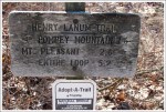
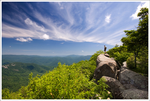
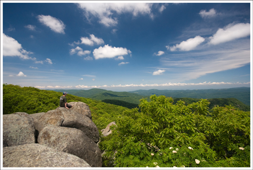
Adam enjoys the vista from the west summit of Mount Pleasant. Below:  Moss was still the only greenery along the trail.  Leaves are still a few weeks away;  The sign at the trailhead marks the loop at 5.2 miles.  Our GPS marked it at 5.75, so we’ll split the difference in mileage for this blog post.

Trailhead Sign

Christine Says…

When we hiked the Cole Mountain trail last fall, we made a mental note to return to the area sometime to do the Mount Pleasant hike.   We’re so glad we did.  The hike up Mount Pleasant provides gorgeous views from both its east and west summits.  We had a crystal clear day and could see for miles in every direction.

We started out on our hike a couple hours later than we normally do.  The delayed start turned out to be quite fortuitous.  As we drove down Wiggins Spring Rd toward the trailhead, we saw 15-20 cars parked near the AT crossing and Cole Mountain trail.  We assumed that they were a group camping and hiking on the Cole Mountain trail and were thankful not to sharing trail with such a large crowd.  A little further down the road, the Mount Pleasant parking lot was empty with the exception of one frost-covered car that had obviously been left there overnight.

We started down the trail.  It was icy and muddy, but pleasantly flat for the first mile.  After we crossed a small stream, the upward climb began in earnest.  It wasn’t terribly difficult or steep climbing, but it was constant for the rest of the way to the summit.  Much of the trail was wet/soupy and covered with a thick layer of leaves.  There were several places that the trail was tough to follow, but I imagine that once more hikers pass this way, the trail will become clear again.
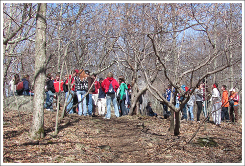
These could be the poster children for the defiance of Leave No Trace principles.  This was just a portion of the group we encountered.

At around the 1.5 mile mark, we started hearing distant voices in the woods – lots of distant voices.  I looked at Adam and said “I don’t think all those people are on Cole Mountain after all.” At 1.9 miles we came to a trail junction being used as a rendezvous point for about 30 kids on a church youth group trip. I have never heard people being so loud in the woods.  One group of three boys thought it was hilarious to repeatedly scream “NINKOMPOOP” at the top of their lungs as they headed down the trail.

After we cut through the crowd, we took a right turn and followed the spur trail up to the mountain top.  On the way up, we passed about 20 more hikers from the same youth group.  As I mentioned earlier, it was lucky we started our hike late, or else we might have been sharing the beautiful mountaintop with 50 shrieking kids.  As it turned out, we had the view all to ourselves.

At the summit, there was a small sign with arrows pointing to the east summit and the west summit.  We headed west first.  The west summit is on a dramatic outcropping of rocks.  It provides an expansive, layered mountain vista, including a great look at the bald summit of Cole Mountain.  The east summit is also lovely, albeit a little less dramatic.  The view is mostly valley and farmland.

We stayed at both summits longer than we normally would.  We wanted to put some time and distance between ourselves and the youth group.  We took in the view, had a snack and a drink and took a few photos.

The hike back down from the summit brings you back to the trail junction, where instead of turning left to hike back down the way you came up, you continue straight on the Henry Lanum Loop Trail.  This trail will almost immediately begin to climb upward again – over the summit of Pompey Mountain.  There are no views from this mountain.  After reaching the peak of Pompey, there is a short, but steep downhill.    The trail from this point on is a mix of uphill and downhill walking until you’re eventually returned to your car.   On this loop, you definitely spend more time hiking uphill than you do hiking downhill.  If you want less climbing, I recommend hiking this as an out-and-back.  It won’t make the hike much shorter, but will significantly cut down on the climbing.

Adam Says…
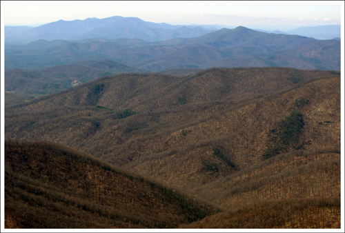
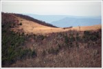
The summit provides a beautiful view of distant mountains. Below: A telephoto shot of the Cole Mountain summit from the west side of Mt. Pleasant; The eastern summit is beautiful, albeit a bit less dramatic.

View of Cole Mountain The East Summit

The hike up Mount Pleasant is one of the better hikes for views in Virginia.  If you have a few days to spend in this area, I would also recommend doing this and the Cole/Cold Mountain hike.  This area has some gorgeous mountains around you and the reason for the town nearby to be named Buena Vista.   When you combine both views from the two overlooks at Mount Pleasant, you get nearly a full view of the area around you.

The hike was not too difficult.  I would recommend that if just want to see the views, complete this hike as an out-and-back hike.  When we did this hike as a loop, we added on the trip up Pompey Mountain, but there are not any scenic views or much of note on the way back.

One interesting note about this trail is that you may see some remnants of fallen American chestnut trees throughout your hike.  They once covered this area until a fungal blight wiped out their population.   It is interesting to think how different these views would have looked in a canopy of chestnuts.

To know which way to start the hike can be a little tricky.  There are lots of paths away from the parking lot, including two blue-blazed trails marking the Henry Lanum Trail.  You will start the hike at the blue-blazed trail that starts off very flat.  The other blue-blazed trail looks clearly uphill and is the path that you will return. We felt this trail was a little hard to follow at times and could have used a few more blue blazes painted.  There were times we were unsure if we were still on the correct trail.

The trail starts off relatively flat or going downhill for about the first 1.5 miles.  Around 1.3 miles, you see a wooden sign that reads “Trail”, but other than that it is fairly easy to follow.  Keep following the blue blazes and you will eventually need to cross a couple of areas that may include small streams.   We didn’t have any trouble hopping across and I’m guessing that most of the year, it is relatively dry.  After you cross the stream, the trail will lead to the climb up to the summit.  Around 2.0 miles you will reach a junction sign that shows the Mount Pleasant Summit Spur Trail to the right.  This summit trail continues for about .4 miles until you reach the saddle.  A sign at the junction here shows there are overlooks to the West and East.  The western summit takes about .1 mile to reach and you will need to climb up the rock outcropping for the great views.  The eastern summit is closer and doesn’t require any climbing, but we were both more impressed with the views from the western summit.  Once you take some time to soak in the views, go back the way you came to reach the junction sign for the Summit Spur Trail.   If you want to continue the loop back to your car, you will continue straight on the Henry Lanum Trail.  This leads you through the forest for some more uphill climbs over Pompey Mountain.    From the junction sign, it is about 1.9 miles back to your vehicle.

Luckily, we were able to avoid the crowds of screaming teenagers that clearly don’t understand Leave No Trace principles.   Once more of the leaves start spreading their leaves, the summit overlooks will give you absolutely amazing views.

Trail Notes

  • Distance – 5.4 miles – loop.
  • Elevation Change –1350 feet.
  • Difficulty – 3.5 This loop has long, moderate uphills and shorter, steeper downhills.  It’s one of those trails that makes you feel like you’re always walking uphill.
  • Trail Conditions – 3. The trail is in decent shape.  There was a lot of mud when we hiked.
  • Views –5. The east/west double summit of Mount Pleasant is magnificent
  • Waterfalls/streams –1. There is a small stream in the woods on the departing arm of the loop.
  • Wildlife – 0. Nothing, but doubtlessly the large church group scared any wildlife away.  We did see lots of juncos along the trail.
  • Ease to Navigate – 2.5. In several spots, the trail was hard to find under thick leaves and blowdowns.  Some blazes are starting to wear away and it might be easy to miss turns.  I think ease of navigation will improve as spring/summer approach and hikers wear the path down.
  • Solitude – 3 . For today, we had a 0 for solitude, but we just had a bit of poor timing.  Being the namesake hike for this area, you will likely run into some other people on the hike.

Directions to trailhead:
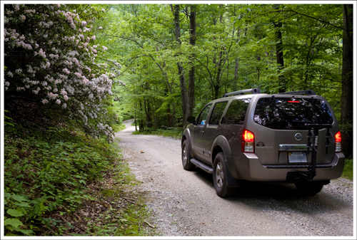
Follow I-81 to Buena Vista (exit 188A).  After passing through the town of Buena Vista, follow US60/Midland Trail for 9.5 miles.  Take a left on Coffeytown Rd.  Follow Coffeytown for just under two miles.  Take a right on Wiggins Spring Rd. Follow Wiggins Spring for 3 miles.  This road will turn to a rugged gravel road.  Follow the signs for the Mt. Pleasant trailhead.  There is a small parking lot at the trailhead.

Cole/Cold Mountain

Amherst County’s Cole Mountain Loop is a moderate 6 mile hike with serious payoffs at the summit.  Situated in George Washington National Forest’s Pedlar Ranger District, this trail (also know as “Cold Mountain”) is one of Central Virginia’s only hikes to cross a bald, pasture-like summit.  Views of the valley from the saddle and summit are open in every direction.

The Cold Mountain summit is open and offers panoramic views in every direction. In this shot you can see the white Appalachian Trail blaze and the USGS benchmark.
The Cole Mountain summit is open and offers panoramic views in every direction. In this shot you can see the white Appalachian Trail blaze and the USGS benchmark.

Christine Says…

Despite the busyness of our weekend, Adam and I made time to hike the Cole Mountain loop on Sunday morning.  We had read a description of the trail on another hiking site.  Their reviewer compared the summit to Scotland or Switzerland.  I don’t know about that, but it was definitely some of the prettiest Virginia summit scenery I’ve ever seen.

We started out from home at 5:30 in the morning.  It was still dark, but we wanted to hike before the crowds and heat got too bad.  We made a short detour before the hike to visit Statons Creek Falls.  It was just a couple miles from the trailhead, and was well worth a look.

The Appalachian Trail crossing is well-marked. Park across from this sign in a small lot.

The forest service road to the Cole Mountain trailhead is unpaved and bumpy.  There is only room for five or six cars at the parking area, which is located right at an Appalachian Trail crossing.

The hike starts out downhill along the forest service road for a couple tenths of a mile.  You’ll soon pick up the blue-blazed Hotel Trail on the right side of the road.  The route follows the Hotel Trail for about 3.5 miles until a junction with the Appalachian Trail (AT).  The AT takes you up a series of switchbacks, across the Cole Mountain summit and eventually back down to the parking lot where you started out.

Just a few of the gorgeous wildflowers on display in the meadow.
Just a few of the gorgeous wildflowers on display in the meadow.  Pictured below:  The old hog wall, the open meadow along the Hotel Trail, a beautiful tree sheltering one of the loveliest backcountry campgrounds in Virginia.

hog wall hotel trail meadow hotel trail meadow campsite_1

The thing I loved about this hike was the ever-changing landscape along the way.  It was a perfect sampling of Virginia’s varied scenery.  The trail started off winding its way down through lush, green beds of ferns sheltered by old hardwoods.  After passing through a short tunnel of pines, the forest gave way to a wide meadow-like clearing filled with shoulder high wildflowers in every shade of pink, purple, yellow and white.   Descending back into the forest, we saw numerous remnants from a bygone mountain farm.  Crumbling stone “hog walls” and errant apple trees were easily spotted along the trail.

The Cow Camp Gap Shelter
The Cow Camp Gap Shelter.  Pictured below:  a checkerboard is painted onto the shelter floor, Adam enjoys reading the shelter journal

checkerboard journal

We took a snack break along a small stream just before the 3 mile mark.  There was a fire pit and log seats that made a perfect place to enjoy some trail mix and water.   We ended up taking another break a few tenths of a mile down the trail when we arrived at the Cow Camp Gap Shelter.  This shelter is just one of many three-sided huts located along (or near) the Appalachian Trail.  This one was especially nice.  There was a checkerboard painted on the floor, with acorn cap and twig game pieces.  The shelter had a newer log book, so there weren’t many entries to enjoy this time.  The site also had the biggest picnic table I’ve ever seen.  It made Adam look like he was hobbit-sized.

The shelter marks the beginning of the only serious uphill climb on this hike.  About a half mile after leaving the shelter, you meet up with the Appalachian Trail and head north.  Along the way, the forest begins to thin out, giving you glimpses of a view from rocky ledges along the trail.

Upon reaching the saddle of Cole Mountain, the terrain changes radically and instantly.  The trees disappear and a wide, pasture-like alley appears across the summit.  The field is dotted with giant boulders and speckled with wildflowers.  It’s a great place for a picnic lunch.  You certainly can’t beat the sweeping views in every direction.

Adam Says…

This truly was a wonderful hike!  I don’t think this hike is very well known to those that don’t live in Central Virginia, but it is a true gem and definitely worth a trip no matter where you live.  We had absolutely perfect hiking weather with beautiful blue skies, dappled with an occasional cloud.  We plan on coming back down to this area soon to try the nearby hike of Mount Pleasant.

Cole Mountain is also commonly known as Cold Mountain (and is listed as such on Hiking Upward), but when we saw its official name through the USGS was Cole Mountain, we are sticking with their name.  I know when I told my family about hiking Cold Mountain, they thought about the movie with Nicole Kidman and Jude Law.  That Cold Mountain is actually in North Carolina, along the Blue Ridge Parkway.

The first lookout point along the Appalachian Trail was already showing some signs of fall.

To begin the circuit that we chose, we took the Hotel Trail.  The origin of the name is supposedly derived from the landowner Joseph Richeson, whose house was known as The Hotel, due to the number of frequent guests.

Once you start the Hotel Trail, you will almost immediately come to a horse gate.  Go through the horse gate and continue to follow the blue blazes.  You will follow these blue blazes until you reach the junction with the Appalachian Trail.  At .9 miles, you will reach the beautiful field of wildflowers on your left that Christine mentioned.  At around 1.3 miles, you will reach a gorgeous spot for an overnight camp.  I would highly recommend this to anyone that is planning on doing a backpacking trip.  There is a large firepit formed with logs to sit and enjoy some S’mores over an open fire.

From the firepit, look to the northeast and you will see the blue blazes continue.  At 1.7 miles, you will come across the “hog wall”, which is neat to think about people that used this area in the past.  Continue down the trail until you reach the bottom of Cow Camp Gap at 2.9 miles.  On our way down, I heard some strong howling off in the distant which sounded like coyotes.  Since we’ve heard of this from other hikers, there must be some nearby.  You will see on the other side of a small stream, the Cow Camp Gap Shelter.  This is a great spot for any thru-hikers or people that just want to have a packed lunch, rest, or fill up water from the spring.  We always enjoy reading the logs that thru-hikers and backpackers leave during their trips there.  Once you see the shelter on the right, just stay on the trail until you reach the junction just ahead.  The path to the right will take you to the shelter and the spring, but after your stop, you will take the path to the left.   I imagine that during rainier times, this would be a nice spot to hear a trickling stream, but it was dried out when we were there.

From the junction at the shelter, you will have another .5 miles to reach the junction with the Appalachian Trail.  At 3.5 miles, take a right (North) on the Appalachian trail.  You will continue your ascent through a few switchbacks.  At 3.7 miles, you will reach the first of two nice spots for an overlook at the edge of the switchback.  Continue on the trail until you reach the large meadow with the summit.  You will see a few vertical 4 foot high rocks sticking out of the ground.  On the ground in the rock, you will see the USGS benchmark which marks the summit of Cole Mountain at 4,033 feet.  Take a moment to enjoy the views at the summit and continue to follow the AT white blazes going north.  You will see many gorgeous panoramic 360 degree views as you cross along the highlands for a few tenths of a mile.  The scenery was truly breathtaking as we trekked across the highlands of the saddle, across the bald summit. (Note: camping and/or fires are not allowed on the bald of Cold Mountain.) At the end of the meadow at 5.2 miles, you will begin your descent into the woods and back to your vehicle.  You will cross over a fire road, but stay on the white-blazed trail until you reach your vehicle.

Adam makes his way across the bald summit of Cole Mountain.
Adam makes his way across the bald summit of Cole Mountain.  Pictured below:  this bush was heavy with berries.

cold mountain summit_8

If you are into geocaching, there are a two that you can find along the way.  The first is at the “hog wall” and the second is near the summit.  There was also another at Statons Creek Falls, which I feel is one of the prettiest waterfalls in Virginia.  Here are links to the sites for those that are interested:

As a slightly humorous aside, we did see a couple of guys hiking that came over from another mountain.  They had already hiked for about 8 miles, making this hike their second summit.  They were planning on going back the way they came and making it a 17 mile hike to do in one day.  We saw them around noon and they were hoping to make it back to their car around dinner time.  They had a poor map and we tried to show them directions, but they were off quickly.  However, they ended up going the opposite way away from their vehicle.  We thought we should probably check the news to see if they became lost.  I hope they got back safely, but I’m sure they had to reheat their dinner.

I would definitely say that this hike is one of my favorites in Virginia.  The views were exceptional and the scenery along the entire trail was magnificent.  Make this a “must-do” hike in your future planning!  You won’t regret it.

Trail Notes

  • Distance – 6 miles loop
    (Check out the stats from Map My Hike)*
    Note – the MapMyHike stats show the loop in reverse. When we rehiked the route on 6/25/16, we did it the opposite way so we hit the meadow views first.
  • Elevation Change – 1490 feet – The trail starts out both up and down, but the ascent to the summit is about 1.5 miles uphill.
  • Difficulty 3. The trail starts with some ascents and descents.  Once you meet the AT, you have about a steady uphill for 1.5 miles, but it wasn’t too tough.
  • Trail Conditions 4. The trail is well-maintained and not too hard on the feet.  There are some downhill portions that have some loose rock.
  • Views – 5. It doesn’t get better than panoramic 360 degree mountain views. We felt the scenery throughout the trail was gorgeous.
  • Waterfalls/streams 0.5.  There is a stream near the Cow Camp Gap shelter, but it was down to a trickle for us.
  • Wildlife 1.5. We only saw a deer around here.
  • Ease to Navigate 3. There aren’t a lot of turns here, but you may feel a little confused starting off.
  • Solitude3.5. We did encounter a few people, but we had a lot of beauty to ourselves.  Expect to see a few people along the highlands at the top, but there is a ton of room to enjoy the scenery privately.

MapMyHike is not necessarily accurate, as the GPS signal fades in and out – but it still provides some fun and interesting information.

Directions to trailhead:   Take Exit 188A off of Interstate-81, merging on to US-60 towards Buena Vista.  After going through Buena Vista, take a left at Coffeytown Road/Rte 634.  After 1.6 miles, take a right on to Wiggins Spring Road/Rte 755.  While four-wheel drive isn’t necessary, I would recommend it since it is a rough gravel road.   Stay on this for about 2.5 miles until you reach parking on the left side of the road.  (GPS Coordinates for parking: 37.759652, -79.195336) Park your vehicle and then proceed further down the road for .2 miles.  Before the road splits, you will see two posts marked with blue blazes which will begin the Hotel Trail.

The Priest

The Priest is a wonderful segment hike along the Appalachian Trail in the George Washington National Forest’s Glenwood & Pedlar Ranger District.  The northbound trail access may be a little tough for some people to reach (4WD vehicles are strongly recommended), but if you can get there, you’ll be treated to magnificent views of the Tye River Valley.

Adam enjoys the view from The Priest

Adam Says…

This was hike number two for us on a three-hike-day.  This was our first trip up The Priest, and it was well-worth the bumpy drive to get to the trail.   See the directions to trailhead (below) for some special precautions to take when approaching the trailhead.  On route 826, we decided to go a little further than  Crabtree Meadows, but didn’t make it all the way up by car to the AT junction.  We ended up parking at a campsite and hiking up the fire road for .3 miles.  Many people will want to park at Crabtree Meadows, but that will add one mile to the overall distance.  Route 826 can be quite steep. In fact, some sections of the road are much steeper than anything you’ll see on the actual trail.  We saw a Jeep brigade coming down the steepest section of road, but they looked like seasoned off-roaders.

Route 826 gets progressively rougher.
Route 826 gets progressively rougher. Pictured below: A group of off-roaders make their way down the road.

When you reach the junction (you’ll see painted rocks indicating north/south) of the Appalachian trail, head north (left).  You will come across the Priest Wilderness sign and trail map. When I was telling someone earlier about doing this trail today, they were wondering about the origin of the name “The Priest”.  The true origin is unknown, but there are a few myths.  The first is that it was named after the DuPriest family that lived in the area.  The second is that a minister in the area gave some of these nearby mountains religious names.  The Cardinal and The Friar are both close to The Priest.

Adam enjoys reading the journal at the AT shelter.
Adam enjoys reading the journal at the AT shelter.  Pictured Below: Some of the entries are funny, some divulge a little bit too much information.

journal_3

We found that the trail was a steady incline, but nothing too strenuous.  There was supposed to be a side trail to The Little Priest at .7 miles, but we didn’t see it (but we weren’t looking too hard).  At .9 miles, you will see a blue-blazed spur trail to an Appalachian Trail shelter.  We definitely recommend taking the extra .2 mile round trip to visit the shelter.  These shelters are a great place for all of the AT hikers to get together and have a roof over their head for a night.  At most of the shelters, you can find a journal in which the hikers will write about their day or plans, leave notes for other hikers, etc.  Since this hike is The Priest, the theme of this logbook was to make a confession.  It was a lot of fun to read through the journal entries.  These confessions ranged from eating two Poptarts, to taking drugs, to not paying for supplies.  If you happen to be hiking the trail in June when most of the AT thru-hikers are passing through, consider bringing along some treats to share.  It’s a form of “trail magic” and is always appreciated.  (read the guidelines – there are some tips for dispensing good magic on the Appalachian Trail Conservancy Site)  We did see a few thru-hikers on the trail today, but we hadn’t thought ahead to bring anything.

Around 1.3 miles, you will see some overhanging rocks to the north that lead to some marvelous views.  Take some time to enjoy the views.  The summit is only .1 mile further, but there are no views at the summit.  We really enjoyed this hike and hope to do this one again as well as the nearby Spy Rock.

Christine Says…

The Priest was probably my favorite of the three hikes we did on this particular day. Discovering a new hike is always a real treat, especially when it turns out to be as nice as this one.

There are actually two different ways to access the summit of The Priest. The southbound ascent is longer and much tougher – it follows the AT along a series of forty switchbacks with just over 3000 feet of elevation gain. It might be the hike with the most elevation gain in all of Virginia. One hiker remarked in the journal that the southbound climb “made him realize that he’s not the man he thought he was.” I guess that’s one way of saying that the hike was a long, tough haul!

We chose the northbound ascent primarily based on our limited time. The hike was listed in our book as strenuous, but I did not find it to be tough at all. The uphill grade was constant, but gentle. Adam and I were easily able to carry on conversation without any huffing and puffing uphill.

The terrain on this hike was so pretty! Along the first part of the trail, forest floor was blanketed with lush ferns. Every now and then, we could catch glimpses through the trees of the valley below. The summit of The Priest is 4,063 feet, so we were pretty high up (by Virginia standards, anyhow).

This appeared to be a popular campsite.

When we finally gained the ridge, there was a perfect (and obviously popular) campsite. Encircling the area was a collection of huge boulders arranged in an almost Zen-like natural sculpture. Amidst the boulders, there was a fire pit and a large smooth, open place to set up tents. If I were to spend a night along the trail, this would be my ideal kind of campsite.

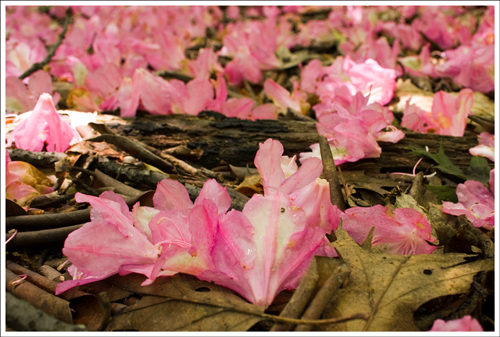
Shortly after the campsite, the trail split. One arm headed down to the shelter and the other continued along the AT up to the summit of The Priest. This section of trail was lined with mountain laurels and wild azaleas in full bloom. Several places along the trail were covered with a carpet of pink and white flower petals that had been blown from the bushes. It was almost dreamlike to walk through all the flowers. In the tree tops, we heard the constant sweet sound of warblers singing. We even caught a few glimpses of the birds. The ridge is fairly level, so this walking was very easy and pleasant.

Wild Azalea flowers carpeted the forest floor.
Wild Azalea flowers carpeted the forest floor. Pictured below: Many of the azaleas and mountain laurels were still in full bloom.

I had read that the summit of The Priest was a lovely shady place, but didn’t offer much in the way of panoramic views. So, it was much to my surprise and delight to find a worn path through the woods that led to an amazing outcropping of rocks with spectacular views of the entire valley below. Even though it was close to high noon, I loved photographing this spot along the trail. The sky conditions were a photographer’s dream – cerulean blue punctuated with both swishes and puffs of white cloud.

The summit was spectacular.

Adam and I sat on this spot for a good, long while. We shared a chocolate donut and some water, watched the hawks soar below and took in the valley view. Afterwards, we made the short walk to the actual summit. There was a fat toad sitting right along the trail at the summit. I like to think of him as the official summit marker.

This toad was our summit marker.

The hike back down to the car was fun – all downhill – just the way I like it!

Trail Notes

  • Distance – 2.8 miles out-and-back. We also recommend adding the .2 mile trail down to the AT shelter. If you park at Crabtree Meadows, add a mile on to the trail’s total length.
  • Elevation Change – 1,000 feet
  • Difficulty – 2. While the trail does have a moderate elevation change, the uphill is not too tough.  If you have to hike up the fire road from Crabtree Meadows to get to the trailhead, that will be much tougher than anything along the AT.
  • Trail Conditions – 4. Like most of the AT in Virginia, this section is nicely maintained.
  • Views – 4. Gorgeous views of about 150 degrees of views out into the Tye River Valley
  • Waterfalls/streams – 0. None, but there is a small spring-fed water source near the shelter.
  • Wildlife – 1.5. We didn’t see much, but this is wilderness area.  There are lots of nice birds for any ornithologists.  We saw a cerulean warbler, which has such a gorgeous song.
  • Ease to Navigate – 4.5. Just stay on the AT.
  • Solitude –4. Since it is difficult to get to, you may run across some backpackers or AT thru-hikers, but not many others.

Directions to trailhead: The best access to this trail is via VA-826.  If you are approaching from I-81, take exit 205 towards Steeles Tavern.  Take a left on to Rte. 11 and then a quick right on to VA-56 heading east.  Follow this past the Blue Ridge Parkway (near BRP Mile Marker 30) and then take a right shortly after the Fish Hatchery on to VA-826.  There is a sign at the entrance that you need to have four-wheel drive to travel on this road.  It is a bumpy gravel road where you have to cross several small streams.  Once you reach Crabtree Meadows, it is .5 mile before you can reach the AT trailhead to start The Priest trail.  Many cars should be able to get up to Crabtree Meadows, but the last .5 mile should be taken cautiously and done only if you have a confident driver and appropriate vehicle.

Crabtree Falls

Crabtree Falls is probably Virginia’s best-known waterfall hike. The hike is located a short distance from the Blue Ridge Parkway. The trail climbs alongside the falls and ends at an overlook of the Tye River Valley.

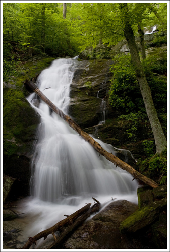
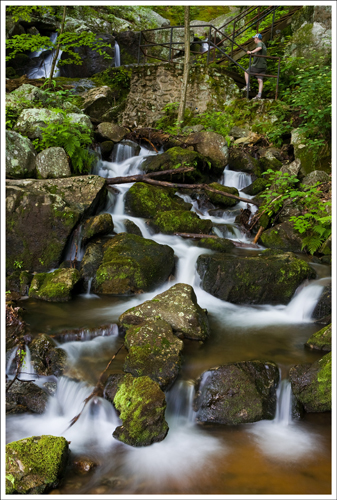
This is the first large cascade you'll encounter on the hike.
This is the first large cascade you’ll encounter on the hike.

Christine Says…

Crabtree Falls, located in George Washington National Forest’s Glenwood & Pedlar Ranger Districts, is one of the classic “must-hike” Virginia trails. When the area is experiencing good amount of rainfall, the 1,200 foot series of falls can be truly impressive.

Adam and I left our house at 5:45 a.m. on the morning of this hike. I wanted to get to the area before the sun started shining into the gorge. Sunny days usually mean crappy waterfall photos. On the morning of our hike, the area was forecast to have quite a bit of fog. I was really excited and had visions of the falls – cascading through the mist, lined with lush, blooming mountain laurel. Unfortunately, it was not to be. When we arrived, the fog was gone, the sun was already high in the sky and the laurel had mostly gone to seed. Nonetheless, I was still able to find a few shady spots along the way to take photographs.

The beautiful arched bridge over the Tye River.

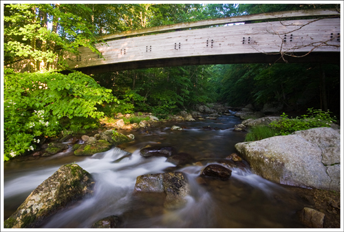
The trailhead is located at the upper parking lot of the Crabtree Falls area. There is a $3.00 fee to use this area. Even though the trail starts from the upper lot, don’t miss walking down to the lower lot to take a walk across the beautiful laminated wooden arch bridge that crosses the Tye River. It was delivered to the area in a single piece and has graced the spot since 1978. Crossing the bridge used to be part of the hike, but improvements to the area expanded parking, added restrooms and shortened the trail.

As you start the hike, don’t neglect reading the bulletin board at the trailhead. It provides many cautionary tales concerning the waterfall’s deadly terrain.  As of June 2015, 29 people have fallen to their deaths at Crabtree Falls – most of them teenagers and young adults. The rocks surrounding the stream are coated with transparent algae. It doesn’t look wet or slippery, but it’s honestly as slick as grease in some spots. The forest service is always warning hikers to stay off waterfalls – but they really mean it at Crabtree.

Adam climbs the steps along the Crabtree Trail.

The first impressive cascade is at the very bottom of the trail and is accessible along a level, paved walkway. The trail to the summit starts on the right side of the paved path, and climbs quickly upward. The trail makes use of steps, railings, wooden walkways and switchbacks to traverse the steep terrain. Some of the switchbacks meander quite a distance from Crabtree Stream, but the sound of rushing water is ever present in the woods. You never move so far from the stream that you can not hear the sound of the waterfall. It’s such a soothing sound. There are five major cascades (and many smaller ones) that make up Crabtree Falls.

The trail is mostly well-graded and maintained. There are a few rocky sections, and some of the rocks may be loose or slippery. On the day we hiked, the trail was really muddy from all the recent rain, but it was still easily passable. I think most of the pretty sections of the falls are within the first three-quarters of the hike. The big, dome-shaped cascade at the top is impressive to see, but it just doesn’t photograph well. At the Tye Valley overlook at the top, you can’t see the falls below you at all. If you hadn’t just walked along the waterfall on your hike, you might not even believe it’s there. The view from the top is just so-so – mostly just tree-covered mountainsides. It pales in comparison to the waterfall views. Most hikers choose to turn around at this point, but you also have the option to continue the hike along the stream, ending up at Crabtree Meadows.

There are discrepancies about the length of this hike. On the internet, I’ve seen it listed everywhere from 2.2 to 4 miles. The on-site plaque at the base of the falls says the hike is two miles to the top, for a total 4 mile out-and-back. Our Blue Ridge Parkway hiking guide lists the hike at 3.4 miles, out-and-back. It seems like the happy medium distance, so we’ll go with that measure.

Adam Says…

The hike along Crabtree Falls is one of the best waterfall hikes, since you hike along the falls for most of the way.  I haven’t experienced any other hike in Virginia that allows you to walk along such an impressive series of falls.

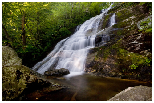
Another beautiful section of falls along the trail.

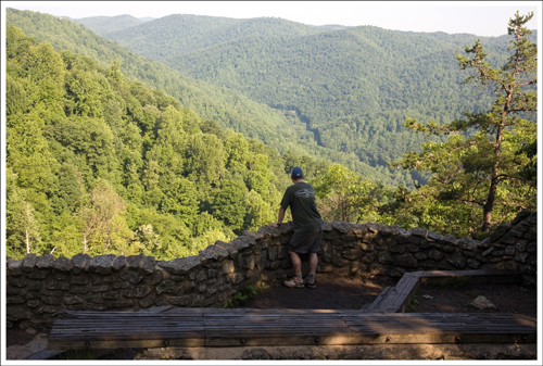
This was our second trip to Crabtree Falls.  We were hoping to go in the late spring or early summer for views of mountain laurel along the stream.  It looks like in this area, we just missed the peak by about two weeks or the laurel didn’t bloom as well this year.  When you reach the top of the falls after a 1.7 mile hike, there is a stone platform at the top that provides you with nice views of the Blue Ridge Mountains.

The view from the top.

Near the entrance to the paved trail you will see a small family cemetery.  These are actually distant relatives of mine.  My great grandmother was a Fitzgerald and owned the farm next to the McCormick Farm.  My mother used to visit that farm often when she was little.  If you are interested in history, the McCormick Farm is open to visitors and has lots of exhibits showing the early farming techniques.  Cyrus McCormick was the inventor of the mechanical reaper which revolutionized farming.

This is a great hike that a lot of families do before picnicking at one of the tables near the lot entrance.  I know we will visit this location time and again.

Trail Notes

  • Distance 3.4miles out-and-back.
  • Elevation Change – 1000 feet
  • Difficulty – 3. This is a fairly steep trail with plenty of switchbacks.  However, most people will stop along the way to enjoy the falls, so it breaks up the pace.
  • Trail Conditions – 3. There are lots of pointy rocks along part of the trail, but there are some sections that are very nice.  The view to the lower falls is even paved for wheelchair access.
  • Views – 2. At the top of the falls, you get a decent view of the Tye River Valley
  • Waterfalls/streams – 4.5. This is one of the best waterfalls in the Central Virginia area.
  • Wildlife – .5. You probably won’t see anything here other than people.
  • Ease to Navigate – 4.5. Just stay on the trail.
  • Solitude –1. This is an extremely popular hike, so you will surely see people along the way.

Directions to trailhead: If you are approaching from I-81, take exit 205 towards Steeles Tavern.  Take a left on to Rte. 11 and then a quick right on to VA-56 heading east.  Follow this past the Blue Ridge Parkway (near BRP Mile Marker 30).  After a few more miles, you will see the signs for the parking area of Crabtree Falls on your right.  The parking lot loops around and you will see the trailhead and map near the restroom facilities.