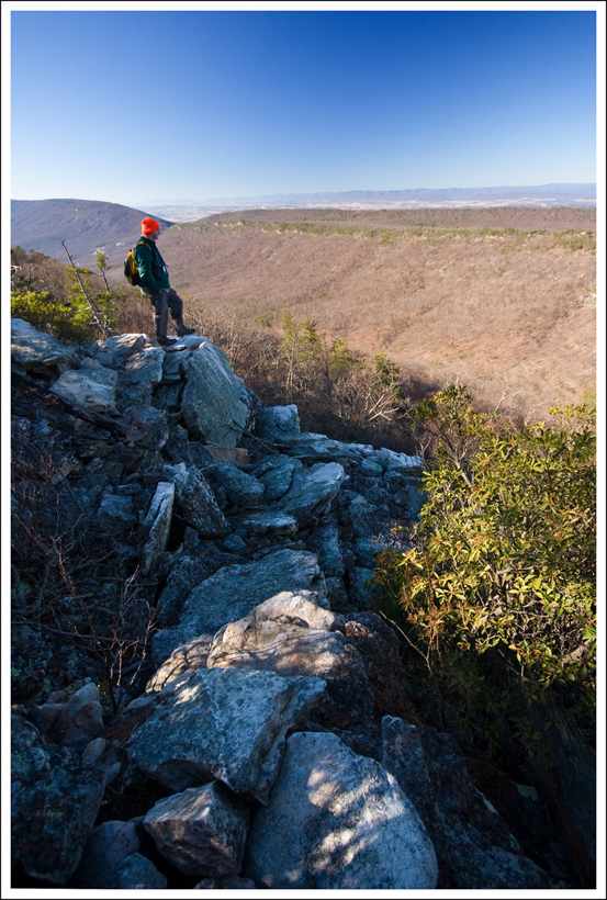
Hawksbill Summit Loop

The Hawksbill Summit is a fairly easy, 2.9 mile trail that takes you to the highest peak of Shenandoah National Park at 4,049 feet.

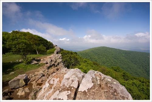
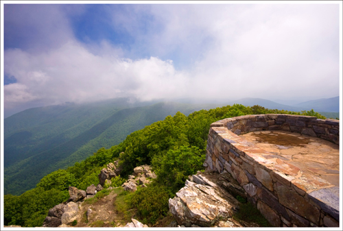
This is the first of the four summit views you'll come to along the Hawksbill Loop Trail.
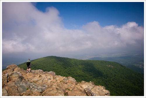
This is the first of the four summit views you’ll come to along the Hawksbill Loop Trail. Pictured below (left to right): The third viewpoint – the hack box for the falcon chicks is along this rock shelf; The CCC constructed summit; Adam climbing around the rock jumble at the summit.

Hawksbill Summit Hawksbill Summit - Shenandoah National Park Adam on Summit

Adam Says…

We really had one of those almost perfect days in Shenandoah National Park.  We made it up to the park before 7AM.  There was a lot of fog on the mountains that made for tough visibility, so we decided to grab breakfast at Skyland Resort before setting out on our hike.  While we were eating breakfast, our waitress pointed out a black bear right outside the dining room window.  It stayed out there for several minutes while people photographed it (they got really close – within 10-15 feet of the bear). While Christine made an attempt to grab her camera from the car for her own photo opportunity (which she missed), I noticed the AT thru-hiker we met on the Loft Mountain Loop had just sat down to dive into a hearty breakfast.  I talked to him about how we were thinking about him braving the thunderstorms the last few days.  He said that the Tuesday night storms had indeed been brutal.

After breakfast, we drove south from Skyland to start our hike on Hawksbill Summit.  The posted trail board listed an out-and-back hike of 1.7 miles and a loop hike of 2.8 miles.  We decided to do the loop and were very glad that we did!
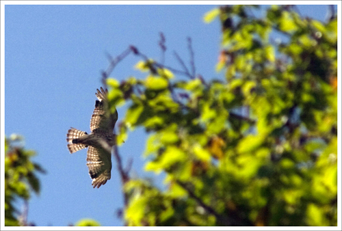
Peregrine Falcons are such fast flyers. Adam took this shot and felt lucky to have even part of the bird, in-focus and in the frame.
Hawksbill Mountain is a great place to watch birds of prey.  While I was photographing the scenery, Adam took this shot of a bird soaring overhead. He felt pretty lucky to have even part of the bird, in-focus and in the frame.  He sometimes feels overwhelmed by all the controls on the dSLR, but I think he does a great job whenever he takes photos.

At around the half mile mark, we heard some screeching up ahead and above.  We came up to the first of three talus slopes and sure enough there were a pair of peregrine falcons swooping around.  We tried to get some pictures of them flying, but they swooped by way too quickly for the camera to lock focus.  When we came to the second talus slope, one of the falcons had landed about 15 feet in front of me, gave me a quick cry, and darted off at eye level from us.  We’ve never had an opportunity to see these birds up close.  We usually vacation in Acadia National Park every summer.  The park’s Precipice Trail is a great place to view falcons; however, this trail is closed off during much of the summer for falcon nesting and we have had to resort to viewing them through binoculars.

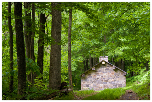
The Byrd's Nest #2 Shelter is available for day use only. It's a three-sided structure.
The Byrd’s Nest #2 Shelter is available for day use only. It’s a three-sided structure.

Once we arrived at the Byrd’s Nest Day Shelter near the summit, we ran into a SNP Volunteer who has been monitoring falcon activity in the area.  Shenandoah National Park has been working with the College of William & Mary’s Center for Conservation Biology to help reintroduce these birds to the park ecosystem.  It was fascinating to learn about these birds of prey. He pointed out the cliff-side hack box that currently houses six falcon chicks.  Students find falcons nesting around Williamsburg and Norfolk, grab the babies when they’re a few weeks old and deliver them to SNP for rehoming.

The volunteer feeds the falcon chicks twice per day, giving the birds quail through a slot door in the hack box. The chicks never actually see the person.  The goal is to keep the chicks completely unaware of the human intervention.

The feeder told us a funny story about his time on the mountainside. He was on his way to feed the birds that morning when he was charged by a deer.  He reached for a slingshot he had in his pocket, but the deer was too close.  He ended up using the slingshot as a club and thumping the doe lightly on the head.  It just stared at him like he was crazy.  He realized as he looked down that he had almost stepped on her newborn fawn.

The volunteer told us that there was a belief that the peregrine falcon pair that we saw was moving over from their established nest site on Old Rag.   They have been observing the Old Rag falcons for a while, and are hoping they stay put.  If the Old Rag falcons relocate to Hawksbill, the hack box holding the chicks will have to be moved to a new location.  The volunteer was trying to read numbers on the bands of the falcons swooping by to see if he could identify them as the same pair from Old Rag.

After a bit more chatting, we left the volunteer and proceeded on to the summit.  When we came back to the shelter, we noticed that there were now three falcons swooping around near the summit.  We found the volunteer and told him.  He told us that seeing the three falcons might help prove that these birds might not be the pair from Old Rag.  We felt proud to have been able to provide some useful information for their research.

Christine Says…

It’s kind of ironic, but Adam really didn’t want to go to the park at all on this particular morning.  He thought the trails would be sloppy-muddy from all the rain.  Also, he was longing for a morning of sleeping in, followed by loafing on the couch and possibly even some video games.  But, being the insanely cruel morning person I am, I dragged him out of bed and told him that I wanted to hike Hawksbill.  After all was said and done, he ended up declaring this to be “one of our best days in the park ever!”

At the trailhead, Adam lobbied for the shorter out-and-back, but I really wanted to do the longer loop.  It’s more scenic and there are many more opportunities to see wildlife along the way.  Besides, the out and back is a tough, boring, uphill climb – straight up the side of Hawksbill Mountain.  You don’t see anything special – you just climb.
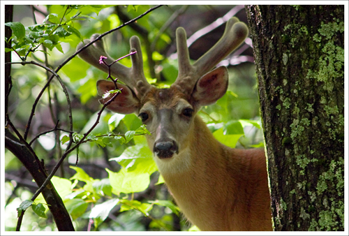
I bet this magnificent buck gets a lot of female attention in the fall.
I bet this magnificent buck gets a lot of female attention in the fall. The photo below is another of the bucks from the group.

Buck

A quarter mile into the hike, we saw three impressive bucks.  Even this early in the season, these guys were already displaying large, velvety racks of antlers. During the summer months, it’s not uncommon to see groups of big bucks hanging out in mini-herds like this.  I think they’re planning strategies on how to get the girls in the fall.  🙂  They were completely indifferent to our presence, so we stayed and watched them for a few moments.  I wish it hadn’t been so dark in the forest.  I would have loved to get some better photos of these handsome guys.
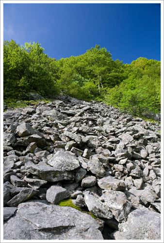
This is the talus slope where we first spotted the peregrine falcons.

Seeing the falcons near the talus slopes was simply amazing.  I’ve never seen peregrines so close in the wild before.  They’re truly expert aerial acrobats.  I also really liked talking to the naturalist at the summit.  No matter how much time I spend in the park, I still feel like I see and learn new things on every visit.

Our view at the CCC-established summit was largely obscured by clouds and fog, but it was still a beautiful, breezy day.  Hawksbill gives full views in every direction.  You get a nice look at Skyline Drive winding its way through the forest and a wonderful, distant view of magnificent Old Rag Mountain.  Hawksbill Mountain actually has four excellent viewpoints along the summit. You only see two on the out and back hike.  Typically you can see all four on the loop hike, but on this particular day one viewpoint was closed off for the falcons.
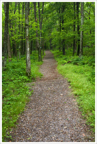
Although you can't tell in the photo, the trail back down Hawksbill Mountain is quite steep.
Although it’s relatively level here, the trail back down Hawksbill Mountain is quite steep.

The hike back down is pretty steep, but the trail is well-maintained and covered with gravel.  My knees always ache climbing down Hawksbill – there are no switchbacks to gentle the grade.  It’s straight down the mountainside.  Hikers should be careful to follow the correct trail back down the mountain!  There are trails leading back to Upper Hawksbill and Lower Hawksbill parking lots.  There is also a fire road.  If you don’t pay attention to the cement marking posts, you may end up on the wrong trail and have an extra mile or so of hiking to do along Skyline Drive to make it back to your car.  We saw a couple who had made that exact mistake walking along the road when we finished our hike.  They didn’t look too happy.

Trail Notes

  • Distance – 2.9 mile loop.  A 1.7 mile strenuous out-and-back is one option, but the loop is recommended for it’s scenic beauty and wildlife viewing potential.
  • Elevation Change – 800 ft
  • Difficulty – 1.5.  If you do the loop.  The out and back may be shorter, but it’s more strenuous.
  • Trail Conditions – 4. The AT portion is well-maintained.  The trail down from the summit is covered with small gravel.
  • Views – 4.  The view from the summit is impressive on a clear day.
  • Waterfalls/streams  – 0.  No streams on this trail.
  • Wildlife – 4. We did hit some great luck this day, but we saw several deer including three bucks and you have some decent chances of spotting peregrine falcons in the summer.
  • Ease to Navigate – 3.   There are a couple turns,  but the directions are well-marked on cement posts. Pay attention on your way back down the mountain.  There are several descents to choose from.
  • Solitude2.  The hike is fairly popular and featured often with SNP handouts, but we never seem to run into many people up there.  I hear the summit gets very crowded on pleasant weekend afternoons.

Directions to trailhead:

Park at the Hawksbill Gap parking lot which is located around mile marker 45.6 in the Central Section of Skyline Drive.  The trail can be done as an out-and-back hike taking a steep trail to the summit, but we recommend that instead of going straight up to the summit,  take the spur trail to the Appalachian Trail and follow the signs to the Hawksbill Summit.
Loft Mountain Loop

The Loft Mountain Loop is an easy, 2.7 mile trail that makes use of a fire road, the Appalachian Trail and the Frazier Discovery Trail. It takes you past one of Shenandoah National Park’s finest views.

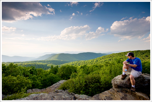
Adam on the Loft Mountain summit

Christine Says…

Adam and I love visiting the park on weeknights after we get off work.  The traffic is usually light and the animals tend to be more active.   On Tuesday night, we saw many deer, a timber rattlesnake, a couple rabbits, a bear with three cubs and only a handful of human beings. If you live close to the park, weekday evenings are the perfect time for a quick hiking escape – especially on June nights when twilight lingers until 9:00 p.m.

On this particular night, we chose to hike the Loft Mountain Loop, which is located in the south district of the park.  Generally, fewer people visit the south end of the park than the other two districts (north and central), so it always feels quiet and peaceful.  I have so many fond memories of camping at Loft Mountain as a child.  We had a rickety, second-hand, pop-up camper.  I remember waking up on cold mountain mornings to the smell of bacon cooking over the campfire and going to sleep at night after roasting marshmallows and listening to my dad’s goofy “ghost stories”.   Ah… such nostalgia!

A friendly rabbit along the fire road.

The hike starts out on a fire road almost directly across Skyline Drive from the Patterson Ridge Trail.  The hike goes uphill for a short distance until you reach the Ivy Creek Hut (used by the Potomac Appalachian Trail Club for maintenance activities) and the Ivy Creek Spring.  Pass through the site and follow the blue blazes uphill for a couple hundred yards to the junction with the Appalachian Trail.  The stretch along the AT climbs steadily uphill for about a mile.   It eventually levels out on the ridge of Loft Mountain.  At this point the terrain opens up – the trees are further apart and the trail is grassy and almost meadow-like.  Adam kept getting ticks on him (FIVE!), but I didn’t get any at all.

The PATC maintenance cabin
The Ivy Creek Hut is used by the PATC.

Your first nice view will come on a small rock outcropping facing northeast, but the big payoff for this hike comes at the 1.5 mile mark.  The southwest facing summit of Loft Mountain is awesome – definitely one of the park’s most spectacular views.

We reached the vantage point in time to see the building storm clouds to the west.  We shared the summit with an Appalachian Trail thru-hiker camping nearby.  He was from Boston and had been on the trail since March.  He told us he had covered 22 miles that day and was looking forward to spending an upcoming night off the trail at the Big Meadows Lodge.  He remarked that he was thinking hard about a big cheeseburger and a cold beer.

I couldn’t help but think of the guy later on in the evening when we were back in our car, watching the Loft Mountain area being pummeled with lightning and torrential downpours.  I love hearing trail stories from thru-hikers, but I don’t think long distance backpacking is for me.

We stayed on the summit for about fifteen minutes, and then quickly made our way down the Frazier Discover Trail and back to our car.

Adam Says…

This is a trail that we both enjoy quite a bit.  It’s not too tough and has some nice views to both the east and west, which is not common for Skyline Drive.  If you do this hike early in the morning or late in the evening, you should be able to see a good view for a sunrise or sunset.  There are also a couple of possible campsites along this stretch of trail and a developed campground along Skyline Drive at Loft Mountain.

The trail was lined with little flowers.

It was very interesting to talk to the AT hiker.  June is the month when most of the northbound thru-hikers are passing through Virginia.  If you have a chance, it’s worth talking to some of these people about their experiences.  Most of them use trail names instead of real names during the hike.   The one we talked to this night was very friendly and talkative.  He said that his toughest leg so far was in the Smoky Mountains, but this was largely due to the snow that was still there.  He was enjoying his first sunset view in SNP.  It’s quite an accomplishment to be able to hike the entire AT.  I would love to be able to have the chance to do this some day.

The rock cliff below is an impressive sight to find along the Frazier Discovery Trail.

This giant rock wall can be found on the descent along the Frasier Discovery Trail
This giant rock wall can be found on the descent along the Frazier Discovery Trail

Trail Notes

  • Distance – 2.7 miles
  • Elevation Change – 600 ft
  • Difficulty – 1.5.  Other than a mile of climbing along the fire road and the Appalachian Trail, the hike is either level or downhill.
  • Trail Conditions – 4.5.   The trail is extremely well-maintained.
  • Views – 4.  The view from the Loft Mountain summit is really spectacular.
  • Waterfalls/streams  – 0.  No streams on this trail.  There is a spring near the PATC maintenance cabin.
  • Wildlife – 2.  We saw deer and a rabbit.
  • Ease to Navigate – 4.   There are a couple turns, but the directions are well-marked on cement posts.
  • Solitude3.  The hike is short and near one of Shenandoah’s campgrounds.  So, on busy weekends, expect to see a fair number of people.  We hiked it on a weeknight in June and came across a pair of backcountry campers and an AT thru-hiker.

Directions to trailhead:

Park at the Loft Mountain Wayside at Skyline Drive mile marker 79.5.  Walk north along the drive for a 150 yard and then cross the drive to pick up the fire road. The trailhead is almost directly across the drive from the Patterson Ridge trail.

Rose River Loop

The Rose River Loop is one of Shenandoah National Park’s most beautiful hikes for streams and waterfalls.  Over the course of 3.7 miles, you’ll hike along the Rose River, the Hog Camp Branch, and finally up the Rose River fire road.

A new log is resting on the crest of the falls
Two large fallen trees obscure Rose River falls.

Adam Says…

This hike is one of our most-repeated hikes in Shenandoah National Park.  It has some great views of running water throughout the trail. This isn’t the most secluded trail since it connects to Dark Hollow Falls.  However, you should normally only come across a few other people on this trail.  There are some good places to do some trout-fishing along the river.  The man pictured a few photos down had caught a 8.5 inch trout the day before at the same spot.

The hike starts off at the parking area just north of the Fishers Gap Overlook.  Cross the road and follow the Skyland-Big Meadows Horse Trail for .5 mile.  There is a steady downhill grade, but it’s not too steep. At .5 miles, you’ll reach the junction of the Horse Trail and the Rose River Trail.  Go right and follow the Rose River Trail, continuing downhill.  Once you reach the bottom of the trail in about a mile, you’ll hear the water. The trail continues alongside the stream for a ways.  You will reach Rose River falls at 1.3 miles.  They are impressive, but more beauty awaits along the trail.  For fans of long-exposure photography, this is a paradise.

The trail will pass an old copper mine at 1.8 miles.  Some people like to explore the old mine, but we don’t think there is anything worth seeing there.

For the next mile, the trail closely follows the stream.  It is very rocky and can be icy or muddy depending on the weather.  There are tons of small waterfalls, slides, and plunge pools to explore.

At 2.7 miles, you will reach the footbridge at the bottom of Dark Hollow Falls.  Turn right, cross the  bridge, and follow the Rose River Fire Road uphill.  At 3.3 miles, you will pass the Cave Cemetery on the right.  At 3.7 miles, you will arrive back at Skyline Drive and your vehicle.

You can see from some of Christine’s pictures that there is really a lot of nice water to see on this trail.  I highly recommend doing this if you have a day or two in the park.

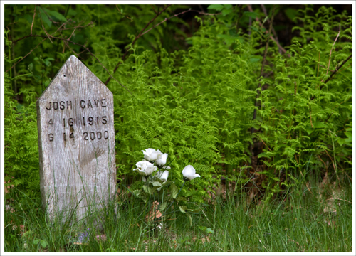
Some graves date back to the Civil War.
Some graves (not this one) in the Cave Family Cemetery date back to the Civil War.

As I usually like to comment, there is a geocache located here.  For those that are unaware, physical geocaches are not allowed in National Parks.  However, there is a small cemetery located off of the fire road that is considered private land and not owned by the Park Service.  The cemetery was used by the people who used to live in the mountain hollows before the government took their land for the park in the early 1900’s.  The Cave family gave permission for a geocache to be placed here called Viking Treasure Cave. ETA:  This cache has since been removed from the park (September 2010)

Christine Says…

When we started down the Rose River trail, I couldn’t help but skeptically watch the blue sky peeking between openings in the trees above.  The local weatherman had forecast a cloudy morning, but as we hiked along the sun began sending down rays and making a dappled pattern across the forest floor.  It was lovely to look at, but was definitely not the kind of light I was hoping to have for the stream and waterfall photos I wanted take.  You see, the Rose River Loop is one of the very best hikes in Shenandoah for folks who enjoy photographing running water.  It’s also the place where my brother proposed to his now wife.  They were engaged on a bitter cold New Year’s Eve camping trip somewhere along the Rose River.

The Rose River
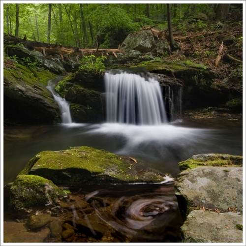
The Rose River has many beautiful small, unnamed falls.  I’ve named this one “Slip and Slide Falls” because the bushwhack down to the base is so steep.

Even though the light made photography a challenge today, I found several spots to shoot along the Rose River.  We had to bushwhack off the trail a couple times, and all I could think about were ticks.  I don’t think I’ve recovered from our walk down the Dry Run Falls fire road yet.

One bushwhack in particular was especially steep, slick and muddy.  As luck would have it, it also offered the prettiest of all the little cascades along the walk.   When I looked down the ravine, for some reason my inner girly-girl came out.  I announced to Adam that I wasn’t going down there no matter what.  He said “Yes, you are!” and took my camera away and starting climbing down without me.  I was left with no choice but to follow.  I got really muddy and touched a gross centipede-like creature.  I’ll never like bugs!

We stopped at Rose River Falls for a few shots.  For the past few years, there has been a huge fallen tree lying across the waterfall.  It’s still there, but now there is a new downed tree stuck at the crest of the waterfall.   Both trees are way too big to move, and will likely be there for years to come.

We paused at a couple other places along the Hog Camp Branch for photos, but there was another photographer who was consistently about ten minutes ahead of us on the hike.  Each time we got to a spot I planned on photographing, he was already there.  He looked pretty serious getting his shots.  At one spot, he even donned chest high waders and water shoes so that he could get to the middle of the stream for an ideal composition.   I skipped a lot of my favorite photo spots along the Hog Camp because I always feel a bit rude stepping into somebody’s shooting space.

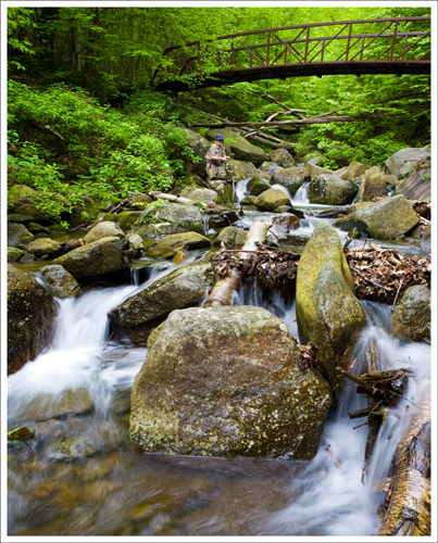
I had my tripod all set up when the fisherman jumped into my scene
Speaking of stepping into someone’s shooting space… I had my tripod all set up when this fisherman dropped into my scene.  Oh well 🙂

We finished the loop hike on the Rose River fire road.  The last mile on the road is always my least favorite part of the hike.  The fire road is easy walking, but yawn… it’s a bit on the boring side. Despite the dull last leg, the Rose River loop is a must-do hike for anyone visiting Shenandoah.

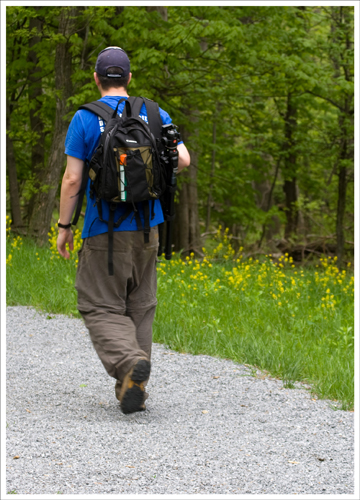
I'm so lucky that Adam routinely offers to carry all my photography gear.
I’m so lucky that Adam routinely offers to carry all my photography gear.

Trail Notes

  • Distance – 3.7 miles loop trail
    (Check out the stats from Map My Hike)*
  • Elevation Change – Around 900 feet
  • Difficulty – 2. Some downhill and uphill, but it’s not too bad.
  • Trail Conditions – 3.5. There are some areas along the river that are more like a 2, but there are some areas that where it is more like a 5.  Footing is tricky around the climb up after the red bridge.
  • Views – 0. Just waterfall and stream views.
  • Waterfalls/streams – 4.5. Some of the most continuous views of water that allow for some great water photography.
  • Wildlife – 1. Some birds and chipmunks, but not much else here.
  • Ease to Navigate – 5. Trail is well-marked and there aren’t any spurs until you get back to the fire road.
  • Solitude – 3. Not the best on solitude, but you won’t run into a ton of people.

Download a trail map

Directions to trailhead: The trail is located on Skyline Drive.  Park at the Fisher’s Gap Overlook (at mile marker 49.4 miles), cross the road and pick up the trail.  The Rose River Loop starts to the left of the fire road.  You will see a cement marker.

McAfee Knob

IMPORTANT: Please read these important regulations and helpful tips before hiking in this area

McAfee Knob is an 8.3 mile hike along the Appalachian Trail near Roanoke.  The summit offers truly magnificent views of the Catawba valley below.  On a clear day, you can also get great views of the Peaks of Otter (Sharp Top and Flat Top) along the Blue Ridge Parkway.

McAfee Knob's View of the Catawba Valley
McAfee Knob’s View of the Catawba Valley

Christine says…

We picked a perfect day in April to hike McAfee Knob.  The trees were still mostly bare of leaves, but the skies were crystal clear and completely free of the milky haze that dominates the Virginia summer.  We got to the trailhead right at 9:00 a.m. and the parking lot on 311 was already about halfway full.  From what I’ve been told, this trail rivals Old Rag in popularity for folks in the southern part of the Shenandoah Valley.

The trail is meticulously maintained.  I believe the Roanoke Appalachian Trail Club and local Boy Scouts do most of the trail work.  There are many wooden bridges and walkways in the first two miles of the trail that were built as Eagle Scout projects. I think the hike, despite its eight+ mile length, qualifies as a solidly moderate hike.  It’s not steep and the trail is smooth and pleasant.  It feels a lot shorter than eight miles.

The first few miles of the hike make their way through beautiful, classic Virginia mountains.  The trees are a mix of hardwoods and pines that smell delicious as they warm in the sun.  There are also expansive stands of mountain laurel along the way.  I’m certain they’re a site to behold when they bloom in June.

The view finally opens up when you complete the toughest part of the climb and walk along the ridge of the mountain.  The gnats were something else on the day we hiked.  If we so much as paused for a few seconds, the bugs swarmed us like mad.  The walk along the ridge is brief and leads you past a very cool series of rock formations nicknamed the Devil’s Kitchen.  After walking past the giant boulders, you come to a short spur trail to McAfee knob.

The hike is an out-and-back, so the return trip simply retraces your steps.

I think this is a hike I’ll return to time and again.  I thought it was one of the most spectacular views I’ve seen in the state.

Adam says…

This was a truly wonderful hike.  The views are spectacular and  are likely the best views I can remember in Virginia. I grew up in Lynchburg, VA and we used to always hike up Sharp Top at the Peaks of Otter on the Blue Ridge Parkway.  I think the views here are better than Sharp Top and well worth the mileage.  You can continue the trek on to Tinker Cliffs, but that adds several miles onto the trek and would work better as an overnight backpack trip.  The views of the ridgeline and Tinker Cliffs are breathtaking.  There is a lot of space at the top to chill out on some rocks and eat a snack.  You will often see pictures like the one below when you see pictures for the Appalachian Trail.

I do a lot of geocaching and there is a geocache here if you approach it from the fire road and not the hike on the AT.  However, I left my notes in the car, so I just tried to go from my memory and GPS.  I tried hiking off the trail and up the mountainside and it took away all my energy.

This View of McAfee is an Appalachian Trail Icon
This View of McAfee Knob is an Appalachian Trail Icon

Trail Notes

  • Distance – 8.3 miles round-trip
  • Elevation Change – 1,740 feet
  • Difficulty – 4.  The trail is fairly easy walking, but because the length, we scored it a 4.
  • Trail Conditions – 5.   The trail is well maintained.
  • Views – 5.  One of the finest views in Virginia.
  • Waterfalls/streams – 0.
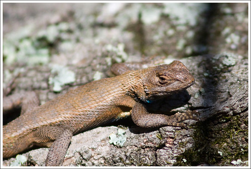
  • Wildlife – 2.  We saw a lot of Eastern Fence Lizards, but nothing else.
  • Ease to Navigate – 5.   It would be nearly impossible to get lost.
  • Solitude – 1.  The trail is exceedingly popular.  Parking can be a challenge if you arrive mid-day.

Special regulations for this area:

  • Maximum group size, day hikes: 25
  • Maximum group size, backpacking/camping: 10
  • No alcohol
  • Dogs must be kept on leash at all times
  • No camping or campfires outside of seven designated areas (north of Va 624/Newport Rd, the only legal campsites are Johns Spring Shelter, Catawba Shelter and campsites, Pig Farm campsite, Campbell Shelter and Lambert’s Meadow Shelter and campsites)
  • No camping or campfires on McAfee Knob or Tinker Cliffs

Directions to trailhead:

Take I-81 to exit 141.  Follow signs to VA-311.  The parking lot is located about 5.5 miles down 311.  Park ONLY in the designated lot.  Roadside parking is prohibited and will result in towing.

Strickler Knob – via Scothorn Gap

The Strickler Knob hike is a beautiful, 5.5 mile hike in the Lee Ranger District of George Washington National Forest.  It offers fabulous views of the Page Valley and a short, but fun, rock scramble.

View from Strickler
The view of New Market Gap from Strickler Knob is amazing! Below: Park at Scothorn Gap; Adam crossing Passage Creek; Trail markers.

Park Here Crossing Passage Creek Trail Sign

Adam says…

This is a great hike that is still not very well known.  There are some great views at the top and a mini rock scramble that is good preparation for anyone who wants a little practice before tackling Old Rag.  I wouldn’t recommend this hike for small children or dogs due to the rock scramble.

The hike can be a little tricky to navigate, so I have provided some clear directions for following the trail.

After parking at Scothorn Gap, you’ll immediately wade or rock hop across Passage Creek.  The hike starts off on a fire road.  The way starts to get fairly steep at .4 miles, but levels off again at .65 miles. At .8 miles, the hike gets steep again, but levels at .95 miles. This is the hardest part of the hike, so once that is done, the elevation changes are small. At 1.07 miles, you will see a nice campsite for anyone that wants to stay overnight. At this point, you will see an arrow pointing to the right, where you will pick up the trail again. The trail continues SSE from the campsite and you will be leaving the fire road for a hike through the woods. At 1.3 miles, you will come to a junction sign. Head straight on to the orange-blazed Massanutten trail.

At 1.94 miles you will come to the junction with the Strickler Knob trail to the right. This trail was built and opened in 2006 by some anonymous trailblazers. The blazes for this trail are marked as pink on rocks and typically red or purple rectangles on trees. This trail is fairly rocky, so be careful not to turn your ankles. Around 2.5 miles, you will see gorgeous views of the Shenandoah River and the Blue Ridge Mountains to the east. To the west, you will see more of the Shenandoah valley and the Appalachian Mountains. At 2.67 miles, you will reach a rock scramble for about one tenth of a mile until you reach the summit. This is a great spot to have 360 degree views of the area around you. Tied to a tree, you will also see a logbook that someone placed for people to journal about their hike.  It’s definitely a good read to those that are interested.

For those that are interested, I also placed a geocache up there.  The direct link for the geocache can be found at:

Rock Formation
The hike to Strickler Knob has lots of interesting rock formations to scramble over! Below: One of the more interesting formations; Adam walks the mountain’s spine; Scrambling up the pinkish-purple blazed Strickler Trail; More rock formations.

Rock Formation Spine Walk Scrambling Rock Formation

Christine says…

We hiked the Strickler Knob trail on the recommendation of a friend of mine from Flickr.  He said it was a fun hike with excellent views.  He wasn’t kidding!

We walked the trail on a bitter, windy winter day shortly before the forest road closed for the season.  The section of road that leads to the trailhead is periodically closed in the winter to prevent damage to the road surface.  (You can always check the status of roads and trails in the George Washington National Forest on their website) The hike was fairly easy and passed through the beautiful woods of Massanutten Mountain.  The Strickler Knob trail branches off the main trail and follows a rocky ridgeline over to the knob.  I love scrambling on rocks, so the last portion of the trail was my favorite part.

When we reached the knob, the view was amazing.  We got there mid-day, so it wasn’t a great time for photography.  I’d like to hike it again in the afternoon sometime.  I think the late day light would be prettier on the rocks and over the valley below.

Trail Journal
There is a log book at the summit of Strickler Knob.  Below:  Adam takes in the view; Geocaching

Strickler View Geocache

While Adam hid his geocache, I spent some time reading the trail journal at the summit.  It was entertaining, and I even came across the name of an old co-worker in the book.    I also remember it being super windy at the summit.  It was so bad, my bag of trailmix blew over and (sadly) sent chocolate covered peanuts spilling all over the rocks.  I hate it when I lose chocolate like that.  I’m sure some stupid crow enjoyed it though.

Trail Notes

  • Distance – 5.5 miles round-trip
  • Elevation Change – 1,600 feet
  • Difficulty – 3.  There is some moderate climbing along the route.  The scramble might be tough/scary for some.
  • Trail Conditions – 3.   Most of the trail is nicely graded and well maintained.  But once you turn onto the Strickler Knob trail it’s rocky and requires some scrambling.
  • Views – 4.  Once you reach the top you have some great views.
  • Waterfalls/streams – 1.  Just a small stream to cross at the beginning.
  • Wildlife – 2.  Hunters like this area, so there must be wildlife (although we didn’t see any.) During hunting season, make sure you’re wearing bright colors and making noise.  A co-worker who was running up here also got attacked by a wild goat here.
  • Ease to Navigate – 3.   The blazes can be a little tricky to follow on the pink blazed Strickler Knob trail.  Otherwise, the trail is pretty straightforward.
  • Solitude – 2.  Since 2009, this trail has become increasingly popular.  We revised the solitude rating from 4.5 down to 2 in 2014.

Directions to trailhead:

Reach the trailhead by turning on to Crisman Hollow Road (FD 274) off of 211 near Luray. Continue on this road for a few miles and park at the Scothorn Gap trail parking.

Once you have parked follow Orange Blazes on Scothorn Gap trail.  Follow trail directions above.