The Virginia Creeper Trail is a picturesque rails-to-trails path that winds its way for thirty-four miles through the Mount Rogers recreational area. The trail starts in Whitetop and ends in Abingdon, with Damascus sitting right in the middle.
We biked the Creeper section from Whitetop to Damascus on a rainy day many years ago. We planned to do the whole thing that day, but the rain became a heavy downpour and it was too muddy to enjoy biking. We tried to come back a couple times to bike the second half, but were foiled by more rain and tornado damage. Last summer, we finally made it back to officially finish the remaining 16 miles between Abingdon and Damascus.
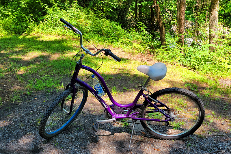
We have our own bikes, but they were badly in need of tune ups, so we left them home and rented from Blue Blaze Bike and Shuttle in Damascus, Va. Adam rented a mountain bike and I decided on a cool, purple cruiser. The trail’s terrain is generally smooth and covered with small gravel, so I decided to go with plush comfort rather than more rugged equipment. The rental shop was affordable and their bikes were impeccably maintained.
We booked seats on their first shuttle van of the day, and ended up being the only riders. Our driver was fun to talk to and was a regular hiker and biker. The shuttle took us from the shop back to mile zero in Abingdon, Va. From there, it was a mostly flat 16 mile ride back to their shop.
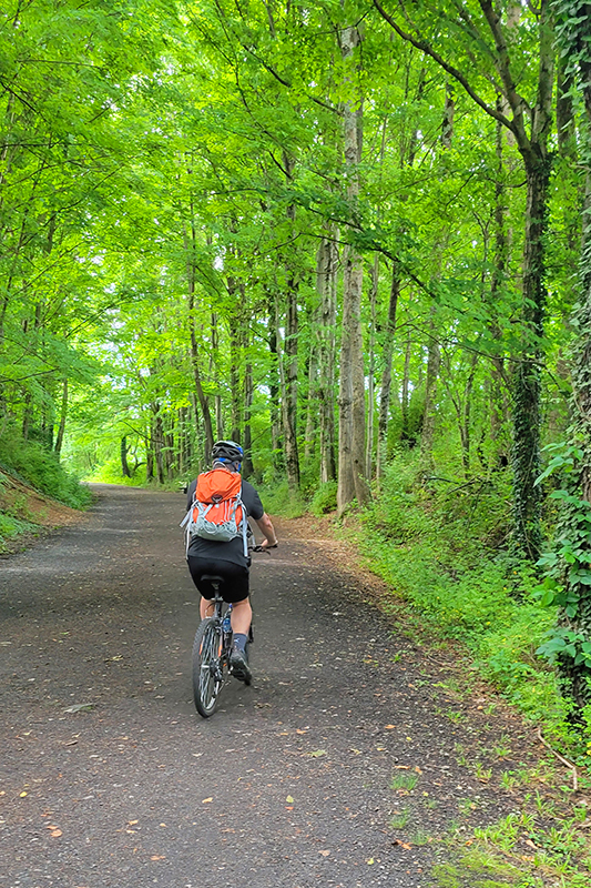
The section from Whitetop to Damascus is far more popular than the section we did this time – it’s a little more scenic and it’s all downhill, so it requires very little exertion. Our ride was still very easy, but we did have to pedal! The nice thing about biking the less popular half on a weekday was that we practically had the whole trail to ourselves. We saw just a handful of other runners and cyclists. The Creeper can get very crowded and congested, so this was a treat!
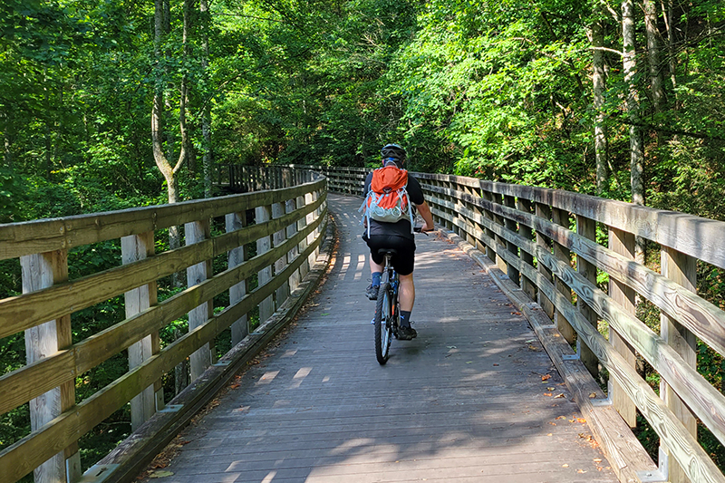
The main things to see along the Creeper Trail are beautiful waterways and railroad trestle bridges. The section we rode passed mostly through farmland, whereas the other half is more wooded. It was still really pretty, and the breeze from riding the bike made the heat bearable.
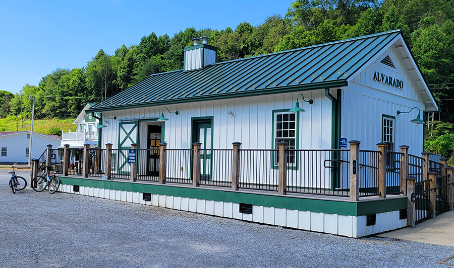
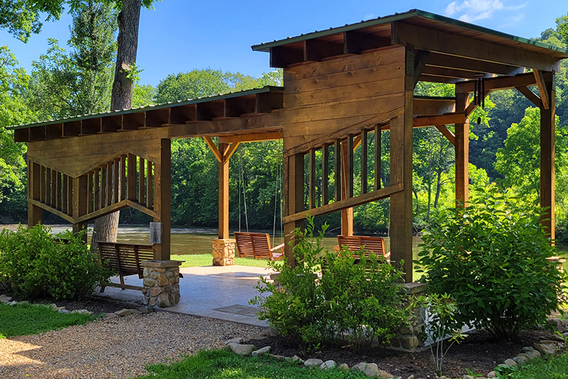
We stopped for a short snack and drink break at Alvarado Station about 8.5 miles into our ride. The station was once a railroad stop halfway between Abingdon and Damascus. It is the only stop for snacks and restrooms on this half of the trail. Across from the restroom building, there was a nice trailside park with a pavilion and porch swings. We sat by the river and enjoyed the view. We even saw a heron!
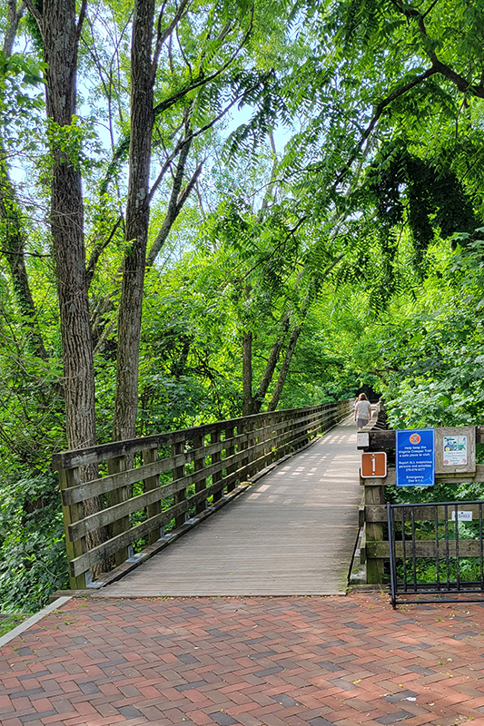
After our break we pedaled the remaining seven-ish miles into Damascus. The last mile or so follows the main road into town, so there are more road crossings and car noise. The nicest thing about trails like this is that the mostly keep car and bike traffic separated, so you always feel safe riding.
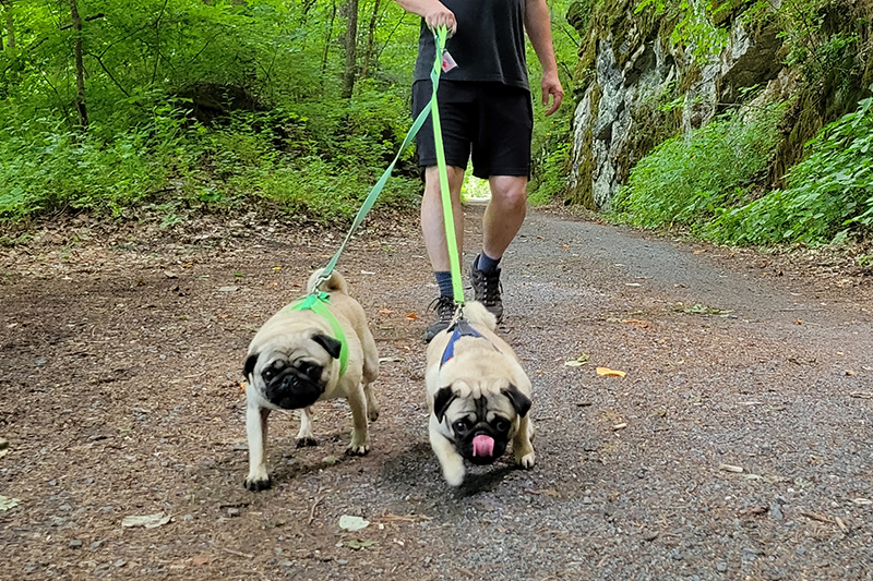
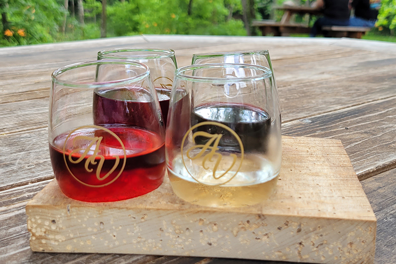
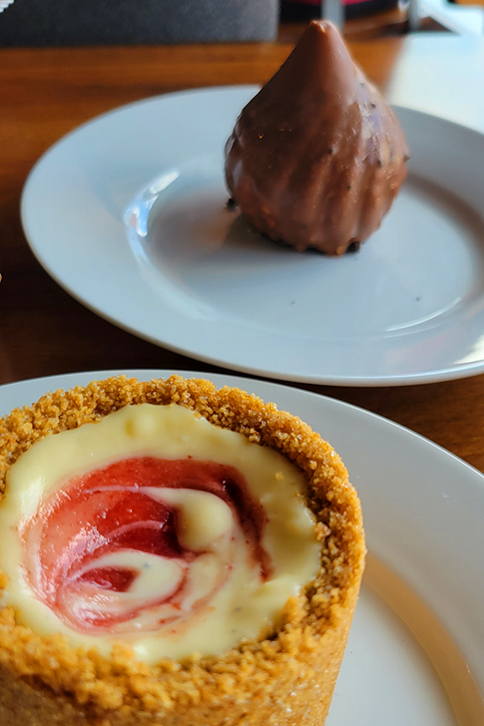
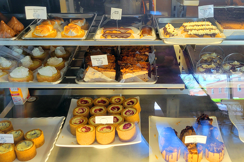
We got back into town, returned our rentals, got some lunch at Wicked Chicken Winghouse – another decent lunch stop in Damascus. Afterwards, we drove back to our AirBnB and picked up the dogs and took them for a two mile walk along the Creeper. After we got them nice and tired, we headed to Abingdon Vineyards to try some wine. The winery is dog friendly and has lots of outdoor tables along the stream. The day finished up with desserts from Anthony’s Desserts in Abingdon. If you’re in the area, this place has the most amazing sweets – don’t miss it!
More Photos
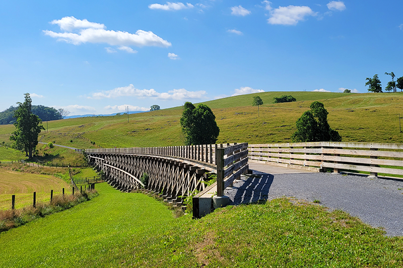
Trestle #1 on the Virginia Creeper
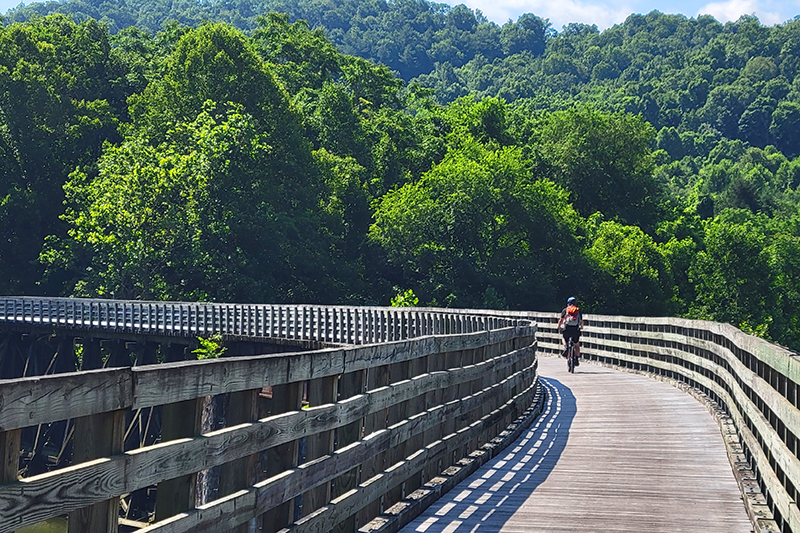
Biking on the Creeper
Crossing railroad trestles
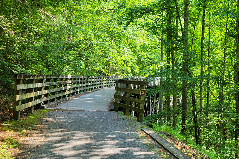
Trestle #2 – they are all numbered and there are over 35!
Pretty farmland
Adam biking along
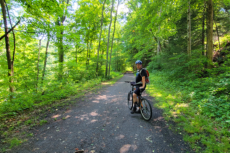
Taking a break in the shade
Alvarado Station park
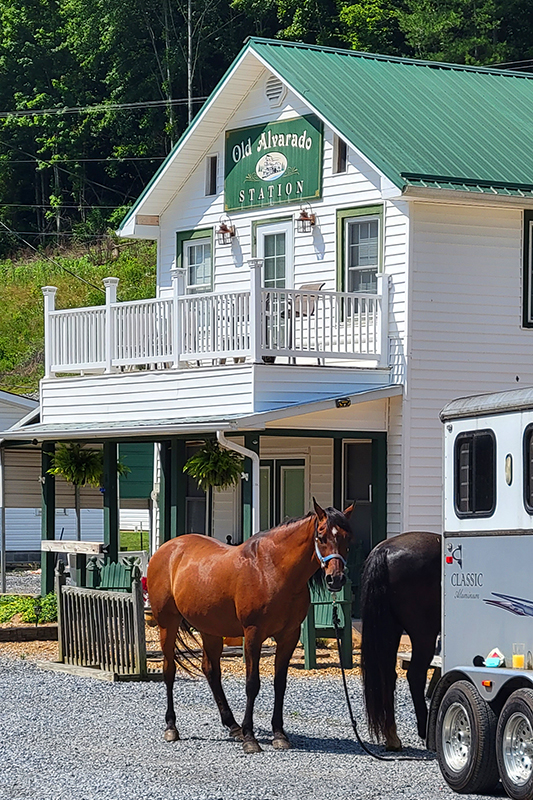
Horses are welcome and common on the Creeper
My sweet purple cruiser
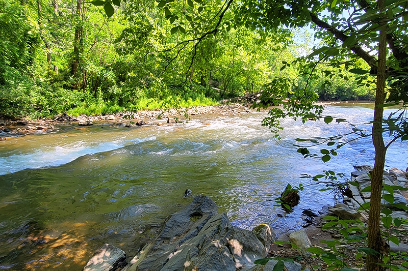
Some small rapids near Damascus
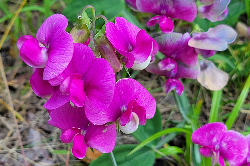
Pretty blooms along the trail
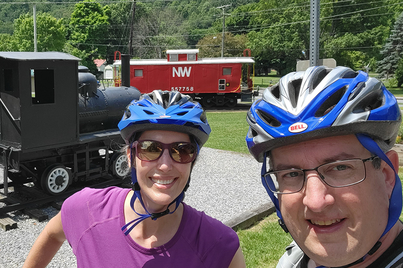
Bike selfie back in Damascus
Pugs on the Creeper!
Abingdon Vineyard
Wine flight
Don’t miss Anthony’s Desserts in Abingdon
Seriously – don’t miss Anthony’s Desserts! This is just half the case!
The New River Trail is a 57-mile rails-to-trails bike path. It starts in Galax or Fries and runs to Pulaski, following the New River closely for most of the way. We biked a 20+ mile section from Fries to Foster Falls.
The trail was shady and lush! Below: One of the many bridges along the trail – this one crossed the New River; A view of the New River at Foster Falls; Adam looks at some small rapids.
Adam Says…
When we were originally planning our trip down near the Grayson Highlands area, we were planning to incorporate a bike ride on the Virginia Creeper Trail. We had previously done the Virginia Creeper Trail from Whitetop to Damascas, but we wanted to do the entire trail. After doing some research, we found out that due to recent tornado activity, only 8 miles of trail is still available to bike south of Damascas. There are plans to restore it soon, but it kept us from going with our original plan.
We were disappointed, but I had remembered hearing good things about the New River Trail. After discovering that we could still stay near Grayson Highlands and do this trail, we had a solution. The next challenge was trying to find a shuttle service to bike. After doing some internet research, I found a place called New River Trail Outfitters that offers the service. However, when I tried to call the numbers were disconnected. I’m not sure if they are out of business, but I couldn’t find any current information for them.
The livery at Foster Falls rents bikes, canoes, kayaks and tubes. They also handle the bike shuttle service. Below: The stable at Foster Falls, A caboose on display; Foster Falls has an old depot building now used as a shop.
I then called the New River Trail State Park and found out that they offer a shuttle service. The park headquarters is located in Foster Falls. The cost per person to shuttle from Foster Falls to Fries or Galax is $25/person. When I called in for information, I found out they opened at 9AM. When I asked if we needed to make a reservation, I was told “No. You can just show up.” It’s definitely much more laid back than making shuttle reservations for the Virginia Creeper. Along the Creeper, shuttles fill up days in advance, so you usually have to make a reservation with a credit card well ahead of your trip.
We decided to get there right at 9AM. The day was calling for temperatures in the high 90s, so we wanted to get most of the bike ride over before the hottest part of the day. We had to wait for a little while for a second employee to show up, but we were able to get our bikes loaded and we were off by about 9:20. It took about 35 minutes to get to Fries. We were thinking that it was going to be a very long bike ride, but the bike path is actually quite a bit shorter than the distance by car.
The New River Trail State Park is the longest state park, measuring a total of 57 miles, but only averages about 80 feet wide. This is a state park with the purpose of biking, hiking, horseback riding, kayaking, or tubing. The guys operating the shuttle service says that most people choose to rent kayaks and float the river along the trail.
Biking Across the Fries Junction Bridge. Below: A variety of scenery along the trail.
I would recommend getting a copy of the bike map to take along with you. This path that we chose mostly takes place in the south section, but you will be 1.2 miles in the north section.
We decided to go for the section from Fries to Foster Falls because we thought it would be a little more manageable in the heat than the Galax to Foster Falls section. The Galax to Fries Junction section would have meant another 8 miles of biking and doesn’t parallel the New River until it reaches Fries Junction.
The bike path at Fries immediately starts by the New River. Right from the parking lot, we were able to see gorgeous views of the river. The trail takes about 5.5 miles to reach Fries Junction (which intersects with the trail from Galax). At Fries Junction, we did run into about 10 camp counselors that were biking the trail and talking about which colleges they were admitted to. I tried to keep quiet for a while, since I work in the JMU Admissions Office, but I did talk to one girl that was going to JMU next year as a freshman. We pressed on after a short break, following the signs to Pulaski (the terminus of the trail). We passed by Byllesby Dam (at mile 8.0) and Buck Dam (at mile 10.6). We stopped to eat a snack at Ivanhoe (at mile 13.7). Shortly after Austinville (at mile 16.5), we went through a short tunnel. This tunnel wasn’t that dark, so you most likely would not need a headlamp to go through. At mile 20.1, we reached Shot Tower. We parked our bikes and hiked up the steep stairs (which is tough after biking a while) to explore the tower. After we were done, we finished our ride back at the Foster Falls state park headquarters where we had started our trip.
There are a few geocaches to find along the way for this bike ride.
I definitely would like to come back and do some other sections of the trail. The section from Galax to Foster Falls is about 28 miles and the section from Foster Falls to Pulaski is about 22 miles. When we were reflecting back on the rails-to-trails bike rides we have done, we would put this only second to the Virginia Creeper trail.
Christine Says…
The New River Trail wasn’t our first choice for this mini vacation. Initially, we had planned to head down to Abingdon and make a second attempt to bike the entire Virginia Creeper. Let’s just say we don’t have good luck when it comes to the Creeper. In 2009, it rained on us for 17 miles before we bailed out and caught a van ride back to Abingdon from Damascus, in 2010 I got bronchitis and was too sick to go when we planned, and in 2011 the section of the trail between Damascus and Abingdon was closed due to tornado damage. Apparently, some mythical force is keeping us from finishing that trail!
This was the only tunnel we passed through on the section we biked. Below: Geese and goslings; Pretty wildflowers along the trail; Rocks and rapids in the new river.
Luckily, Adam was able to do some last minute research and plan an alternate getaway for us that included biking along the New River Trail. The trail is 57 miles long and passes through Grayson, Carroll, Wythe, and Pulaski Counties, linking the towns of Pulaski and Galax with a side spur of the trail linking to Fries. It hasn’t been around as long as the Virginia Creeper, so it’s not as well-known and the area doesn’t have quite as many bike-friendly amenities (shuttle services, bike shops, trailside cafes). But what it lacks in amenities, it makes up for with its beauty and solitude. We saw fewer than two dozen people along the New River Trail over a 20+ mile span and greatly enjoyed the pristine river scenery.
The trail was in great shape – smooth and flat, covered with fine crushed stone. There were lots of pretty wildflowers along the path – snapdragons, mountain laurel and others I didn’t know. Every now and then, I’d catch a deer watching us quietly from the woods. We saw a pair of geese and their goslings hanging out at one of the primitive trailside campsites. The river was fed by many small streams cascading down the hillside above the trail. There were even a few small waterfalls flowing. The New River was spectacular! All the spring rain had water levels higher than average, so there were many rapids and cascades that probably aren’t there when the water is lower. The driver of our shuttle even mentioned that they had to cancel canoe/kayak/tube trips due to high water on the Saturday of Memorial Day weekend.
It was close to 100 degrees outside on the day we biked, so that made it a bit uncomfortable. Although, once we got going, the breeze from pedaling along made the heat bearable. Thankfully, much of the trail passes through a shady tunnel of woods, so we were able to stay out of the direct sunlight most of the way.
Nonetheless, I drank almost three liters of water and a 20-ounce bottle of lemonade over the course of the ride. I also ended up with a huge, salty sweat ring on the front of my shirt (GROSS!) and my legs were crusted with sweat mixed with gravel and grit (DIRTY!). I was not a pretty site at the end of the trail, but I had such a good time I didn’t care!
The Shot Tower.
Two things I liked best along this bike path were the Fries Junction Bridge and the Shot Tower. The bridge was neat just because it was so long and curvy. Shot Tower was interesting for its history. The tower itself sits above the trail. So you have to take a short, steep climb up a hill and several flights of steps to visit the tower – but it’s definitely worth the effort. Another little tidbit of history from the area is that Stephen F. Austin, ‘The Father of Texas’, was actually born in Wythe County, in a small town that now bears his name (Austinville). The trail passes right through that area.
Park employees enjoy a shady spot on horseback.
I would definitely make a return trip to bike more of the New River Trail! The state park shuttle service makes it so convenient. I also might want to go back and ride horses along the trail. Seeing all the horses at the Foster Falls stable really made me miss having a horse and going for long rides.
After finishing up with our bike ride, we got cleaned up and headed into Galax for a movie and pizza. I was shocked that movies in Galax were only $4.00 for a matinee (as of 2011)! After the movie, pizza at RJ’s Pizza and Subs was delicious! They had really good and inexpensive food.
Trail Notes
Distance – 21.3 miles
Elevation Change – negligible
Difficulty – 1.5 The terrain is extremely flat, so if you can do the mileage, you shouldn’t have a problem.
Trail Conditions –4.5. The trail is either very small gravel or dirt. It doesn’t get better unless you find paved trails.
Views – 1.5 You don’t get views from high points, but there are a few nice unobstructed views of the river and some of the mountains around you.
Waterfalls/Streams – 5. Most of the trail, you are biking along the New River.
Wildlife – 2. We saw a couple of deer and a black snake on our ride.
Ease to Navigate –4.5. The trail is very easy to follow and well-marked.
Solitude – 2.5. This trail does get busy on nice weekend days, but it is not as popular as the Virginia Creeper trail.
Directions to trailhead: For the headquarters of New River Trail State Park for the shuttle service, take exit 24 (69 East) off of Interstate 77. Take a left on to US-52 North. Go 1.5 miles and take a right on to Foster Falls Road/State Route 608. There should be signs directing you to the New River Trail State Park. There is a fee of $2 to visit the park.
For the trailhead in Fries, VA, Fries is located off of highway 94. From Main Street in Fries, turn on Firehouse Drive. You should see the small parking lot and bulletin board shelter for the start of the trail at the curve on Firehouse Drive.
The Virginia Creeper Trail is a picturesque rails-to-trails path that winds its way for thirty-four miles through the Mount Rogers recreational area. The trail starts in Whitetop and ends in Abingdon, with Damascus sitting right in the middle. The area caters to bikers, offering plenty of opportunities for shuttles, bike rentals and food along the way.
Adam crosses one of the many old railroad trestles along the Virginia Creeper Trail.
Adam Says…
The Virginia Creeper Trail is something we’ve wanted to do for years. It is very well known in the biking world as being one of the best rails-to-trails in the east.
The origin and history of the name has to do largely with the train that used to ride this route. The train was called the Virginia Creeper due to the slow churning of the train. The trail was also partly named in honor of the native vine that you will normally see turning crimson as an early sign of fall. The train ran its last trip in 1977 and it was converted and opened as a multi-use trail in 1984.
We were expecting rain that day and wanted to hit the trail as early as we could. We arranged for a shuttle to take us to Whitetop Station to begin our trip. We recommend the Virginia Creeper Trail Bike Shop. They are located in Abingdon and run a shuttle to Whitetop and will even pick you up in Damascus if you are thinking about only doing half of the trail. After we were dropped off, we decided to not lollygag, since the rain was imminent. We got through the first couple of miles of the trip with only a few errant raindrops, before the heavier rain started.
Despite the rain, we really enjoyed the beauty of the trail. There are 47 trestles and bridges that pass over the Green Cove Creek and the Whitetop Laurel Creek. You get gorgeous views of the rushing water in the creeks; pass by quaint, country farms; and canopy forests. We picked a perfect weekend to do this trip to see the beautiful fall foliage. The trail is shared by bikers, walkers, runners, horses, and even an occasional dog sledder in the winter.
Here are a few highlights along the way. There are also several information signs along the way that provide valuable insight into the history and nature of the area. You will see mile markers along the way to help point the way.
Mile 34 – The Whitetop Station to park your car. Bathrooms are available. Highest point on the trail at 3576 ft.
Mile 30.5 – Green Cove Station sells a lot of essentials and souvenirs. Bathrooms are also available.
Mile 27 – Creek Junction – Parking and Bathrooms are available. 563 foot trestle.
Mile 23 – Taylor’s Valley – Parking available. Daniel Boone campsite.
Mile 20.7 – Straight Branch – Parking and Bathrooms are available.
Mile 20 – Whitetop Laurel Falls – when you see a large overhanging rock, the falls are down a small path on the right side of the trail.
Mile 16 – Arrive at the town of Damascus. Railroad exhibit is available.
There are so many beautiful farm and stream scenes along the trail. The huge Christmas Tree farms along the way are lovely. Pictured Below: The trail follows a rushing stream with many small waterfalls; The fall color was spectacular in Mid-October.
For those that are interested in geocaching, there are a ton on this trail.
We definitely plan on coming back in the spring and tackle this another time. The rain got us fairly wet and also covered us with “Creeper Streak” – the streak created on your back from the wet dirt being kicked up from our back tire. We decided to stop after the halfway point and catch the shuttle back to our car. While the rain was annoying and kept us from relaxing and enjoying the trail as much as we wanted, we still felt the scenery around us made up for it.
Christine Says…
I woke up early the morning of our Virginia Creeper bike ride, peeked out the hotel window and started silently chanting the mantra “please don’t rain, please don’t rain, please don’t rain”. The sky was that heavy gunmetal gray that promises rain is coming sooner rather than later. It wasn’t supposed to start raining until the evening, but I was fairly certain that we were going to be in for a soggy bike ride.
Nevertheless, I donned my new padded bike pants and a fleece top and headed over to the bike shop to catch our shuttle ride out to Whitetop Station. The shuttle services for the Creeper Trail are a great idea, as they let bikers enjoy the whole trail without making a return trip over repeat scenery to get back to your car. I think most people just bike half the trail – Whitetop to Damascus, but we were really hoping to do the full 34 miles back to Abingdon.
The van ride out to the trail’s end was pretty long – about an hour along winding mountain roads. The driver shared lots of trail trivia and helpful tips to kill the time. Some of the things he shared:
Celebrities like to bike the Virginia Creeper (Clint Black, Troy Aikman, Emmitt Smith, some NASCAR driver I don’t remember). Apparently, Brad Pitt even has a home near Whitetop and has been spotted fishing the area’s rivers. (although I can’t find any evidence to corroborate this as fact)
Most of the accidents (75%) along the trail happen to males between the ages of 13 and 21. Boys on bikes are reckless, I suppose.
It’s a very bad idea to slam on your brakes when crossing wet railroad trestles. You WILL wipe out. I can vouch that this tip is quite true. We saw the same poor woman wipe out on two separate occasions – both times she was on a wet trestle.
The trail is probably the only 34 mile bike ride that you’ll actually gain weight on. There are snack shops, coffee house, bakeries, ice cream parlors and full service restaurants all up and down the trail.
The trestles along the trail are very picturesque. Pictured Below: We were lucky enough to bike the trail during the peak of fall color; The trail is a multiuse trail and is also used by pedestrians and equestrians.
On the ride out, the sky started spitting a bit of rain. It had stopped again by the time we were dropped off at Whitetop Station. We kept our fingers that it would continue to hold off. Adam and I don’t like biking or hiking in crowds, so as soon as we got our bikes off the trailer, we raced off to get a jump start on the crowd of bikers arriving at the trailhead. Our driver told us that on nice weekend days, the trail might see upwards of 2400 riders. Area bike shops have 1800 bikes available, and frequently sell out of rentals. I was a bit surprised that more people rent bikes than bring their own. Maybe most people don’t own bikes these days.
The trail was gorgeous – a leaf-covered pathway under an endless tunnel of fall-colored trees. Every now and then, we’d pass an opening that provided a view of the mountains or one of the area’s many vast Christmas tree farms. Around Green Cove Station the rain started in earnest, and never let up again. I had to put my camera in a trashbag I had packed in my bike rack. There were so many scenes along the way that deserved to be photographed with care. Sadly, with the rain, all I was able to do was take a few quick snapshots.
Even in the rain, the ride was incredibly beautiful. I loved crossing the old railroad trestles and riding alongside the rushing streams. We biked the entire stretch from Whitetop to Damascus in about ninety minutes. I would have loved to take more time to enjoy the scenery, but it was cold, wet and windy. I started thinking less about scenery, and more about a mug of hot chocolate and a steaming cup of soup.
In short order, we arrived in Damascus. We decided to try lunch at one of the places our shuttle driver had pointed out. He had mentioned that In the Country and Fattie’s Diner were both really good. I saw “Hot Soup” on In the Country’s sign, and I was sold.
The trail offers many charming places to stop for a delicious lunch or snack. Pictured Below: We had a fantastic lunch at “In the Country”; The only red train car along the trail is located in Damascus.
The staff at the restaurant was so friendly and welcoming. They didn’t even flinch when we walked in through their front door, soaking wet – covered with mud and trail grit. My ponytail felt like I’d dipped it in wet concrete and my legs were coated with black sludge from my ankles to my knees. Adam even had mud splashed up and down his cheeks. They invited us to eat inside in the warmth, but I felt too guilty about my filthiness and chose a picnic table under their covered porch.
Adam and I both got their boxed lunches which included a sandwich, side, drink and dessert. I chose their potato soup as my side. It totally hit the spot. Lunch was washed down with hot chocolate and followed up with delicious homemade pumpkin squares. We sat on the porch after lunch, watching others from our shuttle group pass by on their way to the pick-up point. I think most bikers take about two and a half hours to bike the Whitetop to Damascus section.
The rain was still falling steadily, and although we wanted badly to see the rest of the trail, we decided to call the bike shop and let them know we’d be joining the shuttle in Damascus. We met up with everyone at the red train car in the middle of Damascus. Everybody looked cold, dirty and tired. The heated shuttle van was such a welcome sight.
It was a real disappointment to miss the second half of the trail, but it’s also a great motivator for us to make a return trip to the area in the spring. I’ve heard the rhododendron and mountain laurel bloom along the Creeper is amazing!
Trail Notes
Distance – 18 miles for this segment
Elevation Change – From Whitetop to Damascus, you lose 1646 feet in elevation
Difficulty –1.5. You hardly have to pedal at all on this stretch of trail, so it is suitable for bikers of all fitness and skill levels
Trail Conditions –3.5. The trail is in good shape. There are some errant holes and jutting rocks to watch out for. Entrances and exits from the trestles can be jarring if you’re going moderately fast.
Views – 3. While the views aren’t high and lofty, they are still beautiful and showcase Virginia’s most picturesque scenery.
Waterfalls/streams -4. The two streams that flow along the trail are gorgeous and include many small waterfalls.
Wildlife –1. We didn’t see anything, but our shuttle driver told us people regularly spot deer and the occasional bear.
Ease to Navigate – 5. The trail is very simple to follow.
Solitude – 0. People love the Creeper! On nice days in the spring, summer and fall, the trail can see over 2000 bikers in a single day.
Directions to trailhead:
We recommend hiring a shuttle service in either Abingdon or Damascus. For a reasonable fee, they will drive you and your bikes to White Top Station. This lets you enjoy the entire trail without having to backtrack on the return trip to your car.