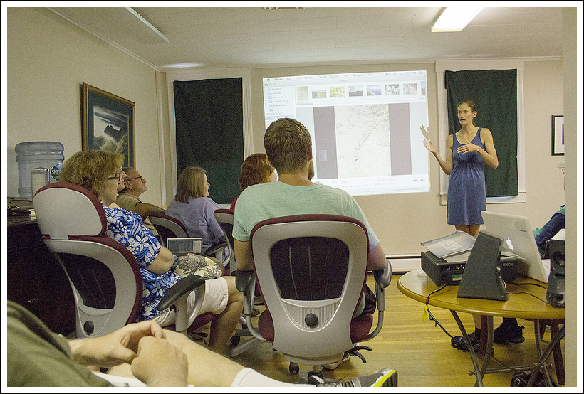
Jennifer Pharr Davis presents at the Appalachian Trail Conservancy Headquarters in Harpers Ferry, WV. Below: Virginia Trail Guide was honored to meet the family!
Back in July, we had the pleasure of meeting Jennifer Pharr Davis (and family) at the ATC Headquarters in Harpers Ferry, WV. She was there to talk about her hiking experiences and help promote her latest book, Called Again. Jennifer holds the record for the fastest hike of the Appalachian Trail, completing the 2150 miles in 46 days, 11 hours, and 20 minutes. Her husband, Brew was there to support her along the trail, meeting her to provide food, shelter, and love along the way. In 2012, National Geographic named her as one of the Adventurers of the Year for her amazing accomplishment. She also holds records for hiking the Long Trail in Vermont and Bibbulmun Track in Australia.
During her presentation at the ATC Headquarters, Jennifer showed pictures of some of the places she has hiked around the world and talked about her experiences hiking the AT. We both left the talk truly inspired and I think a few minutes listening to Jennifer would have the same effect on anyone!
In 2005, she established her company, Blue Ridge Hiking Company, with the mission of “making the wilderness accessible and enjoyable through written and spoken word, instruction and guiding.” She has authored three North Carolina hiking guides and two books about her experiences on the Appalachian Trail. Her husband also wrote a book about supporting her through the record-setting hike. You can purchase her books through her website. Jennifer was kind enough to do a brief Q&A with Virginia Trail Guide. Check out what she had to say!
In Called Again, it was pretty clear that the New England states (especially New Hampshire) were tough on your body. I think most regular hikers have had days on the trail that aren’t fun, when everything hurts, when the weather turns, etc. What do you think about or do that gives you the strength to push through the pain/frustration and make it to your next goal?
The trail has taught me a few lessons that help keep me going during those tough stretches:
Live in the moment. You might not think you can make it to the top of the mountain… or to your car, but I bet you can take one more step and maybe even hike one more mile. Just take it one step and one mile at a time.
It is WORTH it. I wouldn’t take back a single “BAD” day on the trail. Those are the days that strengthen my mind and my body the most. They give me the best stories for my books, Becoming Odyssa and Called Again. AND, the bad days give you a heightened appreciation for the good days.
A bad day on the trail is still better than a good day in an office! We were made to spend time outdoors in motion. It is much more natural than spending all day in a chair.
As I read Called Again, I was impressed by how much of the ‘traditional’ AT experience you were able to still have on your speed record hike. You witnessed beautiful sunrises/sunsets, saw wild animals, ate tons of food, shared time on the trail with an ever-changing cast of people and walked through a lot of weather. Do you have a favorite moment or memory from your most recent thru-hike that is unrelated to attaining the speed record?
Making awesome trail friends. Two unexpected and unplanned thru-hikers came out to help us through the mid-Atlantic. I didn’t really know Rambler, and I had never met Dutch. But after a couple of days of hiking together, I now consider them to be two of the dearest men that I have ever met. I made so many awesome trail friends that summer! I think I appreciated the friendships even more that summer, because the encouragement, laughter and companionship was so helpful. I will never forget hiking up Blackstack Cliffs in the rain and mud listening to my friend Hampton recount all his dating blunders. I could hardly hike I was laughing so hard.
In the beginning of Called Again, you shared some stories about hiking with your husband, Brew. I think a lot of couples who hike together read that section of the book while nodding and thinking ‘yes!’. There are always going to be different paces, changing moods and energy levels. What tips can you offer for communication methods to help maintain sanity and harmony for couples/groups that hike together?
The trail really helps couples to focus on teamwork, communication and forgiveness. Usually Brew and I have it out the first week of hiking together. But after lots of talks, and plenty of forgiveness we are closer than ever for the rest of the trail. Remember that you are only as strong as your weakest link. If one person is miserable, you will both probably be miserable. Also, just because you are hiking together – you don’t always have to hike together. Consider splitting up for the morning or afternoon and meeting back up in time for the next meal. Finally, share the responsibilities of a thru-hike. I was an experienced thru-hiker when I met Brew, and it wasn’t til I started having him plan the trips, buy our resupply food, and select our camping spots that he really started to enjoy OUR hikes.
Can you describe a little about what Blue Ridge Hiking Company does?
We encourage everyone, especially women and kids, to GET OUTDOORS. We try to do that through writing, speaking, and guiding. I have authored two A.T. memoirs, and 3 N.C. hiking guides. Brew even wrote a book called 46 Days. We travel around so that I can give trail based talks at schools, businesses, outdoor stores, libraries, etc… And sometimes we offer very specific workshops for folks ready to take on the trail. Blue Ridge Hiking Company also offers guided hiking trips near Asheville, North Carolina. Right now, I have four contract guides who help me get folks out on the trails. Our most popular offerings are half and full day hikes, but we also lead custom overnight trips.
On your Blue Ridge Hiking Company website, I read that one of your personal goals is to encourage more people to get outdoors, especially women and children. What are some easy and non-intimidating ways for people to get started with hiking or backpacking?
I encourage people to start in their comfort zone. If you don’t want to go alone, then set out with a friend, pet, or protection. If you aren’t in great shape, don’t make your first outing a 10-mile ascent. If you enjoy the wilderness, you will want to go back to the wilderness. If you go back, your comfort zone will probably increase and you will be willing to try new and often more difficult hikes. I believe that when people experience and enjoy nature they are more likely to protect and preserve the wilderness.
Our readers are mostly located in Virginia. Do you have a favorite place along the AT in Virginia that you remember or an interesting story that happened to you in Virginia?
GRAYSON HIGHLANDS! It is really special. I love it there. I got to meet David Horton going up the Priest in 2005, and he has become one of my good friends, on and off the trail. Also, one day in the Shenandoah National Park, I GOT to see 14 bears. That was really cool. I always say, that if any state alone the A.T. has to have over 500 miles of trail then I am glad it is Virginia!
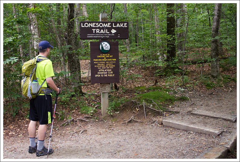
This 3.3 mile hike is one of the easiest and most accessible ‘hut hikes’ in the White Mountains. Lonesome Lake is beautiful and the hut provides a nice place to stop for a picnic lunch.
Lonesome Lake is beautiful and one of the easiest, most accessible ‘hut hikes’ in the White Mountains. Below: The trail for Lonesome Lake starts in the campground; Adam climbs the trail; As is the case with most New Hampshire trails, the path to Lonesome Lake is rocky and rooty.
Adam Says…
After our hike on Franconia Ridge, I had to take a day off to let my leg muscles recover. When we were ready to tackle another hike, we decided to do something on the easier side this time that didn’t have nearly as much elevation as our previous hikes. While we were hiking up the Franconia Ridge Trail, we noticed this serene lake in the far distance.
We started off our hike from the opposite side of I-93, so we walked underneath the interstate bridge and followed the signs for the Lonesome Lake hike. This led us into Lafayette Place campground, which has 98 campsites. With such nice weather we were having, it was no surprise that the campground was full. It always feels awkward to me to be walking by campsites while people are still sleeping, eating breakfast, or hanging out. We made our way along quietly and then reached the true trailhead next to campsite #93.
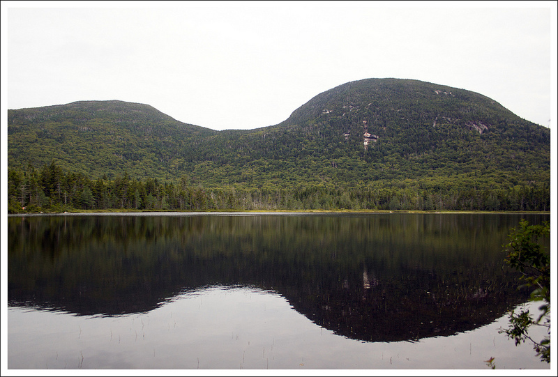
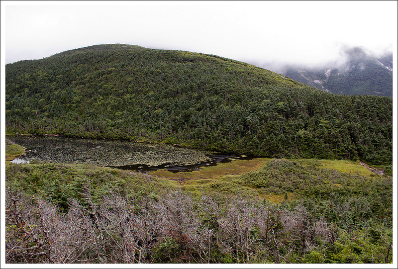
The Lonesome Lake trail consisted of a steady climb through sections that are covered with roots and steep rock steps. At 1.35 miles, we reached the ridge and came upon our first glimpse of Lonesome Lake at a junction point with several other trails. We stopped for a quick breather and to enjoy the view of the lake, a remnant of a glacier that had carved out the mountains. The uphill hiking was over, and we headed left on the Cascade Brook Trail, which winds around the side of the lake. The trail was boggy in many spots, but there were often footbridges, rock steps, or logs to walk on in the muck to make our way across easily. On our way, we passed a croo member from Lonesome Lake who was heading down the mountain with a wooden frame loaded with outgoing refuse from the hut.
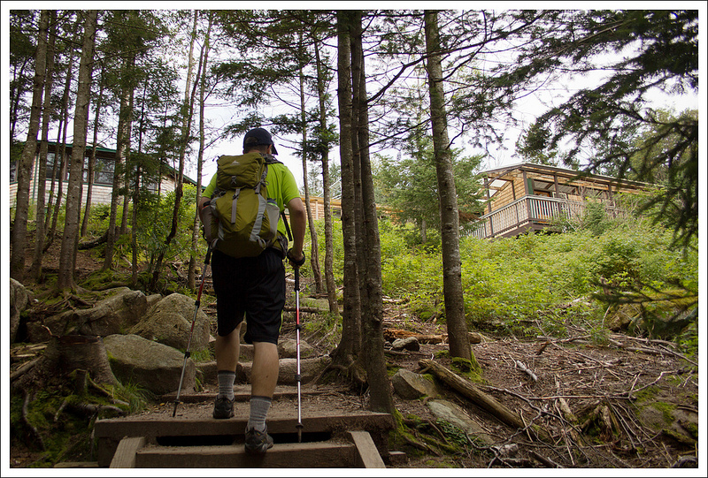
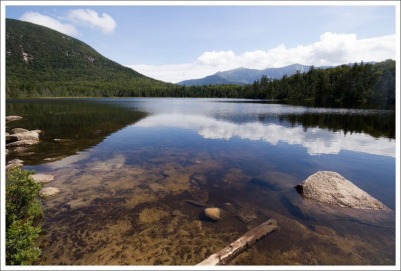
The mountains reflect in Lonesome Lake. Below: There are lots of trail junctions when you reach the end of the lake; The trail around the lake is muddy and traversed by planks and stepping stones; Climbing the stairs to Lonesome Lake Hut.
At 1.6 miles, we reached the junction with the Fishin’ Jimmy Trail. We took a right on to this trail and in a short distance we came to a large dock on the lakeside. There were a ton of teenagers on the dock, so we decided to check this out later. Right above the dock was a series of steps that led to the Lonesome Lake Hut. When we arrived in the hut, there was nobody there except for a few croo members. One was cleaning up the kitchen and the other was packing her frame to take down the mountain. We talked to her for a while and found out that they make several trips a week down to the base of the mountain where they meet up with someone to help them resupply for their trip back to the hut.
We rested a while on the back porch of the hut and talked to a family that was visiting from the Netherlands. They were on their way to visit Shenandoah National Park soon, so we gave them some tips on where to stay in the park and some of the things we would recommend they do while in Virginia. The large group of teenagers had cleared out, so we went to the dock to enjoy views of the southern end of the lake (now occupied by several families with toddlers). We made our way back the way we came to finish the out-and-back hike.
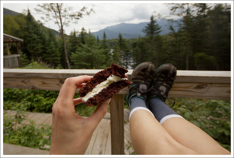
The inside of Lonesome Lake Hut is cozy, bright and cheerful. Below: Adam enjoys a nice seat on the large porch overlooking the lake; Whoopie pies and mountain views; The Lonesome Lake dock gets crowded!
We could tell from the people that we saw climbing up that this is a highly-trafficked hike. We hope in the next few years to do a larger hut-to-hut traverse across this area. It was nice to see a possible overnight location in advance. This is an easier hike that most families should be able to do if they take their time.
Christine Says…
After hiking Franconia Ridge, we decided to take a day off and be restful tourists rather than ambitious hikers. We spent the day visiting Dartmouth College, sampling Long Trail Ale, gorging ourselves on Cabot Cheese and watching glassblowers at Simon Pearce. The next morning, we were ready to get back on the trail. Adam’s knees and calf muscles were still bothering him, so we went with the easy hike to Lonesome Lake.
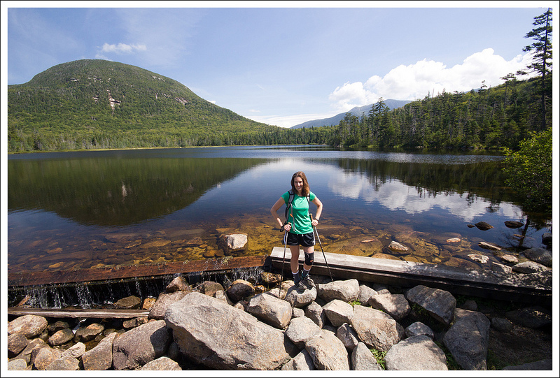
Lonesome Lake is lovely glacial pool sitting between North Kinsman and Cannon Mountains. The initial ascent to the lake is a little steep – about 1000 feet over 1.3 miles, but compared to many other hikes in the area, it’s considered a very easy trail.
When we began our hike, the morning was cold and sort of grey. The forecast called for brilliantly sunny weather, but you just never know what you’re really going to get in the White Mountains. We meandered through the Lafayette Place campground to reach the trailhead. The smell of campfires and cooking bacon was heavy in the air. That smell always makes me so nostalgic for the camping trips of my youth. My mom was a great camp cook – there were always sausages, bacon, pancakes and eggs. Nice memories…
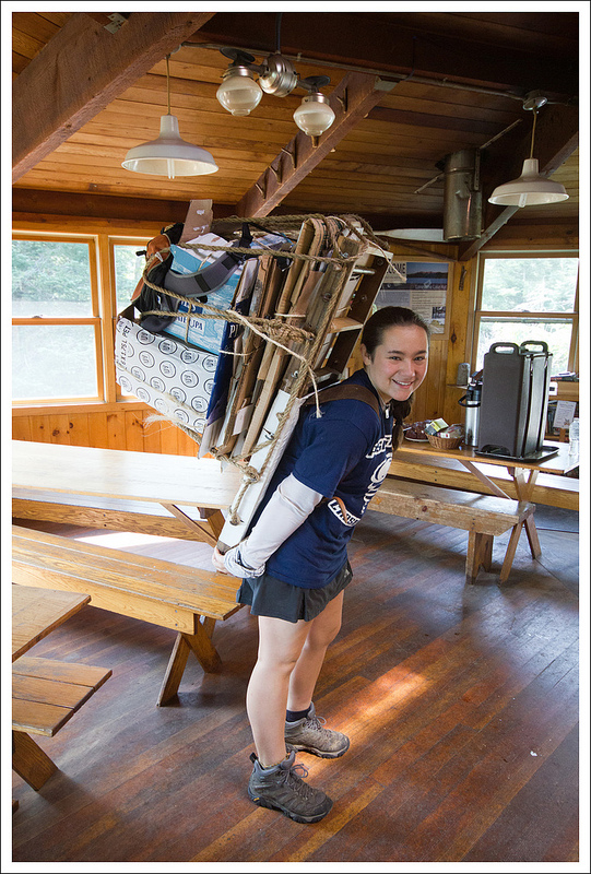
Each hut is run by a ‘Croo’ – mostly college students on summer break. They carry supplies for the hut on their backs using these wooden racks.
The hike up to the small plateau where the lake sits is uphill and pretty, but generally unremarkable. Like most New Hampshire trails, you can expect to see lots of rocks and roots along the way. As you climb, the woods change from predominantly hardwood to a heavier evergreen mix.
At the tail-end of the lake, there was a junction sign with different trail options headed in many different directions. We followed an almost completely flat trail around the perimeter of the lake. We caught lots of glimpses of the water through the trees, but the most memorable feature of this trail was the mud! Thankfully, the trail is well maintained and rocks and planks were strategically situated the entire way, and we never had to get our boots muddy.
At the head of the lake, we crossed a wooden footbridge that came out between a wooden staircase and a lakefront dock. Since the dock was packed with kids from a summer camp group, we decided to check out Lonesome Lake Hut before enjoying the water. We climbed the stairs and found a charming cluster of wooden buildings that make up the ‘hut’. Unlike Greenleaf Hut, which is in a single building, Lonesome Lake Hut is a collection of cabins and a main dining room.
A couple members of the Croo were still cleaning up from breakfast. And of course, Adam managed to snag more free leftover pancakes! If you have a spare minute, check out this fun video about the 2013 hut Croo. If I had known there was such a job opportunity as ‘AMC Croo Member’ when I was in college, I would have leapt at the opportunity. It sure would have been more fun than filing procurement paperwork for the Army Corps of Engineers! (no offense to ACoE).
Christine sports her new knee brace. Below: The beautiful lake; Beginning the climb down; The ranger station at the base of the mountain.
At Lonesome Lake, we met another croo member who was loading up her packboard with empty boxes and other outgoing items to carry down the mountain. She said the trip down is typically a lighter load than the trip up, which includes food and other supplies. The AMC has a fun article about Packboarding Legends. Can you believe some people have carried packboards weighing over 100 pounds? The average is more in the 40-80 pound range, which is still extremely impressive!
After looking around the hut for a few minutes, we found a couple pleasant Adirondack chairs to relax upon. The back porch of Lonesome Lake hut is a great place to idle away a pretty summer afternoon. While we relaxed, the sun came out, making it even nicer for sitting. I shared a whoopie pie with Adam. We also had a very nice conversation with a family visiting from the Netherlands. They were greatly enjoying the expansive, forested terrain of New Hampshire – something they said they have little of at home.
After a while, we made our way back down to the lakeside dock. We found it still crowded, so I took some photos and didn’t linger for long. The hike back went very quickly. We saw lots of families hiking up to spend a night at the hut. I hope we’ll have the opportunity to do a hut stay on our next New Hampshire trip.
Difficulty – 2.5. The climb up was fairly steep, but because of the short distance, you can take your time.
Trail Conditions – 3.5. The trail is well-traveled and in good condition. There are some steeper sections and some worn-out areas that do require careful footing.
Views – 2. You do get views from the lake of the mountains around you, but the height of the mountains around the lake keeps you from getting distant views.
Waterfalls/streams – 4. While you don’t have waterfalls and very limited stream views, you are rewarded with a massive lake on this trail.
Wildlife – 1. We didn’t see anything on this hike other than squirrels.
Ease to Navigate – 3. There are some confusing spots where you wonder where the trail is leaving the campground. Also, the junction at the ridge has a lot of different trails to follow. Read the signs and you should be fine.
Solitude– 1. On a clear day, this hike is likely crawling with people.
Download a trail map (PDF) – Coming soon!
Directions to trailhead: Head north on I-93 until it becomes Franconia Notch Parkway. Pass exit 1 and the exit for the Basin. Take the next exit (for trailhead parking). Park in this parking lot. Leave your car and head underneath the bridge that is I-93. Follow the signs for the Lonesome Lake trailhead, going into the Lafayette Place Campground. The trailhead leaves near campsite #93.
* MapMyHike is not necessarily accurate, as the GPS signal fades in and out – but it still provides some fun and interesting information.
This nine mile hike is challenging, but pays off extravagantly in terms of spectacular views, alpine ecology and gorgeous waterfalls. The route also allows you to pay a visit to the AMC’s Greenleaf Hut.
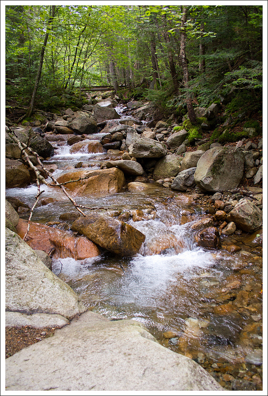
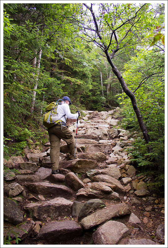
The Appalachian Trail makes its way across the knife edge of Franconia Ridge. The most scenic section is the 1.8 miles between Lafayette and Little Haystack. Below: Walker Brook; Trails signs for the Old Bridle Path; Adam climbs a few of the many rock stairs on the way up.
Christine Says…
Hiking Franconia Ridge has been on my must-do list for as long as I’ve known it existed. The knife’s edge trek, stretching from Mt Lafayette to Little Haystack, is a breathtaking walk across dramatic alpine terrain with a 360-degree view that goes on for almost two miles. The hike shows up on countless lists of hiking superlatives (best hikes, best views) and is definitely one of New Hampshire’s most popular hikes.
The AMC’s White Mountain Guide describes the most popular section of the ridge (from 5,260-foot Mount Lafayette to 4,780-foot Little Haystack Mountain)…
“It’s a Gothic Masterpiece, suggesting the ruins of a gigantic medieval cathedral. The peaks along the high serrated ridge are like towers supported by soaring buttresses that rise from the floor of the notch.”
You can’t help but be drawn to this beautiful place, but you should never forget that it’s also perilous. Numerous injuries and deaths happen on this section of trail every year, mostly due to hypothermia, falls, and fatigue. Franconia Ridge is the first prominent roadblock to fierce weather rolling in from the North Country, putting the exposed trail at high risk for lightning strikes, surprise storms and howling winds. It’s also a challenging climb. With well over 3500’ of ascent, this hike will challenge your lungs and leg muscles.
We were incredibly lucky to have beautiful hiking weather almost every day of our ten-day trip. The day we planned our Franconia Ridge hike came on the heels of a cold front that had pushed through the area. It was forecast to be 70 degrees with crystalline blue skies. I was so full of happy/nervous anticipation when we set out in the morning.
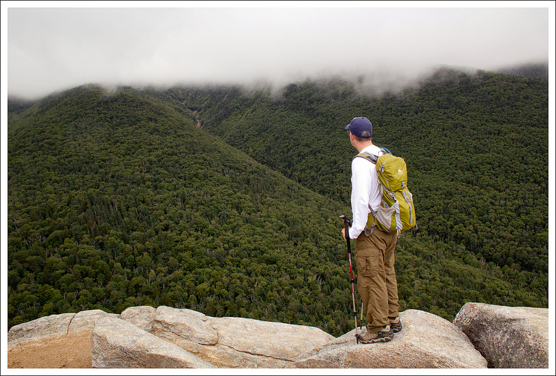
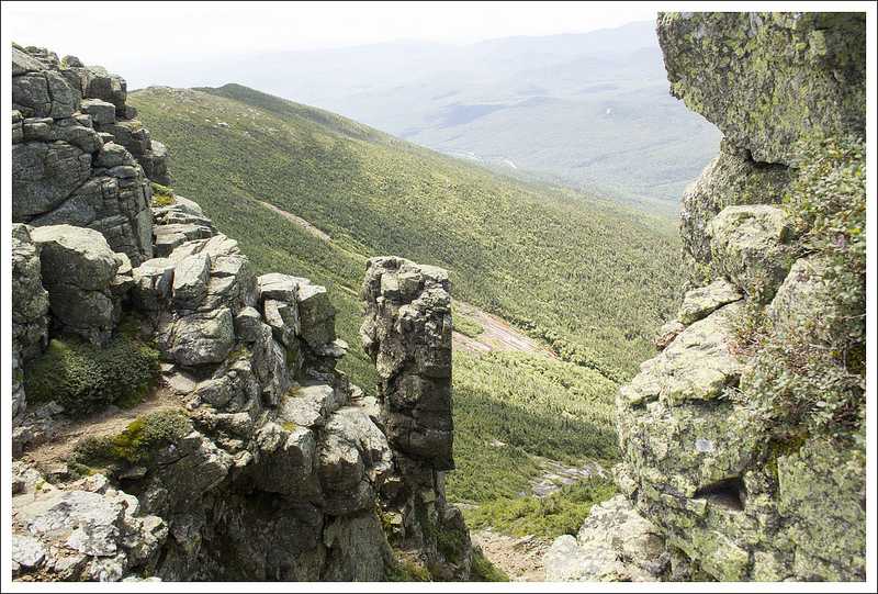
At about 1.5 miles, the trail takes a sharp turn and puts you on on open ledge overlooking Walker Ravine. At this point of the hike, Franconia Ridge was still completely obscured by clouds and fog. Below: The Old Bridle Path has relatively nice footing and climbs steadily, but moderately; They don’t call New Hampshire the Granite State without good reason; Christine is happy to see a clearing view!
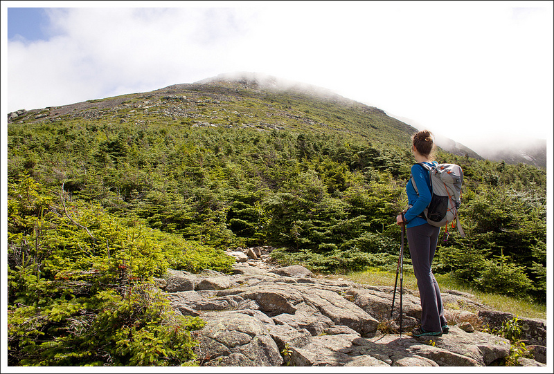
The trailhead was a short 25-minute drive from my parents’ house. The parking area is literally right off I-93, making it one of the easiest hikes to access in the White Mountains. As we approached Franconia Notch, we saw lots of thick, cottony fog still swirling around the summits. Adam and I both expressed a little concern that it might not blow off in time for us to enjoy views, but we pressed on with our plans.
We started off on the Old Bridle Path; climbing steadily uphill over stone stairs, smooth rock and switchbacks. There is nothing technical about this part of the trail. In fact, it’s called the Old Bridle Path for a reason – it’s the route historically used by horses and pack animals. In the 1800’s, there was even a stone shelter and stable at the summit of Lafayette.
About a mile and a half into the hike, the trail comes out of the trees onto an open ledge. If you listen, you can hear Walker Brook roaring in the ravine below. We were able to perch on a rock and look across the notch toward Cannon Mountain. Had it been clear, we would have been able to see Franconia Ridge looming above, but the peaks of Lafayette, Lincoln and Little Haystack were still completely consumed by clouds and dense fog. Adam and I again wondered (and hoped) that the ridge would clear off by the time we reached that point of the hike.
Adam climbs one of the three ‘agonies’ on Agony Ridge. (It really wasn’t that bad!) Below: Christine climbs one of the ‘agonies’; Looking back at Cannon Mountain Sku; Adam takes in the nice view that comes shortly after the second agony.
From the first view, the trail continued more steeply up the ridge. There were a couple more open views along the way, and at each we felt like the clouds seemed to be getting thinner and thinner. We crossed Agony Ridge and it’s three ‘agonies’ – large, steep, stone humps that you must traverse to continue. After the second agony, there is a great view. I was so impressed to look back and see how much elevation and terrain we had already covered!
After the final ‘agony’, the trail leveled out. We passed through misty, lushly vegetated forest. There were colorful fungi, mosses, and Indian Pipes everywhere. Within a couple tenths of a mile, Greenleaf Hut appeared, still veiled by mist.
We were really excited to arrive and have a chance to visit our first AMC hut. It was charming– rustic, but cozy with a nice view of Eagle Lake below. We shared a gigantic Whoopie Pie we had picked up from a bakery in Canaan, NH the previous day. We explored the hut a bit, checking out maps, browsing the library and signing the guest log.
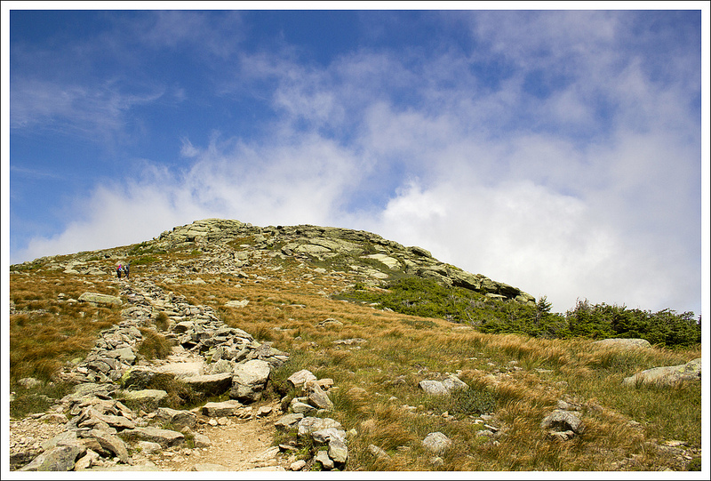
After our brief rest, we made the final 1.1 mile push to the summit of Mt. Lafayette. The route follows the Greenleaf Trail, descending briefly from the hut, past Eagle Lake and then back into a dense coniferous forest. There were so many evergreens that it looked like an overpopulated Christmas tree farm. The thick trees quickly gave way to the Alpine Zone – the rocky, wind-swept area that exists above tree line. The New Hampshire Department of Forests and Land (NHDFL) has a great website and brochure about this climate and ecosystem if you want to learn more.
The climb to the summit was very steep and made even more challenging by the strong winds. The remainder of the cold front and clearing clouds on the summit brought sustained winds over 40 mph, with occasional gusts to 70 mph. We both got our jackets out and prepared for wilder weather. The upside of the strong wind was that it blew away the last of the low-hanging clouds and fog. Views were AMAZING looking back in the direction from which we had just come. We could see the increasingly tiny Greenleaf hut, precipitous ski slopes, tiny Lonesome Lake tucked into a plateau on the other side of the notch, and the dramatic, shining cliff-side of Cannon mountain.
Greenleaf Hut comes into view. Below: We passed briefly into fog and mist near Greenleaf Hut; Indian pipes along the trail; Inside Greenleaf Hut.
We continually plodded uphill until reaching the trail marker at the top of Lafayette. At this point, the Greenleaf Trail ends and joins the Franconia Ridge Trail (which is also the Appalachian Trail). The wind at the summit was insane. I felt like a windsock in my jacket. We decided to go ahead and eat our packed lunch at the summit. To escape the wind, we found a protected place within the foundation of the old shelter/stable that used to be located at Lafayette’s summit. It definitely helped, but it was still really windy! One lesson I learned… don’t pack shredded cheese when wind exceeds 40 mph – your lunch will mostly blow away. I didn’t get to eat much of my cheese, but I had plenty of other windproof options for food, so I didn’t go hungry. 🙂
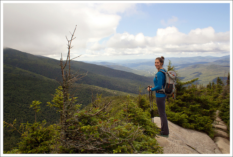
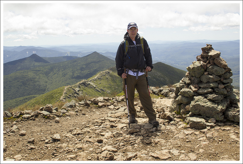
From the summit of Lafayette, the real pay-off portion of the hike begins – 1.8 miles of stunning, spectacular, breathtaking views. From photos I had seen in books and magazines, I knew the scenery along Franconia Ridge would be amazing, but until I saw it in person, I really had no idea how amazing. The beauty almost overcame me emotionally – I felt awestruck and blessed.
The walk along the ‘knife edge’ of Franconia Ridge passed all too quickly. Even though the ridge was crowded with other hikers, I still took every moment possible to appreciate the views and live in that moment. We scaled Mt. Lincoln and eventually made our way over to Little Haystack. It was the best 1.8 miles of hiking of my life!
At Little Haystack, we looked back over the Franconia Ridge Trail one last time. I told Adam, “We’re not even done hiking for the day, but I already want to do that again!’. I can’t even compose words that convey how much I enjoyed that bit of hiking.
On the summit of Little Haystack, Adam consulted a map and I put on my newly acquired knee brace. My knee felt fine, but I knew the Falling Waters Trail would be steep and rocky. I figured a preemptive brace might help me prevent another hard twist like the one I’d experienced on Grandfather Mountain.
Christine looks at the shoulder of Lafayette before making the final push to the summit. Below: Eagle Lake sits right below Greenleaf Hut; you can see it from the dining area windows; From a cairn marking the way, you can look back toward the hut and Cannon Mountain; Christine takes in the amazing view from the shoulder of Lafayette.
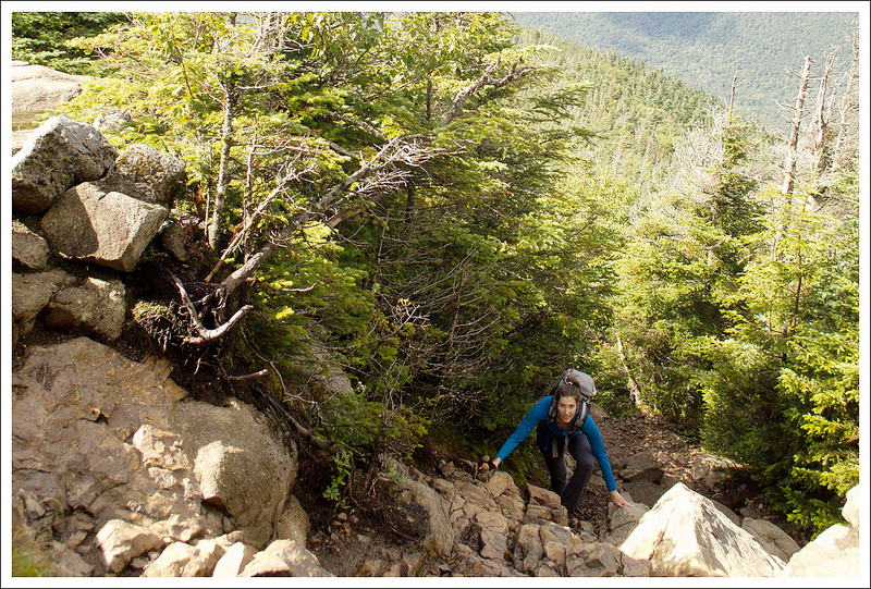
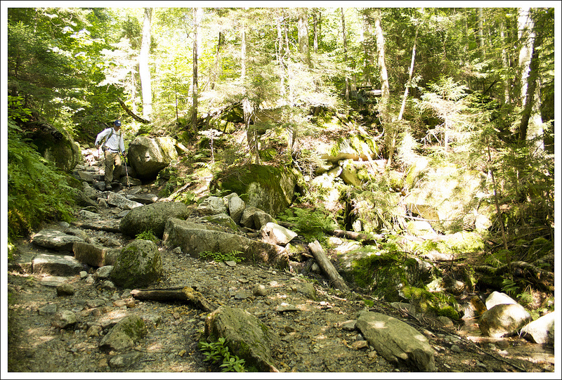
I’m glad I did, because the descent from Franconia Ridge was TOUGH – so much harder than the climb up. We picked our way slowly down the trail – scrambling and climbing ‘crab-style’ over large boulders and loose rocks. In retrospect, it might have been better to ascend Falling Waters and come down on the Old Bridle Path. Experts seem split on the preferred route, our Falcon guide and the Dartmouth Outing Club outline the route we used. However, we learned after-the-fact that the New Hampshire Department of Fish and Game says the Falling Waters Trail is ‘a route normally recommended only for ascending the mountain because of its steepness’. Fish and Game is responsible for hiker rescues in New Hampshire, so their advice is solid.
We saw a lot more people on the Falling Waters Trail than we had on the Old Bridle Path. Some were out for day hikes to see the waterfalls, but others were still making their way up to Franconia Ridge to spend the night at Greenleaf Hut. We saw several hikers that were really struggling; it was later in the day and they still had miles to go to reach the hut. I hope they all made it safely!
On the way down, one of Adam’s knees starting hurting pretty badly. It was hurting seriously enough that I was concerned for him. I offered to give him my knee brace, to take his pack weight – basically to do anything I could to help make his climb down a little easier. In the end, there’s really nothing you can do with pain like that other than take it slow and gut it out. (For the record, after this hike, Adam also acquired his own shiny new knee brace to use the rest of the week. It helped!)
My worry for Adam took a little bit of wind out of my sails. It’s impossible to fully enjoy scenery when you know your partner is hurting. Nevertheless, the Falling Waters trail in incredibly beautiful and scenic. If you think Virginia’s Crabtree Falls presents waterfall after waterfall, this trail has way more falls. I tried to take time to appreciate each of the beautiful waterfalls along the Falling Waters trail. I hoped that the loveliness of the falls would distract Adam a little from his pain, though I don’t think it did.
The spectacular Knife Edge of Franconia Ridge. Below: Christine is blowing up like a windsock on the summit of Lafayette; The foundation of an old stone shelter still sits on the summit of Lafayette – the 6th tallest mountain in New Hampshire; Adam begins the traverse of Franconia Ridge.
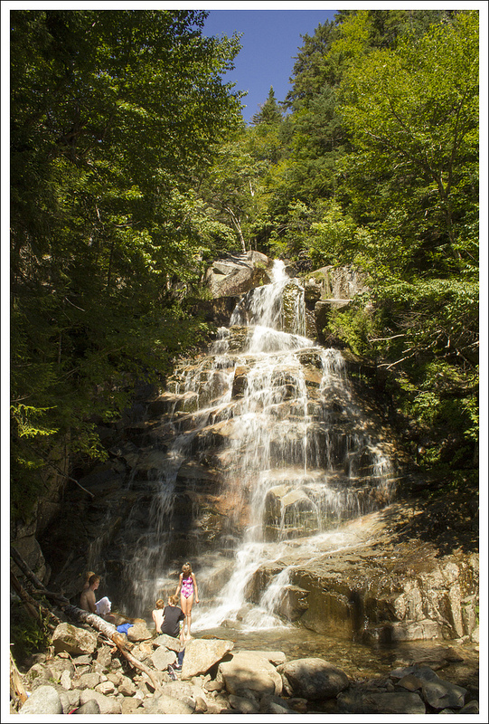
Each waterfall along the trail was unique and had its own special feature. Some slid gently over smooth expanses of rock, some came tumbling out of openings in the forest and some plunged steeply from ledges and spilled into clear pools below. Cloudland Falls was probably the most beautiful of the many cascades.
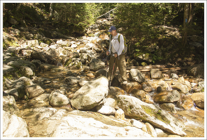
There were a few water crossings, with only one being of moderate challenge. Occasionally the trail would become more level and smooth, tricking us into thinking that the tough terrain was behind us. But the steep, rocky descent just kept coming and coming and coming! The trail finally leveled out for good about a mile from the parking lot. When we crossed the wooden bridge over Walker Brook, we knew we had just a short .2 mile walk back to the car.
Even though I was physically tired, I also felt really energized by all the wonderful things I had seen and the physical accomplishment of completing the hike. It was a great day, and I look forward to doing this hike again someday.
Adam Says…
Christine and I both felt that Franconia Ridge is probably the best hike we’ve ever done. The views are amazing and you definitely feel that you have accomplished quite a feat when you’re hiking along the ridge. This was also probably the toughest hike we had done up to this point. I don’t think we’ve ever done anything with quite this much elevation gain before. After reflecting, we were thinking that we probably couldn’t have done this type of hike a few years earlier when we weren’t in as good of shape. Hiking in the White Mountains is quite tough and you have to be honest with yourself when judging your abilities.
The directions for this loop are fairly simple. We started off from the parking lot heading up a paved path that led us right by a couple of bathrooms. Once you pass the bathrooms, the paved walkway ends. We started our hike on the Old Bridle Path. At .3 miles, we saw a bridge to the right, which crossed over Walker Brook and served as the junction with the Falling Waters Trail, our return route. The Old Bridle Path begins to move away from Walker Brook. The trail begins a moderate climb. At 1.6 miles, you reach “Halfway Corner” and come across “Dead Ass Corner”, an area so-designated because a pack mule that was bringing up supplies to Greenleaf Hut was spooked by lightning and fell to its death. At about 1.8 miles, the trail begins to open up to views of a deep gorge. Across the gorge, you can stare up at Mount Lincoln and (on a clear day) can see your future path across the ridgeline.
Mt. Lafayette looms large behind us on our way to Mt. Lincoln. Below: Christine walks Franconia Ridge; Hikers on the ridge (we liked the red, white & blue); Adam near the summit of Mt. Lincoln – the pointy summits in the background are Mt. Flume and Mt. Liberty.
From this viewpoint, we saw the clouds still hanging on the mountain. We were hoping that the clouds would roll off, but we really weren’t sure if it would happen. We continued upward and the trail led to a few overlooks of the gorge. We looked behind us and were impressed with how high we had climbed up by this point. At one viewpoint, I was watching a thick patch of clouds rolling down the mountainside. I told Christine that I wanted to wait until it crossed down a certain point. I felt that if the clouds were rolling down far enough, we would have some clear views, but the clouds just stuck on the side. I felt my hope for clear views starting to wane, but we pressed on. We saw a few families climbing down that had stayed at the Greenleaf Hut the night before. A young girl told us about the bad storms they had at the hut, but she was having a great time. We thought about how happy she seemed and we thought it was great that her parents had given her such a great experience. The trail started to be a bit steeper at this point, as you reach the area at 2.0 miles called “Agony Ridge”. The footing was a little looser and there were different steep ascents up the different humps. We both felt they weren’t that tough in comparison to some things we have climbed and the “agonies” were over within a short time. At 2.9 miles, we reached the Greenleaf Hut.
Greenleaf Hut is operated by the Appalachian Mountain Club (AMC) and reservations can be made online to stay at this and other AMC huts. Weekends fill up quickly, so plans should be made well in advance. In 1929, the AMC was asked by the state of New Hampshire to run the nearby Lonesome Lake cabins. They agreed, but felt that Lonesome Lake was far removed from the other existing huts at Lakes of the Clouds, Madison Spring, and Carter Notch. After receiving a donation from Colonel Charles Greenleaf, the AMC decided to build the hut at this picturesque location. The hut can accommodate 48 people and is open from early May to mid-October, depending on weather. We hung out a while at the hut. I was pleased to find that the kitchen had leftover pancakes and bacon from the morning breakfast. I always like taking advantage of free bacon whenever the opportunity presents itself. The hut still had a thick bank of fog around, but we felt that it may be clearing off from above.
Franconia Ridge offers dramatic scenery! Below: Looking back over the ridge walk; Adam checks our map on the summit of Little Haystack Mountain.
Continuing from the Greenleaf Hut, you take the Greenleaf Trail and pass by Eagle Lake. The trail dips into a dense pine area and then starts a steep, rocky climb. We followed a path of cairns along the mountainside. The air was cold and the steep hiking had us stopping in a few spots. As we looked behind us, the Greenleaf Hut started to look smaller and smaller and the views were opening up around us. One gentleman that was hiking down Mount Lafayette told us that we may have timed the Franconia Ridge hike perfectly, as the clouds were moving off quickly. We continued the climb until we reached the summit of Mt. Lafayette at 4.0 miles. The wind was blowing strongly and we stopped for a brief moment to get a summit picture of us, thinking this could be good photographic evidence of our hike before we were blown off the side of the mountain. The views were phenomenal as we could see back the way we had hiked and across the gorge to Lonesome Lake and the cliffside of Cannon Mountain, where the Old Man of the Mountain was located.
From the summit, we took a right on the Appalachian Trail. Once we crossed over the rocks of the summit, it helped to shield us somewhat from the winds, but it was still windy and cold. However, we didn’t think much about the wind or cold, since the views were absolutely breathtaking. We were walking along the knife-edged ridgeline with nothing but clear views for hundreds of miles. We can’t even do justice along to Franconia Ridge by trying to describe its beauty in words. The hike along the ridgeline goes up and down for the next 1.8 miles, crossing over Mount Lincoln until you reach Little Haystack Mountain at 5.7 miles.
Christine picks her way through the boulders on the Falling Waters Trail. Below: Adam crosses the stream on the Falling Waters Trail; A beautiful slide fall; Falling Waters is steep and extremely rocky!
Here you reach the junction with the Falling Waters Trail. Take in some last views and then take this route down the steep mountain. The trail enters into deeper forest almost immediately. Boulders and deep steps greet you in a painful climb down. In fact, this trail had me feeling the worst pains I’ve just about ever felt. My left knee was killing me and because I was needing to overcompensate for it with my other leg, that hurt as well. Every step I felt I had daggers shooting up my knees, but I had to press on. We continued down the steep terrain down a zig-zagging trail that then took a more gradual descent near Dry Brook. At 6.1 miles, you reach a junction with a side trail to Shining Rock Cliff. We decided not to go the extra distance, but the Shining Rock Cliff gives you views to Franconia Notch and the granite cliff-face is supposed to be worth the trip if you want to check it out. The trail crosses the stream at 7.3 miles. At this point, you then climb down more boulders on this side of the trail. It rejoins Dry Brook at 7.7 miles, with another crossing. At this point, you begin to see waterfalls along the trail. We passed by Cloudland Falls (7.7 miles), Swiftwater Falls (8.0 miles), and Stairs Falls (8.1 miles) along the path. We began to see a lot more people along the trail at this point, as many families take the trip up to the waterfalls to wade in the swimming holes created beneath the falls. (Taking the Falling Waters Trail to Cloudland Falls is a popular and moderate family hike.)
To be honest, the pain was so bad for me, I barely stopped to look at the falls. I needed the hike to be over soon, since I was in excruciating pain. I regret that I wasn’t able to take the time to enjoy these beautiful falls, but I couldn’t focus on anything other than where my next step was taking me. We finally reached the bridge to rejoin the Old Bridle Path Trail at 8.7 miles. We took a left here and made our way back to the car.
Cloudland Falls was the largest and prettiest of the waterfalls on the Falling Waters Trail. Below: Other smaller falls on the trail.
Despite the pain I was feeling, I was so glad we did this hike. I know Christine was already wondering if I would ever be willing to do this hike again. She realized what I was going through and thought this may be something I wouldn’t want to do again. However, I would go through all the pain again to do this hike. It is truly that remarkable. I think next time though, I would probably recommend climbing up Falling Waters Trail (which appeared to be what most people did) and then heading down the Old Bridle Path for this loop. So, to put this as a public promise to my wife – we’ll do this hike again.. The views here are the best I’ve ever seen, and there is no way that I would not want to see them again.
Difficulty – 5. This is a tough one! The climbing is challenging, but the descent is actually harder. The walk along the open knife’s edge of Franconia Ridge makes all the challenge worthwhile.
Trail Conditions – 3.5. Nice trail conditions, but lots of rocks, boulders and a few possibly challenging stream crossing.
Views – 5+. WOW, WOW, WOW – what an amazing gift to visit this place on a clear day, because the views are magnificent.
Waterfalls/streams – 5. On the descent of the Falling Waters Trail, Walker Brook presents waterfall after waterfall.
Wildlife – 1. We saw far more people than animals, though we did cross paths with an angry, chattering (but adorable) red squirrel.
Ease to Navigate – 4. Trails are well marked.
Solitude– 0. Everybody who is physically capable (and some who are not) wants to hike this trail. It’s one of New Hampshire’s most popular dayhikes and also provides access to Greenleaf Hut.
Directions to trailhead: Head north on I-93 until it becomes Franconia Notch Parkway. Pass exit 1 and the exit for the Basin. Take the next exit (for trailhead parking). Park in this parking lot and the trailhead starts near the large billboard sign with the map of hiking trails.
* MapMyHike is not necessarily accurate, as the GPS signal fades in and out – but it still provides some fun and interesting information.


