This four mile hike is included among New Hampshires ‘52 with a View‘ – this list is composed of ‘view hikes’ with summits under 4,000 feet. They’re generally considered milder hikes compared to the above-treeline 4,000-footers. Mt. Israel is still a steep climb – ascending close to 2,000 feet in two miles. The view at the top wasn’t as nice as many other hikes we’ve done in the area, but it was still a good choice for a beautiful summer day.
A few of Mt. Israel from the valley floor. Below: The Mead Base Conservation Center; The trailhead; Stone stairs.
Christine Says…
Our last day of vacation was the only day we had low-humidity, cool breezes, and bluebird skies! We had packing to do, so we needed a final hike that was relatively short and located close to my parent’s home. Mt. Israel was another hike we had passed over in our hiking guide several times. The route outlined in the book was an 8-mile loop with quite a bit of road walking. Generally, I prefer to avoid road walks, so we had always opted for other hikes. Then, I happened to stumble across a four-mile, no-road-walking route on the ‘52 with a View‘ list, and decided that Mt. Israel might fit the bill after all.
Parking for this hike was at the Mead Base Conservation Center. The center has programming, concerts, community events, camping, and plenty of parking for day hikers. Our route to the top, the Wentworth Trail, starts just to the left of the building (as you’re facing it). The hike gets off to a quick ascent and is relentlessly uphill all the way up to the ridgeline. Like most New Hamsphire trails, there are lots of roots and rocks. There are a few places with slick slab granite, but they’re not terribly steep or extensive. The terrain is generally simple and non-technical.
On the climb, you get an obstructed view of Squam Lake. Below: More scenes along the trail.
The first view comes from a little rocky outcropping about a mile and a half up the mountain. It’s obstructed, but if you peek over the trees, you’ll get a nice look at Squam Lake. You can’t see the lake from the actual summit, so this is a good spot to get a different vista. Shortly after the lake view, the trail levels out and goes through a mossy, piney, boggy area. Right before the ledges, you’ll pass the junction with the Mead Trail. The Mead Trail and Guinea Pond Trails are part of the loop I mentioned earlier in the post.
After the junction, you walk a short distance out onto a series of rock ledges. From the first ledge, bear to the right and continue following the trail through the trees. There is a little bit of very mild rock scrambling through a little saddle before you come out on more ledges. These ledges are more open and provide a nice mountain view. The actual summit of Mt. Israel supposedly is marked by a large cairn – however, it appeared to be mostly toppled when we hiked. The rock pile had once clearly been a cairn, but it was reduced to a gathering of football sized rocks.
We sat on the summit for a while, enjoying the picture-perfect day. We always love the time we spend in New Hampshire and appreciate the endless options for trails the area provides. We eventually made our way down, following the Wentworth Trail again. On our way home, we stopped one more time for lobster rolls at our favorite little lakeside shack. Until next time, New Hampshire!
Views from the climb of Mt. Israel.
Adam Says…
As Christine said, this was our last day before heading back to Virginia. We had trouble picking a hike for the last day. We love it when we can get an amazing hike to remember, but this wasn’t one of the best up here.
I would say that this is a great trail for trail runners. From my experience with trail runners, they tend to look more out for where their feet are stepping and less on the scenery around them. A trail like this one would give plenty of challenge with terrain and elevation gained, but the summit is less than ideal.
Christine enjoying the summit views from Mt. Israel. Below: The junction of the Wentworth Trail and the Mead Trail; Summit scenery.
The hike started off in thick forest and had some areas of rocky areas and narrow trail. There wasn’t anything dynamic to talk about much during the hike until we reached the view for Squam Lake. The view of Squam Lake in the distance was nice, but was probably nicer 10-15 years ago before the trees obstructed the view. About half a mile past this viewpoint, you reach the summit. The summit is actually just a larger boulder that you can climb to take in the view. Again, the trees growing up here has obstructed a lot of the view. We spent a while walking around from the summit boulder to try and see if there was a nicer spot for a viewpoint, but after investigating for quite some time, we found things were obstructed in every direction around here. We enjoyed a snack at the top before heading back. It is always nice to take in some New Hampshire mountain views, I just wish it had been more dynamic for our last hike of our visit. This may be in the ’52 with a view’ list, but there isn’t much of a view keeping this on the list.
Trail Notes
Distance – 4 miles
Elevation Change – 1808 feet
Difficulty – 4. The climbing is quite steady, but there is nothing tricky or technical.
Trail Conditions – 4. Trail clubs in the area have taken very nice care of this trail. There are some obvious improvements with stairs, waterbars, and grading along the route.
Views – 3.5. They weren’t as nice as we hoped for. Trees have grown taller, obscuring a lot of the view.
Waterfalls/streams – 0. None of noteworthiness.
Wildlife – 3. Normal squirrels, birds, and chipmunks.
Ease to Navigate – 4.5. The Wentworth Trail is a straight shot to the summit. There is one place that seems like it’s the top, but is actually a false summit. If you look out toward the view, the trail actually continues through the woods to the right. The actual summit is a few hundred yards past this point.
Solitude– 3. It’s a fairly popular trail with locals. We started early and saw a small handful of people, all on our way down the mountain.
The Albany Covered Bridge. Below: Parking for the loop; Trail signage; Boulders on the route.
Adam Says…
One challenge we face often with hiking in New Hampshire is trying to pick a hike that will work for that day. Typically, weeks before traveling there we are stockpiling a bunch of hike ideas knowing that we will likely adjust to what the day gives us. The night before, we are consulting weather sources (what type of cloud coverage is in the high peaks, when showers may start, etc.), looking at how long a drive we have for the next day, and determining how the day will all fit together with meals and plans for other activities. When you’re on vacation you want to make the most of the time you have. The weather was telling us there would be some cloud coverage in the high peaks of the White Mountains, so we tried to look at some lower elevation plans. Knowing we were going out to eat for a long breakfast and showers that were likely coming in the afternoon, we felt we needed to pick something shorter. So, we decided to give this Boulder Loop a try. A few books we had read didn’t make us feel overly excited to try it, but once we were done with this one, we would highly recommend it.
Massive boulders on the route. Below: Rocks to climb; Pretty evergreen forest with lots of rocks; A nice view before reaching the ledges.
We started off with a mostly empty parking lot. We are always early morning hikers to beat the crowds and we were glad that we did. We crossed the road and started on the trail. The beginning starts with a slight incline. At .2 miles, you come to a junction sign; either way leads to the ledges, but we headed to the left as our books had mostly done. The boulders on this lower elevation section are quite impressive, and you can just imagine the power of glaciers dropping off these large masses of rock before melting away. The yellow-blazed trail steepens through sections of rocks and roots, quite common for well-traveled trails in New Hampshire.
At the 1.2 mile marker, we came to a crest of the hill we had climbed. I noticed a rocky path off to the right leading up and decided to take it. Sure enough, this was the way we should have gone. There is a sign marked “View .2 miles”, but it is placed on a tree facing the other direction of the trail, so be sure not to miss this. We feel that many people could miss it if they weren’t paying attention and then miss all the glory of this hike. We climbed up and stayed on a yellow-blazed path that led first to a rock outcropping for some amazing views and then to a larger cliffside. Be careful up at the top of these cliffs. There is a large sharp dropoff from the viewpoint and something you don’t want to do with reckless children. While the views aren’t as high up as some of the 4000+ nearby White Mountains, they are quite impressive. We could look over to Mount Chocorua and Mount Passaconaway on clear days. We stayed up here a while until we could see clouds moving in. We then went back the way we came off the spur trail until we reached the junction again with the boulder loop.
From here, we went down to the right to continue the loop. We began to see more people coming up so we knew we beat the crowds for this hike. Based on the exhausted looks on the faces of those coming up the other side, we knew we picked the best route to ascend. The way down did seem to be steeper and rockier than the way we had come up. On the way down, you really can enjoy the openness of the forest and when you descend low enough walking through the large boulder field is impressive. The return trip from the junction was 1.2 miles back to the initial junction of the loop trail and we made it back very quickly with the descent.
We took a left at the junction and had a short .2miles back to our car. We were impressed with how the combination of the boulder field with the expansive views from the top make this a wonderful hike when you are trying to fit in a short hike into your day.
New Hampshire’s rocks and roots. Below: The spur trail out to the view; Rocks to negotiate.
Christine Says…
We’ve flipped past the Boulder Loop in our New Hampshire hiking guide, year after year, for many years now. The hike just didn’t look fun or pretty. The only photo the book included was one of a middle-schooled aged boy looking at a shelf fungus growing on the side of a tree. Sorry, but I don’t hike for fungus! However, this year – upon closer inspection – I noticed that the long text description of the hike mentioned ‘views from a ledge’. After that, I Googled ‘views Boulder Loop hike’ and found some amazing photos in the results.
We knew bad storms were on deck for the afternoon, so we decided the short Boulder Loop would be a great choice for a quick hike. We started the morning with a big breakfast with my parents at Polly’s Pancake Parlor. The restaurant is a family tradition and we always try to eat there at least once on every visit. After breakfast, we made our way back to Lincoln and hopped on the Kancamagus Highway. The highway is a scenic drive through White Mountains National Forest. There are sweeping vistas and pull-off viewpoints along the road – it’s kind of like Skyline Drive in Shenandoah National Park (but free.) We found our trailhead right along the highway, next to the Albany Covered Bridge.
Views from the ledges on the Boulder Loop. Below: More views from the Boulder Loop ledges.
We found the lot nearly empty, and paid the day-use fee for parking. I took a few photos of the bridge and the river before hitting the trail. The Boulder Loop is an interpretive trail with numbered stops and descriptions. It would probably be fun for a family who wanted to take lots of breaks along the route. We skipped that aspect of the hike and just focused on reaching the views.
We hiked the loop clockwise, passing enormous lichen-covered boulders. The trail climbed steadily uphill over lots of roots and rocks. Eventually, we reached the ridgeline and came to our first viewpoint. We could see the road and the river below, a plunging cliffside lower in the valley, and mountains as far as the eye could see. It was GORGEOUS!
After the first view, we continued along until we found the sign for the spur. The sign says ‘viewpoint’ on a small wooden plaque. It’s kind of small and blends in to the forest, so be sure to keep your eyes peeled. To follow the spur, look for faint blazes on the rocks. The spur goes for about .15 mile over rocks and ledges with several places to stop and take in the views. We could see lots of mountains in every direction, but Chocorua was especially recognizable with it’s stone dome. We both remarked to each other that the ‘kid with the fungus’ was such a disservice to this beautiful hike.
More Boulders on the descent.
After soaking in the scenery and watching clouds roll in from the distance, we followed the spur back to the main junction. We continued clockwise on the loop. At first, the trail dropped quite steeply over loose dirt and rocks. Eventually it leveled back out, passed through another cool boulder field, and returned us to the parking lot near the covered bridge. The hike was such a pleasant surprise – relatively easy terrain with excellent views at the top.
After packing up, we made our way into North Conway to get lunch at Moat Mountain Smokehouse and Brewery. It’s one of our favorite lunch stops – they make great nachos.
Trail Notes
Distance – 3 miles
Elevation Change – 1161 feet
Difficulty – 3. Some of the sections are quite steep, but the shortness of the overall trail makes this one a popular family hike.
Trail Conditions – 4. The trail was in good shape, but the rocks and roots can make this a challenge in some parts.
Views – 4. Nice 180 degree views from the cliff summit.
Waterfalls/streams – .5 We passed a small stream through the mountains on the way back, but nothing impressive.
Wildlife – 2. Evidently, bears can be spotted here in the fall. May be a good place for birdwatching at the low and high elevations.
Ease to Navigate – 4. It is a self-contained loop. It loses a point since the trail to the view isn’t clearly marked on both sides. Be watching when you crest the high point on the trail.
Solitude– 2.5. As mentioned above, this is popular with families, so you will likely see people along the way. Time this for early morning or late in the afternoon to maximize your solitude.
Trail Map:
Click to download full size map
Elevation Profile:
Click to download full size elevation profile.
Directions to trailhead: Parking coordinates are 44.005395, -71.239270. There is a day fee for parking in this area. You will cross the Albany Covered Bridge and park in the lot labeled Boulder Loop Parking.
This 8.7 mile stretch of Appalachian Trail is pleasant but unremarkable. It’s a walk in the woods, over rolling terrain, that ends in downtown Hanover, NH (where you can eat gelato).
The hike begins in shady, muddy woods. Below: AT benchmark; Ewww… mud; There were lots of swampy, buggy spots along the trail.
Christine Says…
The summary above doesn’t make this hike sound very exciting – it wasn’t. You might ask, “Why bother to hike this piece of trail when there are so many other amazing hikes in the area?” Well – it was convenient, we had a shuttle ride from my parents, and it let us add to our mileage toward one day completing the entire trail. Not every mile of AT is sweeping vistas and babbling brooks. A lot of it (ok… most of it) is a long green tunnel. It’s not always thrilling to walk the trail, but it’s rewarding to take little steps toward completing a goal.
We hoped to get out on a three-day backpacking trip like we did in Vermont last year, but with a new puppy (Indy) to care for and a long run of unusually hot, stormy weather; we settled on just day hikes for our 2018 NH trip. Adam found this stretch of trail in our AWOL AT Guide and figured it would be easy to knock out on the same day my mom had an all-day baking class in Hanover. We left our car parked in a small lot along Three Mile Rd. near Etna, NH. From there, we walked south toward Hanover.
This section of trail was much easier than what you imagine when you think of typical Appalachian Trail in New Hampshire (granite slabs, boulder scrambles, 4,500 foot climbs, exposed cliffsides, and violent storms that blow up out of the blue). This piece of trail had soft footing, gentle hills, and barely more than 1,200 feet of climbing over the entire 8.7 miles. It was extremely muddy in places and there was one extremely steep but brief climb and descent near the midpoint, but the challenges were few and mild.
There are many meadows along the AT. Below; We saw so many indian pipes; the cemetary on Etna-Hanover Center Rd; Dartmouth Outing Club (DOC) signage.
There’s really nowhere to get lost on this section, either. There are some road crossings, junctions with other trails, and parts of the trail have two names. The Dartmouth Outing Club maintains the trail and shelters in this area, so they’ve given club names to parts of the AT. You’ll see bright orange signs with the DOC logo and names like the Hanover Center Trail and the Velvet Rocks Trail. They’re both still the Appalachian Trail, and as long as you keep following the white blazes, you’re going the right way.
We stopped for lunch at the top of the only steep uphill climb of the hike. It was along part of the trail known as ‘velvet rocks’. I’m going to go out on a limb and guess that the name was given due to the abundance of huge, moss-covered boulders all along the trail. They really do look like rocks covered with plush green velvet. There was no view at the high point, so we settled for eating lunch on a big flat rock right along the trail. I had a poorly-chosen lunch of crackers, cheese, and pepperoni for lunch. I know sealed pepperoni stays fresh and safe even in hot weather, but there’s something so unappealing about sun-warmed meat. I ate it, but I also gagged a bit. I should have known better – I can’t even look at beef jerky without being nauseated, so pepperoni isn’t all that different. We also brought a HUGE lemon-blueberry whoopie pie from a local bakery to share. That was much more palatable than the slimy meat.
The descent from our lunch spot was really steep and muddy. There was even a rope tied between a few of the trees to act as an assist, but I was able to manage it by crab-walking downhill. About a three quarters of a mile past the lunch stop, we reached the blue-blazed northern access spur to Velvet Rocks Shelter. The spur trail to this particular shelter has both northern and southern arms. Hikers that use both arms of the spur miss a .6 miles the AT (missing any of the AT is a big deal to ‘purists’.) The sign at the northern spur said the shelter was .4 miles away. The northern spur also went straight up a very steep, rocky hillside, so we decided to continue south on the AT and access the shelter at the southern arm instead. The shelter was an easy .2 mile walk via the southern arm of the spur.
Much of the AT in this area is a narrow corridor through private land. You’ll see many old stone walls. Below: One of the many pretty small streams we passed; Pine forests are nice; Orange DOC signage.
Velvet Rocks shelter was very old and dingy-looking. There was an old tarp slung over the wall and lots of dumb graffiti. There was no sign of a shelter log, either. I think if I were thru-hiking or on a long section hike, I’d skip this shelter and just stay in Hanover. When we visited, there were a couple south-bound thru-hikers already stopped for the day around 1:00 p.m. They both said they were hot and fatigued and didn’t feel like hiking anymore. It really was a sweltering day, and we knew we only had about a mile and a half to go before we were in downtown Hanover.
The next .75 miles was all downhill through shady forest. The trail exited the woods in Hanover right behind Dartmouth College athletic fields. We walked along the fenceline and turned right onto NH 120. There was a Co-op Grocery store right on the corner, so we got a couple cold drinks and sat in the shade. The last three quarters of a mile of ‘hiking’ were just a stroll through town. We had to pay close attention to find white blazes marked on lightposts along the road. There was no shade and the mid-day sun was beating down on us. Despite being completely flat, this was probably the hardest part of the hike because it was just so hot! We finally got to our meet-up spot. I had time to wash my face and wipe the mud off my legs in the Dartmouth bookstore. No one even looked at me funny – a sure sign that a town is used to hikers and backpackers.
My dad picked us up and took us to Morano Gelato – so good! After that, we went to the Cabot factory store and ate free cheese. Then we went to King Arthur Flour company and ate cookies while we waited for my mom’s baking class to end. And then we went out for a proper dinner. It’s a lot of eating, but I think we earned it. After dinner, my parents drove us back to where we had parked our car earlier in the day. Then it was home for showers and relaxing!
Adam Says…
Hiking is often about changing plans for us. As Christine mentioned, we had initially came up with some plans for doing a multiple day backpack of the Appalachian Trail. But, with a new puppy, we didn’t want to subject the babysitting grandparents to the attention he needed (he has been an extremely high-energy puppy). So, I looked up some possible day hikes we could do to still cover a tiny bit of New Hampshire AT miles. It is a goal of ours (we will see how attainable, ultimately) to hike the entirety of the Appalachian Trail in sections. Working full-time with limited time off, we have to do what we can for now. We will hopefully finish what we have left when we retire, so this hike was a way to knock off a very tiny percentage of the trail and connect to our trip last year with a few more contiguous miles. We coaxed Christine’s dad to pick us up in Hanover and drive us back to our car, so the change in plans worked well for us.
I’m pretty sure the Velvet Rocks area is named for these huge moss-covered boulders. Below: This pond was so full of cattails, we couldn’t even see the water; Our lunch spot at the top of the only big climb of the hike; Side trail to Velvet Rocks Shelter.
It took us a little while to find our start point for the trail on Three Mile Road with questionable GPS service that made it difficult to navigate some of these backroads. But, we ultimately got to the correct road and found the AT crossing and a place to park our car on the side of the road. We started off at the road crossing and headed south on the white-blazed Appalachian Trail. The initial trail marker showed we had 8.6 miles to reach Hanover, NH. The trail started off through the fern-covered woods heading slightly downhill through a muddy area. Green was all around us in this lush forest setting. At 2.5 miles, we crossed over the paved Etna-Hanover Center Road (heading east under a mile would lead you to Etna, NH), where there was a cemetery on the opposite side of the road. We crossed the road and continued on with this trail marked by the DOC signs Christine mentioned above.
Shortly after crossing the road, you walk over a couple of footbridges carrying you over a stream. The trail opens up a bit after this where you cross over a field before entering back into the woods. You cross over the paved Trescott Road at 3.9 miles and then pass over a boardwalk over a marshy pond at 4.6 miles. From here, the trail begins to climb up and does reach a very steep section that will reach its peak at 5.4 miles. At the peak, we took a break and ate some lunch before pushing on. The trail descended and then we reached the junction with the north shelter loop trail at 6.2 miles. At this point, we did start seeing some people that were hiking about on this loop trail to check out the Velvet Rocks area. We saw the many mossy boulders that give the area the name ‘Velvet Rocks’. We passed the northern spur to the shelter and decided to stay on the AT. At 6.8 miles, we reached the southern shelter sidetrail and took a break to go check it out. While the sign said it was only .2 miles away, that was the longest .2 miles we have ever seen (it felt more like .35 miles). When we got to the Velvet Rocks Shelter, we were able to talk with a few people that were staying there and doing some larger sections of the AT. We went back the way we came to rejoin the AT (I didn’t include this side trip in the mileage totals).
From the junction with the shelter sidetrail, it was a steep downhill climb until we came out of the woods near a Dartmouth sports field. The trail continues along the back wall of the field and comes out by a convenience store onto NH 120. We took a right at the road and walked by a Food Coop and got a fresh drink. It was just a short walk from here into town to meet up with Christine’s dad, but the exposure into the sun made for a hot walk back into town. We did cool off a bit with some nice gelato. This was a great hike to do if you can have two cars or a pickup plan like we did. The terrain was relatively easy and it is always good to end a hike at a town with lots of amenities.
Velvet Rocks Shelter. Below: Pretty pine-needle forest floor; Some minor rocks on the final descent into Hanover; The trail comes out of the woods behind a Dartmouth Athletic Field.
Trail Notes
Distance – 8.7 miles
Elevation Change – 1204 feet
Difficulty – 2. This is a really easy stretch of Appalachian Trail – especially for New Hampshire. Our only real challenge was the heat.
Trail Conditions – 3. The trail is in nice shape, but was quite muddy when we hiked.
Views – 1. There are a few minor views in small meadows, but nothing grand.
Waterfalls/streams – 2. There are lots of small streams that provide adequate water sources.
Wildlife – 2. Squirrels, birds, and chipmunks!
Ease to Navigate – 4. Just follow the white blazes. The only misdirection might come from the dual-named DOC trails.
Solitude– 2. Expect to see a good number of people when you’re close to a large college town.
Trail Map:
Click to download full size trail map.Click to download full size elevation profile.
Directions to trailhead:
Parking coordinates are 43.718 -72.176. There are two parking areas along Three Mile Road near the Appalachian Trail Crossing. This is a gravel road.
Mt. Kearsarge is located in state park land in Central New Hampshire with 360-degree spectacular views from the summit. On a clear day you can see Mount Washington, the White Mountain range, Merrimac Valley, and Vermont’s Green Mountains.
The summit of Kearsarge is marked by a large cairn.
Adam Says…
Mt. Kearsarge kept popping up on lists of hikes we had not done in New Hampshire that had amazing views, so we decided to tackle it on a day where we could capitalize on the views. The hike starts off in Winslow State Park, reached by driving up Kearsarge Mountain Road and then taking a right on Winslow House Road to the top. The area at the top of the road is a large picnic area, with shelters and outdoor grills that would be perfect for a family gathering before or after the hike. The trail starts through an opening in the trees, near the southern back corner of the parking lot.
You quickly reach a large kiosk that shows the split of the loop trail. We took the Winslow Trail up and returned via the Barlow Trail. The Winslow Trail was quite steep and led through a lot of trail that was filled with lots of roots and rocks. If you do this hike after a lot of rain, expect it to be quite slick in some spots. The trail had us going a bit slow since it was a steep trail that required you to watch your foot placement in order to not twist your ankle.
The Winslow Trail is a steep one mile climb to the summit. Below: The Winslow and Barlow trails make a loop over the summit of Kearsarge; A little mud; Lots of rocks and roots.
The trail then passed a large split boulder on the left around .8 miles. We were able to climb up to the top of this rock and then look behind us which opened up some views that were getting near the top of the tree line. At .9 miles, we reached the top junction with the Barlow Trail and we pushed on from here to reach the top shortly after at the one mile mark. The tower was in the middle of the huge rock expanse, but there were views all around. We took some time to enjoy the views all around. Fairly soon, we were joined by a few other hikers that had approached the summit via Rollins State Park – this is a shorter hike to the top of Mt. Kearsarge. We first talked to a woman with her great niece. The niece was probably about 11 years old and was not a fan of the hike or views. She didn’t want to even look at the views. She just wanted to know if she could touch the rock and leave immediately. I could tell the great aunt was disappointed that her niece didn’t enjoy nature like she did, which was disappointing to witness. The next person was a young woman from New Jersey that came here to do a quick day hike. She had also approached from the Rollins State Park side, but she was hoping to make a larger loop and ended up adding the Winslow and Barlow trails to her day.
We then went to the fire tower. Christine decided to climb to the top, but when I felt the rickety nature of the structure and was nearly hit by squirrel droppings from a squirrel that Christine had upset, I decided to just wait at the bottom. Some men soon arrived to do some maintenance work on the dishes and they were talking about some of the mountain ranges around us. While I am sure they are doing some hard work, I was envious wishing I had an office view like this one.
New Hampshire is called The Granite State with good reason.
We made our way back to the junction at the edge of the treeline with the Barlow Trail and followed the yellow blazes for this way back down. We continued along the top as we walked by an alpine bog and then to some other views. Dragonflies were everywhere at the top and it was neat to see so many of them at this high elevation. We were glad we did the loop the way we did since we had views ahead of us on the way down. The trail had some steep sections going down but weren’t nearly as treacherous as the way up. Most of the trail was deep in the woods, but it was pretty scenery all around us. We eventually made our way back to the lower junction between the Winslow and Barlow trails at 2.6 miles and then took a quick turn to the parking lot and we were done. While the trail was a shorter one at 2.7 miles, the hike up took longer than we would have normally taken and the views at the top will make you want to take a large break to take it all in.
The books we had read and internet research we had done in advance probably didn’t give this hike enough credit. This is definitely one to hit while in New Hampshire. The length of the hike may also make it suitable for a lot of families and there is a wonderful picnic spot where you park to make this a memorable experience for the entire family.
The first views from Kearsarge on the ascent. Below: We had to crossed some slab granite. Fortunately, it was dry; Cairns mark the way over granite; Cell phone tower and an old fire tower on the summit.
Christine Says…
Mt. Kearsarge was our first new hike in New Hampshire during our summer 2018 trip. The small, but prominent, mountain is located in the Dartmouth-Sunapee region. Geologically, the mountain is what is known as a monadnock – a mountain that rises steeply and abruptly from relatively flat land. This type of mountain always looks taller and more imposing than it is in reality. It was a fantastic choice for an easy morning hike – great views, fun terrain, and not too lengthy. We chose to ascend on the Winslow Trail and then come back down on the Barlow Trail, making a 2.7 mile loop.
The Winslow Trail is shorter and quite a bit steeper than the Barlow Trail. I always think it’s nice to tackle the tougher terrain when my legs are fresh. I also appreciate the challenge of a tough climb. Upon entering the woods, the trail is soft and covered with pine needles. However, the trail footing soon becomes rooty and rocky. Red blazes will help you navigate across jumbles of boulders and granite slabs.
The summit view from Kearsarge is fantastic. Below: Adam at the summit cairn; There is an elevation sign and a couple picnic tables next to the tower; Christine enjoys the views.
Your first views from the mountain come from atop a huge split boulder right before you break the treeline. This is also where the junction with the Barlow trail is located. You’ll pass the junction at this point and make your way toward the summit. In the bald, open area, cairns are used to guide hikers to the top. The park has posted several signs imploring hikers NOT to build new cairns. Moving rocks disrupts nature and building new cairns can make wayfinding confusing for hikers.
The summit of Kearsarge is marked by a big rockpile. From the top, the view rolls out in every direction. It’s GORGEOUS! When sky conditions are clear you can see the imposing White Mountains and Mt. Cardigan to the north, the Merrimack valley to the south, and to the west are Vermont’s Green Mountains. Just below the summit, the vista is interrupted by an old fire lookout and a communications tower. There is also a picnic area and a sandwich-board sign noting Kearsarge’s elevation (2,937’).
We followed the longer Barlow Trail for our descent. Below: A small alpine bog; The descent on the Barlow trail had lots of nice views; Blueberries – some of the only ones we saw on this year’s New Hampshire trip.
While the towers aren’t pretty, they barely detract from the magnificent views in every direction. I climbed the tower while Adam hung out below. On my way up the stairs, I encountered a very angry red squirrel. I thought he was going to dive-bomb my face, but he settled for loud chattering. The view from the tower wasn’t really any better than the view from the summit, so I made my way back down and found a nice rock to sit on.
After taking in summit views, we made our way downhill to where the Winslow and Barlow trails meet. The yellow blazed Barlow Trail passes across open areas with more stunning vistas. We saw blueberry bushes and a small alpine bog on our way down. When we visited, dragonflies were swarming the mountain. If you look closely at our photos, you’ll see loads of them!
Eventually, the trail will traverse some slab granite and dip back into an evergreen forest. The trail continues downhill over roots and pine needles. There is one small footbridge over a swampy area near the end. The trail ends at the initial Winslow-Barlow junction near the picnic area at Winslow State Park.
Pretty evergreen forests of New Hampshire. Below: Scenes of the descent along the Barlow Trail.
Trail Notes
Distance – 2.7 miles
Elevation Change – 1224 feet
Difficulty – 3. The trail was steeper than we would have expected, but take your time.
Trail Conditions – 3. Due to the steepness and the abundance of roots and rocks, this could make for a more difficult hike after heavy rainfall.
Views – 5. 360-degree views all around from the summit. There is a fire tower that obstructs some of the view but you can rotate around it to take it all in.
Waterfalls/streams – 0. Non-existent.
Wildlife – 2.5 A decent spot for bird-watching and squirrels.
Ease to Navigate – 4. The trail was fairly well-blazed. The junctions may make things a bit tricky, but follow our map.
Solitude– 2. This is a popular spot and with two approaches to the summit, you may not realize how many people you may see at the top. You should be able to carve out your own solitude at the top since there are views all around.
Trail Map
Click to download full size map.
Elevation Profile:
Click to download full size elevation profile.
Directions to trailhead:
Coordinates for this hike are 43.390281, -71.868260. The trailhead is located in New Hampshire’s Winslow State Park in Wilmot, NH. There is a fee to enter the park.
We did this 4.6 mile hike on an especially beautiful, misty summer morning. It was a moderate climb with lots of interesting things to see along the way – from an old sugar house to the headwaters of a flume gorge, to the lovely viewpoint.
Beautiful misty sunshine on the Kinsman Trail. Below: Trailhead sign; Early parts of the trail.
Christine Says…
This was the last hike of our 2017 trip up north. By the end of two weeks that involved five different dayhikes and a three-day overnight backpacking trip, we were both sore, bruised, and covered with bug bites and scratches. We were both pretty tired, but the weather was nice and we felt we should squeeze one more quick hike in before the long 12-hour drive home. The hike up the Kinsman Trail to Bald Peak was close to my parents’ house and didn’t look too grueling, so we decided it would be the perfect grace note on our wonderful summer vacation.
We parked in the lot for the Kinsman Trail on Route 116. We arrived early and there were plenty of open spots, however it was overflowing by the time we got back to the car around 11:00 a.m. The trailhead is popular as it provides access to the 4,000 footer, Mount Kinsman. Bald Peak isn’t a true summit, it’s a rocky outcropping on the shoulder of a mountain. While it might not be the pinnacle, it provides nice views and is well worth doing.
The first half mile of the hike meanders along single-track trail through the forest. The terrain is rolling and there are abundant ferns and shady hemlocks along the way. At .5 miles in, the trail will arrive a a junction with a wider, road-like trail. Take a right onto the wide trail. In a tenth of a mile, you’ll pass a neat, but overgrown, sugar house. It didn’t look like it had been used in many years. Follow the road/trail for another half mile before coming to another junction. Bear to the right, continuing to follow the steepening blue-blazed Kinsman Trail. Keep an eye out for the blue blazes to keep yourself on track.
This rundown, old sugar house is right along the trail. Below: Scenes along the Kinsman Trail
About .35 miles later, you’ll make your first stream crossing – there are several on this hike, along with several lovely (albeit small) waterfalls. The waterfall pictured below was at the second stream crossing. Continue following the Kinsman Trail for .65 miles to your third stream. This is Flume Brook. Once you cross the water, look for a small sign pointing to the right. Follow a spur trail steeply downhill along the gorge. The rock walls that make the flume are steep and deep, but you will hear water rushing in the gorge below. Be careful looking down into the gorge – the terrain around it is extremely steep and slippery. A fall here would necessitate a dangerous rescue operation if you even survived the initial plunge.
After enjoying the flume, backtrack up to the main Kinsman Trail. Hike a couple more short tenths of a mile uphill, and you’ll reach the next junction. Bearing to the left will take you up the Kinsmans, so stay to the right and head along the Bald Peak spur. The trail is blazed yellow and follows a short series of ups and downs for about a quarter mile. The spur was a beautiful mix of evergreens, moss, and granite. At the end of the spur, you’ll come out onto a wide rocky ledge. From the viewpoint, you should be able to see Mount Kinsman, Mount Moosilauke, and a great peek into Vermont. Once you’ve enjoyed the view, return to your car the same way you hiked up for a round trip of 4.6 miles.
Small waterfall on the Kinsman Trail to Bald Peak. Below: Mist in the forest; Small cascades; A look into the gorge.
Adam Says…
The Bald Peak hike had a lot of things that made us pick it – close by to where we were staying, waterfalls, plunging gorge, and view. This hike doesn’t get a lot of traffic except by locals since people will opt for bigger, grander views, but this one has a nice sampling of things to see.
The trail always seemed more of a gradual uphill and never felt too tough for us. In that first half mile, we came across the sugar house on the side of the trail. I peaked through the spaces in between the boards and saw some of the old materials used to collect maple sap inside.
Mosses on the Kinsman Trail. Below: The spur to Bald Peak; Hiking along the spur
We had picked a morning to hike this right after rain the previous day. The morning mist rising up through the trees caught the morning sunlight and the beams of light cast a mystical picture across the forest. The rain also made the hike slippery over some of the roots and rocks that you always have to step on in a hike in New Hampshire.
As Christine mentioned, when you pass over Flume Brook there is a small sign to view the gorge. We both started down this side trail, but it was incredibly slick. Christine stopped, but I decided I wanted to go further to see if I could actually be able to look down into the gorge. Christine was freaking out a bit that I was pushing on, but I did want to see if I could get some pictures. I went a bit further and actually slipped, sliding about 10 feet before I caught myself on the trail. One false step here could mean your death. The gorge was located just a few feet away from the trail and all I could see was that it went down quite a bit. There was never a good place to actually be able to see down into the gorge, so I would recommend skipping this feature – it’s too dangerous, anyway.
Bald Peak views. Below: More perspectives on the viewpoint.
When we reached the view at the top, I was impressed. It was a fairly clear morning so we could see all around us and far off to Vermont. We talked with a couple of women that loved to hike together that lived locally. They had been working on the 48 peaks above 4000 feet and had a lot of advice on places to hike in the future. We love picking the brains of local people for hiking suggestions. Many people that you may come across use this trail to go all the way to Mt. Kinsman without taking this spur trail to Bald Peak for an extra view. You will likely have solitude on this peak during most days. This was a nice final spot to take in some views of New England before heading back to Virginia.
Trail Notes
Distance – 4.6 miles
(Check out the stats from Map My Hike)*
Elevation Change – 1400 ft.
Difficulty – 3. Moderate and well-graded.
Trail Conditions – 3.5. The trail was nice, with some rocks and roots typical to the area.
Views – 4. Very nice, but not quite 360.
Waterfalls/streams – 4. The headwaters of the flume are pretty cool and there are several small waterfalls along the trail.
Wildlife – 3. Typical squirrels and birds.
Ease to Navigate – 4. The route was well-blazed/marked and easy to follow.
Solitude– 4. We only saw a handful of others along the way. This trail gets far less traffic than more popular hikes in the area.
This 3.6 mile, family-friendly hike has a bit of steady climbing to reach the ridgeline, but with two summits – both with amazing vistas – it’s a hike that should not be missed when visiting this area.
Adam takes in the amazing views from Middle Sugarloaf.
Adam Says…
If you are visiting the White Mountains of New Hampshire, I would definitely put Sugarloaf on your list of must-do hikes. With a total of just 3.6 miles to cover both summits, it’s a great family hike and the views on a clear day are hard to beat.
From the parking lot, cross the bridge. You will see the yellow-blazed trail head off to the right just past the bridge. This is the Trestle Trail and it goes along the Zealand River. There are a few places to duck off the trail and get some gorgeous water views. In just a quarter of a mile, the junction for the Sugarloaf summits branches off to the left. The trail goes over some boggy areas at first before coming to a boulder field. You will see two huge boulders (among others), that were dropped off by glacial melt many years ago. The trail really starts to climb at this point and at one mile, you will reach a junction sign that points to the left for Middle Sugarloaf and to the right for North Sugarloaf.
The hike starts off along the scenic Zealand River. Below: Trailhead parking along Zealand Road. For some reason, the pay stations were covered; Adam follows the Sugarloaf Trail away from the road; The trail follows the stream for a little while.
We opted to go to Middle Sugarloaf first. The trail continues to climb, often through some very rocky areas. Eventually, you come to a ladder staircase that is your last climb before reaching the summit area at 1.4 miles. After the staircase, the trail opens up from the trees and the vast expanse of views are all around you on a large open ledge. When you first emerge, straight ahead of you is Mt. Hale looking to the south. If you wind around towards the right, you will have great views of North Twin and South Twin mountains. If you wind around to the left, you will come to a viewpoint to the east where you can see the far-off Presidential Range and a keen eye may even see the tower at the top of Mount Washington on a clear day. This open area is a photographer’s dream, as there are gorgeous views no matter which way you look and it is easy to lose track of time exploring the summit area.
We eventually returned the way we came and reached the junction at 1.8 miles (keep in mind if you are tracking distances, you may have walked a couple of tenths around the summit of the Middle Sugarloaf). We then headed toward the North Sugarloaf summit, which is not as steep but winds around until it reaches the summit at 2.1 miles. The summit here gives you views of US-302 cutting through the landscape before the Presidential range, but you still have gorgeous views of mountains all around. This summit would look outstanding on most hikes but we were a little spoiled from the views at Middle Sugarloaf. Since North Sugarloaf is usually less crowded (many people just do an out-and-back to Middle Sugarloaf), you may have a little more solitude. We did come up to some families that were staying at the Sugarloaf campgrounds near the initial parking lot, that were alternating doing hikes to both summits on different days.
After a bit of climbing, you’ll reach this junction. We visited Middle Sugarloaf first. Below: A few scenes from the climb up to the ridge: wooden trestles over a muddy area, a giant boulder you can walk by (or through… see photo later in post), typical New Hampshire rockiness.
After taking in the views at North Sugarloaf, we headed back the way we came, reaching the junction at 2.5 miles and then getting back to our car around 3.6 miles. These peaks were ones that I’m sure we will come back to time and time again on a clear day. When you want a relatively easy hike for this region with a big payoff, look no further than this one. I would recommend hitting it in the early morning since this is an extremely popular hike so you can pick your prime place to sit down and soak in the beauty of the White Mountains.
Christine Says…
I don’t know what took us so long to do this hike. It’s been on our radar for years – ever since my parents initially moved to New Hampshire. I guess there are just so many amazing trails in the area, that sometimes we overlook the short/popular hikes for fear of them being overrun by crowds.
Honestly, the key for maximizing solitude on hiking is simply getting up early. I find it’s true everywhere. If you can get to trailhead parking just as the sun is coming up, you’ll almost always beat the big crowds of casual hikers that come out mid-morning.
There is a ladder-stair to reach Middle Sugarloaf. Below: The forest along the ridgeline was lush and gorgeous; Adam standing on Middle Sugarloaf; Middle Sugarloaf offers views in every direction.
We got a little bit turned around when we first started this hike. There is a trail that leads directly away from the parking area. We missed the fact that we had to cross the bridge to get to the Sugarloaf Trail and instead started walking along the closer trail. In a couple tenths of a mile, we reached a campground and knew we were going the wrong way. We backtracked, reread our guidebook, and were set straight a couple minutes later.
The early part of the hike followed the scenic Zealand river. The boggy areas Adam described were extremely buggy – mosquitoes everywhere! We had to stop and coat ourselves with OFF in order to proceed. The big climb starts pretty quickly after passing the huge boulders. It’s a steady climb until the junction. Once you reach the ridgeline, the hike becomes more moderate. We opted to visit the prettier Middle Sugarloaf first. As we were walking along, I wondered why there was a north and middle summit, but no mention of a South Sugarloaf. Apparently, there is a south summit, but it’s a total bushwhack and is therefore rarely visited. I found photos of that summit on another hiking blog, and it looks like a beautiful spot for people who have orienteering skills and enjoy exploring off-trail.
The views from Middle Sugarloaf are truly spectacular. Below: After passing the junction, we climbed up North Sugarloaf; The forest had a lot of evergreens, The summit had a some trees between two different places to take in the view.
On Middle Sugarloaf, we enjoyed the summit all to ourselves for a good 30 minutes. I basked in the sun and ate my traditional New England hiking snack of a whoopie pie. I rarely eat them in Virginia, but I have to have them on the trail in New England. It just seems right – possibly mandatory. 🙂
When a few more hiking groups began arriving at the summit, we decided it was time to make our way over to North Sugarloaf. The hike was pleasant and easy. When we got to the vista, we were a bit disappointed. It was just a small rock ledge with a partial view. It was packed with a large family group. Luckily, we realized this wasn’t the actual viewpoint – the trail continued from one opening back into the trees before coming out on a larger open area with another panoramic view. North Sugarloaf still doesn’t impress as much as Middle, but it was definitely worth checking out.
After enjoying a few more minutes of the view, we hiked down and made our way to one of our favorite post-hike hangouts in the area – the AMC Highlands Center. The rustic lodge serves as the main hub and information center for the White Mountain’s Presidential range. There is a gear shop, lodging, a lounge, and a decent cafe. We got sandwiches and beers and sat at a table outside so we could take in the view and sunshine. What a great day!
The views from North Sugarloaf are different, but also very nice! Below: Another North Sugarloaf view; This is the boulder you can walk through. There is a big slit in the middle; Another look at the beautiful Zealand River.
Trail Notes
Distance – 3.6 miles
(Check out the stats from Map My Hike)*
Elevation Change – 925 ft
Difficulty – 2.5. There is some climbing on this one, but since the distance is shorter take your time. Great for a family hike.
Trail Conditions – 4. This hike is very popular, so the trail is well worn.
Views – 5. On a clear day, you can see for hundreds of miles around you.
Waterfalls/streams – 4. Passing by the Zealand River in the very beginning of the hike gives you gorgeous river views.
Wildlife – 1. Other than birds, you likely won’t see a lot of wildlife due to the popularity of the hike.
Ease to Navigate – 4. There are a couple of turns to make, but overall the trail is well-blazed and signs at the junctions are helpful.
Solitude– 1.5. On a clear day in the summer, this will be a popular hike. There is typically more solitude on North Sugarloaf. Start early to avoid crowds and get good parking.
Directions to trailhead: Parking coordinates are: 44.254858, -71.503993. The trail begins on the far side of the bridge on the right, on the same side of the road as the parking area. There is normally a fee station box here, but the box was sealed when we were there. Typically, the hikes here would charge $3 for parking, so bring some cash for an envelope to pay the fee.
* MapMyHike is not necessarily accurate, as the GPS signal fades in and out – but it still provides some fun and interesting information.
This was a pleasant hike to a pretty waterfall located near a scenic backcountry campsite. At just under five miles with only 1100 feet of climbing, it’s one of the area’s easier hikes.
The water level was low from dry conditions, but the falls were still pretty. Below: Signage at the parking area; Early parts of the hike followed the road; The hike enters the woods.
Christine Says…
We stumbled across this hike in one of my parents’ hiking guide books. They had never done it, but the description sounded quite appealing for a quick morning hike. Trailhead parking is on Coppermine Road, a private gravel road off NH116. Be careful to park only in the designated area, so you don’t infringe on homeowner’s private property.
The first .4 mile of the hike follows the unpaved road. You’ll pass a number of private cabins as you walk. Look for yellow blazes and a hiker sign on the left side of the road. Follow the path into shady woods. The trees are a mix of evergreens, maples, and white birches. It’s a peaceful setting and a gentle uphill. At 1 mile in, Coppermine Brook meets the trail’s right side.
The remainder of the hike stays close to the brook’s path, so this is a great hike if you enjoy the sound of bubbling water. There are lots of places to leave the trail and explore the boulder-strewn streambed. When we visited, water was running low, so it was easy to hop rocks and stand in the middle of the stream without getting wet.
At 2.2 miles, the trail crosses the stream via a sturdy wooden footbridge. Another .2 miles beyond the bridge, you’ll reach Coppermine Shelter and the base of Bridal Veil Falls. The shelter is a three-sided lean to for overnight campers. The falls are behind the shelter, tucked into a small cliffside. The falls drop several times over granite shelves. To get to the prettiest view of the waterfall, you have to cross the bottom pool and climb up one of the granite shelves.
The Coppermine Trail climbs gently and is only moderately rocky. This small bridge crosses the stream just a couple tenths of a mile before the falls. Below: Typical terrain for this hike; Stream scenery.
When we visited, the granite was really slippery from a brief rain the night before. We scrambled up to a viewpoint and surveyed the area. Adam wanted to climb even further up to another higher pool at the point where the falls take their largest plunge. We discussed the best route, as it looked a bit perilous and tricky.
While we were talking about the scramble to the top, my parent’s hiking guidebook, which I had set next to my backpack, went sliding down the rocks and into the water. It careened down two drops of the stream before settling in a eddy in the pool at the very bottom of the falls. CRAP – the book was full of years’ worth of handwritten hiking notes! Adam scrambled quickly back down to the bottom of the falls and retrieved it. It was completely sodden and I felt awful about not being more careful with it.
Adam eventually made it to the higher pool and took some closer photos of the falls, but worrying about the book kind of took the luster off the rest of the hike. Eventually, we headed back the way we came in. The hike back was quick and all downhill. When we got in the car, I turned the air conditioning on full blast to dry out the book’s pages before they stuck together. It was pretty hopeless, though.
Despite the mishap with the book, we enjoyed the hike and highly recommend it.
Adam Says…
This hike was one of the easiest hikes we have done in the area. The hike to the falls is uphill, but very gradual. We never felt out of breath on this one, so it may be a good one for a family hike. The recent rain had left some of the trail quite slippery, especially near the final climb up to the falls. When Christine mentioned it was slippery, we had to scramble on all fours to be able to make it up, because our feet could not find purchase on the slick rock.
This trail has an interesting, yet mysterious, past to it. After hiking about 1.2 miles on the Coppermine Trail (a couple of tenths after the brook and trail meet), there is a plaque on a large boulder in the streambed. While we didn’t see the plaque on our trip, we read about it later. To find the plaque, look for an area that has a steep slope down to a flat area. The boulder sticks out into the stream about halfway along the flat area and the plaque is facing downstream. The plaque states, “In Memoriam to Arthur Farnsworth ‘The Keeper of Stray Ladies’ Pecketts 1939 Presented by a Grateful One”. According to a 1987 Magnetic North article, there is an answer to the meaning behind this mysterious message. Arthur Farnsworth worked at a resort called Pecketts, located in Sugar Hill. Farnsworth’s job at Pecketts was to make his guests feel most comfortable. The actress, Bette Davis stayed there in 1939 to relax after a tiring filming schedule. Bette Davis fell in love with the beauty and anonymity of this area, feeling she could escape the burden of her fame. The story to be told here is that she strayed away from a hiking party on this trail and Arthur Farnsworth was sent to find her. They fell in love and were married in 1940 and moved to California, but often came back to the White Mountains to visit. In 1943, Farnsworth died from a fall at their Sugar Hill home. Bette Davis continued to visit this area afterwards, but eventually sold her home on Sugar Hill in 1961. This plaque showed up during this time.
The last bit of climbing to the falls can be slippery. Below: Boulders along the trail; The Coppermine Shelter; The pool at the base of the falls.
As Christine mentioned, our hiking book fell into the water. To watch a book slowly go down the rocks and fall into the lower pool pictured above was worrisome. Knowing how long her parents had spent hand writing notes as a journal of all the hikes they had been on, we felt so terrible. Before we returned home with our soggy mess of a book, we stopped by the White Mountains Visitor Center and purchased two copies of the replacement book – AMC’s Best Day Hikes in the White Mountains. We bought two because we thought we would be permanently banned from borrowing books in the future. The book had been updated and now included a few more hikes. To try and make amends, I spent several hours that evening transferring all the notes from their previous book (miraculously still legible despite wet pages). Her parents were not upset, but I wanted to make sure we made it right.
We both highly recommend this hike if you want an easy day hike to do for a nice waterfall view. Just please keep your hiking book (or printouts from this website) in a safe place.
Trail Notes
Distance – 4.8 miles
(Check out the stats from Map My Hike)*
Elevation Change – 1100 ft.
Difficulty – 2. The climbing is gentle the whole way. The only challenge is scaling the rocks up to the base of the falls.
Trail Conditions – 4. This trail is only moderately rocky by New Hampshire standards.
Views – 0. There are no open views on this hike.
Waterfalls/streams – 4. The falls are small, but very pretty, The stream is also gorgeous. I wish we could have visited when there was more water running.
Wildlife – 2. Lots of birds and squirrels.
Ease to Navigate – 4. The trail is well-marked and easy to follow.
Solitude– 3. We saw a handful of people on our hike back, but had the falls to ourselves for almost half an hour.
Directions to trailhead: Parking coordinates are: 44.180903, -71.755717. Make sure you park in the designated parking area and nowhere else. This is a private road.
* MapMyHike is not necessarily accurate, as the GPS signal fades in and out – but it still provides some fun and interesting information.
This 4.9 mile hike was such a pleasant surprise. Our hiking guide said there were views, but didn’t really mention how nice they were! The route had moderate grades and the most blueberries we’ve seen on any of our New England hikes.
While Mount Roberts is a small peak, it offers great views of Lake Winnipesaukee. Below: The hike sets out on the grounds of Castle in the Clouds; Trails are well marked; The early part of the trail is very rocky!
Adam Says…
Since we did our big backpacking trip earlier in Vermont, we decided we would do a lot of easier hikes for the remainder of our trip to New England. We had been to Castle in the Clouds on a previous trip and there are a good number of hiking trails there that are maintained by the Lakes Region Conservation Trust. We saw a write-up about this hike in one of our hiking books, 50 More Hikes in New Hampshire, and decided to give it a try. We parked near the stables at the Castle in the Clouds. Walking up the road past the stables, the sign for the Mt. Roberts Trail was clearly labeled. We followed the trail which led us quickly into the woods and leads along the back side of the fenced-in stable property. The trail takes a sharp left and then a sharp right before you feel like you are really on a trail that is leading up a mountain.
In 1.2 miles you reach a side path that leads you to an area that is called Sunset Hill. It provides a great panoramic view of the valley below you, Lake Winnipesaukee, and mountains that range from the Belknap Range, Mount Kearsarge, Mount Cardigan, Squam Range, and Mount Moosilauke among many others. We talked to an older couple that were taking in the view and were local to the area. The husband talked about how he had been visiting this view for many years – its nice to have this as a place you can revisit. If you want to take a short hike or have small children, this may be a perfect family short out-and-back to do. After enjoying the view, we pressed on to the summit.
Most of the hike up Mount Roberts follows a ridgeline. Below: Adam makes his way along the granite ridge; Near the summit the trail goes back into a pine canopy; The summit.
The trail from this point began to be a little more steep, but overall we found it quite moderate. There were many times that the hike was in the open as we walked along rocky ridgeline, so keep an eye on the orange blazes painted on rocks to point where to go next. On the climb up, we noticed that most of the views were behind us, so we thought we would just press on and then enjoy most of the open views on the way back.
We reached the summit at 2.4 miles, which was marked by a sign in a cairn. The views from the summit were limited due to overgrowth around, but stepping on to the rocks gets you more of a view. As soon as we got to the summit marker, a snake darted out from the rocks so be careful where you step and place your hands. The view wasn’t as spectacular as what we had passed, so we made our way back after a short stay at the summit.
We noticed on our climb up, the abundance of blueberry bushes that were on the trail. We decided we would pick some to eat as a snack on the way back. I have never seen so many ripe, wild blueberries in one place than here. Everywhere we looked, there were blueberries and they were at the perfect ripeness – there is nothing like eating a snack provided by nature in a setting like this. On the way back, we took many more pictures and enjoyed the lake views from nice outcroppings.
We got back to our car at 4.9 miles and thought this was a perfect, easy hike that was much better than what we thought was described. I can see us visiting this hike often and I understand why that older couple keeps coming back. To finish the perfect day, we stopped by the Squam Lakeside, which serves our favorite lobster rolls with tons of fresh lobster and lime cream slushes.
Christine Says…
Adam described the hike really thoroughly, so I’ll chime in with just a few of my memories from the hike. The best part of the hike was the spectacular views on the hike down. It was like a mountain theater and truly breathtaking.
Another note – this hike was really popular with DOGS! I think we saw as many dogs as we did people along the way. From big labradors to jack russell terriers to a dachshund. After seeing one of the dogs make a ‘pit stop’ on the blueberries, it made me choose bushes that were far from from the trail to snack on.
You get great views of the Presidentials and Mount Chocorua from the summit of Roberts. Below: A great look at the rocky cone of Chocorua; Trail markers back to the castle grounds; This hike had so many blueberries!
Another thing that struck me on the early section of the hike was how tough the footing was to traverse safely. Climbing to Sunset Hill was a little bit steep, but the footing was the challenge. The area had a drought-y summer, so the dirt was loose and gritty. On top of the loose soil, there were lots of round, softball-sized stones. It was definitely ankle-turning terrain.
After we passed Sunset Hill, we came across a large group of backpackers from a girls’ summer camp. The Lakes Region of New Hampshire is packed with sleep-away camps. I was really glad to see such a big group of girls, campers and counselors alike, being exposed to overnight backpacking. When I was growing up, backpacking was typically something meant for boys. My Girl Scout troop’s camping trips were limited to cabins and platform tents. We learned to cook, do dishes, clean latrines, and make crafts. My first exposure to backpacking was a single overnight when I attended summer camp with the National Wildlife Federation the summer after my fourth grade year. After that, I never had the opportunity to backpack again until I was an adult. It’s something I truly love and I wish I’d started years before. Seeing all these girls on the trail also made me wonder how this hike hooks into the larger trail network in the area… something I plan to research!
You get great views looking toward the lake on the way down. Below: A moment to enjoy the lake view; Shuttles and the castle’s stable grounds; Post hike lunch of lobster rolls!
I guess another favorite memory from this hike was the great view of Mt. Chocorua and the Presidentials from the summit of Roberts. Yes… the mountains were far off and the view wasn’t panoramic, but those mountains are super impressive even at a distance. Mt. Chocorua was especially breathtaking from this angle, as you could really see the sheer stone cone of its summit.
And finally… who can forget lobster rolls! Squam Lakeside finds a way to pack about two full lobsters’ worth of tender meat onto a hot dog roll for each of their sandwiches. They’re nothing short of glorious!
Trail Notes
Distance – 4.9 miles
(Check out the stats from Map My Hike)*
Elevation Change – 1320 ft.
Difficulty – 2.5. With a short elevation gain, we never found this trail to be very tough. There are a few rocky areas, but they are short-lived.
Trail Conditions – 4. The Lakes Region Conservation Trust does a great job maintaining this trail. We never experienced any blow-downs or overgrown areas on the trail.
Views – 4.5. The Lake Winnipesaukee views were outstanding. Views from the summit were a bit disappointing, but you have plenty of other spots to enjoy on the way up.
Waterfalls/streams – 0. Non-existent.
Wildlife – 3. Watch out for snakes on the exposed rocks. Lots of bird watching to be done from the rocky overlooks also.
Ease to Navigate – 3.5. The trail was mostly easy to follow, but we did have to watch for some of the blazes on the open areas.
Solitude– 3. This is a popular hike in the summer. With that being said, there is plenty of space at the views to carve out your personal space if needed.
This easy 1.6 mile hike is a great beginner’s sample of what it’s like to hike in the White Mountains region. You get great views, rocky summits, and a little bit of rock scrambling. It’s a popular family hike, so expect a crowd! We enjoyed the scenery so much, that we returned a second time to hike just the Artists Bluff portion with our little pug, Wookie!
Wookie and Adam take in a great view of Franconia Notch from the viewpoint at Artists Bluff.
Christine Says…
When compared to all the surrounding mountains, Artists Bluff and Bald Mountain are downright tiny – topping out at around 2,300 feet. However, both summits offer outstanding views and the trail is just rugged enough to provide a fun little challenge. We thought it was a perfect recovery hike after our Vermont backpacking trip just a couple days earlier. We started off by parking in the Echo Lake lot. Exiting the lot, we took a right and walked east along the road (back toward the interstate) for a short distance. Across the road there is a clearly marked path with a sign pointing the direction toward Artists Bluff.
There are some short but steep climbs en route to Artists Bluff. Below: The beginning of the hike has a trailhead marker; Adam makes his way through the boulders; The trail is very rocky.
As you enter the woods, bear to the right. The return arm of the loop trail is to the left. The trail immediately begins a steep climb over rocky terrain. You’ll pass boulders and climb up stone stairs for a couple tenths of a mile. At .25 miles, you’ll reach a large boulder marked with red directional arrows and labels. Follow the marked spur trail to the right out to Artists Bluff. Enjoy the fantastic view of Echo Lake and Cannon Mountain Ski Area. You can see I-93 trailing its way through Franconia Notch. On the eastern side of the highway, you can see towering Mount Lafayette and Eagle Cliff. If you’re feeling adventurous and energetic, use another day to hike to the summit of Mt. Lafayette and take in the splendor of Franconia Ridge.
After enjoying the views from Artists Bluff, follow the spur trail back to the marked boulder at the junction. Follow the red blazes in the direction of Bald Mountain. The trail will meander up and down hills, crossing a saddle and climbing a small knob before reaching the Bald Mountain spur. This junction is about .65 miles into the loop. The spur trail circles around the shoulder of Bald Mountain, climbing gently until you reach the ledges directly beneath the summit.
A nice view of Cannon Mountain ski slopes, Echo Lake, and Franconia Notch. Below: The loop junction is well marked; A view across Franconia Notch looking toward the Lincoln and Lafayette; The saddle between Artists Bluff and Bald Mountain.
From here, there is a little over a tenth of a mile of steep boulder scrambling. Near the top, you will pass through a brief pine-covered area before stepping out onto an expansive dome of bare rock. Pay attention to where the trail exits the trees and steps out to the view. We kind of lost the way and had to backtrack to find the trail again. It wasn’t a big backtrack, but still worth noting. The view from the summit of Bald Mountain includes the ski area and a little bit of the lake, but it also includes views of mountain ranges to north and glimpses west into Vermont. It’s really an excellent vista!
After we spent some time enjoying the view all to ourselves – Artists Bluff is infinitely more popular than Bald Mountain – we made our way back down the spur trail. After returning to the junction with the loop follow the trail downhill for about .3 miles. At this point, you should see the road and alternate parking through the trees. Turn left, continuing on the loop for .4 miles. The last .4 miles parallels the road and returns you to where you started at the Echo Lake parking area.
Adam Says…
As Christine mentioned, we hiked this one twice. It’s an easy hike to fit in just about any day you have some extra energy while in the White Mountains. The first time we hiked it, we wanted to make sure it would be OK for Wookie to join us on a future hike. We always like to get him out for a hike or two on our vacations.
We knew there was rain coming later in the first day we hiked it, so we wanted to tackle it early. The trail up to Artists Bluff is short but steep. There are lots of boulders to scramble up, but if you take your time, most people should be able to handle it. On the first day, we came across two girls at the summit that were celebrating the view with morning mimosas. I could tell it was a nice moment for their friendship. We left the summit and backtracked until we veered off to the trail to head towards the Bald Mountain summit. On our way to the second summit, we came across a large family group from New Jersey. They had decided to do the full loop but skipped the summit of Bald Mountain. We could tell this was a family that didn’t do much planning for hiking, because they had a lot of questions about distance, directions, and terrain. It wasn’t long before we came to the junction where the Bald Mountain summit side trail is marked by a sign. It was a short, tough scramble up, but once we got to the top the views were great. The wind was incredibly strong that first day, so it was hard to stand straight and actually take a picture. We could only imagine how strong the wind was on the summit of Mt. Washington, just about an hour’s drive away.
The scramble to the summit of Bald Mountain is brief, but intense. Notice the red blaze way at the top? Below: The view from Bald Mountain looking toward Cannon Mountain ski area; The view off the back of Bald Mountain looks into Vermont; Christine scrambling down; Back at the parking area.
The views from Artists Bluff are a bit more picturesque with the lake below, but you get a highway view also. From the summit of Bald Mountain, the views are mostly of mountains beyond. You also will find that most people only hike to Artists Bluff and don’t take in nearby Bald Mountain, so there is more solitude on that summit.
We made our way back down to the junction and bore right to continue the loop and head back to the car. When we were almost back, we came across the same family that we had seen earlier. They were exhausted from the hike and were dreading their walk back to the car at the alternate parking lot. We offered to give them a ride, but they politely declined. One of the family members was then going to hike to the car and come back and pick them up.
On the second trip to do this hike, we just did the short trip to Artists Bluff. We were very proud of Wookie tackling the hike without any trouble. It was so cute to watch him navigate the boulders climbing up and down. On the ascent, his tail was down sometimes as he does when he is feeling less confident, but it was curled tightly on the way down as he was confident he knew the way back. He truly enjoyed himself up on the top and took in the scenery. We often wonder what is going through his mind at times, but we could tell that the view made him happy. We love our little hiking buddy!
Wookie Says…
It had been quite a while since I’ve been on a new hike. Whenever I see Adam and Christine put on their hiking clothes and grab their trekking poles, I’m hoping that I can come along. They usually leave me behind since a lot of hikes are tough on a short-legged pug like me, but this time my luck turned.
I enjoyed the hike up Artists Bluff but some of the boulders were huge. You can always see my quick brain working to find the easiest path up, but there were some steps that were just too large for me. Adam had to lift me up a few of them and on the return had to carry me down a couple. I mean, there is no need to overdo things when you have a perfectly capable human to take some of the danger out of it.
At the top, I did look out quite a bit and enjoyed the view. I was startled to see cars on the highway. This was my first hike ever where I could see and hear cars below, so it had me cock my head to the side as I was trying to figure it all out. We sat at the top for a good while and enjoyed the view. It was quite windy at the top, but the scenery was beautiful. I made my way quickly down in hopes that there would be an extra bowl of food at the end for all of my efforts. Instead of dog food, Christine surprised me with a glazed munchkin from Dunkin Donuts. I gulped it down and settled into a goof nap on the car ride back to grandma’s house.
I love a beautiful view! Below: But hiking makes me so tired!
Trail Notes
Distance – 1.6 miles
(Check out the stats from Map My Hike)*
Elevation Change – 433 ft.
Difficulty – 2. Most of this hike is very simple with easy terrain, however the ascent to the summit of Bald Mountain will require scrambling over bare rock. There are a couple steep, but short, climbs.
Trail Conditions – 3. The trail is generally well maintained and traveled. There will be some rocky areas and muddy areas.
Views – 5. Excellent views from both Artists Bluff and Bald Mountain. The Bald Mountain view is especially panoramic.
Waterfalls/streams – 0. You will see water in the viewshed, but there is none along the trail.
Wildlife – 2. You will likely see birds, chipmunks, and squirrels.
Ease to Navigate – 3. There are several junctions where trails intersect. There are also two places you can begin your hike. However, everything loops back, so you should find the trail system easy to follow. Pay attention to where the trail enters/exits the summit area of Bald Mountain. It is not clearly marked and is easy to lose if you’re not paying attention.
Directions to trailhead: Parking coordinates are: 44.178537, -71.696247. There is a large parking area near the entrance to Echo Beach. To begin the hike, park in the lot. On foot, take a right onto Profile Road and walk about a tenth of a mile along the road. The trail begins on the north side of Profile Road. You will see a sign marking the loop.
* MapMyHike is not necessarily accurate, as the GPS signal fades in and out – but it still provides some fun and interesting information.
We tackled this 24.5 mile section of Vermont’s Appalachian Trail during a spell of very hot, dry weather – especially by New England standards. The route has quite a bit of road-walking and traversing open fields in full sun. We’ll admit… it wasn’t one of our favorites.
This is the first section of Vermont’s Appalachian Trail that we have attempted. We looked at a few different routes but decided on this short three-day trip. We were staying with Christine’s parents in central New Hampshire and wanted to start tackling some miles nearby since they could watch our dog, Wookie, while we were backpacking. Another great thing about staying with them is they offered to provide the shuttle for us. Probably like most family members, they don’t quite understand what we were doing since they have never done a backpacking trip. We are often riddled with questions about where we are going, preparations, how we use different equipment, etc. They tried on our weighted packs and didn’t understand how we could walk for miles with these strapped to our backs and make decent time. They followed us in their car and we parked at our end destination. We then shuttled back in their car to Hanover, NH.
Shortly after leaving downtown Hanover, you cross the Connecticut River which is the state line between New Hampshire and Vermont. Below: the Connecticut River is a significant body of water; Hiking into Norwich, Vermont; Just a couple miles in to our hike, we were already in need of shade and a cold drink.
Before we began our trek, we had lunch with her parents at Molly’s in the heart of Hanover. They have great American fare and a trip to Molly’s has been an annual tradition for us for the last several years. We ate an early lunch, got our backpacks out of the car and started walking towards Dartmouth College on Main Street. The Appalachian Trail cuts right through the heart of Hanover, NH. It may be a rarity in most small towns to see people walking through your downtown with large backpacks, but Hanover is a classic hiker-friendly town. People would whisper as we walk by and take photos, making you feel like a celebrity more than anything. Of course, we had not walked all the way from Georgia to this point, but people are fascinated with long-distance backpacking. We took a few pictures on Dartmouth College’s quad lawn called The Green, walking by an admissions tour group, before turning down Wheelock Street/SR10 after just a few tenths from Molly’s to keep south on the Appalachian Trail. The white blazes that signify the AT trail markers through towns typically are blazes painted on lampposts or backs of signs.
The day was hot – abnormally hot for the summer in Vermont. The day was approaching 90 and we were walking on open road with no shade so we quickly got overheated. SR10 crossed over the Connecticut River and you see a sign halfway across the bridge that signifies the state border between New Hampshire and Vermont at .8 miles. With more road walking, we reached Norwich, VT and began to climb up a steeper section of sidewalk. With the sun beating down and the uphill climb, it was quite unbearable. At 2.7 miles, we rested at a gazebo in front of a church. Christine couldn’t take much more sun, so we threw our backpacks off and I went searching for places to buy some cold drinks in fear of losing all of our water in just a short amount of time. I found a nearby deli shop and got some cold drinks. We had trouble finding the blazes at this point so I also looked around for blazes (which ended up being on the opposite side of the road). Luckily, the road that I found the deli was also where the AT turned down Elm Street.
Vermont had so much road walking in the open sun. It was tough going! Below: Some nice people in the houses along the trail had cold drinks and ice; Finally some woods and shade; A tiny bit of “Vermud” – we had the mixed blessing of hiking during a drought-y time.
We continued on Elm Street going steeply uphill. There were several houses along the way that had trail magic – cold drinks and snacks in coolers or places to get a new paperback to read for the trail. I stopped again on our climb and took advantage of some ice cold water to drink and poor over my head to keep my body as cool as possible. We eventually came to a large kiosk (adorned with Uber business cards to avoid the road walking and get right into Hanover) where the AT finally entered into the woods and we had a bit of shade from the trees. The trail passed by a small stream (which was dry) and continued uphill. Overall the trail to our first shelter was mostly non-descript but serene. There was a brown path cutting through the sea of fern around us with pine, oak, and birch trees around us.
Happy Hill Shelter was cute, but lacked a consistent water source. We had to dry camp and fill up a couple miles into the next morning.
The trail crossed over a woods road at 4.5 miles and continued slightly up and down until we reached a junction with the blue-blazed Tucker Trail at 5.9 miles (a trail that also leads to Norwich, VT in 3 miles). From this point, it was just another .3 miles until we reached the sign that marked the side trail to the Happy Hill Shelter which was just less than a tenth off the main trail. We stopped for the night and were soon joined by some other hikers, including one of our favorites, Hobbes the dog, who had been suffering like all of us in the heat. He collapsed on the soft ground telling his owner, trail-named Calvin, that he was done for the day. He rolled onto his side while Calvin peeled off his doggy pack with no help from Hobbes. We talked while eating some dinner about things we had seen on the trail. We learned a bit about porcupines from one thru-hiker that told us that they mostly climb in trees during the day and are active at night. They gave us a warning to hang our poles because they like nibbling on the cork handles. We set up camp and tried to go to sleep but it was too hot of a night and everything felt clammy and sticky.
Christine Says: Day Two – Happy Hill Shelter to Thistle Hill Shelter (9.6 miles)
Our night at Happy Hill was kind of hot and fitful. Neither of us slept well. The tent was stuffy and I kept thinking I heard animals walking around the tent (porcupines!) The sun comes up so early in the New England summer that we were awake and packing up our gear before 6:00 a.m. We knew we had another hot day ahead of us, so getting an early start was important.
Our first stop of the day was 1.7 miles into the hike. We stopped to filter water from a unnamed small stream along the trail. Since the water source at the shelter had been dry, it was nice to replenish our Camelbaks.
The second day of hiking was a mix of forests, fields, and meadows. Below: Fields, fields, fields; Filtering water for the day; Pretty ferns!
Our first four miles of the day were mostly downhill and under the shade of the forest canopy. We walked through beds of fern, small meadows, and across a couple small streams. It was how I imagined Vermont would be.
At 3.4 miles into the day, we came out onto pavement and crossed under I-89. It’s always strange to step out of the woods and see 18-wheelers zipping by on a four-lane highway. The next mile of ‘hiking’ was over paved town roads heading into West Hartford. It was still pretty early, but the sun was already high in the sky and beating down full force on the asphalt. We were both red-faced and drenched with sweat.
The Harts provide support and kindness to all hikers. Adam got his AT passport stamped there. Below: Crossing under the interstate; The West Hartford Library; Bridge crossing over the White River.
We arrived to the main part of town right at 9:00 a.m. – which happened to be the same time the community library opened. The library door had a ‘hikers welcome’ sign, so we figured we’d go in and make use of their facilities. Even after one night in the woods, it’s wonderful to be able to wash your hands with soap and running water. The library attendant told us to make ourselves comfortable and to help ourselves to coffee or water from their cooler. We sat in the air conditioning and chugged a couple bottles full of chilled spring water. After about 45 minutes, we decided we should probably move on because the day was only going to get hotter.
We had only been walking about 50 feet when a woman starting waving and shouting to us from her front porch – “Hello hikers!! Come on over!” Adam and I always stop to chat with people and explore towns along the trail, so we made our way over to the house. It turned out we were at the Hart’s residence. The Hart’s are a well-known and valued provider of trail magic. She offered to cook us breakfast – there were eggs, pastries, muffins, watermelon, and cold sodas. We weren’t hungry, but we gratefully accepted a cold soda and stayed to chat for a while. People along the Appalachian Trail are always so kind and generous. Finally, we said farewell and made our way across the bridge over the White River and back into the woods.
Our first view of the trip. Below: A little mud; Another overgrown field; Resting in the shade.
The shade of the woods was short-lived and all the remaining miles of the day were uphill and mostly crossing open fields and forest with thin canopy. It was blazing hot. We took lots of breaks to cool off. We came to a partially obstructed view at 5.2 miles into the day. There was a bench shaded by an apple tree at the vista.
We took our lunch break at a forest road crossing at 7.5 miles into our day. We sat in the dirt and ate crackers and cheese, candy, and nuts. We were both running low on water, but figured we could make it a couple more miles to the water source at the shelter. While we ate, we checked out the large sugaring operation in the woods around us. It looked like there were miles of tubes to collect sap from the maple trees. It was neat and something we never see in Virginia.
After lunch, we made the final push to Thistle Hill shelter. There were so many open fields to climb across. It was in the mid-90s, breezeless, and the sun was unrelenting. I could feel my skin burning despite multiple applications of sunscreen. We both ran out of water and were so totally ready to be done for the day. As it so often goes, you reach camp just when you think you can’t take another step. We were so thankful to reach the spur trail to the shelter.
We were baking in the sun for much of day two. Below: Thistle Hill Shelter; Tent resting; Even Rosco was tired from the heat.
Adam probably had heat exhaustion and was badly dehydrated. He collapsed into the shade of the shelter to rest. I went about setting up camp while he took a break. After some time resting, we went to collect water. The source was really nice – a lacy little waterfall pouring over mossy rocks. I mixed electrolyte drinks and tried to get Adam to drink more. Several southbound thru-hikers we’d met the night before (and Rosco the dog) rolled into camp over the next hour.
We had an early dinner at the shelter. Everyone talked about the heat and the brutality of the five+ mile uphill climb. We retreated to our tent a little before sundown. Adam still didn’t feel well and I started to worry that it might be more than dehydration. At one point, I said to him, ‘We have cell service, we can call for help if you need it.’ He refused and fortunately started to feel better as the day cooled and the fluids started to rehydrate him.
More and more hikers arrived at camp as nightfall approached. I think there were probably close to 25 people camped at Thistle Hill by the time it was dark. A few more even stumbled in by headlamp as late at 10:00 p.m. We left our rainfly off the tent to catch the cross breeze, so every headlamp at camp woke us up. It was still a cooler, more comfortable night than we’d had at Happy Hill. We both got a decent night of rest in advance of our final day of hiking.
Adam Says: Day Three – Thistle Hill Shelter to Woodstock (8.7 miles)
With our last day ahead of us, we got up with the sunrise, used the neat screen-porch privy at the shelter, quickly packed up camp, and were on our way. I think only one thru-hiker made it out of camp before us. The heat was tough on a lot of us.
From the shelter, the trail descended. At 1.8 miles, we came to a junction marking a trail to the Cloudland Shelter (.5 miles west of the trail). This shelter used to be maintained by AT volunteers but was now on private land. Hikers can still stay there and it is owned by the owners of Cloudland Market. For the past two days we had been asking northbound hikers about Cloudland Market. It had been closed on Sunday and Monday when we started our hike but this was Tuesday and we had read in our AWOL thru-hiking guide that it was open on Tuesday. One guy had told us it was also closed Tuesday, but we had heard how great the shop was and thought a cold soda or snacking on some Vermont cheese could be nice. When we reached Cloudland Road at 2.3 miles, we saw a note taped to a sign stating that is was closed on Tuesday also, so we missed out.
The third day started off almost cool. Below: Tall, straight pines; Farm field; Old country road.
We crossed Cloudland Road and had a very steep climb up an open field of grass and wildflowers to reach a hilly summit at 2.9 miles. This was probably the nicest view on the trail and gave us a glimpse of Vermont farms and mountains in the distance. We stopped for just a short time because the sun was beating down again, whipping us to push on for shade. The trail descended from this point and then we had another short uphill to reach another small view at 3.7 miles. We could see ski slopes off in the hazy distance. From this second viewpoint, it was a steep downhill until we reached the paved Pomfret Road at 4.1 miles.
This was the best/prettiest view on the trip. Below: White birches; The trail followed an old road bed; Another view with ski slopes.
On the other side of the road, was a small brook and we filled up water while talking with a bunch of northbound thru-hikers. They were having a debate on who would win in a fight between a horse and a cow and asked us for an opinion. We debated with them on why we felt a horse would win (because it had more speed and agility and could also pull off a painful kick or bite). It was a fun conversation and reminded me that when you don’t have the depressing world news to hear every day that these common topics were more enjoyable than the nightly newscast. Conversation with hikers that are going the opposite way are your version of the internet. You get information about trail conditions, water sources, sights to see, and how much uphill is ahead (its always stated that its not too bad even if it is). We also heard from other hikers that this section of Vermont that we had picked was probably the least beautiful of any of the sections of Vermont. While it was disheartening to hear, it at least renewed our opinion that the rest of Vermont would have nice streams, views, and farmlands fit for a postcard and we should do more of it another year.
A stream crossing. Below: Pretty trail; So many fields; Huge broken tree.
After taking a short break and filling up with water we pressed on. We crossed another small stream and reached the gravel Bartlett Brook Road at 5.7 miles. At 6.5 miles, we crossed Totman Hill Road and reached another stream at 7.0 miles (where was all this water earlier in the trip?). At 7.3 miles, we reached Woodstock Stage Road and Barnard Brook. We had one less-steep climb up, a one mile climb up Dana Hill before descending again. On our final descent, we saw a black bear foraging off to the side that took off running when we got close. It was very exciting to finally see some wildlife and was a reward for the end of our journey! We finally reached our final road crossing at 8.7 miles, Barnard Gulf Road, and got back to where we had parked our car. We made it! We had been so hot and miserable for most of the trip we wondered if we would make the entire section. Filled with pride it was now time to fill our stomachs. We drove to nearby Long Trail Brewery for some cold beers and amazing food to toast our accomplishment.
The last big climb was a tough one! Below: Our final descent – close to where we saw the bear; Some well earned beers at Long Trail Brewery.
Trail Notes
Distance – 24.5 miles
Elevation Change – 6,341 ft
Difficulty – 4. This section had tons of steep, unrelenting ups-and-downs (most without a view payoff). It was similar to a bigger, badder version of Virginia’s roller coaster.
Trail Conditions – 3.5. The trail was generally well maintained, but there were some very overgrown sections. There was also a bit of mud and erosion in places.
Views – 2.5. There were a couple nice views from high meadows. They were pretty, but not spectacular. Many were partly obstructed.
Waterfalls/streams – 3. There were streams for water sources and several larger rivers to cross (on bridges).
Wildlife – 4. Other hikers near us saw porcupines and we saw a bear!
Ease to Navigate – 4. The trail was easy to follow with adequate blazing and signage.
Solitude– 3. Surprisingly, we saw very few people on the trail, but campsites were moderately crowded.
Directions to trailhead: The parking lot that we left our car was at 43.6552N 72.5662W on Barnard Gulf Road on VT 12. From here, we made our way to Hanover, NH by heading south on VT 12 for 3.7 miles. We turned left when reaching to town of Woodstock to stay on VT 12 for .6 miles before turning left on to US-4 east. Stay on US-4 East for 9.4 miles and then merge on to I-89 South. Stay on this for 3 miles before taking the I-91 exit towards Brattleboro/White River. Keep left at the fork and follow signs for I-91 North. Stay on I-91 North for a little over 5 miles before taking exit 13 for Norwich. Take a right to merge on to 10A/W. Wheelock Street. Follow this for .8 miles before turning right on to Main Street. Parking is available hourly behind a lot of the restaurants/shops but is a good dropoff point for a shuttle.
* MapMyHike is not necessarily accurate, as the GPS signal fades in and out – but it still provides some fun and interesting information.


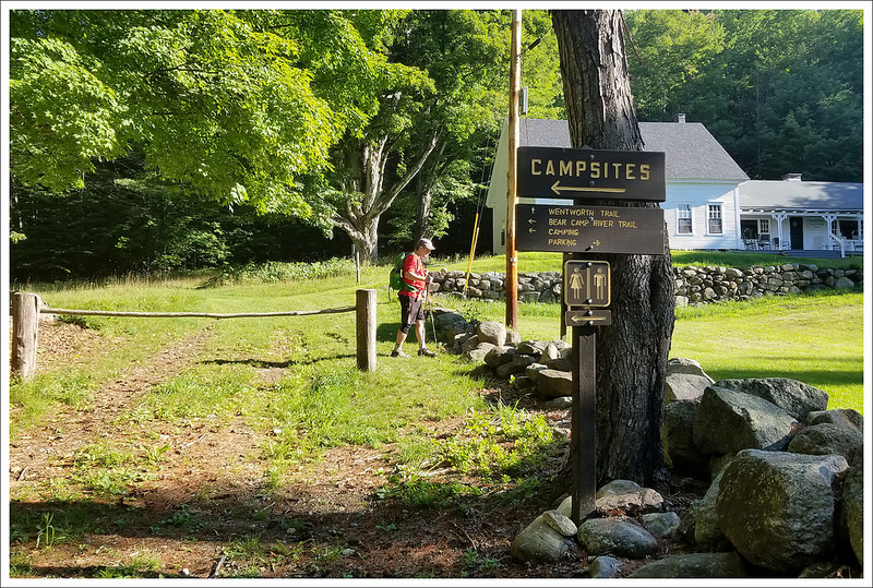
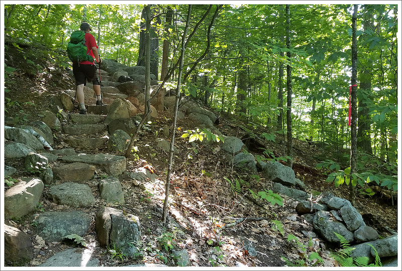

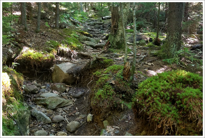
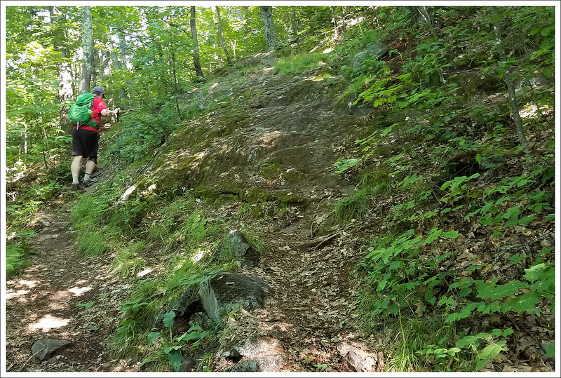


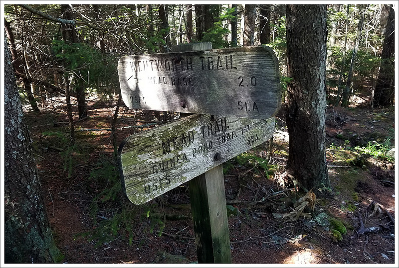


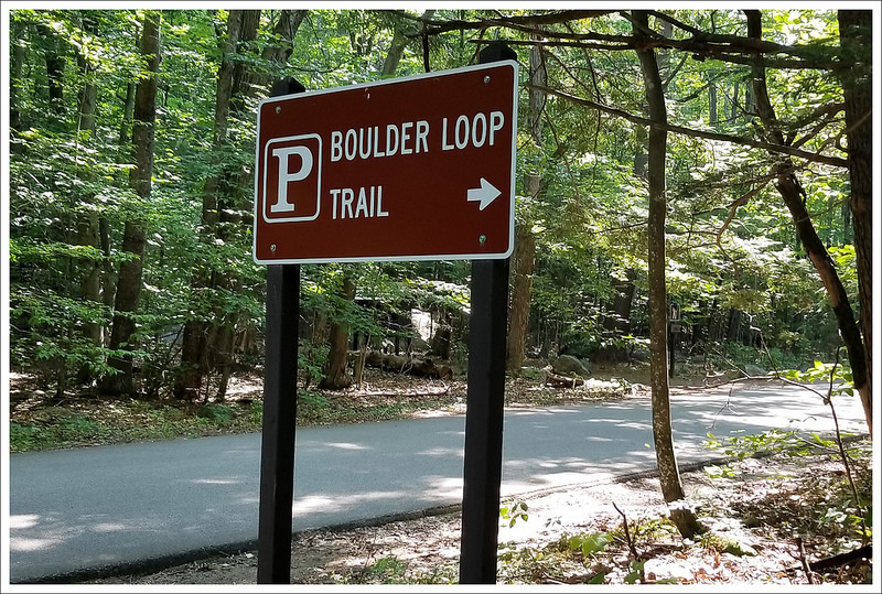


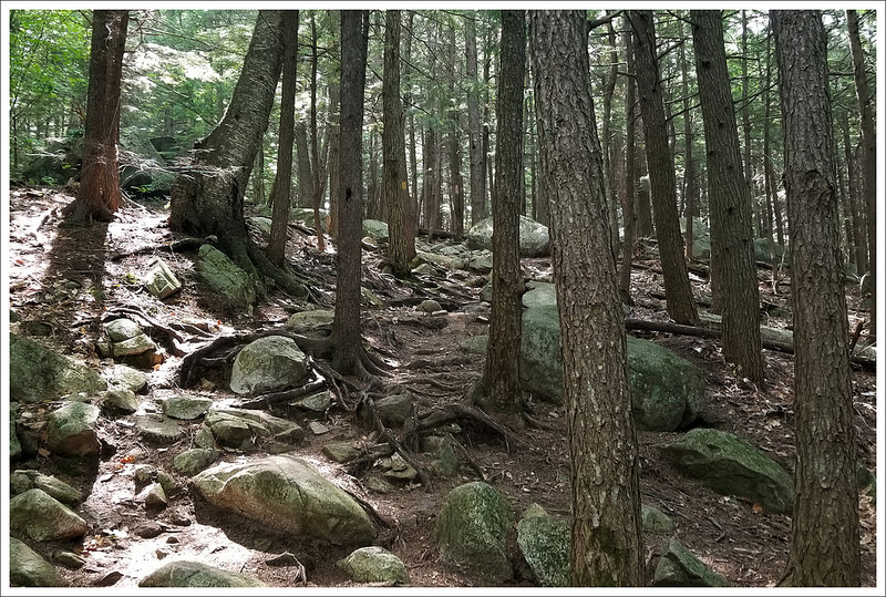

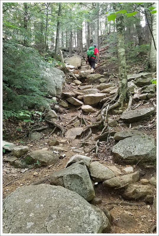


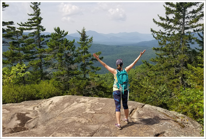


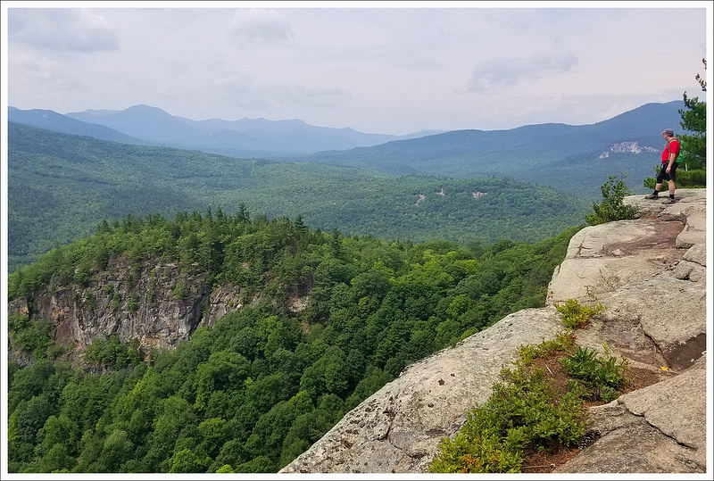


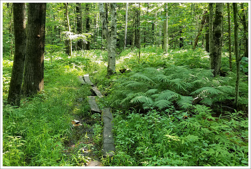
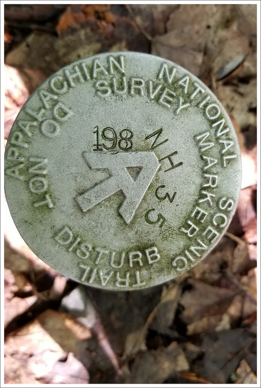
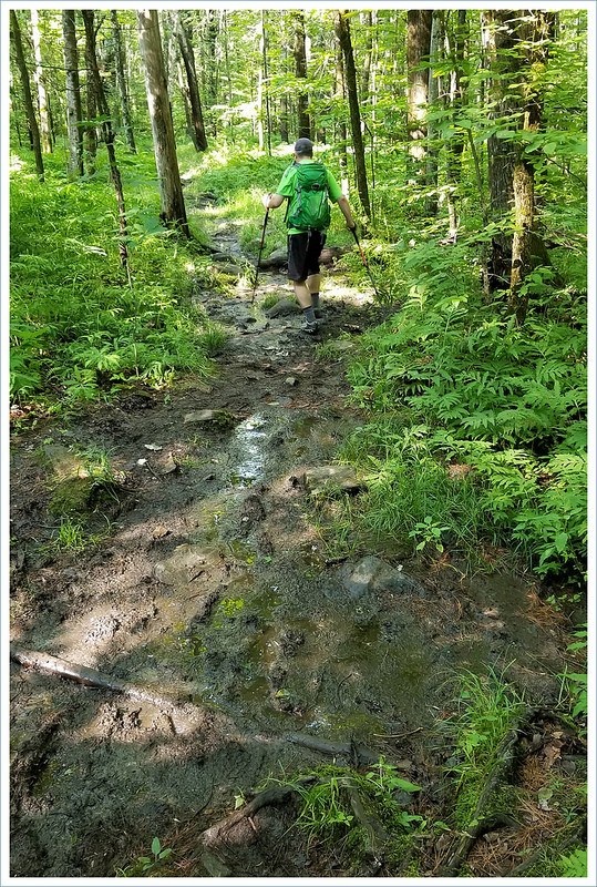


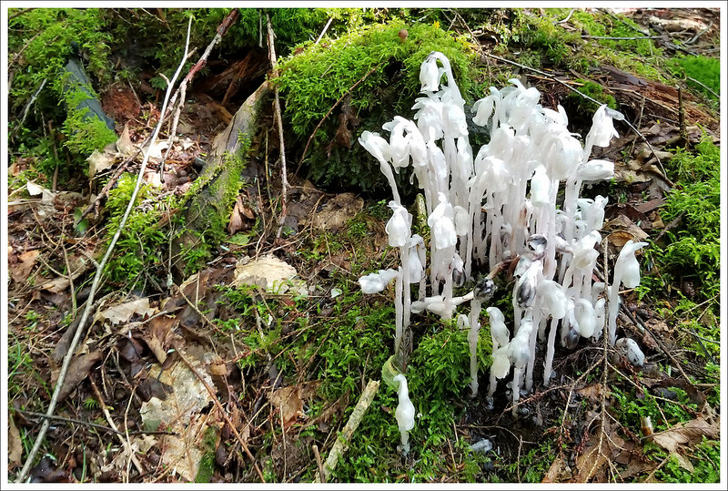
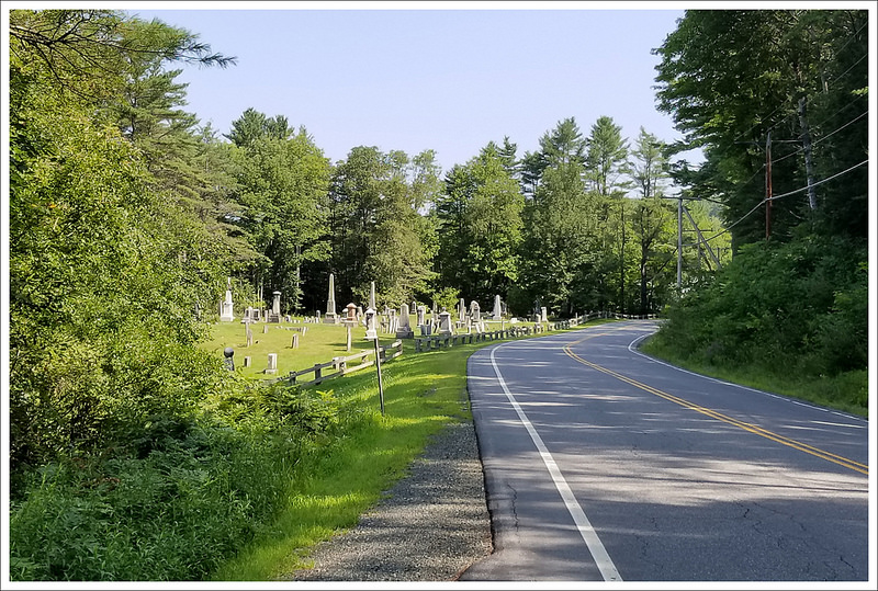
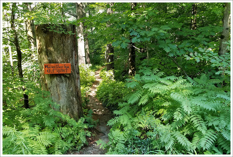
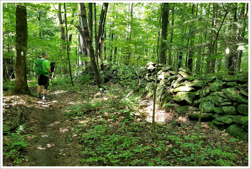

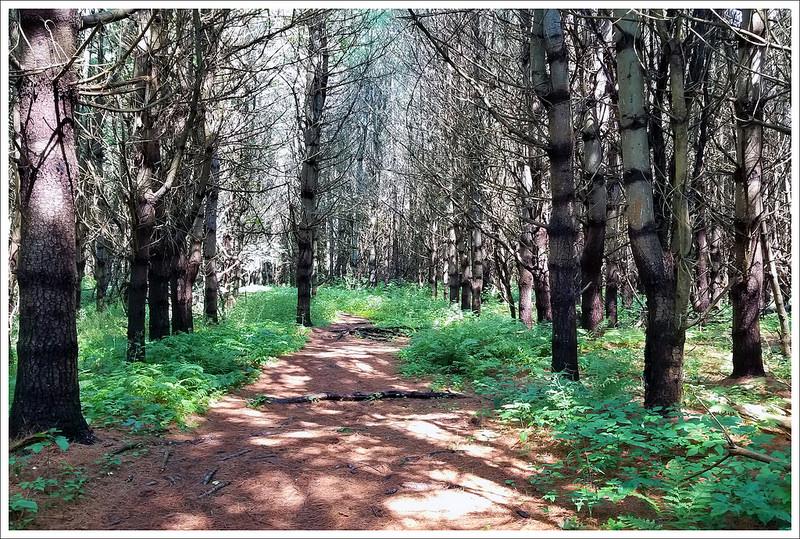
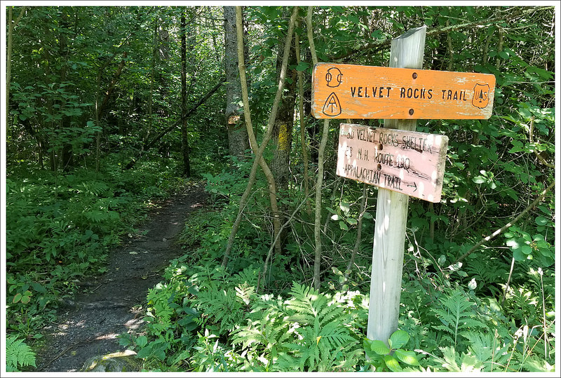
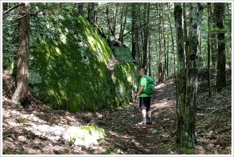


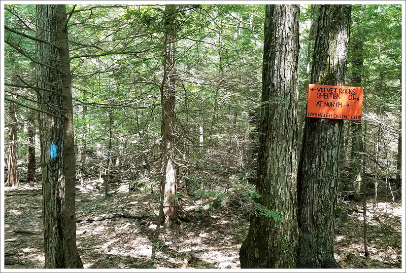

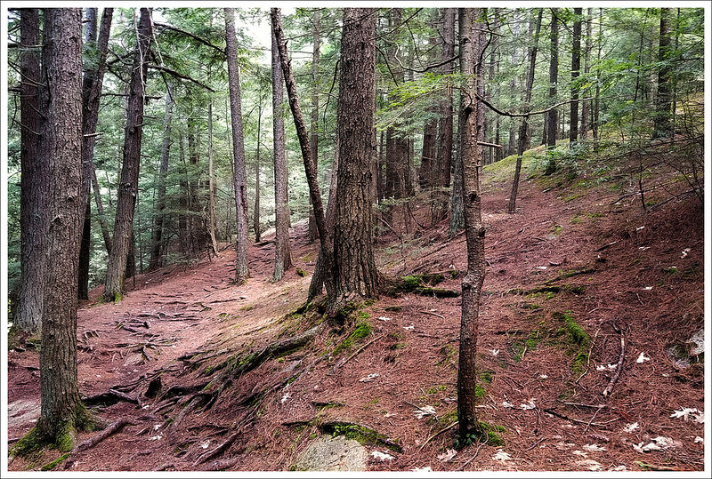

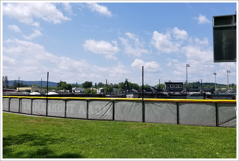
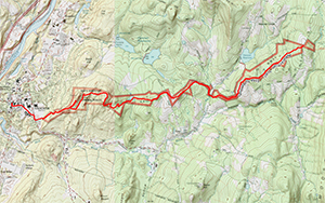

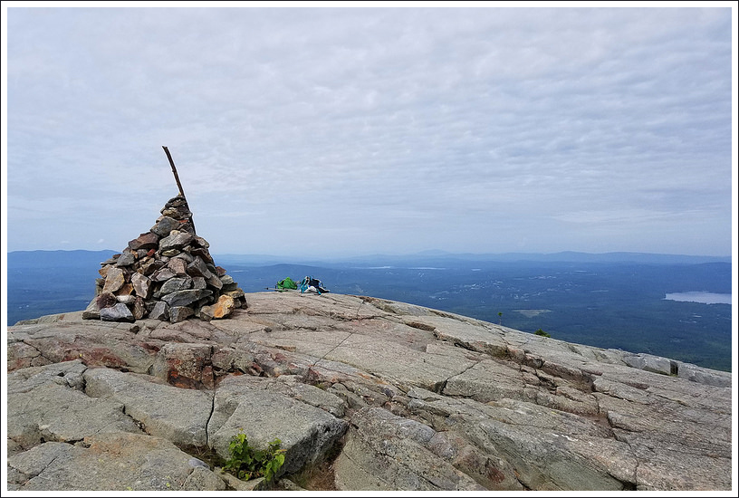


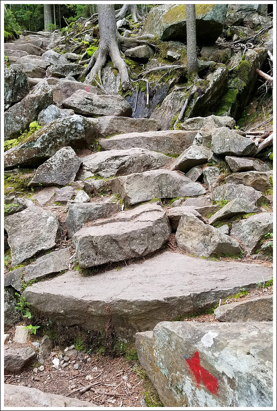


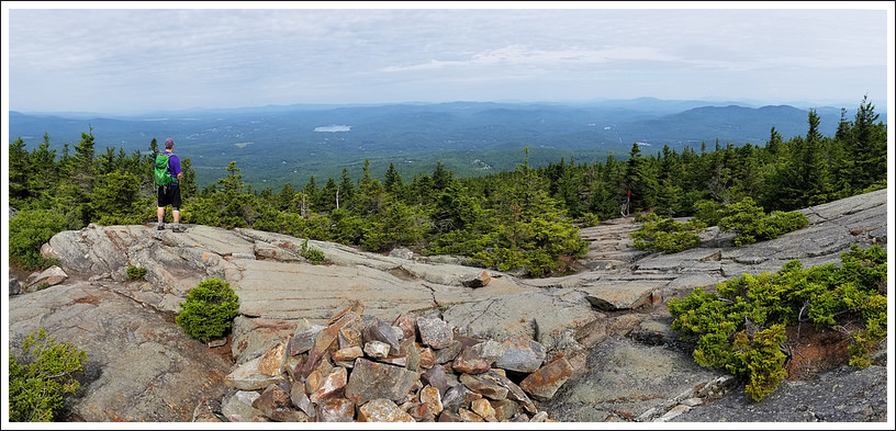

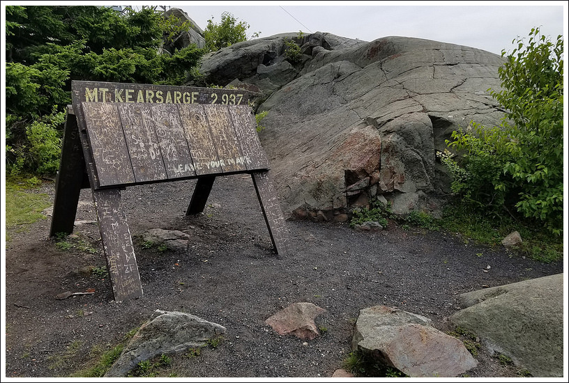


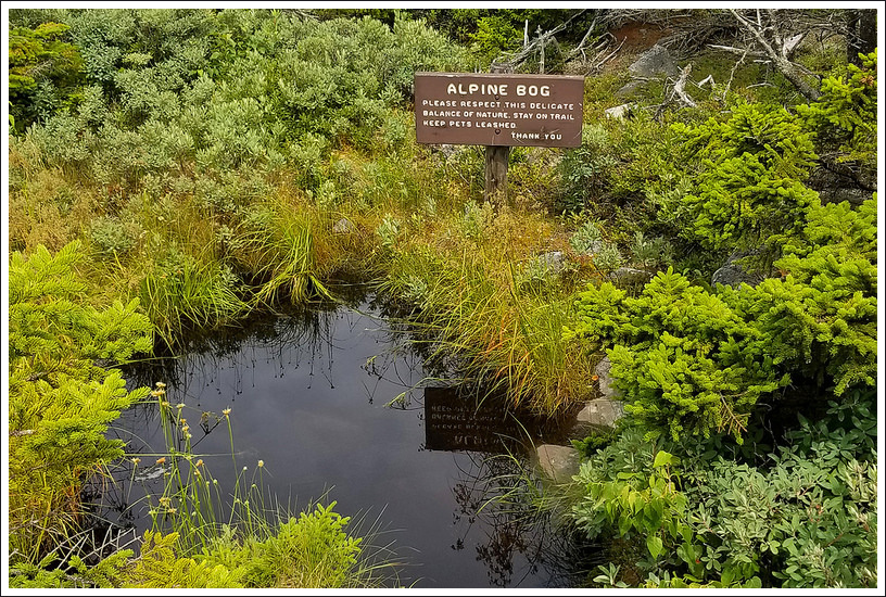

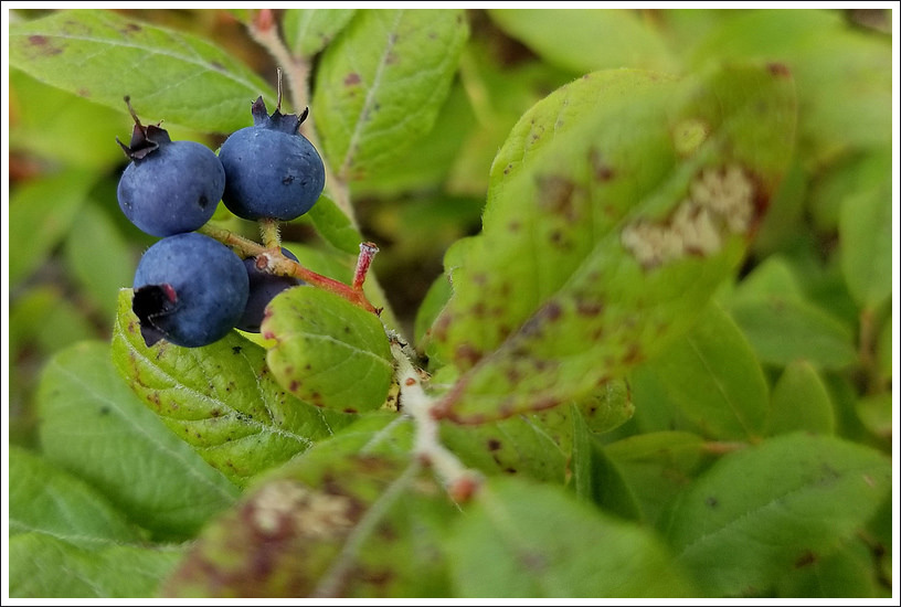
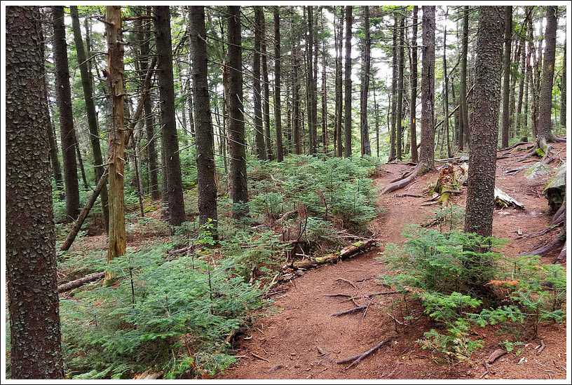


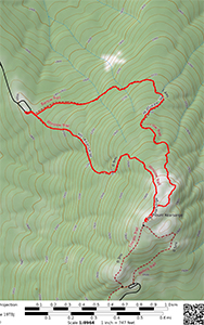


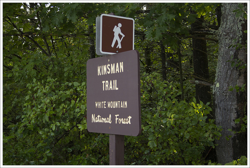


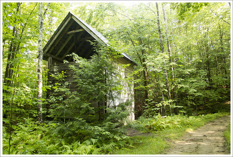


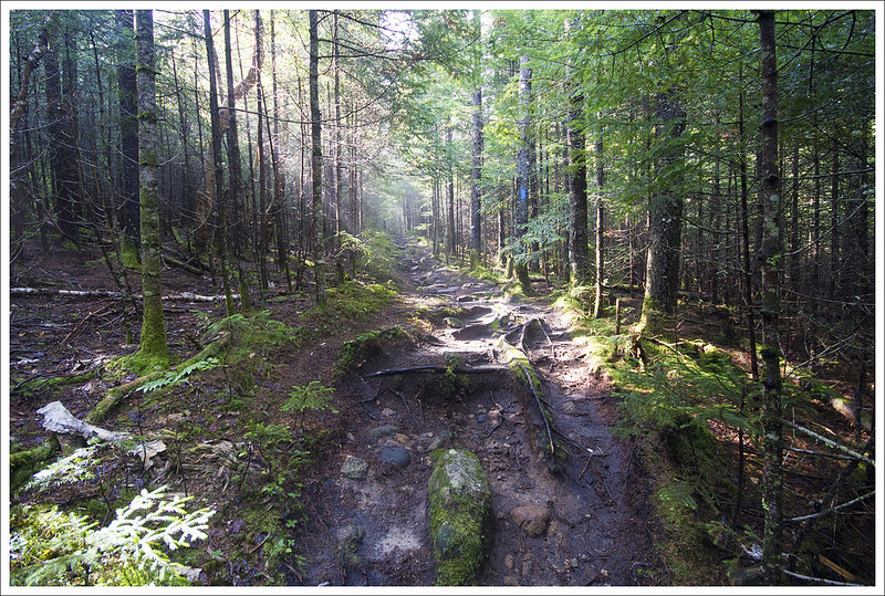
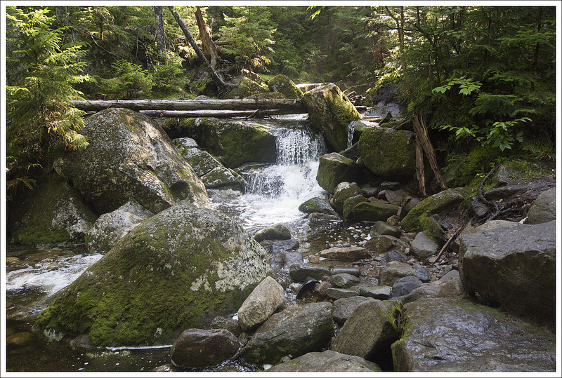


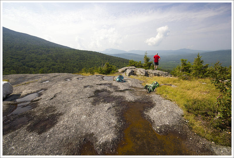


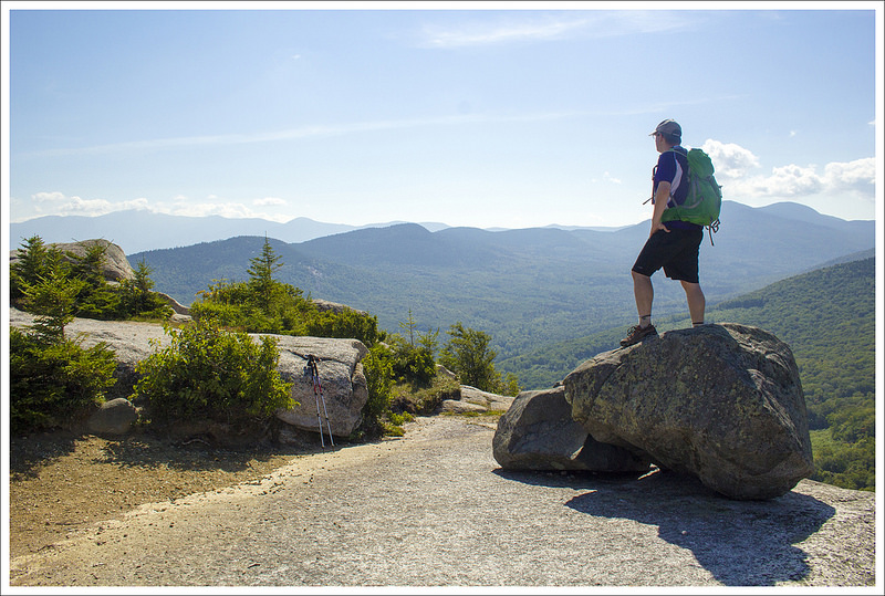


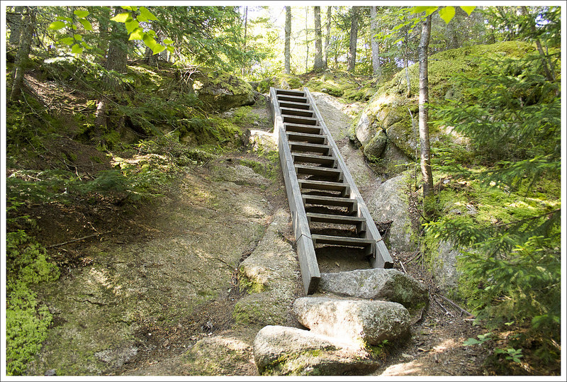
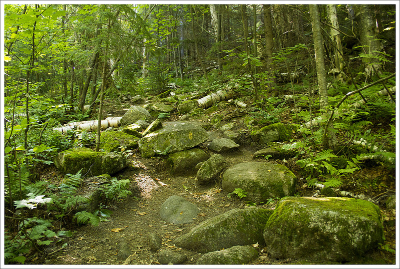


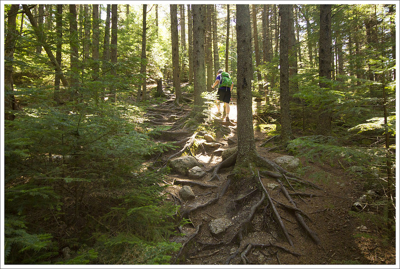


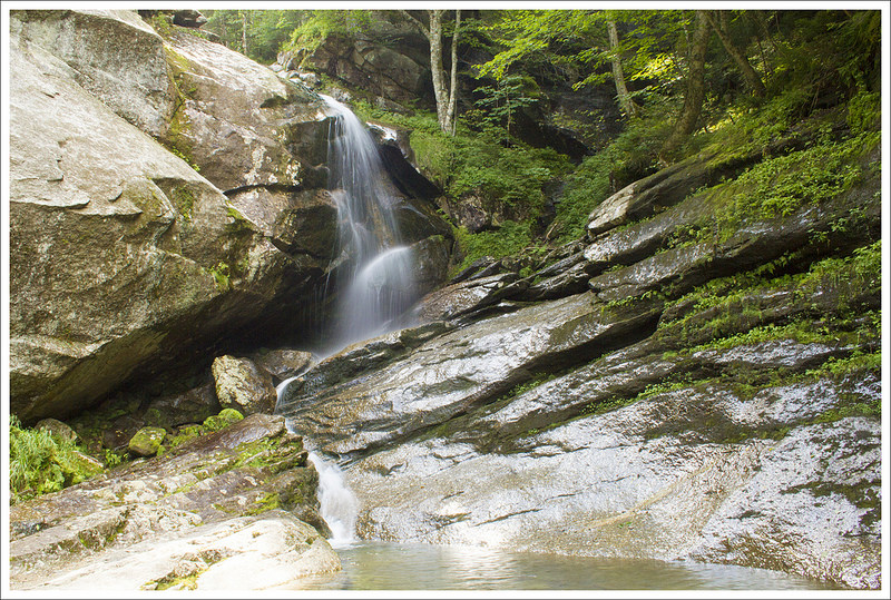
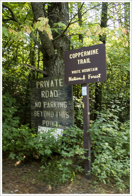
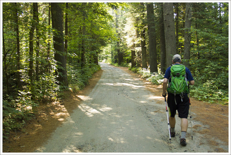
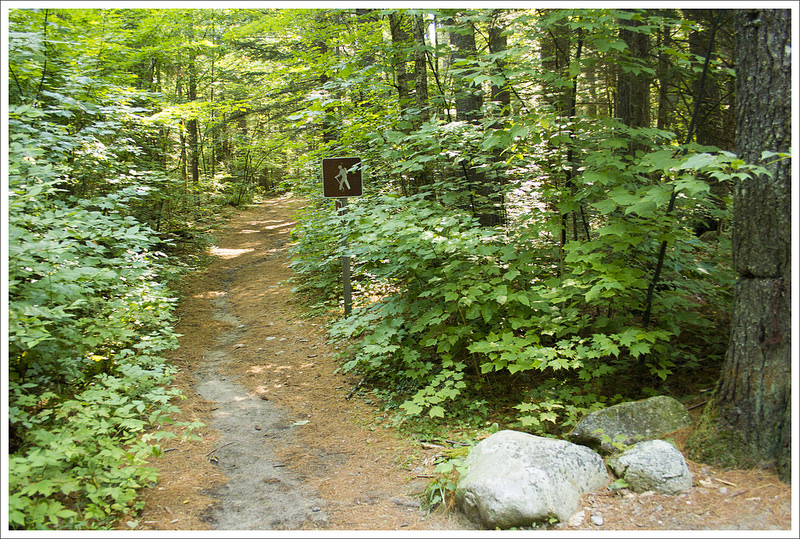
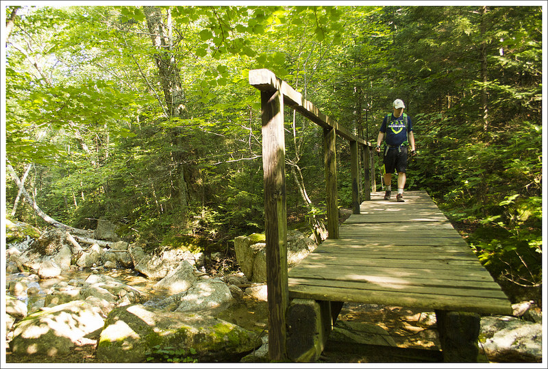
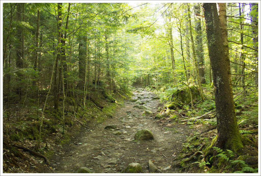
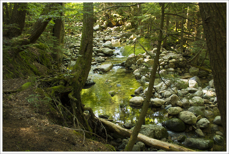
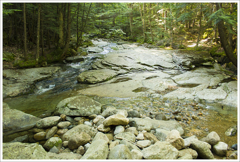
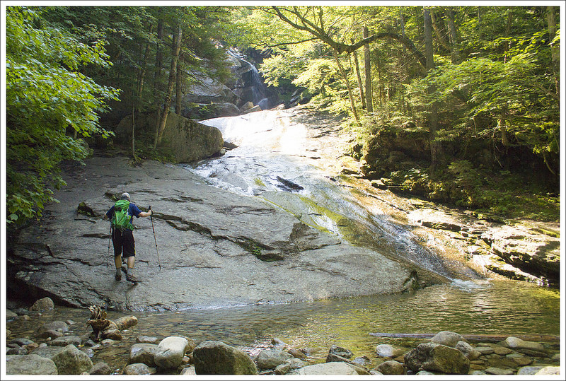
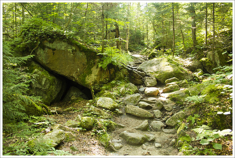
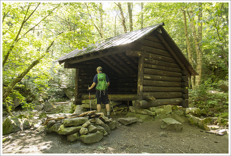
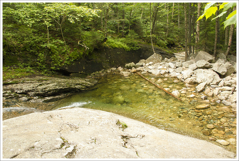
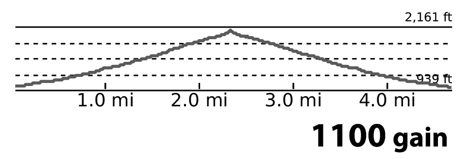
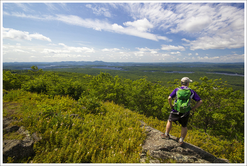


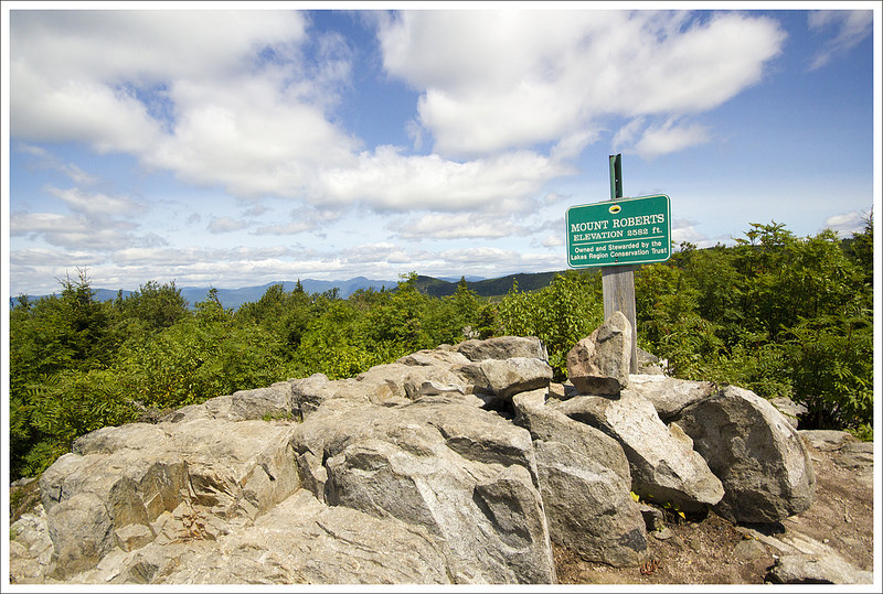


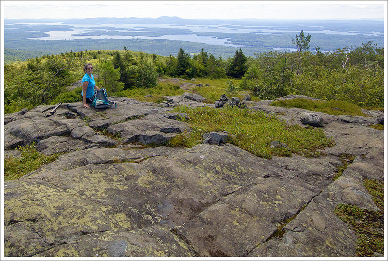


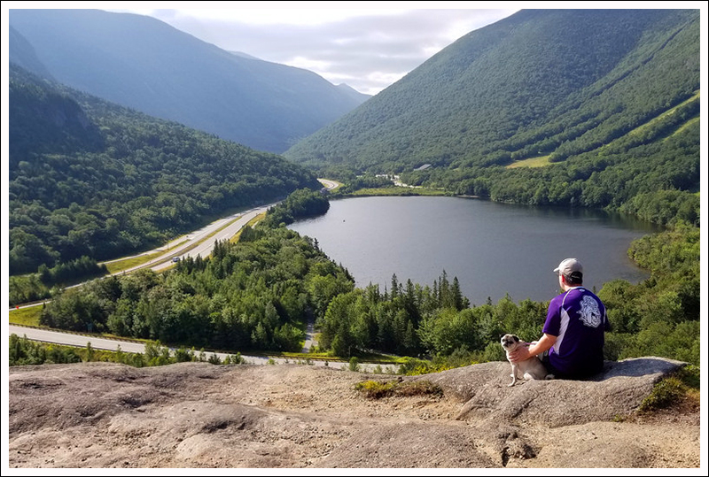

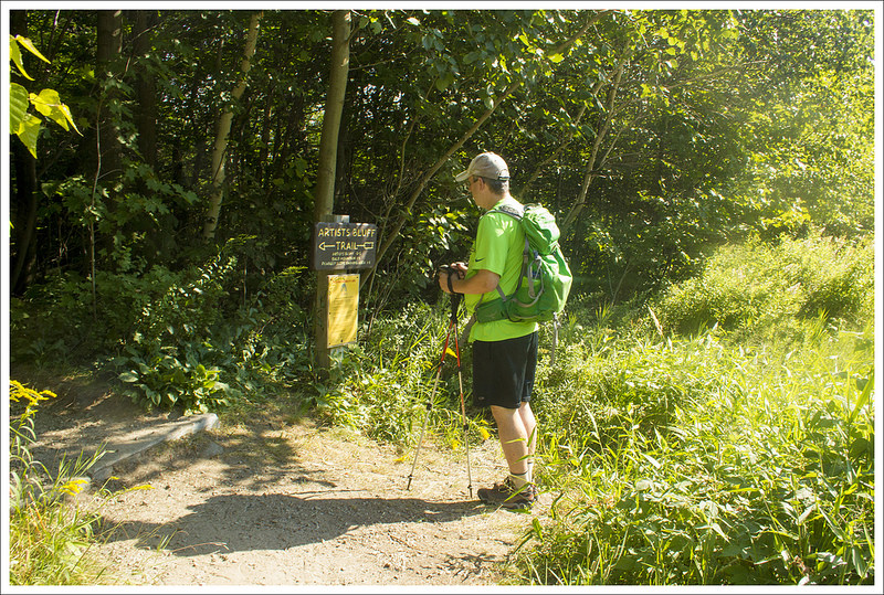
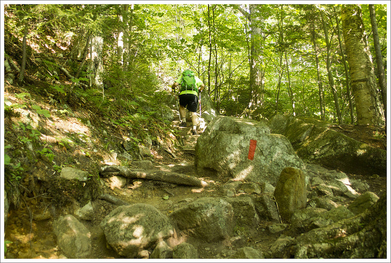
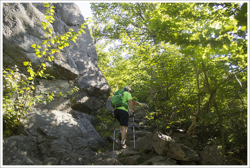


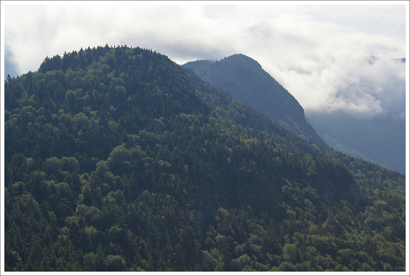

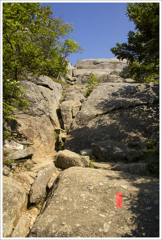


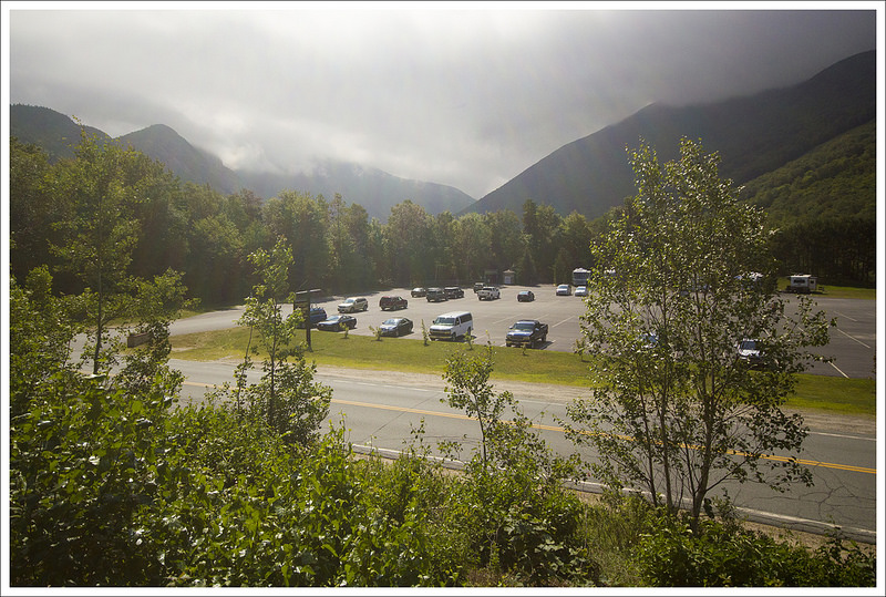
 Wookie Says…


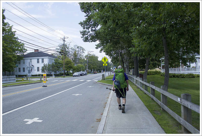
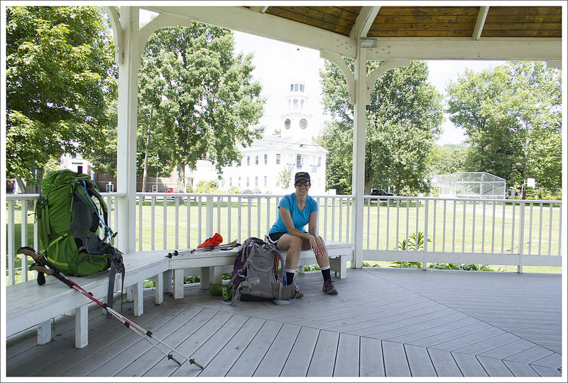
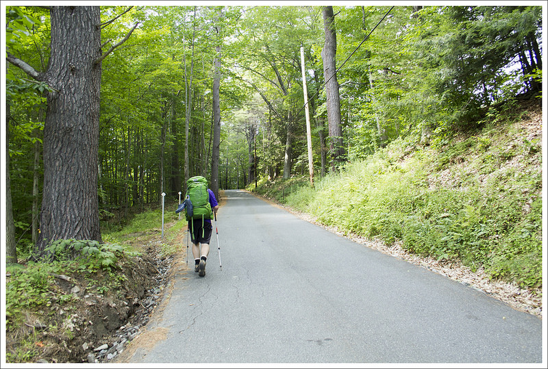
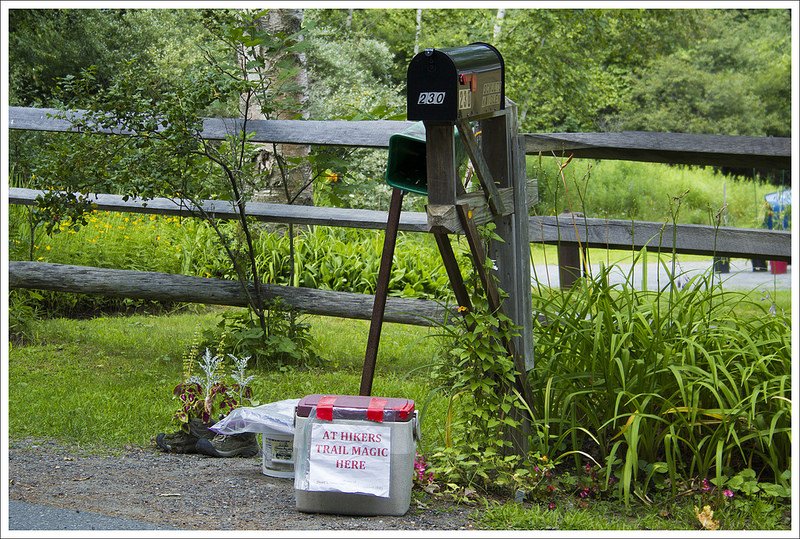
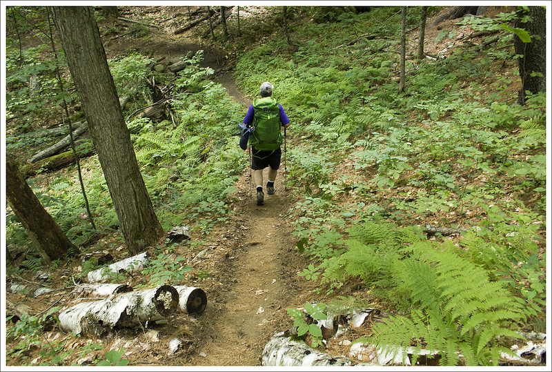
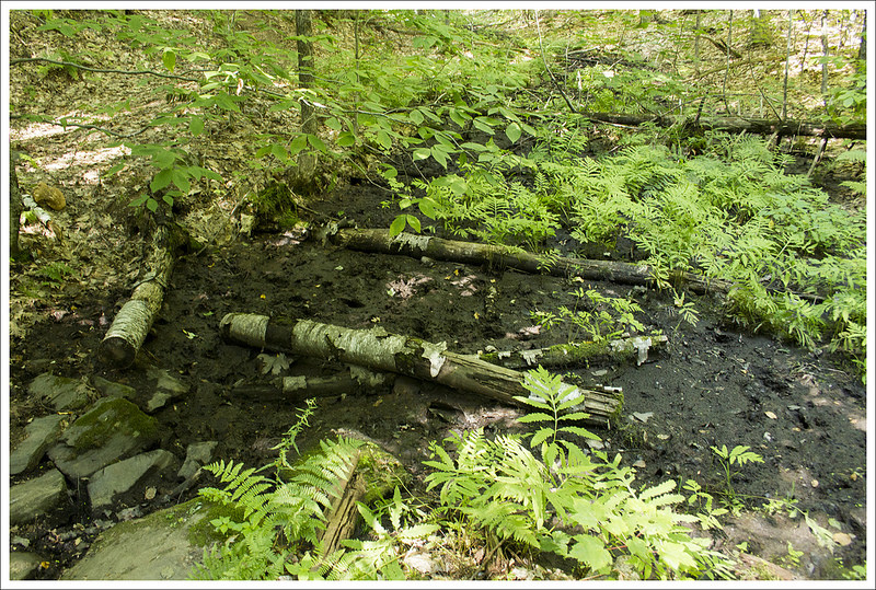
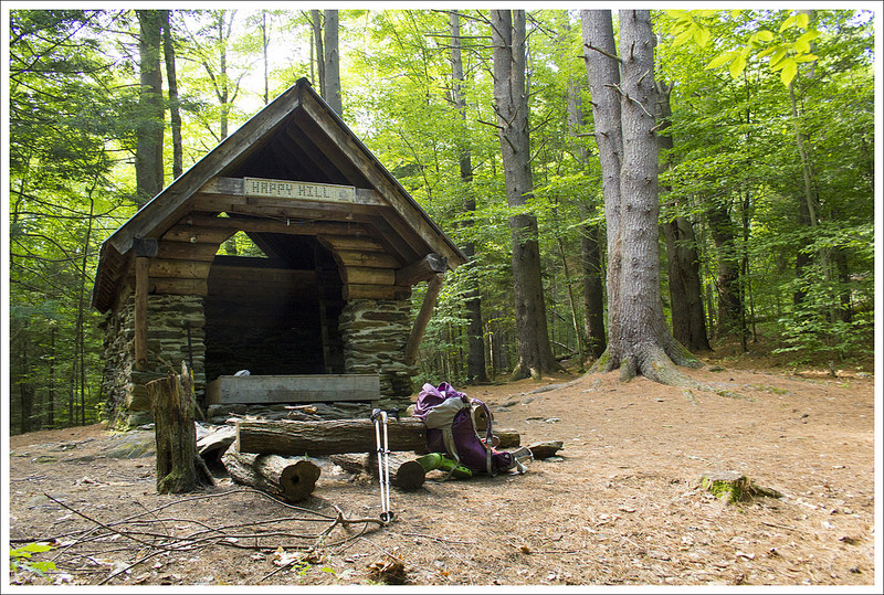
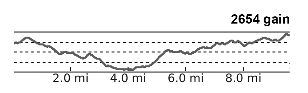


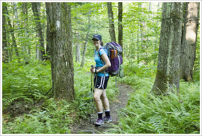
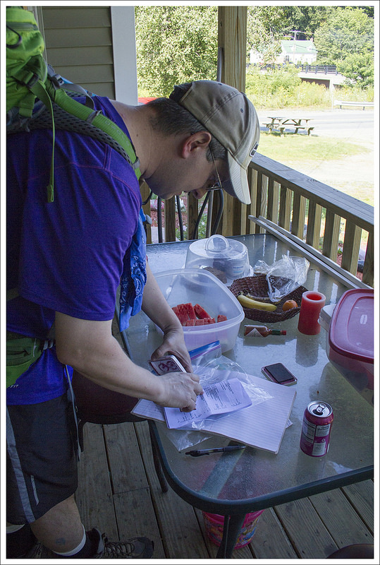


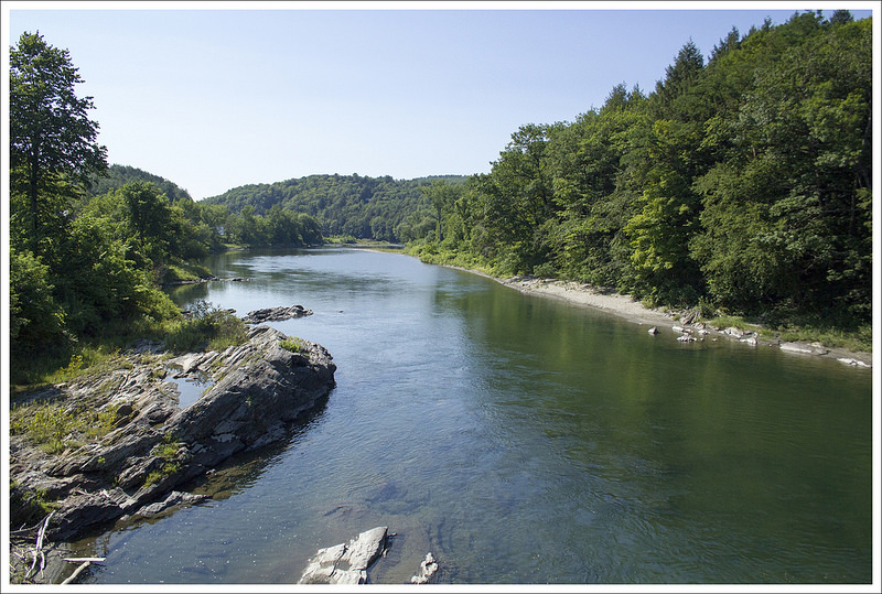
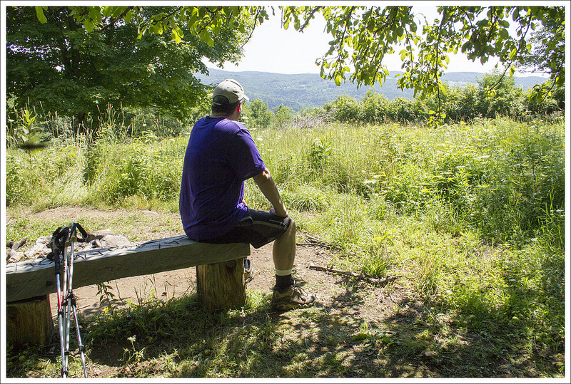
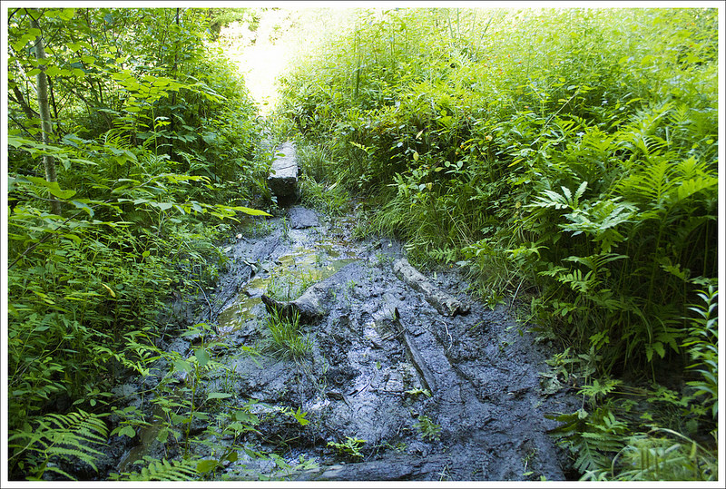
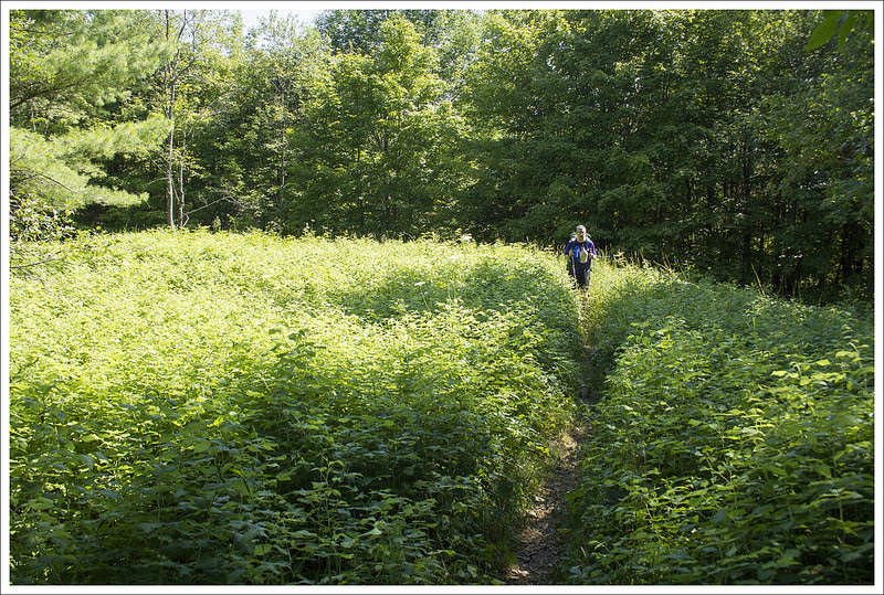
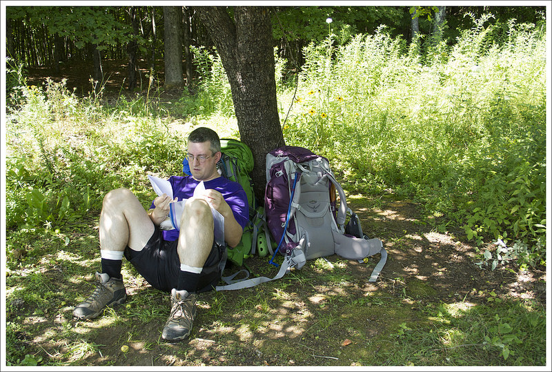


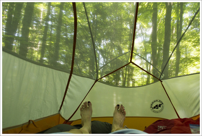

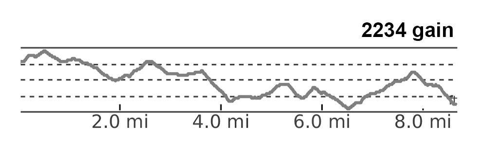

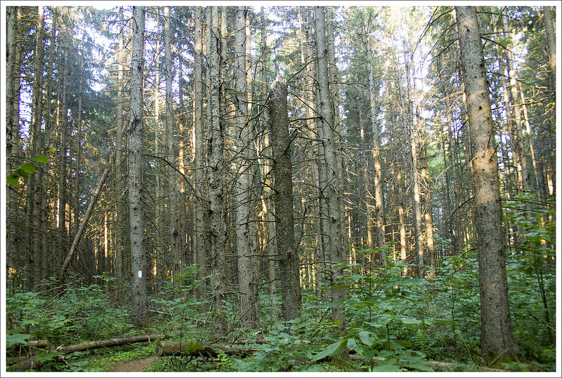
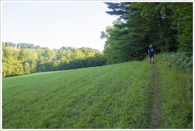
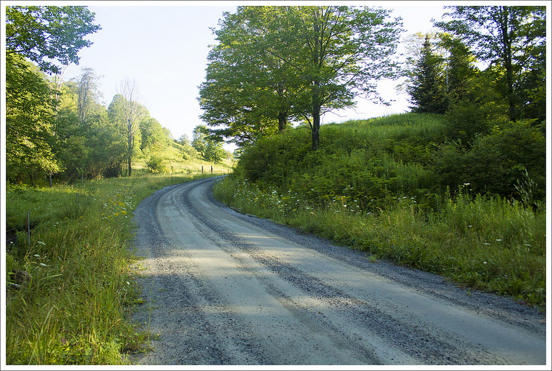

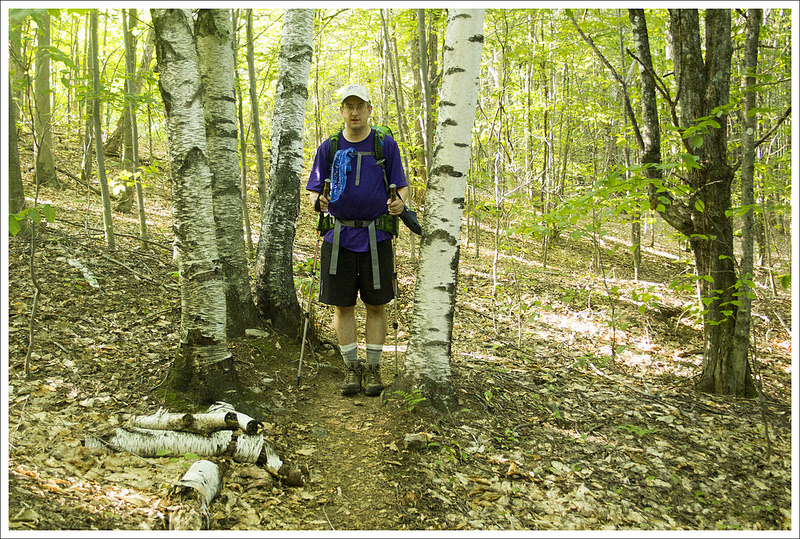
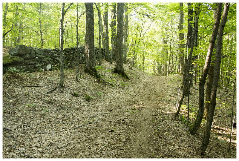

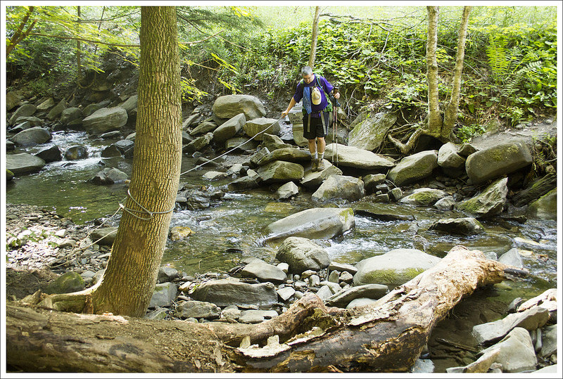
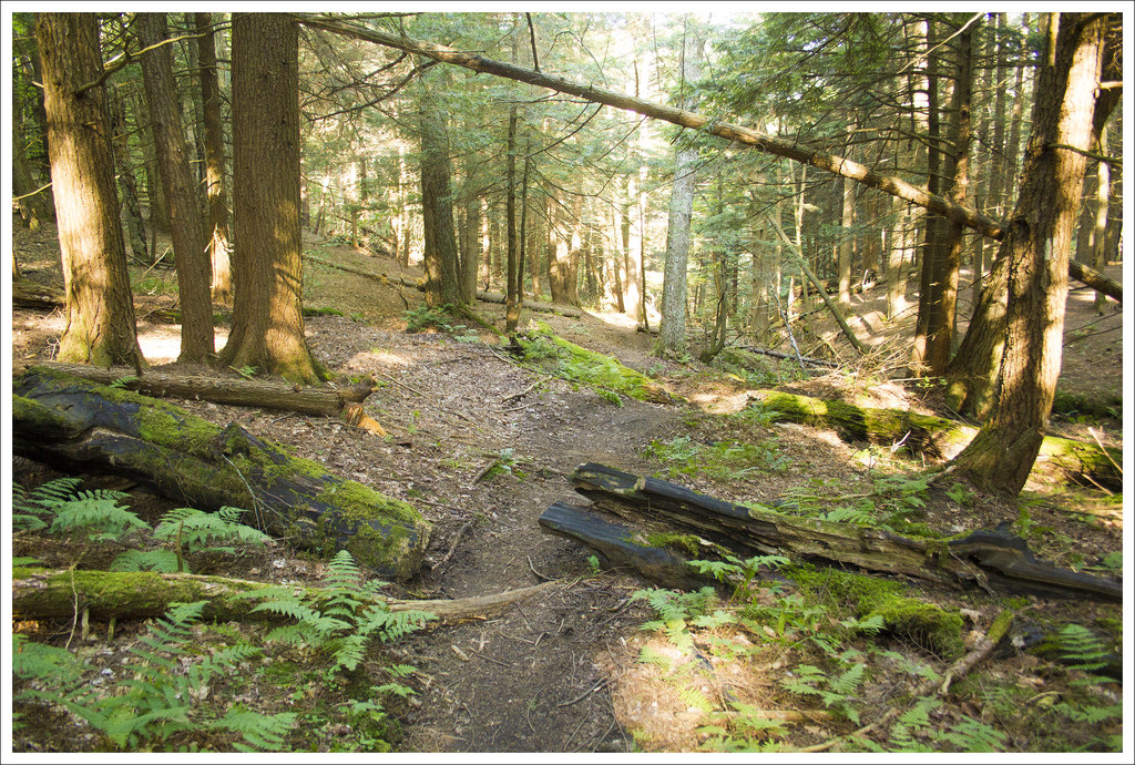
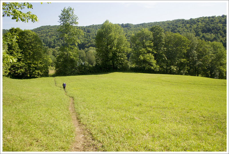


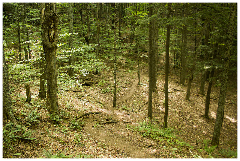

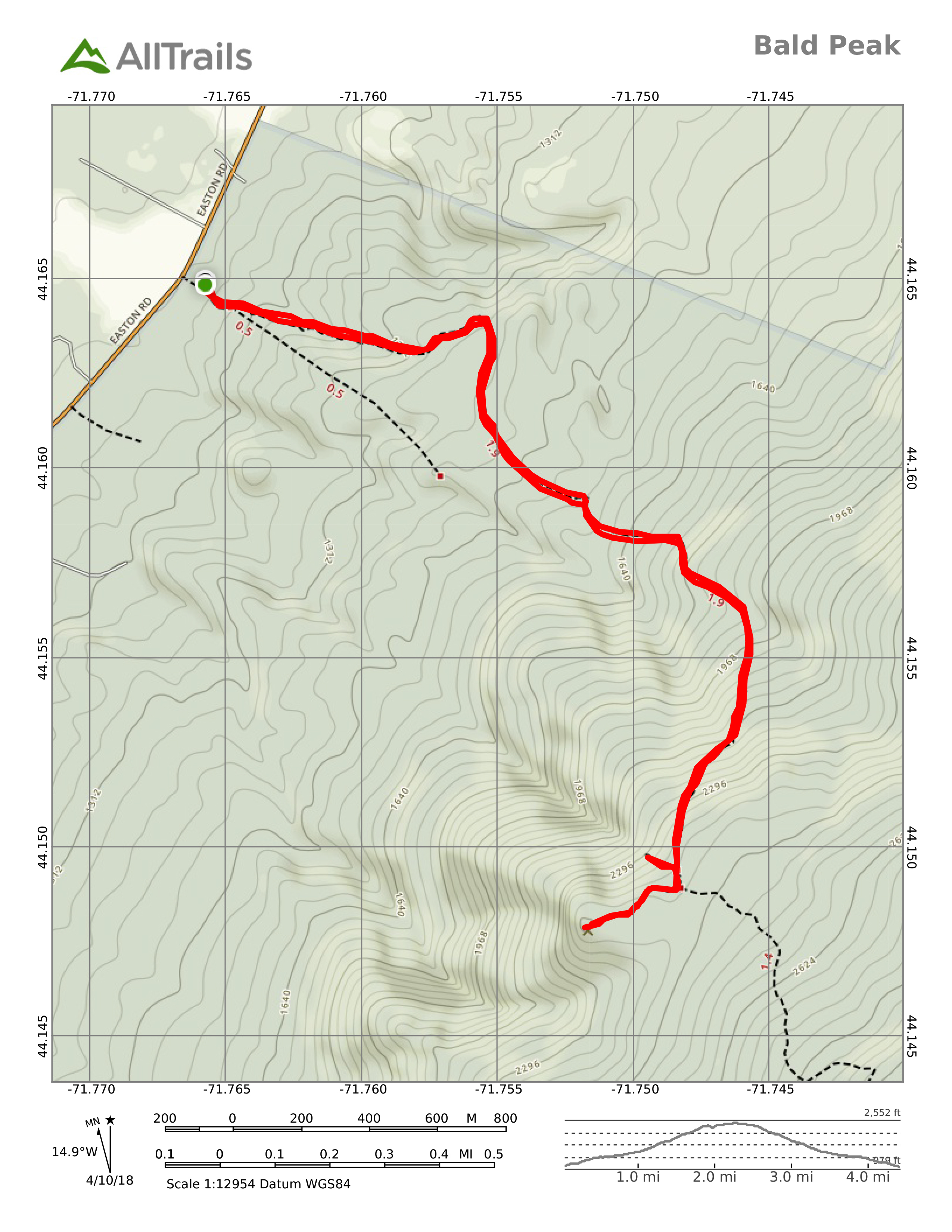