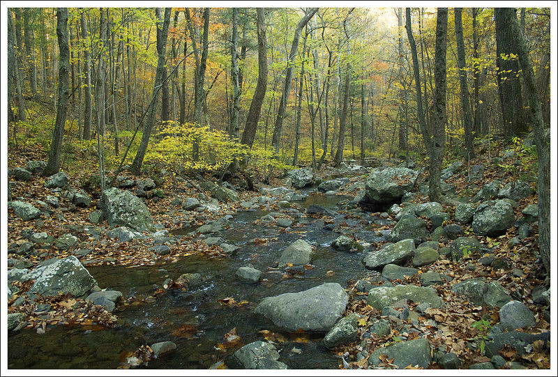
This 3.8 mile hike on the Appalachian Trail completed a short 1.9 mile gap in unbroken Appalachian Trail mileage we left after hiking the Three Ridges circuit in 2012. After you cross the scenic Tye River footbridge, the hike doesn’t boast any views or unique scenery. It’s a moderate uphill climb to a junction marker in the woods.
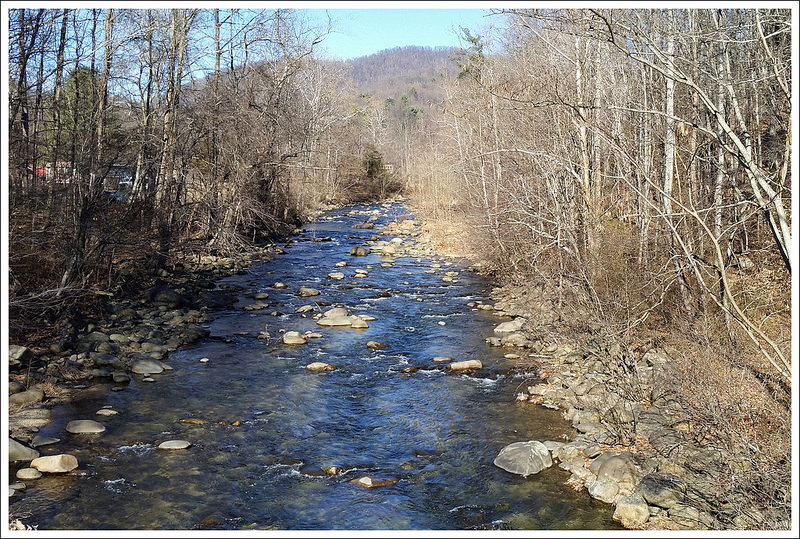
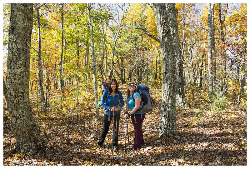
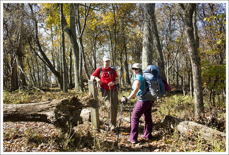
Our hike started off headed northbound over the Tye River footbridge. Below: White Blaze painted on the bridge; Adam and Christine on the bridge.
Adam Says…
We have been working on section hiking some of the Appalachian Trail through Virginia. Hopefully one day, we will have the entire section that crosses Virginia on here. In doing it in sections, we have ended up with a few small gaps between sections. This gap was created when we hiked Three Ridges and did it as a loop trail that included a return trip on the Mau-Har trail. I got a text from my friend Bryce from Hiking Upward that mentioned he was going to try and hike Spy Rock the next day. I mentioned that we were trying to get this section done as well, so he agreed to accompany us on this section also. It was January 1st and we wanted to start the year off right with a great day of hiking.
We parked our cars at the lot on 56 where the Appalachian Trail crosses the Tye River. We crossed the road and almost immediately you come upon a large suspension bridge that crosses the Tye River. We knew this was probably the highlight of the trip, so we took some time to get some pictures across the bridge and of the Tye River from under the bridge.
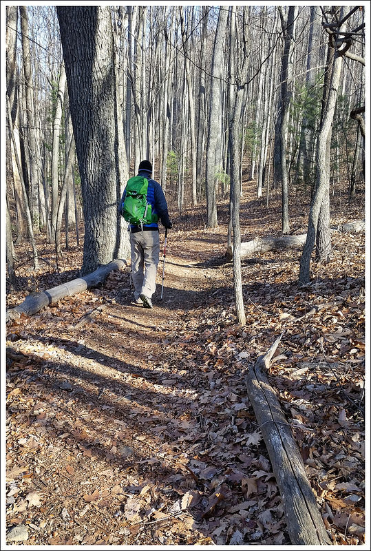
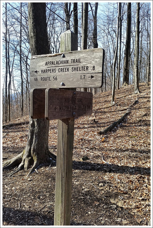
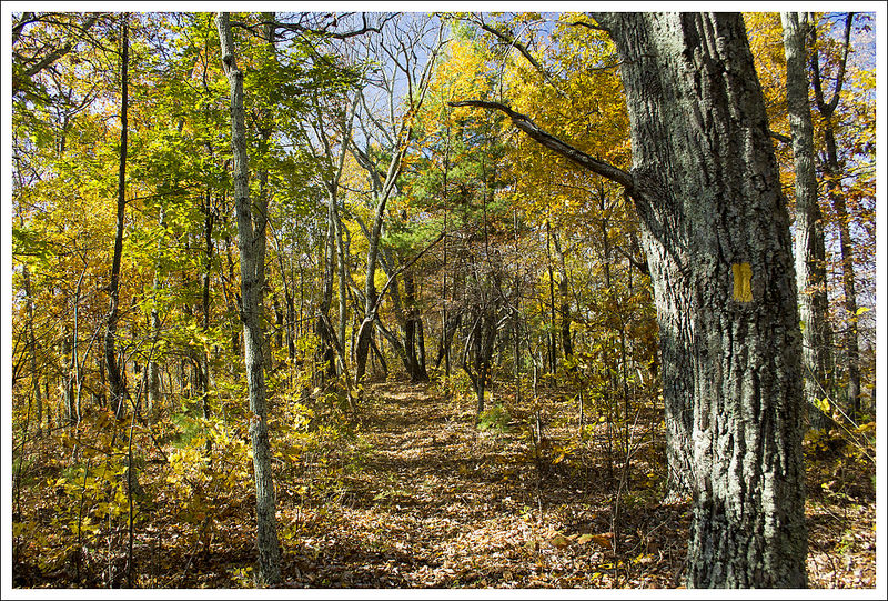
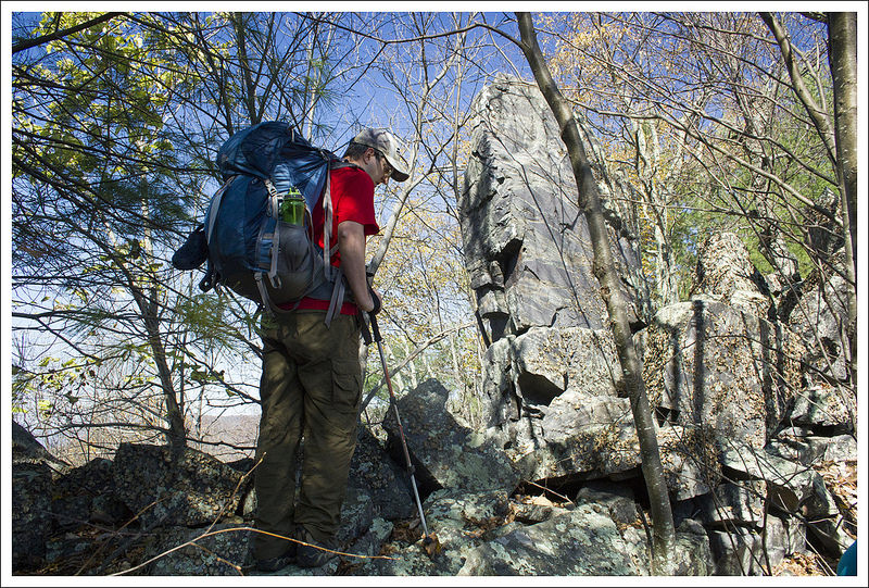
Looking through the trees toward the Priest. Below: Adam on the trail; Our stop point for this hike was just a sign at the junction of the AT and the Mau-Har trail.
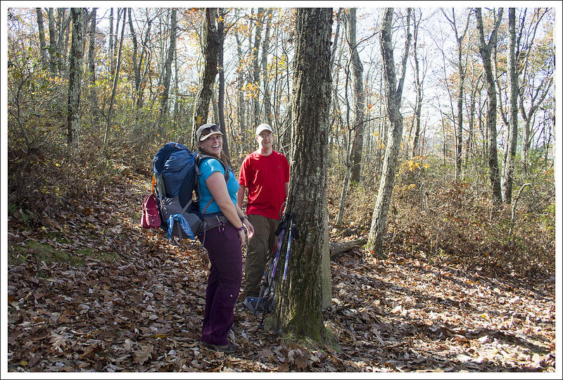
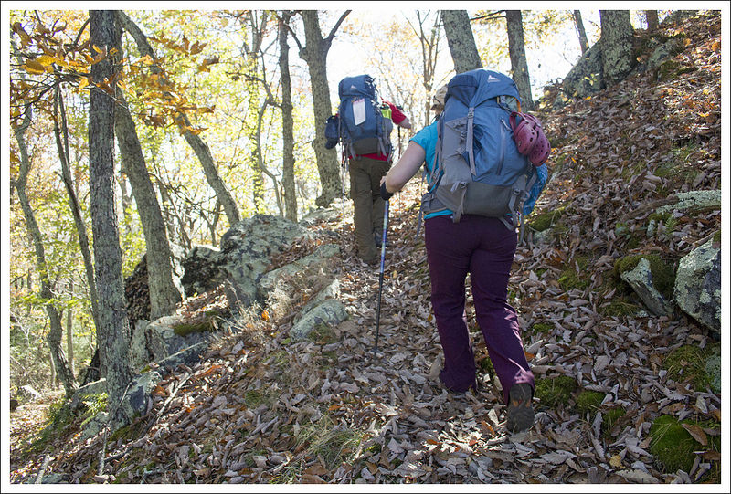
After crossing the bridge, the trail takes a few switchbacks and then starts a fairly steep uphill through the woods. Looking back from the trail, we were able to see some obstructed views of Pinnacle Ridge and The Priest, but when spring hits these views will likely be more obstructed. On our climb up, we saw a dog come racing towards us. As it turns out, it was a bear-hunting dog, as it had a large radio collar around his neck. The dog barely stopped at all and barreled past on a mission to try and find a bear. We continued our hike up and came up to the sign post that marked the trail junction with the Mau-Har trail. From this point, you could continue on the Appalachian Trail to the right to reach Chimney Rock and Three Ridges or take a left on to the Mau-Har Trail, to reach the Maupin Field Shelter. We tapped the post to mark that we had completed this section and made our way back.
After our hike, we got in our cars and stopped by Crabtree Falls, which had frozen water on the sides. This iconic waterfall is always a nice place to visit any time of year. Our next stop was to hike up to Spy Rock. When we first arrived, the parking lot was full of cars and vans. We felt defeated and were about to make the decision to not do the hike, when someone came down the trail and mentioned that a few car loads were getting ready to leave. We waited just a couple of minutes and two parking spaces opened up. We hiked up to Spy Rock, which was covered in snow in some parts. At the top of the trail, Bryce decided he wanted to bushwhack to another rock outcropping that would look back on Spy Rock. So, we set a plan to try and take pictures of each other from the different summits. The climb up Spy Rock was pretty dangerous, since the water that falls into the cracks that your normally use to help pull yourself up was frozen, making it very treacherous. When we got up to the top of Spy Rock, the wind was blowing so hard and the temperatures from the wind chill put it way below freezing. We waited for a few minutes at the top. We eventually saw Bryce making his way to the rock outcropping. We took a quick photo of him and then made our way off Spy Rock, since we felt we could get frostbite fairly quickly up there. We reconvened where we had split up and then made our way back down the mountain. We got back to our cars and headed to Staunton for lunch.
This area where we hiked is a real sweet spot for Virginia hiking. You have The Priest, Three Ridges, Crabtree Falls, and Spy Rock all within a few miles. If you want a place to get a few great days of Virginia hiking, this is a great destination. We were glad to reconnect again with Bryce and getting another AT section checked off our to-do list.
The lovely, scenic Tye River. Below: Adam and Bryce crossing the footbridge at the end of the hike.
Christine Says…
I don’t really have anything to add about the hike! It was just a pleasant walk in the woods that finished a hole in our continuous AT miles. It was great to see Bryce (Hiking Upward) and spend the first day of 2015 on the trail!
After a couple little hikes, we all went for a decadent lunch and beers at Byers St. Bistro in Staunton. They have great sandwiches and a nice variety of beers on tap. Check it out if you’re in the area.
Trail Notes
Distance – 3.8 miles (Check out the stats from Map My Hike)*
Elevation Change – 1100 ft.
Difficulty – 3. The climbing is steady and moderate the entire way up.
Trail Conditions – 4.5. Well maintained, smooth trail.
Views – 0. No views other than a few glimpses through bare winter trees.
Streams/Waterfalls – 0. The stream and waterfalls are a little further up trail from this spot.
Wildlife – 0. We did see a hunting dog – that probably scares wildlife away.
Ease to Navigate – 4. There’s really no place to go wrong here.
Solitude –2. This trail leads up from a very popular AT access point. You can expect to see a good number of people.
Directions to trailhead: From I-81, take exit 213A to head on to US-11 South towards Greenville. Go 8.2 miles and take a left on to US-56. Go 16.6 miles down US-56 and you will come to a parking lot for the Appalachian Trail on the right-hand side of the road. Park here and then cross the road to start hiking on the Appalachian Trail heading north.
* MapMyHike is not necessarily accurate, as the GPS signal fades in and out – but it still provides some fun and interesting information.
This 14.7 mile route offers wilderness, beautiful views, and stunning stream scenery (even a small waterfall!) It’s a wonderful, moderate overnight backpacking loop; or a really challenging day hike. We set out intending to camp along Jeremy’s Run, but it didn’t quite go as planned!
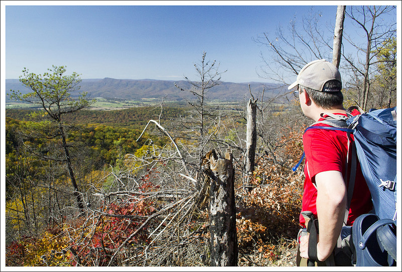
The views on this loop hike come along the descent of Neighbor Mountain. Below: The trailhead at Elkwallow Picnic Area; Hiking along in golden woods; Adam and Kris at the junction of the Appalachian Trail and Neighbor Mountain Trail.
Christine Says…
The final weekend of October 2014 was so beautiful – perfect, made-to-order backpacking weather. We decided to head out on one more overnighter before the weather turned cold. We invited our friend, Kris, to come along. She loves the outdoors as much as we do, and I was sure she’d enjoy this loop. Don’t miss her guest blogger entry later in this post! It had been several years since we last hiked in the vicinity of Jeremy’s Run, and I was really looking forward to camping along the beautiful stream.
After stocking up on some lunch provisions at Elkwallow Wayside, we finally hit the trail around 11:00. We figured we had a little over eight miles of hiking on our first day, so starting late morning would get us to camp before 3:00, with plenty of daylight left to pitch tents, cook dinner, and relax.
Hiking along the Neighbor Mountain Trail. Below: The fall color was still close to peak; Adam checks out a rock formation; At the summit of Neighbor Mountain.
We started out at the Elkwallow Picnic Area. A short spur trail leads downhill to the junction with the white-blazed Appalachian Trail. The AT descends for about .3 of a mile before coming to a junction with the blue-blazed Jeremy’s Run Trail. Follow the Appalachian Trail, veering to the left. The trail ascends for a little over a mile before coming to a more level ridge. You’ll pass the junction with the Thorton River trail, continuing south on the AT. At just over four miles into the hike, you’ll reach the junction with the yellow-blazed Neighbor Mountain trail.
We decided this junction would be a nice place to stop for lunch (hummus – my favorite trail lunch of late – easy to eat and lots of quality calories!). After a relaxing, thirty-minute break, we took the turn onto the Neighbor Mountain trail. The path meandered across the ridge. For the first couple miles, it was mostly walking in the woods. There was a nice breeze and gorgeous sparkling sunshine was filtering through golden leaves. It was everything you want fall to be!
Even though there is no view, the summit of Neighbor Mountain is marked with a cement post. At the summit, I noticed I had picked up a ‘hitchhiker’ along the way – a walking stick bug was clinging to my pants. I wonder how far he had come with me. I picked him off, and set him on a fallen log off the trail.
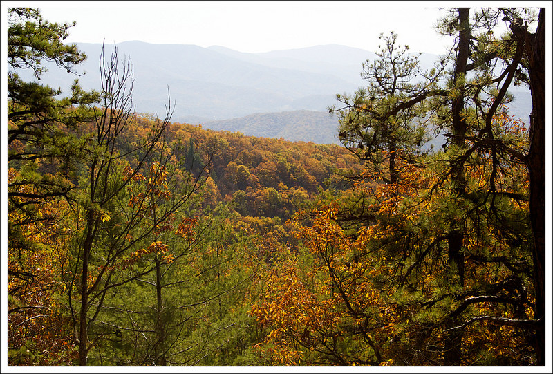
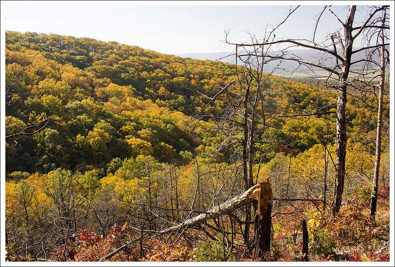
Between six and seven miles into the hike, there are a few excellent views of the Massanutten ridge and Three Sisters. There was a forest fire in this area several years ago, so the view was pretty open and expansive. We all paused a while to enjoy the fall foliage. It was so wonderful to see colorful mountains rolling our before us. We talked about how privileged and blessed we all felt to be out on such an amazing day!
Adam enjoys a view of the valley and mountains to the west. Below: This part of Neighbor Mountain burned in 2012. Alot of damage is still evident; Fall color; Adam descends Neighbor Mountain toward Jeremys Run.
The last mile and a half of the day was steady downhill, meandering across switchbacks until the Neighbor Mountain trail reached the bottom of the valley and Jeremy’s Run. As soon as you reach the stream, campsites are everywhere. The first few we passed were already taken, so we ended up returning to the hidden campsite we used several years earlier. It’s a flat spot under the trees shortly before the first water crossing.
And here’s where the story takes an unexpected turn…
Adam Says…
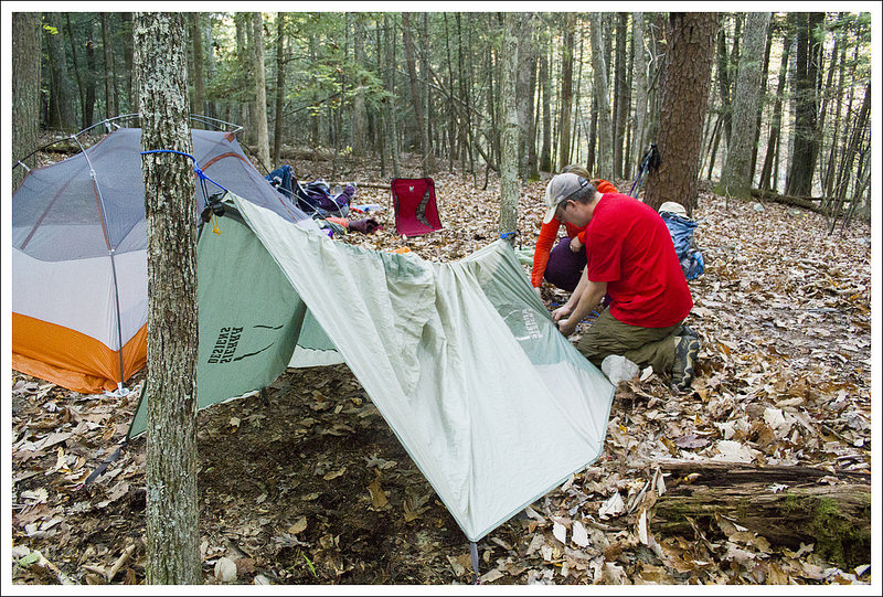
We all worked on pitching our tents and setting up camp. I set up our tent while Christine worked on inflating our sleeping pads. Kris was on the other side of the clearing working on setting up the one-person tent she had borrowed, when she suddenly she groaned, “Uh… guys – I think we might have a little problem.”
As it turned out, the tent bag only held the rain fly and the poles. The ground cloth and the actual tent were missing in action. She hadn’t checked the bag before hitting the trail. We spent the next 45 minutes trying to improvise a shelter with everything and anything we had. We tried piling three people in our Big Agnes Copper Spur UL2 (bad idea). We discussed whether or not the evening would be suitable for cowboy camping under the stars. We talked through a few different scenarios: 1) we all hike back immediately, 2) I sleep under the tarp while Kris and Christine sleep in the tent, or 3) I hike back to the car tonight and pick them up in the morning. I was least excited about the second option because the area felt tick-infested with the wet leaves. We debated the options for a few minutes, but ultimately, we decided the best choice was to keep the group together and make our backpacking trip into a very long day hike.
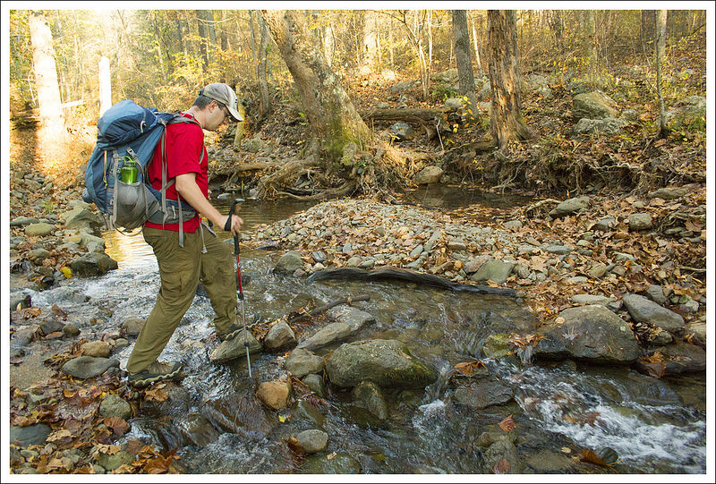
We tried to find a way to rig up shelter, but in the end we decided it was better to hike out. Below: Crossing the first stream and trying to eat something with enough calories to hike out happily; Adam doing one of many stream crossings; The best campsite along Jeremys Run sits above a waterfall.
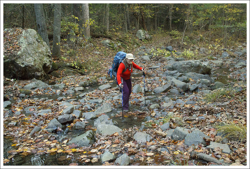
We knew we only had a little over an hour of daylight left – the sun sets early behind the mountains surrounding Jeremy’s Run. We rushed to pack everything up as quickly as we could. Cooking a hot dinner would have required getting more water, so we opted to just eat a few snacks from our bags. We started off at a quick pace. I twisted my knee at the first major water crossing we had to make, which made the rest of the trip pretty painful. But sometimes, you just have to suck it up and hike.
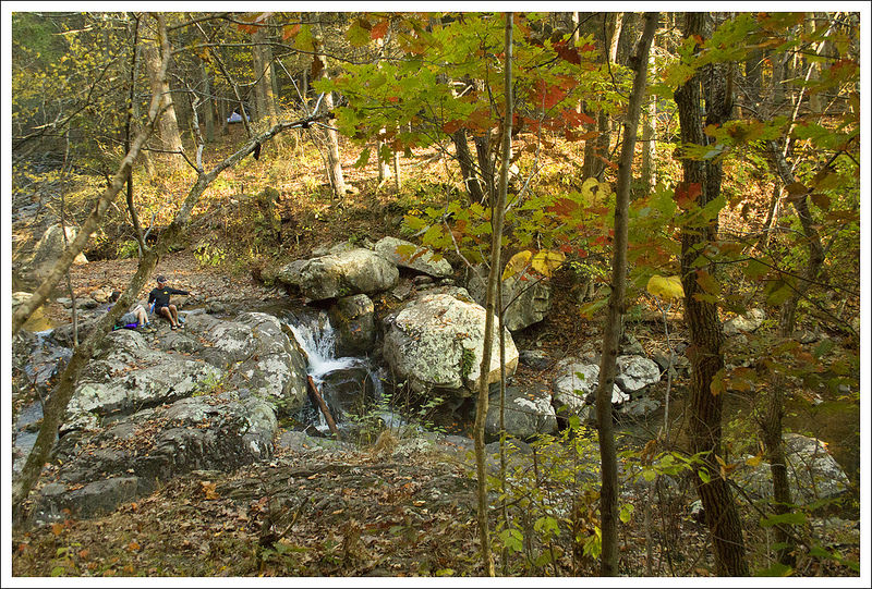
We soon passed another great campsite next to a small waterfall. The trail meanders along and across Jeremy’s Run, requiring lots of rock-hopping across the stream. The sun was dipping down quickly and we soon found that we needed to put on our headlamps. Christine and Kris had legit headlamps, but I was using a small clip-on headlight that didn’t have the lumen output needed for a night hike. When it reached dusk a few miles from our campsite, we came across a couple with a dog. They asked us how far it was to the campsites and if they were all taken. The guy was carrying an outrageous amount of gear and the girl looked completely miserable. We knew they were going to be hiking to the campsites by nightfall and setting up camp in the dark. I’m not sure if this was her first venture into overnight camping, but based on the daggers she was shooting him with her eyes, it may be their last. They warned us they had seen a couple of bears just ahead of us, so we were on full alert.
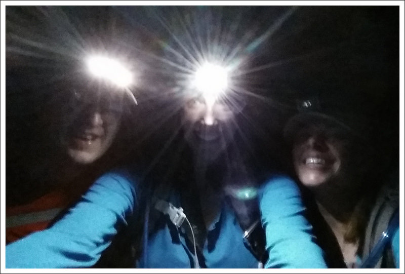
We hiked by headlamp the last hour. Below: Jeremys Run in twilight; A large pool along the run; One of the last few stream crossings before it became too dark to take photos.
As it became fully dark, we still had a few stream crossings to make, which made it quite hazardous. I reminded myself that the water wasn’t that deep so if we stepped in the water, we would probably be OK. Another danger of night-hiking is the ability to lose the trail. We really had to pay attention to the ground and try to keep an eye out for occasional blazes to make sure we would stay on the trail. Hiking in the fall after most of the leaves have covered the trail provides an extra challenge. Because I had a weaker headlamp, it was hard for me to lead along the trail since the lights from Christine and Kris were blasting my shadow ahead of me on the ground. And then, I heard large noises in the woods, which I’m guessing was the bears that we had been warned about. We kept talking loudly and playing some games to keep our minds sharp (animals/foods/colors that start with each letter of the alphabet) as we hiked along.
At 4.25 miles from our intended campsite, we finally came across a concrete marker post. This post marked the junction with the Knob Mountain cutoff trail, so we knew were getting closer. We kept straight on the Jeremy’s Run Trail and at 5.15 miles, we reached our first junction with the Neighbor Mountain Trail. It was now just .3 miles straight ahead until we reached the parking lot where we started. We made the last climb with renewed energy and celebrated that we made it through this adventure.
It was definitely one of the longest hikes we have done in a day and with the extra weight on our back, was one of the toughest. We got back in the car and decided to go out to dinner to celebrate with drinks and food at Ciro’s in Elkton, VA. We were physically exhausted and hungry, but it was quite an adventure we will never forget.
One takeaway I had from this trip was that we were all great at hiking together. When we faced the challenge of not having two functional tents, we kept our wits about us, made a quick decision and went with it. There was no complaining and we just relied on each other to get through. If we had panicked or become overly upset, it could have led to a dangerous situation. It is through this challenge, that we learned that having good hiking partners that work well together is a great trait to have for survival. We all vowed to come back to this spot to camp together sometime in the spring to get the full experience through camping on Jeremy’s Run. After the hike, Kris bought her own tent and I bought a better headlamp.
Kris Says…
Backpacking 101- It doesn’t matter if you were up late celebrating your birthday and borrowing some equipment…ALWAYS double check your equipment or your trip will not be so fly!
I was excited to be hiking with friends on a beautiful fall day. We have always shared an appreciation of nature, lots of conversations and tons of laughter. I guess that is why we handled our little upset so calmly and reasonably. Although, I’m pretty sure I said “Adam, just because I am a girl doesn’t mean you have to give up your tent. I will cowboy up. Now, everyone hand over any booze or sleep aides you may have!” Of course that didn’t fly.
Ultimately we laughed at the situation, even as we crossed that creek 14 or so times and in the dark. And I learned a few things on this trip: I am capable of hiking 15 miles with a 25 lbs pack in a day, Little Debbie Peanut Butter pies are so tasty and 400 calories, it was time to purchase my own backpacking tent, a packing checklist is important and a good attitude goes a long way.
I vowed to return to Jeremy’s Run and hike early enough to snag the sweet waterfall camp spot, I also plan to cowboy camp sometime just to prove I can (my dog will protect me).
Christine and Adam- you two are SuperFly!
Trail Notes
Distance – 14.7 miles (We had issues with MapMyHike on this trip, so we have partial stats. We have the Neighbor Mountain segment and most of the Jeremys Run to Elkwallow segment. We’re missing the portion along the Appalachian Trail and a few early tenths of a mile along Jeremy’s Run. Technical issues!)*
Elevation Change – 2610 ft.
Difficulty – 4. The terrain is fairly moderate throughout the hike, but the length ups the difficulty rating.
Trail Conditions – 3. Sections along the Appalachian Trail and Neighbor Mountain are in great shape. The Jeremy’s Run trail is rocky and has at least 14 water crossings – some of them can be challenging!
Views – 3.5. The views descending Neighbor Mountain are beautiful, but never fully open/panoramic.
Streams/Waterfalls – 3.5. The stream is beautiful and scenic.
Wildlife – 5. We saw a bobcat! Hikers we passed at sunset told us there was a bear ahead, but we couldn’t see anything in the dark. But, the last time we hiked in this area, we saw three bears. We have also seen/heard owls, pileated woodpeckers, and whippoorwills.
Ease to Navigate – 4. The junctions are clearly marked and easy to follow — unless you’re hiking in the dark! 🙂
Solitude –1. It’s the most popular backpacking loop in the park’s northern district.
Directions to trailhead: From the US-211 entrance of Shenandoah National Park, head north for 9 miles on Skyline Drive. Take a left towards the Mathews Arm Campground. In .7 miles, you will reach a parking lot. The trail takes off next to the outdoor bathroom.
* MapMyHike is not necessarily accurate, as the GPS signal fades in and out – but it still provides some fun and interesting information.