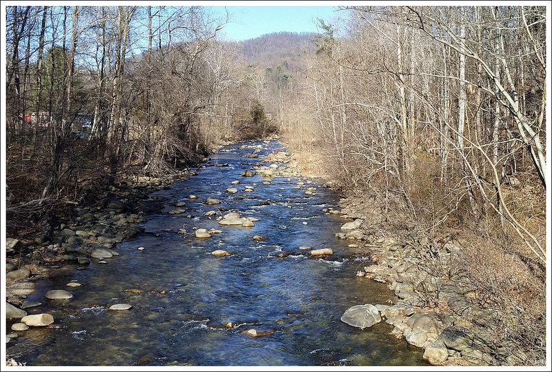
This 3.8 mile hike on the Appalachian Trail completed a short 1.9 mile gap in unbroken Appalachian Trail mileage we left after hiking the Three Ridges circuit in 2012. After you cross the scenic Tye River footbridge, the hike doesn’t boast any views or unique scenery. It’s a moderate uphill climb to a junction marker in the woods.
View the Full Album of Photos From This Hike


Adam Says…
We have been working on section hiking some of the Appalachian Trail through Virginia. Hopefully one day, we will have the entire section that crosses Virginia on here. In doing it in sections, we have ended up with a few small gaps between sections. This gap was created when we hiked Three Ridges and did it as a loop trail that included a return trip on the Mau-Har trail. I got a text from my friend Bryce from Hiking Upward that mentioned he was going to try and hike Spy Rock the next day. I mentioned that we were trying to get this section done as well, so he agreed to accompany us on this section also. It was January 1st and we wanted to start the year off right with a great day of hiking.
We parked our cars at the lot on 56 where the Appalachian Trail crosses the Tye River. We crossed the road and almost immediately you come upon a large suspension bridge that crosses the Tye River. We knew this was probably the highlight of the trip, so we took some time to get some pictures across the bridge and of the Tye River from under the bridge.

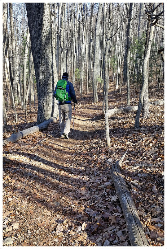
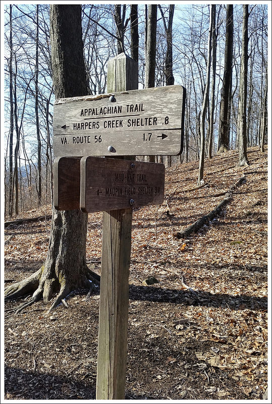
After crossing the bridge, the trail takes a few switchbacks and then starts a fairly steep uphill through the woods. Looking back from the trail, we were able to see some obstructed views of Pinnacle Ridge and The Priest, but when spring hits these views will likely be more obstructed. On our climb up, we saw a dog come racing towards us. As it turns out, it was a bear-hunting dog, as it had a large radio collar around his neck. The dog barely stopped at all and barreled past on a mission to try and find a bear. We continued our hike up and came up to the sign post that marked the trail junction with the Mau-Har trail. From this point, you could continue on the Appalachian Trail to the right to reach Chimney Rock and Three Ridges or take a left on to the Mau-Har Trail, to reach the Maupin Field Shelter. We tapped the post to mark that we had completed this section and made our way back.
After our hike, we got in our cars and stopped by Crabtree Falls, which had frozen water on the sides. This iconic waterfall is always a nice place to visit any time of year. Our next stop was to hike up to Spy Rock. When we first arrived, the parking lot was full of cars and vans. We felt defeated and were about to make the decision to not do the hike, when someone came down the trail and mentioned that a few car loads were getting ready to leave. We waited just a couple of minutes and two parking spaces opened up. We hiked up to Spy Rock, which was covered in snow in some parts. At the top of the trail, Bryce decided he wanted to bushwhack to another rock outcropping that would look back on Spy Rock. So, we set a plan to try and take pictures of each other from the different summits. The climb up Spy Rock was pretty dangerous, since the water that falls into the cracks that your normally use to help pull yourself up was frozen, making it very treacherous. When we got up to the top of Spy Rock, the wind was blowing so hard and the temperatures from the wind chill put it way below freezing. We waited for a few minutes at the top. We eventually saw Bryce making his way to the rock outcropping. We took a quick photo of him and then made our way off Spy Rock, since we felt we could get frostbite fairly quickly up there. We reconvened where we had split up and then made our way back down the mountain. We got back to our cars and headed to Staunton for lunch.
This area where we hiked is a real sweet spot for Virginia hiking. You have The Priest, Three Ridges, Crabtree Falls, and Spy Rock all within a few miles. If you want a place to get a few great days of Virginia hiking, this is a great destination. We were glad to reconnect again with Bryce and getting another AT section checked off our to-do list.

Christine Says…
I don’t really have anything to add about the hike! It was just a pleasant walk in the woods that finished a hole in our continuous AT miles. It was great to see Bryce (Hiking Upward) and spend the first day of 2015 on the trail!
After a couple little hikes, we all went for a decadent lunch and beers at Byers St. Bistro in Staunton. They have great sandwiches and a nice variety of beers on tap. Check it out if you’re in the area.
Trail Notes
- Distance – 3.8 miles
(Check out the stats from Map My Hike)* - Elevation Change – 1100 ft.
- Difficulty – 3. The climbing is steady and moderate the entire way up.
- Trail Conditions – 4.5. Well maintained, smooth trail.
- Views – 0. No views other than a few glimpses through bare winter trees.
- Streams/Waterfalls – 0. The stream and waterfalls are a little further up trail from this spot.
- Wildlife – 0. We did see a hunting dog – that probably scares wildlife away.
- Ease to Navigate – 4. There’s really no place to go wrong here.
- Solitude –2. This trail leads up from a very popular AT access point. You can expect to see a good number of people.
Download a Trail Map (PDF)
Directions to trailhead: From I-81, take exit 213A to head on to US-11 South towards Greenville. Go 8.2 miles and take a left on to US-56. Go 16.6 miles down US-56 and you will come to a parking lot for the Appalachian Trail on the right-hand side of the road. Park here and then cross the road to start hiking on the Appalachian Trail heading north.
* MapMyHike is not necessarily accurate, as the GPS signal fades in and out – but it still provides some fun and interesting information.

400 acre Solar Power Plant may be approved. 3 other Solar Farms have already been approved. The panels have killed thousands of birds and reduces the life expectancy of humans nearby. May put toxic metals in soil & rivers. This site sits between 2 rivers. Meeting to oppose March 16th 7pm 153 Washington St Amherst, Va
LikeLike
Sounds like a great day!
LikeLike