This 21.2 mile route along the Appalachian Trail crosses Sky Meadows State Park and the G. Richard Thompson Wildlife Management Area. There are a couple nice vistas along the way, but it is mostly a quiet, wooded walk. This section of the trail has three shelters – one of the most luxurious (Jim & Molly Denton) and one of the oddest/smallest (Dicks Dome). Christine is going to cover the first day and Adam will pick up the second.
View the Full Album of Photos From This Hike


Day One (6 miles total – 4.8 on the Appalachian Trail and 1.2 walking around Sky Meadows State Park)…
Most typical couples want to spend their anniversary in a cozy bed & breakfast inn or possibly out for a fancy multi-course dinner. Not us — we go backpacking — especially when we’re given a sunny weekend in the middle of peak fall color season! We took a Friday off of work so we could have two nights out on the trail. I was coming off a knee injury, so we picked a section with gentle terrain and several shelters/campsites spaced to allow for shorter mileage each day. The section between Ashby Gap and Front Royal fit the bill perfectly. It was also a good chunk of miles we hadn’t hiked before.
To make transportation easier, we hired a shuttle driver for this trip. None of the recommended shuttle drivers listed in our AWOL Guide were available, so we turned to the Appalachian Trail Conservancy’s list of shuttles. ‘Sharon’s Shuttles’ was prompt and affordable. The mother-daughter team has been shuttling hikers for over a decade now. We also arranged for a parking spot at the Mountain Home Bed & Breakfast in Front Royal. For just a couple bucks a day, Mountain Home will give you safe, off-road parking spot at their inn. (There is a small AT lot on Rt. 522, but we don’t recommend leaving a car there overnight.) Mountain Home also has a clean, well-equipped hiker hostel! The proprietors are past thru-hikers, so they’re a great source of information for the trail and the local Front Royal area.


We met our shuttle driver at the inn around 10 a.m. She drove us the 20 miles to our start point at Ashby Gap. As she pulled into the parking area above Ashby Gap, she said ‘I’m going to drop you off here because someone left a headless deer at the other end of the parking lot’. Gross! I am glad she gave us the warning because that is not something I want to see! I imagine the headless deer had a nice set of antlers that somebody wanted to keep. 😦
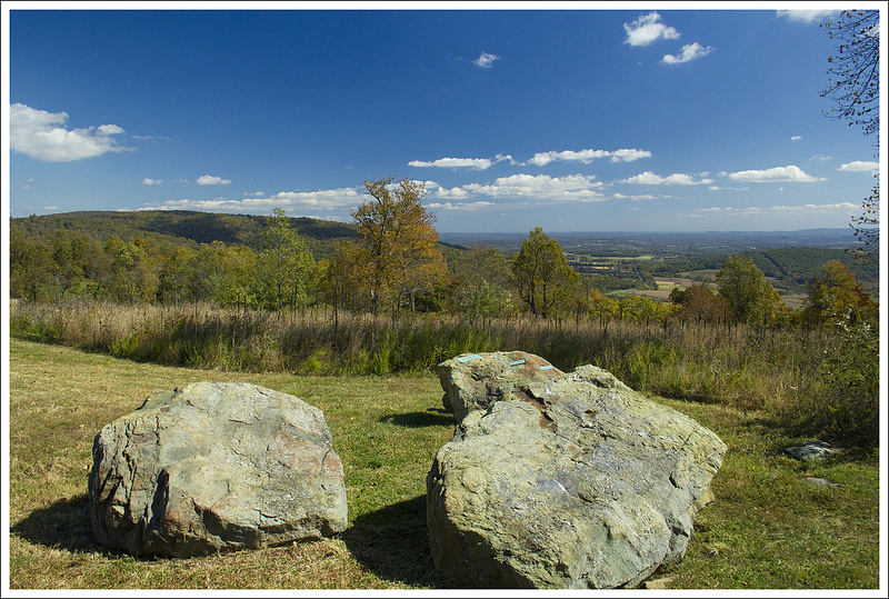
By 11:00 a.m., we were on our way! We followed a short spur trail from the parking area downhill to its junction with the Appalachian Trail. Headed south, we reached the busy road crossing of Rt. 50 after just several hundred feet. Cars were zipping by at 55+mph, so we made a run for it as soon as it was safe. After crossing the highway, we had a steady 1.75 mile climb up to the high point of Sky Meadows State Park. Most AT hikers probably walk across the high meadows of the park without detouring, but we decided to turn onto the Ambassador Whitehead Trail and enjoy a scenic view while we ate our packed lunch. At the viewpoint, there was a picnic table and a nice look down into a valley dotted with farm houses. I had been warm enough hiking in short sleeves, but as soon as we stopped I got cold really quickly. The brisk wind across the open meadow was enough that I pulled out my down jacket!
After lunch, we hiked the remaining mile within Sky Meadows, crossing into the G. Richard Thompson Wildlife Management Area. Near a trailside campsite, our paths crossed with two young guys hunting small game. They came out of the thick woods, and totally startled us. They were friendly enough, but it was pretty obvious they were mostly out to smoke pot and drink beer rather than actually hunt! As we walked along, we passed thick tangle of old grape vines. Some of the vines still had bunches of grapes. I tried a couple – they were very sour!


We descended from higher, more open areas back into the woods. Over the last mile of trail before reaching our first campsite at Dicks Dome, we passed under power-lines and crossed a shallow spring. A small sign marked the spur trail to the shelter. The path was heavily covered with leaves and a little hard to follow. It looked like no one had passed by in days. Dicks Dome sits almost a third of a mile off the AT. A rickety, sagging bridge takes hikers across across Whiskey Hollow stream to the front of Dicks Dome Shelter. The shelter is a tiny, geodesic dome that might comfortably sleep three people. It was built by a scout group in 1987 and has seen better days. It’s so run down and small that the PATC is currently working on building a new shelter uphill from the dome. When it’s complete, it will be called Whiskey Hollow Shelter.
When we’re out backpacking, we leave the shelter space for thru-hikers and sleep in a tent. We spent some time looking around the shelter area for a decent tent site. There was nothing – everything flat was mucky and wet and everything else was on a slope. Because of the lack of tent sites, we ended up setting up camp on the completed deck of the unfinished shelter. There were no signs saying ‘keep out’ or ‘do not use’, so we figured the deck would be the easiest and most comfortable place to pitch our tent.
It was still really early in the afternoon – maybe 2:30, so we set up camp and filtered water. I took a nap while Adam read a book. Around 4:30, we collected a stack of small firewood so we could have a campfire that evening. The new shelter had a nice firepit with benches around it! We relaxed, played cards, and made spaghetti for dinner. As the sun sank lower in the sky, the temperature dropped quickly. What had been a warm, pleasant day turned into a cold night. We started our campfire and tried to stay warm!


We climbed into our tent around 8:30. It was already completely dark, and we wanted to put the fire out completely before it got too late. We knew the nighttime lows on this trip were going to be unseasonably cold, so we had both borrowed 0 degree sleeping bags from the Adventure Program at JMU. Isn’t that a great work perk? I was able to rent a nice-quality Big Agnes bag for just a few dollars! We normally don’t backpack when it’s cold, so we both just have summer bags rated for 32 degrees. I’m a cold sleeper, so I knew it wouldn’t be enough to keep me warm on this trip. I was thankful I had rented the bag… because it was COLD! I slept in a hat, gloves, thick socks, and a silk baselayer. I was comfortable and warm enough. It took me a while to fall asleep, but I eventually did. I think I ended up sleeping over ten hours that night. I guess that’s what happens when you sleep and wake by the natural light!
Day Two (15.2 miles)…
We woke up in the cold at the first sign of daylight and made a warm breakfast of granola, Nido, and hot drinks (coffee for Christine and cider for me). We packed up everything quickly and made our way back on the trail. Some people like to have a leisurely morning when backpacking, but we like to be up at sunrise and back on the trail as soon as possible. The cold helped us get moving quickly since we knew we would warm up once the blood started flowing.


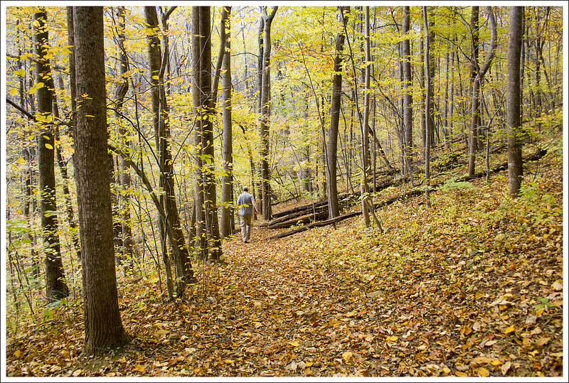
From Dicks Dome, we had only had a few tenths of a mile before we were back on the AT. The hike started off with some ups and downs, enough to get my blood going enough that I wanted to take off my outer fleece. After 2.5 miles, we reached a junction with the Trico Tower spur trail which leads to a communication tower. From this junction the trail descended a bit and at 3.2 miles, we passed a reliable spring. While a lot of the hiking in the morning was uneventful, we marveled at how beautiful the trees looked in the fall. The ground was covered with color and the sun shining through the tree tapestry gave us a reminder that the hard work of carrying packs was worth it.
At 4.5 miles, we reached the Manassas Gap Shelter. It was a little early for lunch, but we decided to stop and eat since we knew there was a reliable spring and a table to cook. We combined a macaroni & cheese meal with a buffalo chicken meal and topped it with bacon to make a glorious warm lunch. Once we had stopped, we could feel the chill of the wind, so it was back into our outer layers while we stopped. After resting a bit at the shelter, we pushed on.


Descending from Manassas Gap, we came upon a large stone wall at 5.5 miles, which skirted the trail for a good distance. The trail continued to descend and we reached Tuckers Lane at 6.8 miles, which had some parking for the trail. Here, we hung a left and passed some houses with people doing yard work. I’m sure they are used to seeing lots of hikers, but it would strike me funny to see people coming out of the woods often right across from my house. You walk along the road for a while until you pass underneath I-66. The loudness of all the traffic made me feel eager to escape back into the wilderness. At 7 miles, you cross US-50 and continue on to a footbridge to stay on the AT. You pass over some railroad tracks before your hike begins a steep ascent.
At the top of the ascent, the trail opens up to a beautiful grassy bald with a bench at the top of the hill. The views were somewhat obstructed, but this is a nice stop for a picturesque scene. My guess is that a lot of people park at Tuckers Lane and do this as a short out-and-back of about 2 miles, a nice spot for a picnic. Due to the cold wind whipping along the bald, we didn’t stay but a minute. At the top of the ascent, the AT enters the woods and descends again. On the descent down, the trail did open up through some gorgeous farmland. We walked along the trail and enjoyed the views – the scenery exemplifies Virginia mountains and farmland. At 8.8 miles, we reached VA 638. We crossed the road and rock-hopped a small stream at 8.9 miles.


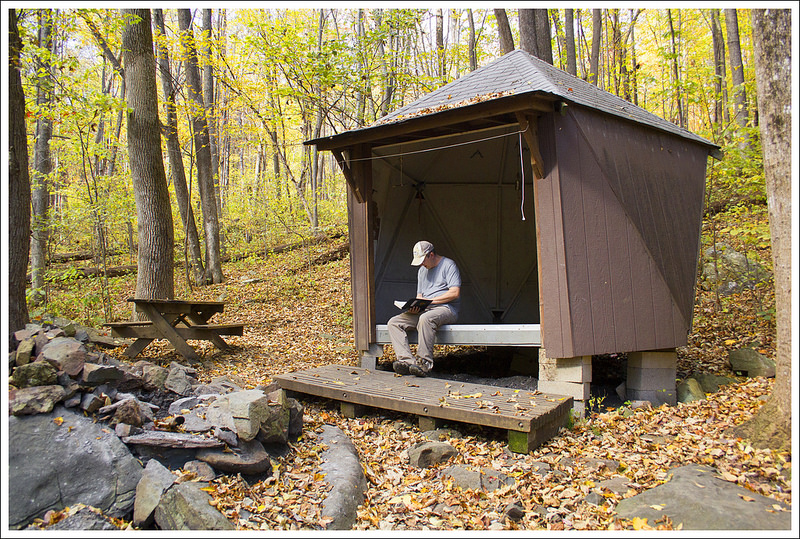
At 10 miles, we arrived at the Jim & Molly Denton Shelter around 2:30 p.m. The temperatures were supposed to rise more that day, but the heavy cloud cover and brisk wind kept it from warming up at all during the day. Our plan was to stop for the night here and we found a nice campsite away from the shelter. This shelter is one of the plushest we’ve seen along the trail – it has a solar shower, separate cooking pavilion, nice Adirondack chairs, and even horseshoes to keep you entertained. We stopped for a snack before working on setting up camp. There, we met a very nice lady by the trailname of Puddles. She had thru-hiked the trail several years ago. We struck up a long conversation with her and loved her outlook on life; she has had a lot of trials in her life, but her positive attitude and love of nature keep her going.
The temperatures were dropping quickly while we ate our snack. With the foreboding skies and whipping wind, we knew we were going to be in for an even colder night. I really didn’t feel that the sleeping bags we rented were any warmer than what we personally owned (I know bags are often debated about how warm they stay with the gear-reviewing community). We talked it through and felt it may be best to try and push on to see if we could make the rest of the trip before it got dark. It was a shame to leave such a perfect spot, but we felt it was the best decision. As we had lollygagged a bit, we knew we needed to get going right away.


From the Denton Shelter, the trail was a gradual uphill. We passed a powerline at 11.1 miles and then arrived at the spur trail for the Mosby campsite at 11.8 miles. Christine checked out the campsite while I waited on the trail. She came back and talked about how nice and spacious the campsite looked. What I didn’t know was that Christine wanted to camp here for the night because her knee was hurting and she wasn’t sure she had any more miles left in her. However, I didn’t pick up on her subtle signals and suggested we move along. When we’re backpacking, we both reach a threshold somewhere between 10-12 miles when things start being less fun for both of us. When you’re a weekend backpacker, you never really get the chance to build up the trail legs you need to easily carry a pack 15-20 miles a day.
At 12 miles, we crossed a forest service road. The trail stayed level for a while before a long descent that leads to Bear Hollow Creek. The sound of the creek was nice to hear and we soon came across a large fence to our right of the trail. This serves as the boundary for the Smithsonian Conservation Biology Institute land, an area used to preserve and study animals. We kept hoping to see elephants or cheetahs through the chain-link fence (not that they necessarily house any), but nothing was to be seen. We knew we were at the end of the trail as we reached this fence area and at 15.2 miles for this day, we reached US 522. We took a left on the road and reached Mountain Home in a short distance. We shambled into our car totally drained. We made our way to Spelunkers in Front Royal, our favorite place for a burger and shake after a long hike in the nearby area. We knocked off another section of the AT in Virginia and that is something we were proud of as we slurped up the last remnant of shake from the bottom of our cups.


Trail Notes
- Distance – 21.2 miles
(Check out the stats from Map My Hike [Day One] [Day Two – Part 1] [Day Two – Part 2])* - Elevation Change – 3717 ft.
- Difficulty – 3. The (unexpected) distance we covered on the second day was challenging, but overall this was a relatively easy backpacking trip.
- Trail Conditions – 4. The trail was in great shape with pleasant, non-rocky conditions.
- Views – 3. We had nice views from Sky Meadows State Park and then some slightly obstructed field views on the second day.
- Streams/Waterfalls – 2. There were only a couple very small streams on this section. They were sufficient as a water source, but not that scenic.
- Wildlife – 2. We saw one deer on the second day, but that’s about it!
- Ease to Navigate – 4. The White Blazes are frequent and easy to follow.
- Solitude – 2. We saw relatively few people along the section. We saw two people hunting small game in the wildlife management area. There were two weekenders and one SOBO thru-hiker at the shelter.
* MapMyHike is not necessarily accurate, as the GPS signal fades in and out – but it still provides some fun and interesting information.
Download a Trail Map (PDF)
Directions to trailhead: To get to Mountain Home, take exit 13 off I-66W to get on VA-55W. Turn right on to VA-55W and follow it for 4.7 miles. Turn left on to US-522S and go 3.5 miles until you turn on to Remount Avenue and reach Mountain Home. To get to Ashby Gap from Mountain Home, head back on US-522 and now go north. In 3.5 miles, take a right on to VA-55E and follow that back to I-66. Head east on I-66 from 9.1 miles before taking exit 23/US-17N. Turn left on 55-E and go .5 miles before turning left on US-17N. Follow US-17N for 7.1 miles. Turn left on to US-50W and go 1.1 miles. Turn right on 601/Blue Ridge Mountain Road. About 1 mile up the road, you will see a small gravel parking lot on the left to park.

I enjoyed the read. My wife and I are planning a 3 day walk from where you started going North to Harper’s Ferry.
LikeLike
I just finished this hike. In the fog and rain. Very enjoyable. The best part was staying at the Mountain Home B&B. NOT expensive! Thanks Scott and Lisa!
LikeLike
Glad you had a great hike! Mountain Home is so accomodating.
LikeLiked by 1 person
Happy anniversary (late) you two. What a great way to celebrate. I think I would have enjoyed the second night on the trail but I am slower. Sounds like a nice overnight hike. Happy Trails. Art
LikeLike
A second night would have been nice, but the wind would have made a campfire dangerous and we just didn’t fancy huddling in the tent for 14 hours. Our tent is very, very tight quarters! haha
LikeLike
Looks like a great walk. I gotta go do that too.
Thanks for the report!
LikeLike
Thanks for the visit, Chuck!
LikeLike