NOTE: Parking at Edith Gap was greatly restricted starting in fall 2020. If you attempt to park there, be sure to pay attention to the the new ‘No Parking, Tow Away’ signs. Unless you are very certain you are legally parked, we suggest following the updated route outlined below, starting from the horse trailer parking area for the Stephens Trail about a mile lower on the mountain.
Kennedy Peak is an beautiful seven-mile out-and-back hike in the Lee District of George Washington National Forest. It gives hikers gorgeous views of the bends in the Shenandoah River.
The view from atop the Kennedy Peak Tower
Christine Says…
I love this hike. We’ve hiked it in winter and fall before, but this was the first time we’ve hiked it in the spring. Sunday afternoon was the kind of day that is custom made for hiking. It was dry, sunny, breezy and in the low 70’s. The trail was lined with brilliant, pink rhododendrons. All the trees were covered with new, spring green leaves and/or blossoms. Butterflies were fluttering all around the trail, taking pauses on the blooming trees and wildflowers. It was, in a word, idyllic.
Box Turtle, Swallowtail on Rhododendron, Indigo Bunting
We began in the Stephens Trail/horse trailer parking area on VA675. The Stephens Trail departs from the back of the parking area. You should look for the orange-blazed Massanutten Trail at the head of the parking lot. The trail climbs moderately uphill for .9 miles. At the top of the climb, you’ll exit onto VA675 at Edith Gap (the old parking area). On the road, take a sharp left, staying on the orange-blazed Massanutten Trail.
Hiking uphill along the Massanutten Trail, headed to Edith Gap.
The part of the trail starts off as a wide, almost road-like track. This part of the hike is extremely easy – climbing just a couple hundred feet over the next 1.75 miles.
At around mile 2.65, the trail takes a sharp, hairpin turn and begins to climb more steeply over increasingly rocky terrain. At this sharp switchback, you may be tempted to continue straight along a visible path, but be careful to make the turn and follow the orange blazes uphill. This slightly tricky misdirection has been blocked off by logs and rocks, but enough people have missed the turn that the false path remains well-trodden. We once followed it out of curiosity and it doesn’t lead anywhere. It eventually fades out into the forest.
Don’t miss this switchback!
After the switchback, the trail continues uphill for another half mile. There is a small outcropping on the left with a obstructed views and a tiny campsite (room for a hammock or a one-person tent). After you pass this spot, continue a couple tenths of a mile to the junction with the Stephens Trail. (Note: If you want to make a longer day, adding about two more miles to your route, you can descend back to your car via the Stephens Trail. We’ve heard it’s not very scenic and is often muddy and manure-covered, so we chose the out-and-back.)
At the junction, you will turn right and follow the signs toward the fire tower. The tower is a little over .2 miles from the junction. The last stretch to the fire tower is steep and rocky. It’s really the only challenging section of the hike. The tower is a sturdy one-story structure with great views looking into the valley and Shenandoah National Park beyond.
When we got to the summit, we had the observation tower all to ourselves. We watched birds in the treetops, spotted lizards climbing around on the rocks and took in a fantastic view of the Shenandoah River and the Page Valley. It was one of the least hazy days we’ve had in a while, so we could clearly see Shenandoah National Park from this summit. Lots of vultures were soaring overhead, and even though they’re kind of creepy, they were casting cool bird-shaped shadows onto the mountain top. I always like it when they do that.
The trail is pretty rocky for the last half mile.
Sunday was the only time we’ve hiked Kennedy Peak in the afternoon. Adam and I tend to be morning hikers — it helps us avoid the crowds. But, the light is definitely prettier in the afternoon on Kennedy Peak. If you hike it in the morning, the sun shines right in your face at the summit. That makes it hard to appreciate the great view, and makes it nearly impossible to get any decent photos.
Adam Says…
This is one of our favorite hikes. This hike is not very steep and the payoff is wonderful. This is a good multi-use trail, since there are campsites and good footing for horses. There are a couple of campsites at the beginning of the trail, near the road. The nicest campsites are further up the trail. Once you are on the fire tower trail, you will find a couple of places where you can have some nice lookouts over the valley and the Shenandoah River. From some points, you can see several bends in the River. Once you reach the top, there is an observation tower where you can chill for a while before heading back down.
Views from the other side of the tower.
If you are into geocaching, look for the Presidential Peek Cache! After your hike, be sure to visit Camp Roosevelt – a great spot for a picnic.
Trail Notes
Distance – 7 miles round-trip
Elevation Change – 1300′
Difficulty – 3. The trail for the first miles is moderately uphill. The next two miles are either flat or gentle rolling terrain. The last third of a mile up to the observation tower is steeper, but very manageable.
Trail Conditions – 3. The trail is well-maintained, but there are a lot of rocks, so you’ll need to watch where you step.
Views – 4. You can really see some nice views close to the top.
Waterfalls/streams – 0. This trail is dry as a bone.
Wildlife – 2. Seems like a great bird-watching area. We saw an Indigo Bunting, Goldfinch, Wood Thrush, and Eastern Towhee. Also spotted a box turtle and Eastern fence lizard. We saw a bear when we hiked it in spring 2017.
Ease to Navigate – 4. Other than the one tricky spot at the switchback, it would be nearly impossible to get lost.
Solitude – 2. This trail is well-loved by a lot of locals, but the bulk of area tourists stick to the trails in Shenandoah National Park. You may see a few groups of hikers along the way, but it’s rarely a crowded trail.
All Photos
Directions to trailhead: The parking lot is the Stephens Trailhead on VA675. Coordinates: 38.72795, -78.51536
If you’re looking for a short, easy hike in the vicinity of the Riprap trail (southern district – Shenandoah National Park), the 3.4 mile walk to Calvary Rocks and Chimney Rock is a great option. It follows the same route as the 10-mile Riprap circuit, but turns around right after two excellent viewpoints.
The view from the second viewpoint along this short, pleasant hike. Below: Adam at the trailhead; Hiking the AT; along the AT
Christine Says…
After our long hiking trip to North Caroline and Tennessee, I came home with a really sore knee. Every step I took, it felt like someone was sticking an ice pick into the soft tissue under my kneecap. Even after a week’s rest, it didn’t feel better, so I reluctantly made an appointment with an orthopedist. He couldn’t find anything obviously wrong, so he diagnosed it as a bit of IT-band syndrome, a bit of inflamed cartilage and maybe the beginnings of arthritis. I was given orders to cross-train… which is essentially code-speak for ‘do something other than hiking‘. Bah! So, I spent most of June and July in the gym, doing cardio equipment and weights. I only managed to hit the trail a few times – all short and easy hikes. This walk to Calvary Rocks and Chimney Rock was one of those hikes.
It was a beautiful, sunny, crisp day for midsummer. We set out in the morning and had the trail almost completely to ourselves. The hike started off in the same parking lot as the longer Riprap loop hike. The hike follows the Appalachian Trail uphill for almost a half mile before intersecting with the Riprap trail.
At the junction, turn left onto the Riprap trail. The first viewpoint, Calvary Rocks comes shortly after passing a small talus slope. There are two small outcroppings of rocks at this viewpoint. It’s pretty, but in my opinion, the second view from Chimney Rock is the nicer of the two.
Taking in the view. Below: Flowers blooming along the trail; A bug finds shelter; Ripening blueberries; Indian pipes.
The second view comes several tenths of a mile past Calvary Rocks. The view is great and this outcropping is a bit more expansive. There are lots of places to scramble around. There were also a ton of blueberries growing around Chimney Rock. Most of them weren’t ripe, but I found a few that were dark purplish-blue and sweet-tart!
We lingered on the rocks for a while before heading back the way we came. It was great to be out on the trail after so many days of doing indoor workouts, and (thankfully) my knee held up pretty well!
Adam Says…
This truly hasn’t been a typical summer in Virginia. I remember brutal, hot, muggy summers in which we never could feel we could escape the heat. Luckily, this summer has been much cooler. The bugs have also not been as bad this year, which has made hiking much more pleasant.
This was a test for Christine’s knee to see if she could take another hike after just a little rest. The amount of hiking we did in the Smokies demanded for some time off, but I was glad her knee was cooperative on this hike.
Calvary Rocks are geologically different looking than most of Shenandoah’s rocks. Below: Views!
We started from the parking lot and began our hike uphill on the white-blazed Appalachian Trail. In about .4 miles, you reach the junction with the Riprap Trail. Take a left here and the trail goes down steeply before ascending. Around 1.2 miles, you will reach your first viewpoint of Calvary Rocks. There are some very nice views here, but not a lot of room to spread out if there are others on the trail. Continue from here along the trail and around 1.7 miles, you will reach Chimney Rock. Chimney Rock has great views and a little more room to enjoy the views with others or stop to eat a snack.
Along the trail, Christine was complimenting me on my ability to be able to find indian pipes. She is definitely the wildflower expert between the two of us, but for some reason I tend to spot indian pipes before she does. We found a few nice specimens along the trail.
Handsome buck near the trailhead.
We lingered for a short while to enjoy the views on such a nice summer day. We made our way back the same way on the return trip. If you would like some nice views with little effort, this is hike in the south district of Shenandoah National Park that shouldn’t be missed.
This six-mile loop hike in the Fridley Gap area of George Washington National Forest has everything – views, waterfalls, beautiful stream scenery, rugged climbing and great backcountry camping. It’s a perfect hike to get away from the crowds in Shenandoah National Park.
If you miss spotting the faint side trail behind one of the many backcountry campsites along this loop, you’ll miss the best view of the hike! Below: Adam crosses the stream; A small waterfall on the stream; This loop has many choices for backcountry camp sites.
Adam Says…
Last year, we made an attempt to do this Fridley Gap loop hike, but we had trouble finding one of the trails. We bushwhacked for a while, but finally gave up. This time when we returned, we had better directions and the blazes had recently been repainted on much of the loop.
From the top end of the parking lot, we started on the trail. We saw both purple and blue blazes early on, and started to worry. (Fortunately, it turned out that this was the only section of the trail that hadn’t been recently re-blazed.) Early parts of the trail traverse large rocks, and it’s sometimes tough to see exactly which way the trail goes. We saw faded red Xs painted on the surface of some of the rocks which let us know that we were going the right way. The trail is uphill but not too steep. In .2 miles, you come to a fire road. Take a right here and continue on the fire road. You will pass by some small falls and Mountain Run to the right and a large boulder slide to the left. The trail actually follows the streambed, and you will need to rock-hop to continue on. At .45 miles, you will reach another falls area and you will cross over Mountain Run until you see the trail junction cement post. This is also the point that Mountain Run and Fridley Run join. It was at this point that we failed last time trying to find the orange-blazed Massanutten South trail. Looking at the cement post as you approached it, look back around 4:00. You will see the orange blazes on the Massanutten South trail as you will cross the water again (this time it is Fridley Run) and climb up the hillside. These weren’t painted on the trees before (they look fresh now), so you should be able to find your way more easily.
Early in the hike, the trail traverses the streambed. There are plenty of rocks, so it’s fairly easy to hop from spot to spot and avoid getting your feet wet. Below: Adam climbs up the trail shortly after the parking lot; A rockslide early on the hike; Blooming redbuds.
The climb up the Massanutten South trail is quite steep and you may need to stop a few times along the way to catch your breath. This trail is also narrow and you may have to cross over a few blown-down trees, but the trail wasn’t too hard to navigate with the recent re-blazing. At 1.85 miles, you will reach a campsite area. Look closely and you will see a path that leads to a rock outcropping called Grubbs Knob Overlook. Take this path up to the overlook to get the best views along the hike. You will see the top of Grubbs Knob to the left from the overlook and views to the west. After taking in the view, go back to the campsite and continue along the Massanutten South trail. At 2.05 miles, the trail reaches its peak and then you will start to descend, as the trail takes a steep turn to the left. You will make your way back down this very narrow path and cross Fridley Run at 2.70 miles.
After crossing Fridley Run, you will begin to ascend on the trail again (turning again into a wider fire road) until you reach a rocky slide that gives you views of Fridley Gap and North Mountain at 3.25 miles. Continue to ascend as you walk around part of Third Mountain. The fire road stops ascending at 3.5 miles. The trail then descends and you reach another cement junction post at 3.84 miles. Take a left on the purple-blazed Fridley Gap trail, which follow another wide fire road. You will likely see lots of burned trees from a fire in 2010 that covered a big portion of this area. At 4.5 miles, you will reach another junction. The purple-blazed Fridley Gap trail ascends to the left and continues through the woods. Take this trail and begin a steep ascent across some switchbacks. At 4.85 miles, you will reach the top of your climb and there are a few stones that you can rest on for a few minutes if you need to catch your breath.
This small waterfall feeds one of the most popular swimming holes in the area. Below: More pretty cascades.
The trail now begins to descend very steeply. We were so glad we had our trekking poles since the rocks under the leaves were often loose and it helped to lower ourselves down the steep steps. We were also glad we did this hike this direction rather than the clockwise version of the loop. At 5.5 miles, we reached another junction with the Massanutten South trail. Take a left on the orange and purple-blazed fire road (don’t go the way that crosses the bridge) and you will reach the junction that closes the loop at 5.65 miles. Take a right here, crossing Mountain Run again and make your way back down the fire road. Be sure to catch the rocky path at 5.8 miles that leads back to the parking lot at 6 miles.
A funny moment happened along the hike. Christine had programmed her phone to use the MapMyHike app. In a recent upgrade, it now includes some vocal updates along the way, usually at the mile increments. One time, we heard the voice say “Don’t stop now. Walgreen’s is behind you.” (Walgreen’s is now advertising on MapMyHike.) While this is meant to be a word of encouragement to keep hiking strong, I was thinking of it as “Walgreen’s is chasing us.” As I sometimes do, I started thinking of a parody song to the tune of the Road Runner Show TV theme song. So for your enjoyment, here are my lyrics: “Fridley hiker, Walgreen’s is after you. Fridley hiker, if he catches you, you’re through. That Walgreen’s is really a crazy store. They have pharmaceuticals, toiletries, and so much more. Fridley hiker, never, never, never slow down. Fridley hiker. Walgreen’s is after you. Fridley hiker. If he catches you, you’re through.”
There is one geocache along the trail, Fridley’s Cache, a normal-sized cache near the swimming hole.
It is always a good feeling to know that we redeemed ourselves by covering a hike that we had previously failed to navigate. If you are looking for good views of streams or a swimming hole, along with a challenging hike to get some views, this may be a great hike to try out some time.
The rocks at Grubbs Overlook might trick people into thinking there isn’t an open view. Below: Views from Grubbs Overlook and the campsite that sits adjacent to the overlook.
Christine Says…
Hallelujah for freshly painted blazes! I was so frustrated last year when our attempt to hike the Fridley Gap Loop ended in failure. The failure was mostly my fault. I tried to map out the hike based on a course I saw on someone’s Runkeeper page. There were no directions, just the route overlaid on a rudimentary map of the area. I thought we’d be able to figure things out on our own with a NatGeo map of the area. It turns out that faded blazes and a large group of people camping in the middle of the trail are insurmountable challenges to my ability to navigate. We’ll let bygones be bygones and get on to the successful version of our Fridley Gap hike.
Let me start by saying, I loved this hike! It was even better than I expected. The stream was running beautifully, the views of the valley ‘greening up’ below were lovely and the weather was perfect (sunny, cool and breezy enough to keep the bugs away). I really enjoyed the little rock-hop as the trail followed the stream bed. The small waterfall and swimming hole were so pretty.
The climb up the Massanutten South trail to Grubbs Knob was steep enough to be challenging, but not so steep that we had to stop for a breather. On the way up, we could see all the little signs of spring creeping back into the forest – tiny buds on trees, tightly curled ferns and the occasional early season wildflower poking up through the leaves. The overlook at Grubbs Knob is rather easy to miss. It lies at the top of a faint footpath above a campsite. When you first climb to the top of the footpath, vertical, spine-like plates of rock obstruct any possibility for a view. But if you climb along the rocks, eventually you come to a few footholds that allow you to scramble to the top of the rocks. Once you’re there, the valley below spreads out as far as the eye can see – farms dotted with red barns; small country towns; and wide, green fields make up most of the vista.
The climb downhill after Grubbs Knob takes you through dense mountain laurel. The harsh light makes for an ugly photo… but you get the idea. Below: Adam approaches the stream; Crossing Fridley Run.
After leaving the Grubbs Overlook, we ascended a few more moments before taking a sharp downhill turn. The trail passed through dense mountain laurel, with occasional peeks toward the next ridgeline. Eventually, we heard the sound of water again. For a short way, the trail followed Fridley Run. But soon, we had to cross the stream and head back uphill along a wide fire road. From the fire road, we caught our second open viewpoint of the hike. It was a nice view, but nowhere nearly as lovely as the one from Grubbs Overlook. It’s one thing to slog uphill and come to a magnificent rocky outcropping with a sweeping vista to appreciate. It’s a little less stirring to stop along a roadside and take in a view of a couple mountain ridges.
Eventually, the fire road met up at a four-way trail junction. One direction headed toward the Boones Run shelter, another toward Cub Run Road, another continued along the Fridley Gap trail in the direction of Martins Bottom, and of course the fourth headed back in the direction from which we arrived. Seeing this junction made me think of all the different ways these trails cross and connect. There are definitely multiple possibilities for overnight backpacking loops in this area.
The second overlooks comes at a spot along the fire road. Below: Adam checks out the map at this four-way trail junction; Continuing along the fire road before our climb up Third Mountain; Charred trees from the 2010 fire.
We followed the fire road to another junction. Heading straight would have taken us toward Martins Bottom, but to stay on course we turned left and started very steeply uphill along the purple-blazed Fridley Gap trail. By this point of the hike, I was pretty hungry and my energy was starting to flag. If I were smarter, I would have eaten a snack before tackling the climb. But I’m not smart, so I spent most of the climb complaining that I was hungry!
After a short break (and snack) atop the tree-covered peak of Third Mountain, we began a crazy-steep descent. For three-quarters of a mile, we carefully picked our way down the craggy, leaf covered mountainside. Through the trees, we could see some really fascinating rock formations on the shoulder of the next mountain over. I kept trying to appreciate the view, but every time I did, I lost my footing a bit. This climb down definitely makes the case for paying attention and using your trekking poles.
The ascent of Third Mountain may not look steep in this photo, but it is! Below: Descending Third Mountain – you can see rock formations through the trees; A bridge not taken on the Massanutten trail; Adam once again crosses the stream we crossed early in our hike.
At the bottom of Third Mountain, we had just a short walk back to our original junction – the one where everything went wrong when we tried to hike Fridley Gap last year! I was quite pleased to see that marker again and be 100% certain that we had actually found our way successfully this time around. From the last junction, we retraced our steps through the streambed, past the rockslide and back to our car.
Difficulty – 3.5. The trail goes up and down several times.
Trail Conditions – 3. The trail had blowdowns, loose conditions, and narrowness, but there were also sections that followed a fireroad. It gets an overall average rating.
Views – 3. The views from the Grubbs Knob overlook are the best on the trail, but if you miss the path from the campsite you’ll miss the best view on the loop. The views along the path at 3.25 miles are nice, but not remarkable.
Waterfalls/streams – 4. The trail goes along (and through) Mountain Run and Fridley Run on several occasions. The small falls and swimming hole gives it a bonus.
Wildlife – 2. This may be a good hike for bird watching. We saw a peregrine falcon soaring above at the Grubbs Knob overlook and enjoyed hearing the song of the eastern towhee along the way.
Ease to Navigate – 2. If we got lost before, we have to give this a low rating. The path to start the trail from the parking lot could be better blazed and there are several turns to make.
Solitude – 4. You may see some people at the swimming hole or camping alongside the junction with Mountain Run and Fridley Run. However, we only saw one other group after this point on a nice spring weekend day.
Directions to trailhead:
From Harrisonburg, VA, head east on 33. Take a left onto VA-620 North/Indian trail Road and continue for 1.7 miles. The road will turn into Rt. 717. Go 3.4 miles and take a right on Minie Ball Ln. Go 1.1 miles. At this point, the road will turn back into Rt. 620. Go 2.7 miles and take a right, continuing on 620 for about half a mile. Take a right onto Armentrout Path. Take the first left onto Airey Ln. Parking is a lot at the end of this gravel lane. If you pass the lot, you are on private property. The directions to this trailhead are a little confusing, and we recommend putting the coordinates on the map below into your phone/GPS.
* MapMyHike is not necessarily accurate, as the GPS signal fades in and out – but it still provides some fun and interesting information.
This 13.2 mile circuit can be done as a day-hike, but we recommend extending the beauty and wildness into an overnight backpacking loop. Take your time, and you’ll be treated to panoramic views, lovely mountain streams, demanding climbs and peaceful campsites.
Christine takes in a a view of The Priest from Three Ridges mountain. Below: Welcome to the Three Ridges Wilderness; Over half of the circuit follows the Appalachian Trail; Nothing beats a campfire in the evening.
We had long been planning a three-day backpacking trip across Mt. Rogers, but as the day of the trip drew closer, we started seeing the term ‘Appalachian soaker’ thrown around in weather forecasts. We’re fine with passing showers and fleeting thunderstorms, but we didn’t want to get pinned down on Mt. Rogers on a wet and stormy night.
Fortunately, the weather in central Virginia was far more favorable, so we ditched our Mt. Rogers plan, and decided to hit another backpacking circuit on our list – Three Ridges. This route, which makes use of the Appalachian Trail and the Mau-Har Trail, is known as one of Virginia’s most rugged hikes. Everything we read about the circuit in advance of our trip emphasized the hike’s strenuous nature. With roughly 6,800 feet of elevation change, you’re almost never walking on flat trail. It’s a constant onslaught of heart-pounding climbs and knee-grinding descents. But along with the challenging terrain, you get spectacular views, beautiful streams and lovely campsites.
We started out early Saturday morning. The first stop was fuel… for ourselves. We had a huge breakfast at The Chuckwagon in Harrisonburg. If you have a chance, stop by and indulge in one of their homemade 4-inch biscuits (Adam’s favorite is ‘The Round-Up’) or a stack of their amazingly fluffy pancakes. (Sadly… Chuckwagon closed in January 2013) With full stomachs, we made our way to Reed’s Gap at mile marker 13.7 on the Blue Ridge Parkway.
When we got to the parking area, the lot was already jam-packed, mostly with heavy-duty construction vehicles left idle for the weekend. Just as we were about to give up and find a parking spot further down the parkway, one car pulled out and left an opening for us!
Adam makes the initial climb up Meadow Mountain. The climbing was occasionally rocky, but never terribly steep.
We started the Map My Hike app on Christine’s phone, hoisted our packs, and headed south along the Appalachian Trail. From the parking area, the trail hugs the edge of a meadow, which was full of blooming yellow ragweed and purple thistle. It was such perfect weather for backpacking – sunny skies, low humidity and a crisp breeze. The trail almost immediately began to climb uphill over Meadow Mountain. The climbing was steady, but never difficult, for about .8 of a mile.
At the top of the ridge, there was a small dry campsite with obstructed views. Department of the Interior boundary markers were all along the ridge. We spotted at least three or four right next to the trail. After walking briefly along level ridge, the trail descended to Maupin Field Shelter. The shelter site had tons of space for tents (many of the tent sites were flat, soft and grassy), a typical AT three-sided hut, a metal bear-hang post and a picnic table. The area also had an informational kiosk with trail notes and wilderness-usage policies. There was also a child’s orthodontic retainer tucked into a Ziploc and pinned to the board. We’re guessing there is now one retainer-less Boy Scout and a less than happy mother!
Christine climbs the stone steps up Bee Mountain.
After Maupin Field Shelter we began climbing again, over Bee Mountain. The climbing was slightly more strenuous, but definitely manageable. In several places, rock steps were set into the trail to make the climbing easier. Along the way, we started playing ‘Categories’. It’s pretty basic – each player designates a category, then players take turns naming items that fit within that category. For example, categories might include Movies Based on Comic Books or Items You Need on a Backpacking Trip. It’s pretty mindless, but it kills time. Whoever successfully names the last item for the given category wins the round. The best category of the day was Complaints Uttered When Hills Are Steep. We won’t share the specifics of our trail talk here, but it was pretty funny to reflect on this topic! Bee Mountain didn’t offer any views and was followed by a short descent before tackling the more serious climb up Three Ridges Mountain.
The climb up Three Ridges consisted of several steep pushes, with nice stops for views all along the way. The first view, Hanging Rock, was very impressive, so we decided to break for lunch and enjoy the amazing vista. As we ate our Panera bagels (Cherry-Vanilla with Justin’s Chocolate Hazelnut Butter for Christine and French Toast with Peanut Butter for Adam), we noticed two dogs fitted with radio collars – doubtlessly bear hunting dogs set loose in the woods for pre-season practice. Both dogs were female; both were emaciated and showed signs of over-breeding. We hate to cast aspersions or generalizations on any group of people, but we are not fans of hunters that use this type of technology to hunt bears. Both of the dogs were pretty persistent about trying to steal our food. The bolder dog, who was heavily perfumed by a skunk encounter, came within inches of snatching Christine’s bagel right out of her hand.
One of the bear hunting dogs we encountered seemed to be enjoying a view of the Priest from the Hanging Rock Overlook. Below: Adam climbing the first uphill section of Three Ridges Mountain; Southbounders (BeeSting, Fats and Happy) contemplate the Priest and their upcoming climb; The view from Hanging Rock.
While we sat at the overlook, we had a chance to chat with three Southbound AT hikers – Happy, Fats and BeeSting. All three had started in Pennsylvania in August and were making their way toward Georgia. Happy was already there when we arrived, so we got to talk with him for a good bit while he waited for his companions to show up. He was from Las Vegas and on his first long-distance hike. He told tales of his shoes breaking down on the Pennsylvania rocks, getting caught in a vicious cold-front driven storm on Bearfence Mountain, and his epic weight loss (40 pounds in less than a month!). He was a nice kid and we enjoyed talking to him and telling him about some of the things he has to look forward along the trail in Virginia – The Priest, Spy Rock, Cove Mountain, McAfee Knob the Grayson Highlands. He told us the friendliest place he’d stopped on the trail was the town of Waynesboro.
After a while, Fats and BeeSting came along. They were a young couple from Montgomery County, Pennsylvania. We didn’t talk to them as much, because we wanted to press on and make our way to camp by mid-afternoon. Happy left a few minutes ahead of us, and we were sure we wouldn’t see him again. Thru-hikers are known for keeping a blistering pace!
Upon leaving the vista, there was quite a bit more uphill climbing before we finally reached the true summit/highpoint of Three Ridges Mountain. At the highpoint, we ran into a group of three women out on the same circuit we were hiking. We chatted briefly about the great weather before leaving them to enjoy their lunch.
Christine enjoys the view on a perfect late-summer day. Below: The actual high point of Three Ridges is in the trees; Adam walking through ferns along the trail.
After the high point, the long, seemingly endless descent to Harper’s Creek began. It wasn’t always super-steep. Sometimes it almost leveled off. As we were walking along, we saw a bear dash off through the brush. We were both glad that the bear hunting dogs hadn’t pestered the bear into a tree. A few steps later, we heard an exuberant voice shouting into the wind – ‘Woooooo!’ ‘Yeaaaaaah’! ‘Echo Echo Echo’ and ‘I’m on TOP of the WORLD’. As the voice drew nearer, we guessed it was Happy having a ‘mountain moment’. Sure enough, he called to us through the trees so we could share the nice view spot he had found a little ways off the trail.
We left the spot before he did, knowing that there would be more views along the way. One unnamed view on the left side of the trail was especially beautiful. We stopped for photos and a pack-less rest. A bit further along, we saw a huge flat, upright rock that looked just like a tombstone. Immediately past that, we noticed a faint trail that climbed up steeply through the woods to a jumble of rock. We guessed correctly that we had found Chimney Rock. It was a great place to sit, and every bit as scenic as the very first overlook on Three Ridges. We enjoyed looking down into the valley, dotted with homes, streams and a large Christmas tree farm. The Priest, one of Virginia’s most beautiful and distinct mountains, loomed impressively across the way.
Adam enjoys one of the many spectacular views from Three Ridges Mountain. This particular stop came at a rocky outcropping known as Chimney Rock. Below: Views, views and more views!
After Chimney Rock, the last real vista was a wide flat shelf of rock overlooking the scene below. After that, the downhill got pretty bad. It was the bone-jarring, steep, type of downhill that makes your knees beg for mercy! We both slipped a couple times on the descent. It was probably all the fallen acorns – if your boot hits them just right, they sort of function like tiny roller-skate wheels. Adam managed to hyperextend his knee on one slip, and hiked in a significant amount of pain the rest of the day. Christine hit a loose flat rock and rode it like a surfboard until she finally landed hard, but unharmed, on her rear end.
Honestly, the uphill on this hike is moderately hard, but the downhill is brutal. Anyone in reasonable condition should be able to handle the physical demands of the ascents along the trail, but if you have bad knees, the descents are nothing short of punishing. We both tried to keep our packs on the light side for this trip. Christine’s pack was 22 pounds and Adam’s was 29… but that was before water. After a dry week, we weren’t sure if Harpers Creek would be flowing, so we both carried quite a bit of extra water – 3.5 liters for Christine and 4 for Adam. We knew there was a chance we wouldn’t need it, but when it comes to water it’s always better to be safe than sorry.
The climb down from the summit of Three Ridges was grueling and rocky! Below: The trail went over many large boulders; It passed thick stands of rhododendron and mountain laurel; We were thrilled when the Harpers Creek shelter site came into view.
After over two miles of switchbacks, dangerous acorns and tricky rocks, the colorful domes of tents came into sight. We had reached Harpers Creek Shelter – our stop for the evening. We found the shelter itself empty, but most of the tent sites adjacent to the shelter had already been claimed by a large group of Boy Scouts from Fluvanna County.
We found a mostly flat and smooth tent site across the creek, about 50 yards south of the shelter. We figured it was a perfect spot – we were close to the shelter and could use it for a ‘kitchen’. Also, the privy was on our side of the stream, but far enough from the tent that it wouldn’t be annoying when people went to use it.
For the most part, Harpers Creek wasn’t flowing. There were several shallow pools in the streambed, which gave us plenty of access to water, but also provided a perfect breeding ground for mosquitoes. Christine immediately noticed bites forming welts on her legs, so she quickly changed out of her shorts and into long pants. She tried to change behind a large boulder, but she’s pretty sure the Boy Scouts saw her in her underpants, but hey… modesty sort of goes out the window in the backcountry.
Within twenty minutes, the tent was up, the sleeping pads were inflated, and sleeping bags were in place. We set aside all the food, cooking implements, water filter and bear bags to take over to the picnic table at the shelter. The Harpers Creek shelter was small and kind of dingy. There was no shelter log. Actually, the only thing in the shelter was a sodden pair of ‘tighty-whiteys’.
Adam set about collecting water. We recently picked up a very handy collapsible bucket made by Sea to Summit. It folds down to about the size of a deck of cards and weighs just a few ounces. But, it allows us to collect up to nine liters of water at once. Typically, we pump water through our Katadyn straight into the bucket. Then we cover the bucket with a bandanna and usually have plenty for dinner, breakfast and bottle refills.
While Adam filtered water, Christine worked on collecting wood for a campfire. It was already starting to get chilly, so it was a perfect night for a fire. As is the case at most shelters, good firewood is hard to find. There is always plenty of tinder/kindling, but the larger, long-burning pieces of wood are at a premium. In the backcountry, we only use downed wood that we can break by hand.
Our camp on Harpers Creek. Below: Setting up our ‘kitchen’ at the Harpers Creek shelter; On the menu for dinner; Adam feeds the fire.
Christine made a teepee-style campfire with larger pieces of wood on the outside, and a tinder-packed center. All of the wood collected from the forest floor was cold and damp, so the fire had a hard time catching at first. A little squirt of alcohol-based hand sanitizer took care of that problem, and within a few minutes a small fire had sprung to life.
With the campfire going, water collected and the campsite set, it was time for dinner! We keep saying we’re going to prepare our own fancy homemade backpacking meals, but when the time comes we always seem to find ourselves reaching for Mountain House or Backpacker’s Pantry. It’s just easier, and for the most part, the packaged food is really tasty (notable exception – Natural High’s Banana Cream Pie – worst dessert EVER.) Our menu for the evening included Chili Mac with Beef as the entrée and Cheesecake for dessert. Christine brought several sticks of cheddar cheese to mix into the chili and single-serving plastic bottles of Merlot. It was quite the feast!
After dinner, we put up our bear hang. Oddly, this shelter did not have a metal post like most AT shelters in this part of Virginia. We had to find a tree with a free branch. After the food was secured, we settled into our camp chairs and enjoyed the fire. Some people we’ve met along the trail think the camp chairs are a waste of pack space, but they fold down to about the size of a water bottle and weigh just about a pound. We find them well worth the extra weight for the back-resting comfort they provide. We might not carry them on a long multi-day trip when every bit of pack space counts, but for a weekend trip, we like having creature comforts.
Entertainment unfolds by the campfire. Below: Our tent at night.
As we sat by the fire, we watched a little piece of comedy unfold on the other side of the stream. A couple of the older Scouts had been assigned the task of hanging the group’s food. We watched as they missed getting the rock and rope over the tree branch, dozens and dozens of times. The boys took turns making fun of one another for their off aim. Eventually, they got the rope over a branch. They celebrated with a high-five and a ‘Woot!’. But, the branch snapped off the tree as soon as they tried to hoist the weight of many food bags. Eventually they went for help and settled on a less-than-perfect, but still functional tree. All in all, it took them over an hour to get their food hung.
Our campfire died around 9:00, so we headed back to the tent. Adam read by headlamp and Christine listened to a book on her iPod. For one of the first times ever, we both fell asleep quickly and slept soundly through the night. We were actually awoken by voices and headlamps at what seemed like the middle of the night. Christine rolled over and asked Adam ‘Is it around midnight and these kids are up late or is it morning already?’ It turned out that the Scouts were awake and cooking/packing up at 5:30 a.m. We lazed around in the tent for another hour until the sun came up.
The Scouts actually hiked out around 7:00, just as we were getting breakfast together. Usually, we’re the early risers and the first out of camp! We made maple-brown sugar oatmeal with freeze-dried bananas and coffee and hot chocolate for breakfast. We both ate two packs, knowing that we had a tough day of hiking on the Mau-Har Trail.
After a good night of sleep, Christine is ready to tackle day two! Below: Adam changes out of his Crocs and back into boots; The Appalachian Trail departing Harpers Creek.
After breakfast, we broke down camp. Adam’s hyperextended knee was still pretty sore, so Christine stowed some of his gear in her pack to make his load a little lighter. While she was transferring gear, she noticed that a mouse had chewed through the little mesh compartment on the hipbelt of Adam’s pack! The only thing in the compartment was a set of car keys, so we’re really not sure why it was appealing to a mouse. It reminded Adam of one of his favorite books as a kid – The Mouse and the Motorcycle. He thought this mouse was trying to make a sequel with their car.
We left Harpers Creek around 8:00. On our way out, we passed four or five other groups that had been tenting near the shelter. All told, there were probably somewhere between 25 and 30 people camped along the creek that night. Quite a tent city!
After leaving the shelter site, we followed the Appalachian Trail for almost a mile, largely uphill, to its junction with the Mau-Har Trail. The odd trail name is a combination of Maupin and Harpers – the names of the two shelters the trail runs between. The Mau-Har was designed by a man named Angelo Filippi. One funny review we read of the hike evidently thinks ‘designed’ is too kind a word for the trail. The review states:
“We started from Reeds Gap and heading down the Mau-Har, cussing Angelo Philippe [sic] the whole dang way. I swear he unfolded a map, put it on the ground, pulled out a piece of string, dropped the string onto the map and said “There! That is where the trail should go!” What a jerk!”
The start of the Mau-Har Trail. Below: The Mau-Har trail starts innocently enough; Then it starts to climb more steeply downhill; And then it gets even steeper than it already was!
To be fair, the trail was clearly designed to follow scenic Campbell Creek as closely as possible and following a creek that goes tumbling through a deep gorge is going to require some rugged climbing. The Mau-Har trail descended very steeply to the creek. Adam grimaced in pain from his knee injury on every downhill step. The weight of his pack, combined with the steep trail was almost more than he could bear. This was some of the gnarliest downhill we’ve ever done.
Eventually, we got to the spur trail that leads to a series of small waterfalls. Adam decided to stay put and rest his knee while Christine explored the falls. She took off with the camera, hoping to get a few documentary shots for the blog. A few minutes later, Adam decided to follow. He had heard there was a geocache hidden by the falls (known as “firedogs fishbowl”), but he had forgotten to input coordinates into his GPS. He looked for it, but without coordinates it was pretty close to impossible to find. The waterfalls were all very small due to low water flow. In spring, with snowmelt and heavier rain, the creek is probably spectacular!
Water volume in Campbell Creek was fairly low. Below: The section of the Mau-Har that follows Campbell Creek is very steep; Some sections require you to pull yourself over the rocks; Christine is happy for a more moderate grade.
From the waterfall spur trail to the Maupin Field shelter, the Mau-Har climbs very steeply uphill. At first, the trail is very rocky as it passes through the canyon. You wind your way between and over boulders. Sometimes you have to stow your trekking poles in one hand to pull yourself up over a big step. It reminded us very much of hiking the gorge at Little Devils Stairs. The terrain was very similar. After leaving the canyon, the trail becomes less rocky, but no less steep. A series of sweeping switchbacks carry you relentlessly uphill. Eventually the grade becomes more moderate in the last half mile before you arrive at the Maupin Field shelter.
Near the end of the climb, Adam announced that he was going to stop at the shelter and ‘eat every single bit of anything edible left in his snack bag’. Two packs of oatmeal, bananas and hot chocolate burn off pretty fast when the climbing is tough! He proceeded to eat a Luna Bar, ShotBlox, a bag of cashews and a bunch of mini candy bars. He reined himself in and skipped eating a dry packet of cocoa mix.
At Maupin Field, we read the shelter log. Entries talked about the skunky, food-nabbing bear dogs (someone had named them Bagels and Muffins). A southbounder left a warning to northbounders about 20-30 miles of dry hiking. Someone even left a really nice pair of ladies LaSportiva for someone to claim.
Adam relaxes at the Maupin Field Shelter. Below: One of the stream crossings near Maupin Field Shelter; Adam checks out the shelter log; The Mau-Har’s end point at the shelter.
The last 1.6 miles retraced our route from the morning before. We had a gradual climb up and over Meadow Mountain and then back to our car at Reeds Gap. We drove back toward home along the Blue Ridge Parkway, stopping at Humpback Rocks to wash our hands with soap and running water. Our last stop was the Sonic in Waynesboro for more ‘refueling’. We definitely earned some tater tots and CreamSlushes!
Three Ridges turned out to be a great alternative to our planned Mt. Rogers trip! While the terrain was challenging, we think most people accustomed to backpacking/hiking would be up for the challenge and would enjoy the beautiful and wild scenery offered by this loop.
The one issue we would like to bring up is a discrepancy about the length of this hike. Most sources list the loop at 14.4 miles. Based on our information (maps, GPS, trailer marker posts), here is how we would break down the segment distances on the trail.
0.0 miles – Start from parking lot on Reeds Gap, heading south on the Appalachian Trail and begin your ascent. .8 miles – The trail reaches the first ridge and shortly begins to descend through some switchbacks 1.6 miles – Reach the junction with the Fire Road (which heads to Love Gap). Take a left to stay on the Appalachian Trail and pass a few side trails that lead to campsites at the Maupin Field Shelter. The trail begins to climb again. 2.0 miles – Reach the summit of Bee Mountain 3.7 miles – Reach some great views from Hanging Rock. Continue to climb further up through the woods. 4.2 miles – Reach the summit of Three Ridges 5.8 miles – Great viewpoint of the eastern ridge 5.9 miles – Reach the tombstone and take an immediate right up the path to reach Chimney Rock and the best views on the trail. Rejoin the trail and descend steeply. 7.5 miles – Arrive at Harpers Creek Shelter across the creek and your stay for the night. The next morning, cross back over the creek and continue on the Appalachian Trail. 7.6 miles – Cross Harpers Creek and the trail begins to ascend very steeply. 8.5 miles – Reach the junction with the blue-blazed Mau-Har trail. Turn right and follow the trail that parallels Campbell Creek. 10.0 miles – Reach a sign designating a short yellow-blazed trail to a few waterfalls. The waterfalls are only a few hundred feet off the Mau-Har trail. Retrace your steps and continue on the Mau-Har trail. 11.5 miles – Reach the Maupin Field Shelter. Continue straight past the shelter to rejoin the Appalachian Trail. 11.6 miles – Take a left on the Appalachian Trail to retrace your steps back to your vehicle. 13.2 miles – Return to the Reeds Gap parking lot.
Returning to Reeds Gap. At this point, Adam said he was 90% sure he was going to survive the trip. Below: Christine had a great time!
Trail Notes
Distance – 13.2 miles (Check out the stats from MapMyHike [Day One] [Day Two])*
Elevation Change – About 3900 feet
Difficulty – 5. This hike is no joke. The downhill areas are steepest on the Appalachian Trail coming down from Chimney Rock and the uphill on the Mau-Har trail is equally brutal.
Trail Conditions – 2.5. The trail starts off quite nicely, but once you reach Three Ridges, expect a rocky slide downhill and loose footing uphill for much of the hike. The Mau-Har Trail was pretty overgrown in places.
Views– 5. Absolutely amazing. Chimney Rock and Hanging Rock provide some of the nicest views.
Streams/Waterfalls – 3. You’ll be near a stream most of the second day and there are a few small waterfalls. The water wasn’t flowing too strongly though.
Wildlife –3. We did see a bear. Oh yeah, and the mouse ate through part of Adam’s backpack, so there is some wildlife out there.
Ease to Navigate – 4. The trails were fairly well marked and signs were at the junctions.
Solitude – 2. This is a tough hike, but it is popular for backpackers, trail runners, and day visitors to the shelters.
Directions to trailhead: On Blue Ridge Parkway, south of Humpback Rocks. Park at mile marker 13.7 at Reeds Gap in the large lot. Head south on the Appalachian Trail, marked with white blazes on a tree near the left of the open field.
This 8.1 mile hike passes an impressive boulder field then climbs along the Gunter Ridge trail for some nice (but obstructed) views.
Adam scrambles around the Marbleyard. Below: The hike begins on the Belfast Trail; Entrance to the National Forest is marked by a placard. The two stone pillars mark an old Boy Scout camp that used to be located in this area. You can still see the footprint of the swimming pool and a few building foundations along the Belfast Trail. The camp was named after Chief Powhatan; Catawba Rhododendron were in bloom everywhere!
Christine Says…
We keep a list of hikes we want to do stuck with a magnet to the side of our refrigerator. The Devil’s Marbleyard hike had been on that list for nearly three years. It kept getting delayed for closer hikes or hikes with better views or taller waterfalls. We finally decided it was time to knock it off the list.
We got up early Sunday morning, grabbed donuts, bagels and coffee en route and made our way down the Blue Ridge Parkway. We got to the trailhead parking area around 10:00 and thankfully found only a couple other cars there. Evidently, cars that overflow the official parking lot are frequently towed. So, if you hike this trail, make sure your car is in the lot or that all four wheels are off the road and not on private property.
The beginning of the trail takes you over Belfast Creek. Below: The bridge over the creek; Adam crossing a small stream early in the hike; All the recent rainy weather made conditions ideal for snails.
After crossing a small bridge over a stream, the trail passes through an old stone gateway that used to mark entry to a Boy Scout camp called ‘Camp Powhatan’. You immediately come to a National Forest/Wilderness placard. At this point, you’re only a little over a mile from the Devil’s Marbleyard. (The sign says one mile, but our GPS and most trail guides seem to say it’s about 1.4 miles to reach the Marbleyard). The trail meanders through the woods, crossing shallow spots on the creek a couple times.
I really enjoyed seeing the blooming azaleas, Catawba rhododendron and mountain laurel. The laurel bloomed so early this year! What I did not enjoy were the locusts! The Blue Ridge Brood of the seventeen-year cicada is currently emerging in our area, and they were everywhere along the Belfast Creek trail. They were screaming overhead in the trees — I likened the sound to the one made by a failing belt tensioner on our SUV a few years ago. It’s a squeal mixed with an undertone of hiss. Not only are the locusts noisy – they’re CREEPY! Sometimes they fly into you. They have red eyes. And worst of all, they leave yellowish-clear, crunchy, empty husks everywhere when they molt. I will be very glad when locust season is over and I can have seventeen years of peace again!
So much stuff was blooming along the trail. Below: Christine checks out the large boulders that make up the Devil’s Marbleyard; Adam climbs back down the Marbleyard to rejoin the trail; A creepy locust husk.
As we came upon the Marbleyard, we crossed paths with the hikers from the two other cars we had seen in the lot. The first was a nice guy from Virginia Beach who was at the tail end of a week-long hiking vacation along the Blue Ridge Parkway. We enjoyed chatting with him and sharing information and tips about favorite hikes. The second was a pair of local kids who warned us of muddy/slippery conditions on the trail ahead. Adam had a little incident there, but I’ll let him share that tale in his portion of the post.
Before proceeding up the trail, we took some time to explore the Marbleyard. Basically, it looks like an immense stone mountain exploded and collapsed into thousands of boulders of every shape and size. If you want to climb to the top of the Marbleyard, you have to do so by scrambling up the rocks. It looks like the trail alongside the Marbleyard reaches the top, but in reality the trail turns slightly away from the boulder field and climbs upward to the Gunter Ridge trail. I imagine most hikers visit the Marbleyard and then head back to their car, making this a short 2.8 out and back. We considered doing this, but since we had already driven so far, we decided to do the full 8.3 mile loop.
After playing on the rocks for a while, we headed along… climbing uphill for a while until we reached the junction of the Belfast trail and the Gunter Ridge trail. At this spot there is a spacious (but dry) campsite.
Christine climbs the steep trail that runs alongside the Marbleyard. Below: The junction of the Belfast and Gunter Ridge trails; Adam spotted a black widow spider along the trail; Christine walks past an especially pretty stand of mountain laurel.
The Gunter Ridge trail was easy walking, but was quite overgrown. Because of the heat and humidity, I had decided to hike in shorts and a t-shirt, so I started to worry about ticks climbing onto my legs from the tall grass. Adam, on the other hand, hiked in long pants tucked into his socks. I’m getting ahead of myself, but guess who came home with six ticks crawling on his clothes – and guess who came home with none crawling on her. I always joke that my husband is a real ‘tick magnet’.
The trail along this section really opens up and provides some nice, but slightly obstructed, views. A forest fire that swept through this area about a decade ago is still very evident. There are no tall trees and charred stumps can be seen peeking up through the brushy vegetation in many places.
After walking along the ridge for a while, you come to a seemingly endless series of switchbacks climbing down the mountain. Eventually you reach a wooden horse gate, and cross out of designated wilderness into standard National Forest. Almost immediately after passing through the gate, you will encounter a stream. We stopped here for lunch. I had been wanting to eat for almost an hour, but this was the first place that really had an opening to sit and eat since the campsite at the junction of the Gunter Ridge and Belfast trails.
A hazy mountain view from the Gunter Ridge Trail. Below: Damage from a forest fire about ten years ago is still very evident; A view of mountains and clouds along the trail.
After lunch, we still had a couple miles of walking along the Glenmont Horse trail. It was easy hiking, but also really boring. It’s the part of the hike where you know you’ve seen all the cool stuff, but you still have several miles of walking along a featureless road/path. It reminded me a lot of all the fire road/paved road walking at the end of the Old Rag hike.
All in all, the hike to Devil’s Marbleyard made for a pleasant day. But, if I were to recommend the hike to others, I’d suggest just hiking to the Marbleyard as an out-and-back. If the rhododendron, laurel and azaleas hadn’t been blooming, I don’t think there was much to see on the rest of the loop.
Adam Says…
It has been about 20 years since I last hiked the Devil’s Marbleyard trail. Those that know me personally or have read this blog for a while know I grew up in Lynchburg. Some of the hikes that are most popular with people around there are Sharp Top, Flat Top, and Devil’s Marbleyard. The first two have great views and are close to Peaks of Otter, a popular picnic area. The last time I did this hike I was with with a group of friends from home. I remember the boulder field seemed so impressive. While there are similar slopes of rock along Furnace Mountain and Hawksbill summit (among others), these boulders are much larger. My friends and I climbed up the boulders from the bottom of the field. One of my friends almost stepped on a rattlesnake that was sunning itself on the rocks. I’m sure a number of rattlesnakes make their home in the cracks between the rocks, so be careful. The climb up to the top takes longer than you would expect and requires a lot of energy to navigate the scramble. Since we planned on hiking a long loop, we opted to just climb around a while on the bottom.
Beautiful mountain laurel along the ridge hike. Below: Stopping to enjoy the mountain laurel; Passing out of the designated wilderness area; Lunch by the stream.
With every interesting geological feature, there seems to be a legend that has been passed down over the years and Devil’s Marbleyard is no different. In the local tale, this area was occupied by Native Americans and the land was supposedly very green and lush. There was a large stone altar at the top of this hill that was used for worship on full-moon nights. A white couple met the Native Americans and they were thought to be spirits since they looked so different than the local tribes. The couple said they were not spirits but they worshiped a higher power. They converted the Native Americans to Christianity. However, the next year brought about a great drought and the Native Americans felt the new God and the missionaries were to be held responsible. They burned the couple alive on the altar. As the flames reached high into the sky, a storm formed. Lightning struck down upon the altar and exploded the rock over the mountainside.
Christine and I talked about this legend on the hike. I guess there can be a few different morals to the story depending on your perspective. From the perspective of the white missionaries, it may be best to not spread your religion to others if you want to stay alive. From the perspective of the Native Americans, it may be to either believe your own gods or keep faith in your new God. It is an interesting thing to think about on this hike, even if there may not be much truth to the origin of the boulder slope.
Walking along the Glenmont Horse Trail gets tedious.
To complete the full loop hike, begin in the parking lot and cross the bridge and take the blue-blazed Belfast Trail. At .2 miles, the trail splits. Bear right to stay on the blue-blazed trail. The trail is a rocky, uphill climb that leads to the Devil’s Marbleyard boulder field at 1.4 miles. Continue up the trail which follows parallel to the right of the boulders up a steep section (which can also be very slippery if there has been recent rain – as I found out with a hard fall onto slick rock). After you near the summit of the boulder field, the steepness of the trail lessens. At 2.5 miles, you reach a junction with the Gunter Ridge Trail and a small campsite. The Gunter Ridge Trail heads off to the left heading down the mountain slightly, but you are mostly following along a ridge line. Eventually, this trail begins to open up to some obstructed but nice views on the ridge. The trail then descends quickly through a series of switchbacks. At 5.8 miles, you will exit the James River Face Wilderness boundary through a gate and cross Little Hellgate Creek. At the 6.0 mile mark, you will reach the orange-blazed Glenwood Horse Trail, a large fire road. Follow this to the left and make your way along this trail that does go slightly uphill until reaching the junction with the Belfast Trail at 7.9 miles. Take a right on the Belfast Trail to reach the parking lot at 8.1 miles.
If you are interested in geocaching, there is one geocache that can be found on the scramble up the boulders at the Devil’s Marbleyard – Devils Marble Yard Cache.
Like Christine, I would probably recommend that if you were coming here to see the best features of the trail, I would just do this as a 2.8 mile out-and-back to the Marbleyard and back. The views from the top of the Gunter Ridge Trail are more obstructed and doesn’t seem necessary when there are many other nice view hikes nearby on the Blue Ridge Parkway.
Trail Notes
Distance – 8.1 miles
Elevation Change – 1510 feet
Difficulty – 3. The climb up past the Marbleyard to the Gunter Ridge trail is steep, but once you gain the ridge it’s most level or downhill. The Glenmont horse trail is wide open and slightly uphill.
Trail Conditions – 3. The trail is in decent shape in most places. It was very slick, steep and muddy climbing alongside the Marbleyard. The Gunter Ridge trail was easy to follow, but very overgrown with tall grasses and brush.
Views– 2. There are plenty of obstructed views on the Gunter Ridge Trail, but nothing spectacular.
Streams/Waterfalls – 2.5. The stream running along the Belfast Trail is small but lovely.
Wildlife – 2. We saw a ton of fence lizards but not much else (unless you want to count the seventeen year locusts)
Ease to Navigate – 3. There are a few turns and trails here are not as well marked as trails in the national park, but if you pay attention, finding your way should be easy.
Solitude – 3 You will likely share the Marbleyard with other hikers, but the rest of the loop does not seem heavily traveled.
Directions to trailhead: From the Blue Ridge Parkway at mile 71, you will see a small road (FSR 35) that is on the western side of the road at a curve. Take this road which leads past the Petites Gap AT parking area. At 4.2 miles, you will see the parking area on the right (just after you start seeing more houses on the road). Make sure you either park in the lot or make sure you park completely off the road or your vehicle may be towed.
This five mile hike has a fair amount of climbing, one nice view and lots of solitude.
Adam enjoys the view from Abbie Point. Below: The trailhead for this hike is along Hone Quarry Road; Colorful foliage, A campsite near the ridgeline.
Christine Says…
Last weekend, we had a perfect fall day – probably one of the last ones of the 2011 season – bluebird skies, temperatures in the sixties and glorious fall color. We had obligations in Harrisonburg on Sunday morning, so we decided to choose a hike close to town so we wouldn’t miss out on such a nice hiking day. We did some research and decided on the Hone Quarry Ridge Trail. Its five mile length and close proximity to town made it perfect for a quickie hike squeezed into a busy day.
The hike was actually tougher than I expected! The climb went uphill without many switchbacks which was a small part of the challenge, but most of the difficulty came from the tricky footing. Large sections of the trail were covered with loose, pointy, ankle-turning rocks covered with a deep layer of dry autumn leaves. I was so glad to have my trekking poles. I am sure they saved me from turning my ankles multiple times.
The woods were so colorful – reds, oranges, golds mixed in with occasional evergreens. On the climb up, we caught glimpses of views through the thinning trees. We passed a few established backcountry campsites and enjoyed one gorgeous open view from Abbie Point.
Yellow blazes were few and far between. Below: Adam makes his way up the trail; A couple of the signs we spotted along the way. There were several trail junctions that were unsigned.
Hiking in George Washington National Forest can be a real adventure. Some popular trails like Big Schloss and Kennedy Peak are as navigable and well-maintained as anything in Shenandoah National Park. While other trails, like Hone Quarry Ridge, have very little foot traffic. Not much attention goes into maintaining these trails. The double yellow blazes were spaced pretty far apart. Trail junctions were often unmarked, leaving us to consult a map and compass to decide our direction. The signs that were standing were in relatively poor condition, slowly rotting into the woods. Don’t let this deter you from trying the trail, just be prepared to double-check your navigation.
After enjoying the view from Abbie Point, the remainder of the hike was mostly downhill (with the exception of a few short uphills), along rocky and occasionally narrow trail. We moved pretty quickly, because we were hungry and had exciting late lunch plans. If you’re ever in Harrisonburg, don’t miss trying Jack Brown’s Beer & Burger Joint. They have the best burgers made with American Kobe/Wagyu beef and the fries are always hot and perfectly cooked. They always have plain burgers and one specialty burger on the menu. I got a cheeseburger and a Crispin Hard Cider. We sat on the heated outdoor patio and enjoyed our decadent lunch.
It was another great hike, with one downside. I got the largest, most painful blister I’ve ever had in my life. I really don’t know how it happened. My boots were the same. My socks were the same. I’m pretty sure I laced up the same. I made it through the hike, but the half dollar sized blister on my left heel has been monstrously painful all week. It was so bad, that I ended up at the doctor’s office on Wednesday to make sure it wasn’t infected. I could hardly walk and I couldn’t wear shoes. We were supposed to hike with my parents the weekend before Halloween, but I still wasn’t ready to wear boots again. It’s finally starting to feel better a week later.
Adam Says…
As Christine mentioned, this is a hike that I’m glad we have a few modern-day conveniences for hiking since leaves were covering most of the trail. My GPS was handy to make sure we were going the right direction and our trekking poles helped to test the ground out and give some extra support with each step.
An example of the rocky trail conditions.
The trail started off shortly after the the Hone Quarry campground. After crossing the spillway, we parked our car on the right where there is space for about 3 cars. The trail starts off across the road and you should see a hiking trail marker on a fire road that shortly leads to a wider off-road parking spot. You’ll see the trail marker go over a mound to the left and up the hill to start the hike. In .1 mile, you’ll arrive at an intersection. The left heads towards the Heartbreak trail and the right heads to the Big Hollow Trail. Follow the trail to the right. The trail begins to ascend going up a wider trail that follows a stream along the way. At .8 miles, the trail will hit a switchback and start a steeper ascent up the mountain. At the 1.1 mile mark, the trail will cross a fire road, but keep going straight. At 1.4 miles, the trail rejoins the same abandoned fire road you joined (you’ll see a small firepit to your left).
Take a right here to join the wider fire road. The trail is quite steep at this point as you’re heading straight up the mountain with few breaks in the uphill climb. At 2.1 miles, you will reach the intersection with the Hone Quarry Mountain trail. Take a left on this trail and you will see another firepit immediately on your left. The trail descends into a small saddle and then begins a steep hike up to a rocky overlook on your right at 2.7 miles. This is the best point for views on the entire hike.
The trail from this point is mostly downhill, but quite overgrown. Much of the trail feels like an animal path through the thick vegetation around. Keep your eye out for the yellow-blazed trail markers. At about the 4.0 mile marker you reach another firepit/campsite area and the trail seems like it splits again (There was a log covering the path straight, so I’m not sure if the trail continues at this point or everything goes to the left). Take a sharp left here (this is now the Heartbreak trail). The trail descends rather quickly through the forest, often through loose rocks, so be careful about your footing! The Heartbreak trail was the most difficult to navigate. The blazes were sparse, so we had to keep hoping we were still on the trail, since leaves covered anything that could be called a path below our feet. Eventually the blazes led us closely to the campground area and we crossed the stream and made our way back to the intersection around 5.0 miles. We continued straight and made our way back to the car around 5.1 miles.
There was a large group of Mennonites picnicking at Hone Quarry. They’re a common site in the Shenandoah Valley. If you hike anywhere west of the city (towards Dayton or Ottobine) on Sunday, you’ll see many families out in buggies and on bikes. Below: A few more shots.
I joked with Christine that the Heartbreak trail was aptly named, since I can imagine lots of couples arguing about if they were still on the hiking trail and then breaking up after the hike was over. After we got back to the car, we came across a bunch of Mennonite families that were enjoying a potluck picnic. Several of the families were heading off to another hiking trail. The simpler life does make me think of how families may have done this type of thing often in the past. Seeing people hiking in suits and dresses reminds me of old pictures that I have seen of people hiking many of the national parks when they were first being established. Today we have trekking poles, wicking shirts, hiking pants that unzip to become shorts, GPS systems, camelbaks, etc.
If you are interested in geocaching, there are a few available on this trail.
Gnome Watch – a fun clue that leads you to the nearby cache.
Hone Quarry – a standard cache not far from the trail.
Cache Advance – a standard cache near the picnic area. Not on the hike, but hard to resist since you pass near it on the drive.
While I think this hike was enjoyable, I was expecting more chances to catch some views. You really only get views from the one rocky outcropping. Everything else is obstructed.
Trail Notes
Distance – 5 miles
Elevation Change –1480 feet.
Difficulty – 3. The climbing on this hike is actually pretty steep, both uphill and downhill.
Trail Conditions – 1.5. Like many less known trails in the National Forest, the Hone Quarry Ridge Trail is minimally maintained. The trail is extremely rocky, and under a deep layer of fallen autumn leaves it can be downright perilous.
Views–3. One nice, open view and some nice peeks through the trees along the way.
Streams/Waterfalls – 2. The nearly dry stream along this trail has the potential of being quite prettier when there is more rain.
Wildlife – 1. We didn’t see anything.
Ease to Navigate – 1.5. The trail is minimally blazed and signs are far and few between. We recommend bringing a map and a compass. There are several trail intersections where you might go wrong.
Solitude – 4. Hone Quarry is a popular camping and picnic area, but you probably won’t see many people on this hike. On a gorgeous Sunday, at the peak of fall, we saw only three people on the trail.
Directions to trailhead: From 33, head south on SR 613/Clover Hill Road. After passing Paul State Forest, the road comes to an intersection. Stay straight and follow the signs to 257/Briery Branch Road. 257 eventually enters into George Washington National Forest. Take the first right on to Hone Quarry Road. Pass by the picnic area and then a small spillway over a stream. You will see a parking area shortly after on the right and the hiking trail is on the opposite side of the road.
The Twin Pinnacles trail is a gentle trail that takes you to the highest point in Grayson Highlands State Park. The views from each of the Pinnacles are nothing short of spectacular.
The view from Little Pinnacle. Below: Although this blog post primarily covers the Twin Pinnacles trail, don’t miss hiking up through Massie Gap to where it meets the Appalachian Trail. You’ll see ponies and spectacular scenery.
Christine Says…
When visiting the southwest region of Virginia, a visit to Grayson Highlands State Park is practically mandatory. That park and the high country around Mount Rogers might be my favorite spot in the entire state of Virginia for many reasons. The lovely boreal forest seen in much of that area is uncommon elsewhere in our state. The bald, open high country is stunningly beautiful. And, the kicker… there are WILD PONIES. Honestly, if there was nothing besides the wild ponies to set Grayson Highlands apart, I would still love it best. I grew up a horse crazy girl and that sentiment has never really abated in my adulthood.
Last time we visited Grayson Highlands, we hiked up Mount Rogers. This time we wanted to try something new, so we decided to hike the Twin Pinnacles trail, which lies completely within the state park’s boundaries. But before we set off on our new hike, I insisted that we hike far enough up the Appalachian Trail that I could see and photograph some of the ponies and their spring foals. The wild ponies of Grayson Highlands are not everywhere in the park. The best chances to see them are hiking through Massie Gap and then south along the Appalachian Trail.
As it turned out, the ponies were all tucked into the shade and relaxing at the higher elevations. We ended up hiking a little over halfway up Mount Rogers before we found the herd. We enjoyed watching a small family group of ponies – two mares, two foals and a stallion for about an hour before we headed back down to do our ‘real’ hike.
This foal looked so beautiful with the mountainous background. Below: Adam walking along the Virginia Highlands Horse Trail; A couple shots of the Catawba Rhododendron in bloom.
We also spent a little time headed slightly north on the Appalachian Trail so Adam could look for a geocache. While he did that, I enjoyed the spectacular blooms of the Catawba Rhododendron. They’re so colorful, and really set the mountainside awash in brilliant purple.
By the time we got to the trailhead for Twin Pinnacles, which is located behind the park’s Visitor Center, I was already sunburned, tired and hungry. Thankfully, Twin Pinnacles is a very, very short hike. At 1.6 miles, it barely makes my personal cut-off of one-mile for actually being considered a ‘hike’. Anything shorter than a mile is just a walk in my book!
For such a short hike, Twin Pinnacles packs in a ton of majestic scenery! The trail climbs very gradually to the highest point in the park – Little Pinnacle – at 5084 feet. You would think Big Pinnacle would be the taller, but the name is a slight misrepresentation.
From the top of Little Pinnacle, we had views in every direction. We could see Christmas Tree farms down in the valley. We could see Mount Rogers and Whitetop Mountain off in the distance. All through the forest, bands of red spruce were visible. They really stand out among other conifers due to their richer, russet colors.
The trail leaving Little Pinnacle.
Walking across the rocky, bare top of the mountain was reminiscent of hiking in New England. We quickly dipped back into the trees and walked through a small saddle over the Big Pinnacle. After a short, very steep climb, we stepped out onto bare rock overlooking a gorgeous vista. Of the two Pinnacles, I think Big Pinnacle has slightly nicer views of the park – especially looking down into Massie Gap. We enjoyed the breeze atop the Pinnacle, and I spent some time daydreaming more about the ponies and what they might be up to. (yes… really – I love those ponies!)
After leaving the second Pinnacle, we had a short walk back to the Visitor Center and a long ride back home. I wish we had more time to spend in the area – I love Grayson Highlands!
Adam Says…
The last time we had visited Grayson Highlands, we spent most of the day at Mount Rogers and had little time or energy left for anything else. I thought it would be nice to see some other features of this wonderful state park. Since the weather and views were lovely, we tried out the Twin Pinnacles Trail.
The 1.6 mile loop trail has several storm shelters built by a local boy scout troop. Below: The trail starts behind the visitors center.
During our morning in Grayson Highlands, Christine was determined to see wild ponies. She stated that she didn’t want to leave until she saw ponies and hopefully foals. In my best Mr. T impression, I said “I pity the foals” and we started our search. We ran into an Appalachian Trail thru-hiker. I wish we had stopped to get his trail name, because he was such a happy guy. He was from Florida and just said that he is just amazed every day at what he is doing. He said that he often goes blue-blazing (since all of the AT is white-blazed, trails off the AT are typically blue-blazed) to see other things that people recommend. He wasn’t out to set any records for speed, he was just enjoying every moment. I hope he makes the trip the whole way. I kept thinking that he is adding on a lot of extra miles that I know many other hikers wouldn’t want to do. I was asking if he had seen any ponies and he said he walked through about four herds getting to this spot today, so I knew we were on the right path. Shortly after we parted ways, we ran into our first two ponies. They were a little stand-offish, but they didn’t run away from us. These ponies looked a little rough, like they needed some time with a grooming brush. Christine wanted to continue to try and find some more groups of ponies. Shortly after we continued to climb up the AT, I looked back to enjoy the view (and catch my breath) and I saw some ponies not far from where we were hiking. We decided to climb back down and check them out and Christine saw there were two foals with them. We spent about 45 minutes just watching their behavior from a safe distance before I nudged Christine away to continue on with our day. I’m sure she could have stayed all day looking at this set of ponies.
There are two different options for this trail. You can start from the parking lot at Massie Gap and hike steeply uphill via the Big Pinnacle Trail. We decided to go the easier way, since we had already spent a good time hiking before this.
Big Pinnacle overlooking Massie Gap.
To get to the trailhead, just continue on the park road, Grayson Highland Lane, until you reach the parking lot to the Visitor’s Center. Once you park the car, you will have to climb up several stairs until you reach the Visitor’s Center. As you are looking directly at the Visitor’s Center, the red-blazed trail begins behind and to the left of the Center. After a short distance, you will reach a larger bulletin board with a map of the trail where the trail forks. Take the left fork. You will soon come across the first of four storm shelters along the trail that were created as an Eagle Scout project. You will reach the first rocky outcrop, Little Pinnacle around .7 miles. The Little Pinnacle is actually higher than the Big Pinnacle in elevation. The trail continues on for a few tenths of a mile until you reach the sign for the Big Pinnacle overlook. The trail up to the Big Pinnacle consists of steep stairs leading to the top, but it isn’t too far of a climb to the top. Once there, you should be able to see the Massie Gap parking lot below. Go back to the sign and continue to follow the signs leading back to the Visitor’s Center. You should finish your trip at 1.6 miles.
I did do a little geocaching on the trail while I was there. In one of the geocaches, I found a toy Pinnochio from the Shrek movies. I decided to grab it (in geocaching, you typically take something and leave something in the container). As we continued to hike, I kept thinking that I heard something barking or voices that were in the distance. I asked Christine a couple of times if she heard anything and she said she didn’t. After thinking that I was going crazy, I finally realized that this Pinnochio was making noises. He makes some grunts and occasionally says, “I’ll never become a real boy”. We had a good laugh at my expense over that. If you would like to find the geocaches on the trail, they are:
For a hiker in Virginia, it really doesn’t get any better than a visit to Grayson Highlands State Park. This is truly a magical place!
Trail Notes
Distance – 1.6 miles
Elevation Change – 250 feet
Difficulty – 2. The trail is mostly flat and easy with the exception of one short, steep climb up Little Pinnacle.
Trail Conditions –4. The trail is heavily-traveled and in great shape.
Views– 5. Spectacular views from one of Virginia’s highest spots.
Wildlife – 1. We saw some birds. There might be bears and deer in the area, but we didn’t see anything.
Ease to Navigate – 4.5. There are a couple turns, but if you follow the signs you’ll easily be able to stay on the loop.
Solitude –2. The short length and excellent views make this trail very popular.
Directions to trailhead: From Abingdon, take 58 East until you reach Grayson Highlands State Park on the left through SR 362. Continue on Grayson Highland Lane until you reach the parking lot for the Visitor’s Center. The trailhead is behind and to the left of the Visitor’s Center.
The New River Trail is a 57-mile rails-to-trails bike path. It starts in Galax or Fries and runs to Pulaski, following the New River closely for most of the way. We biked a 20+ mile section from Fries to Foster Falls.
The trail was shady and lush! Below: One of the many bridges along the trail – this one crossed the New River; A view of the New River at Foster Falls; Adam looks at some small rapids.
Adam Says…
When we were originally planning our trip down near the Grayson Highlands area, we were planning to incorporate a bike ride on the Virginia Creeper Trail. We had previously done the Virginia Creeper Trail from Whitetop to Damascas, but we wanted to do the entire trail. After doing some research, we found out that due to recent tornado activity, only 8 miles of trail is still available to bike south of Damascas. There are plans to restore it soon, but it kept us from going with our original plan.
We were disappointed, but I had remembered hearing good things about the New River Trail. After discovering that we could still stay near Grayson Highlands and do this trail, we had a solution. The next challenge was trying to find a shuttle service to bike. After doing some internet research, I found a place called New River Trail Outfitters that offers the service. However, when I tried to call the numbers were disconnected. I’m not sure if they are out of business, but I couldn’t find any current information for them.
The livery at Foster Falls rents bikes, canoes, kayaks and tubes. They also handle the bike shuttle service. Below: The stable at Foster Falls, A caboose on display; Foster Falls has an old depot building now used as a shop.
I then called the New River Trail State Park and found out that they offer a shuttle service. The park headquarters is located in Foster Falls. The cost per person to shuttle from Foster Falls to Fries or Galax is $25/person. When I called in for information, I found out they opened at 9AM. When I asked if we needed to make a reservation, I was told “No. You can just show up.” It’s definitely much more laid back than making shuttle reservations for the Virginia Creeper. Along the Creeper, shuttles fill up days in advance, so you usually have to make a reservation with a credit card well ahead of your trip.
We decided to get there right at 9AM. The day was calling for temperatures in the high 90s, so we wanted to get most of the bike ride over before the hottest part of the day. We had to wait for a little while for a second employee to show up, but we were able to get our bikes loaded and we were off by about 9:20. It took about 35 minutes to get to Fries. We were thinking that it was going to be a very long bike ride, but the bike path is actually quite a bit shorter than the distance by car.
The New River Trail State Park is the longest state park, measuring a total of 57 miles, but only averages about 80 feet wide. This is a state park with the purpose of biking, hiking, horseback riding, kayaking, or tubing. The guys operating the shuttle service says that most people choose to rent kayaks and float the river along the trail.
Biking Across the Fries Junction Bridge. Below: A variety of scenery along the trail.
I would recommend getting a copy of the bike map to take along with you. This path that we chose mostly takes place in the south section, but you will be 1.2 miles in the north section.
We decided to go for the section from Fries to Foster Falls because we thought it would be a little more manageable in the heat than the Galax to Foster Falls section. The Galax to Fries Junction section would have meant another 8 miles of biking and doesn’t parallel the New River until it reaches Fries Junction.
The bike path at Fries immediately starts by the New River. Right from the parking lot, we were able to see gorgeous views of the river. The trail takes about 5.5 miles to reach Fries Junction (which intersects with the trail from Galax). At Fries Junction, we did run into about 10 camp counselors that were biking the trail and talking about which colleges they were admitted to. I tried to keep quiet for a while, since I work in the JMU Admissions Office, but I did talk to one girl that was going to JMU next year as a freshman. We pressed on after a short break, following the signs to Pulaski (the terminus of the trail). We passed by Byllesby Dam (at mile 8.0) and Buck Dam (at mile 10.6). We stopped to eat a snack at Ivanhoe (at mile 13.7). Shortly after Austinville (at mile 16.5), we went through a short tunnel. This tunnel wasn’t that dark, so you most likely would not need a headlamp to go through. At mile 20.1, we reached Shot Tower. We parked our bikes and hiked up the steep stairs (which is tough after biking a while) to explore the tower. After we were done, we finished our ride back at the Foster Falls state park headquarters where we had started our trip.
There are a few geocaches to find along the way for this bike ride.
I definitely would like to come back and do some other sections of the trail. The section from Galax to Foster Falls is about 28 miles and the section from Foster Falls to Pulaski is about 22 miles. When we were reflecting back on the rails-to-trails bike rides we have done, we would put this only second to the Virginia Creeper trail.
Christine Says…
The New River Trail wasn’t our first choice for this mini vacation. Initially, we had planned to head down to Abingdon and make a second attempt to bike the entire Virginia Creeper. Let’s just say we don’t have good luck when it comes to the Creeper. In 2009, it rained on us for 17 miles before we bailed out and caught a van ride back to Abingdon from Damascus, in 2010 I got bronchitis and was too sick to go when we planned, and in 2011 the section of the trail between Damascus and Abingdon was closed due to tornado damage. Apparently, some mythical force is keeping us from finishing that trail!
This was the only tunnel we passed through on the section we biked. Below: Geese and goslings; Pretty wildflowers along the trail; Rocks and rapids in the new river.
Luckily, Adam was able to do some last minute research and plan an alternate getaway for us that included biking along the New River Trail. The trail is 57 miles long and passes through Grayson, Carroll, Wythe, and Pulaski Counties, linking the towns of Pulaski and Galax with a side spur of the trail linking to Fries. It hasn’t been around as long as the Virginia Creeper, so it’s not as well-known and the area doesn’t have quite as many bike-friendly amenities (shuttle services, bike shops, trailside cafes). But what it lacks in amenities, it makes up for with its beauty and solitude. We saw fewer than two dozen people along the New River Trail over a 20+ mile span and greatly enjoyed the pristine river scenery.
The trail was in great shape – smooth and flat, covered with fine crushed stone. There were lots of pretty wildflowers along the path – snapdragons, mountain laurel and others I didn’t know. Every now and then, I’d catch a deer watching us quietly from the woods. We saw a pair of geese and their goslings hanging out at one of the primitive trailside campsites. The river was fed by many small streams cascading down the hillside above the trail. There were even a few small waterfalls flowing. The New River was spectacular! All the spring rain had water levels higher than average, so there were many rapids and cascades that probably aren’t there when the water is lower. The driver of our shuttle even mentioned that they had to cancel canoe/kayak/tube trips due to high water on the Saturday of Memorial Day weekend.
It was close to 100 degrees outside on the day we biked, so that made it a bit uncomfortable. Although, once we got going, the breeze from pedaling along made the heat bearable. Thankfully, much of the trail passes through a shady tunnel of woods, so we were able to stay out of the direct sunlight most of the way.
Nonetheless, I drank almost three liters of water and a 20-ounce bottle of lemonade over the course of the ride. I also ended up with a huge, salty sweat ring on the front of my shirt (GROSS!) and my legs were crusted with sweat mixed with gravel and grit (DIRTY!). I was not a pretty site at the end of the trail, but I had such a good time I didn’t care!
The Shot Tower.
Two things I liked best along this bike path were the Fries Junction Bridge and the Shot Tower. The bridge was neat just because it was so long and curvy. Shot Tower was interesting for its history. The tower itself sits above the trail. So you have to take a short, steep climb up a hill and several flights of steps to visit the tower – but it’s definitely worth the effort. Another little tidbit of history from the area is that Stephen F. Austin, ‘The Father of Texas’, was actually born in Wythe County, in a small town that now bears his name (Austinville). The trail passes right through that area.
Park employees enjoy a shady spot on horseback.
I would definitely make a return trip to bike more of the New River Trail! The state park shuttle service makes it so convenient. I also might want to go back and ride horses along the trail. Seeing all the horses at the Foster Falls stable really made me miss having a horse and going for long rides.
After finishing up with our bike ride, we got cleaned up and headed into Galax for a movie and pizza. I was shocked that movies in Galax were only $4.00 for a matinee (as of 2011)! After the movie, pizza at RJ’s Pizza and Subs was delicious! They had really good and inexpensive food.
Trail Notes
Distance – 21.3 miles
Elevation Change – negligible
Difficulty – 1.5 The terrain is extremely flat, so if you can do the mileage, you shouldn’t have a problem.
Trail Conditions –4.5. The trail is either very small gravel or dirt. It doesn’t get better unless you find paved trails.
Views – 1.5 You don’t get views from high points, but there are a few nice unobstructed views of the river and some of the mountains around you.
Waterfalls/Streams – 5. Most of the trail, you are biking along the New River.
Wildlife – 2. We saw a couple of deer and a black snake on our ride.
Ease to Navigate –4.5. The trail is very easy to follow and well-marked.
Solitude – 2.5. This trail does get busy on nice weekend days, but it is not as popular as the Virginia Creeper trail.
Directions to trailhead: For the headquarters of New River Trail State Park for the shuttle service, take exit 24 (69 East) off of Interstate 77. Take a left on to US-52 North. Go 1.5 miles and take a right on to Foster Falls Road/State Route 608. There should be signs directing you to the New River Trail State Park. There is a fee of $2 to visit the park.
For the trailhead in Fries, VA, Fries is located off of highway 94. From Main Street in Fries, turn on Firehouse Drive. You should see the small parking lot and bulletin board shelter for the start of the trail at the curve on Firehouse Drive.
This 5.5 mile loop through Sky Meadows State Park offers spectacular valley views and the opportunity to hike in high, open meadows.
Adam takes in the view from the Piedmont Overlook. Below: Mt. Bleak House was built in 1843 and is open for tours; An Appalachian Trail Thru-Hiker makes his way down the trail (he is in the far left of the photo, beyond the dogwood trees); A cute village in the valley below.
Adam Says…
This hike was amazing! I can’t believe that we had never been to Sky Meadows State Park until now. Each year, Christine and I pull a list of hikes together that we want to try and cover. When I was looking through the Falcon Guide Hiking Virginia book, they mentioned under “other hikes” to try the Sky Meadows State Park. I am shocked that the authors didn’t feature a trail through this area rather than leaving it as a footnote. I think this is one of the best hikes in Virginia for views. I would liken the scenery and open views to those you would find at Cole Mountain or Grayson Highlands/Mount Rogers. Put this on your list of “must hikes” – you won’t regret it!
Across from the Visitor Center, you will see the Park Office on the hillside. Walk past the large board showing the map of hiking trails and walk up the gravel path that leads into the woods. Once you reach the fork, take a left and continue down the gravel Boston Mill road. Continue on this road, passing by the junction with the Gap Run trail, until you come to the junction with the South Ridge trail at .45 miles.
The Snowden House ruins. Below: We crossed this small stream early in the hike. It’s probably dry most of the year; Adam makes his way up the South Ridge Trail; Adam reads information about Snowden; Dogwoods were at their peak.
Take a right on to the yellow-blazed South Ridge Trail. The trail begins to quickly climb up the steep hillside. At .5 miles, there is a short spur trail to a nice view. At .58 miles, you will come to the Snowden Ruins. You’ll see the foundation of the old homestead along with what is left of a stone chimney. Further up the trail, you will come to the South Ridge overlook which sits under a dogwood tree. Continue along the trail which tends to ascend most of the way. At 2.2 miles, you will reach a junction with the North Ridge trail. Take a left up the blue-blazed North Ridge Trail. At 2.6 miles, you will reach a junction with the white-blazed Appalachian trail. Take a right, heading north on the Appalachian Trail. At 3.5 miles, you will come to a fork.
Take a right at the fork to go on to the light blue-blazed Ambassador Whitehouse trail. At 3.9 miles, you will come to the Paris overlook viewpoint, which also provides gorgeous panoramic views. After this viewpoint, the trail descends back through the woods. At 4.53 take a left back on to the North Ridge trail, but in just a few feet you will take a left up the red Piedmont Overlook trail.
Adam under the Dogwoods. Below: Hepatica; Tiger Swallowtail; Mayapple Flower
The trail ascends through a steep section here, but you will climb up a few stairs and then reach a wider trail that leads to a few benches and the Upper Piedmont Overlook. Enjoy the views here and as you climb down to the Lower Piedmont Overlook. After passing by an old farm building, you will climb over a few stairs and then down until you come back to the Boston Mill Road at mile 5.1. Take a left on the road and you should be making your way back to your vehicle and the Visitor Center.
The land that became Sky Meadows State Park was donated by Paul Mellon (son of Andrew Mellon – U.S. Secretary of State from 1921-1932), a famous philanthropist, art collector, and Kentucky Derby-winning horse owner. He donated 1132 acres of the land in 1975 and later more donations (including the land for the Appalachian Trail) have taken it up to the current 1862 acres. The history of the land also dates back to Lord Fairfax and previous owners had ties to Belle Grove.
This really was a perfect day to do this hike! We started off the day with a trip through Shenandoah National Park to view some early morning wildlife and to take in some breakfast at Skyland. We then made our way to Front Royal and headed to Sky Meadows State Park. The weather was perfect for hiking with highs in the 70s and a breeze throughout. The sky was very clear with a few clouds, but no threat of rain. The views were extraordinary and I can’t wait to come back some time.
Adam find the Hiking Upward Cache. Below: Lunch on the trail; Turning onto the AT; Making our way across the high meadows.
If you are interested in geocaching, there are several geocaches to find on this loop:
Last Saturday was a perfect spring day. We got up before sunrise and drove through the central and north districts of Shenandoah National park en route to Sky Meadows State Park for a day of hiking. (Passing through Shenandoah, we saw a bear and had a good breakfast at Skyland!)
Sky Meadows was established in the early 1980s and is home to a beautiful restored Civil-war era farm and twelve miles of hiking trails – including a little snip of the Appalachian Trail. Sky Meadows is unique in that its campground has no car access. Anyone wishing to stay overnight has to hike in to their campsite.
We parked at Mt. Bleak House. From there, we hiked down a gravel path leading to the park’s network of trails. Finding the trail we wanted to start on was a little tricky, because park maps were not to scale. After a little fumbling around, we were on our way up the South Ridge Trail. The trail climbed slowly and steadily uphill, past the ruins of Snowden – another old farm within the park’s boundary. All that’s left standing of Snowden is a crumbling chimney and a number of foundations from outbuildings. The site has a plaque describing the house and the people that lived there many years ago.
From Snowden, the path ascended continually passing through open meadows and pretty forest. The dogwoods and redbuds were all near their peak of spring glory. The flowers on the trees were truly spectacular against the perfect blue sky. The breeze kept bugs (and sweating) at bay! It really was ideal weather to be outdoors.
A Beautiful Redbud along the trail. Below: A view into the valley from the Piedmont Overlook; More Views; A spectacular dogwood.
For a while, the trail was pretty level as it passed through thicker woods. We startled a turkey and watched it fly off, chortling and gobbling in dismay at being disturbed. I must say… turkeys look really funny in flight. The trail in this area was lined with lots of tiny wildflowers – mostly violets and hepatica.
Eventually, we started climbing again and came to the junction of the North Ridge and South Ridge trails. We contemplated stopping for lunch at this point, but decided to press on, following the North Ridge trail to where it meets Appalachian Trail. Another nice thing about Sky Meadows… there are benches at most trail junctions and overlooks. It’s nice to have a comfortable place to sit and eat lunch – away from ticks, poison ivy and other crawly things. We ended up using the bench along the Appalachian Trail for our picnic spot.
For lunch, we feasted on sandwiches, brownies, grapes and cheese. Adam was eating his cheese and looking especially contemplative, when he turned and asked me “What kind of cheese is this?” I responded “It’s mozzarella and cheddar twisted together. You don’t like it?” He said “No, it’s really GOOD… it sort of tastes like lobster dipped in melted butter!” It’s weird, but he was actually kind of right – something about the texture of warmish mozzarella blended with the flavor of sharper cheddar ended up tasting remarkably like lobster. We’ve taken to calling this particular cheese snack ‘Lobster Cheese’.
While we ate lunch, we watched several other groups of hikers pass by. No one really seemed to know where they were going. Someone asked us if Harper’s Ferry was where the Appalachian Trail began. Someone asked if they were already in Shenandoah National Park. Two guys with cigarettes, sodas and no hiking gear contemplated aloud to one another “Should we go to Shenandoah or Harper’s Ferry?” (they were 20+ miles from either destination.)
After lunch, we headed north along the Appalachian Trail for a short while. Along the ridge, the forest completely opened up to high meadows with amazing views into the valley below. We were walking along the trail, chatting, when a fast hiker snuck up and passed us from behind. He turned out to be the first AT thru-hiker we’ve seen in Virginia this year. He’s definitely ahead of the pack!
We passed this old farm building on the hike down the Piedmont Overlook Trail. Below: A pretty lone tree; Adam stands in the middle of a huge four-trunked tree.
We really enjoyed walking across the open meadow terrain. Most hikes we do are through thick forest, so this was a welcome change of pace.
At the junction of the Ambassador House Trail, the Appalachian Trail continued north and we turned right to make our way across more meadows and downhill to the Piedmont Overlook Trail. We dipped back into forested area and passed a really cool four-trunked tree. It was big enough for Adam to stand inside between all the trunks.
We took the optional arm of the trail uphill to get to the actual Piedmont Overlook, which was beautiful! I loved seeing all the little houses and farms below in the valley. From the overlook, the remainder of the hike was steeply downhill across open meadow.
Mt. Bleak House Grounds. Below: A couple other shots from the Mt. Bleak grounds.
We arrived back on the gravel road and made our way back to the Mt. Bleak House area. We stopped in the gift shop and chatted with the ranger. We overheard her asking everyone walking in “Did you hike today?” and pretty much everyone answered “No – we’re just here to picnic!” So, I made a point to tell her that we had hiked, had a great time and thought the park’s trail system was fantastic and very nicely maintained. Adam got his passport book stamped and got credit for finding the state park’s official geocache. We took a few minutes to poke around the farm and talk to two historical interpreters – one of them in a wonderful Zouave uniform.
We enjoyed our day in Sky Meadows very much. It’s definitely a park we’ll visit again.
On our way home, we stopped briefly in Linden, Va to buy apple butter-cinnamon donuts from the Apple House. If you’re in the area – you should do the same – they’re delicious!
Trail Notes
Distance – 5.5 miles.
Elevation Change – 1100 feet with one large climb in the beginning of the hike. It’s mostly downhill or flat afterwards.
Difficulty –2.5. The beginning section is the toughest and is not for every person, but if you take it slow most people will be fine.
Trail Conditions –4. It is very well-maintained. The only rocky section was the .3 mile section on the North Ridge Trail. The trail is wide in most places for two people to walk side-by-side. Some sections you are even walking on soft grass.
Views – 5. You have lots of views along this hike of the valley and farm below. On a clear day, you can see for miles!
Waterfalls/streams – 1. You cross one small stream in the beginning. It’s probably dry most of the year.
Wildlife – 2. We only saw one wild turkey and some other birds (there are bluebird boxes along the road). They have spotted golden eagles in the area recently.
Ease to Navigate – 3. There are many options and junctions with other trails and the trails are not that well marked along the way. While I don’t think a lot of people get lost up here, I do think some people take wrong turns before deciding they may have not gone the best way.
Solitude – 2. You will likely see people along the trail. However, I think most of these people will be within a mile of the visitor’s center. While we did see several people, you should be able to find your peace along the trail to soak in the views.
Directions to trailhead: From Route 17, turn on to Edmonds Lane as you see the sign for Sky Meadows State Park. Follow this road until you reach the parking lot in front of Mt. Bleak House. Park your car here and then walk past the large billboard with hiking trails on the small gravel path near the Park Office House. All of the hiking trails start once you reach the junction on the edge of the woods. Take a left to start your hike.
Wookie Enjoys the View from Duncan Knob. Below: The foliage along the trail was pretty; The scramble is a foreboding pile of boulders; Adam and Wookie make their way up the scramble.
Christine Says…
On Friday, Adam and I both took a vacation day from work to get in some fall hiking. We decided Duncan Knob suited our plans perfectly. We wanted to avoid hikes in the national park (the crowds are dreadful this time of year) and we didn’t want to drive more than an hour. We did a little online research to look at our route options, and found pretty much everyone did the hike as an 8.7 mile loop. The common route passes by just one spot with a view and includes significant uphill climbs on both the outgoing and return arms of the loop.
We decided to look at our maps to see if there was a more direct route to Duncan Knob. I know lots of people primarily hike for the exercise. They love anything that makes the trail longer, steeper and more challenging. I am not one of those people. I don’t mind distance or elevation as long as there is a payoff for it. But if there’s a more direct route to get the same view, I usually opt to take it. Needless to say, we were pleased to find a 3.4 mile, out-and-back route that involved just 900 feet of elevation gain.
The Blue Blazed Trail Gap Creek Trail. Below: The Gap Creek trail is well-marked; Near the beginning of the trail you cross a small stream; Wookie enjoyed running back and forth across the bridge.
The hike starts at the Gap Creek trailhead on Crisman Hollow Road. You’ll walk a short way up a blue-blazed fire road until you see a campsite on the left side of the road. The road continues uphill from this point, but you’ll want to cut through the campsite and cross the small bridge over the stream. After crossing the bridge, the trail climbs steadily uphill. For the first mile, the elevation gain is very gentle and is punctuated by flat stretches. The trail is extremely rocky the entire way. At mile 1.2, the blue-blazed Gap Creek trail intersects the yellow-blazed Scothorn Gap trail. Continue on the blue-blazed trail until you reach a level place near the top of the ridge at 1.5 miles. There’s a great campsite at this spot. It has a big stone fire pit ringed by log benches. There are lots of flat places to pitch tents, too.
Directly across from the campsite, the Duncan Knob spur trail begins. The trail is blazed white and climbs steeply uphill to the summit. As you walk along, you’ll notice the rocks on the trail are getting larger and more abundant. Eventually, you step out of the woods and find yourself facing an enormous pyramid-shaped summit of jumbled rocks and boulders.
Wookie and Adam scramble upward. Below: The trail becomes progressively rockier; Adam explore the boulders; Wookie spots Adam climbing back down from the geocache.
Climb the rock scramble any number of ways (we followed a rather informal series of cairns along the left side of the rock pile) and you’ll be treated to sweeping views in almost every direction. The scrambling was fun and not difficult at all. I found a nice rock “chair” to sit on while Adam found a geocache hidden at the summit. It was freezing cold and blustery sitting on the rocks, so we didn’t stay too long.
On the way down, we stopped back by the campsite and had some water and a snack. We even gave our dog, Wookie, some graham crackers and marshmallows from our trail mix. He did a great job on the rock scramble – especially considering how small he is. The hike back down was pretty uneventful and just retraced our steps. What a great hike! I told Adam it’s been one of my favorite recent hikes.
Adam Says…
Ever since we did the Strickler Knob hike (actually our very first post!), I had been hearing that Duncan Knob also had amazing views. I believe we put off this hike for a while due to the long 8.7 mile length, combined with lots of elevation gain. So, I pulled out my map of the area to see if there was a different way. Sure enough, you can easily get up to Duncan Knob by just sticking to the Gap Creek Trail. The hike may have a little steeper of an elevation than approaching it from the Scothorn Gap Trail, but the hike up the Gap Creek Trail is much shorter and you aren’t missing much scenery.
The trail does include a few switchbacks once you start the trail over the bridge which takes the pressure of the elevation off your leg muscles. The hike is almost all uphill, but before you know it you’ve reached the ridge where the campsite is. We took a break here to see if there was anything else to see along the ridge, before proceeding up the white-blazed trail to the summit of Duncan Knob. This white-blazed trail is slightly overgrown and some of the white blazes are quite faded, but it wasn’t too hard to navigate. After only about .2 miles on this trail, we saw the looming rock scramble in front of us. We decided to approach the rock scramble on the left-hand side. Once you begin to climb up a few rocks, the views really begin to open up around you. The rocks weren’t too tough to navigate, but it was harder to help navigate a small dog on a leash. From the top, you will have great views of Middle Mountain, Waterfall Mountain, Strickler Knob, and Kerns Mountain. The color was very nice and we took some time to soak in the scenery.
Adam takes in the view from Duncan Knob. Below: A nice campsite on the ridge; Adam and Wookie take a break on the climb down; Wookie did surprisingly well on the scramble, but occasionally he had to be carried.
I left Christine to keep climbing up to the summit of the rock scramble and found the Duncan Knob Geocache. A few people before me were not able to find it before me, so the owner had taken the posting offline until he had time to investigate. I’m glad I was able to save the owner a hike back. This was my 499th find, so I need to do something special for my 500th geocache.
If you haven’t done any hiking off Crisman Hollow Road, I would highly recommend making this a stop in the near future. With the Massanutten Story Book Trail, Strickler Knob, and Duncan Knob hikes all off this road, I feel this road leads to some amazing hiking gems that are unknown to many.
Wookie Says…
I’m so glad that I finally got invited to go hiking again! I really enjoyed most of this trail because there wasn’t any water for me to cross. When we first started the trail, I did a few runs across the wooden bridge with my masters on both sides. I was feeling frisky and I was ready to get moving. We made our way up the trail and I felt it wasn’t as bad as I was expecting. When we got to the final rock scramble, I was a little worried. I really enjoy climbing up on rocks, but I wouldn’t recommend it to my less-agile canine friends. There were a couple of moments where I had to perform an iron cross and pull myself up some rocks, but Adam helped navigate me the right way through the maze of boulders.
Wookie enjoys trailmix!
The way down was a little more challenging, so Adam tucked me under his arm for most of the way down to make sure I didn’t get hurt. I really enjoyed the views from the top of Duncan Knob and I enjoyed sniffing the air around me. After our hike back down, my masters even let me sample a few pieces of trail mix. I really liked the marshmallows best! One time I dropped a marshmallow and when I picked it up again the dirt from the ground made it look like cookies and cream. I look forward to my next time hiking and I’ll be sure to put on my pitiful, pleading face the next time Adam and Christine get ready to head out for a hike.
Trail Notes
Distance – 3.4 miles (Check out the stats from Map My Hike)*
Elevation Change – 900 feet
Difficulty – 2.5. The hike is squarely moderate – even with the rock scramble.
Trail Conditions –3. The trail is in good shape. The rock scramble is not formally marked and there are some unbalanced rocks.
Views – 5. Beautiful views of the Massanutten Mountain area. The view looking toward Strickler Knob is awesome!
Waterfalls/streams –2. The stream is seasonal and may be dry part of the year. When the stream is running, the area is popular with fishers.
Wildlife –1.5. The area is popular with hunters, so animals tend to be reclusive. We’ve heard of people spotting bears and deer in the general area, but we’ve never seen larger animals.
Ease to Navigate – 3.5. Trails are clearly blazed, but turns are not labeled and signed like they are in the national park. It’s a good idea to have a map for this hike.
Solitude – 4.5. On a beautiful fall day, we saw just one other couple of hikers.
Directions to trailhead: From New Market, take 211 east. In about 3 miles, take a left on Crisman Hollow Road. The road starts off paved, but turns to gravel. At about 4.5 miles, park on the right at the Gap Creek trail. Follow the fire road until you reach the first campsite on the left. The trail starts behind the campsite at a wooden bridge.


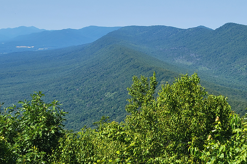
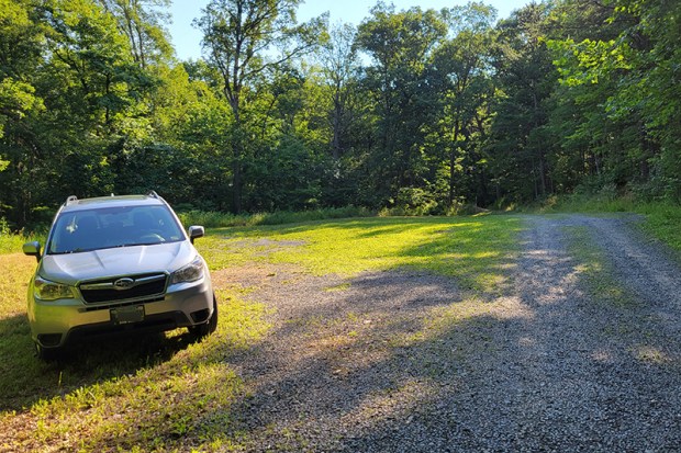

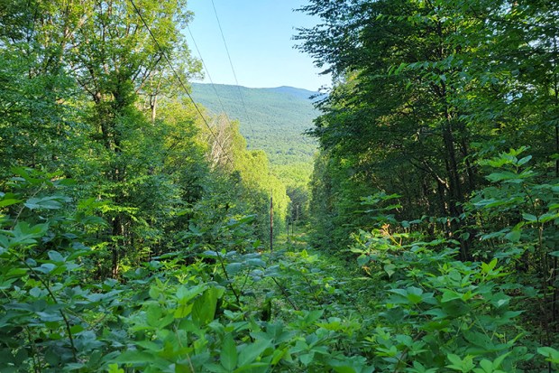
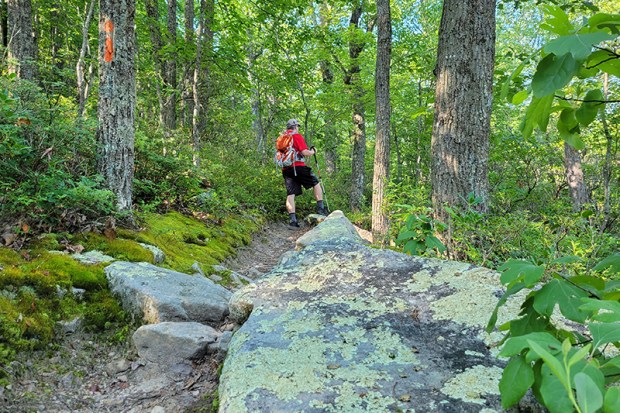


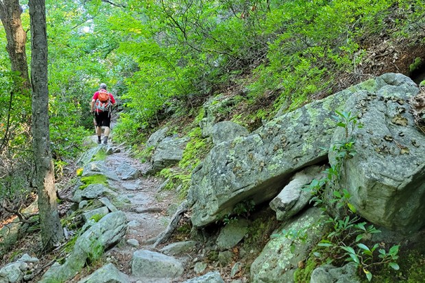

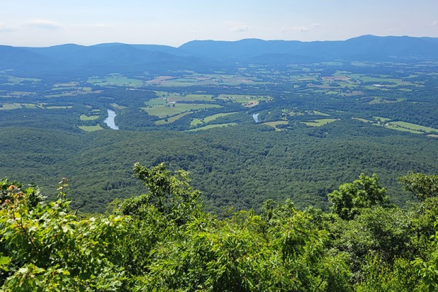


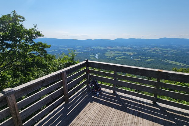
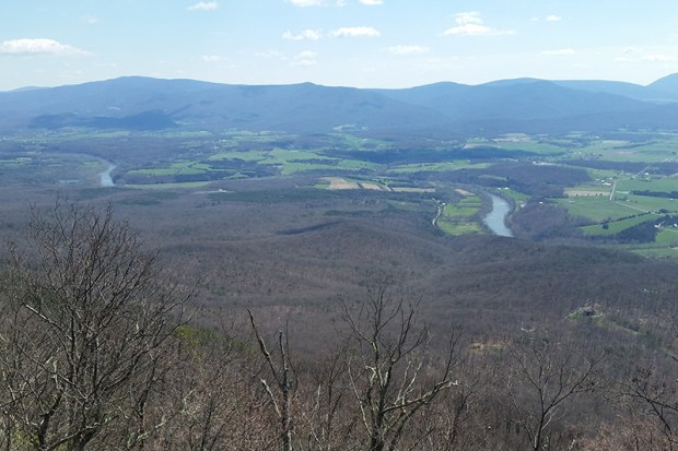


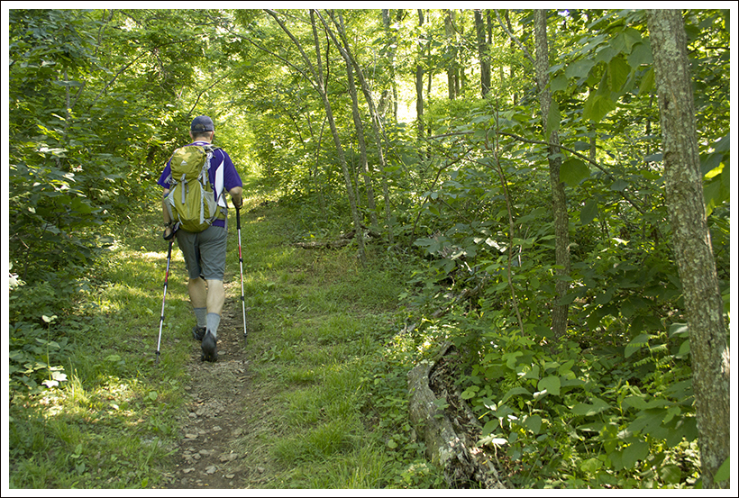
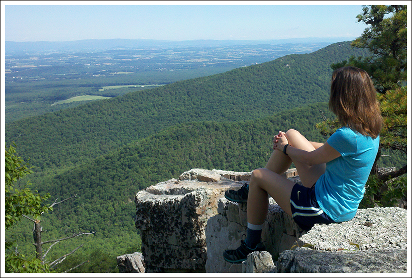


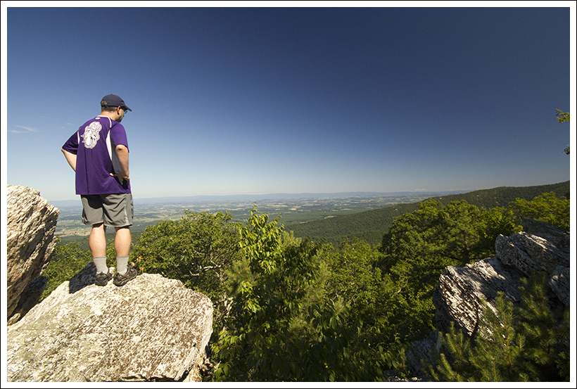
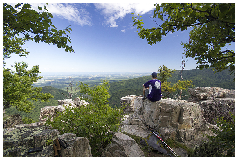


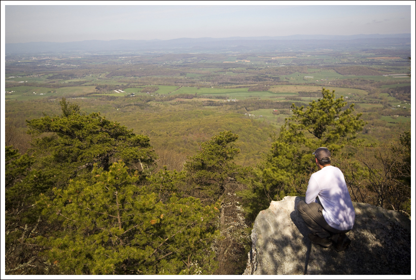
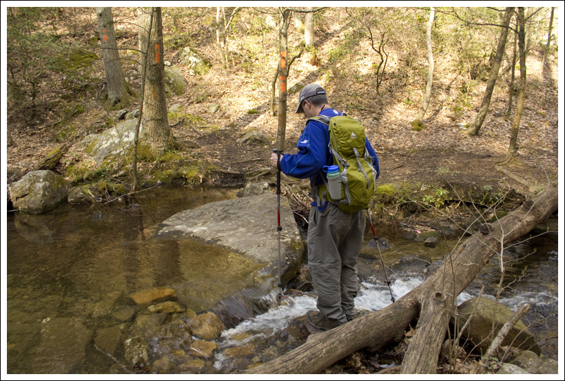
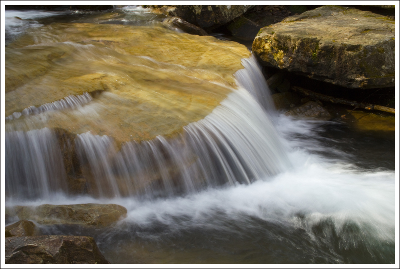
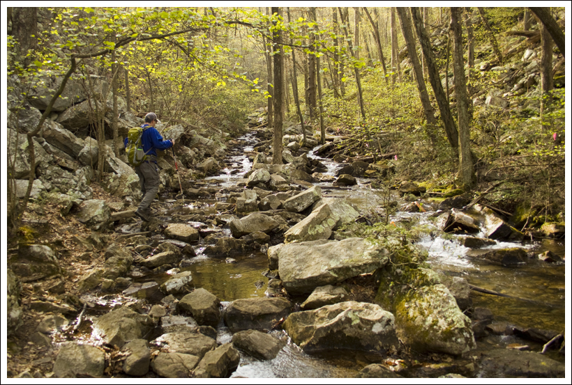
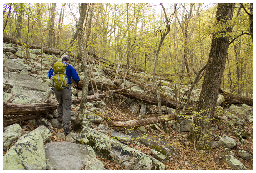
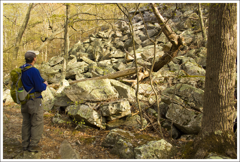

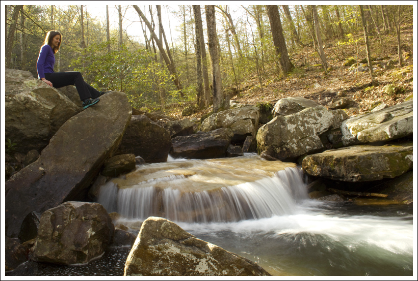
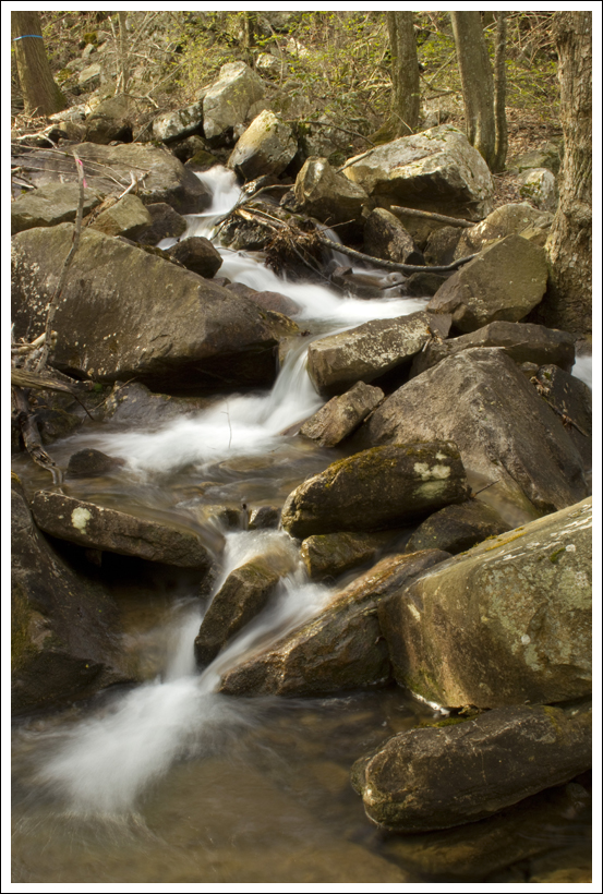
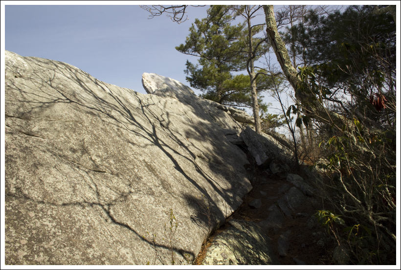
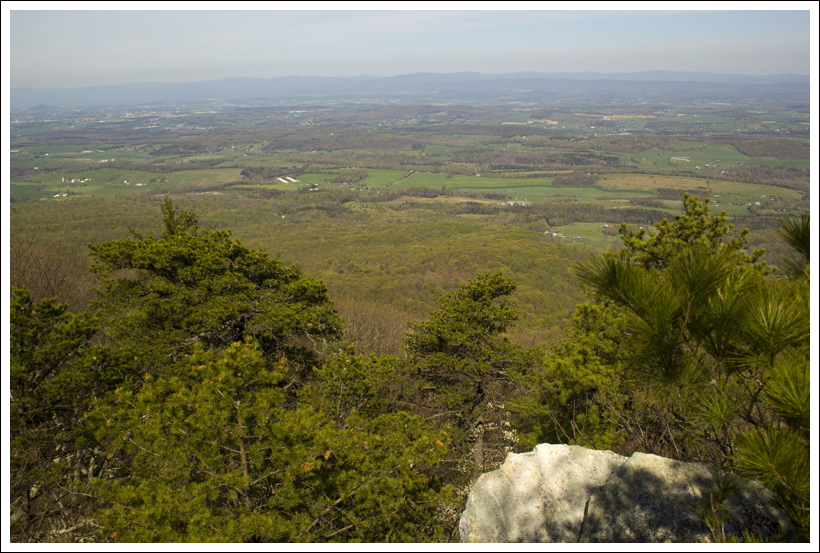
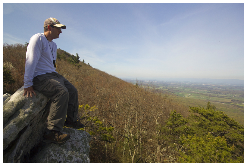
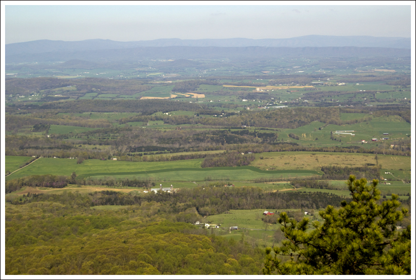
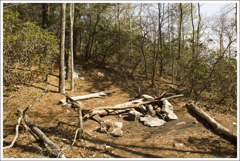
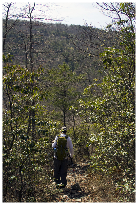
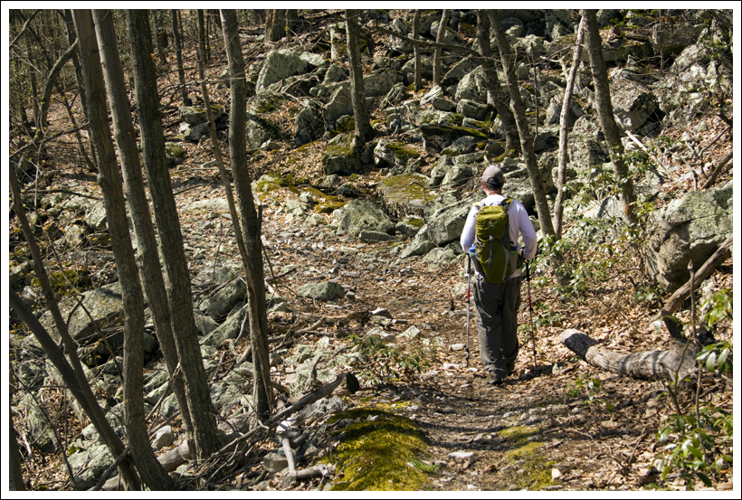
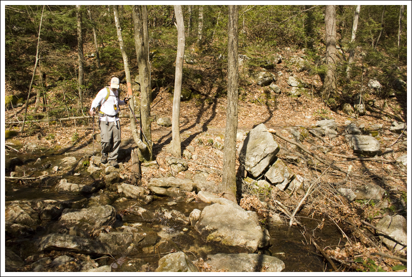
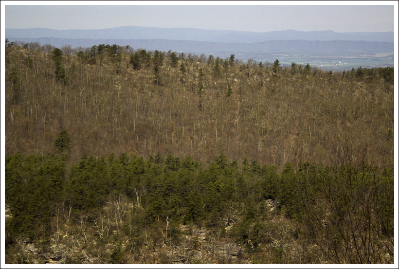
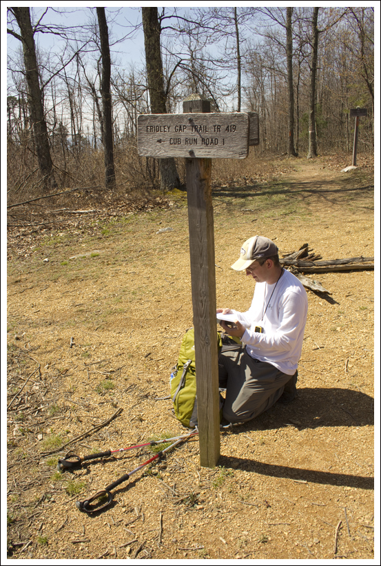
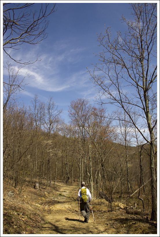
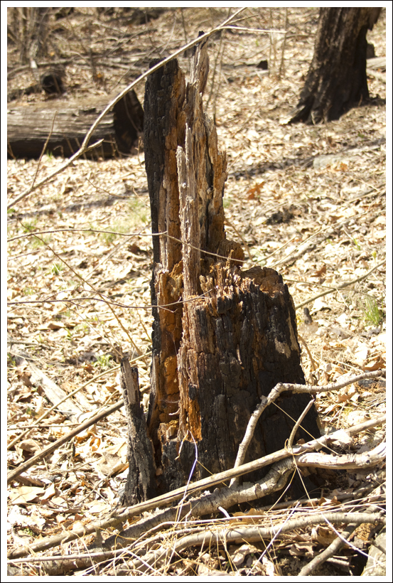
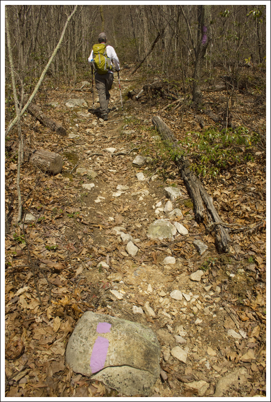
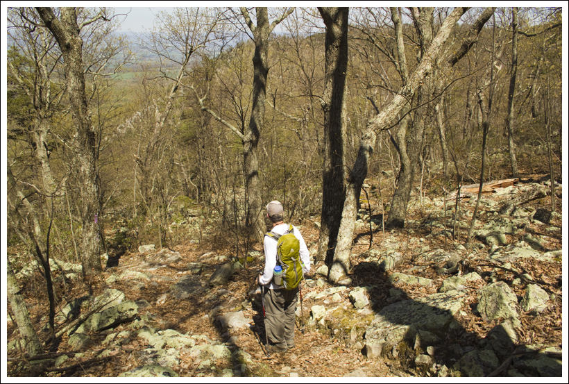
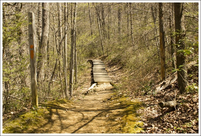


 Wookie Says…

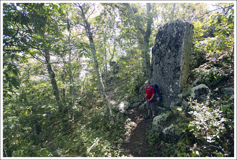