After coming off the Teton Crest Trail, we took a day off hiking and chilled in Jackson Hole. We stayed at a hotel, ate lots of good food, and checked out more of the Tetons by car. We initially planned to head into Yellowstone National Park the next day, where we had a campsite booked at Bridge Bay Campground for two nights. Adam’s back was still bothering him, so we decided to stay an extra night in a hotel before joining our friends at the campsite in Yellowstone.
The next day, we made a long, leisurely drive into Yellowstone National Park, stopping many places along the way for photos and wildlife-related traffic jams. We got to Bridge Bay midafternoon, set-up camp, and met our friends. We had dinner, enjoyed s’mores by the campfire, and attended the evening ranger program. It was like all the park camping experiences I remember from my childhood.
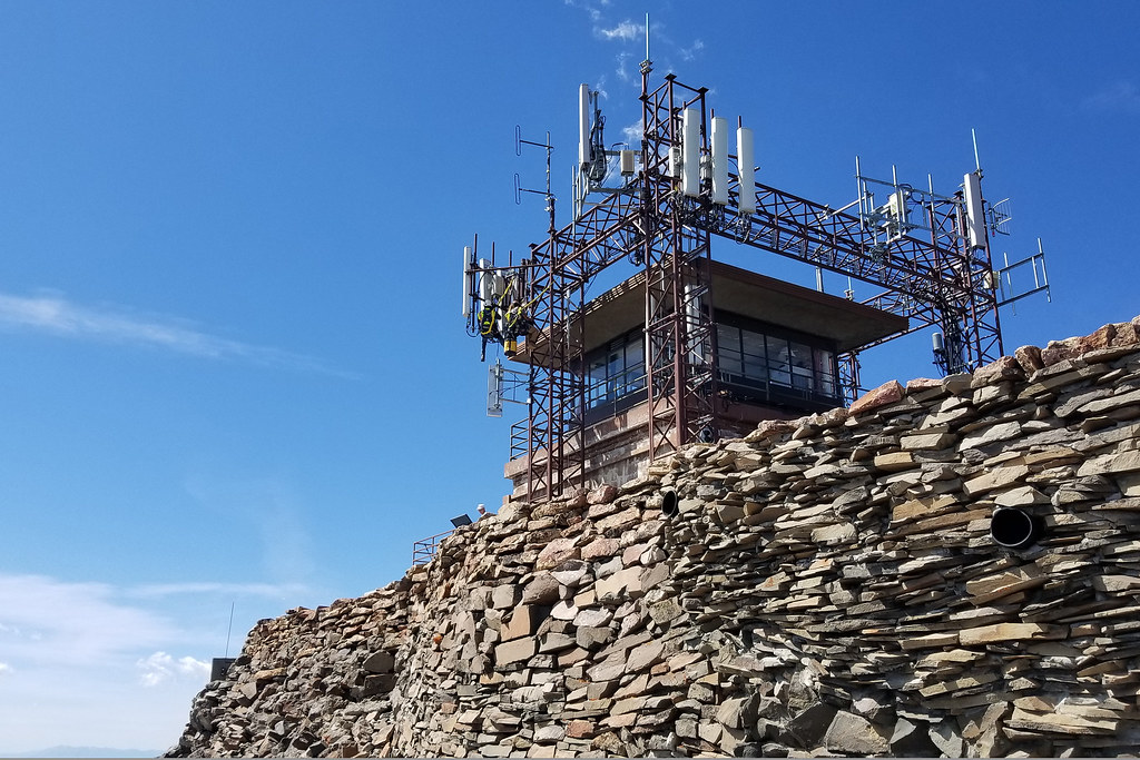
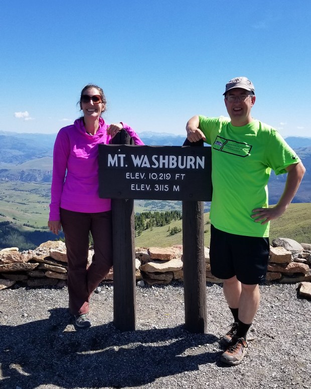
The next morning, we got up, grabbed breakfast, and discussed plans for the day. Brian decided to go fishing and the rest of us decided to hike up Mount Washburn. At 10,219′, Mount Washburn is the highest peak in Yellowstone’s Washburn range, and is also home to one of the park’s few remaining fire watch towers.
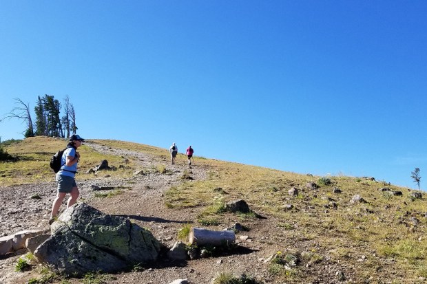
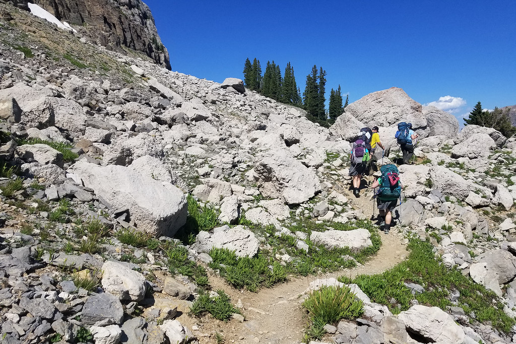
There are two hiking routes to the summit of Mount Washburn. The first option is to park at the Dunraven Pass Trailhead for a 6.5 mile hike with about 1400′ of climbing. We chose the second option – a shorter route starting at Chittenden Road. This route was only 4.5 miles, but has about the same elevation gain.
If I had it to do over, I would have started at Dunraven Pass and just done the longer hike. It’s supposedly prettier and has a more gradual ascent. I think my tired legs and oxygen deprived brain were just thinking “shorter is better!” I struggled with the altitude on this hike and felt queasy and dizzy most of the way. I think after seven really busy, active days with staying at a mix of campsites and hotels, I was just run down, tired, and dehydrated. I still had fun and I still made it to the top, but this was probably my toughest hike of the trip (even though it shouldn’t have been.)
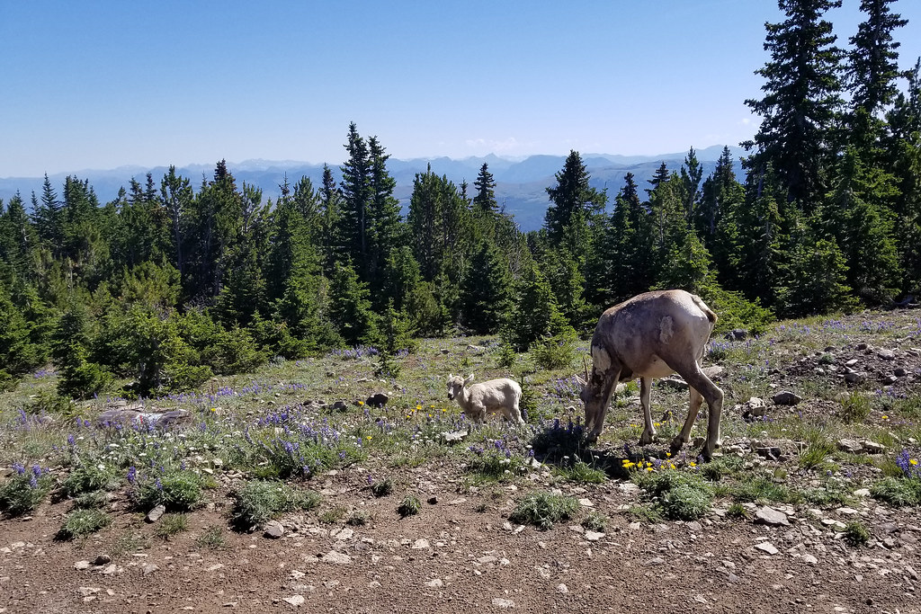
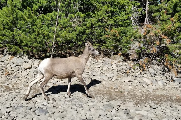
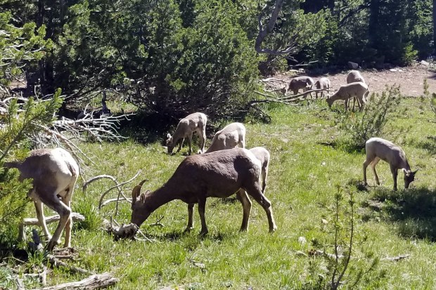
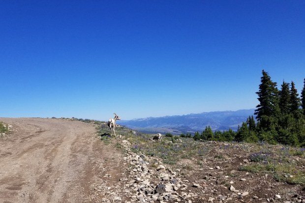
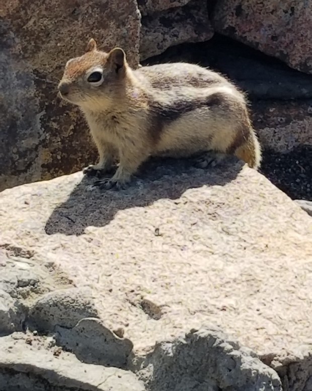
The Chittenden Road is all out in the open, so bring your sunscreen. The route follows a gravel roadbed straight up the mountain, not a switchback in sight! The major up-side of the unshaded terrain is that you always have views. When we visited there were also many wildflowers and maybe just as many bighorn sheep! It was neat to see the herd which was mostly mothers and babies. Although, we never did see a big ram with the classic curled horns.
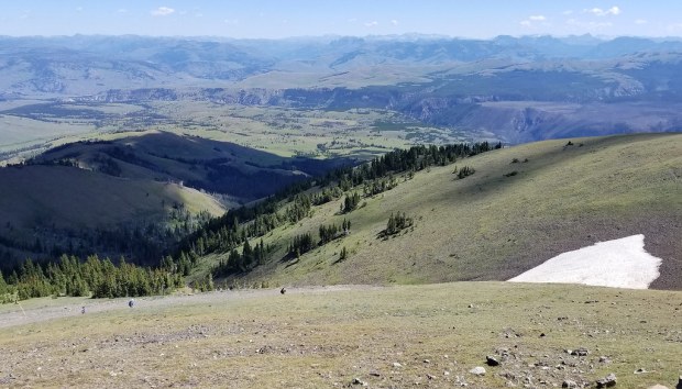
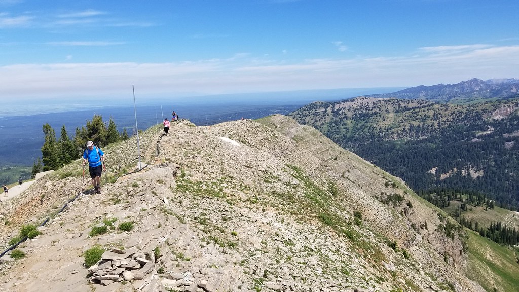
At the top of the climb, you reach the summit tower. There are bathrooms, trash cans, and information at the top. There was a ranger staffing the tower, as well. We took lots of photos, had a snack, talked to some people wearing JMU gear (fellow alumni!) The vistas at the top are truly panoramic – you can see all across Yellowstone and back into the Tetons.
After the hike, we met back up with Brian (who had a great day fishing!) and moved on to our next campsite at Canyon Campground in Yellowstone. Canyon was a much nicer campground than Bridge Bay. It had better access to amenities and the campsites were lovely and tree-shaded. Bridge Bay was mostly an open field with tent-sites so close that we heard our neighbor snoring the entire night!
A couple things to consider before you plan this hike: 1) Check the road status on Yellowstone’s official website before you go! Oftentimes, the trailhead are not accessible due to either weather or construction. 2) Start this hike early in the day. It’s one of the park’s most popular and parking is competitive.
In late fall 2018, friends messaged us and asked “Would you like to hike the Teton Crest Trail with us next summer?” After a brief discussion the answer was a resounding YES! This is a once-in-a-lifetime kind of hike that makes you feel like you’re walking into scenery that belongs on the cover of Backpacker magazine.
It was such a privilege to go on this trip and we were so grateful for the invitation and our friends’ expertise. We’ve included some tips and planning advice at the bottom of this post. We’re by no means experts – we mostly wanted to share photos and our personal experience.
There are lots of route options for hiking the Teton Crest Trail. We hiked in via the Tram Approach and hiked out through Cascade Canyon to the Jenny Lake ferry – a total of about 29 miles. We hiked four days and camped three nights. What an adventure… read on!
Day One – Tram Approach to Death Canyon Shelf (9.8 miles)
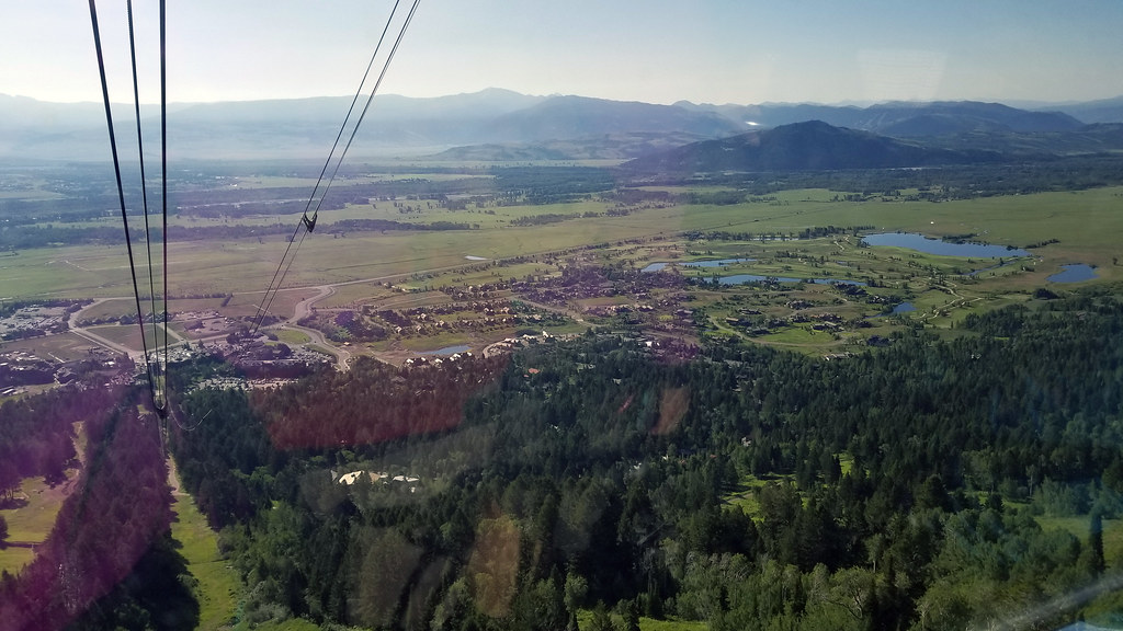
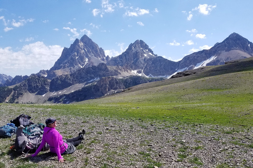
Christine Says… I’ll admit it – my stomach was full of nervous butterflies when we stepped on the Aerial Tram at Jackson Hole Mountain Resort. The tram was our ride to the top of Rendezvous Peak, our start point for hiking the Teton Crest Trail (TCT).
Everything in the Tetons seems wilder and more dangerous than hiking in the east. I worried about the high altitude and how it would impact my cardio capacity. I wondered if I would react fast enough if I needed to use bear spray on a charging grizzly. I looked at the jagged peaks above and thought, “Do I really have any business going up there?”
As the gondola climbed ever upward to 10,450′, I took deep breaths and told myself I was going to have an amazing time on this four day adventure. How could I not? I was with my husband and some of my favorite hiking friends – Christy, Brian, and Kris. It was all good.
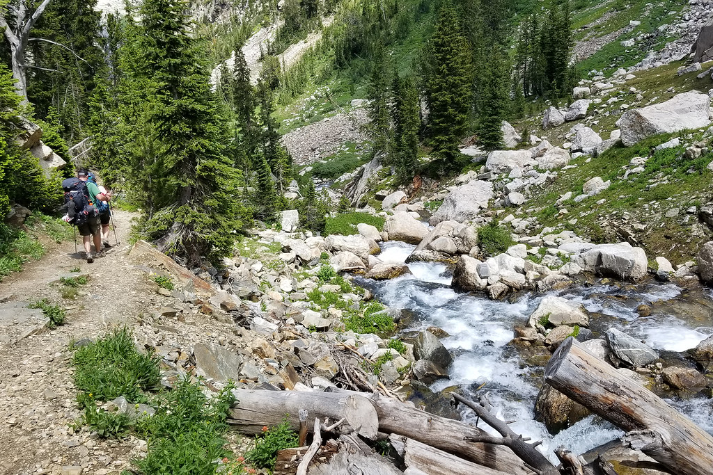
After getting off the tram, we took a few minutes for photos before descending through the pines for about 4 miles to our junction with the TCT. At each switchback, Christy made sure to say “Hey, Bear!” to make sure we didn’t startle any wildlife coming around a blind curve.
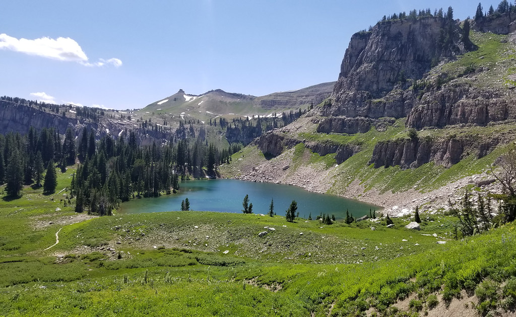
Once we were on the TCT, the terrain was open and vast. The sky was bluebird with only an occasional cotton-puff cloud. There were so many wildflowers and snow-frosted peaks to enjoy as we walked. After couple more miles, we reached our lunch stop at Marion Lake. We found some scrubby pines that offered a bit of shade while we ate. Marion Lake was lovely – cold and clear, so everyone made sure to collect and filter water.
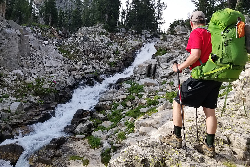
After leaving Marion Lake, we had a 2.9 mile climb toward Fox Creek Pass. We crossed some snow along the way. There was no way around it – it was wider than it looks in the photos. Honestly, we were pretty lucky with our timing with snow – ice axes and crampons were necessary on the TCT just ten days before our visit. The snow had been deep and melted slowly in 2019.
Crossing Fox Creek Pass brought us to the Death Canyon Shelf ‘camping zone’ – which is where our permit designated we would spend our first night. The camping zone goes on for 3.4 miles of trail, and hikers can pick any suitable spot as a campsite. We had to hike another 1.5 mile or so before we found a good spot – near water – that would accommodate all three of our tents.
I’ve never camped in such an open, exposed area. It was literally like its name sounds – an open shelf with steep canyon walls both above and below it. It was so beautiful!
We got camp set-up, ate dinner, found a good place to stash our bear canisters, and went to bed early. We were all tired and my eyes were really dry from the wind, sun, and arid climate. When we zipped up our tents, it was nothing but clear skies! Even when I peaked out around 11pm, it was a dark sky filled with as many stars as I’ve ever seen.
But, as they like to say…weather changes quickly in the mountains! Sometime after midnight, we all were awakened by peals of thunder echoing down the canyon walls. Lightning was reaching across the sky and striking all around us. We heard Christy say from her tent “Hey guys, I think we need to bail to someplace less exposed.” I found my shoes and my jacket and followed the group to a place with a little more shelter and some medium height trees. Adam couldn’t find his shoes and socks easily, so we watched him from a distance, sitting in the tent, illuminated by lighting, rustling around half-asleep, trying to find his footwear. Thankfully, he made it out and joined us and didn’t get hit by lightning. We all got rained on a bit. Eventually the thunder and lightning subsided and we were able to get back in our tents.
There ended up being several more bands of storms, but none were as fierce as the first one. We stayed in our tent for the rest of them. It poured buckets of rain. It hailed a bit. The wind howled and shook our tent. I have to say, the Big Agnes Copper Spur UL2 held up like a champ! We slept as much as we could, but most of the night we were awake anticipating what our second day would be like.
Day Two – Death Canyon Shelf to Alaska Basin (5.2 miles)
Adam says… The second day started off with rain also. We hung out in our tents for a while, but when the rain finally slowed down, we thought it would be a good idea to attempt to make a quick breakfast and then pack up our gear for a day of hiking. We knew we were going to get more rain that day, but we felt we had a window to try and get some dry miles done.
Of course, with a lot of rain from the night before, the trail was full of slippery mud. The hiking was slow going for much of the day and we often had to stop to knock the mud off our shoes and boots as it caked on and made every step a bit more challenging. The trail started off a bit uphill as we continued up to Meeks Pass.
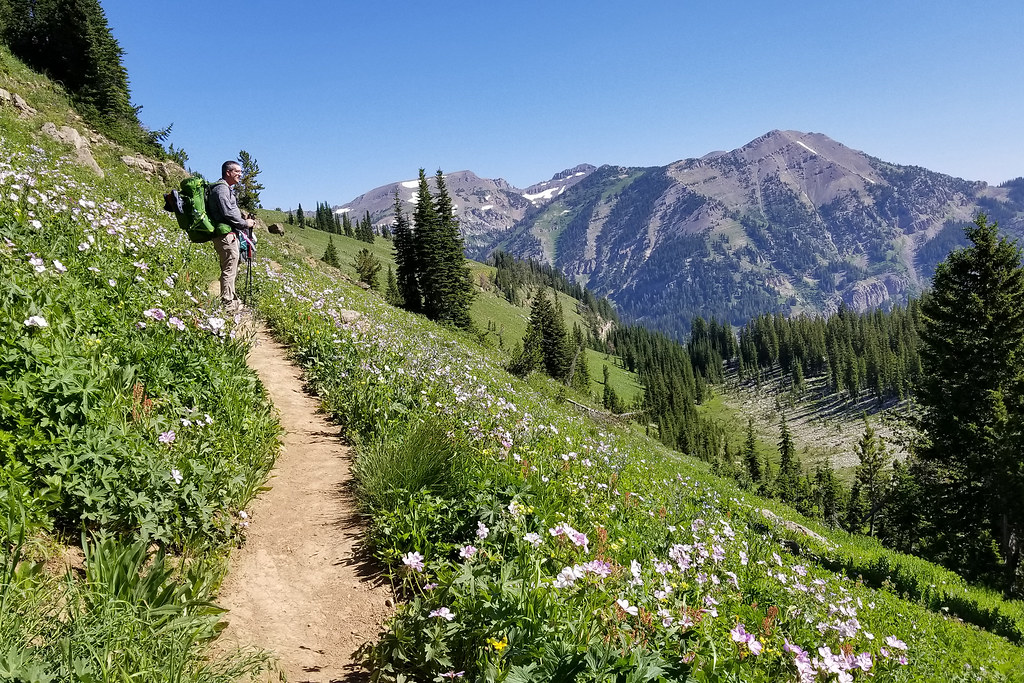
One of the amazing things about hiking here is that every steps feels like you are looking at a postcard. The beauty all around is amazing and there are a ton of expansive views! The hike started off for an early portion of the day with views of the Tetons ahead, so we knew we were making progress towards our goal.
Much of the hiking today was filled with expansive views and interesting rock formations that had been shaped from the glaciers and high elevation winds. As we made it up to the crest of Meeks Pass, there was a sign stating we were entering into Jedidiah Smith Wilderness.
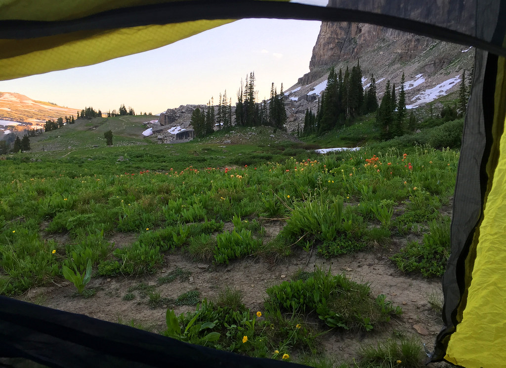
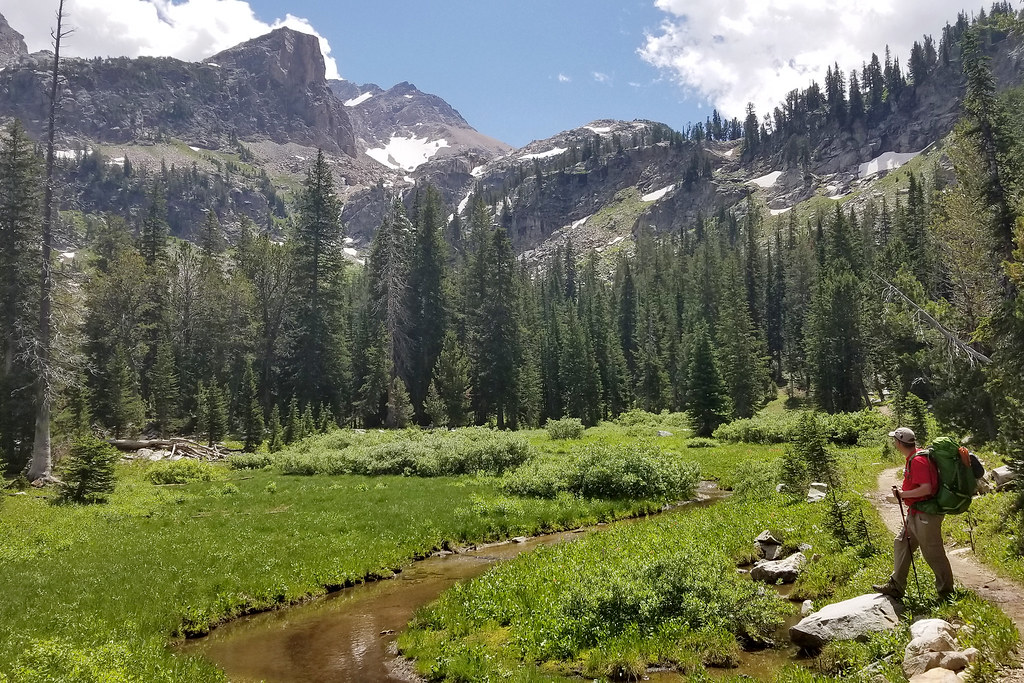
The trail ultimately does a steeper downhill to arrive into Alaska Basin, our camping spot for the second night. We did not need a permit to camp in this area, as it’s outside the National Park boundary. Alaska Basin has a ton of small ponds and streams around with lots of rocks to hop around and investigate this interesting area. We found a secluded place to set up camp. We pitched our tents shortly before the rain started to downpour again. We ducked inside our sleeping bags and napped for most of the afternoon while listening to rain and hail coming down on our tent.
We lucked out with not getting soaked, but as we could see other groups arriving later in the day, they weren’t so fortunate. The rain stopped at one point in the late afternoon and we had a chance to make a hot meal and explore the area a bit before nightfall. Since this area allows people to have bear hangs, we hung up our trash, but Brian had a nightmarish time working on getting a tree to cooperate. We stretched and did some yoga (I am not very flexible) on some large rock outcroppings. We had a lot of fun despite the weather this day and the day was filled with laughter.
Day Three – Alaska Basin to Cascade Canyon (7.3 miles)
Christine Says… After a long afternoon of rain followed by a night of more storms, we wondered if we’d get a break in the weather to enjoy Hurricane Pass – which offers the hike’s best view of the iconic Grand Tetons. Luckily, I unzipped the tent to find sparkling sunshine and clear skies. I think there’s a particular clarity and cleanness to the air after storms, and this morning was especially fresh.
We ate breakfast, broke down camp, and prepared for a third day of hiking. We had some small streams and a moderate rocky ascent leaving Alaska Basin. From there, we descended again to beautiful Sunset Lake. We talked to a few people who had camped near the lake. They mostly talked about the assault by mosquitoes that they had endured. Death Canyon shelf really didn’t have any bugs!
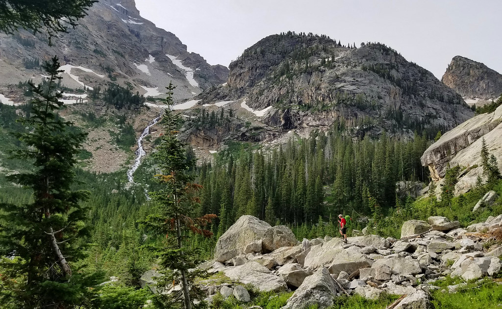
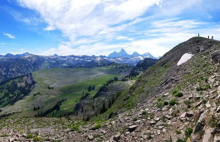
Leaving the lake, we could see Hurricane Pass off in the distance. It looked high and unreachable, but it ended up being a moderately steep climb for just a couple miles. We stopped near the top for a snack and some photos looking back into Alaska Basin.
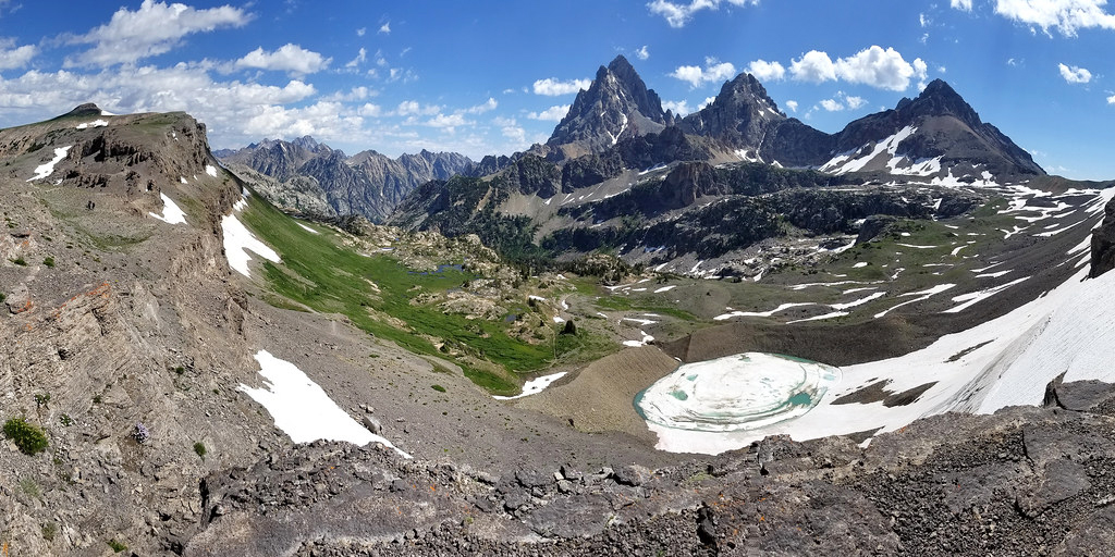
A short distance later we reached Hurricane Pass and its mind-blowing views of of South, Middle and Grand Teton. We spent a lot of time here, celebrating the view and feeling gratitude for the opportunity to have this adventure. I actually had tears in my eyes because I couldn’t believe I (ME!) was standing and beholding such a majestic view.
It’s hard to walk away from Hurricane Pass, but eventually we had to make our way down. Leaving the pass, the trail drops steeply toward Schoolroom Glacier. When I say steeply, I really mean it. The trail is a literal drop-off – one misstep could send you rolling down a very steep hillside. It was really the only obstacle on the trail that gave me any inkling of a nervous pause. Incidentally, I believe the NPS has a trail restoration project going on at this drop-off to repair erosion and make it safer.
Once I took the initial plunge, the trail was fine – lots of switchbacks leading down into Cascade Canyon. As we descended, the day got hotter and I got more and more dehydrated. I had been so careful the first two days to drink often, but I guess I got careless on the third day. As we hiked on, I started to feel kind of sick with cramps and an awful headache. Even after I started drinking again, it never felt like enough to quench my thirst. Even though I was struggling, I really enjoyed walking along the stream.
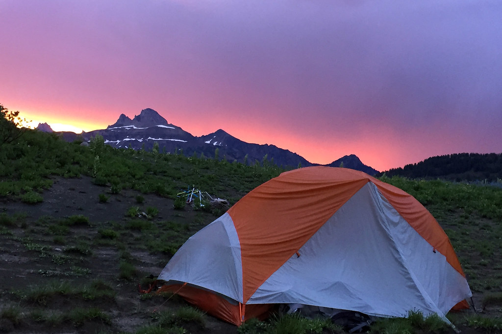
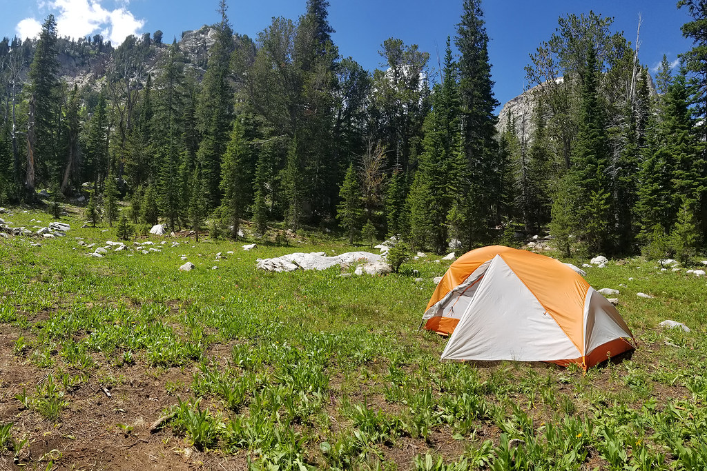
We eventually got to the South Fork Cascade camping zone, which is where we had a permit for our third night of camping. We found a great spot just uphill from the stream. There was room for two tents under a cluster of trees and room for many tents in an open meadow with a canyon wall as the backdrop. Adam and I set our tent up in the meadow. Kris and I walked down to the stream and soaked our tired feet in the icy water.
We cooked dinner and spent most of the evening reflecting on the trip – highs, lows, things we were still looking forward to seeing. With this group, there is always a ton of laughter and jokes, so camp is always a fun time. We even took some time to be silly and recreate the scene pictured on the Mountain House package our dinner came in.
This was also the only night I had to use a bug net over my head! For whatever reason, I am very attractive to mosquitoes and despite all the measures I took, I still got many, many bites. I was so itchy I had to take Benadryl before bed. It was hard to believe this was our last night of the trip, and the next day we would walk back out into civilization!
Day Four – Cascade Canyon to Jenny Lake Ferry (5.7 miles)
Adam says… Due to snow, the Paintbrush area was only safely accessible to people with ice axes, so we didn’t do a full Teton Crest Trail traverse. We came down Cascade Canyon to arrive at Jenny Lake for our last day.
The trail went by some dramatic landscapes and hiked down along some fast-moving streams and waterfalls on the way down. The power of nature is really humbling through the vastness of the terrain of high elevations. As we made our way down to the Cascade Canyon area, we saw a couple of deer hanging out at a trail junction.
As we continued along Cascade Canyon, the trail was heading downhill and we started to see more day-hikers arrive as we got closer to Jenny Lake. Along the creek, we spotted a bull moose sitting in the brush and we were so glad we had the opportunity to see some of the wildlife we don’t get in Virginia.
The hike along Cascade Canyon was so scenic and we felt the warmer temperatures as we reached some lower elevations. Eventually, we reached the area known as Inspiration Point and there were a lot of day-hikers hear that were taking in the view. My back had been killing me that day, so I relaxed and worked on stretching out my back while we had a snack.
We had one last bigger descent to make down from Inspiration Point and we made it to the bottom to see tons of people along the trails. We took a short side trip to check out Hidden Falls, which is a most impressive waterfall.
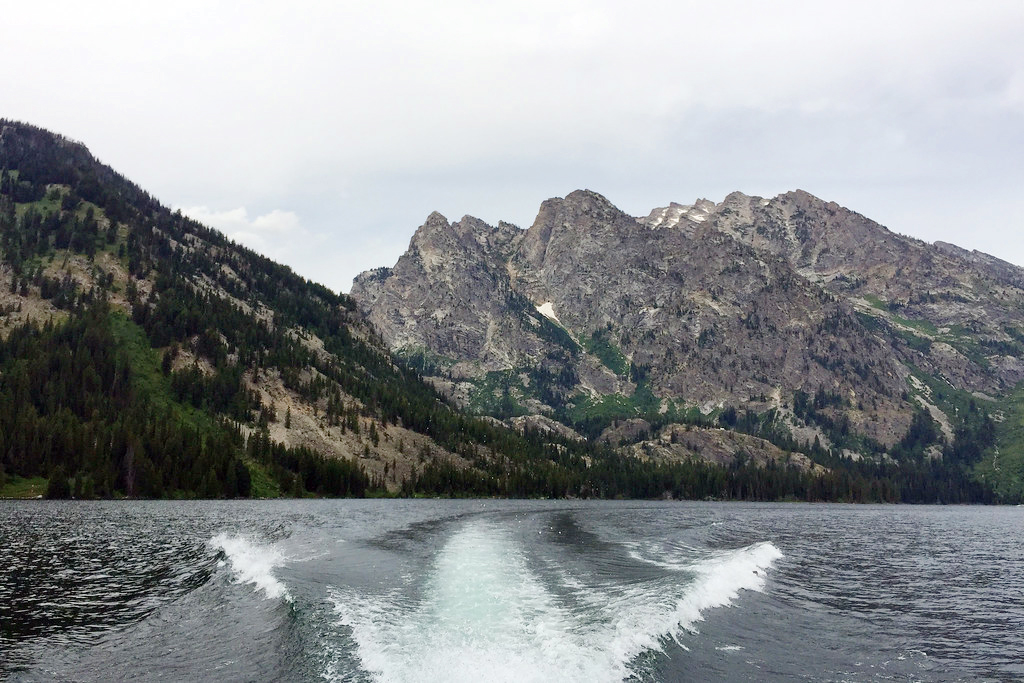
From here, it was a short walk to the ferry, where we hopped on a boat to take us to the other side of Jenny Lake. While most of the passengers were just out for a short trip, they were all asking us questions about our trip over the mountains. With the cool lake breeze hitting us, we were refreshed yet exhausted from all we had done over the last several days. We picked up our car at Jenny Lake and we picked up our other cars at the tramway. Unfortunately, our rental car had been hit by another car in the parking lot, but that didn’t dampen our moods too much as we had just done a trip we will remember for a lifetime. If you’re fit enough and can navigate the permit process, make this a must-do adventure!
Final Thoughts: The Teton Crest Trail is not a trip you can go on without significant planning and preparation.
You have to get permits for each place you plan to camp along the route. Getting a permit can be competitive and the process opens in January on recreation.gov.
You’re going to need a ride at the end. This is a segment hike, so you’ll finish many miles from where you started. Plan ahead for this! Because we were in a group with multiple cars, we dropped one at our finish point the night before we started our hike.
You’ll have to carry a bear canister and bear spray. You must have an approved bear-proof container in GTNP. The ranger station can issue you a loaner if you need one. You also should plan to carry bear spray, since this is grizzly country!
If you’re arriving from the east (or anywhere considered low-country), plan to acclimate a few days before you attempt the Crest Trail. The high altitude can make you sick if you don’t give your body a bit of time to adjust.
Bring lots and lots of sunscreen! Seriously, there is very little shade along the trail. Paired with the high altitude, it is easy to get a bad sunburn very quickly.
While this hike seemed remote and intimidating, it was actually moderate terrain and I think it could be done by most people of average hiking fitness. It was not a killer-tough hike.
There are some good planning guides online that will help you plan. A couple examples:
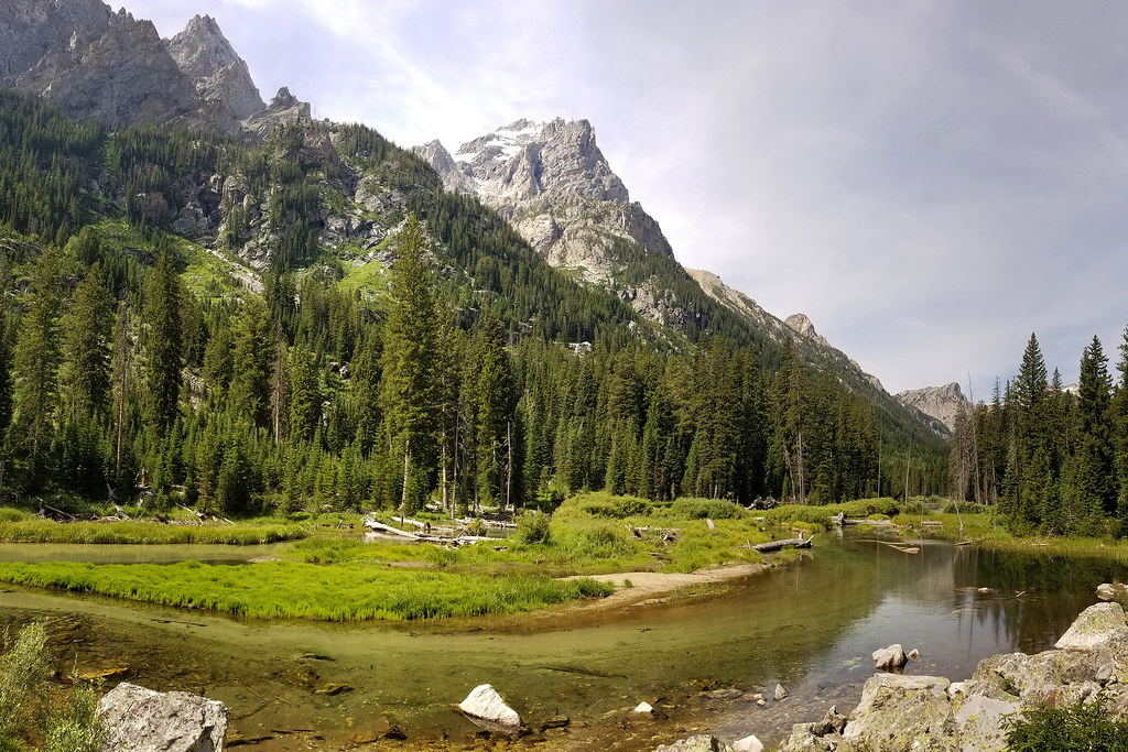
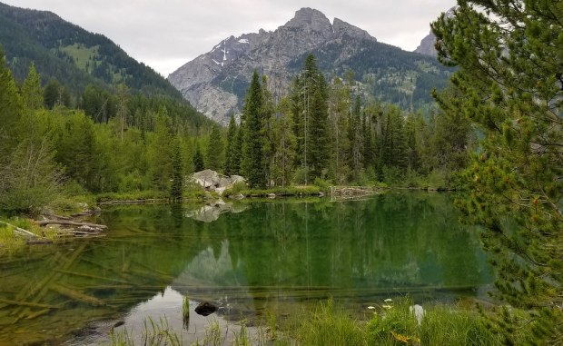
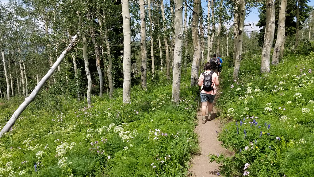
In our visit to Grand Teton National Park, our big goal was to backpack a few days on the Teton Crest Trail. Still acclimating to the high altitudes and with a goal of also trying to conserve energy before the big trek, we picked this easy and scenic hike to Taggart Lake.
We started off fairly early and went for a drive along Moose Wilson road to start the day. On the side of the road, we were lucky enough to see a moose grazing in a clearing and we were so glad to start our day with such a fortuitous sighting! We stopped by the Jenny Lake Ranger Station to drop off a car for our return trip on the Teton Crest Trail and we were also able to swap out some of our backpacking permits for our trip so we had better camping options.
We then made our way to the Taggart Lake trailhead and parked to start our hike. The hike is 3.3 miles with only 300 feet of elevation gain. The hike is well traveled and in good condition, so most people will find this to be an easy, family hike with a big payoff.
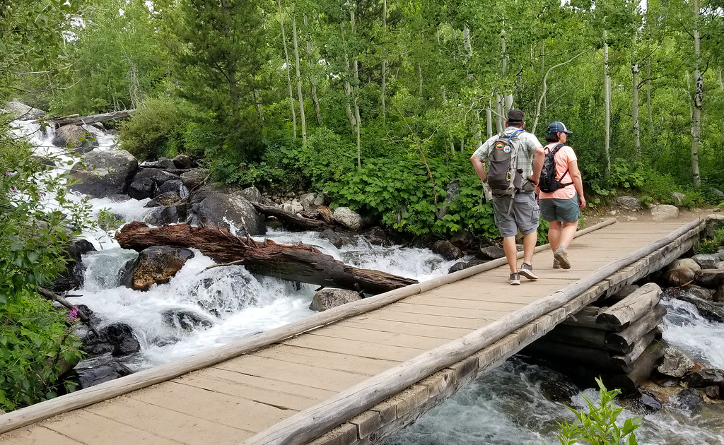
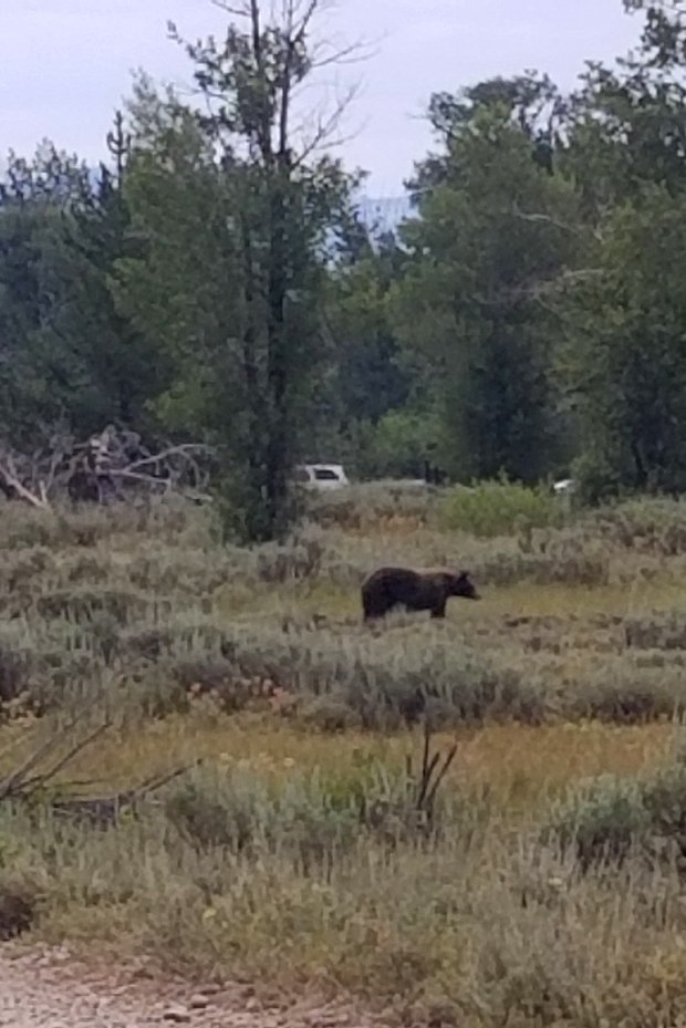
The trail starts off with an open field view. We veered to the right at the first junction. Just about two tenths of a mile along the hike on the gravel road, we saw a black bear far off in the distant. We headed the opposite way to the right to start the main part of the hike. Shortly after that, the trail ducks more into woods and we crossed over a footbridge over a roaring creek.
After a short distance, the trail then begins a slight climb as you hike along the Taggart Creek. About a mile into the hike, the trail then opens up again into a larger field where we had great views of the Tetons. After a short distance, we came upon the junction with the Bradley Lake Trail, but stayed on the Taggart Lake Trail.
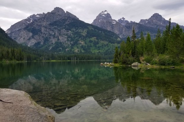
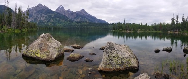
The trail stayed fairly flat from this point and in another half mile, we reached the edge of Taggart Lake. The day had been cloudy and a bit drizzly, but it made for nice reflections on the lake of the Tetons in front of us. There were a few different angles and rocks to spread out on, but this is a popular hike and you may not get the best solitude on a busy weekend. The lake was still and quite scenic and it just begged us to pause, relax, and take in the beauty of the reflections and the looming mountain backdrop.
After taking a ton of pictures, we made our way back and drove into Jackson Hole. We had lunch at Merry Little Piglets, which served delicious Tex-Mex food in a fun, decorated atmosphere. We then stopped by to get some groceries for our upcoming backpacking trip and made it back to our hotel to load our backpacks for the next day.
Note: Over the past couple years, we’ve struggled with what to do with Virginia Trail Guide. We love sharing the hikes we go on, but writing detailed posts with full turn-by-turn directions takes a ton of time. Also, it seems that most hikers prefer to visit AllTrails.com for maps and route options.
Because we still love sharing our adventures, Virginia Trail Guide is evolving! Actually, maybe devolving.. we originally started off as a blog to share photos and overall impressions of trails, while leaving mapping and wayfinding to you – the hiker. We’re going back to that model – Virginia Trail Guide will be pictures and opinions.
On that note, we have an immense pile of backlogged hikes we’ve never posted, because we simply didn’t have time to write up all the details. We’re going to be working through that backlog and sharing some of the amazing hikes we’ve done over the past few years.
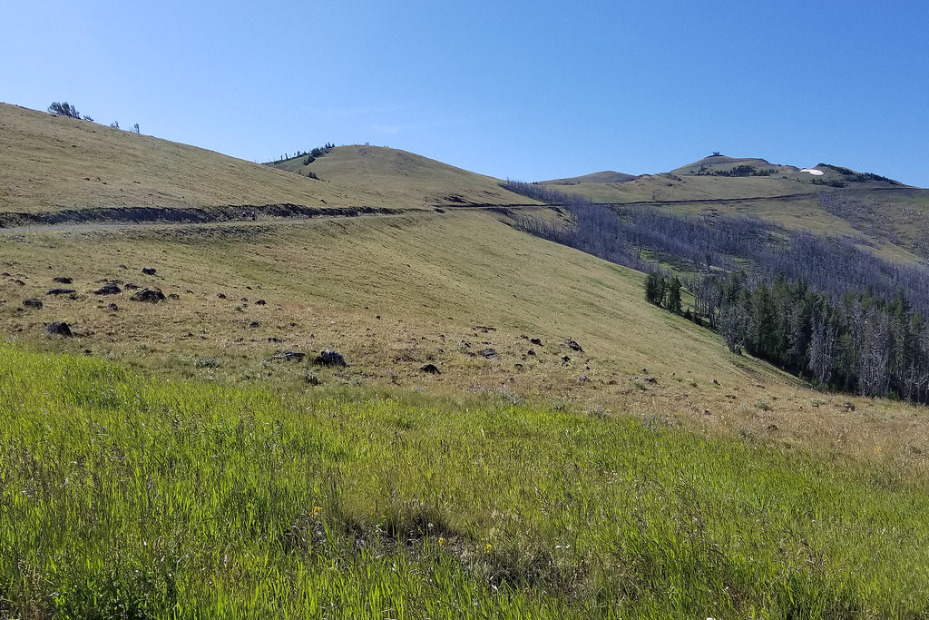
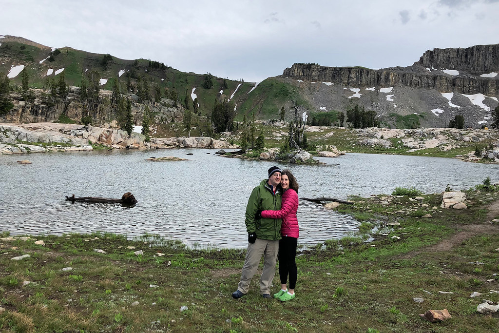
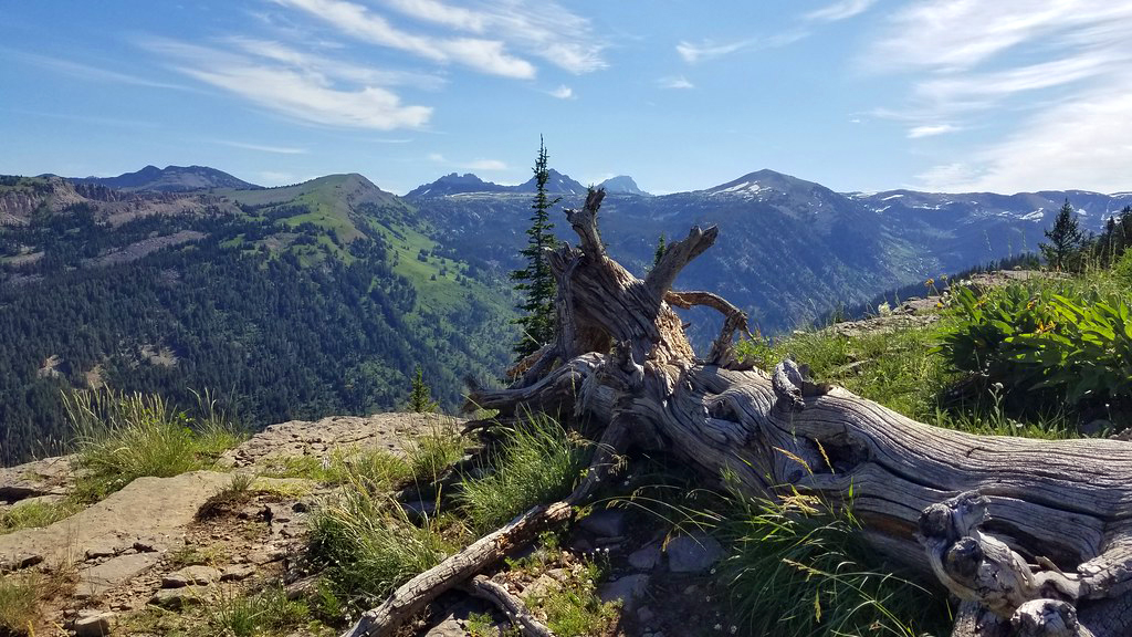
The first we want to share is this amazing hike we went on at Grand Targhee Resort in Alta, Wyoming in July 2019. Our friends (and guides for this trip), Christy and Brian, picked this hike out to serve as a solid training/acclimatization hike – in preparation for a bigger adventure we had planned later in the week (more about that in another post!)
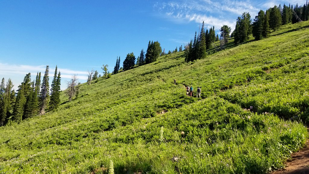
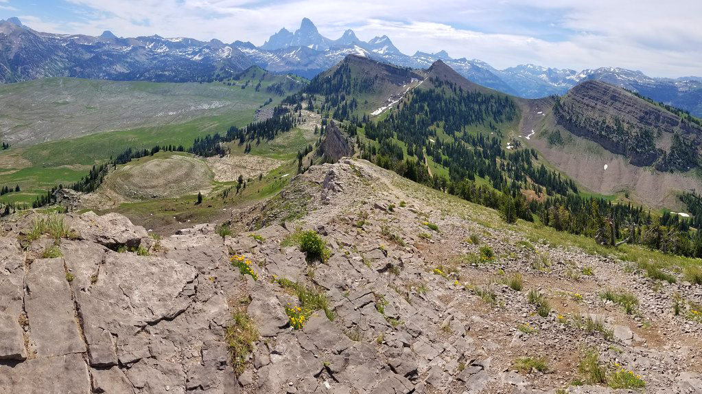
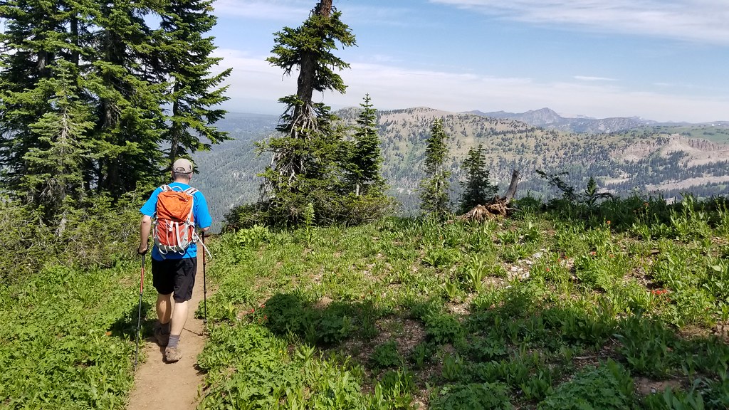
The hike was about seven miles with a little over 1,900′ of elevation gain. The route used several trails on the resort property – the Bannock Trail, the Summit Trail, and the Mary’s Saddle Trail (View a Targhee Summer Trail Map.) The elevation gain was made even more challenging due to the fact that Targhee’s base sits at 8,000′ above sea level, with the final vista of the hike at close to 10,000′. Those lofty altitudes mean thinner air that leaves the unacclimated hiker gasping for oxygen.
Luckily, the hike is so beautiful that you kind of forget that you’re struggling to breathe! The early part of the trails meanders upward using switchback after switchback. The trail is very exposed to direct sun most of the way up the mountain, so you’ll definitely want to wear a wide-brimmed hat, sunglasses, and loads of sunscreen. You’ll also want to drink extra water – the arid climate and high elevation will dehydrate you more quickly than hiking in Virginia. You should also carry a canister of bear spray – this is grizzly country. Even though this trail is well-traveled, you should be prepared.
On the day we hiked, we happened to be sharing the route with a Ragnar race. There were many runners on course. It was impressive to see people running up those hills, as walking was challenging enough for me!
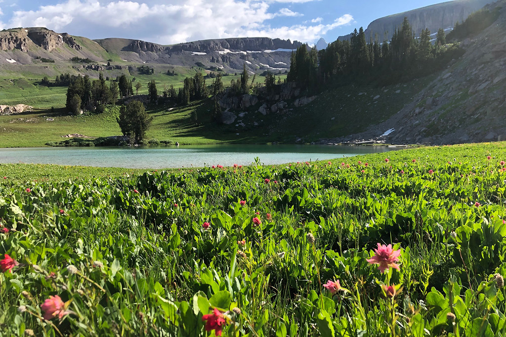
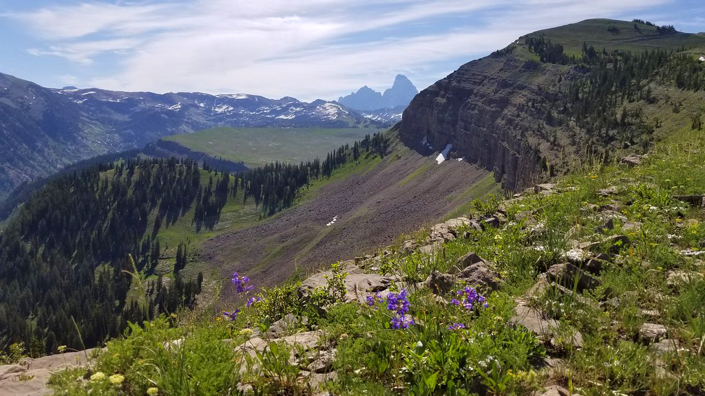
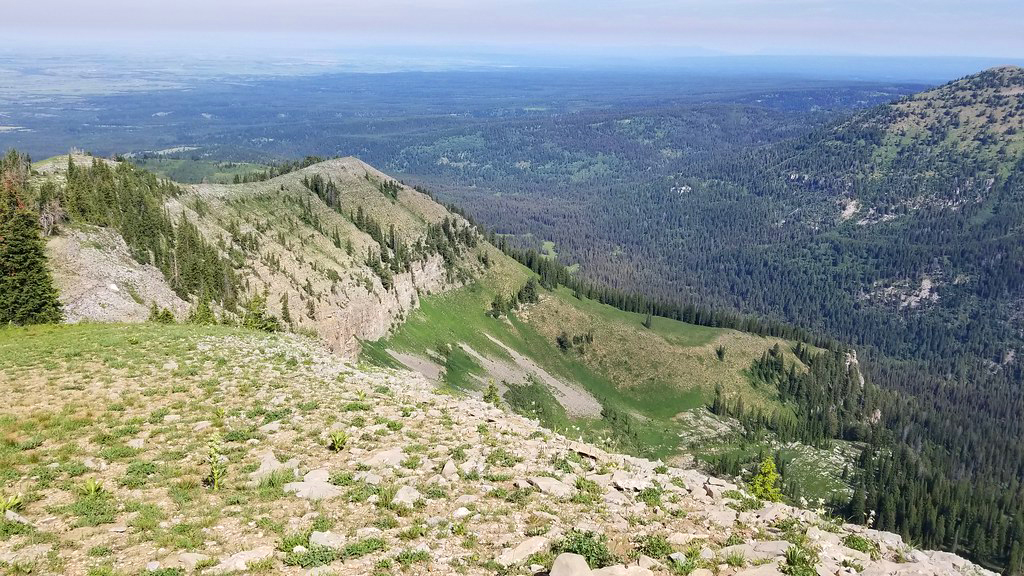
The objectives of this hike are the views from Mary’s Nipple and the vista of the Grand Tetons at the end of the Mary’s Saddle Trail. Along the ridge near the end of this hike, we could still see the last remnants of melting snow and the jagged peaks of the Tetons. It’s truly majestic scenery. Hiking out west is a totally different world compared to our rolling Appalachians.
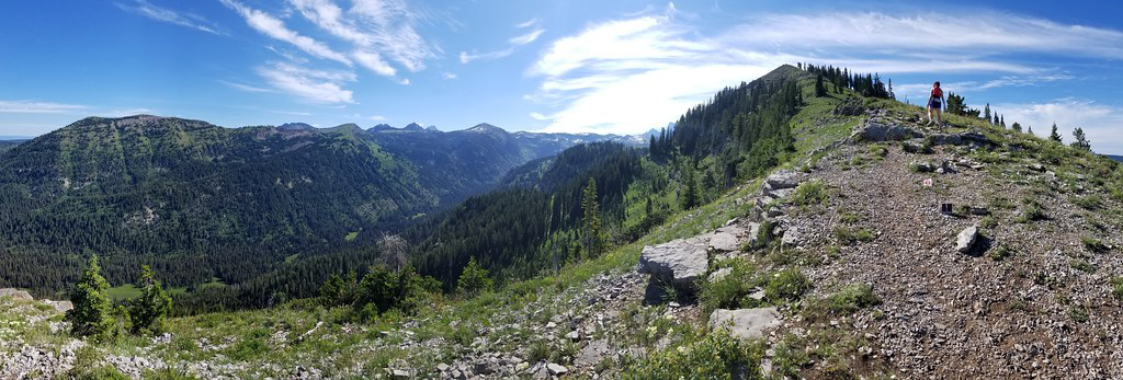
This hike was an out-and-back, so after taking in the views, we hiked back down the same way we had come up. The hike down was spectacular, partly because the exertion of climbing uphill was done, but also because we were able to enjoy open views the whole way down! I also appreciated the huge variety of wildflowers along the trail.
After arriving back at the base, we enjoyed a late lunch at Grand Targhee’s Trap Bar & Grill. Of course, we had to get their famous Wydaho Nachos and ‘Sloshies’ (basically a boozy Slurpee).