
Note: Over the past couple years, we’ve struggled with what to do with Virginia Trail Guide. We love sharing the hikes we go on, but writing detailed posts with full turn-by-turn directions takes a ton of time. Also, it seems that most hikers prefer to visit AllTrails.com for maps and route options.
Because we still love sharing our adventures, Virginia Trail Guide is evolving! Actually, maybe devolving.. we originally started off as a blog to share photos and overall impressions of trails, while leaving mapping and wayfinding to you – the hiker. We’re going back to that model – Virginia Trail Guide will be pictures and opinions.
On that note, we have an immense pile of backlogged hikes we’ve never posted, because we simply didn’t have time to write up all the details. We’re going to be working through that backlog and sharing some of the amazing hikes we’ve done over the past few years.

The first we want to share is this amazing hike we went on at Grand Targhee Resort in Alta, Wyoming in July 2019. Our friends (and guides for this trip), Christy and Brian, picked this hike out to serve as a solid training/acclimatization hike – in preparation for a bigger adventure we had planned later in the week (more about that in another post!)
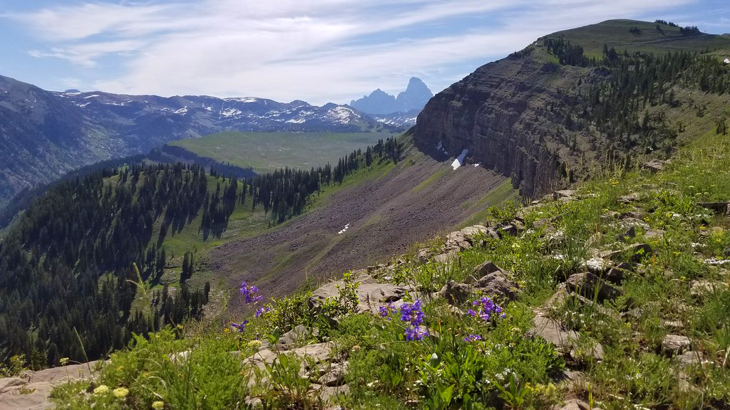
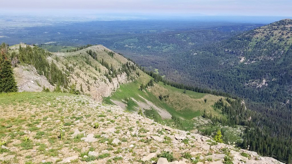
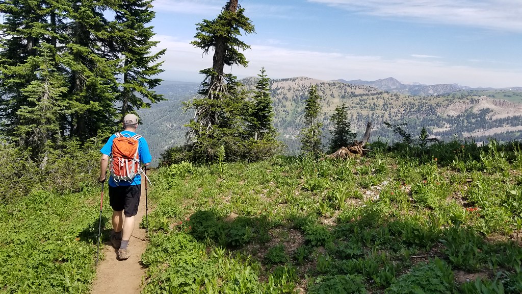
The hike was about seven miles with a little over 1,900′ of elevation gain. The route used several trails on the resort property – the Bannock Trail, the Summit Trail, and the Mary’s Saddle Trail (View a Targhee Summer Trail Map.) The elevation gain was made even more challenging due to the fact that Targhee’s base sits at 8,000′ above sea level, with the final vista of the hike at close to 10,000′. Those lofty altitudes mean thinner air that leaves the unacclimated hiker gasping for oxygen.
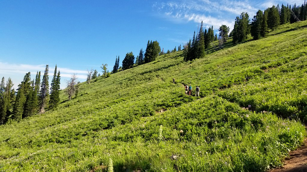
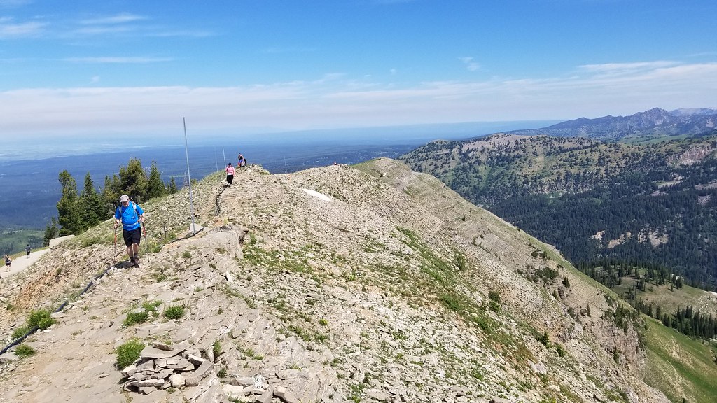
Luckily, the hike is so beautiful that you kind of forget that you’re struggling to breathe! The early part of the trails meanders upward using switchback after switchback. The trail is very exposed to direct sun most of the way up the mountain, so you’ll definitely want to wear a wide-brimmed hat, sunglasses, and loads of sunscreen. You’ll also want to drink extra water – the arid climate and high elevation will dehydrate you more quickly than hiking in Virginia. You should also carry a canister of bear spray – this is grizzly country. Even though this trail is well-traveled, you should be prepared.

On the day we hiked, we happened to be sharing the route with a Ragnar race. There were many runners on course. It was impressive to see people running up those hills, as walking was challenging enough for me!

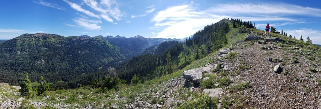
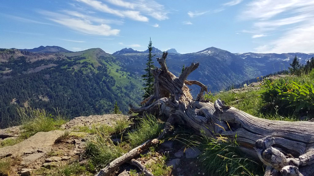
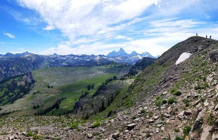
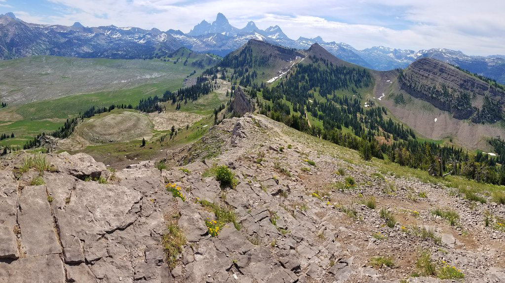
The objectives of this hike are the views from Mary’s Nipple and the vista of the Grand Tetons at the end of the Mary’s Saddle Trail. Along the ridge near the end of this hike, we could still see the last remnants of melting snow and the jagged peaks of the Tetons. It’s truly majestic scenery. Hiking out west is a totally different world compared to our rolling Appalachians.

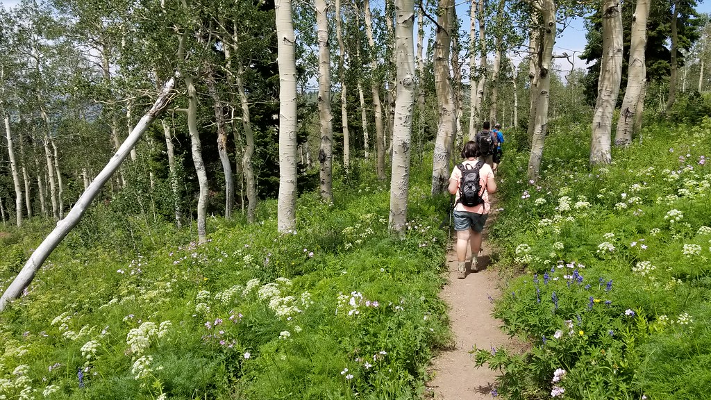
This hike was an out-and-back, so after taking in the views, we hiked back down the same way we had come up. The hike down was spectacular, partly because the exertion of climbing uphill was done, but also because we were able to enjoy open views the whole way down! I also appreciated the huge variety of wildflowers along the trail.

After arriving back at the base, we enjoyed a late lunch at Grand Targhee’s Trap Bar & Grill. Of course, we had to get their famous Wydaho Nachos and ‘Sloshies’ (basically a boozy Slurpee).


Beautiful pics! Thank you for sharing.
LikeLiked by 1 person