Cadillac Mountain South Ridge – Acadia National Park (ME)

Special: Acadia Edition

The seven-mile South Ridge trail takes you to the highest mountain on the east coast – Cadillac Mountain.  At over 1500 feet, it is also one of the first places sunlight hits the U.S. each morning,  The views from this hike are panoramic and breathtaking!

A View of the Porcupines from the Cadillac Summit
A View of the Porcupine Islands from the Cadillac Summit. Below:  The marker at the trailhead; A view of Cadillac Mountain from along the lower part of the trail; Geodetic Marker at the summit.

Trailhead Marker Cadillac Mountain Along the Route Geodetic Marker

Christine Says…

We’ve driven to the top of Cadillac Mountain.  We’ve also walked up the 4.4 mile North Ridge trail a few times.  But this is the first time we’ve ever hiked to the summit via the South Ridge route.  At seven miles (plus some additional length for the side trip to Eagles Crag and walking the summit path) this route probably qualifies as one of Acadia’s longest hikes.  It’s also become one of our favorite Maine hikes.  It was fantastic!

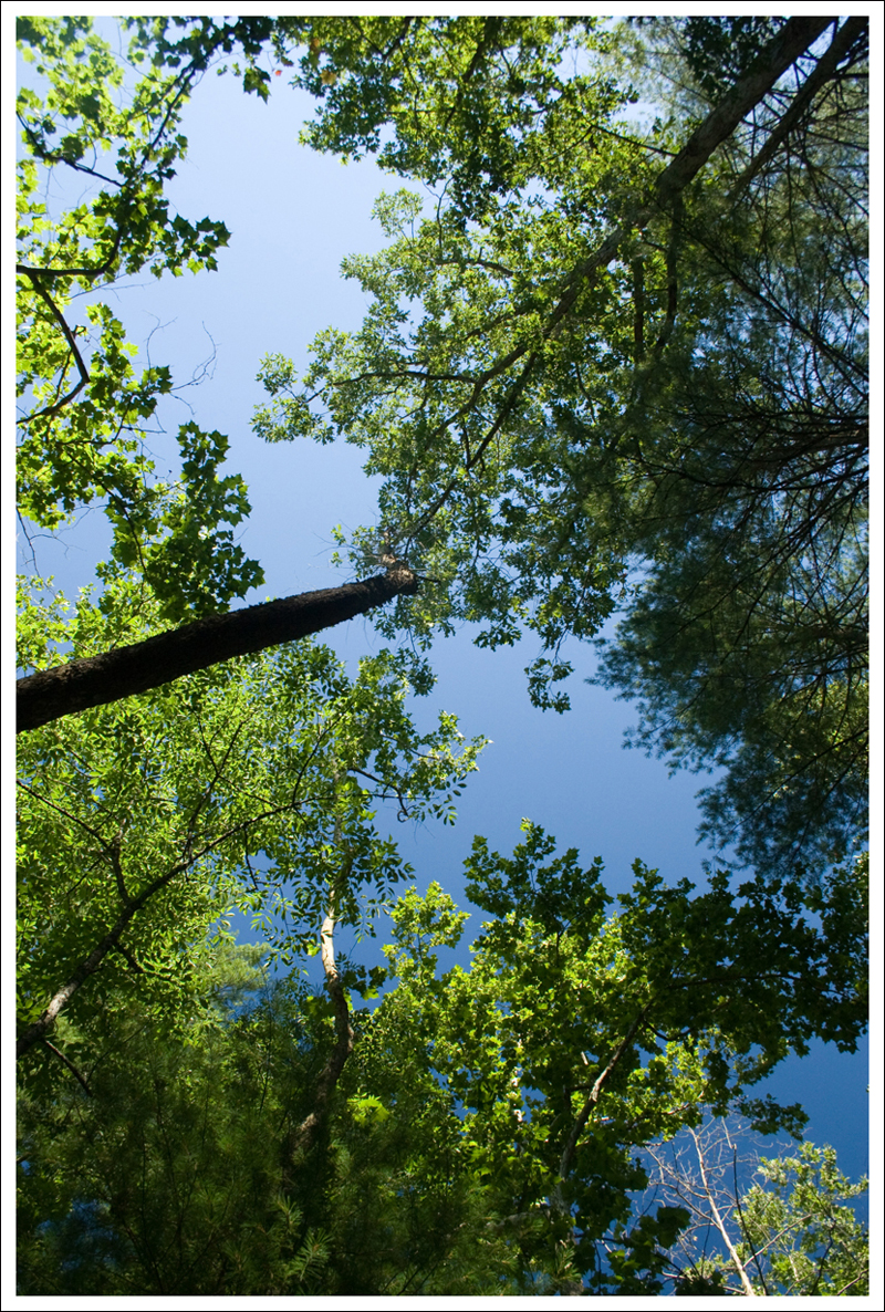
The trail starts off in the deep coolness of the evergreen forest.  Everything is green – covered with moss and ferns.  The thin island soil leaves gnarled roots and rocks exposed along the trail.  You have to constantly watch where you’re stepping so you don’t catch a boot toe and trip.  Planked boardwalks traverse the boggy, marshy places along the trail.   This part of the trail is one face of Acadia, with the other being expansive, open domes of granite.

Root-Covered Trail
The lower trail is covered with roots and rocks. Below: The view from Eagles Crag; Abundant blueberries along the trail; The first open views on the climb up.

View from Eagles Crag Abundant Blueberries First Open Views

The first trail junction you come to marks a short side-loop across the Eagles Crag.  The trail is quite a bit steeper here and leads out to an open rock ledge overlooking the ocean.  We hiked early in the morning, so the view looked directly into the sun, rendering the ocean silver and shiny.

On the return arm of the side-loop, we reentered the woods for a short while.  Near the trail junction where we met back up with the South Ridge trail, we found one of the densest patches of wild blueberries we’d ever seen!  I stopped to pick and eat some berries before we pushed on.  Yum!  Blueberries are at their peak in late July and early August, so our trip was timed perfectly for enjoying the fruit.

Near this point of the trail, the forest started thinning out and becoming patchier.  There were still trees, but they were broken up by open rocky sections.  Eventually we left the shade of the trees completely and stepped out onto the pink granite that Acadia is so famous for.  The trail was blazed blue, but we also had cairns guide our way.  The granite was punctuated by abundant patches of blueberry bushes and water filled glacial potholes.  The view behind and to the side of us was SPECTACULAR!  We found ourselves stopping time and time again to take in the majestic views.  I’ve been to a good number of national parks.  They’re all beautiful in their own way, but there is something really special about Acadia.

There were some sections of rock that required climbing and scrambling, but the way was never really steep or difficult.  We climbed one especially large rocky pass and found ourselves looking down into a small forested ravine tucked between two mountains.  The trail climbed downward into the trees and past a lovely glacial pond called ‘The Featherbed’.

The Ocean and the Featherbed
The Ocean and the Featherbed. Below: Another look at the Featherbed; Trails in Acadia are marked by cairns and blazes; Christine hikes up toward the summit.

The Featherbed Cairns and Clouds Christine Climbing

After the pond, we began the climb up Cadillac in earnest.  The first little bit after leaving the pond was quite steep with some mild rock scrambling.  Once we regained the ridge, the trail became moderate again.  The sun was bright.  The sky was deep blue and painted with wispy clouds.  The ocean below was sparkling and so beautiful.  I must have said to Adam a couple dozen times “It’s so gorgeous! This is a perfect Maine day!  We are so lucky!”

Along the ridge, we began to see distant glimpses of cars making their way up the auto road to the Cadillac summit.  But we didn’t come close to the road at all until we were almost to the top of the mountain.  Once drawback of the shorter 4.4 mile North Ridge is its proximity to the road for much of the hike.  We really enjoyed staying away from the road this time.

Near the summit, we passed through one more section of forest and came out on a gravel road behind the gift shop located at the summit.  It’s always kind of bizarre to hike several miles along pristine, quiet trail only to summit a mountain with auto access.  More than a few people looked at us strangely with our Camelbaks and trekking poles.

Even though it was still pretty early, the summit was packed with people!  Adam got cold drinks from the gift shop and I walked around the summit path to take a few photos.  The view from Cadillac offers a great look at the town of Bar Harbor and the outlying Porcupine Islands in Frenchman Bay.

With the thick crowds and the notion of a big lunch, we didn’t linger too long at the summit.  On the way down, we passed quite a few people heading up the trail.  I was really glad we had started around 7:30 and had been able to enjoy a bit of solitude.

The hike down was bright and hot under the mid-morning sun!  I had slathered myself with SPF 50, but I missed one spot between my ponytail and my backpack.  I ended up with a strange sunburned triangle on my back. 😦

We really enjoyed the views the whole hike down!  I was kind of bummed when the trail eventually descended back into the woods.  The shade was nice, but losing the view was not!

When we got back to the car we debated whether we should go back to our room and shower, or head straight to lunch in town.  In the end, hunger won out and we ate lunch covered with sweat and grime.  We went to one of our favorite lunch spots in town – Rupununi.  They have the best Buffalo Chicken sandwiches and clam chowder.  We got a great seat out on the patio, the food was delicious and I didn’t even care that I was filthy!

Adam Says…

A trip to Acadia National Park almost requires you to visit Cadillac Mountain.  However, most people drive to the top of it rather than try hiking up.  Their are also some insane bikers that bike up the mountain, but we’re not in that kind of shape.  Since Cadillac Mountain is the highest summit in the park, we used to feel intimidated about trying to hike up.  Several years ago, we hiked up the north ridge since that seemed to be the easiest route.  We remembered the north ridge hike being a great hike, so this time we decided to try a different route.

View of Eagle Lake
A view of Eagle Lake.

To start the hike, we parked on Route 3, almost directly across from the entrance to Blackwoods Campground.  You take a few steps up and then the trail begins.  This first section is just about the only part that is completely in the woods.  At .8 miles, you reach a junction with the Eagles Crag trail.  We took a right and went on the Eagles Crag trail, which joins back on to the South Ridge Trail at 1.2 miles.  The Eagles Crag trail was probably the toughest climbing on the trail, but it does take you out of the woods to some nice views to the east of Otter Cove and Gorham Mountain.  In retrospect, we feel that it really isn’t necessary to do Eagles Crag, since you will quickly see tons of views right after you rejoin the trail.  But, if you want more views and/or some more challenge, go for it.  When you rejoin the South Ridge Trail at 1.2 miles, the trail begins to open up to more views in a short distance.  You will need to pay attention to the cairns on the trail since there are no tall trees to mark trail paths.  The views on this trail are completely amazing!  You have to turn around to see the great views on the way up.  We found ourselves taking pictures from a gorgeous spot and then going another .1 mile and finding even better views behind us.  At 2.4 miles, you reach a summit of a small hill where you can see the small pond, The Featherbed, below.  You climb down this small hill and then reach The Featherbed and a junction with the Canon Brook Trail at 2.7 miles.  Stay straight on the South Ridge trail as you begin your next ascent to reach the summit.  At 3.2 miles, you reach a junction with the West Face Trail to the left, but stay straight.  The trail is steeper up this last section of the trail.  There are a few areas where you will climb up some rocks (even using one iron rung handrail), but we didn’t find it to be overly difficult.  Through this section, you are likely to hear or see people along the Auto Road heading up Cadillac Mountain.  At 3.7 miles, you will reach the summit of Cadillac Mountain.  Go back the way you came.

Hiking in the Open
Adam hiking along in the open.  Below: Trail junctions are well-marked in Acadia; The building at the summit; Another view of the Porcupine Islands from the summit;  Views on the hike down.

Trail Markers Summit Building
Cadillac Summit and Porcupines View Hiking Down

You feel like you are making an accomplishment when you hike up Cadillac Mountain.  While many of these people are driving to the top, you feel like you really earned the views.  The actual summit marker for Cadillac Mountain is not as easy to find.  As you’re coming up the South Ridge trail, you may walk right past it.  I like to get a picture of each summit we make.  Unlike most of Acadia that marks the summit with a large wooden summit marker, Cadillac Mountain only has a USGS marker in the rock.  To find it, walk behind the gift shop by about 100 steps where the gravel ends.  To the right, you will see a greenish-looking marker on a rock.  This marker has an arrow, that points about 20 feet to another marker on another rock.  This is the true summit marker.

We took a little time to hit the bathrooms, buy some cold drinks (that is always welcome when you are finishing a hike), and take in the views.  From Cadillac Mountain, you can see just about all of Mount Desert Island and on a clear day, the views are spectacular.  Many people drive to the summit of Cadillac Mountain to see the sunrise.  This is the second earliest place where you can see the sunrise on the east coast (only to be beaten slightly by Maine’s own Mount Katahdin).  While Christine was off taking some photos, I relaxed and talked to a family that just arrived from New York.  They were impressed that we hiked up it and I told them about some other things they should do during their week of vacation.  I could tell the father of the family was ready to tackle it all, but I could see some of his family wasn’t as enthusiastic.  After talking with me, they were going to try and hike up Cadillac Mountain that afternoon.

Cadillac Mountain does have some interesting history.   The area was named after Antoine Laumet de La Mothe, sieur de Cadillac, a french explorer and trader.  This area was well-explored and controlled by the French and Antoine was given this area (now known as Bar Harbor) with this mountain (then known as Mount Desert).  When I was attending a ranger program while I was trying to achieve my rank as a “Acadia Senior Ranger”, I learned about how this man was much-hated and was basically run out of this area for misappropriation of money.  He then left this area and founded what became Detroit.  The Cadillac car is named after this man and the seal is his family crest.  It is funny that this country holds the car in such high esteem, when the man was a criminal (once called “one of the worst scoundrels to set foot in New France”).

If you are interested in geocaching, you can find a geocache near the top of Cadillac Mountain that is located near the beginning of the north ridge trail: Cadillac Mountain Cache.

As Christine and I were reflecting on all of the hiking we have done in Acadia, I will say this is my favorite hike to do in the park.  You truly don’t get any better views than on this hike up the south ridge of Cadillac.  There were times that I even felt tears welling up due to the awe-inspiring, panoramic landscape.  The north ridge trail also has great views along, but several times you are walking very close to the Auto Road and you are limited to views on one side of the trail.  With the vast expanses on the south ridge trail, it can’t be beat.  If you are up for doing a longer hike in Acadia, make this the one to do!

Trail Notes

  • Distance7.4 miles
  • Elevation Change – approximately 1300 feet
  • Difficulty – 3.  The hike is steadily uphill but is quite moderate.
  • Trail Conditions – 3. The trail is occasionally root-covered and has a lot of open granite.
  • Views 5.  It doesn’t get any better than this!
  • Waterfalls/Lakes/Streams – 4.  The Featherbed is beautiful and you get lots of distant views of the bay and ocean.
  • Wildlife – 1.  Maybe some red squirrels and (if you’re lucky) hawks on Eagles Crag.
  • Ease to Navigate – 4.  Just follow the markers, blazes and cairns, and you can’t go wrong.
  • Solitude – 1.  We started early and didn’t see many people on the trail, but the summit is always very crowded.

Directions to trailhead:  Located on Route 3, about 5 miles south of the Jackson Lab.  Look for the signs for Blackwoods Campground and park directly across the road from the entrance to the campground.  You will see a break in the woods with a few steps that starts your trail.

Appalachian Trail – Elkwallow to Thornton Gap

This 8.35 mile hike (with an optional .4 mile detour to the Pass Mountain Hut) follows the Appalachian Trail through beautiful forest and past one decent view.

Path to Pass Mountain Hut
Path to Pass Mountain Hut. Below: Adam walks along the Appalachian Trail descending Pass Mountain; Rocks along the trail descending Neighbor Mountain; We crossed Skyline Drive at Beahm's Gap.

Ferns Rocks along trail Skyline drive near Beahms Gap

Christine Says…

Last weekend was one of my only free weekends between July and August (lots of art shows and an upcoming trip to Maine!), so we decided to go for a hike.  I wasn’t in the mood to go anywhere that required a long drive, so we settled on doing another section of the Appalachian Trail in Shenandoah National Park.  We’ve completed the central district and a couple segments in the south district, but we had yet to hike any of the AT in the park’s northern section.  To make the drive time the shortest possible, we chose to hike from Elkwallow to Thornton Gap (Rt. 211).

We started out at the Elkwallow Picnic Area, the same exact spot we began our backpacking loop down to Jeremy’s Run last year.  After a short downhill to meet the AT, we began a gradual, steady climb up the trail – the first of three significant climbs on this section of trail.  We passed lots of thickets of ripening blackberries along the trail.  We also saw a lot of eastern red columbine still in bloom.

Blackberries
Blackberries along the trail. Below: Red eastern columbine; a couple unidentified wildflowers; Indian Pipes

Columbine Wildflower Wildflower
Wildflower Indian Pipes

After the first climb, the trail is really gentle and level until you reach the next climb, headed up Neighbor Mountain.  The Neighbor Mountain trail, which branches off the AT, is another option for making a loop with Jeremy’s Run.  It’s a little longer than the Knob Mountain Loop we chose, but the steepness of the climbs are a little more gradual.  At the junction of the AT and the Neighbor Mountain trail, we ran into two gentlemen that turned out to be doing the same exact segment hike we were working on.  They offered us a share of their fresh picked peaches and plums from a local orchard!

Near the trail junction, you have the option to take a side loop past Byrd’s Nest #4, but we decided to stay on the AT.  Descending Neighbor Mountain is a little steep and rocky.  On the steepest part of the descent, we passed three section hikers slogging uphill.  Near the bottom of the descent, we stopped for a snack and were eventually passed by the two guys we met at the Neighbor Mountain junction.  We continued to play ‘leap frog’ with them for the remainder of the day.

View off Pass Mountain
Adam takes in the view from Pass Mountain. Below: Blueberries ripening; Adam picks berries.

Blueberries Picking Blueberries

A bit later, we crossed Skyline Drive near the Beahm’s Gap overlook and began the final big climb of our hike – over Pass Mountain.  I didn’t really expect any views on this hike, so I was pleasantly surprised to find a very nice overlook just north of the Pass Mountain Summit.  It was a little hazy, so the view wasn’t as pretty as it could have been.  Even if the views were slightly lacking, the abundant wild blueberries more than made up for it!  It was one of the thickest, densest accumulations of ripe berries I’ve ever seen!  (and this is coming from someone who has spent many, many summers in Maine).

The park has a policy allowing limited gathering of berries, nuts and seeds for personal consumption, so we ended up picking about a quart of berries.  I made vanilla-blueberry pancakes with them.  YUM!

After we picked berries, we had a short distance more to climb over the summit.  After crossing the high point, the remainder of the hike was an easy downhill grade for a couple miles.  With about 1.5 miles left, we passed the spur trail to the Pass Mountain Shelter.  I ditched my backpack and hiked the extra .2 miles down to the shelter.  It was set in a pretty opening under the trees.  I took a peek at the journal and noticed one of the recent entries mentioned a bear visiting the shelter!

After the shelter, we continued downhill back to the car.  When we crossed 211 to get back to where we parked, we noticed that there were police cars and park rangers all over the road.  It turns out that 211 was closed due to a fatal motorcycle accident – very sad.  Since we had to wait for the road to open, we headed back into the park to get some lunch at Elkwallow Wayside.  It was a tasty, indulgent treat after our hike.

Adam Says…

Well, we’ve reached about the halfway point in covering the Appalachian Trail through Shenandoah National Park.  With the Central District done, we have been starting to work on some other sections in the North and South districts.  This was our first section through the North District.

We parked one car on 211 near the sign for where the Appalachian Trail crosses and outside the park boundary.  We drove the other car to the Elkwallow Picnic Ground.  The trail starts right near the privy and heads down into the woods.  Continue on this spur trail for a short distance until you reach the junction with the Appalachian Trail.  Take a left heading south on the white-blazed trail.  In about a quarter of a mile, you reach a junction with the Jeremy’s Run trail but stay on the Appalachian Trail.  The trail begins to ascend fairly steeply and you will gain about 500 feet of elevation over the next mile.  The trail levels off at this point and even starts to descend for the next two miles.  At 3.2 miles, you will start another ascent of 400 feet.  You will then pass a junction with the Neighbor Mountain and Byrds Nest 4 trail.  We stayed on the AT, but you can take the trail to the Byrds Nest shelter and it will rejoin the AT after the shelter.  The trail descends again over the next mile and you reach Skyline Drive at the Beahms Gap parking area at mile 5.2. Cross Skyline Drive and begin the ascent up Pass Mountain as you gain 600 feet of elevation over the next mile.  Once you reach the unmarked summit of Pass Mountain, the hard part is over and it is two miles back to your vehicle on 211.

Pass Mountain Hut
Pass Mountain Hut. Below: The shelter has a picnic table and a firepit; A peek inside the shelter journal; A curious doe along the trail.

Journal and fire pit Shelter journal Doe near the Pass Mountain Hut

The best part of the hike was definitely getting to the summit of Pass Mountain.  We were hiking near the summit and we saw a rock outcropping to the west of the trail about 100 feet.  Christine was doubtful that there would be any opening for views, but I said that I thought there would be.  When I went to investigate I saw there was a decent view, but I was quite pleased to see all the wild blueberries.  As Christine mentioned, we have often seen blueberries when we go hiking in Acadia National Park in Maine, but these patches seemed untouched.  We spended about 30 minutes picking blueberries and taking in the view.  We also thought of our friend, Suzanne, that accompanied us on the backpacking trip in Dolly Sods the previous week.  She went crazy for wild blueberries, and we pictured her screaming in glee over these patches.  There were still lots of blueberries that weren’t ripe enough to pick, so if you are interested in doing this hike for some blueberries, I would hit this trail in mid to late July.  I’m guessing that this trail could also be frequented by bears since they tend to go where the food sources are.

Path through woods
The Appalachian Trail is like a green tunnel through the woods. Below: Christine crossing 211 at the end of the hike; Blueberries at home!

Crossing 211 Blueberries at home

Christine was impressed when I spotted the indian pipes on the trail.  Of course, I wasn’t sure what they were called.  I just said, “Isn’t this something you’re interested in?”  She has quickly become great at identifying wild flowers.  Maybe one day I will get there also, but I can at least point some things out for now.

Most of this hike is more or less a walk through the woods.  The terrain wasn’t too tough, and this is not a section of the AT that is riddled with views and interesting things along the way.  Unless you’re tackling a section of the AT, I would say that most people that you would run into on this section are hiking up Pass Mountain.

Trail Notes

  • Distance 8.35 miles (8.75 if you do the optional side trail to the Pass Mountain Hut)
  • Elevation Change – 1600 feet
  • Difficulty – 3.  This hike is a moderate mix of climbs, descents and flats.
  • Trail Conditions – 4.  The trail is in great shape, but a little overgrown due to the wet summer.
  • Views –2.5  The view from Pass Mountain is nice.
  • Wildlife – 1We saw a deer but nothing else.
  • Ease to Navigate – 4.5.  The trail is unmistakably easy to follow.
  • Solitude – 2.5.  You probably won’t see many hikers after the peak of thru-hiking season.  We saw only a handful of people over the miles.

Directions to trailhead: From Skyline Drive around mile marker 24.3, follow the signs to the Elkwallow Picnic area (not Elkwallow Gap parking lot).  Park near the privy.  The trail starts next to the privy.

Appalachian Trail – Powell Gap to Swift Run Gap

This section of the Appalachian Trail gives you stunning views from the summit of Hightop Mountain.

Summit of Hightop Mountain
Adam and Wookie enjoy the summit of Hightop Mountain.

Adam Says…

We started off our hike by parking one car at the Swift Run Gap entrance and one car near the Powell Gap trailhead around mile marker 70 on Skyline Drive.  The trail immediately starts with going uphill.  Get used to it, because 3.6 miles of this hike is uphill.  You gain 1250 feet of elevation during this stretch.  For 1.7 miles, the hike from Powell Gap until you cross Skyline Drive again at Smith Roach Gap was overgrown in many parts.  I can imagine that maintaining this section of trail was more challenging this year with all the rain, but we wish we had a weed-whacker with us to keep the grass and weeds from brushing up against our legs.  The mountain laurel during this section was so abundant.  It gave good cause to pause from huffing and puffing up the trail.  After crossing Skyline Drive and continuing the white-blazed Appalachian Trail, you will continue your ascent.  The trail was not as overgrown in this section.  At mile 2.7, you will reach a blue-blazed spur trail that leads to the Hightop Hut, adding .2 mile to your hike.  At mile 3.6, you will reach the summit of Hightop Mountain which has an overlook with valley views.  The trail begins to descend at this point, through some slightly-rocky terrain.  At 5.1 miles, you will cross Skyline Drive again.  Continue to follow the trail until you reach Swift Run Gap at 6.4 miles.

Wookie on the Appalachian Trail
Wookie on the Appalachian Trail.  Below:  The mountain laurel were gorgeous along the trail.

Mountain Laurel Walking along the AT

I really think Wookie enjoyed himself on this trip.  It was his longest hike ever, but he pushed on through. We are always amazed at how we think he would be exhausted for the rest of the day, but he runs around the house as soon as he gets home like a puppy on crack.  I think it is his way of boasting to our other dogs that he got to do something fun.

The views are always nice at the top of Hightop Mountain.  This trail does get some decent traffic (especially in the area between Swift Run Gap and the summit), since it is really the first hike you could possibly do in the southern section of the park if you are driving from the north.  We had met the thru-hiker “Shenanigans” at Hightop Hut, who talked to us for a while.  He had heard of the Bearfence Mountain hut being closed.  Rangers had put up a sign letting people know that the hut was closed, which helps the thru-hikers plan on where they were staying next.  His goal was to make it up to Big Meadows, which would have given him a hike of close to 30 miles for the day.  We went to check out the Trail Days festivities at Big Meadows Lodge and talked to one of the ridgerunners.  These ridgerunners are hired by the Potomac Appalachian Trail Club to basically hike the maintained trails through the area, talking to hikers, and checking in on the huts/cabins along the way.  He told us that the Bearfence hut was going to be re-opened, so hopefully Shenanigans had a closer place to stay if he wasn’t feeling like doing a ton of miles that day.

Christine Says…

A couple days after we returned from our Virginia Highlands trip, we decided we were ready to go for another hike.  After all, June 4th was National Trails Day, and we couldn’t let the day go by without hiking somewhere.  We didn’t want to go anyplace that required a lot of driving.  We also wanted to do something shorter, so we could bring Wookie along.  Pugs are not the best hiking dogs, but Wookie always enjoy accompanying us on less strenuous hikes on cooler days.  In the end, we settled on another Appalachian Trail section.  Swift Run Gap is only a 10-15 minute drive from our house, so we decided to do the 6.4 mile section between Powell Gap and Swift Run Gap.

Hightop Hut
We stopped at Hightop Hut and chatted with the thru-hiker ‘Shenanigans’.  Below: One of the Skyline Drive crossings; Columbine in bloom.

Crossing Skyline Drive Blooming Columbine

This section of trail is about 65% uphill.  It’s never unbearably steep uphill, but for almost the first four miles, you are almost always climbing.  The trail goes by one nice view, from the summit of Hightop Mountain.  It also takes you by Hightop Hut, which is another overnight stop for multi-night backpackers and thru-hikers.

On the particular day we hiked, much of the trail was lined with mountain laurel at their peak bloom.  2011 has been a fantastic year for mountain laurel.  Spectacular, abundant, lush blooms have been everywhere across the mountains.

At the summit of Hightop Mountain, we encountered two hikers and their dog.  Their dog clearly wanted to eat Wookie for breakfast, so we were extra glad she was leashed!  We enjoyed the views and the breezes.  Hightop has a great view of Massanutten Mountain – one of the most distinct and impressive mountains on our local skyline.

After Hightop, the last couple miles of the hike were pretty easy – lots of downhills and flat.  We were back at the car by lunchtime, so we decided to drive up to the Big Meadows area to have lunch and check out the PATC display for Trails Day.

We were able to say hello to one of our instructors from Backpacking 101.  We also chatted with trail maintenance crews and participated in a demo of their big two-man saw.  We happened to catch one of the ridgerunners at a ranger display and were able to chat with him about a bear incident we heard about near Bearfence Mountain Shelter.  Apparently, a bear was getting too bold for his own good near the shelter.  He had even started exploring tents in search of food.  The last straw was when the bear destroyed an unoccupied tent belonging to a thru-hiker.  The bear was trapped and transported to a less populated area of the park.  While rangers worked on trapping the bear, the shelter was closed, forcing hikers to push on another 10-12 miles to the next shelter.

We enjoyed a nice picnic lunch at Big Meadows – burgers, fries and blackberry milkshakes (YUM!).

wookieWookie Says…

This is the first time in quite a while that I’ve been invited out on a hike!  It was a nice cool morning, so Christine and Adam decided to bring me along on a 6.4 mile hike along the Appalachian Trail.  It’s the longest hike I’ve ever been on!

I had a lot of fun trotting along the trail.  I like walking second in line, because I feel safer between my two humans.

When we got to Hightop Hut, I considered stealing some trailmix from the thru-hiker, but Christine wouldn’t let me.  Instead, I got to drink a bowl of water from my collapsible dog dish.  On the summit of Hightop Mountain, I met a big, black and white spotted dog.  She was really loud and scary.  I think she would have attacked me if she had free run.  Being so small, I always appreciate dog owners that follow the rules and keep their canine hiking companions on six foot leashes.

On the last mile of the hike, I started getting really tired.  I could barely hold the curl in my tail, I was so exhausted.  When we got back to the car, I stretched out on the floor between Christine’s feet and took a nap until we got to Big Meadows.

At lunch, I even got some well-earned treats – a few fries and some of Christine’s burger patty. I would have liked to taste a blackberry milkshake, but I don’t think anyone was willing to share.  Lots of people wanted to pet me and say hello at National Trails Day.  I guess hiking pugs are sort of unusual!

Trail Notes

  • Distance 6.4 miles one-way with a shuttle required.
  • Elevation Change – 1250 feet
  • Difficulty – 2.5  The trail is over halfway uphill, with a few steeper sections.
  • Trail Conditions – 3The trail between Powell Gap to Smith Roach Gap was overgrown.  Otherwise the trail is fairly well-maintained, but there are a few loose rock sections going downhill.
  • Views – 4.  Great views.
  • Wildlife – 2.  We saw a few deer and a scarlet tanager on the trail.
  • Ease to Navigate – 4.5. Just stay on the Appalachian Trail. 
  • Solitude – 2.5  The promixity to the beginning of the south district of Shenandoah National Park make this popular for the last three miles of the trail.

Directions to trailhead: On Skyline Drive through Shenandoah National Park, go to mile 70 in the South District of the Park.  Park on the side of the road, near the sign for Powell Gap.  You will see the beginning of the trail on the eastern side of the road.  Follow the white blazes.

Appalachian Trail – Bearfence to Swift Run Gap

The Appalachian Trail from Bearfence Mountain to Swift Run Gap is a nine mile section.  It doesn’t really offer any majestic views or pretty stream scenery, but it is a pleasant walk through classic Shenandoah forest.

Blooming Trillium Along the Appalachian Trail
Blooming Trillium Along the Appalachian Trail.  Below: Adam makes his way along the AT; The only view on the hike comes from an opening in the trees near Pocosin Cabin; Climbing the one rocky section of trail; Ferns were everywhere!

The Green Tunnel Spring View near Pocosin Cabin Rocky Climb Ferns

Christine Says…

This post should have been about our backpacking trip to White Rock in George Washington National Forest.  We spent all morning on Saturday getting ready – making toiletry kits, forcing our sleeping bags into waterproof stuff sacks, testing batteries in our headlamps, filling our Camelbaks, et cetera.  We even drove the nearly two hours over into West Virginia.  The forecast called for a 30% chance of spotty showers, however, at the trailhead we found a steady deluge of cold rain.  We sat in the car for about an hour and a half, waiting for the rain to pass by.  It never did, so we bailed on our backpacking trip and headed home feeling completely bummed out.

The next morning, we woke to drizzle and clouds, but the local weather guy kept saying “Not a washout, don’t cancel outdoor plans, dry air moving into the area.”  So, we decided to head out into the gloomy morning and finish our last section of Appalachian Trail in the central district of Shenandoah National Park. We had already hiked three sections – Big Meadows to Bearfence, Skyland to Big Meadows and Skyland to Thornton Gap, so that left the nine miles between Bearfence and Swift Run Gap.

It turned out to be a perfect day for this hike!  The drizzle stopped shortly after we arrived in the park, and the cool, overcast weather was ideal for a hike through the woods.  I always like cloudy weather when I’m going to be photographing scenes under the tree canopy.  The clouds are like a giant softbox – filtering the light and making every scene look softly-lit and shadow-free.  Sunny days in the woods always result in spotty/stripy uneven photos – the contrast between light and dark is too much.

Yellow Lady Slipper
The yellow lady slipper is a rather uncommon wildflower.  Below: A collection of wildflower shots… trillium, wild violet, wild geranium, and some others we don’t know.

Wild Violet Wild Geranium Wildflowers
Trillium Wildflowers Lots of Trillium

It also was a fabulous day for enjoying the amazing display of wildflowers Shenandoah has underway right now.  I saw everything from wild violets to expansive carpets of trillium to colorful and rather uncommon yellow lady slippers.  The forest floor lining the trail was like an ocean of wildflowers – there were so many.  It was so gorgeous!  I think I must have said “Can you believe all these flowers!?” to Adam at least five or six times.  I don’t think he was as moved as I was!  For example, when I spotted the lady slipped, I gasped and said “Oooooh – oh, my gosh – look!”  He thought I saw a bear cub, and was duly disappointed when he learned I only saw a flower.

In addition to all the wildflowers, we also saw many birds that we don’t see often down in the valley.  We saw two mating pairs of Scarlet Tanagers, several Baltimore Orioles, many Eastern Towhees, Eastern Phoebes and a few Bluebirds.

This section of Appalachian Trail is a good example for why the path is aptly nicknamed ‘The Green Tunnel’.  Even though the leaves were not fully out, the trail always felt like a narrow passage cutting through the greenest of greens.  Everywhere you walk, trees form an umbrella overhead and ferns, grasses and other understory plants come right up to the trail’s edge.  It’s such a peaceful setting.

We didn’t pass any grand views – really, the only spot you could really see off into the distance was one small peek through the trees shortly before passing the Pocosin Cabin.  We also didn’t pass any streams bigger than small runnels that could be traversed by a single large step.  We also didn’t see many other hikers.  We ran into several AT thru-hikers.  They’re probably the first of many we’ll see over the next couple months!  Late May through the end of June seems to be when most of them pass through Shenandoah.

Pocosin Cabin
The Pocosin cabin sits just a few hundred feet off the Appalachian Trail.  Below: Spring leaves are starting to pop up at even the higher elevations; Lower elevations are already leafed out; Lunch at South River Picnic Area.

Walking the AT Spring Green Lunch at South River

As we got closer to the South River picnic area, we started seeing a few more people – a man out looking for morels, a few couples walking the South River Falls loop, and lots of picnickers.  We stopped at the picnic area and ate our packed lunch.  It was a nice place to take a break before knocking out the last three miles of our hike.

Most of the last three miles we hiked just a few months earlier, when we did the Saddleback Mountain loop.  There were several places along the trail that I remembered seeing covered with a dusting of snow last time we passed by.  Green leaves dramatically change the scene!  It didn’t look like the same place at all.

The last couple miles of our hike were all downhill back to Swift Run Gap.  Overall, this nine-mile section of trail was really easy walking, with only about 1300 feet of climbing.  And although it didn’t have the most impressive scenery, I enjoyed the hike very much.  It was a great ‘consolation prize’ for our canceled backpacking trip!

Adam Says…

This hike finished our Central District section hike of the Appalachian Trail.  Please see our Skyland to Thornton Gap, Skyland to Big Meadows, and Big Meadows to Bearfence entries to read about the entire hike through this section.  We hope to continue working on sections in the South and North districts of Shenandoah National Park to complete this section of the AT.

Bearfence Hut
Bearfence Hut is an overnight shelter for backpackers. Below: The trail down to the shelter is slick and steep; the AT passes right behind Lewis Mountain campground and cabins.

Trail Down to Bearfence Hut Lewis Mountain Cabins

We left one car at the Swift Run Gap entrance to the park and then drove up to the Bearfence Mountain parking lot around mile 56.8 on Skyline Drive (keep in mind there is also a Bearfence Trail parking lot around mile 56.5, so be sure to park at the correct lot).  There is a parking lot on both the west and east sides of Skyline Drive.  The Appalachian Trail picks up near the parking lot on the eastern side of Skyline Drive.  Head south on the white-blazed AT.  The trail descends slightly and you will soon come across a spur trail to the Bearfence Mountain Hut, that can be used for overnight backpackers.   The .1 mile spur trail is steep and may be slippery on the way down, but it is always interesting to see these huts along the AT.  (Note added 2022: This spur trail has been decommissioned. The hut is now accessed via the fire road from the parking area.)

Continue along the AT and the trail ascends slightly.  You will be able to see spur trails along the way to the Lewis Mountain Campground and picnic area.  After passing by this area, the trail will descend again.  At 2.7 miles, you will cross over the Pocosin Fire Road as you start a 500 foot ascent.  At the 4.0 mile mark, you will reach the peak of Baldface Mountain and then begin your descent.  At 5.5 miles, you will reach the South River Picnic Area to your right.  This is a great place to stop and eat a snack or use the restroom.  Once you get past the South River picnic area, you will shortly come across another fire road.  Take a left at this road to continue on the AT.  You will follow this road uphill a short distance and then you will find the entrance back on the AT on the right-hand side of the road.  Keep following the AT as it ascends the Saddleback Mountain.  You reach the peak of Saddleback Mountain around mile 7 on your hike.  You then descend for the next two miles back to the Swift Run Gap station.

The highlights of this hike were really all the bird sightings and the wildflowers.  There seemed to be a trillion trillium on the trail.  We really enjoyed seeing all the Baltimore Orioles (no sign of Cal Ripken, Jr.) and the Scarlet Tanagers.  With the rain being so heavy this spring, the colors were bursting.

Native Azaleas Along the Trail
Native Azaleas Along the Trail.  Below: Closeup of azaleas; Adam passing a pretty dogwood at the end of the hike.

Azaleas Adam Arrives at Swift Run Gap

We enjoyed hiking the little side trail down to Bearfence Hut and chatting with a group of section hikers.  They had spent a rainy night in the shelter and were gearing up to hike another 8+ miles to the Big Meadows area.  One of the group was a boy, maybe eight or nine.  He asked if we were thru-hikers and talked about how much you have to eat when you’re hiking.  It was nice to see a kid learning to love the outdoors.

We also diverted down the trail to Pocosin Cabin for Christine to take a couple photos, but ended up staying only briefly because we didn’t want to disturb the party that had rented the cabin.  They had an adorable long-haired German Shepherd puppy named ‘Chance’.  He greeted us near the privy and was in full play mode!

I did feel a little out of shape on this hike.  It seems that after I hit the seven mile mark, my legs tend to cramp and I have to hobble along the trail.  Hopefully this will improve over the next few months.  The first part of the hike was great, but then fatigue started to set in for me.  Christine has been doing a ton of training with weights and cardio this spring, so she felt really energetic the entire hike.  Personally, I thought it was great to see the car at the finish line!

Trail Notes

  • Distance9.25 miles. This includes the shorter spur hikes to Bearfence Hut, Lewis Mountain Campground, Pocosin Cabin and South River Picnic Area
  • Elevation Change – 1350 feet in three main climbs.
  • Difficulty –2. This is a pleasant and easy section to hike.
  • Trail Conditions – 4. Very nicely maintained and easy to walk.  There are several rocky sections.
  • Views1. You get one decent view near Pocosin Cabin.
  • Waterfalls/streams – 0. Non-existent.
  • Wildlife – 3.5. You will likely see deer and you may even see some black bears during the warmer months.
  • Ease to Navigate – 4. Follow the white blazes.  The one tricky place is where you cross the fire road that leads to South River Spring and the PATC maintenance hut.  As you come out on the fire road, follow it downhill to pick the AT back up.  You should see a white blaze.
  • Solitude – 2. You will likely see people along the trail, especially near South River and Lewis Mountain.

Directions to trailhead: Park at mile 56.8 on Skyline Drive at the Bearfence Mountain parking.  The trail begins near the eastern parking lot.

Appalachian Trail – Skyland to Thornton Gap

The Appalachian Trail from Skyland to Thornton Gap follows ten miles of trail and includes no fewer than four spectacular panoramic views.

Adam and Jason on Stony Man
Adam and Jason take in the view from Stony Man mountain. To the left of where they are standing, you can see the buildings of Skyland Resort. Below: The view looking northwest from Stony Man; A view from Little Stony Man; A section of trail following below and parallel to Skyline Drive; A view from the Pinnacle looking toward Mary’s Rock; A view looking down into Thornton Gap from Mary’s Rock.

The View from Stony Man The View from Little Stony Man The trail hugs the edge of the mountain The Pinnacle Looking Toward Marys Rock Mary's Rock View

Christine Says…

Monday was a real treat – a day off work, an out-of-town friend and an amazing hike along the Appalachian Trail.  My friend, Jason, came to visit for a day while his wife attended a conference in Washington D.C.  He’s from Seattle and lives surrounded by three of our most spectacular national parks (Rainier, Olympic and North Cascades.)  I was a little worried that Shenandoah would disappoint him.  We don’t have dramatic peaks, towering waterfalls or the quiet, sapphire blue glacial lakes that western parks have.  Our mountains are old and roll gently down into the valley.  The streams and waterfalls are typically small and ponds/lakes are uncommon.  At this time of year, we don’t even have foliage.  The forests in our area are largely deciduous, and are still bare and brown from the winter.  Considering all these factors, I wanted to pick a hike that would still show Jason a nice ‘snapshot’ of what Shenandoah has to offer.

After tossing around a number of ideas, we settled on the ten mile section of the Appalachian Trail between Skyland Resort and Thornton Gap.  The hike includes four great views (Stony Man, Little Stony Man, the Pinnacle and Mary’s Rock) and passes an AT hiker hut (Byrd’s Nest).  I thought Jason would especially enjoy the fact that the hike traverses a (albeit small -.45% to be exact) section of the storied Appalachian Trail.

A Fellow Hiker Takes in the View from Little Stony Man
A hiker enjoys the view from Little Stony Man.  Below: Jason checks out the lichen growing on one of the many giant boulders along the trail; Adam walks along one of the rockier section of trail; Another Little Stony Man view.

Jason checks out the lichen The trail was rocky in many places Another Little Stony Man View

We met at Thornton Gap and shuttled back up to the north entrance of Skyland Resort to begin our hike.  We climbed up along the trail until it joined with the Stony Man spur-loop.  Although Stony Man is not technically on the AT, the view from the summit is well worth adding the extra .3 onto the total mileage. The wind was fierce atop Stony Man – backpacks blew open, hats had to be held and we had to shout to hear one another.  We stopped to take a few photos, but we didn’t stay long. We got a later start than we anticipated, so we had to be  quite business-like about our pace.

We hiked downhill from Stony Man to our next viewpoint from Little Stony Man.  We stopped again to have some water and give Jason a chance to eat some lunch.  Of the two views, I actually think Little Stony Man is a bit nicer.  After a few more photos, we climbed down a few hundred more feet into a saddle between the mountains.  This section of trail is fairly level and follows closely to Skyline Drive.  Without leaves on the trees, we were able to enjoy many open views along the trail. The lack of leaves allowed the sun to beat down strongly on our heads.  It was an unseasonably warm day – a bit humid and around 80 degrees.  Jason and I both struggled a bit with the heat.  I’m definitely not acclimated to warm weather hiking yet!

After the low point of the saddle, we began a slow, long uphill climb to the Pinnacles picnic area.  We rested there and gave everyone a chance to refill their water bottles with cold mountain water.  I had my 3 liter CamelBak so I still had plenty to drink.  I love my CamelBak!  We took a few minutes to chat with a couple section hikers resting at the picnic area.  They mentioned that they were on their way to Pennsylvania and were hoping to get into the town of Luray for a night off the trail.  I hope they made it, because the thunderstorms were crazy later that night!

After the Pinnacles picnic area, the remainder of the hike followed pretty much the same route we use for Mary’s Rock.  The climb up to the Pinnacle gains about 550 feet of elevation.  It wasn’t hard climbing, but we were all pretty tired, so we stopped to eat brownies.

The climb up to the Pinnacle passes lots of huge, lichen-covered boulders.  Eventually, we arrived at the view.  I like the Pinnacle because you can see the entire route all the way over to Mary’s Rock.  While we were enjoying the view, Jason remarked that the end of the hike still looked a good distance off.  It was! We still had about five miles to go at this point, so we had to start keeping an eye on the sun’s level in the sky.  Adam kept checking our distance and walking pace on his GPS to keep us on track to be out of the woods before nightfall.

Photography on the Pinnacle
Jason takes a few minutes to take a few photos from the Pinnacle.  You can see Adam peeking up from another rocky outcropping.

After leaving the Pinnacle, we dipped down into another saddle between mountains.  At the bottom of the saddle lies Byrd’s Nest #3 – one of the long-distance hiker huts along the AT.  I had hoped we would have time to let Jason read some of the hiker log book and poke around the shelter, but we only had a few minutes to stop and chat with a hiker who had settled in for the evening.

Our last uphill climb was relatively easy and led us to our final viewpoint – Mary’s Rock.  The viewpoint lies about .1 mile off the Appalachian Trail, but you don’t want to miss taking this short spur trail!

Once we were at the summit, Jason took some time to scramble around on the giant boulders and take some photos.  I stayed off the boulders because climbing on them always gives me vertigo.  The light wasn’t great, but I’m sure he was still able to get some nice shots of the valley below.  One of the prettiest things I noticed from the view was the evening sun shining on all the little farm ponds down in the valley below.  Each pond glowed golden-orange in the evening light.

By the time we left Mary’s Rock, we had about 25 minutes of light and 1.8 miles to go.  Because it was all downhill, we didn’t have any problem making it back to the parking lot before total darkness.

Adam Says…

There must be something about Mary’s Rock and the threat of darkness for us.  The last time we hiked up Mary’s Rock, we were threatened with the setting sun and this time was no different.  After some discussion on if we thought we could do the ten-mile stretch, we decided it was doable and we drove to the Skyland entrance and the Stony Man parking lot to begin our hike around 2PM.  As many of you know, I do carry a GPS with me, which has the ability to track distance and walking speed.

We were surprised at how hot it was when we were hiking.  A few days ago, the temperature was in the 40s, but today the sun was beating down relentlessly on us.  We kept up a good pace throughout the hike as sweat was dripping from our brows.  For some reason, even though we were walking at a good pace, the mileage seemed like it was going slowly.  Jason and Christine both were asking me how far had we traveled and when I first answered three miles, it felt like we had gone almost twice as far.

The trail starts near the northern Skyland entrance off Skyline Drive.  As soon as you turn into this entrance, the Stony Man parking lot is on the side.  You start on the white-blazed Appalachian Trail.  Keep your eye out for black bears if you try this hike during the late spring or summer as we have often spotted bears near the Skyland entrance.  In about .5 miles, you will come to a blue-blazed junction with the Stony Man trail.  This is a .3 mile loop trail that leads to nice views from Stony Man Mountain.  There is an interpretive brochure you can purchase for $1 from the trail start of this loop if you want to learn more about the features along the trail.   You can read more about our hike up Stony Man and Little Stony Man here.

Once you rejoin the Appalachian Trail, the trail descends 500 feet until you reach the Little Stony Man overlook at 1.3 miles with more gorgeous views (I believe the Little Stony Man views are nicer than the Stony Man views).  At 1.6 miles, you will reach an intersection with the Passamaquoddy Trail, but stay on the white-blazed AT.  The trail continues to descend and at 2.3 miles, you have reached the bottom of the saddle and have arrived at the Stony Man overlook on Skyline Drive.  The trail begins to climb at this point.  At around 4.2 miles you will reach the Pinnacles Picnic area.  There are rest rooms right on the side of the trail and a pump behind the rest rooms that provided a nice cooling refill of our water bottles.  The trail continues to ascend in the last steep uphill stretch.  At 5.5 miles, you will reach the peak of your climb and a nice viewpoint from The Pinnacle.  The trail then descends and winds down through the woods until you reach the Byrds Nest No. 3 shelter at mile 6.8.  This used to be a day-use only shelter, but recently became an overnight shelter.  The trail begins to ascend slightly for the next mile and the footing is a little more rocky as you make your approach to Mary’s Rock.  At mile 7.8, you will reach a junction with a short .1 spur trail to lead you to the summit of Mary’s Rock.  Once you take in the views from the top, meet back with the AT and continue to follow north through steep switchbacks for another two miles.  You will most likely be able to see the Panorama waystation and parking lot when you are almost done.  At 9.9 miles, you will see the post that leads to a short walk to the parking lot for Panorama.

Jason on marys rock
Jason climbed to the top of Mary’s Rock to take in the view.  Below:  Adam was exhausted by the time we got to Mary’s Rock.  He enjoyed resting on a rock; A hazy view from Mary’s Rock; Beyond Adam you can see Rt. 211 entering the park at Thornton Gap; Jason makes his way to the top of Mary’s Rock.

Adam rests on Mary's Rock View from Mary's Rock
Thornton Gap View
Climbing up to the viewpoint

We ran into a few long-distance hikers at the Pinnacles picnic area.  When I asked where they were heading, they said they were on their way to Pennsylvania.  I’m guessing they are tackling the Appalachian Trail in sections.  Their goal that night was to make it to the town of Luray.  We told them about the thunderstorms that night, but they were hoping to make it down to a hotel and stop by a liquor store.  We ran into them again at the Byrd’s Nest Shelter No. 3.  My guess is that they stayed their overnight, but I know they were in for a night of torrential thunderstorms, since the lightning and rain woke me up in the middle of the night.

Fading light across the valley
The fading light across the valley was really pretty.  It made all the little ponds glow.  Below: The rolling mountain layers in the fading light.

Rolling Hills Near Sunset

We managed to make it back to our vehicle with about 10 minutes to spare of sunlight.  We did keep a steady pace, which was why my calves were quite sore for the next few days.  This hike is definitely one of the best hikes for views in all of Shenandoah National Park.  I would allow for at least 6.5 hours to do the entire hike, since you will want to take time to enjoy the views.

Trail Notes

  • Distance10 miles. This includes the shorter spur hikes to Stony Man and Mary’s Rock.
  • Elevation Change – 2000 feet with two climbs up and down two mountains
  • Difficulty –3.5. The distance is the largest reason.  It is definitely best to do this section from south to north.
  • Trail Conditions – 4. It is well-maintained, but the sections near Little Stony Man and Mary’s Rock are very rocky.
  • Views4.5. You have lots of views along this hike of the western valley.  On a clear day, you can see all the way to West Virginia.
  • Waterfalls/streams – 0. Non-existent.
  • Wildlife – 3.5. You will likely see deer and you may even see some black bears during the warmer months.
  • Ease to Navigate – 4. As long as you read the posts at the junctions with other trails, you shouldn’t have any trouble.  Just stick with the white blazes.
  • Solitude – 2. You will likely see people along the trail and at some of the big draws of Stony Man and Mary’s Rock.

Directions to trailhead: We handled this hike as a shuttle, leaving one car at the Panorama parking lot at mile 31.3 on Skyline Drive.  To start the hike, park your other car by turning into the northern Skyland entrance at mile 41.8.  The Stony Man parking lot is immediately to your right.  You will see the trailhead on the eastern side of the parking lot (along with a box to purchase the Stony Man brochure).

Appalachian Trail – Big Meadows to Bearfence

This 8+ mile segment along the Appalachian trail offers a couple nice views, a visit to an old cemetery and the opportunity to cross over one of the park’s most fun rock scrambles.

Snow on Hazeltop
Adam hikes through the snow covering the Hazeltop Mountain summit.

Christine Says…

This winter, we planned to hike the 100+ miles of the Appalachian Trail leading through Shenandoah National  Park.  Sadly, our grand plans have been foiled by frequent closures of Skyline Drive.  As mentioned in our last post, the road through the park closes if there is even a slight threat of a dusting of snow.  So, this is the first section of AT that we’ve hiked since our Skyland to Big Meadows hike last spring.

Big Meadows Buck
This majestic buck watched us as we started our hike.  Below:  He ended up leaping off into the woods with another buck friend; they continued to watch us; we parked near the campground check-in station.

Buck Leap Two Bucks Park Here

We started out at the Big Meadows campground, leaving one car parked there and our other car parked at the southern terminus of our hiking route.  The no-fee weekend made doing this segment hike logistically easier. We’d actually been planning to buy a second park pass to accommodate our need for two cars to do these segment hikes.  The Big Meadows area was covered with a thin dusting of snow.  The whole area was eerily quiet – no campers, no cars, the lodge and restaurants closed for the season.  We saw so many bucks hanging out together in small groups – friends again after the animosity of mating season.  One especially majestic buck greeted us at the trailhead.  He watched us quizzically for a few moments before bounding back into the woods.

The trail was frosted with snow, and our footprints were (in many places) the first human ones set into the path.  We saw lots of animal tracks along the way – deer, coyote, turkey, rabbit and bobcat.  It took about the first half-mile of walking for me to warm up enough to be comfortable.  Within the first mile, we passed two of the three viewpoints on our eight mile route.  Both lookouts are directly behind the Big Meadows lodge area, and look into the western valley.  I’m always struck by how barren winter is in our area when I get a sweeping view on a January hike.  As far as the eye can see, everything is brown and faded – bare trees and a pale winter sky.  Winter in places with lots of evergreens is so much prettier!

Blackrock View
Winters are so bleak and pale in the Shenandoahs. Below: Adam takes in the view; A look at the rocks that make up the Blackrock viewpoint from below; The back of Big Meadows Lodge is visible from the trail.

Adam takes in the view Back View of Blackrock Big Meadows Lodge

After a couple miles of hiking, we reached a cemetery – the largest I’ve seen within park boundaries.  There were lots of people with the last name “Meadows” buried in this one.  One tombstone was engraved with the name “Fairy Meadows” – a woman who lived in the early part of the twentieth century.  What a neat name!

After leaving the cemetery, we made our way toward Milam Gap.  We encountered a hiker dressed all in camouflage.  He had a camera with a long lens and was headed in the direction of the cemetery.  We could see his footprints in the snow.  They were the only human prints in the snow coming from the opposite direction.  The odd thing is… they disappeared abruptly and were replaced by dog tracks.  There was no trail junction or other place he could have come onto the trail where the boot prints changed to dog prints.  So… here’s my theory — werewolf of Shenandoah!  I’m all for starting a new myth or legend.  🙂

Cemetery
This cemetery is the largest weve seen within park boundaries. It sits along a park access road not generally open to the public. Below: The trail was icy between the cemetery and Milam Gap; the old split rail fence borders the parking area at Milam Gap; an interesting headstone in the cemetery.

Icy Trail Milam Gap Fence Horse Headstone

I knew we were getting close to Milam Gap when we started seeing wizened, old apples in the snow.  The area around the gap has many apple trees from an old orchard before the area was incorporated into the park.  At the Milam Gap parking lot, we took a break to drink some water, stretch and look at our map.  After a short rest, we crossed Skyline Drive and began the long climb up Hazeltop Mountain.

Along the way up we passed a few people at a backcountry campsite.  In fact, we saw a couple groups of people on winter backpacking trips.  I guess that camping in the snow could be fun, but I’ll just have to take their word for it. You can’t even have a fire in the backcountry in the park.  It seems awfully bleak to go out and sleep in the snow without a campfire.  I think I’ll stick to fair-weather backpacking.

The snow got sort of deep near the summit of Hazeltop Mountain.  It was hard work climbing uphill in the snow.  This summit has no view or marker.  In fact, the only reason you know you’ve reached it is that the uphill climbing ends.

After the descent from Hazeltop, the hike continues on mostly flat terrain for a while until you get to Bearfence Mountain.  For this stretch of of the hike, you’ll be pretty close to Skyline Drive.  The road is often in view from the trail.  You’ll climb a moderately steep slope until meeting up with the Bearfence Trail junction.  If you have the time and energy, it’s worth taking the Bearfence trail loop across the rock scramble.  You’ll get a third, beautiful, panoramic view from the scramble.  The Bearfence trail crosses the AT again on the opposite side of the scramble, so taking this option doesn’t really add any mileage.  Because of the snow on the ground, we opted to skip the scramble and stick to the AT.  It was probably a good choice, because we found the trail across Bearfence mountain to be very icy.  The ice was concealed by snow and was extremely slippery.  I had a startling moment along this stretch of trail when I encountered a dead skunk wrapped around a tree branch.  At first I thought it was a live skunk and I was about to be sprayed, but I was soon left wondering how on earth a dead skunk ended up there.  Could a hawk have swooped it up and then dropped it?  I really have no idea…

From this point, the trail meanders away from Skyline Drive, making the hike longer than you would expect it to be at this point.  From Bearfence, the trail zig-zags down via a series of switchbacks.  This section of trail is lined by rhododendrons, mountain laurels and hemlocks.  It was really the only greenery we saw along the way.  Eventually, the trail empties out into the parking lot marking the end of this section of Appalachian Trail.

It was a fun day and great to be out hiking again!  The thing that has struck me so far with our two trail segments is how easy to moderate the AT is through Shenandoah.  I’ve always heard thru-hikers remark that Shenandoah is “flat” and “all the mountain summits require more than 200 feet of climbing”.  Those claims are a bit of a stretch, but walking the AT through Shenandoah is definitely much easier than hiking the blue and yellow blazed trails in the park.

Adam Says…

With Shenandoah National Park having a free weekend, we took advantage and drove two cars up so we could do a shuttle hike to cover more ground.  We dropped off our first vehicle at the small parking lot near the Bearfence Mountain Hut at mile 56.8 on the western side.  Keep in mind, this is not the main Bearfence Trail parking, which is around mile marker 56.4.   We then combined into one car and drove to the Big Meadows Campground.  The campground was closed, so we had to walk through the parking lot at the picnic area until we made it to the short spur trail that leads to the Appalachian Trail. We started on the trail heading south to make it back to the car.  The Appalachian Trail is always marked with white blazes.  The trail at this point is relatively flat.  You’ll begin to see the lodge to the left and in about .3 miles, you’ll reach a junction with the Lewis Springs Falls Trail.  Just continue on the AT.  Around .5 miles, you will start seeing some lovely views of the valley below.  There is a short path on the left side of the trail that is marked with a post for a view from Blackrock.  This trail is often closed due to the nesting of peregrine falcons.  If you decide to add this overlook, it is an uphill .2 miles to the view.  The trail shortly begins to descend about 300 feet over the next mile.

At 1.7 miles, you will reach the Tanners Ridge Administrative Road.  You will see to your right a large family cemetery.  It is nice that families that once lived on the mountain are still allowed to be buried here.  I can’t think of a more restful spot than being placed in a national park.  Pick up the AT directly across the road and continue south.  At mile 2.7, you will come to the Milam Gap parking lot.  You will cross Skyline Drive from here to continue on the AT.  The trail begins a gradual climb that will gain about 550 feet of elevation over 2 miles.  At mile 4.7, you will reach the summit of Hazeltop Mountain.  We did not see a marker for the summit, but you will know that you have passed it when you start descending again.  The descent is more severe as you lose about 600 feet of elevation in .6 miles.  At 5.3 miles, you will reach the junction with Bootens Gap (a parking lot and a horse trail).

Tree Near Bearfence Trail
I knew we were close to Bearfence when we saw this tree. Its very distinctive.  Below: We stopped for a snack of Clif Bars along the way; A view of the Bearfence rock scramble from below.

Clif Bar Snack A View of Bearfence Scramble from Below

The trail ascends again and at 6.8 miles, you will reach the junction with the Bearfence Mountain Trail.  Stay on the AT heading south.  After the junction, you reach the steepest and slickest ascent over the rock-covered trail.  Passing the Bearfence rock scramble on your left, you will continue to rise for another . 4 miles.   At mile 7.3, you will begin to descend and it is less than a mile back to the parking lot and your vehicle.

The trail was more difficult than I was expecting.  I had first thought that we should do about 10 miles of the trail, but snow on the trail made for harder work.  The most snow was up on Hazeltop Mountain, which we saw some remains of snowshoe tracks.  While our feet didn’t sink deeply in the snow at any point, it made for tricky footing and sometimes you had to lift your legs up a little higher than normal.  At some point, I slipped through some frosty areas and wrenched my knee slightly.  Hiking up and down Bearfence was quite tough for me, but I’m glad we didn’t do an extra two miles.

Snowy Laurel-Lined Trail
The section of trail descending Bearfence was lined with mountain laurels, rhododendrons and hemlocks.

One aspect of the trail that I thoroughly enjoyed was being able to see coyote tracks on the trail.  We’ve seen a coyote up in this area frequently during the fall.  While some local farmers hate the nearby coyotes for their predatory habits, I enjoy seeing them in the protected park area.   I also enjoyed seeing several bucks along the trail that greeted us at the beginning of our hike and followed nearby for the first mile of the trail.

The one regret I had during our hike was that I forgot to pack my Jetboil stove.  I would have liked to have paused and had some hot chocolate along the way in the snow.

Trail Notes

  • Distance8.25 miles
  • Elevation Change – about 1000 feet
  • Difficulty – 2.5. There are several climbs of 500-600 feet, but the trail is mostly easy walking.
  • Trail Conditions – 4. Since most is on the AT, the trail is very well-maintained.
  • Views2.5 We enjoyed the western views near Big Meadows.
  • Waterfalls/streams – 0. Non-existent.
  • Wildlife – 3.5. We saw lots of impressive bucks and saw coyote tracks in the snow.
  • Ease to Navigate –5. Just follow the white blazes!
  • Solitude –3.5. You may see some hikers on the AT due to the proximity to Big Meadows. Bearfence is also a popular hike, so you’ll likely see people in that area as well.

Directions to trailhead: We left one vehicle at mile 56.8 in the small parking lot on the western side of Skyline Drive.  We then drove to Big Meadows and followed the signs to the Big Meadows campground.  Normally, you can drive right up to the trailhead.  It is on the westernmost side of the parking lot of the picnic area at the campground.

Thomas Reserve – Cowpasture – Cranberry Glades Loop (WV)

This nine-mile loop offers glimpses of area history, great views of the tundra and peeks at distant mountains.

Meadow on the Cowpasture Trail
The trail offered many beautiful meadow views.  Below: Adam checks out the sign at the entry to the Cranberry Glades boardwalk; The old Mill Point Federal Prison used to sit along the present-day Cowpasture Trail; The Thomas Reserve Trail is lined with ferns; A view of the Glades boardwalk.

Entry to the Cranberry Glades Boardwalk
Thomas Reserve Trail The Glades Boardwalk

Christine Says…

The morning did not start well.  We drove into Marlinton, WV before our hike to make some reservations for a bike shuttle.  Once we were in town, we learned that Verizon wireless was not available anywhere in the area (and I really needed to check in on a family emergency).  We couldn’t find anyone that sold pre-paid phone cards in all of Marlinton.  When we did find a phone card, we couldn’t find a pay phone that worked. Apparently, the only pay phone that works in all of Pocahontas County is at the hospital.  After filling up at a BP station, the “service engine” light came on in our car and the gas gauge stopped working.  (Can I blame BP for that?)  Finally, to top everything off, we couldn’t find the trailhead for this hike.  In the end, it all turned out OK, as it usually does.  We ended up hiking a couple extra miles, but on a beautiful, cool, blue-sky day… that’s not a bad thing!

Our original plan was to hike the 7.1 mile Cowpasture Loop which encircles the entire Cranberry Glades Botanical Area and crosses into the beautiful, wild Cranberry Wilderness.  But, the trailhead was not marked and the map we had did have enough detail to indicate the exact location.  We ended up parking at the Thomas Reserve trailhead, instead.  We knew this trail would intersect the Cowpasture Loop after about a mile or so.

This rock ledge along the Thomas Reserve Trail is probably a pretty waterfall when the stream isn’t dry. Below: The trailhead for the Thomas Reserve trail; Trails were adequately marked.

Thomas Reserve Trail Trail Sign

I’m really glad we went this way, because the Thomas Reserve Trail took us past some beautiful and interesting scenery.  There were ruins that looked like some kind of old pool or water treatment facility.  The concrete basin and pillars were still intact, along with several large pipes with wheels attached.  I did a quick Google search to try and figure out exactly what the ruins are, but I didn’t have much luck.  From that point, the trail passes through beautiful fern-carpeted forest and past a dry stream.  The stream has an interesting rock ledge/cave that I think probably makes a lovely, small waterfall when water is actually running.  Eventually, the path intersects an old road that is part of the Cowpasture Loop.

After a short walk along the old road, the trail opens up into a gorgeous open meadow with views of the mountains in the distance.  This is the site of the old Mill Point Federal Prison.  Even though the buildings were all torn down in the late 1950s and early 1960s, you can still see some leftover signs of the site – there are bits of road left, abandoned stairs to nowhere, an old well.   There is also a series of informational signs that include old photos and talk about life at the prison.  Apparently, it was a prison without walls or gates.  Prisoners were treated to weekly movies and could spend their afternoons hiking in the area.  I guess you could say it was very low security! We stayed at the prison site long enough to read the signs and enjoy the meadow view.

After the meadow, the trail climbed back into the forest, following rolling ups and downs for a couple miles.  We saw lots of bear scat and several deer leaping across the trail.  We crossed a small dry stream shortly before passing out into another wide open area.  The meadows along this trail were really overgrown.  The ragweed and other plants were shoulder-height and constantly batted me in the face as I walked the trail.  Even so, the meadow areas of this hike were spectacular!  This section in particular offered beautiful views of Kennison Mountain.

Beaver Dam on the Cranberry River
We got a nice view of a beaver dam on the Cranberry River. Below; The bridge over the Cranberry River.

Bridge over the Cranberry River

The trail dips down to the South Fork of the Cranberry River.  This crossing had a pretty arched bridge and a great look at an active beaver dam.  There were crabapple trees everywhere – so I was really wondering if we’d eventually see a bear.  We never did – just the deer and a very angry red squirrel.

From the river, the trail ascends to a ridge and follows a series of gentle ups and downs.  We passed several beaver ponds and got nice looks at the bogs and glades the area is known for.  One pond even has an elevated wooden platform to view the area.  Because of the dry months we’ve had lately, the ground was much dryer than it should be.  The ponds were so low, I wondered if the resident beavers were able to swim at all.  While we were passing one of the ponds, we heard a huge tree come crashing to the ground someplace nearby.  It must have been a monster tree – it sounded like gunshots as it splintered and fell to the ground with a huge KABOOM.

Just before coming out on FS Road 102, the trail passes over another pretty arched bridge.  The walk along 102 is completely level and pretty uneventful.  You’ll pass a gate and the board marking the entry to Cranberry Wilderness.  The area looks fantastic for backpacking – lots of loops and shelter options.  We’re already talking about making a three day trip sometime in the spring.

After crossing the chain gate, the walk is along the developed portion of 102.  Cars passed by and the walking was really boring.  When we got to the Cranberry Glades Boardwalk, we decided to add the .6 mile loop onto our larger loop.  The boardwalks pass through a beautiful open bog area.  If you visit the right time of year, you can even see carnivorous pitcher plants.

After the quick turn along the boardwalk, we walked the last mile along the paved road back to our car. By the time we got back, I was pretty tired and hungry and was looking forward to making homemade pizza for dinner back at our Watoga State Park cabin.  Although the day got off to an inauspicious start, it really turned out to be perfect.

Adam says…

Christine had suggested this hike to me when we were planning our trip to Watoga State Park and I’m so glad that she suggested it.  This hike is one of my favorites that we’ve done this year.  It has some interesting history and the open views of tundra are nothing short of beautiful.

Ruins on the Thomas Reserve Trail
We saw these mysterious ruins along the Thomas Reserve Trail.  Below: The Thomas Reserve trail begins; An old well at the prison ruins site.

Thomas Reserve trailsign Old well at the prison ruins

We had trouble finding the start of the hike, since the trailhead for the start of the Cowpasture Loop was not marked.  We saw a sign for the Thomas Reserve trail and I could tell from our map that it hooked up with the Cowpasture Loop.  The Thomas Reserve Trail starts bisecting a field, but quickly moves into woods.  At about .6 miles, we saw the pillars of the old “pool” that Christine mentioned off to the right of the trail.  The trail continues for another .4 miles through the woods until it comes to a sign.

Take a right here to get on to the Cowpasture Loop.  The trail is quite level at this point as you move through a field with great views of the tundra around you.  Here, and in some places throughout the entire loop, there may be tall plants that you have to push aside, but you shouldn’t need to bushwhack.  As you’re passing through the tundra area, you may notice several bluebird boxes.  The trail begins to turn towards the left and then opens up to more of a clearing.  You will see posts that give information about the Mill Point Federal Prison camp and life for the inmates.  You will then come to a sign around mile 1.5.  Take a left here to stay on the Cowpasture Loop.  This will loop back around the tundra, paralleling Charlies Creek, and then goes back into the woods.    You will start to reach some footbridges around the two mile mark that take you above some marshy areas.

A view of the Glades Boardwalk
The glades boardwalk is a pleasant .6 mile walk around the bog. Below: The walk along the forest road wasn’t that exciting; Once we got back to the paved portion of 102, there were some pretty scenes along the road.

Forest Service Road 102 The walk back to the car

After this point, you will begin to climb slightly up.  At the height of this gradual hill, you will begin to see views of Kennison Mountain.  At mile 3.5, the trail then takes a sharp left (marked by an arrow on a sign) and descends again.  This area was quite overgrown, but the trail was still clearly visible.  The trail tends to alternate at this point from going through areas of marshy glades to trails through the woods with slight ups and downs in elevation.  At mile 5.7, you will see a destroyed sign where there is a side path of about 100 yards to an observation deck.  This would be an excellent spot for birding.  At mile 6.4, the trail connects again to FS 102.  Take a left on the fire road until you reach the gate at mile 6.6.  At mile 7.3, you will reach the parking lot for the Cranberry Glades Boardwalk loop.  This loop is only about .5 miles and I would highly recommend it.  There are interpretive signs along the boardwalk and it does give some more wonderful views throughout the loop.  Once you complete the loop, just walk back up FS 102 to reach your car.

There are also a few geocaches along this loop:

Trail Notes

  • Distance –9 mile loop
  • Elevation Change – 200 feet
  • Difficulty 3. This is really an easy hike, but we’ll give it a 3 due to the longer length.
  • Trail Conditions 2.5. The trail was largely passable, but very overgrown.  Several bridges over streams were broken and rotted through.
  • Views –3. You get some nice views of the mountains and great views of the glades/tundra.
  • Waterfalls/streams 3. In times with normal to higher precipitation, this trail has great views of streams, ponds and the Cranberry River.
  • Wildlife 4.  We saw deer, signs of bears, active beaver dams, red squirrels and many kinds of birds.
  • Ease to Navigate 3.  Once you find the trailhead, the trail is relatively easy to follow.
  • Solitude 4.  Outside the popular boardwalk area, you probably won’t see a soul!

Directions to trailhead: From Mill Point, WV head west of WV 39/55.  After about 7 miles, you will find a sign for the Cranberry Glades area on your right (FS 102).  Head down this road for one mile until you reach the trailhead for the Thomas Reserve trailhead.

Knob Mountain – Jeremy’s Run Loop

The Knob Mountain – Jeremy’s Run Loop takes hikers along a 12.4 mile route through one of Shenandoah’s most popular backcountry camping areas.  This hike could be done as a long dayhike, but the campsites in the area are too inviting to pass up.

Pool on Jeremys Run
The Knob Mountain – Jeremy’s Run Loop offers beautiful stream scenery. Below: Mountain vistas can be seen along the descent on the Knob Mountain Trail; Blue Blazes mark the way across streams on the Jeremy’s Run Trail; Adam negotiates one of the many stream crossings.

View from the Knob Mountain Trail Water Crossing Adam Crossing the Stream

Adam Says…

Since the weather looked like it was going to be a cooler, we decided to take off and go on an overnight backpacking trip.  Our first overnight trip was the Hazel Mountain-Catlett Mountain trail which we did with a group from the PATC.  This trip was our first non-group outing, so we felt it would be a good chance to put into practice what we learned from our Backpacking 101 course.

To do this trail as a loop, leave from the Elkwallow picnic grounds.  You will see the entrance to the trail next to the pit toilet, which provides a last chance to “take care of business” before embarking on the hike.  You will begin the trail on a short spur trail to the white-blazed Appalachian Trail.  Turn left on the AT.  In .2 miles, you will reach the junction with the blue-blazed Jeremy’s Run Trail.  Continue straight on the Jeremy’s Run Trail.  Around 1.2 miles, you will reach the junction with the Knob Mountain Connector Trail.  Take a right at the post to join this trail.  As soon as you cross Jeremy’s Run with a little rock-hopping, you will begin this steep connector trail.   There are lots of switchbacks and this is definitely the steepest part of the entire trip.  Around 1.7 miles, you will reach a junction with the yellow-blazed Knob Mountain Trail.  Take a left at the trail junction and continue to follow this slowly ascending ridge trail.  We would probably name this portion of the loop the Bear Scat Boulevard, because there was a ton of bear evidence in the area.  You will see a few views through the trees, but nothing remarkable from the trail.  At mile 3.9 you will reach the summit of Knob Mountain, marked by a concrete post.  After the summit, you will begin your steep descent down the mountain.  This is broken up by several switchbacks.  The trail does open up at times to give you views of mountains along the way, including Strickler Knob and the Three Sisters.  At 6.8 miles, you will cross Jeremy’s Run and reach the junction with the blue-blazed Jeremy’s Run Trail.  Since we were fairly exhausted from our trip, we picked a campsite near the junction of the trail, which gave us great access to water.  From the junction, you just continue on the Jeremy’s Run Trail until you reach the parking lot, crossing over Jeremy’s Run fourteen times.   In some areas, it was necessary to rock hop across, but most of the time the traversing was quite easy.  I imagine during heavy rain seasons, this would be more of a challenge.

Filling Out Paperwork for a Backcountry Permit
The overnight trip started with a brief stop to fill out paperwork for our backcountry permit. Below:  Adam makes his way down the Jeremy’s Run Trail; Snacks on the Knob Mountain summit; A view through the trees from the Knob Mountain Trail.

Adam Hiking Snacks on the Knob Mountain Summit Views from Knob Mountain Trail

Jeremy’s Run truly provided a great opportunity for camping in the backcountry.  We saw several previously-used campsite areas, so we decided to use our Leave No Trace principles and use an existing campsite rather than creating our own.   The campsite was short walking distance to a reliable water source.  After starting our trip around 9:30AM, we arrived at camp around 1:00PM.  We were very hungry, so Christine worked on getting some lunch together and I began working on getting our tent set.  The ground was very hard and rocky, so it took an effort to find a good place to get stakes into the ground.  After lunch, we finished getting our sleeping pads/bags ready, hung our bear-bag rope, and prepared our kitchen area.  We got some water to use for the trip at the nearby stream and I dug a few preemptive catholes.  With every thing set, we decided to relax a little in our tents to stretch out our backs.  I like to bring a book along the trip so we took turns reading aloud a few chapters from A Walk for Sunshine by Jeff Alt, an entertaining read about hiking the Appalachian Trail.  We took a short nap and then played a few hands of the Monopoly card game we also brought.  We then broke in our new JetBoil and prepared a great dinner.  After cleaning up dishes, we went down to a place along Jeremy’s Run and stretched out on a large rock.   We watched several brook trout jump out of the water, catching mosquitoes that were lightly dancing on top of the water.  We retired to our tents to the sweet chorus of whippoorwills and the “who cooks for you” hoots of nearby barred owls.

Neighbor Mountain
On the hike down from the summit of Knob Mountain, hikers get a few decent views of adjacent Neighbor Mountain. Below: A scenic spot on Jeremy’s Run; Our campsite.

Jeremy's Run Camp

There were so many things I enjoyed about our trip.  We saw tons of wildlife – three black bears, a wild turkey, scarlet tanagers in glorious color, and heard lots of birds at night.  The temperature was perfect and the bugs were not out as much as we expected.  The trip also helped affirm our ability to handle a backpacking trip by ourselves. I think we really learned a lot of great skills in the last few months to help us feel well-prepared.   I was a little more apprehensive wondering if we could handle the 12+ mile hike with 35 pounds on my back, since our previous trip was about 8 miles total with a little less weight each.  The hike was more strenuous the first day, but we were able to complete the hike without much trouble.  I think we’re both looking forward to going on another backpacking trip, but we are now getting into the hot summer months.  Hopefully, we’ll be able to find a cooler weekend in the near future.

Christine Says…

When Mother Nature gives you the gift of a sunny, dry, 70-degree day in the midst of a long string of 90+ degree scorchers, you must take advantage of that gift!  We chose to make the most of the pleasant weather and go on an overnight backpacking trip.  One of the leaders on our last trip recommended Jeremy’s Run as one of his favorite places in the park.  As dayhikers (until recently), the Jeremy’s Run hike had always been a little out of reach.  At 12.4 miles with well over 2,500 feet of elevation gain, it was always more than we were willing to tackle on a day hike.  It seemed like a perfect candidate for this little weekend getaway.

After filling out all the requisite paperwork, we set out from the Elkwallow Picnic Area along the Appalachian Trail.  Right away, I was struck by how much heavier my pack was compared to our last trip.  On that trip, we had seven people to split the weight of group gear.  But this time, we had to carry our own stove, fuel, collapsible bucket, water filter, food and rope.  I also chose to carry my old dSLR camera, a couple card games, extra batteries, a fleece and my iPod.  In the end, my pack weighed in about nine pound heavier than our last outing.

I brought my iPod along this time for a couple reasons 1) I wanted to be able to listen to my “workout mix” when climbing a couple of the big hills on the route and 2) my iPod is loaded with audio books, which I thought would be pleasant to listen to after sunset in the tent.  The first big hill we hit was on the Knob Mountain Cut-Off Trail.  It was really steep, so I put in my earbuds and started chugging up the hill.  Listening to mindless pop music with a beat – anything from Tupac to Lady Gaga to Gnarls Barkley – makes climbing hills so much less painful.  I had worked up a pretty good rhythm, listening to the early 90’s party song, “Rump Shaker”, when I rounded a curve a spotted two black bears about 50 yards up the hill.  I’m not sure if they were a mom and a yearling or two adults.  We looked at them, they looked at us, then they quickly decided to leave the area.  I didn’t have time to free myself from my trekking poles and iPod cord to get a photo, but it was still a great treat to see the bears. Backpacking seems to involve an inordinate number of straps and buckles.  Sometimes, it makes me feel like a horse pulling a cart.

Christine On the Rocks
After camp was set up, Christine spent some time relaxing on the rocks in Jeremy’s Run. Below:  Adam collects water in a collapsible bucket to use for cooking later; Crocs and Socks – they might not be high fashion, but they’re functional; Playing Monopoly at camp.

Collecting Water Crocs and Socks Cards

After the cut-off trail met the Knob Mountain Trail, the tough climbing was over for the day.  I listened to my iPod a bit more, but eventually put it away in favor of listening to the birds and the breeze in the trees.  We took a snack break on the top of Knob Mountain.  There weren’t any views at the summit – just shade and a ton of poison ivy.  It felt really good to throw the pack off for a while and have a good stretch.  I could really feel the heavier pack weight bruising my hip bones.

The walk from the summit to Jeremy’s Run was all downhill.  The woods along the trail are pretty and occasionally open to views of the valley below.  You also get nice views of Neighbor Mountain, which lies parallel to Knob Mountain.  Another slightly longer loop hike option approaches Jeremy’s Run from Neighbor Mountain.

The downhill walk lasted a little over 3 miles.  We soon arrived at the stream, where the Knob Mountain Trail converges with both the Neighbor Mountain and Jeremy’s Run Trails.  We crossed the stream a couple times and decided it was high time to find a campsite.  We were both completely knackered after walking about 7 miles with our packs.  I honestly don’t know how thru-hikers cover 20-30 miles a day with even heavier packs.  I’m convinced I wouldn’t last a week!

We found a beautiful place for camp under the shade of pines and hardwoods.  It was clearly a place others have camped before.  Stones were arranged like seats in a semi-circle in one of the clearings.  It was also about 30 yards from a gorgeous spot along Jeremy’s Run – so we had great access to water.

We designated separate sleeping and kitchen areas right away.  Adam pitched the tent while I fixed lunch.  I made Buffalo Chicken Wraps – which were delicious. We found a place for our bear hang and dug a couple catholes for future use.  With camp all set up, we settled into our tent for a nap.

Post-nap, we collected water for cooking in our collapsible bucket.   On our water run, we also took some time to stretch out and lounge on one of enormous boulders in the middle of the stream.  The sky above was so blue and it was very soothing to watch the trees swaying above in the breeze. I actually tried out my Crocs again, and found them more comfortable, albeit considerably dorkier, with socks.  I may keep them as my camp shoes after all.

Filtering Water for Dinner
We filtered water for our dessert and boiled water for our entree. Below:  We had Pad Thai for dinner; Dark Chocolate Cheesecake for dessert.

Pad Thai Dark Chocolate Cheesecake

Around 5:30, we started getting things together for dinner.  Because this trip was rather impromptu, we brought pre-packaged dehydrated meals instead of taking the time to make homemade food.  But it was still delicious.  The Backpacker’s Pantry Pad Thai was filling and tasty.  It had a yummy, spicy peanut sauce with noodles and vegetables.  For dessert, we ended up having Dark Chocolate Cheesecake (instead of Tiramisu, as originally planned).  It was really tasty, too!  I was stuffed from dinner, so we decided to take a short walk down to a deep pool I had seen along the trail a way back.  We sat on a rock and just enjoyed the quiet of the evening.

It got dark quickly down in the hollow, so we retired to our tent a little before nine.  I listened to a book on my iPod and Adam read.  I started to doze off well before 10:00.  All through the night, I could hear a couple barred owls hooting, over and over and over again.  Pretty soon, a whippoorwill joined in and sang through almost the entire night.  I haven’t heard a whippoorwill since I was a child, so it delighted me to hear the song in the night again.  I slept pretty soundly, until the roar of a train whistle woke me up around 2:00 in the morning.  I could hear the wheels on the track so clearly; it seemed like the train was rolling through camp.  I guess some distant sounds really carry on the quiet night air.  When I awoke, I found I was drenched with sweat in my sleeping bag.  It was in the mid-50’s outside, so the down bag was a bit too warm.  However, if I slept outside my bag, I got cold quickly.  I want to get a blanket and sheet for my sleeping pad to make summer camping more comfortable.  Despite being hot or cold, I eventually fell back to sleep and stayed so until 6:30 a.m.

I got up before Adam and got the bear bag down, so I could start breakfast.  We ended up leaving the bacon home because we didn’t want to carry a pan.  Instead we had oatmeal, boxes of apple juice and hot chocolate.  It was a satisfying breakfast on the cool morning.

Bear on the Appalachian Trail
We saw three bears, including one on the Appalachian Trail.  Below: Another scenic pool on Jeremy’s Run; We encountered this loose dog on the trail (one of many).  He apparently lives on the border of the park and runs the trail often.;  Rocks in the stream bed were covered with moss.

Pool on Jeremys Run Loose Dog Mossy Rocks

We broke camp down quickly and were back on the trail around 8:00.  The second day of hiking was substantially shorter and easier than the first day.  With about 5.5 miles to cover, we knew we’d be back at the car by mid-morning.

The trail climbs ever so gradually along Jeremy’s Run.  We passed lots of fantastic campsites along the stream.  It’s no wonder this area is so popular with backpackers!  We crossed the stream 14 times over the course of the morning. Because of all the dry weather we’ve had lately, none of the crossings were challenging at all.  Most of them were bone dry, and the ones with water were still easily rock-hopped.

We took a snack break where the Jeremy’s Run trail crosses the Knob Mountain Cut-Off.  From this point, the trail follows the same route as we’d used hiking out the day before.  The grade becomes steeper for the last mile and eventually meets back up with the Appalachian Trail.  For this section, I put my iPod back on again to help endure the uphill.  “Rump Shaker” came up in the shuffle again, and after the first few moments, I spotted another bear.  There must be something about that song that conjures bears!  I did manage to get a few distant photos of this bear before he disappeared deeper into the woods.

About ten minutes later, we were back at our car and on our way.  We stopped by the Elkwallow wayside, where I rinsed my face and used  a flushing toilet!  Plumbing is so exciting after being without it.  On our way home, we stopped at McDonald’s for lunch.  Coke and salty French fries taste absolutely amazing after a long hike.  As luck would have it, their credit card machine was broken and they gave us our lunch for free!  It was a fitting bonus for a perfect trip.

Trail Notes

  • Distance – 12.4 miles
  • Elevation Change – 2600 ft
  • Difficulty – 3. If you were going to do this in one day without stopping, I would up the difficulty slightly due to the length.
  • Trail Conditions – 3.5. The trail was very well-maintained.  We saw evidence that the Knob Mountain trail had been cut back, but I can imagine in late spring, much of the trail could have some overgrown areas.  The ground was well-traveled and there were only a few rocky spots around the streams.
  • Views1.5. The best chance of views are on the descent from the Knob Mountain summit down to Jeremy’s Run.  After leaves fall, this may be slightly better.
  • Waterfalls/streams – 3.5. You do get lots of chances to cross Jeremy’s Run.  There was only a small fall near the base.  If you want to photograph streams, you should have plenty of opportunities.  You’ll also have a reliable water source.
  • Wildlife – 4. We saw black bears, a turkey, and scarlet tanagers; we heard whippoorwills and barred owls at night.
  • Ease to Navigate – 4. The trails are well-marked and just stick to the signs on the cement posts.
  • Solitude –3. This is a popular spot for backpacking and trail running.  However, we felt that we were able to find our own peace in the woods.  We also came across a dog that belongs to a nearby family that evidently roams the trails frequently, so we had a companion during part of the hike up from Jeremy’s Run.

Directions to trailhead:

Located in the northern section of Shenandoah National Park.  Park at the Elkwallow Gap picnic grounds around mile 24.3 of Skyline Drive.  The Jeremy’s Run trail begins next to the pit toilet at the parking lot.

Hazel Mountain – Catlett Mountain Loop

This nearly 8-mile loop takes hikers deep into a beautiful, remote section of Shenandoah National Park.  The trail passes bubbling streams, stands of hemlocks that haven’t yet fallen and crumbling stone walls left behind by families that used to live in the park.  This post could also be called part four of the Backpacking 101 series, because we did this trail as a backpacking trip with the great folks from the Potomac Appalachian Trail Club.

On the Hazel Mountain Trail
Walking the Hazel Mountain Trail was peaceful and green.

Adam Says…

This was our first overnight backpacking trip together and served as our graduation trip from the Backpacking 101 course we took through PATC.  We were unable to go on our previously-scheduled trip due to Christine’s sprained ankle she suffered on our Buzzard Rock hike. We were thrilled that our instructors gave us the opportunity for a make-up trip.  You can read our other sections of the review of this class in Part One, Part Two, and Part Three.

The outing leaders, John and Jeanne, chose the Hazel Mountain – Catlett Mountain loop for the trip. The hike winds around the mountains and through pretty forest, but doesn’t lead to any summit views.  The trail starts off from the Meadow Spring  parking lot around mile 33.7 on Skyline Drive.  Like many trails in Shenandoah National Park, the Hazel Mountain trail descends from the road.  You will stay on this trail until you reach the Catlett Mountain Trail.  The Hazel Mountain Trail is also marked on maps as a horse trail, so you may encounter horses on many of the trails around this area.

Day One Hiking: Shortly after leaving the parking lot, you will see a junction with the Buck Hollow Trail (a tough loop hike).  At .3 miles, you reach a trail junction with the Buck Ridge Trail (that is the loop back from the Buck Hollow Trail).  At 1.6 miles, you come to the first junction with the White Rocks Trail (another loop trail).  At 2.2 miles, you will see a post marking the junction with the Catlett Spur Trail, marking where you will rejoin the trail after you complete the loop.  While you just descended about 1000 feet, the trail begins to ascend from this point, gaining about 400 feet over the next .6 miles.  Around 2.8 miles, you will see the other junction with the White Rocks Trail.  Around 3.1 miles, you will reach the top of the climb and take a right to continue on the Hazel Mountain trail.  At mile 3.7, you will take a right on to the Catlett Mountain Trail.  We picked a campsite near the top of this trail, as it does provide a close proximity below to a spur of Runyon Run, a reliable water source on the trail.

Day Two Hiking: Upon leaving camp, you descend down to the stream we used as the water source.  Once you rockhop across Runyon Run, the trail ascends fairly steeply up 300 feet.  At mile 4.7, you will take a right onto Catlett Spur Trail.  The trail descends crossing over Runyon Run in a few spots.  You will eventually pass an old stone perimeter wall, marking land that may have marked a boundary for a settler’s house or farm.  At mile 5.6, you will come back to the junction with the Hazel Mountain Trail.  Take a left on the trail and ascend for the final 2.2 miles back to the parking lot.

Our Tent
Our tent set-up at camp. Below: The backpacking group at the beginning of the trip;  We took our packs off and enjoyed lunch at a boulder jumble near a stream; There were many different kinds of tents at camp… one of the group used a hammock.

Backpacking Group Backpacks Hammock

Christine and I had a great time on the trip.  We met up with our group at 9:30AM, reintroduced ourselves to each other, and got our packs ready for the trail.  We divided up some group gear that we needed to share for the trip and weighed our packs for curiosity.  I ended up with a little over 34 pounds in my pack and Christine had about 28 pounds.  I would say that our average for the group was a little under 30 pounds, so it was manageable for an overnight trip.  We hiked fairly fast, but we did take a few breaks to get a breather and eat some lunch.  We hiked onto the Catlett Mountain trail and found our campsite around 12:30.  We set up our tents and our kitchen area.  We put up a tarp and brought all of our dishes, utensils and food to the kitchen site.  Most of the group then decided to go down to Runyon Run, to load up some collapsible buckets for water for camp.  This was a chance for us to try out our new Katadyn Hiker Pro water filter to refill some water bottles.  When we hiked back up to the campsite, we happened to see an adult bear running from the direction of our campsite.  Unfortunately (or maybe fortunately?), we never saw him again.

Shortly after getting back to camp, we experienced a scary moment.  We thought two people had stayed back at camp when we went on the water run, but came back to see only John.  We started to hear shouts from the woods, but we couldn’t distinguish if the voice was shouting “Help” or “Hello”.  Our instructor grabbed his first aid kit and we continued to call back to the person.  We shouted “Are you hurt?” and “What’s your name?”, but we couldn’t distinguish the response.  We kept calling out and eventually we saw one of our group members emerge from the dense underbrush.  He had spotted a timber rattler that rose up against him.  He ran out of the way, but in his haste to get away from the snake, he got turned around and lost.  He had lost his whistle along the way, so he resorted to shouting to try and find his way back to the group.  It really shows that you can quickly get turned around and lost without your bearing in the woods.

We then learned how to hang a bear bag, tying a rock to a roop and throwing it over a branch (after dinner we substituted the rock with the actual bags to hang and tied the other end of the rope to a tree).  Since we had some time to kill in camp, Christine and I decided to take a quick siesta in our tent before dinner.  A storm quickly rolled in with loud thunder, high winds, and heavy rain.  It rained for close to an hour.  After it slowed to a light sprinkle, we made it back to the kitchen site, to find the rest of our group huddled under the tarp. Later, we ate an amazing dinner (which Christine will talk about) and cleaned up. After watching a nice sunset through the trees and hanging out with the group, Christine and I retired for the night.

Friendly Buck
This friendly buck visited our camp all weekend. Every time we were in our kitchen area, he came over to hang out.  Below:  Night falls at camp (notice all the rain on the tent!)

Night Falls at Camp

The next morning we got up early and worked on packing our gear.  We ate a wonderful breakfast and then broke  camp around 8:45AM.  We finished our hike, arriving back at our cars shortly after noon.  I think everyone was planning a victory meal after the trip, so we made a trip to McDonald’s in Luray.

We really enjoyed our first backpacking trip.  It was great to have this experience with the Potomac Appalachian Trail Club.  Our instructors were absolutely wonderful and really shared a lot of their experience with us.  It was also great to meet a lot of nice people through the Backpacking 101 class that share a common interest and experience level.  This trip really affirmed to us that we could handle doing an overnight backpacking trip and we are excited to try it again sometime in the very near future.

Christine Says…

On the eve of our backpacking trip, I was feeling exceedingly fretful.  I wondered if I’d be able to bear the heat/humidity without passing out. I worried that I’d be such a sluggish hiker that I’d slow the whole group down. I had concerns about the storms forecast for the day.  At one point when we were loading our backpacks. I looked and Adam and said “I don’t know if I’m cut out for this.”

But, wow… it turns out that I LOVE backpacking.  It was simultaneously fun, challenging and relaxing.   I was amazed at how comfortable my pack was – the 28 pounds felt balanced and easy on my back.  I may have sweated like crazy in the heat, but I managed to stay hydrated and felt really strong the entire hike.  I had such a sense of tranquility falling asleep in our tent after dinner, listening to the sounds of evening birds and the wind rustling in the trees.

I can’t say enough great things about our PATC (Potomac Appalachian Trail Club) trip leaders – John and Jeanne.  Their expertise made me feel really safe and confident on my “maiden voyage” overnight in the woods.  Actually, I have nothing but great things to say about our entire backpacking group.  Our fellow adventurers, Anthony, Suzanne and Ed were all friendly and fun people.

Adam Throws the Rope Over the Limb
Adam throws a rope over the fallen tree to create a bear hang.  He used a rock to make the throw easier.  Below:  A lot of planning went into picking the right spot for the hang; three waterproof bags were hung. The bags contained anything with a scent.

Planning the Bear Hang Bear Bags

Adam already did a thorough job describing the terrain and features along the route, so that leaves me to talk about FOOD (and maybe a few other things, too).  When I think of backpacking, I think of tuna pouches, power bars, beef jerky and freeze-dried, pre-packaged meals.  But, Jeanne is a true backcountry gourmand (she brought a lobster roll for her packed lunch!).   For dinner, we feasted on Chicken with Thai Peanut Sauce and Rice and Curried Couscous with Peas and Cashews.  We even had banana pudding, replete with fresh banana slices and Nilla Wafers for dessert.  Cleaning up was super-easy, since we did most of the cooking using Ziploc freezer bags.  You can pour boiling water right into the bags, and avoid dirtying a pot.  Individual utensils and bowls were cleaned by thorough eating (not a crumb left behind) and then sanitized with more boiling water.  People either drank the water or broadcast it into the woods – away from camp.  Either method is acceptable for Leave No Trace practices.  The main goal is not to send any food particles into the woods.

Breakfast the next morning exceeded all my expectations!  Of course… there was instant oatmeal and hot chocolate, but there was also real BACON and cheesy hashbrowns!  Jeanne brought Boar’s Head shelf-stable bacon, cheddar cheese, butter and dehydrated potatoes.  I decreed to Adam that we shall always have bacon when we go backpacking.  I’m totally spoiled for backcountry breakfast now!

Bacon at Camp
How cool is this… nice, crispy bacon in the backcountry.  Below: We also had cheesy hashbrowns for breakfast.  Below: On the hike out we passed several sections of old, stone walls; The group post-hike… all a lot sweatier than when we started.

Hashbrowns Stone Wall Backpacking Group, Post-Hike

Over breakfast, Adam and I spent some time talking to our trip leader, John, about everything from gear to favorite backpacking spots.  He’s like a walking encyclopedia of backpacking expertise.

I have so many fantastic memories from our first real backpacking trip… the outgoing buck that hung out with us all weekend, Adam sitting straight up in his sleeping bag (twice) to accuse me of being a bear, the feeling of being away from complications and civilization, but most of all, making new friends who might become future outing companions.

It was a rewarding experience, and I can’t wait to get out there again!

Trail Notes

  • Distance – 7.8 miles loop
  • Elevation Change – About 1000 feet, but there are also some ups and downs of about 400 feet on the Catlett Mountain-Catlett Spur Trail loop.
  • Difficulty – 3
  • Trail Conditions –3.  The trail isn’t too rocky, but is overgrown, especially the Catlett Mountain-Catlett Spur Trails.
  • Views0.  There were really no views of anything from this trail, since it is through a thick wooded area.
  • Waterfalls/streams – 2. Good water sources, but nothing too scenic.
  • Wildlife –4. With people in our group seeing deer, a bear, and a timber rattler, there should be a decent chance to see wildlife here. We also saw an American Redstart and a few red-spotted newts on the trail.
  • Ease to Navigate –3. There are lots of spurs off of the trails, but everything loops back at some point.  Pay attention to the cement posts and you shouldn’t have any difficulty.
  • Solitude – 2.5. The first section down to the White Rocks Trail seemed to include all the traffic that we saw.  This is popular with many day-trippers, since it is one of the first parking lots in the northern portion of the Central District of Shenandoah National Park.

Directions to trailhead:
On Skyline Drive, park at the Meadow Spring parking lot between mile markers 33 and 34.  The trail starts at the southern end of the parking lot.

Appalachian Trail – Skyland to Big Meadows

This pleasant section 7.9 mile hike along the Appalachian Trail takes you between Shenandoah National Park’s two large, historic lodges.  You can eat breakfast at Skyland, do the hike, and then have lunch at Big Meadows.

View from Timber Ridge
This hike offers a great mix of open views and passages through deep, fern-carpeted woods. Below: Hikers pass three talus slopes on Hawksbill Mountain; The forest floor was covered with abundant ferns; The trail is clear and well-maintained, but can be rocky.

Talus Slope on Hawksbill Ferns Christine on the Trail

Christine Says…

Most popular hikes in Shenandoah National Park lead away from the Appalachian Trail – down into the hollows or up to Shenandoah’s taller peaks.  The AT is usually relegated to being used as a connector trail or the return arm of a loop hike.  Many hikes on our blog include segments along the AT, but we’ve never posted a hike exclusively along the trail.  We decided it was time to change that.

On Saturday, we decided to do a “lodge-to-lodge” section hike – taking the Appalachian Trail from Skyland to Big Meadows.  It’s a 7.9 mile section, with an optional .2 mile spur trail to visit the Rock Spring Cabin and Hut.  Our original plan was to eat breakfast at Skyland, do our hike, and then eat lunch at the Big Meadows Wayside. But, we woke up hungry and ended up having bagels and fruit before we left the house in the morning.

We left one car parked at the Big Meadows amphitheater and proceeded to the Stony Man parking area at the north entrance of Skyland to set out on our hike. The trail initially cuts through the patch of forest between Skyline Drive and the lodge.  Recently, we’ve been seeing a bear with three new cubs along the road running parallel to this patch, so we were hoping we would come across the family.  No such luck.

After about a half-mile, we crossed the road at the south entrance of Skyland (you could also park here and cut a small amount of distance off the hike).  The trail passes the Skyland Stables and descends into the woods.

The terrain along the Appalachian Trail is varied and diverse.  Some sections are smooth dirt, others are jagged and rocky.  The vegetation along the trail is beautiful – alternating between lush expanses of fern, thick stands of mountain laurel and majestic groves of trees.  Occasionally, the trail passes beneath a scenic overlook on Skyline Drive.   Uphill from the trail, you can see families taking in park scenery from the comfort of their cars.  Most of them never even notice us hiking below.  I always wonder how many people visit the park and never leave the scenic byway.  The best of Shenandoah is off the road, and so many people miss that.

Rock Spring Hut
We took the short spur trail off the Appalachian Trail that leads to the Rock Spring Hut and the Rock Spring Cabin. Below: The view of the valley from the front porch of the Rock Spring Cabin; We checked out the journal in the hut and found entries from the thru-hikers we met a couple weeks ago;  Although we didn’t see any fawns on the hike, we saw a few on the ride back to pick up our second car.

View from the Rock Spring Cabin Rock Spring Hut Trail Journal Newborn Fawn

The trail skirts around the western side of Hawksbill Mountain – Shenandoah’s tallest.  Shortly after passing Hawksbill, a spur trail leads .1 miles down to two structures maintained by the Potomac Appalachian Trail Club (PATC).  The Rock Spring Cabin is rented out by the PATC and is available to the general public.  The cabin has a beautiful view of the valley beyond.  We were lucky to run into a woman renting the cabin for the weekend, and she was kind enough to let us take a peek inside.  The cabin was quite cozy and well equipped.  The other structure in the area is the Rock Spring Hut.  It’s a three-sided building with an elevated sleeping platform.  A spring for fresh water and a privy are located close by.  The hut was put in place to provide shelter to thru-hikers and section hikers along the Appalachian Trail.  We took a few minutes to check out the journal at the shelter, and were able to find entries from the thru-hikers we met a few weeks ago.

After leaving the Rock Spring area, we saw a HUGE increase in traffic along the trail – Boy Scout troops, a busload of day hikers out for a leg-stretcher and various other parties. There are lots of easy access points to the trail in this area, so the traffic wasn’t completely surprising.  This stretch of trail passes several nice overlooks from rocky ledges.  By this point of the trail, clouds had really started to roll in.  The weather was really odd on this hike.  Skies went from perfect blue to stormy very quickly and the winds varied from dead calm to very brisk.  The temperature stayed pleasantly cool – in the low 70’s, even though it was close to 90 in the valley below.

After walking across the Fisher’s Gap Overlook, the trail takes a distinct uphill turn toward the Big Meadows area.  In the last mile, hikers ascend almost 700 feet in elevation.  It’s the only tougher climb on the entire hike – most other ascents and descents are 200 feet or less.  Near the end of the climb, the trail passes very close to the Big Meadows Campground.  We were literally 25 feet or less from people’s tents and campers.  After passing the campground, the trail levels out for the last few tenths of a mile before arriving back at the amphitheater.

It was a fun hike, and really quite easy for an 8-miler!  We were also lucky to finish our hike before the thunderstorms roared across the mountains.

Adam Says…

Since Saturday was National Trails Day, we felt it was absolutely necessary to do a hike in one of our favorite places to hike – Shenandoah National Park.  Since we’ve recently met a few thru-hikers, Christine suggested hiking the Appalachian Trail from Skyland to Big Meadows.  June is a heavy month to encounter Appalachian Trail thru-hikers in Shenandoah National Park, since most start their trip in March or April.  We ended up seeing nine thru-hikers on their way North to Maine.  The few that we spoke to were looking forward to a big breakfast at the Skyland Lodge.  Christine mentioned how crowded the trail was this day.  This was mostly due to thru-hikers, boy scout groups, and tour groups.  The boy scout group consisted of several parents that were along for the trip.  The parents looked much more miserable than the scouts did themselves.  In the bus group, one lady whispered to us as she passed, “I envy your freedom”, meaning that she wasn’t enjoying hiking in such a large group.  As you near the Big Meadows Lodge and campground, you will likely see lots of people that are going for a hike, so travel on the AT nearby is one of the closest options for a hike.  There was another pair of couples that were doing the lodge-to-lodge hike heading northwards, but I feel going from Skyland to Big Meadows does save you a little on the elevation gain (though the southbound route does save your largest uphill climb for last).

One of my highlights on the trail was walking along the talus slopes near the Hawksbill parking lot.  We had completed a hike through the same area almost exactly one year ago to Hawksbill summit.  It is impressive to view the talus slopes and watch out for peregrine falcons.  We saw several swooping overhead from this point and we also saw some from the Franklin Cliffs overlook.  If you are a bird lover, you will likely see some of the closest views of peregrine falcons in Virginia from here.

Due to the big storms we have had in the last few days, there was running water in a few spots on the trail.  I wouldn’t expect this normally, but it could give some people an opportunity to fill up water bottles and treat the water if you are running low.

Mountain Laurel
Mountain Laurel was still abundant all along the trail.  Below: The Appalachian Trail passes right by the Skyland Stables; Adam enjoys the view from Timber Hollow; There is quite a bit of construction going on along Skyline Drive and the AT has been marked with warning signs; There are several nice rocky ledges along the trail a couple miles north of Big Meadows.

Timber Ridge Construction Along the Trail View Along the Trail

We ended the trip by stopping at the Big Meadows wayside for lunch.  It was the most crowded I have seen the dining room in a while.  We topped our lunch off with a dish of blackberry ice cream.  This is something most thru-hikers have heard about and they can’t wait to try (especially the blackberry milkshakes).  We then went over to talk to the volunteers at National Trails Day.  There was an exhibition on two-person lumber sawing, information on safety, gear demonstrations and sign-ups for guided hikes.  We talked to a few of the leaders from the Backpacking 101 course that were there on behalf of the Potomac Appalachian Trail Club.  We had signed up to join the PATC last year at Trails Day.  We were able to talk to our leaders for next weekend’s backpacking trip, so we were able to find out where we are going next week for our first backpacking trip.  We’re quite excited! (more about that later)

On our way home, we saw a few fawns with their mothers.  Most of the deer give birth in late May/early June, so they are quite tiny at this point in their lives.  You will likely see hordes of photographers in Big Meadows trying to get pictures of the fawns, but I encourage people not to harass the wildlife by approaching too closely.

While this wasn’t the entire Appalachian Trail distance of 2175 miles, we enjoyed our small portion of the trail.  We are hoping that we can hike the entire 105 miles of the AT that runs through Shenandoah National Park next summer.

Trail Notes

  • Distance – 7.9 miles as a shuttle trail.
  • Elevation Change – Constant ups and downs, but the longest uphill climb is about 650 vertical feet at the very end of the hike.
  • Difficulty – 2. This is an easy hike for eight miles.  The Appalachian Trail in Shenandoah is never very steep.
  • Trail Conditions – 3. There are some rocky sections, but overall the trail is in great shape.
  • Views3.5 – There are nice views from Timber Hollow, Hawksbill, Spitler Knob, and Franklin Cliffs.
  • Waterfalls/streams – 0.
  • Wildlife – 2. We know there is a lot of wildlife in this area, but we only saw the peregrine falcons soaring over Hawksbill Mountain.
  • Ease to Navigate – 4.5.  As long as you’re following the white blazes, you can’t go wrong.
  • Solitude –1. We hiked this trail on a pleasant June morning.  We saw *many* people – literally dozens and dozens.

Directions to trailhead:
On Skyline Drive, park at the Stony Man trailhead (located at the northern entrance to Skyland – near mile marker 42).  You will see an Appalachian trail marker near the parking lot.  You will see two AT cement posts, but the one that starts the trail is further away from Skyline Drive.  Follow the trail south from this point.