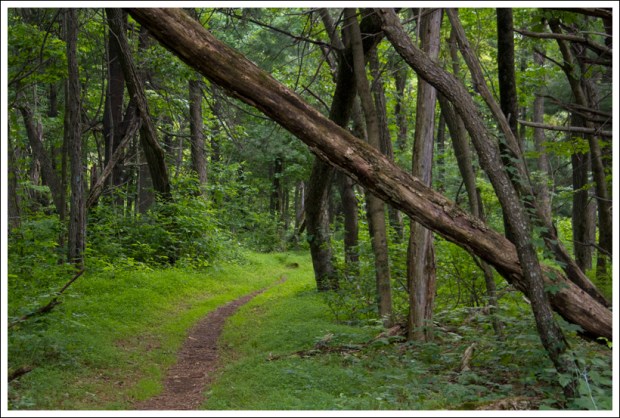
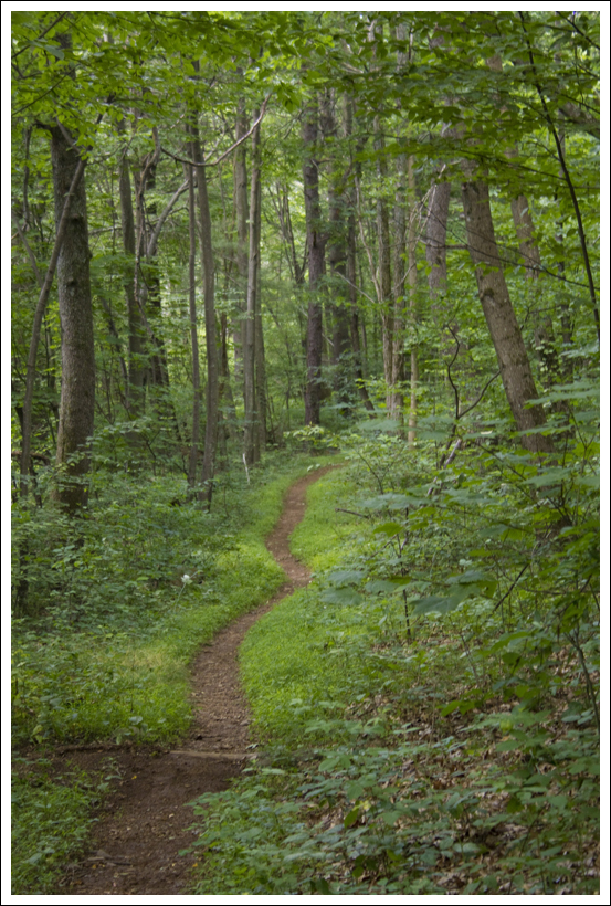
This 8.35 mile hike (with an optional .4 mile detour to the Pass Mountain Hut) follows the Appalachian Trail through beautiful forest and past one decent view.

Christine Says…
Last weekend was one of my only free weekends between July and August (lots of art shows and an upcoming trip to Maine!), so we decided to go for a hike. I wasn’t in the mood to go anywhere that required a long drive, so we settled on doing another section of the Appalachian Trail in Shenandoah National Park. We’ve completed the central district and a couple segments in the south district, but we had yet to hike any of the AT in the park’s northern section. To make the drive time the shortest possible, we chose to hike from Elkwallow to Thornton Gap (Rt. 211).
We started out at the Elkwallow Picnic Area, the same exact spot we began our backpacking loop down to Jeremy’s Run last year. After a short downhill to meet the AT, we began a gradual, steady climb up the trail – the first of three significant climbs on this section of trail. We passed lots of thickets of ripening blackberries along the trail. We also saw a lot of eastern red columbine still in bloom.

After the first climb, the trail is really gentle and level until you reach the next climb, headed up Neighbor Mountain. The Neighbor Mountain trail, which branches off the AT, is another option for making a loop with Jeremy’s Run. It’s a little longer than the Knob Mountain Loop we chose, but the steepness of the climbs are a little more gradual. At the junction of the AT and the Neighbor Mountain trail, we ran into two gentlemen that turned out to be doing the same exact segment hike we were working on. They offered us a share of their fresh picked peaches and plums from a local orchard!
Near the trail junction, you have the option to take a side loop past Byrd’s Nest #4, but we decided to stay on the AT. Descending Neighbor Mountain is a little steep and rocky. On the steepest part of the descent, we passed three section hikers slogging uphill. Near the bottom of the descent, we stopped for a snack and were eventually passed by the two guys we met at the Neighbor Mountain junction. We continued to play ‘leap frog’ with them for the remainder of the day.

A bit later, we crossed Skyline Drive near the Beahm’s Gap overlook and began the final big climb of our hike – over Pass Mountain. I didn’t really expect any views on this hike, so I was pleasantly surprised to find a very nice overlook just north of the Pass Mountain Summit. It was a little hazy, so the view wasn’t as pretty as it could have been. Even if the views were slightly lacking, the abundant wild blueberries more than made up for it! It was one of the thickest, densest accumulations of ripe berries I’ve ever seen! (and this is coming from someone who has spent many, many summers in Maine).
The park has a policy allowing limited gathering of berries, nuts and seeds for personal consumption, so we ended up picking about a quart of berries. I made vanilla-blueberry pancakes with them. YUM!
After we picked berries, we had a short distance more to climb over the summit. After crossing the high point, the remainder of the hike was an easy downhill grade for a couple miles. With about 1.5 miles left, we passed the spur trail to the Pass Mountain Shelter. I ditched my backpack and hiked the extra .2 miles down to the shelter. It was set in a pretty opening under the trees. I took a peek at the journal and noticed one of the recent entries mentioned a bear visiting the shelter!
After the shelter, we continued downhill back to the car. When we crossed 211 to get back to where we parked, we noticed that there were police cars and park rangers all over the road. It turns out that 211 was closed due to a fatal motorcycle accident – very sad. Since we had to wait for the road to open, we headed back into the park to get some lunch at Elkwallow Wayside. It was a tasty, indulgent treat after our hike.
Adam Says…
Well, we’ve reached about the halfway point in covering the Appalachian Trail through Shenandoah National Park. With the Central District done, we have been starting to work on some other sections in the North and South districts. This was our first section through the North District.
We parked one car on 211 near the sign for where the Appalachian Trail crosses and outside the park boundary. We drove the other car to the Elkwallow Picnic Ground. The trail starts right near the privy and heads down into the woods. Continue on this spur trail for a short distance until you reach the junction with the Appalachian Trail. Take a left heading south on the white-blazed trail. In about a quarter of a mile, you reach a junction with the Jeremy’s Run trail but stay on the Appalachian Trail. The trail begins to ascend fairly steeply and you will gain about 500 feet of elevation over the next mile. The trail levels off at this point and even starts to descend for the next two miles. At 3.2 miles, you will start another ascent of 400 feet. You will then pass a junction with the Neighbor Mountain and Byrds Nest 4 trail. We stayed on the AT, but you can take the trail to the Byrds Nest shelter and it will rejoin the AT after the shelter. The trail descends again over the next mile and you reach Skyline Drive at the Beahms Gap parking area at mile 5.2. Cross Skyline Drive and begin the ascent up Pass Mountain as you gain 600 feet of elevation over the next mile. Once you reach the unmarked summit of Pass Mountain, the hard part is over and it is two miles back to your vehicle on 211.

The best part of the hike was definitely getting to the summit of Pass Mountain. We were hiking near the summit and we saw a rock outcropping to the west of the trail about 100 feet. Christine was doubtful that there would be any opening for views, but I said that I thought there would be. When I went to investigate I saw there was a decent view, but I was quite pleased to see all the wild blueberries. As Christine mentioned, we have often seen blueberries when we go hiking in Acadia National Park in Maine, but these patches seemed untouched. We spended about 30 minutes picking blueberries and taking in the view. We also thought of our friend, Suzanne, that accompanied us on the backpacking trip in Dolly Sods the previous week. She went crazy for wild blueberries, and we pictured her screaming in glee over these patches. There were still lots of blueberries that weren’t ripe enough to pick, so if you are interested in doing this hike for some blueberries, I would hit this trail in mid to late July. I’m guessing that this trail could also be frequented by bears since they tend to go where the food sources are.

Christine was impressed when I spotted the indian pipes on the trail. Of course, I wasn’t sure what they were called. I just said, “Isn’t this something you’re interested in?” She has quickly become great at identifying wild flowers. Maybe one day I will get there also, but I can at least point some things out for now.
Most of this hike is more or less a walk through the woods. The terrain wasn’t too tough, and this is not a section of the AT that is riddled with views and interesting things along the way. Unless you’re tackling a section of the AT, I would say that most people that you would run into on this section are hiking up Pass Mountain.
Trail Notes
- Distance – 8.35 miles (8.75 if you do the optional side trail to the Pass Mountain Hut)
- Elevation Change – 1600 feet
- Difficulty – 3. This hike is a moderate mix of climbs, descents and flats.
- Trail Conditions – 4. The trail is in great shape, but a little overgrown due to the wet summer.
- Views –2.5 The view from Pass Mountain is nice.
- Wildlife – 1. We saw a deer but nothing else.
- Ease to Navigate – 4.5. The trail is unmistakably easy to follow.
- Solitude – 2.5. You probably won’t see many hikers after the peak of thru-hiking season. We saw only a handful of people over the miles.
Directions to trailhead: From Skyline Drive around mile marker 24.3, follow the signs to the Elkwallow Picnic area (not Elkwallow Gap parking lot). Park near the privy. The trail starts next to the privy.


I think I’d lose my appetite at “Elkwallow” Picnic area, all I’d be able to envision was a muddy, feces-encrusted bull. I’m glad you and Adam were able to get out in spite of the recent sweltering heat. Good hike, you covered some ground. There were some nice little surprises along the way, too.
Out of curiosity, when is the peak of thru-hiking season for the Appalachian Trail (in your area, at least)?
LikeLike
LOL – Jason… since there are no elk in Shenandoah, I bet you’d get over the mental image pretty quickly. The peak season for thru-hikers in Shenandoah is usually late May through the end of June for northbounders. Southbound hikers start later to avoid mud/black fly season in New England. They usually pass through Shenandoah in September. (but there are relatively few southbounders).
LikeLike
Very nice blog… smart layout, well written articles, and beautiful pics. I just started my own blog about hiking trails in Virginia. So far I’ve only got two trails listed. My son and I have talked about doing portions of the AT and it’s interesting to read your trail descriptions. I look forward to reading more of your posts!
LikeLike
Thanks for the visit, Rob! It looks like your new blog is off to a good start.
LikeLike