
Introductory Guide to Visiting the White Mountains
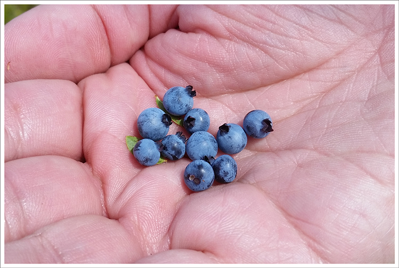
Hedgehog Mountain is tiny compared to most of its neighbors, but this 5-mile hike still packs in tons of scenery and great views. The ledges are also a super place to stuff your face with wild blueberries!
View the Full Album of Photos From This Hike

Christine Says…
After arriving in New Hampshire and hiking Mt. Major, we took a couple days off hiking to relax and spend time with family. The combination of daily hikes in New York paired with not sleeping or eating enough really wore me out. So we took it easy and did other fun things like exploring Franconia Notch State Park, paddling kayaks across quiet ponds, sampling craft beer at Schilling (Littleton, NH) and Long Trail (Bridgewater Corners, VT), and stuffing our faces with Cabot cheese and pastries from King Arthur Baking Company. By Wednesday, we were ready to hike again. Our second hike in New Hampshire was a repeat trip to visit beautiful Lonesome Lake. Our third hike was something entirely new – Hedgehog Mountain. It’s the most diminutive of New Hampshire’s ’52 With a View’ – a collection of the state’s nicest view hikes on mountains under 4,000 feet.
We started out the morning with a big breakfast at Polly’s Pancake Parlor. Then I went for a short paddle with my dad across and around Echo Lake. By 10:00 a.m., Adam and I were on our way across the mountains on the scenic Kancamagas Highway. We parked at the Downes Brook parking area and paid our $3 parking fee. The summit of Hedgehog is accessed by the UNH Loop Trail. The trail gets its name from an old University of New Hampshire forestry camp that operated at the mountain’s base from the mid-1940s until 1964.
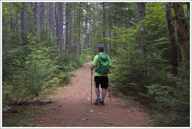

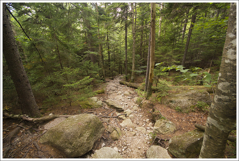
There were just a few cars in the lot, so we knew we would have a relatively quiet hike. We decided to hike the loop clockwise, allowing a more gradual ascent followed by views of the Presidentials on the way down. The hike starts off along a lovely pine-shaded trail following the route of the old Swift River Railroad. The hike climbs gradually, passes a clearing, and soon reaches a sign indicating the beginning of the loop portion. We chose to turn left and cross the east ledges before reaching the summit.
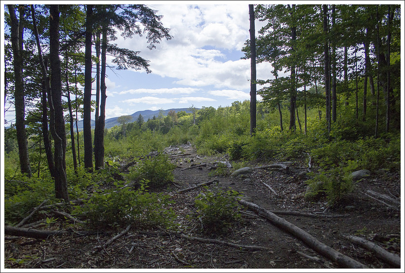
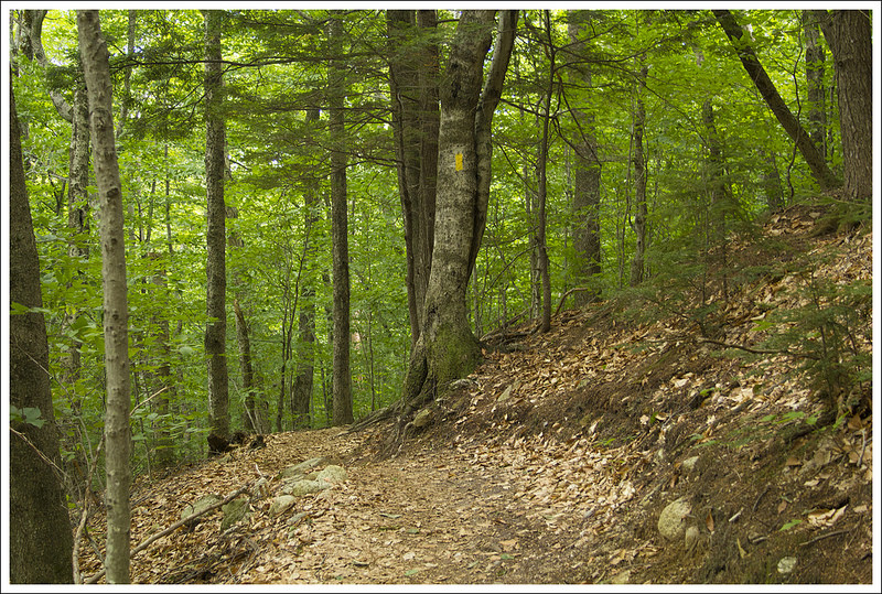
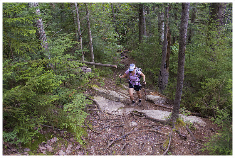
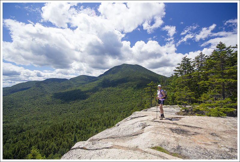
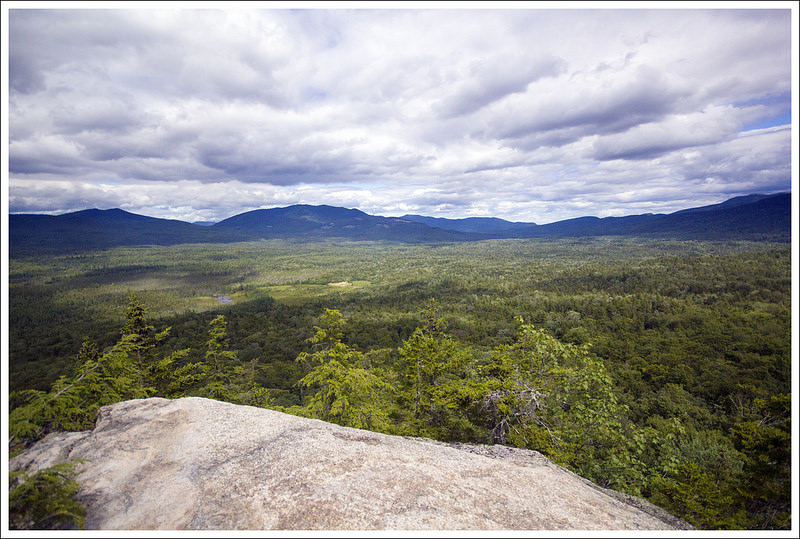
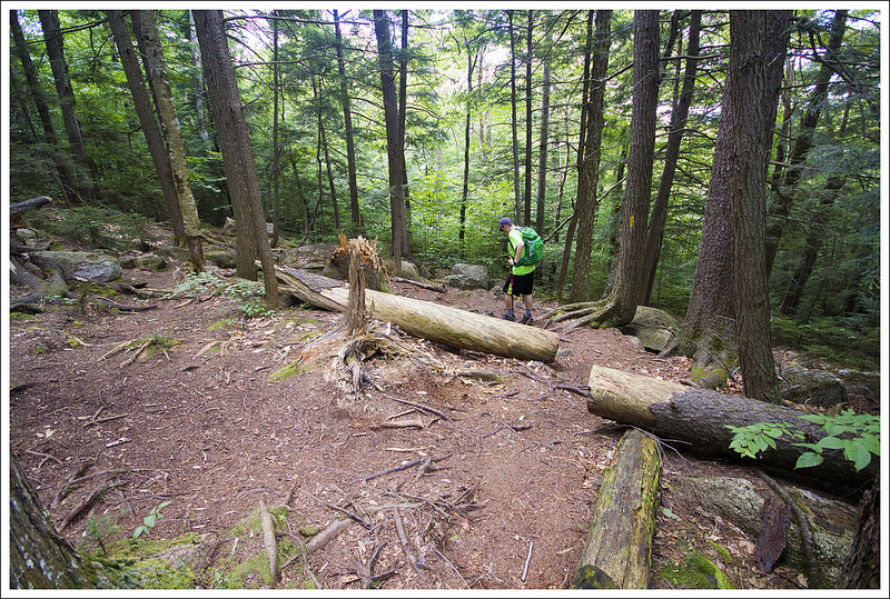
For 1.2 miles we walked through a peaceful pine forest. The climb was steady, but quite gentle. There were roots and rocks, but they were always padded by fallen pine needles. As we hiked on, the route became steeper and rockier and eventually opened onto bare cliffsides and ledges with magnificent views of so many big mountains – the Tripyramids, Carrigain, Chocorua, and Passaconaway. Most of the ledges were wide and generous, but one section in particular was narrow and precipitous. There were blueberries growing everywhere! From the ledge, we could also see the last steep section of trail we had to climb to reach the summit. The ledges were definitely my favorite part of the hike!
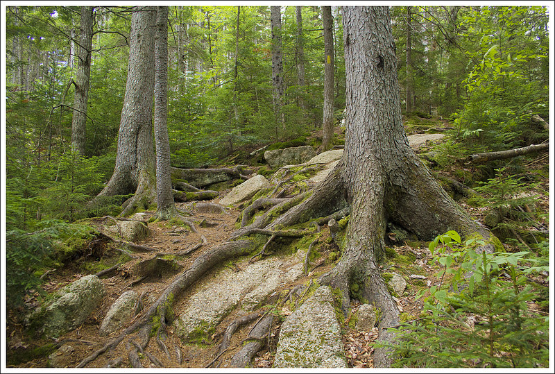
The last bit of climbing to the Hedgehog summit was steep – definitely more challenging than I expected on this loop! At first we passed through a tangle of roots and boulders. The higher we climbed, the roots gave way to smooth granite slabs and boulders that required scrambling. I told Adam at one point that I was very tired of putting my knees down on granite! Granite gives me so many bruises. The actual summit had nice views, but (in my opinion) the view from the lower ledges had been nicer.


Leaving the summit, we spied glimpses of the Presidentials off in the distance. Evidently, on clear days one can even see the weather observatory atop Mount Washington. We weren’t that lucky. The descent was much rougher and steeper than the climb up. I was really glad we had gone clockwise! On the way down, we took the short spur trail to Allen’s Ledge. The rocky outcropping offers a chance to take in a final sweeping view of many of the area’s bigger mountains. From Allen’s Ledge, the rest of the hike was a moderate descent back to the old railroad grade.
Over the course of the day, we only saw three small hiking groups. That’s great solitude for a nice summer day in the White Mountains! We would definitely recommend this hike if you’re looking for great views and don’t feel like tackling a 4,000-footer.
After the hike, we decided to drive into North Conway and look around the shops and have an early dinner at one of our favorite stops – Moat Mountain. They brew a nice selection of beers and have fantastic food. It was so tasty; I think I finished an entire half pound burger and all my fries!


Adam Says…
As Christine mentioned, we started our day off a little later than normal. It was a gloomy morning, with fog settled in. Since Polly’s Pancake Parlor and Echo Lake were quite a distance from our home base, we decided to take a separate car from her parents and take off on our hike after we had done our morning activities with them. When Christine and her dad went paddling earlier on Echo Lake, it was cold and there was a little bit of drizzle. I can’t swim so I don’t like being on a canoe or kayak. I was quite content to watch Christine and her dad go out paddling on the peaceful, yet foggy waters.
We were worried it wouldn’t warm up or be able to see the sun on our hike. Two things that hiking in New England has taught me is to be patient and be an opportunist. There have been a lot of hikes that we have done in the White Mountains that if you wait a few minutes, clouds may break. So, we took our time that morning knowing that our best chance of seeing views would be a little later in the day.

The trail started off very flat through a tunnel of pine trees. After a short distance, it takes a sharp right and begins to ascend. Within a few tenths of a mile, the trail crosses over with a clearing, but stay straight on the trail. The trail continues on an ascent, but the terrain wasn’t too difficult. With the morning activity of paddling, Christine bonked a bit so we paused to eat an energy bar before continuing onward. The trail became a little steeper and more narrow as we navigated through some interesting terrain with pine trees and granite steps. There were a few obstructed views along the way. The woods were so quiet it was eerie – we felt a bear would jump out at any minute in this deep wilderness. Eventually the trail became quite steep and rocky, leading to larger granite steps. The trail soon popped up to some gorgeous cliffside panoramic views. Not reading about this on trail reviews we found online we were quite surprised. We navigated the cliffsides, going back into woods for a short time before coming out onto a large shelf of granite. We spotted the summit above us, but below us were tons of blueberries. We picked a few and enjoyed the gorgeous mountain and valley views around us.


The trail ducks back into the woods and descends a short bit through some thick forest. There were blowdowns across the trail and the cobwebs were thick in places, making me think that many people don’t come on this section of trail to make it a loop. The trail then began to ascend again through some very steep and rocky sections, requiring us to pull ourselves up with our hands in a few areas. We finally reached the summit. We ate a snack, talking with a woman who had done much hiking in the Whites while enjoying some obstructed views from the summit. We both agreed that the views from below were more exceptional than the summit views.
As we were making a loop hike, we continued on and found another obstructed viewpoint to give you views of many of the Whites. As Christine mentioned, we couldn’t see the summit of Mount Washington but we could spot a few of the Presidential range in the distance. The return trip was quite steep and we were treated to a few views on the climb down, which you would likely miss if you did the loop in the opposite direction. On our descent, we found a small side trail that led to Allen’s Ledge. Allen’s Ledge also had some nicer views than the summit. We relaxed at this spot for a few minutes before rejoining the UNH trail and making our way back down the mountain. Before too long we had rejoined the loop where it split and returned to the parking area.

While it isn’t as popular as some other hikes in the area, if you want some seclusion with great views, check out Hedgehog Mountain. We were pleasantly surprised at how gorgeous the views were and the interesting terrain along the trail makes this a rewarding hike.
Trail Notes
- Distance – 5 miles
- Elevation Change – 1312 feet
- Difficulty – 3.5. There are a few steep, rocky sections, but most of the trail is gentle.
- Trail Conditions – 3.5. The trail is adequately maintained, but expect lots of rocks and roots.
- Views – 4. In Virginia, these views would warrant a 5, but there are even grander views in this area.
- Waterfalls/streams – 0. None.
- Wildlife – 2. Other than birds and squirrels, we didn’t see wildlife.
- Ease to Navigate – 3. There were a couple tricky spots, like the clearing early on the trail, but generally this was an easy route to follow.
- Solitude – 4. By White Mountains standards on a nice summer day, we enjoyed quite a bit of solitude on this hike
Download a trail map (PDF)
Directions to trailhead: From Interstate 93, take exit 32 (NH-112E). Follow NH-112E for 22 miles. Parking is on the right in the Downes Brook – Mount Potash lot. Parking Coordinates: 43.9960876,-71.3688126
