Introductory Guide to Visiting the White Mountains
This 6.6 mile route is one of the fastest, easiest ways to get above treeline in the Presidentials. The trail is rocky (like everything in this area), but the climb is very moderate by White Mountain standards. Trivia: This peak was named Mt. Pleasant until after President Eisenhower’s death in 1969.
View the Full Album of Photos From This Hike

Adam Says…
We have made it up to New Hampshire the last several years. Each year we try to do at least one of the Presidential peaks – big, granite mountains named after our country’s past presidents. This year, we decided to tackle Mt. Eisenhower by way of the Edmands and Crawford Paths. We read in our Falcon Guide to Hiking New Hampshire that this trail route had a moderate grade and the footing was “pleasant”
We have learned to not trust New Hampshirite descriptions with regard to grade or footing. From a Virginian’s standpoint, most of the hiking in the White Mountains is so much tougher than anything we experience in our state. Your body will pay a price and you may end up cursing the granite you walk upon.

Over the first 1.4 miles of the Edmands Path, you gain about 650 feet of elevation, but in the last 1.5 miles, you gain 1750 feet. The first half of the outgoing hike is a steady climb, but the steeper grade and bigger steps on rock and gnarled roots take over pretty quickly!
As we huffed and puffed up the mountain, we eventually got some views through the trees and knew that our hard work was going to pay off. Through some of the openings we could see the red roof of the grand Mount Washington Resort below, which gave some perspective of how far we had come.

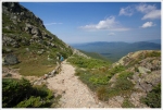
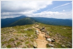
We eventually came across a U.S. Forest Service Alpine Zone sign warning us that we were entering an area with some of the worst weather in the world. This is definitely a sign to heed on rough weather days, but we had a gorgeous day of mostly clear skies above us. We arrived above treeline and were soon on a rocky path that skirted the shoulder of Mt. Eisenhower. At 2.9 miles, we reached the junction with the Crawford Path (the name given to the Appalachian Trail through these parts) and took the first right on the Eisenhower Loop Trail, which leads to the summit. The views from the junction were phenomenal as we were looking right at Mt. Monroe with Mt. Washington in the distance behind it. The path to the summit zig-zagged up some switchbacks on a skinny path that mostly had nice footing and in about .4 miles we had reached the summit.

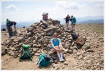
When we got to the top, we found lots of people that had hiked over from Lakes of the Clouds Hut or Mizpah Spring Hut. We ate our snack while taking in views in all directions. We took a ton of photos to capture the vast landscapes and beautiful partial cloud coverage.
We made our way back down the same way we came up, reaching the Crawford Path junction quickly. We then took the Edmands Path back down to our car. We paused for a few moments before ducking back in below treeline to soak up some last views of the majesty of mountains and valleys below us. It is moments like this that we revisit in our minds to help us get through the stress of work and life through the rest of the year.

If you’re interested in visiting these high peaks, you can do a multi-day backpacking trip that is called a “Presidential Traverse”. The route connects Mt. Jackson, Mt. Pierce, Mt. Eisenhower, Mt. Monroe, Mt. Washington, Mt. Jefferson, Mt. Adams, Mt. Quincy Adams, and Mt. Madison. Hikers typically stay at the AMC huts along the way. This route is nice, because you only have to climb up from the valley floor once! The rest of the traverse is tough, but the bulk of the big climbing is done on the first day. The Presidential Traverse entails additional perils because the constantly changing weather can put you at risk for getting lost in the fog or pinned down by storms. We hope to do a Presidential traverse someday to take in the full experience, but for now we have settled for day hikes. We’ve enjoyed the majestic views, but we have had to work a little harder for each one (climbing all the way from the bottom to reach each summit).
Christine Says…
Mt. Eisenhower was a great choice for our 2016 Presidental climb! We had gorgeous, clear views and the mountain’s lofty elevation gave us a little bit of relief from the brutally hot summer day in the valley below. The area broke a heat record on August 11 – close to 100 degrees at the base of the mountain. The normal high is usually closer to 80.
We got an early start and arrived at the Edmands Path parking area before the crowds. We paid $3.00 for our WMNF one-day parking pass and set out on our way up the mountain. (There is a self-service parking fee station at one end of the lot.)
Like Adam said, nothing in Virginia really compares to the rigors of a New Hampshire climb, but this route was definitely a more moderate climb than others we’ve tackled. Today’s hikers can thank revolutionary trailbuilder J. Rayner Edmands for many of the gradual, meandering trails in the White Mountains. Edmands, one of the founding members of the Appalachian Mountain Club, modeled his eastern trails after the livestock trails he had climbed as a young man in the Rockies. He believed in the philosophy of “always climbing, never steeply” when it came to trail design.

He spent time surveying each mountain to find the best grades and the most favorable terrain to reach the summit. He built each trail like a puzzle; using large boulders, extensive cribbing, and selective tree clearing. His philosophy differed greatly from other well-known New Hampshire trail builders of the time; most of them opting for the shortest routes, regardless of steepness or terrain. Built in 1909, the Edmands Path was one of the last trails Edmands built before dying of a stroke at the age of 60 in 1910.
If we’re being completely honest, we have to say that there’s no truly easy way to hike to mountain summits in the Presidentials. Even with Edmands’ thoughtful design, you’re going to get a solid cardio workout climbing to the summit of Mt. Eisenhower.

Since it was a hot day, we took many water breaks as we worked our way uphill. Despite the effort, I still thought the tough climbing over boulders and roots went by quickly. I was actually surprised when we reached the alpine zone sign… “Here? Already?” The last bit of the Edmands Path before we reached the junction with the Crawford Path was almost flat and passed through a lush bed of alpine mosses and wildflowers. After we cleared that last swath of green, the view gave way to a theater of bare granite mountains.
The last tenth of a mile before the junction with the Crawford Path was a jumble of football-sized rocks along an exposed cliffside. When it’s wet, a stream flows over these rocks, but on this day it was thankfully bone dry. In the winter, this particular spot is known for being treacherously icy and windy. I’m glad we only visit New Hampshire in the summer. Virginia winters are tough enough for me!

The last .4 miles of trail from the Crawford Path junction to the summit of Eisenhower follows the Eisenhower loop – essentially a spur trail that detours people from the Crawford Path over the summit. Most of the mountains in this area have an “over or around” option. No matter which option you pick, you’re going to have SPECTACULAR views if you hike on a clear day. The majesty of the Presidentials is without compare – so much rugged beauty. It takes my breath away every time!
The hike down simply retraced our steps. As we descended, we could feel the heat and humidity of the lower elevations closing in around us. I was glad we finished hiking rather early in the afternoon, as it gave us time to make a couple more stops before heading back to my parents’ house. First we detoured into Jackson. We stopped at a great bakery for cold drinks and cookies and paid a visit to the White Mountain Puzzle Company. If you enjoy working jigsaw puzzles, they make a great variety! After Jackson, we hit one of our favorite lunch spots in the area – Moat Mountain Brewery and Smokehouse. A tasty lunch and cold craft beer made the perfect ending to another excellent New Hampshire day.
Trail Notes
- Distance – 6.6 miles
(Check out the stats from Map My Hike)*
- Elevation Change – 2800 ft
- Difficulty – 4.5. The hiking may be moderate by New Hampshire standards, but it is a tough hike and you should be in decent hiking shape to tackle it.
- Trail Conditions – 2. While the trail was well maintained, the boulders of rock that you have to climb in the last 1.5 miles of the Edmands Path makes it tough climbing.
- Views – 5. The 360-degree views from the Presidential Range is hard to beat anywhere on a clear day.
- Waterfalls/streams – 1. You cross over a small stream early in the hike, but otherwise there wasn’t much water to see. However, we visited in drought conditions. In a normal to wet year, stream crossings may be more numerous and/or more difficult.
- Wildlife – 1.5 Squirrels scampering and birds chirping will give you sounds along the way, but don’t expect anything once you go above treeline.
- Ease to Navigate – 4.5. There is just one turn from the Edmands Path to reach the summit, so it should be very easy to follow.
- Solitude – 3. We didn’t come across many on the Edmands Path, but on a beautiful summer day, the summit had a lot of people.
Download a trail map (PDF)
Directions to trailhead: Parking Coordinates: 44.248988, -71.391665. The trailhead is on Mt. Clinton Road, off U.S. 302 near the AMC Highlands Center. The parking area requires a White Mountain National Forest parking pass. You can buy an annual pass or use the self service station to pay the $3 day fee. For more information about parking passes, visit the national forest website.
* MapMyHike is not necessarily accurate, as the GPS signal fades in and out – but it still provides some fun and interesting information


Hello! I’m looking for the photos of the Crawford Path and your blog came up in a search. I’d love to discuss the option of licensing a photo for Backpacker, and also be sure my favorite photos are on the Crawford Path and not the summit trail or other connecting trails. gfullerton@aimmedia.com
LikeLike
I think Old Rag can compare in toughness with hiking in the Whites! What luck you had with the weather, great trip report.
LikeLike
Thanks for the visit! We really have been lucky with weather on most of our White Mountain trips! I agree that Old Rag’s rock scramble is good preparation for learning to traverse slick granite, but the ascent/elevation and overall terrain in the Whites are tougher. Maybe if you could stack four Old Rag Rock scrambles together and then tilt them to a steeper degree, you could recreate the Whites! haha
LikeLiked by 1 person
Haha, wooof that would be intense!
LikeLiked by 1 person