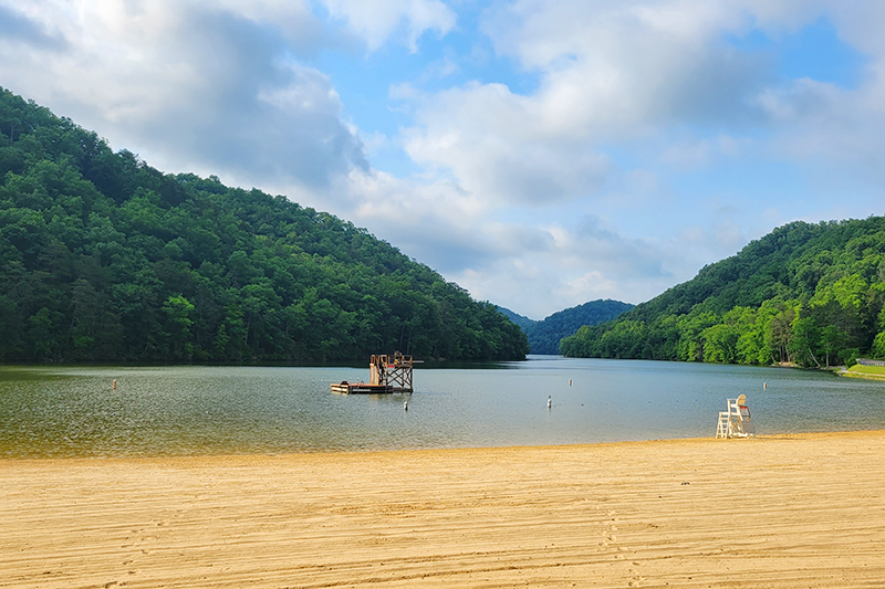
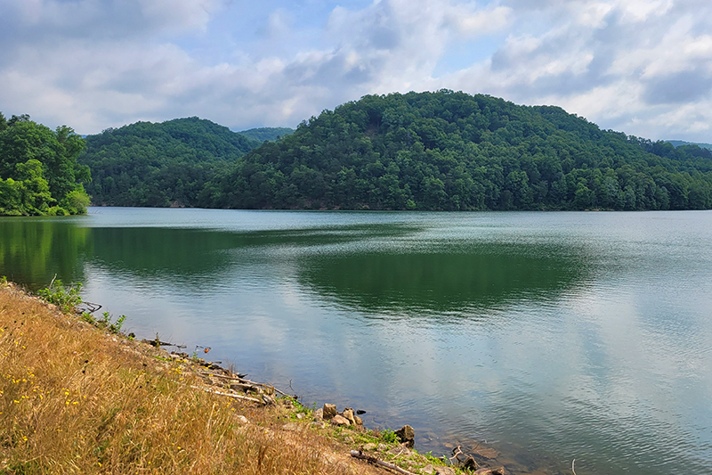
This 6.1 mile loop is located in Hungry Mother State Park. It follows the perimeter of the lake and has about 830′ of climbing along the loop. The developed side of the lake, where the hike begins, is flatter and often paved, while the backside of the lake is wooded and has more rugged terrain.
If you’re looking for a scenic-but-easy hike that’s longer than five miles, check out the Lake Loop at Hungry Mother State Park! We decided to tackle it as a bit of a recovery hike on our vacation to the area last June. The day before, we had hiked a piece of the Appalachian Trail from Damascus, VA to the Tennessee state line. It had been a significant uphill climb on a very hot day, so we wanted a hike that was a bit easier.
We’ve only visited Hungry Mother once before – to hike Molly’s Knob. If you’re interested in hiking Molly’s Knob as a longer loop with the Lake Trail, there are two junctions along the far side of the lake that will allow you to create this loop. You can download a copy of the Hungry Mother trail map from the park’s website.
For this Lake Loop hike, we paid our entrance fee at a self check-in station and parked in a large lot along the waterfront. The trail can be started in different places, but we set off counter-clockwise from the busy, developed part of the park, where picnic shelters, guarded swimming, boat rentals, a snack bar, and restrooms are all located. Because we visited on a Monday, the park was really quiet and lightly trafficked. We ended up only seeing several people along the entire loop.
The trail began on paved, flat walkway following closely along the shoreline. The entire loop is open to foot and bike traffic, but you’re probably most likely to see bikes on the flatter. easier developed side of the lake.
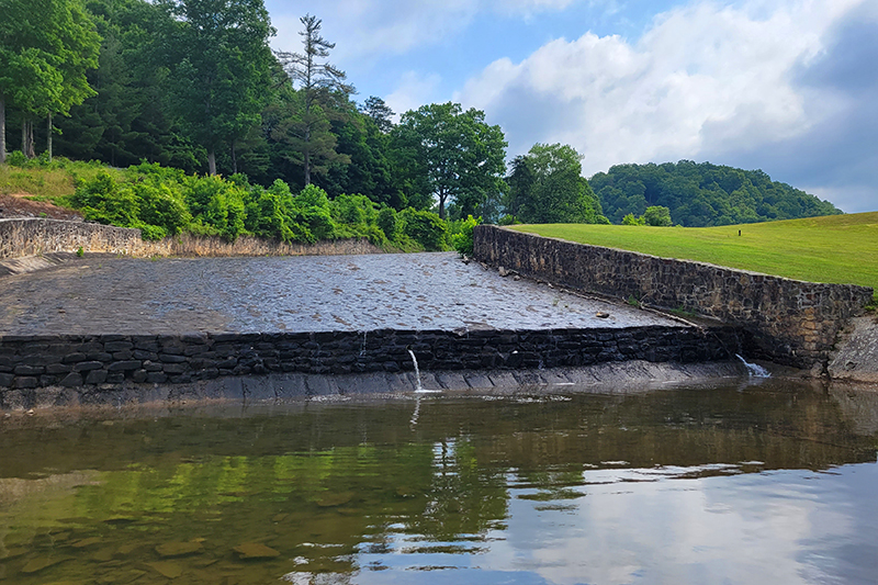
At the end of the lake, we passed a spillway/dam before reaching Camp Burson – the RV campground run by the state park. There is also a tent/yurt campground called Royal Oak at the other end of the park. After passing the campground, the trail crossed a bridge into the woods.
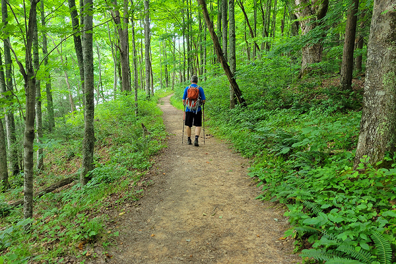
On the far side of the lake, the trail is a bit more rugged with many small ups and downs. The trail departs the lakeshore, and you only get glimpses of the lake through the trees for much of the way. On this side, we passed an old shed used by the CCC to store dynamite when the park was being built.
As we reached the end of the lake, the trail descended and began to follow the shoreline more closely, giving us lake views again. Eventually, we reached the park’s cabin area and found ourselves on flat footing back to our car.
All in all, this was a pleasant, easy walk in the woods. There are definitely more scenic and impressive hikes in the area, but this was a fun way to spend a recovery day.
More Photos
Spillway at Hungry Mother
Stream beyond the spillway at Hungry Mother
View from the top of the dam
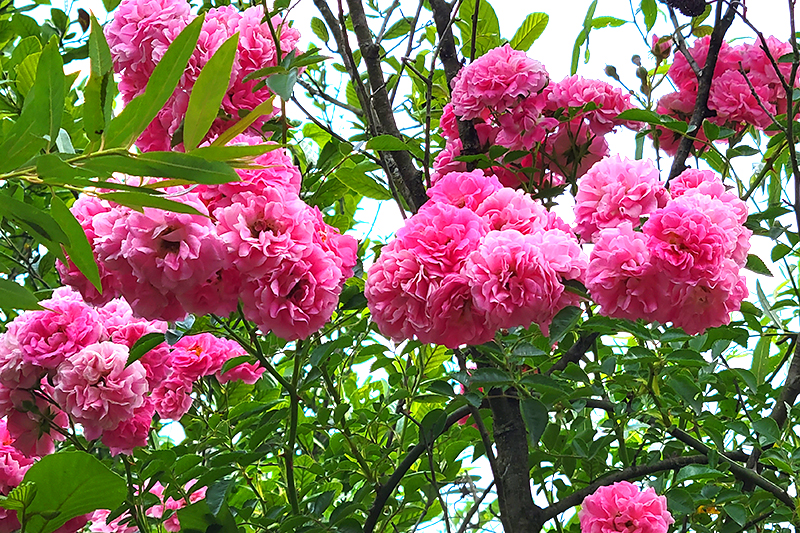
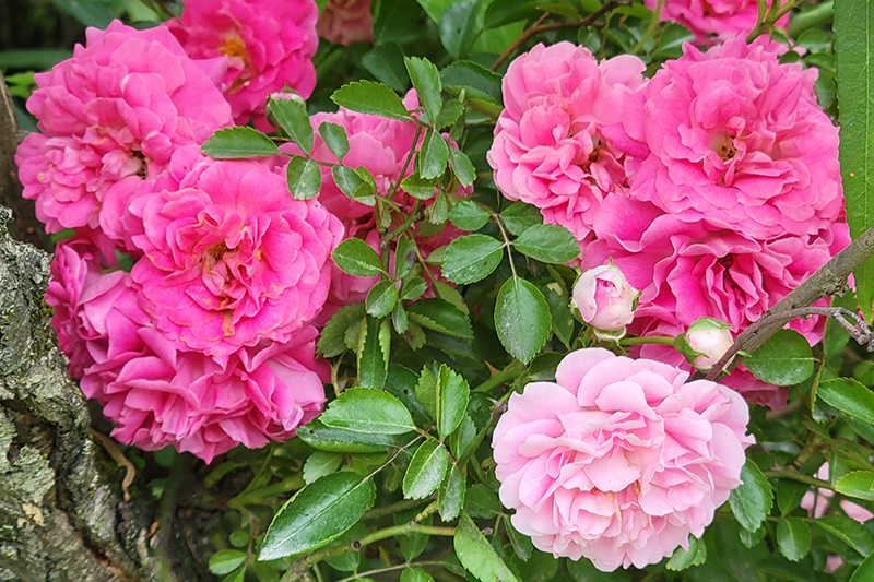
Pretty blooms
Close up of pretty blooms
Leaving the campground area, There is a obstacle course/playground you can see in the far distance.
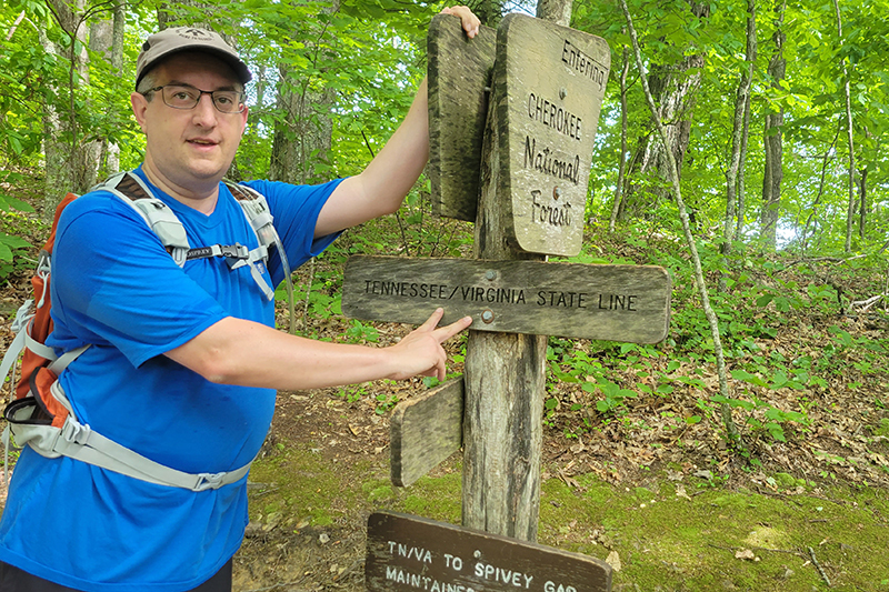
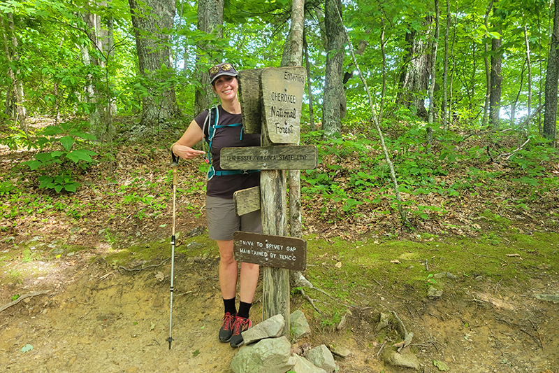
This 7.8 mile out-and-back is a section of trail we primarily did to work toward our completion of the entire Appalachian Trail in Virginia. This hike starts off in downtown Damascus and climbs 1,500 feet uphill to the Tennessee state line. There’s nothing in the way of views or noteworthy scenery – just a nice walk in the woods. We were lucky enough to have a great bear sighting on the trail.
Christine Says…
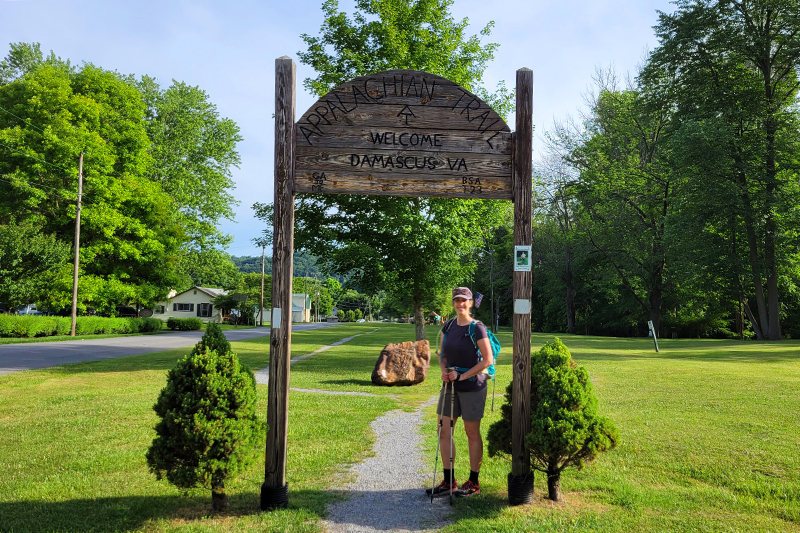
We seem to have a penchant for picking record-setting heat weeks for our vacations. I guess it’s not that unlikely when you’re limited to traveling in the summer, but man… this was an especially sweltering day to hike! Back in 2019, we did a week-long AT section hike that ended in Damascus at the parking lot across from Mount Rogers Outfitters. That left a 3.9 mile unhiked section between town and the Virginia/Tennessee border. As most of our regular readers know, we’re slowly section hiking our way across Virginia, so we had to fill in this little gap when we had a chance.
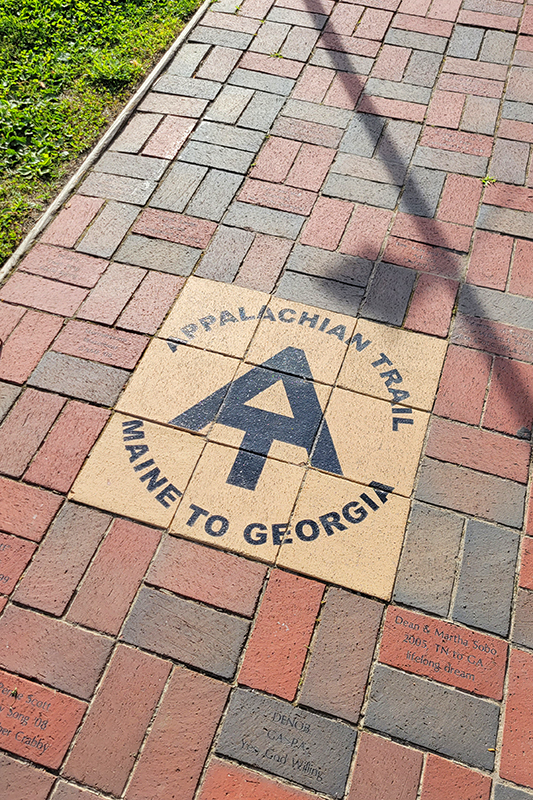
We parked in a public lot off of Laurel Street and picked up the AT where we left off in 2019. Headed south through town the trail is actually road walk, there are blazes on utility poles and AT logos built into the brick walkway. You can see people have made individual donations to have namesake bricks placed along the town section of trail. In a couple tenths of a mile, we turned left on Beaver Dam Ave. and walked through a little town park.
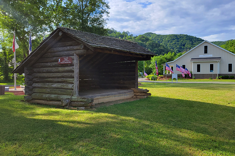
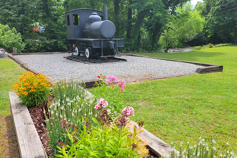
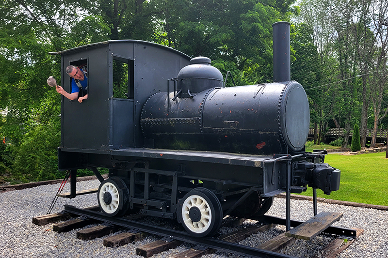
The park has an old train engine, a replica of an AT shelter, and the famous Damascus AT Welcome Arch. You’ve probably seen countless photos of hikers posing under the arch. We both took the obligatory photo for ourselves. After going through the park, the trail turns right onto Water Street, passing through a residential area before turning sharply uphill into the woods.
From there, the trail goes steadily uphill for 3.4 miles. About halfway up the climb, there’s a large campsite adjacent to a water source. I imagine some thru-hikers like the free camping right outside town the night before a resupply. Since we were hiking in late June, we had the trail all to ourselves, as most AT hikers are far north by then.
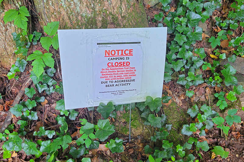
We plodded uphill until we finally reached the sign marking the state line! We both took a few steps into Tennessee, just for fun! We had a quick snack, and headed back down. The hike was naturally much easier going back downhill. We even saw a large, healthy-looking black bear about a mile south of town. Most of the bears we’re seeing in the Shenandoah are thin and mangy, so it was great to see a bear looking so fit. There had been a sign at the trailhead leaving Damascus warning of an aggressive bear further into Tennessee. I don’t think it was this bear, because this bear crashed away into the woods as soon as we saw him.
Pretty soon, we were back in town. It was even hotter in town as we walked the final third of a mile in the baking sun. After our hike, we went to Mojo’s Trailside Café for lunch and Off the Beaten Path for ice cream. Both are great stops post-hike!
The Twin Pinnacles trail is a gentle trail that takes you to the highest point in Grayson Highlands State Park. The views from each of the Pinnacles are nothing short of spectacular.
The view from Little Pinnacle. Below: Although this blog post primarily covers the Twin Pinnacles trail, don’t miss hiking up through Massie Gap to where it meets the Appalachian Trail. You’ll see ponies and spectacular scenery.
Christine Says…
When visiting the southwest region of Virginia, a visit to Grayson Highlands State Park is practically mandatory. That park and the high country around Mount Rogers might be my favorite spot in the entire state of Virginia for many reasons. The lovely boreal forest seen in much of that area is uncommon elsewhere in our state. The bald, open high country is stunningly beautiful. And, the kicker… there are WILD PONIES. Honestly, if there was nothing besides the wild ponies to set Grayson Highlands apart, I would still love it best. I grew up a horse crazy girl and that sentiment has never really abated in my adulthood.
Last time we visited Grayson Highlands, we hiked up Mount Rogers. This time we wanted to try something new, so we decided to hike the Twin Pinnacles trail, which lies completely within the state park’s boundaries. But before we set off on our new hike, I insisted that we hike far enough up the Appalachian Trail that I could see and photograph some of the ponies and their spring foals. The wild ponies of Grayson Highlands are not everywhere in the park. The best chances to see them are hiking through Massie Gap and then south along the Appalachian Trail.
As it turned out, the ponies were all tucked into the shade and relaxing at the higher elevations. We ended up hiking a little over halfway up Mount Rogers before we found the herd. We enjoyed watching a small family group of ponies – two mares, two foals and a stallion for about an hour before we headed back down to do our ‘real’ hike.
This foal looked so beautiful with the mountainous background. Below: Adam walking along the Virginia Highlands Horse Trail; A couple shots of the Catawba Rhododendron in bloom.
We also spent a little time headed slightly north on the Appalachian Trail so Adam could look for a geocache. While he did that, I enjoyed the spectacular blooms of the Catawba Rhododendron. They’re so colorful, and really set the mountainside awash in brilliant purple.
By the time we got to the trailhead for Twin Pinnacles, which is located behind the park’s Visitor Center, I was already sunburned, tired and hungry. Thankfully, Twin Pinnacles is a very, very short hike. At 1.6 miles, it barely makes my personal cut-off of one-mile for actually being considered a ‘hike’. Anything shorter than a mile is just a walk in my book!
For such a short hike, Twin Pinnacles packs in a ton of majestic scenery! The trail climbs very gradually to the highest point in the park – Little Pinnacle – at 5084 feet. You would think Big Pinnacle would be the taller, but the name is a slight misrepresentation.
From the top of Little Pinnacle, we had views in every direction. We could see Christmas Tree farms down in the valley. We could see Mount Rogers and Whitetop Mountain off in the distance. All through the forest, bands of red spruce were visible. They really stand out among other conifers due to their richer, russet colors.
The trail leaving Little Pinnacle.
Walking across the rocky, bare top of the mountain was reminiscent of hiking in New England. We quickly dipped back into the trees and walked through a small saddle over the Big Pinnacle. After a short, very steep climb, we stepped out onto bare rock overlooking a gorgeous vista. Of the two Pinnacles, I think Big Pinnacle has slightly nicer views of the park – especially looking down into Massie Gap. We enjoyed the breeze atop the Pinnacle, and I spent some time daydreaming more about the ponies and what they might be up to. (yes… really – I love those ponies!)
After leaving the second Pinnacle, we had a short walk back to the Visitor Center and a long ride back home. I wish we had more time to spend in the area – I love Grayson Highlands!
Adam Says…
The last time we had visited Grayson Highlands, we spent most of the day at Mount Rogers and had little time or energy left for anything else. I thought it would be nice to see some other features of this wonderful state park. Since the weather and views were lovely, we tried out the Twin Pinnacles Trail.
The 1.6 mile loop trail has several storm shelters built by a local boy scout troop. Below: The trail starts behind the visitors center.
During our morning in Grayson Highlands, Christine was determined to see wild ponies. She stated that she didn’t want to leave until she saw ponies and hopefully foals. In my best Mr. T impression, I said “I pity the foals” and we started our search. We ran into an Appalachian Trail thru-hiker. I wish we had stopped to get his trail name, because he was such a happy guy. He was from Florida and just said that he is just amazed every day at what he is doing. He said that he often goes blue-blazing (since all of the AT is white-blazed, trails off the AT are typically blue-blazed) to see other things that people recommend. He wasn’t out to set any records for speed, he was just enjoying every moment. I hope he makes the trip the whole way. I kept thinking that he is adding on a lot of extra miles that I know many other hikers wouldn’t want to do. I was asking if he had seen any ponies and he said he walked through about four herds getting to this spot today, so I knew we were on the right path. Shortly after we parted ways, we ran into our first two ponies. They were a little stand-offish, but they didn’t run away from us. These ponies looked a little rough, like they needed some time with a grooming brush. Christine wanted to continue to try and find some more groups of ponies. Shortly after we continued to climb up the AT, I looked back to enjoy the view (and catch my breath) and I saw some ponies not far from where we were hiking. We decided to climb back down and check them out and Christine saw there were two foals with them. We spent about 45 minutes just watching their behavior from a safe distance before I nudged Christine away to continue on with our day. I’m sure she could have stayed all day looking at this set of ponies.
There are two different options for this trail. You can start from the parking lot at Massie Gap and hike steeply uphill via the Big Pinnacle Trail. We decided to go the easier way, since we had already spent a good time hiking before this.
Big Pinnacle overlooking Massie Gap.
To get to the trailhead, just continue on the park road, Grayson Highland Lane, until you reach the parking lot to the Visitor’s Center. Once you park the car, you will have to climb up several stairs until you reach the Visitor’s Center. As you are looking directly at the Visitor’s Center, the red-blazed trail begins behind and to the left of the Center. After a short distance, you will reach a larger bulletin board with a map of the trail where the trail forks. Take the left fork. You will soon come across the first of four storm shelters along the trail that were created as an Eagle Scout project. You will reach the first rocky outcrop, Little Pinnacle around .7 miles. The Little Pinnacle is actually higher than the Big Pinnacle in elevation. The trail continues on for a few tenths of a mile until you reach the sign for the Big Pinnacle overlook. The trail up to the Big Pinnacle consists of steep stairs leading to the top, but it isn’t too far of a climb to the top. Once there, you should be able to see the Massie Gap parking lot below. Go back to the sign and continue to follow the signs leading back to the Visitor’s Center. You should finish your trip at 1.6 miles.
I did do a little geocaching on the trail while I was there. In one of the geocaches, I found a toy Pinnochio from the Shrek movies. I decided to grab it (in geocaching, you typically take something and leave something in the container). As we continued to hike, I kept thinking that I heard something barking or voices that were in the distance. I asked Christine a couple of times if she heard anything and she said she didn’t. After thinking that I was going crazy, I finally realized that this Pinnochio was making noises. He makes some grunts and occasionally says, “I’ll never become a real boy”. We had a good laugh at my expense over that. If you would like to find the geocaches on the trail, they are:
For a hiker in Virginia, it really doesn’t get any better than a visit to Grayson Highlands State Park. This is truly a magical place!
Trail Notes
Distance – 1.6 miles
Elevation Change – 250 feet
Difficulty – 2. The trail is mostly flat and easy with the exception of one short, steep climb up Little Pinnacle.
Trail Conditions –4. The trail is heavily-traveled and in great shape.
Views– 5. Spectacular views from one of Virginia’s highest spots.
Wildlife – 1. We saw some birds. There might be bears and deer in the area, but we didn’t see anything.
Ease to Navigate – 4.5. There are a couple turns, but if you follow the signs you’ll easily be able to stay on the loop.
Solitude –2. The short length and excellent views make this trail very popular.
Directions to trailhead: From Abingdon, take 58 East until you reach Grayson Highlands State Park on the left through SR 362. Continue on Grayson Highland Lane until you reach the parking lot for the Visitor’s Center. The trailhead is behind and to the left of the Visitor’s Center.
The New River Trail is a 57-mile rails-to-trails bike path. It starts in Galax or Fries and runs to Pulaski, following the New River closely for most of the way. We biked a 20+ mile section from Fries to Foster Falls.
The trail was shady and lush! Below: One of the many bridges along the trail – this one crossed the New River; A view of the New River at Foster Falls; Adam looks at some small rapids.
Adam Says…
When we were originally planning our trip down near the Grayson Highlands area, we were planning to incorporate a bike ride on the Virginia Creeper Trail. We had previously done the Virginia Creeper Trail from Whitetop to Damascas, but we wanted to do the entire trail. After doing some research, we found out that due to recent tornado activity, only 8 miles of trail is still available to bike south of Damascas. There are plans to restore it soon, but it kept us from going with our original plan.
We were disappointed, but I had remembered hearing good things about the New River Trail. After discovering that we could still stay near Grayson Highlands and do this trail, we had a solution. The next challenge was trying to find a shuttle service to bike. After doing some internet research, I found a place called New River Trail Outfitters that offers the service. However, when I tried to call the numbers were disconnected. I’m not sure if they are out of business, but I couldn’t find any current information for them.
The livery at Foster Falls rents bikes, canoes, kayaks and tubes. They also handle the bike shuttle service. Below: The stable at Foster Falls, A caboose on display; Foster Falls has an old depot building now used as a shop.
I then called the New River Trail State Park and found out that they offer a shuttle service. The park headquarters is located in Foster Falls. The cost per person to shuttle from Foster Falls to Fries or Galax is $25/person. When I called in for information, I found out they opened at 9AM. When I asked if we needed to make a reservation, I was told “No. You can just show up.” It’s definitely much more laid back than making shuttle reservations for the Virginia Creeper. Along the Creeper, shuttles fill up days in advance, so you usually have to make a reservation with a credit card well ahead of your trip.
We decided to get there right at 9AM. The day was calling for temperatures in the high 90s, so we wanted to get most of the bike ride over before the hottest part of the day. We had to wait for a little while for a second employee to show up, but we were able to get our bikes loaded and we were off by about 9:20. It took about 35 minutes to get to Fries. We were thinking that it was going to be a very long bike ride, but the bike path is actually quite a bit shorter than the distance by car.
The New River Trail State Park is the longest state park, measuring a total of 57 miles, but only averages about 80 feet wide. This is a state park with the purpose of biking, hiking, horseback riding, kayaking, or tubing. The guys operating the shuttle service says that most people choose to rent kayaks and float the river along the trail.
Biking Across the Fries Junction Bridge. Below: A variety of scenery along the trail.
I would recommend getting a copy of the bike map to take along with you. This path that we chose mostly takes place in the south section, but you will be 1.2 miles in the north section.
We decided to go for the section from Fries to Foster Falls because we thought it would be a little more manageable in the heat than the Galax to Foster Falls section. The Galax to Fries Junction section would have meant another 8 miles of biking and doesn’t parallel the New River until it reaches Fries Junction.
The bike path at Fries immediately starts by the New River. Right from the parking lot, we were able to see gorgeous views of the river. The trail takes about 5.5 miles to reach Fries Junction (which intersects with the trail from Galax). At Fries Junction, we did run into about 10 camp counselors that were biking the trail and talking about which colleges they were admitted to. I tried to keep quiet for a while, since I work in the JMU Admissions Office, but I did talk to one girl that was going to JMU next year as a freshman. We pressed on after a short break, following the signs to Pulaski (the terminus of the trail). We passed by Byllesby Dam (at mile 8.0) and Buck Dam (at mile 10.6). We stopped to eat a snack at Ivanhoe (at mile 13.7). Shortly after Austinville (at mile 16.5), we went through a short tunnel. This tunnel wasn’t that dark, so you most likely would not need a headlamp to go through. At mile 20.1, we reached Shot Tower. We parked our bikes and hiked up the steep stairs (which is tough after biking a while) to explore the tower. After we were done, we finished our ride back at the Foster Falls state park headquarters where we had started our trip.
There are a few geocaches to find along the way for this bike ride.
I definitely would like to come back and do some other sections of the trail. The section from Galax to Foster Falls is about 28 miles and the section from Foster Falls to Pulaski is about 22 miles. When we were reflecting back on the rails-to-trails bike rides we have done, we would put this only second to the Virginia Creeper trail.
Christine Says…
The New River Trail wasn’t our first choice for this mini vacation. Initially, we had planned to head down to Abingdon and make a second attempt to bike the entire Virginia Creeper. Let’s just say we don’t have good luck when it comes to the Creeper. In 2009, it rained on us for 17 miles before we bailed out and caught a van ride back to Abingdon from Damascus, in 2010 I got bronchitis and was too sick to go when we planned, and in 2011 the section of the trail between Damascus and Abingdon was closed due to tornado damage. Apparently, some mythical force is keeping us from finishing that trail!
This was the only tunnel we passed through on the section we biked. Below: Geese and goslings; Pretty wildflowers along the trail; Rocks and rapids in the new river.
Luckily, Adam was able to do some last minute research and plan an alternate getaway for us that included biking along the New River Trail. The trail is 57 miles long and passes through Grayson, Carroll, Wythe, and Pulaski Counties, linking the towns of Pulaski and Galax with a side spur of the trail linking to Fries. It hasn’t been around as long as the Virginia Creeper, so it’s not as well-known and the area doesn’t have quite as many bike-friendly amenities (shuttle services, bike shops, trailside cafes). But what it lacks in amenities, it makes up for with its beauty and solitude. We saw fewer than two dozen people along the New River Trail over a 20+ mile span and greatly enjoyed the pristine river scenery.
The trail was in great shape – smooth and flat, covered with fine crushed stone. There were lots of pretty wildflowers along the path – snapdragons, mountain laurel and others I didn’t know. Every now and then, I’d catch a deer watching us quietly from the woods. We saw a pair of geese and their goslings hanging out at one of the primitive trailside campsites. The river was fed by many small streams cascading down the hillside above the trail. There were even a few small waterfalls flowing. The New River was spectacular! All the spring rain had water levels higher than average, so there were many rapids and cascades that probably aren’t there when the water is lower. The driver of our shuttle even mentioned that they had to cancel canoe/kayak/tube trips due to high water on the Saturday of Memorial Day weekend.
It was close to 100 degrees outside on the day we biked, so that made it a bit uncomfortable. Although, once we got going, the breeze from pedaling along made the heat bearable. Thankfully, much of the trail passes through a shady tunnel of woods, so we were able to stay out of the direct sunlight most of the way.
Nonetheless, I drank almost three liters of water and a 20-ounce bottle of lemonade over the course of the ride. I also ended up with a huge, salty sweat ring on the front of my shirt (GROSS!) and my legs were crusted with sweat mixed with gravel and grit (DIRTY!). I was not a pretty site at the end of the trail, but I had such a good time I didn’t care!
The Shot Tower.
Two things I liked best along this bike path were the Fries Junction Bridge and the Shot Tower. The bridge was neat just because it was so long and curvy. Shot Tower was interesting for its history. The tower itself sits above the trail. So you have to take a short, steep climb up a hill and several flights of steps to visit the tower – but it’s definitely worth the effort. Another little tidbit of history from the area is that Stephen F. Austin, ‘The Father of Texas’, was actually born in Wythe County, in a small town that now bears his name (Austinville). The trail passes right through that area.
Park employees enjoy a shady spot on horseback.
I would definitely make a return trip to bike more of the New River Trail! The state park shuttle service makes it so convenient. I also might want to go back and ride horses along the trail. Seeing all the horses at the Foster Falls stable really made me miss having a horse and going for long rides.
After finishing up with our bike ride, we got cleaned up and headed into Galax for a movie and pizza. I was shocked that movies in Galax were only $4.00 for a matinee (as of 2011)! After the movie, pizza at RJ’s Pizza and Subs was delicious! They had really good and inexpensive food.
Trail Notes
Distance – 21.3 miles
Elevation Change – negligible
Difficulty – 1.5 The terrain is extremely flat, so if you can do the mileage, you shouldn’t have a problem.
Trail Conditions –4.5. The trail is either very small gravel or dirt. It doesn’t get better unless you find paved trails.
Views – 1.5 You don’t get views from high points, but there are a few nice unobstructed views of the river and some of the mountains around you.
Waterfalls/Streams – 5. Most of the trail, you are biking along the New River.
Wildlife – 2. We saw a couple of deer and a black snake on our ride.
Ease to Navigate –4.5. The trail is very easy to follow and well-marked.
Solitude – 2.5. This trail does get busy on nice weekend days, but it is not as popular as the Virginia Creeper trail.
Directions to trailhead: For the headquarters of New River Trail State Park for the shuttle service, take exit 24 (69 East) off of Interstate 77. Take a left on to US-52 North. Go 1.5 miles and take a right on to Foster Falls Road/State Route 608. There should be signs directing you to the New River Trail State Park. There is a fee of $2 to visit the park.
For the trailhead in Fries, VA, Fries is located off of highway 94. From Main Street in Fries, turn on Firehouse Drive. You should see the small parking lot and bulletin board shelter for the start of the trail at the curve on Firehouse Drive.
This 5.5 mile loop through Sky Meadows State Park offers spectacular valley views and the opportunity to hike in high, open meadows.
Adam takes in the view from the Piedmont Overlook. Below: Mt. Bleak House was built in 1843 and is open for tours; An Appalachian Trail Thru-Hiker makes his way down the trail (he is in the far left of the photo, beyond the dogwood trees); A cute village in the valley below.
Adam Says…
This hike was amazing! I can’t believe that we had never been to Sky Meadows State Park until now. Each year, Christine and I pull a list of hikes together that we want to try and cover. When I was looking through the Falcon Guide Hiking Virginia book, they mentioned under “other hikes” to try the Sky Meadows State Park. I am shocked that the authors didn’t feature a trail through this area rather than leaving it as a footnote. I think this is one of the best hikes in Virginia for views. I would liken the scenery and open views to those you would find at Cole Mountain or Grayson Highlands/Mount Rogers. Put this on your list of “must hikes” – you won’t regret it!
Across from the Visitor Center, you will see the Park Office on the hillside. Walk past the large board showing the map of hiking trails and walk up the gravel path that leads into the woods. Once you reach the fork, take a left and continue down the gravel Boston Mill road. Continue on this road, passing by the junction with the Gap Run trail, until you come to the junction with the South Ridge trail at .45 miles.
The Snowden House ruins. Below: We crossed this small stream early in the hike. It’s probably dry most of the year; Adam makes his way up the South Ridge Trail; Adam reads information about Snowden; Dogwoods were at their peak.
Take a right on to the yellow-blazed South Ridge Trail. The trail begins to quickly climb up the steep hillside. At .5 miles, there is a short spur trail to a nice view. At .58 miles, you will come to the Snowden Ruins. You’ll see the foundation of the old homestead along with what is left of a stone chimney. Further up the trail, you will come to the South Ridge overlook which sits under a dogwood tree. Continue along the trail which tends to ascend most of the way. At 2.2 miles, you will reach a junction with the North Ridge trail. Take a left up the blue-blazed North Ridge Trail. At 2.6 miles, you will reach a junction with the white-blazed Appalachian trail. Take a right, heading north on the Appalachian Trail. At 3.5 miles, you will come to a fork.
Take a right at the fork to go on to the light blue-blazed Ambassador Whitehouse trail. At 3.9 miles, you will come to the Paris overlook viewpoint, which also provides gorgeous panoramic views. After this viewpoint, the trail descends back through the woods. At 4.53 take a left back on to the North Ridge trail, but in just a few feet you will take a left up the red Piedmont Overlook trail.
Adam under the Dogwoods. Below: Hepatica; Tiger Swallowtail; Mayapple Flower
The trail ascends through a steep section here, but you will climb up a few stairs and then reach a wider trail that leads to a few benches and the Upper Piedmont Overlook. Enjoy the views here and as you climb down to the Lower Piedmont Overlook. After passing by an old farm building, you will climb over a few stairs and then down until you come back to the Boston Mill Road at mile 5.1. Take a left on the road and you should be making your way back to your vehicle and the Visitor Center.
The land that became Sky Meadows State Park was donated by Paul Mellon (son of Andrew Mellon – U.S. Secretary of State from 1921-1932), a famous philanthropist, art collector, and Kentucky Derby-winning horse owner. He donated 1132 acres of the land in 1975 and later more donations (including the land for the Appalachian Trail) have taken it up to the current 1862 acres. The history of the land also dates back to Lord Fairfax and previous owners had ties to Belle Grove.
This really was a perfect day to do this hike! We started off the day with a trip through Shenandoah National Park to view some early morning wildlife and to take in some breakfast at Skyland. We then made our way to Front Royal and headed to Sky Meadows State Park. The weather was perfect for hiking with highs in the 70s and a breeze throughout. The sky was very clear with a few clouds, but no threat of rain. The views were extraordinary and I can’t wait to come back some time.
Adam find the Hiking Upward Cache. Below: Lunch on the trail; Turning onto the AT; Making our way across the high meadows.
If you are interested in geocaching, there are several geocaches to find on this loop:
Last Saturday was a perfect spring day. We got up before sunrise and drove through the central and north districts of Shenandoah National park en route to Sky Meadows State Park for a day of hiking. (Passing through Shenandoah, we saw a bear and had a good breakfast at Skyland!)
Sky Meadows was established in the early 1980s and is home to a beautiful restored Civil-war era farm and twelve miles of hiking trails – including a little snip of the Appalachian Trail. Sky Meadows is unique in that its campground has no car access. Anyone wishing to stay overnight has to hike in to their campsite.
We parked at Mt. Bleak House. From there, we hiked down a gravel path leading to the park’s network of trails. Finding the trail we wanted to start on was a little tricky, because park maps were not to scale. After a little fumbling around, we were on our way up the South Ridge Trail. The trail climbed slowly and steadily uphill, past the ruins of Snowden – another old farm within the park’s boundary. All that’s left standing of Snowden is a crumbling chimney and a number of foundations from outbuildings. The site has a plaque describing the house and the people that lived there many years ago.
From Snowden, the path ascended continually passing through open meadows and pretty forest. The dogwoods and redbuds were all near their peak of spring glory. The flowers on the trees were truly spectacular against the perfect blue sky. The breeze kept bugs (and sweating) at bay! It really was ideal weather to be outdoors.
A Beautiful Redbud along the trail. Below: A view into the valley from the Piedmont Overlook; More Views; A spectacular dogwood.
For a while, the trail was pretty level as it passed through thicker woods. We startled a turkey and watched it fly off, chortling and gobbling in dismay at being disturbed. I must say… turkeys look really funny in flight. The trail in this area was lined with lots of tiny wildflowers – mostly violets and hepatica.
Eventually, we started climbing again and came to the junction of the North Ridge and South Ridge trails. We contemplated stopping for lunch at this point, but decided to press on, following the North Ridge trail to where it meets Appalachian Trail. Another nice thing about Sky Meadows… there are benches at most trail junctions and overlooks. It’s nice to have a comfortable place to sit and eat lunch – away from ticks, poison ivy and other crawly things. We ended up using the bench along the Appalachian Trail for our picnic spot.
For lunch, we feasted on sandwiches, brownies, grapes and cheese. Adam was eating his cheese and looking especially contemplative, when he turned and asked me “What kind of cheese is this?” I responded “It’s mozzarella and cheddar twisted together. You don’t like it?” He said “No, it’s really GOOD… it sort of tastes like lobster dipped in melted butter!” It’s weird, but he was actually kind of right – something about the texture of warmish mozzarella blended with the flavor of sharper cheddar ended up tasting remarkably like lobster. We’ve taken to calling this particular cheese snack ‘Lobster Cheese’.
While we ate lunch, we watched several other groups of hikers pass by. No one really seemed to know where they were going. Someone asked us if Harper’s Ferry was where the Appalachian Trail began. Someone asked if they were already in Shenandoah National Park. Two guys with cigarettes, sodas and no hiking gear contemplated aloud to one another “Should we go to Shenandoah or Harper’s Ferry?” (they were 20+ miles from either destination.)
After lunch, we headed north along the Appalachian Trail for a short while. Along the ridge, the forest completely opened up to high meadows with amazing views into the valley below. We were walking along the trail, chatting, when a fast hiker snuck up and passed us from behind. He turned out to be the first AT thru-hiker we’ve seen in Virginia this year. He’s definitely ahead of the pack!
We passed this old farm building on the hike down the Piedmont Overlook Trail. Below: A pretty lone tree; Adam stands in the middle of a huge four-trunked tree.
We really enjoyed walking across the open meadow terrain. Most hikes we do are through thick forest, so this was a welcome change of pace.
At the junction of the Ambassador House Trail, the Appalachian Trail continued north and we turned right to make our way across more meadows and downhill to the Piedmont Overlook Trail. We dipped back into forested area and passed a really cool four-trunked tree. It was big enough for Adam to stand inside between all the trunks.
We took the optional arm of the trail uphill to get to the actual Piedmont Overlook, which was beautiful! I loved seeing all the little houses and farms below in the valley. From the overlook, the remainder of the hike was steeply downhill across open meadow.
Mt. Bleak House Grounds. Below: A couple other shots from the Mt. Bleak grounds.
We arrived back on the gravel road and made our way back to the Mt. Bleak House area. We stopped in the gift shop and chatted with the ranger. We overheard her asking everyone walking in “Did you hike today?” and pretty much everyone answered “No – we’re just here to picnic!” So, I made a point to tell her that we had hiked, had a great time and thought the park’s trail system was fantastic and very nicely maintained. Adam got his passport book stamped and got credit for finding the state park’s official geocache. We took a few minutes to poke around the farm and talk to two historical interpreters – one of them in a wonderful Zouave uniform.
We enjoyed our day in Sky Meadows very much. It’s definitely a park we’ll visit again.
On our way home, we stopped briefly in Linden, Va to buy apple butter-cinnamon donuts from the Apple House. If you’re in the area – you should do the same – they’re delicious!
Trail Notes
Distance – 5.5 miles.
Elevation Change – 1100 feet with one large climb in the beginning of the hike. It’s mostly downhill or flat afterwards.
Difficulty –2.5. The beginning section is the toughest and is not for every person, but if you take it slow most people will be fine.
Trail Conditions –4. It is very well-maintained. The only rocky section was the .3 mile section on the North Ridge Trail. The trail is wide in most places for two people to walk side-by-side. Some sections you are even walking on soft grass.
Views – 5. You have lots of views along this hike of the valley and farm below. On a clear day, you can see for miles!
Waterfalls/streams – 1. You cross one small stream in the beginning. It’s probably dry most of the year.
Wildlife – 2. We only saw one wild turkey and some other birds (there are bluebird boxes along the road). They have spotted golden eagles in the area recently.
Ease to Navigate – 3. There are many options and junctions with other trails and the trails are not that well marked along the way. While I don’t think a lot of people get lost up here, I do think some people take wrong turns before deciding they may have not gone the best way.
Solitude – 2. You will likely see people along the trail. However, I think most of these people will be within a mile of the visitor’s center. While we did see several people, you should be able to find your peace along the trail to soak in the views.
Directions to trailhead: From Route 17, turn on to Edmonds Lane as you see the sign for Sky Meadows State Park. Follow this road until you reach the parking lot in front of Mt. Bleak House. Park your car here and then walk past the large billboard with hiking trails on the small gravel path near the Park Office House. All of the hiking trails start once you reach the junction on the edge of the woods. Take a left to start your hike.
The Beaver Lake trail is a 2.5 mile loop around a 24 acre (and shrinking) lake in Pocahontas State Park.
Reflections on Beaver Lake. Below: Some of the trail around the lake is traversed by boardwalks; Two docks overlook the lake; a shallow stream feeds the lake.
Christine Says…
We happened to be in Richmond for the CAA Men’s Basketball Tournament (JMU lost in the first round – Boooooooo!) last weekend. Since we had some free time on Saturday morning, we headed over to Pocahontas State Park for a short leg-stretcher hike. It was a warm, but cloudy, day – spring is definitely in the air. On our way to the park, we even saw some cherry trees starting to flower.
I was surprised by how big Pocahontas State Park is – especially so close to Richmond. As it turns out, Pocahontas is actually Virginia’s largest state park. After paying our $5.00 parking fee, we headed over to the CCC Museum and Nature Center area, where our trail began.
The hike traces the perimeter of Beaver Lake, using a series of gentle paths and boardwalks. We followed the trail counterclockwise. The near side of the path was relatively flat, while the far side climbed up a small ridge and followed a series of easy ups and downs.
Adam finds a geocache. Below: Trails in the park are clearly marked; Fallen trees have been carved into chairs; An abandoned beaver dam.
Beaver Lake is slowly being consumed by the landscape around. Erosion and plants are reclaiming the water, and turning the area into a freshwater marsh. There wasn’t much growing when we visited, but in the spring and summer, the area is covered with water lilies, cattails, and other aquatic plants. We saw a few buffleheads on the water, but they were too far off to get a decent photo. We also saw evidence of beavers – an old dam and lots of gnawed trees. Though, I doubt any beavers still live in the lake. It’s probably too shallow.
One of the things I really liked along the trail were the tree stumps that had been sawed into chairs. What a clever way to make use of a fallen tree!
The hike was short and easy, so we were done within the hour. I’m really looking forward to nicer weather, longer hikes and hopefully several overnight backpacking trips. On the way back to the hotel, we even got the chance to stop by REI! That was a real treat for us because we only have one very small outdoor store in our area. We were able to pick up some new backpacking gadgets and I got a new pair of hiking shoes. I can’t wait to try them out!
Adam Says…
When we were thinking about checking out the CAA Men’s Basketball Tournament, I suggested that we try to find a hike in the area. I had been a few years ago to Pocahontas State Park and thought it would be a great place to start.
It is great that Richmond has a nice park just about 20 minutes away in Chester, VA. This park is quite popular with people trying to get outdoors without having to drive too far. This park is definitely a multi-use area. We saw lots of mountain bikers through the park and we saw several trail runners on the Beaver Lake Trail. The footing is perfect for trail running and only has a few hills, making it great exercise or cross-country training.
Buffleheads on the lake. Below: The park has a lot of holly growing; The first buds of spring; The trails are popular with bikers.
We parked at the nature center and found the signs for the blue-blazed Beaver Lake trail. The trail passed by an old furnace and then descended until you reach the lake. At the lake, there is a nice pier to view the water and do some birdwatching. We then took the trail counter-clockwise, which went around the lake. During most of the beginning of the trail, the lake was in view. We were serenaded by frogs in the lake, which reminded us both of the sounds of didgeridoos. Along this northern part of the lake, there are a couple of places to get close-up views of the lake. After about .75 miles, the lake shows evidence of being shrunk from what it once was as a boardwalk leads you across the swampy, marshy remains of the lake. I can only imagine the mosquitoes along the marsh during the summer.
After reaching the halfway point, the trail begins to climb up the hillside, being rather steep in some sections. The trail winds around and crosses a small stream at 1.5 miles. The trail then climbs up the hillside until views of the lake are seen again around 1.75 miles. You will then descend for a short distance and continue the trail walking along the southern side of the lake. Around 2.1 miles, you will come to a nice view of a dam at the lake. After crossing the bridge at the bottom of the dam, you will take a short ascent. You can either make your way back to the pier at this point or take the orange-blazed spillway trail back up, passing by the CCC museum, before reaching your vehicle.
There is a dam and spillway at the end of the lake.
For any geocachers, there were two geocaches to find along this trail:
The Death of Beaver Lake – an earthcache that explains the geological features of the lake succession
Piglet’s Cache – a nice geocache in honor of someone’s pet
I enjoyed our trip to Pocahontas State Park. If you’re ever in the area and want a decent leg-stretcher, try out the Beaver Lake Trail.
Trail Notes
Distance – 2.5 miles
Elevation Change – Maybe 150-200 feet
Difficulty – 1.5. There are several easy climbs on the ridge side of the lake.
Trail Conditions – 4. The trail is very well-maintained and easy to walk on.
Views – 3 The lake views were lovely.
Waterfalls/streams –3. The stream through the woods was pretty and the dam creates a nice waterfall at the end of the lake.
Wildlife –3. This seems to be a good place to see water birds.
Ease to Navigate –5. The trail is a well-marked loop.
Solitude –1. This park is located next to densely populated Richmond. We saw lots of trail runners, hikers, bikers and dog-walkers.
Directions to trailhead: From Route 10/Iron Bridge Road in Chester, VA turn on to Beach Road/State Route 655 (near shopping center). Continue on this road following the signs for Pocahontas State Park. Enter the main entrance on State Park Road. Pay the parking fee ($5 on weekends) and park at the nature center. You should be able to start seeing signs from the parking lot to the Beaver Lake Trail.
With all its snow, Canaan Valley provides wonderful opportunities for southerners to try out snowshoeing. The 2.5 mile Middle Ridge trail in Canaan Valley State Park is a pleasant trek through the woods.
A whitetail doe watches us in the woods. Below: Adam walks along the trail, being careful not to ruin the cross country ski tracks; The Blackwater River is covered with snow and ice; A sign cautions cross country skiers to take care on the steep hill.
Adam Says…
We wanted to go snowshoeing at least once this winter. We enjoyed going to Canaan Valley last year, so we decided to take another trip to the high country of West Virginia. There are several short trails throughout Canaan Valley State Park that are suitable for snowshoeing or cross-country skiing.
Snowshoes can be rented for a day behind the Canaan Valley Lodge near the ice rink for $20/adult. You can also pick up a map and trail guide of the Canaan Valley Resort area at the lodge. The last two times we had rented more modern, aluminum snowshoes; this time, they had the traditional snowshoes with rawhide webbing. While we felt the traditional snowshoes seemed a little heavier initially, I actually found they were a little easier to use. The snow tends to not get piled on the top as often as with the modern snowshoes, making them feel a little lighter while on the trails.
We rented snowshoes from Canaan Valley State Park.
We left the rental center and drove to the Balsam Swamp Overlook. From here, the trail starts cutting down across the meadow. At .2 miles, take a right on the green-blazed Middle Ridge Trail. This trail starts off with a short, steep uphill before easing to a gentle incline for the first mile. You then go down a steep hill until you reach the view of the Blackwater River at 1.2 miles. This area along the river has the best views of the meadow and the mountain ridges in front of us were covered with rime ice.
The trail takes a sharp left at this point and you follow the river for about .1 mile. At 1.3 miles, you reach a junction with a spur trail to the Railroad Grade Trail. Ignore this spur and continue on the green-blazed Middle Ridge Trail. You will begin your ascent. The trail ascends about 150 feet over the next .7 miles. While the map made it look quite tough, I felt that the elevation was not too bad. Near the crest, the trail tends to wind through the forest. You will then start your descent. At 2.1 miles, you will reach another junction leading to the Ridge Top Trail. Ignore this trail also and just stay on the Middle Ridge Trail. You will then steeply descend the Middle Ridge Trail. Stay straight on the trail until you reach your vehicle at the Balsam Swamp Overlook.
Adam takes a rest stop at the trail junction.
This snowshoe trip was more challenging than the Deer Run-Mill Run trails that we did last year, but it was worth it. The snow tends to keep people away from many of the hiking trails, so I really find it quite peaceful when all you can hear is your breath and the light crunching of the snow below you.
We finished up our trip with a short drive to Sirianni’s Cafe in Davis, WV. It is probably our favorite pizza place on the planet and you shouldn’t miss it. If you have the option, try to get a seat near the back left of the restaurant and read the notes/business cards placed under the glass-covered tables.
Christine Says…
I love making a quick trip over to West Virginia for a day of snowshoeing. It’s become one of my favorite winter traditions! We chose to go on a weekend right after the area received a little over a foot of new snow. The conditions were great – the snow was a bit heavy and soft, but it was still fresh and pristine – a real winter wonderland.
I liked the traditional showshoes we rented. They were made by Tubbs and looked like snowshoes that explorers or fur trappers in the 1800’s might have used. The trail we chose didn’t offer any grand views or spectacular scenery, but it was a beautiful walk through the woods. The few trails we’ve showshoed on before were completely flat, but the Middle Ridge trail has a couple “easy” climbs. I say easy in quotes because climbing in showshoes is always harder work than walking on a dirt trail. It’s also tough to snowshoe across deep, unbroken snow. Even though the snowshoes hold you aloft and prevent you from having to go post-holing through deep snow, you’ll still sink a little bit if the snow is deep and soft.
The trees and fresh snow made a beautiful and stark landscape. Below: Adam looks down on the trail from the Balsam Swamp parking area; Walking uphill across the open meadow; The snow was heavy and deep.
We really tried our best to stay off the cross-country tracks, but in some places the trail was too narrow or the tracks were already trashed by other walkers. I have to admit, I was thankful whenever we got a chance to walk on already-broken snow!
The lowest point on the trail is along the Blackwater River. We couldn’t see the river at all under all of the ice and snow. It looked more like an open field than a river basin. After leaving the river, we had a slow and steady uphill back to the top of the ridge.
I enjoyed coming across a lone doe making her way through the deep snow. Deer in the Canaan area are very accustomed to humans, so she made no effort to run when she saw us. It gave me the opportunity to get a couple photos.
The rest of the hike along the ridge and back down to the parking area was easy and quick. After changing clothes and turning our snowshoes in, we headed over to Davis, WV for our pizza lunch. Sirianni’s was recently named West Virginia’s best pizza by USA Today. In addition to great food, I love the atmosphere in their little restaurant. It’s such a warm and cozy place!
We got to sit in our favorite little corner booth at Sirianni’s – best pizza in West Virginia. Below: People from all over have written notes to tuck under the glass tabletops in the back corner of Sirianni’s – such fun to read!; Sirianni’s is right on the main street through Davis, WV.
Trail Notes
Distance –2.5 miles
Elevation Change – about 300 feet total.
Difficulty – 2. The snow makes this easy trail a little more challenging. Take some breaks when you’re tired, but overall, this trail is quite manageable for most people.
Trail Conditions – 3. While there were cross-country ski tracks, we tried to avoid those at all times for other people. Walking on snowshoes and establishing new tracks can be challenging, so it is best if going with others to alternate who is breaking the trail.
Views –2. The only views are of the meadow and mountains near the Blackwater River.
Waterfalls/streams – 2. You have views of the Blackwater River, but you won’t be getting too close to the river from the trail.
Wildlife –3. You are likely to see some deer on this trail any time of year.
Ease to Navigate – 3. Without any previous tracks, this could be challenging, but look for the green blazes on the trees.
Solitude–5. We were the only ones on the trail, but this trail is used somewhat often by cross-country skiiers. If you’re going when it is not snow-covered, I would lower the solitude rating, since it is a popular, short hiking trail.
Directions to trailhead: The Canaan Valley State Park is located off Route 32. For snowshoe rentals, follow the signs from the entrance to the Canaan Valley lodge. This trail takes off from the Balsam Swamp Overlook.
The Basin and Kinsman Falls is a short 1.2 mile out-and-back walk to a lovely waterfall in Franconia Notch State Park. The trail follows Cascade Brook and passes many beautiful (and popular) water features. The falls are also called Tunnel Falls.
The Basin is a beautiful glacial pothole at the base of this hike. Below: Kinsman Falls is a pretty 20 foot waterfall that plunges into a wide pool at the bottom; Many of the streambeds look sculpted.
Adam Says…
We had visited the Basin last year, but it is always worth a quick stop off I-93. It takes only .1 mile to reach it from the parking lot. You will see signs to lead you directly to the Basin. The Basin was formed about 15,000 years ago as an ice sheet eroded the pathway. According to the plaque at the site there, Henry David Thoreau wrote “this pothole is perhaps the most remarkable curiosity of its kind in New England.” Samuel Eastman called this area, “One of the most beautiful haunts of Nature, a luxurious and delicious bath fit for the ablutions of a goddess.”
There are several paths to walk along in this area to explore streams and small waterfalls. If you go back the way you came, you will see a larger junction with a sign for Kinsman Falls being .5 miles away. The path up to Kinsman Falls was filled with roots and rocks, so you do need to continually watch where you are stepping. Shortly up the ascent, you will see several spots to your left along the way of the river. These are good places to soak in the sun or to wade in a small pool. Be careful about footing if you venture into the water, since the water does rush through these areas rapidly. Getting back on the trail, you have more of an ascent, but you will quickly come up to the sign pointing to Kinsman Falls. The falls were very impressive as they plunged into a serene pool at the base.
View of the Mountain from Cascade Brook. Below: Colorful fungus on the trail; Christine’s dad and Adam climb back up from the base of the falls.
I definitely recommend checking out these areas if you are taking a trip through the White Mountains. Most people just view the Basin and some of the swimming holes along the way and don’t venture any further, but it is worth the hike up to Kinsman Falls and most families can easily make the trip.
We planned to do lots of family hikes on this visit to New Hampshire, but about a week before the trip an MRI revealed that my dad had torn his meniscus. His doctor told him to be careful and to limit activity that could extend the tear. Sadly, this put most of his hiking plans on hold for the time being. He did decide that he felt up to joining us on the short hike past the Basin and up to Kinsman Falls.
Like Flume Gorge, this little hike packs in a lot of impressive scenery over a very short distance. Also, like the Flume, it is extremely popular and crowded.
The Basin is such a gorgeous spot. I love how the water curls through the rock formation. The rock walls of the Basin are smooth and sculpted – they almost look unnatural. The water is blue-green colored and crystal clear. It’s one of those spots you’ll never forget!
After the Basin, the beautiful water features keep on coming! There are so many small waterfalls and cascades along the trail, that you always hear the pleasant sound of rushing water. A sign marks the way to Kinsman Falls, but honestly, we could say “just follow the water uphill” and you’d find your way there.
The trail was rocky and root-y. Below: The base of the falls was a nice place to stop and contemplate nature; Cascade Brook rushes over the rocks.
The trail followed alongside Cascade Brook for a half mile. There were many little side-trails leading to scenic spots along the brook. Dozens of people reclined on the rocks while kids used the streambed like a natural waterslide. One mother remarked to us that her family had visited the spot two days in a row, and both her boys had worn through the backsides of two sets of swim trunks.
The trail is muddy, with a mix of gnarled roots and slick granite underfoot. It’s all uphill, but it’s never steep. It really is an ideal family hike.
A small sign announces Kinsman Falls. From the trail, you get a view of the falls from above. The twenty-foot waterfall crashes into a large, round pool in a chasm below. There is a rough footpath down to the base of the falls – take care if you climb down – it’s slippery with numerous rocks to scramble over.
There are lots of big rocks to sit on around the edge of the pool. It’s a nice place to relax and enjoy feeling the mist from the falls spray your face. We were really surprised to have the falls all to ourselves. Even though there were many people in the area, no one else was at the waterfall. Odd – but very welcome! On our return trip, we passed quite a few people hiking up, so I suppose we just had fortuitous timing.
Trail Notes
Distance – 1.2 miles out-and-back. Plus a couple additional tenths of a mile to get to and from your car.
Elevation Change –Around 300 feet
Difficulty – 2. The hike is all uphill over slick granite and gnarled roots, but it is short and never steep.
Trail Conditions – 2. The trail is extremely rocky, muddy and covered with gnarled tree roots.
Views –2. From the Cascade Brook streambed, you get a decent view of the mountains.
Waterfalls/streams –5. Nothing short of spectacular!
Wildlife – 0. A few squirrels and chipmunks.
Ease to Navigate – 4. After walking uphill from the Basin, look for the sign to Kinsman Falls and follow the blue blazes uphill.
Solitude – 0. This area is extremely popular. We saw dozen of people along the way, but surprisingly had Kinsman Falls all to ourselves.
Directions to trailhead:
From I-93N. Once you enter the Franconia Notch area, take the Basin exit. The area is well-marked and has ample parking.
Located in Franconia Notch State Park, this two-mile path around the Flume Gorge showcases a lot of beautiful scenery on a short and easy walk. If you crave solitude, this is not the place for you. But if you don’t mind crowds and want to see some unique scenery, don’t miss a visit to this area.
The Flume is a beautiful and unique place. Below: Avalanche Falls is located inside the Flume; Liberty Gorge Cascade is also impressive; The trail is lined with large boulders called glacial erratics; The Sentinel Pine Covered Bridge is for pedestrians only.
Christine Says…
Last year, when we visited New Hampshire for the first time, we went to Flume Gorge with my parents. It was insanely crowded, unusually hot and glaringly sunny on that visit, so we decided to make a return visit on this trip – hoping that the clouds and cooler weather would keep the crowds at bay. There were definitely fewer people this time, but that’s not to say we had solitude. Flume Gorge is an extremely popular area. There will always be hordes of people, no matter the time of day, week or year you visit.
It’s no surprise the area draws such large crowds – it packs an amazing amount of unique scenery into an easy, two-mile loop. For anyone who doesn’t want to walk the two miles, there is a bus that will take visitors to a drop-off point at the Boulder Cabin. This option substantially shortens the distance and climbing necessary to see the gorge. However, bus riders miss seeing a lot of the other impressive scenery along the loop.
The two-mile loop starts off along a shady, wooded path that climbs down to the Pemigawasset River. In .25 miles, there is a bright, red covered bridge across the water – the bus goes through the bridge, but pedestrians cross a walkway attached to the side of the bridge. After a short uphill, both the bus riders and the walkers arrive at the Boulder Cabin. The building is full of exhibits – both historical and natural.
The first covered bridge in Flume Gorge is brilliant red. Below: Table Rock; The path through the woods is peaceful and shady; Bear Cave is located near the top of the Flume; The side view of Avalanche Falls.
After passing the cabin, the path follows alongside an area called Table Rock. The water in the river passes thinly over a wide, smooth expanse of granite. A sign announces the beginning of the Flume. The Flume is a fascinating geological area – a narrow slot canyon carved out from thousands of years of river flow over the rock. Wooden walkways are attached to the sheer canyon walls and allow people to climb through the gorge using a series of ramps and steps. Near the top of the Flume, visitors are treated to views of the crashing water of Avalanche Falls. The falls take several directional turns through the Flume – each angle makes it look like a completely different waterfall. After passing the waterfall, be sure to take a quick peek inside Bear Cave.
At the top of the Flume, the trail has two options – one returns people to Boulder Cabin and the bus stop, the other follows a trail for a little over a mile back to the main entry. If you’re able, it’s definitely worth following the longer route to see Liberty Gorge Cascade, the Pool, The Sentinel Pine Covered Bridge, the Wolf’s Den and several impressive erratics along the trail.
My favorite view along the trail came at the spot overlooking the Sentinel Bridge. Below: The river under the bridge is very scenic; The Pool is a wide, still spot on the river.
One of my favorite views along the trail was looking back at the Pool and the Sentinel Covered Bridge from a little spur trail to an overlook. From this point, the walk back is steeply uphill for a short while. Once you gain the ridge, the path levels off and you get a nice view of Liberty Mountain. A short while later, you arrive back at the visitor’s center – where you can treat yourself to an ice cream cone.
Even though Flume Gorge is crowded and rather expensive to visit, it’s still very worthwhile. Not many short two-mile loops pack in quite so much scenery into a pleasant, easy-to-walk package.
Adams Says…
After dropping off our thru-hiker friends, The Traveling Circus, we headed off to hike around Flume Gorge. We did this trip last year with Christine’s parents, but thought it was worth a second trip.
This is a very popular attraction and is definitely one of the highlights of the Franconia Notch State Park. Similar to many areas of New Hampshire, it requires a fee (in 2010, it was $13 for adults). The visitor center has a theatre that shows an informational film throughout the day and a few exhibits around the entrance. The snack bar is also fully equipped to provide enough refreshment and food for a lunch or snack.
The entire Flume Gorge area is loaded with small waterfalls and cascades. Below: Tree roots grow over rocks; The crowds at Flume Gorge are always thick; Ramps and stairs allow people to climb easily through the gorge; We saw lots of chipmunks and red squirrels.
This hike packs a lot of features into one short hike. The covered bridge was built in 1886. While you can’t walk inside since it is for bus traffic, it does provide a nice photo opportunity. Table Rock is a large rock outcropping where Flume Brook slowly glides over the water. The rock is 500 feet long and 75 feet wide. The Flume Gorge is quite impressive. You walk along a boardwalk that clings to one side of the gorge. The Conway granite walls rise on either side 70-90 feet as you see the brook rush out of Avalanche Falls and down the brook. We were impressed to see all of the small trees and moss that grows amazingly out of the cliff walls. The Flume was discovered in 1808 by a 93 year-old woman while she was fishing. Signs describe a large boulder that was suspended between the walls of the gorge but a storm in 1883 swept it away and no signs of the boulder have been spotted since. Avalanche Falls is an impressive 45-foot waterfall that you can see from several angles while along the boardwalk.
After walking another .5 miles from Avalanche Falls, Liberty Gorge is your next stop. There is a nice overlook to see the water flow through this gorge. After a few tenths of a mile past Liberty Gorge, you will come across the Pool overlook and another covered bridge. Shortly after the covered bridge, you have an option to join go through the one-way Wolf’s Den, but it does require crawling on your hands and knees to make it through the cave. We continued pass the Wolf’s Den, to catch the additional overlook of the Pool. We thought this was a better view of the covered bridge and the Pool. Continue from here to arrive at the Glacial Boulder garden to view some nice erratics.
While there aren’t any geocaches inside the gorge, there are a few outside the area:
Difficulty – 1.5. There are some steps and hills, but most people should be able to do this without too much effort.
Trail Conditions – 4.5 The trail is covered in small crushed gravel, allowing for easy footing.
Views – 1. You do get one view of Liberty Mountain, but otherwise you won’t see many far-off views.
Waterfalls/streams – 5. Great views of Avalanche Falls and much of the trip is in sight of water.
Wildlife – 1. We saw a few red squirrels and chipmunks, but this is so popular with tourists, you won’t see a lot of wildlife.
Ease to Navigate – 5. The area is secluded from other areas, so you can’t get lost. You just have options to cut distance off of the trail.
Solitude – 0. You will always find lots of people here.
Directions to trailhead:
From I-93, once you enter the Franconia Notch area, take the Flume Gorge exit. The area is well-marked. Park at the Visitor’s Center. The trail starts from the Visitor’s Center. Purchase tickets and proceed.
Flat Run Trail is a short, fairly easy hiking and mountain bike trail in Douthat State Park.
A mountain bike works best on this trail. Below: The trail crosses the creek a couple times.
Adam Says…
After our hike up Beards Mountain, we decided to try out a short bike ride. Douthat State Park is known to many bikers for having some great mountain bike trails and is host to the Middle Mountain Momma Bike Race. We did see a couple mountain biking on our hike to Beards Mountain. The man was looking happy at the top of the trail and the woman was pushing her bike up the hill looking miserable (I’m sure they had an interesting car ride home).
The Flat Run Trail is only a five mile out-and-back trail. I would strongly suggest having a mountain bike for this trail. Christine started off on her hybrid bike, but she didn’t enjoy jumping over the rocks in the creek without suspension. I continued on the trip solo since I do have a mountain bike. I found the trail to be fairly easy for mountain bikers. There are a few large rocky creek beds to cross as the trail goes in between the main road and Wilson Creek.
After your first few creek crossings, you will come across a bridge pictured above at about the .5 mile point. At the 1 mile mark, you should be able to see some great fishing spots to your left of Wilson Creek. At 1.5 miles, you will see the swinging bridge that leads to the Brushy Hollow Trail. At 2.25 miles, you will see the beginning of the Stony Run trail. At mile 2.5, you will reach the end with a trail that connects to a parking lot a few feet ahead to the right. This marks the end of the trail, so you can return the way you came or bike along the road back to your vehicle.
While it was a short bike trail, I did enjoy seeing the creek along the way. The trail wasn’t too bumpy (except for crossing the creeks) compared to other mountain bike trails I have done.
Christine Says…
I don’t have a mountain bike, so after two seconds of jarring bumps, I cut through the woods and continued riding on the road. That’s all I have to say about that.
Trail Notes
Distance – 5 miles
Elevation Change – Negligible. Hardly any elevation change. It is called Flat Run for a reason.
Difficulty – 2. Hiking or mountain biking it should be fairly easy. Most mountain bikers would give this a 1.
Trail Conditions – 3.5 A few creek sections to cross, but other than that, it’s well maintained.
Views – 0. The trail is scenic in spots along the creek, but there isn’t anything very scenic on this trail.
Waterfalls/streams –2. The path does run along Wilson Creek for part of the trip.
Wildlife – 1. You may see fish and minnows in the creek if you stop by to look.
Ease to Navigate – 4.5
Solitude – 4. I didn’t see any people on the trail. I think for mountain biking, people do most of the more serious trails over this one.
Directions to trailhead: Take I-64 to exit 27 near Clifton Forge, VA heading north on state route 629. Continue on this road until you enter the park. In Douthat State Park, the trail begins about .25 miles south of the park office before the fee station. However, you do need to pay the fee before parking and using the trails. There is a parking lot and sign for the beginning of the trail.


