The Virginia Creeper Trail is a picturesque rails-to-trails path that winds its way for thirty-four miles through the Mount Rogers recreational area. The trail starts in Whitetop and ends in Abingdon, with Damascus sitting right in the middle.
We biked the Creeper section from Whitetop to Damascus on a rainy day many years ago. We planned to do the whole thing that day, but the rain became a heavy downpour and it was too muddy to enjoy biking. We tried to come back a couple times to bike the second half, but were foiled by more rain and tornado damage. Last summer, we finally made it back to officially finish the remaining 16 miles between Abingdon and Damascus.
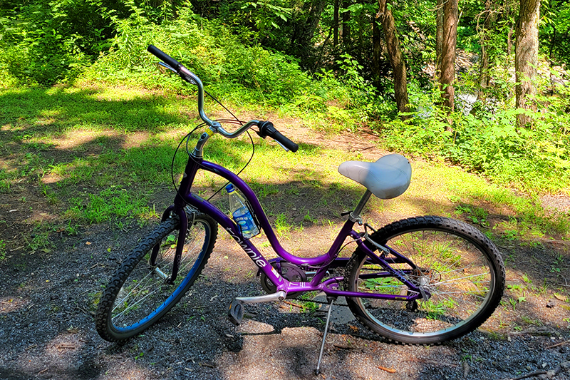
We have our own bikes, but they were badly in need of tune ups, so we left them home and rented from Blue Blaze Bike and Shuttle in Damascus, Va. Adam rented a mountain bike and I decided on a cool, purple cruiser. The trail’s terrain is generally smooth and covered with small gravel, so I decided to go with plush comfort rather than more rugged equipment. The rental shop was affordable and their bikes were impeccably maintained.
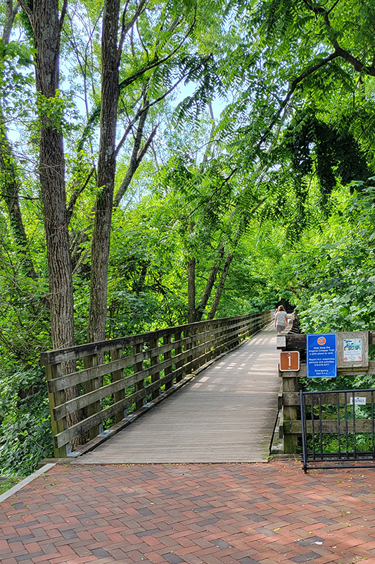
We booked seats on their first shuttle van of the day, and ended up being the only riders. Our driver was fun to talk to and was a regular hiker and biker. The shuttle took us from the shop back to mile zero in Abingdon, Va. From there, it was a mostly flat 16 mile ride back to their shop.
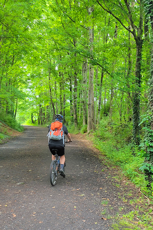
The section from Whitetop to Damascus is far more popular than the section we did this time – it’s a little more scenic and it’s all downhill, so it requires very little exertion. Our ride was still very easy, but we did have to pedal! The nice thing about biking the less popular half on a weekday was that we practically had the whole trail to ourselves. We saw just a handful of other runners and cyclists. The Creeper can get very crowded and congested, so this was a treat!
The main things to see along the Creeper Trail are beautiful waterways and railroad trestle bridges. The section we rode passed mostly through farmland, whereas the other half is more wooded. It was still really pretty, and the breeze from riding the bike made the heat bearable.
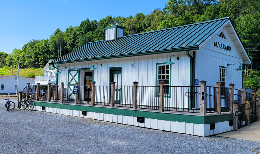
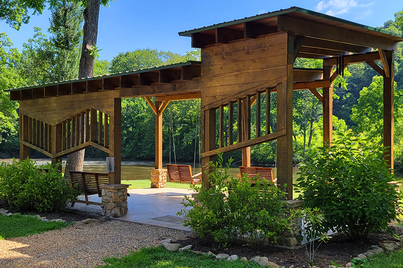
We stopped for a short snack and drink break at Alvarado Station about 8.5 miles into our ride. The station was once a railroad stop halfway between Abingdon and Damascus. It is the only stop for snacks and restrooms on this half of the trail. Across from the restroom building, there was a nice trailside park with a pavilion and porch swings. We sat by the river and enjoyed the view. We even saw a heron!
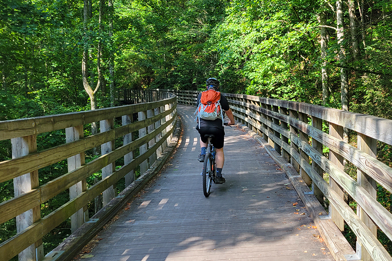
After our break we pedaled the remaining seven-ish miles into Damascus. The last mile or so follows the main road into town, so there are more road crossings and car noise. The nicest thing about trails like this is that the mostly keep car and bike traffic separated, so you always feel safe riding.
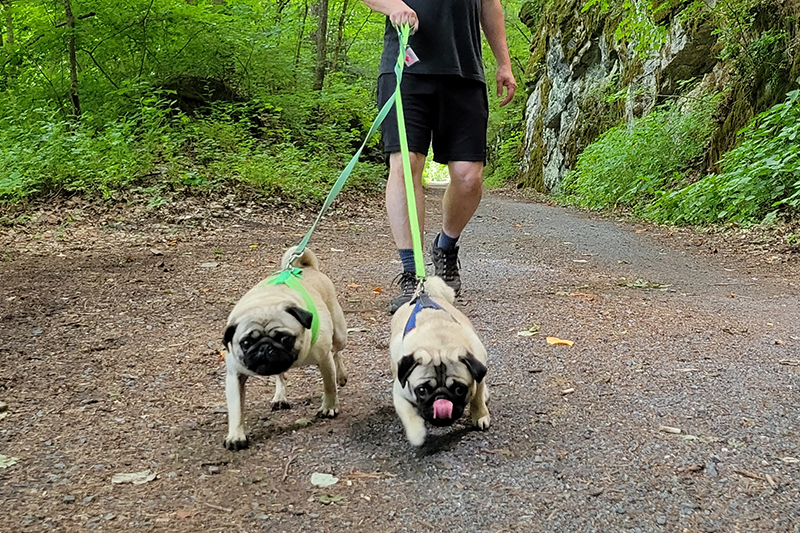
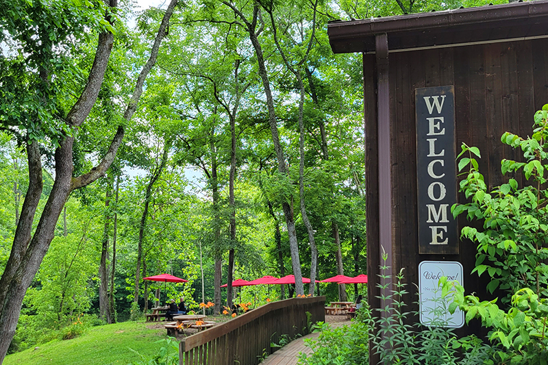
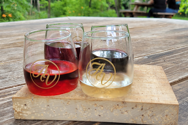
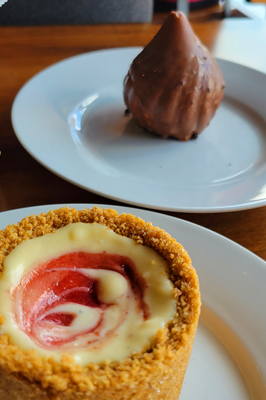
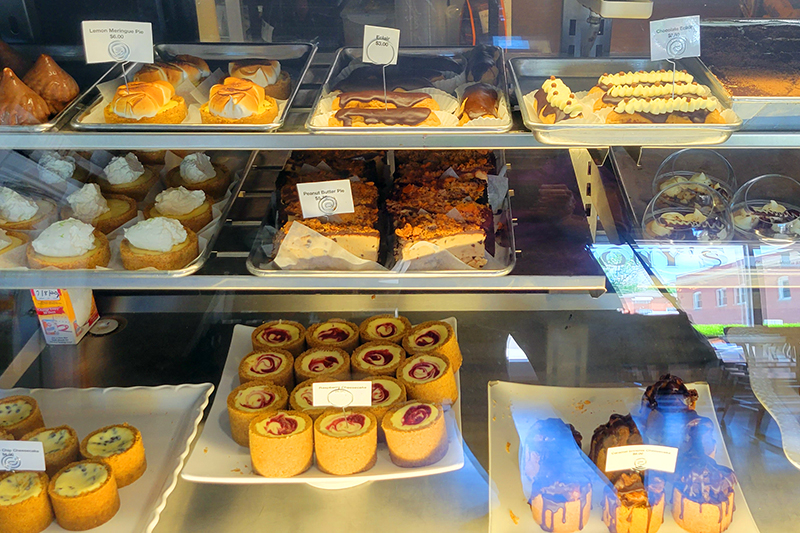
We got back into town, returned our rentals, got some lunch at Wicked Chicken Winghouse – another decent lunch stop in Damascus. Afterwards, we drove back to our AirBnB and picked up the dogs and took them for a two mile walk along the Creeper. After we got them nice and tired, we headed to Abingdon Vineyards to try some wine. The winery is dog friendly and has lots of outdoor tables along the stream. The day finished up with desserts from Anthony’s Desserts in Abingdon. If you’re in the area, this place has the most amazing sweets – don’t miss it!
More Photos
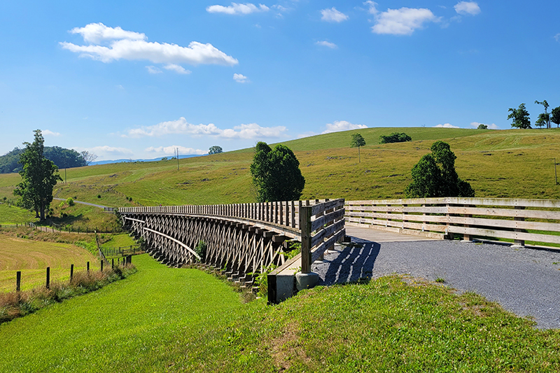
Trestle #1 on the Virginia Creeper
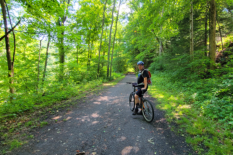
Biking on the Creeper
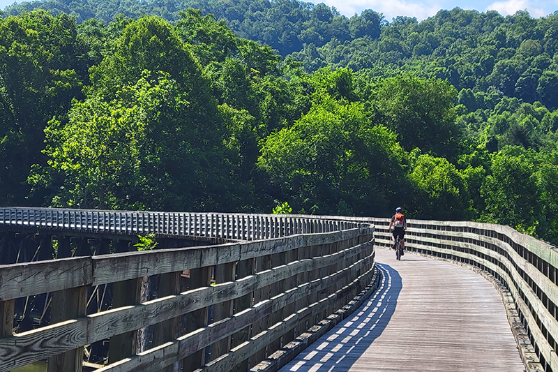
Crossing railroad trestles
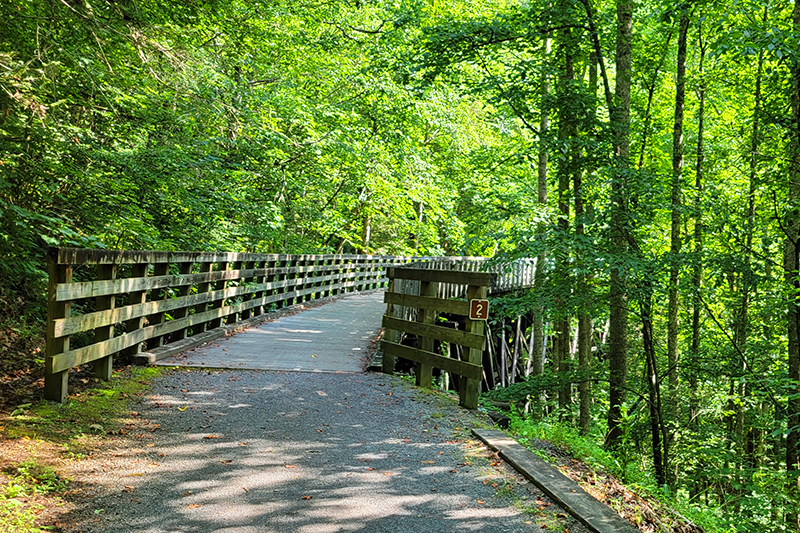
Trestle #2 – they are all numbered and there are over 35!
Pretty farmland
Adam biking along
Taking a break in the shade
Alvarado Station park
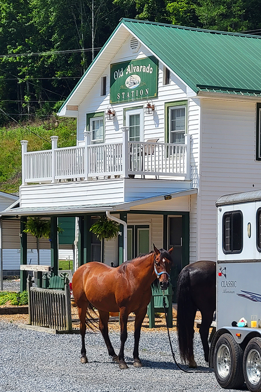
Horses are welcome and common on the Creeper
My sweet purple cruiser
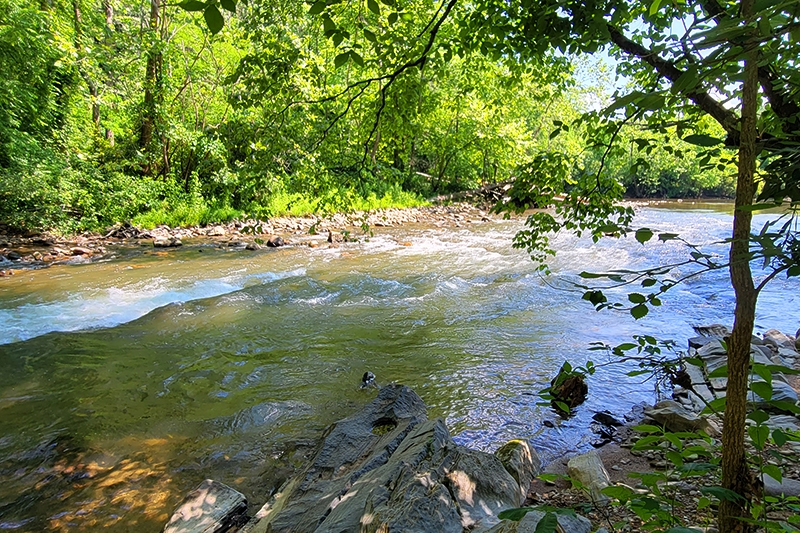
Some small rapids near Damascus
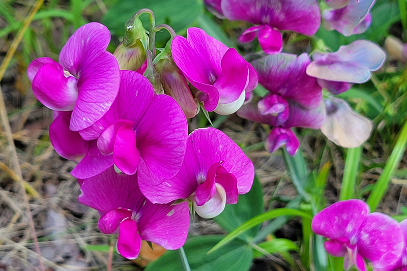
Pretty blooms along the trail
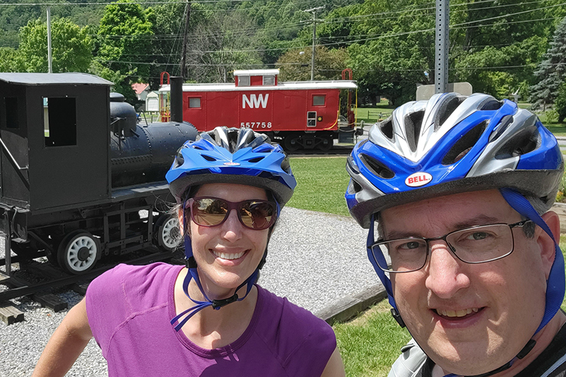
Bike selfie back in Damascus
Pugs on the Creeper!
Abingdon Vineyard
Wine flight
Don’t miss Anthony’s Desserts in Abingdon
Seriously – don’t miss Anthony’s Desserts! This is just half the case!
On Wednesday and Saturday mornings from May through late September, the eleven-mile Cades Cove Loop Road is closed to vehicles until 10:00 a.m. Don’t miss the opportunity to rent a bike and tour this scenic area without the nuisance of heavy car traffic!
Biking the Cades Cove Loop is a popular activity on Wednesday and Saturday morning when the road is closed to vehicle traffic. Below: The Cades Cove visitor center; Horses heading from the paddocks back to the barn; A distant view of a homestead.
Christine Says…
On the Saturday we were due to drive home from vacation, we woke up a few minutes before 5:00 a.m. I was comfortable – the room was pleasantly cool, the bed was soft and I felt relaxed and still pretty sleepy. Adam rolled over and asked me ‘So… are we going or not?’ The issue at hand was whether we should sleep in, have a leisurely breakfast and then drive home or if we should get up, grab something quick to eat and make the hour long drive into Cades Cove to rent bikes and ride the eleven-mile scenic loop on one of the mornings it’s closed to vehicle traffic. My inner dialogue went something like this…
‘Stay in bed, Christine! You can go to Pancake Pantry again! You love crepes!’
‘Nooo… this is your last day in the Smokies – you must pack in more fun activities.’
‘If you go biking, you’ll have to ride in the car for almost seven hours all sweaty and dirty. You can come back to the Smokies another year and ride the loop then.’
‘But Adam already bought a collectible patch that says we biked the Cades Cove Loop. You can’t have a patch for something you didn’t do. That would make you a liar!’
‘But I’m tired. We’ve already been on six hikes! I just want to take a shower and eat breakfast’
‘Get your butt out of bed and onto that bike! It will be fun and I bet you’ll see cool stuff. Eleven miles of biking is nothing!’
‘Alright… let’s go do this thing!’
With that discussion done, we got up, packed the rest of the stuff in our room, checked out and headed toward Cades Cove. As I mentioned before, Gatlinburg starts breakfast late – even our hotel didn’t put the complimentary breakfast out until 7:00 a.m. The only choice we found for breakfast (other than gas station food) was ‘The Donut Friar.’ That turned out to be quite fortuitous! I’ve never eaten such delicious donuts. Even now… the thought of those donuts makes me feel a wistful sense of longing. I could write an entire post about those donuts, but I’ll move on to the biking.
Cades Cove offers beautiful mountain and meadow views. Below: One horse (Ted) got loose and walked outside the fenceline; Christine coasting along; Three does make a run for it!
When we had initially inquired about bike rentals, the attendant told us that the rental shop opened at 7:00, but that we should plan on getting there about 15 minutes early. Since it was Memorial Day weekend and the campground was full, they expected rentals to sell out quickly. For almost three quarters of the drive into Cades Cove, we didn’t see a single car. But at the junction with incoming cars from Townsend, we started seeing many. It was a line of moderate traffic rolling toward the cove. We were anxious enough that we didn’t even stop when we spotted a bear climbing a tree alongside the road. No way was I going to miss the chance to rent a bike after giving up my leisurely morning!
Ironically, we ended up first in line at the bike rental shop. They opened promptly at 7:00 and we were on our way with bikes and helmets by 7:15.
The one-way road through Cades Cove is normally a real log jam of cars. It can be maddening to go so slowly. So, breezing along on a bike was a true treat. While there aren’t bike jams, do be prepared to share the road with lots of other bikes. Biking the loop is very popular!
When we first entered the Cove, it was a beautiful misty morning. A thin veil of low fog was floating across the open meadow. The rising sun made everything look golden and shimmery. One of the first stops we made was to watch all the horses being herded from the field up to the barn for the day. One horse, a big draft-cross named Ted, decided to take an alternate route. Instead of following his buddies through the field, he walked right out the gate and headed up the road. One of the volunteers who help keep the road safe radioed back to let others know a horse was on the loose. Ted didn’t look like much trouble though. I’m sure someone caught him and ushered him back to where he belonged. I sort of gathered from the conversation that this was not Ted’s first foray out onto the road.
Along the way, we passed old churches, old homesteads, and old barns. Normally, I’m pretty interested in history and park-lore, but on this particular morning I was in the mood to keep biking. I was having fun coasting down the steeper hills. It felt great to pick up some speed and feel the wind against my face.
There are lots of old homesteads in the Cove. Below: There are also lots of churches; And evidently, lots of invasive wild hogs!
We also saw lots of turkeys and deer. The turkeys were especially impressive putting on their mating displays. Most of the time, turkeys aren’t what you would call ‘beautiful’, but a Tom turkey all puffed up and putting on a show is truly something to behold. You can almost understand why Benjamin Franklin put the turkey forth as a candidate for our national bird. (Though, I think the bald eagle was still probably the better choice.)
We had hoped to see more bears on this ride around Cades Cove, but we struck out. Thankfully, we had already seen seven bears during our week, so we didn’t feel too disappointed.
The one thing that surprised me about biking through Cades Cove was that some of the hills were actually pretty challenging. When you drive around the cove, it seems mostly flat or perhaps ‘rolling’. While none of the hills are long, there are a number that are quite steep and require some power-pedaling. The rental bike I used didn’t have quite as many gears as my normal bike, so that made things a bit tougher. We biked most of the hills without stopping or getting off, but there were two hills near the end where it just seemed more efficient to dismount and walk our bikes up the hill. When you can’t shift your gears anymore, and people are walking by while you valiantly pedal, it’s time to revisit your pride! Besides, it seems that the majority of people walk their bikes a little bit in Cades Cove, so I didn’t feel too bad.
The whole loop took us less than two hours to bike – even with plentiful stops for scenery and wildlife. It was really a nice way to spend our final morning in the park, and I’m glad we made time to do it! Although, I was too exhausted to help with the drive home. I ended up sleeping in the car about half the way home – which is very unusual for me!
Adam Says…
Some of you may have thought we were done with our Smokies Edition posts and based on Christine’s inner-dialogue you can see that was almost true. But, we thought this opportunity was too good to pass up. We have always treated our vacations as days that we should run ourselves ragged. You can always be exhausted when you’re sitting behind your desk at work.
At 7:15 when we started off, there were already plenty of bikes on the road. Since we didn’t have the foresight to bring our own bikes along, we had to rent them. The bike shop opened promptly and was very well-organized. The shop requires you to either put down a $50 cash deposit or leave your car keys. You pay for the first hour in advance and then pay the rest when you check back in. We ended up paying less than $30 for less than two hours, so it is quite affordable.
We left the campstore and biked up to the Orientation shelter to start our loop ride. The road starts off fairly flat with large views of open farms. At 1.1 miles shortly after passing the intersection with Sparks Lane , you come across the John Oliver cabin on the right. Built in the early 1820s, this is the oldest building along the loop. The road becomes more like rolling hills at this point and some of the hills can be steep going up or down. Around the 2 mile marker, you come to the Primitive Baptist Church on your left, shortly followed by the Methodist Church on your right. The Primitive Baptist Church was first established in 1827 as a log building, but the building that is there now replaced it in 1887. During the Civil War, this church closed since the church officials were Union supporters amidst a land filled with Confederate supporters. The Methodist Church was established in the 1820s as log building but was replaced by this building in 1902. Baptists outnumbered the Methodists in this area, but the populations were enough to keep many churches around. At 2.75 miles, you reach an intersection with Hyatt Lane, which does allow you to shorten the loop. A short distance later, you come to the Missionary Baptist Church on the left. Continuing on, the road begins to lead out of the woods again into more open areas. At 4.25 miles, you do reach a trailhead on the right of the road that leads to the Elijah Oliver Place. Elijah Oliver was the son of John Oliver, whose cabin you saw first. At 5.0 miles, you reach a junction with a road that leads down to the parking lot for the Abrams Falls trail.
This solo buck enjoyed grazing in a misty meadow. Below: Some of the downhills are steep and curvy, so warnings are posted; Old cabins are abundant in the cove.
Within another half mile, you reach the large Cable Mill Historic Area and Visitor Center. You can take a while to walk around the many buildings that are here including the Visitor Center, Gregg Cable House, grist mill, and LeQuire Cantilever Barn. Leaving the Visitor Center and rejoining the road, the trail becomes much steeper for a good portion of the remaining ride. At 7.0 miles, you will pass the Dan Lawson Place. At 7.5 miles, you reach the Tipton Place, a home built by a colonel in the Mexican War that housed his two daughters and was later rented out to others. At 8.25 miles, you will see the Carter Shield cabin on your right, one of my favorite buildings to see on the ride. This cabin was built by George Washington Shields, who was wounded at the Battle of Shiloh. Continue your ride which re-enters the forest for the remaining trip until you reach the junction that leads back to the campstore at 11.0 miles.
The male turkeys were putting on quite a show! Below: Bikers are treated to many open views – perfect for wildlife watching; Christine and her rented bike after the ride.
One thing that makes this part of Great Smoky Mountain National Park so popular is the ability to see wildlife. Due to the large open areas here, wildlife viewing is prime. We had driven through the area an earlier day and we did see lots of deer, a few bears, and wild turkeys. When the road is open to cars, you should expect a slow drive around the loop. We even had people in a truck in front of us sitting in lawn chairs in the back creeping along to try and spot wildlife.
I would strongly recommend if you want to avoid some crowds on the road normally, get up early and get here to bike the loop. You’ll be able to take in all the beauty and hopefully see some wildlife along the way before the crowds descend. When we were leaving, we were already seeing cars lining up to get ready to drive the loop.
After we left the loop, we headed back to Virginia passing through Townsend and Pigeon Forge, TN. It is amazing that such a commercialized area is so close to such a gorgeous national park. I’m just glad that the National Park Service protected this land before it became overrun with visitors. Like Shenandoah National Park, some of the people in Cades Cove were displaced by the national park service as they bought their land. Some were given the option to stay in their houses until they died, but their offspring were not allowed to live there.
Trail Notes
Distance – 11 miles
Elevation Change – lots of rolling terrain
Difficulty – 3.5. There are many flat sections and downhills. The uphill sections are short, but quite steep.
Trail Conditions – 5. The road is paved and in great condition.
Views– 4. Lot of open meadows and views looking up to the mountains.
Streams/Waterfalls – 1. There are a few small streams along the route. Nothing amazing or photo-worthy, though.
Wildlife – 5. This is a great place to see all kinds of Smokies wildlife.
Ease to Navigate – 5. Very simple – just follow the road and all the other bikers!
Solitude – 0. Expect to see lots of other folks.
Directions to trailhead: The Cades Cove loop is located on Laurel Creek road, 7.5 miles west of the junction of Little River Road and Tennessee Route 73 (leading to Townsend). Once you approach the main entrance, you will see a road leading to the campstore if you are renting bikes. Start the loop at the main entrance, near the Orientation shelter.
The bike ride along this loop gives you beautiful lakeside views in the interior of Acadia National Park.
A view of Eagle Lake from the Carriage Roads. Below: The Duck Brook Bridge entrance to the Carriage Roads; There are lots of water lilies in Acadia’s ponds; Adam bikes along the shore of Jordan Pond. The rocks lining the trail are affectionately known as ‘Rockefeller’s Teeth’.
Adam Says…
This is truly one of our favorite places to bike! If you are ever near Acadia, I would recommend taking a bike ride around Eagle Lake. While there are 45 miles of carriage roads in Acadia National Park, the loop around Eagle Lake is by far the most popular.
The carriage roads were donated and built by John D. Rockefeller, Jr., emulating the carriage roads his father created in Ohio and New York. While the Park Loop Road provides access to much of the circumference of Acadia National Park and ocean views, the carriage roads provide great access to the interior, providing glimpses from the top of mountains and around the lakes and ponds.
I recently had a co-worker, Kristen, that was going to Maine to visit some family property. Having been to Acadia many times, I planned out an ambitious day for her and her sister to capture the things I enjoy up here. She wasn’t able to do everything I suggested, but she did the Eagle Lake/Jordan Pond section of the trail. They rented bikes in Bar Harbor and decided to bike from town to reach the carriage roads. There is a large hill from Bar Harbor to reach the entrance to the Eagle Lake parking lot. Her sister was yelling up ahead to her, “KRISTEN! I DON’T THINK I CAN MAKE IT!” I should have been explicit in telling her to rent a bike rack and park near the carriage road entrance. Some people bike to the carriage roads from town, but I think it is best to park closer or you’ll burn up all your energy before you get to enjoy the actual ride.
Adam on his rented comfort bike, passing under the Eagle Lake bridge. It was quite different from the mountain bike he normally rides. Below: Christine’s parents take a break after a long uphill stretch along Eagle Lake. This is the spot we took a wrong turn!
We started our ride, by parking on Duck Brook Road. Right before the roadside parking, you pass a beaver dam on New Mill Meadow. Park your vehicle near the bridge that begins your journey. The carriage road intersections are all numbered on wooden posts (that also serve as posts to provide you some overall direction) and have this trail started at Post #5. We took a right after crossing the bridge to make our way around Witch Hole Pond. The trail does tend to go uphill during this part of the section about 100 feet. In 1.1 miles you will take a left at Post #3. You will begin to see some up close views of Witch Hole Pond. At 1.3 miles, you take a left at Post #2. The trail continues to loop around Witch Hole Pond. At mile 2.3, you will reach Post #4, bearing right and seeing views of the small Halfmoon Pond. At mile 3.4, you will reach Post #6, going under a bridge and close access to the Eagle Lake parking lot. Most people start their bike ride here, so expect lots of people around this bridge. After going through the bridge, you will arrive at Post #9 at mile 3.5. The trail goes along the western side of Eagle Lake, but goes up during one of the tougher sections of this loop ascending over 200 feet. At mile 5.5, you will come to Post #8. Take a break if you would like here, for the toughest part of the first section is over. At Post #8, take a right (this is where I failed to follow the map closely which caused us to retrace our steps and made us go uphill). At mile 5.7, you will reach Post #10. Take a left at this junction to make your way. The trail does ascend slightly. At mile 7.0, the trail begins to open up to views of Jordan Pond and the Bubbles to your left. At mile 7.9, you reach the Jordan Pond House and Post #14. Bear left at this intersection for about .3 mile passing by Post #15 and Post #16. Cross the Park Loop Road carefully and then you will see the large Jordan Pond Gatehouse. Bike carefully through the gate. At mile 9.8, you reach Post #17, near Wildwood Stables. Take a left here and your climb begins again. Once the trail levels out, you will pass by Bubble Pond on your right. At mile 12.9, you reach Post #7. Take a right at this junction and you will begin to enjoy the best views of Eagle Lake. The trail continues along the eastern side of Eagle Lake. At mile 15.1, you will reach Post #6 again. Take a right and go under the bridge. At mile 16.2, you will reach Post #4. Take a right here and at mile 17.3, you will reach Post #5 to complete your loop.
As there are a lot of intersections, I would recommend picking up a map of the trails. While you can purchase them from many places in Bar Harbor or Acadia National Park, they do have some decent carriage road maps that are free. These are typically in some of the boxes attached to the post intersections near some of the entrances to the carriage roads. I did spot these boxes at Post #5 and Post #8.
Lunch on the lawn at Jordan Pond is not to be missed. Below: Views of Jordan Pond and the Bubbles.
If you do your planning well, you can include a stop near the halfway point at the Jordan Pond House Restaurant. This is a must-visit restaurant while in Acadia. Get a seat outside and enjoy popovers as you take in the scenes of Jordan Pond and the Bubbles. The menu has been expanded since the last time we had been here, so we were thrilled to try some new things. Christine really enjoys their lobster quiche and I like their cranberry walnut chicken salad sandwich. While the prices are a little high, you do have one of the best views for a restaurant. There are plenty of places nearby to lock your bike and there is a gift shop that sells everything from hiking gear to pottery to Gatorade. They even sell Jordan Pond coffee and popover mix.
I have two favorite sections of scenery along this trail – the view near the rock slide approaching Jordan Pond and the eastern side of Eagle Lake. This is a bike ride that almost invites you to take your time by soaking in the great views of the lake, taking your time to pick wild blueberries near Witch Hole Pond, or listening for the cry of loons on Eagle Lake or Jordan Pond.
Christine Says…
Biking Acadia’s Carriage Roads is always one of the Maine activities I look forward to most on our trips! It’s funny, when I visited Acadia as a child and teen, I never tried the carriage roads by bike. Instead I preferred to run. Looking back, I don’t know what I was thinking! Sure… the carriage roads are great for walking and running, but I can’t imagine a better way to see them than by bicycle (Unless I was given the option to go on horseback; but unless you arrive at Acadia with your own horse, the closest you can get is taking a chauffeured horse carriage ride.) The car-free carriage roads in Acadia meander through the woods, passing ponds and lakes. If you’re lucky, you’ll spot beavers or loons swimming. You get occasional glimpses of the ocean. You breathe in the clean, evergreen-scented air. And best of all… you can bike right up to the Jordan Pond House and indulge in popovers with butter, popovers with strawberry jam, popovers with soup, popovers with salad and even popovers a la mode! Don’t even get me started on how much I love popovers a la mode. They’re one of my raison d’êtres. I’m not even kidding – ask Adam!
Sometimes we bring our bikes on the long drive up to Maine, but this time we drove our small car to save gas money, and ended up renting bikes at the Bar Harbor Bicycle Shop. The folks there are really friendly and knowledgeable and their bikes are all expertly maintained. We tried renting a carrier for our car, but none of them worked with our particular hatchback. Thankfully, my parents were vacationing with us and were able to haul our bikes to the start point of our ride. Technically, you can ride your bike from the shop to the carriage road entrance, but it’s an arduous uphill ride along a very busy road. Biking the few extra miles from the shop to the trails takes a lot of the enjoyment out of the ride, so we avoid it any way we can.
On this particular day, we decided to follow one of our absolute favorite routes. Starting at Duck Brook Bridge, we biked around Witch Hole, then around Eagle Lake, past the north shore of Jordan Pond to the Jordan Pond House. After lunch, we continued the route past Wildwood Stables, along Bubble Pond and the opposite shore of Eagle Lake. A few final miles along the other side of Witch Hole returned us to our car.
Even though the Gatehouse sits in the park, it’s still privately owned. Below: A horse carriage on its way from Wildwood Stables to Jordan Pond.
It’s a fabulous route that shows off a little bit of all of Acadia’s best scenery. There are some substantial hills along the route, and it’s not uncommon to see people walking their bikes uphill instead of riding them. I remember the first time I biked the carriage roads many years ago, the first steep hill along the first side of Eagle Lake about killed me! Despite the fact I was beet red and out of breath, I was determined NOT to walk my bike. I did have to take a water break or two, but I never had to get off and push my bike uphill. Nowadays, I’m in much better shape (even though I’m almost 20 years older) and biking the hills is no sweat at all! In fact, I must brag that I biked easily past dozens of people headed uphill. 🙂
The trail marker at the far end of Eagle Lake is one of the only places that directions get confusing along the ride. The trail branches off in several different directions at this point. As (bad) luck would have it, we biked following our instinctive directions instead of looking at our detailed map. We ended up going the wrong way for almost two miles – mostly along a steep, beautiful downhill coaster of a descent. This meant we had a tough uphill slog once we finally realized we were going the wrong way.
I suppose we could have kept on going in the wrong direction – most of the trails eventually cross one another and we would have ultimately arrived at the Jordan Pond House. However, I really enjoy the ride along the north shore of the pond, so we decided to retrace our ride. My parents decided to stay the course (my mom didn’t want to bike back uphill) and meet us at the Pond House.
The uphill turned out to be less painful than I imagined and after about 15 minutes, we were coasting downhill along the edge of Jordan Pond. I enjoyed the sparkling water, the first glimpse of the Bubbles, passing the big rock slide and knowing I’d soon be eating popovers.
The ride along Jordan Pond goes really quickly. At Jordan Pond, the first thing we always do is get our name on the waiting list for a table on the lawn. If you visit the Pond House, you can almost always get an indoor table immediately, but you DO NOT want to do that. The best place to sit is outside on the lawn at one of the picnic tables overlooking the water and the Bubbles. I always start my meal off with lemonade. It’s fresh-squeezed and comes unsweetened with a tiny pitcher of simple syrup, so you can sweeten the drink to your personal taste. The regular lemonade is good, but the strawberry lemonade, loaded with fresh strawberry puree, is even better. As soon as you finish placing your order, a waiter will come around with a basket of piping hot popovers. They’re served with butter and homemade strawberry preserves. On this particular day, I ordered the lobster quiche, which has always been a favorite of mine. I also couldn’t refuse a second popover, even though it cost a little extra. Because we were biking and I didn’t want to feel over-full, I had to pass on the a la mode (for now).
After lunch, we refilled water bottles and took a few minutes to digest lunch while browsing the Acadia gift shop. We also stopped to chat with the Friends of Acadia who were working on fundraising and recruiting new members. We joined a few years ago and are happy to support our favorite National Park.
After leaving the Jordan Pond House, we crossed the Park Loop Road and passed by the privately owned gate house. We happened to time our departure perfectly to pass a team of draft horses pulling a buckboard up the hill. They’re such huge and beautiful creatures!
The ride along this section is wooded and doesn’t pass anything remarkable. You can take a side road to get down to Wildwood Stables and Day Mountain, but we continued on toward Bubble Pond.
A look at Bubble Pond from the Carriage Roads
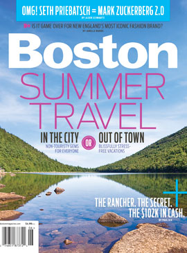
Bubble Pond is a gorgeous spot. We’ve seen loons there and I’ve even taken a photo of the pond that was featured on the cover of Boston Magazine’s 2011 Summer Travel issue. This year, the view was as lovely as ever, but the experience was marred by a couple changing the diaper of their caterwauling toddler. They had the child laid out on a rock on the pond’s edge… the edge of the pond that is a source of public drinking water. Ewww! I know babies need changing, but for God’s sake… take the diaper-changing activities off the trail and away from the water source.
After passing the end of Bubble Pond, you go over a neat arched bridge, cross the Park Loop Road again and make the final push back toward the opposite shore of Eagle Lake. As the trail gets closer to the lake side, you get some really lovely lake and mountain views. You also pass one of the most popular kayak launch spots in the park.
Shortly after passing the launch, you arrive at the Eagle Lake parking area. This area is another parking option for accessing the Carriage Roads, but it’s usually horrible congested. We continued past this spot to bike the remainder of the trail along Witch Hole and back to our car.
Witch Hole is very pretty – full of lily pads and beaver dams.
It was a fantastic ride – one that I know I’ll want to do again and again! After we wrapped up the ride, we headed back to the hotel to get cleaned up before dinner. Sometime between the end of the ride and leaving for dinner a heavy fog rolled over the island. It’s really amazing how quickly clear blue skies can turn to thick, cottony fog in Maine! It’s part of the island’s charm, I suppose! We enjoyed the foggy evening at one of our favorite lobster pounds, Thurston’s (in Bernard). If you’re on MDI and want a classic Maine lobster experience, don’t miss Thurston’s!
Trail Notes
Distance – 17.3 miles. We added about another 4.4 miles due to our misdirection.
Elevation Change – Approximately 500 feet.
Difficulty – 2. There are some uphill sections which will have you switching to lower gears, but it is doable for most people. Take breaks whenever you need one or walk your bike up the steeper sections.
Trail Conditions – 4.5. The only thing better is pavement. The carriage roads have small crushed gravel, which is good for just about any type of bike. I would recommend a hybrid or mountain bike though due to the gravel.
Views– 3.5. Most of the views are of the lakes, so you can’t see for miles and miles in most parts, but the lakes and ponds are gorgeous.
Waterfalls/Streams – 4. You get great views of Witch Hole Pond, Eagle Lake, Jordan Pond, and Bubble Pond.
Wildlife – 1. You may see an occasional loon or gull in the lakes, but not much else other than a red squirrel.
Ease to Navigate – 3. There are lots of turns on this trail, but bring a map and follow the signposts and you should do well.
Solitude – 0. This is an extremely popular spot for bikers, walkers, runners, and even horses.
Directions to trailhead: Head west on 233 out of Bar Harbor. After about a mile outside of town, take a right on Duck Brook Road. Travel for about two miles until you reach the roadside parking near the park service building.
The New River Trail is a 57-mile rails-to-trails bike path. It starts in Galax or Fries and runs to Pulaski, following the New River closely for most of the way. We biked a 20+ mile section from Fries to Foster Falls.
The trail was shady and lush! Below: One of the many bridges along the trail – this one crossed the New River; A view of the New River at Foster Falls; Adam looks at some small rapids.
Adam Says…
When we were originally planning our trip down near the Grayson Highlands area, we were planning to incorporate a bike ride on the Virginia Creeper Trail. We had previously done the Virginia Creeper Trail from Whitetop to Damascas, but we wanted to do the entire trail. After doing some research, we found out that due to recent tornado activity, only 8 miles of trail is still available to bike south of Damascas. There are plans to restore it soon, but it kept us from going with our original plan.
We were disappointed, but I had remembered hearing good things about the New River Trail. After discovering that we could still stay near Grayson Highlands and do this trail, we had a solution. The next challenge was trying to find a shuttle service to bike. After doing some internet research, I found a place called New River Trail Outfitters that offers the service. However, when I tried to call the numbers were disconnected. I’m not sure if they are out of business, but I couldn’t find any current information for them.
The livery at Foster Falls rents bikes, canoes, kayaks and tubes. They also handle the bike shuttle service. Below: The stable at Foster Falls, A caboose on display; Foster Falls has an old depot building now used as a shop.
I then called the New River Trail State Park and found out that they offer a shuttle service. The park headquarters is located in Foster Falls. The cost per person to shuttle from Foster Falls to Fries or Galax is $25/person. When I called in for information, I found out they opened at 9AM. When I asked if we needed to make a reservation, I was told “No. You can just show up.” It’s definitely much more laid back than making shuttle reservations for the Virginia Creeper. Along the Creeper, shuttles fill up days in advance, so you usually have to make a reservation with a credit card well ahead of your trip.
We decided to get there right at 9AM. The day was calling for temperatures in the high 90s, so we wanted to get most of the bike ride over before the hottest part of the day. We had to wait for a little while for a second employee to show up, but we were able to get our bikes loaded and we were off by about 9:20. It took about 35 minutes to get to Fries. We were thinking that it was going to be a very long bike ride, but the bike path is actually quite a bit shorter than the distance by car.
The New River Trail State Park is the longest state park, measuring a total of 57 miles, but only averages about 80 feet wide. This is a state park with the purpose of biking, hiking, horseback riding, kayaking, or tubing. The guys operating the shuttle service says that most people choose to rent kayaks and float the river along the trail.
Biking Across the Fries Junction Bridge. Below: A variety of scenery along the trail.
I would recommend getting a copy of the bike map to take along with you. This path that we chose mostly takes place in the south section, but you will be 1.2 miles in the north section.
We decided to go for the section from Fries to Foster Falls because we thought it would be a little more manageable in the heat than the Galax to Foster Falls section. The Galax to Fries Junction section would have meant another 8 miles of biking and doesn’t parallel the New River until it reaches Fries Junction.
The bike path at Fries immediately starts by the New River. Right from the parking lot, we were able to see gorgeous views of the river. The trail takes about 5.5 miles to reach Fries Junction (which intersects with the trail from Galax). At Fries Junction, we did run into about 10 camp counselors that were biking the trail and talking about which colleges they were admitted to. I tried to keep quiet for a while, since I work in the JMU Admissions Office, but I did talk to one girl that was going to JMU next year as a freshman. We pressed on after a short break, following the signs to Pulaski (the terminus of the trail). We passed by Byllesby Dam (at mile 8.0) and Buck Dam (at mile 10.6). We stopped to eat a snack at Ivanhoe (at mile 13.7). Shortly after Austinville (at mile 16.5), we went through a short tunnel. This tunnel wasn’t that dark, so you most likely would not need a headlamp to go through. At mile 20.1, we reached Shot Tower. We parked our bikes and hiked up the steep stairs (which is tough after biking a while) to explore the tower. After we were done, we finished our ride back at the Foster Falls state park headquarters where we had started our trip.
There are a few geocaches to find along the way for this bike ride.
I definitely would like to come back and do some other sections of the trail. The section from Galax to Foster Falls is about 28 miles and the section from Foster Falls to Pulaski is about 22 miles. When we were reflecting back on the rails-to-trails bike rides we have done, we would put this only second to the Virginia Creeper trail.
Christine Says…
The New River Trail wasn’t our first choice for this mini vacation. Initially, we had planned to head down to Abingdon and make a second attempt to bike the entire Virginia Creeper. Let’s just say we don’t have good luck when it comes to the Creeper. In 2009, it rained on us for 17 miles before we bailed out and caught a van ride back to Abingdon from Damascus, in 2010 I got bronchitis and was too sick to go when we planned, and in 2011 the section of the trail between Damascus and Abingdon was closed due to tornado damage. Apparently, some mythical force is keeping us from finishing that trail!
This was the only tunnel we passed through on the section we biked. Below: Geese and goslings; Pretty wildflowers along the trail; Rocks and rapids in the new river.
Luckily, Adam was able to do some last minute research and plan an alternate getaway for us that included biking along the New River Trail. The trail is 57 miles long and passes through Grayson, Carroll, Wythe, and Pulaski Counties, linking the towns of Pulaski and Galax with a side spur of the trail linking to Fries. It hasn’t been around as long as the Virginia Creeper, so it’s not as well-known and the area doesn’t have quite as many bike-friendly amenities (shuttle services, bike shops, trailside cafes). But what it lacks in amenities, it makes up for with its beauty and solitude. We saw fewer than two dozen people along the New River Trail over a 20+ mile span and greatly enjoyed the pristine river scenery.
The trail was in great shape – smooth and flat, covered with fine crushed stone. There were lots of pretty wildflowers along the path – snapdragons, mountain laurel and others I didn’t know. Every now and then, I’d catch a deer watching us quietly from the woods. We saw a pair of geese and their goslings hanging out at one of the primitive trailside campsites. The river was fed by many small streams cascading down the hillside above the trail. There were even a few small waterfalls flowing. The New River was spectacular! All the spring rain had water levels higher than average, so there were many rapids and cascades that probably aren’t there when the water is lower. The driver of our shuttle even mentioned that they had to cancel canoe/kayak/tube trips due to high water on the Saturday of Memorial Day weekend.
It was close to 100 degrees outside on the day we biked, so that made it a bit uncomfortable. Although, once we got going, the breeze from pedaling along made the heat bearable. Thankfully, much of the trail passes through a shady tunnel of woods, so we were able to stay out of the direct sunlight most of the way.
Nonetheless, I drank almost three liters of water and a 20-ounce bottle of lemonade over the course of the ride. I also ended up with a huge, salty sweat ring on the front of my shirt (GROSS!) and my legs were crusted with sweat mixed with gravel and grit (DIRTY!). I was not a pretty site at the end of the trail, but I had such a good time I didn’t care!
The Shot Tower.
Two things I liked best along this bike path were the Fries Junction Bridge and the Shot Tower. The bridge was neat just because it was so long and curvy. Shot Tower was interesting for its history. The tower itself sits above the trail. So you have to take a short, steep climb up a hill and several flights of steps to visit the tower – but it’s definitely worth the effort. Another little tidbit of history from the area is that Stephen F. Austin, ‘The Father of Texas’, was actually born in Wythe County, in a small town that now bears his name (Austinville). The trail passes right through that area.
Park employees enjoy a shady spot on horseback.
I would definitely make a return trip to bike more of the New River Trail! The state park shuttle service makes it so convenient. I also might want to go back and ride horses along the trail. Seeing all the horses at the Foster Falls stable really made me miss having a horse and going for long rides.
After finishing up with our bike ride, we got cleaned up and headed into Galax for a movie and pizza. I was shocked that movies in Galax were only $4.00 for a matinee (as of 2011)! After the movie, pizza at RJ’s Pizza and Subs was delicious! They had really good and inexpensive food.
Trail Notes
Distance – 21.3 miles
Elevation Change – negligible
Difficulty – 1.5 The terrain is extremely flat, so if you can do the mileage, you shouldn’t have a problem.
Trail Conditions –4.5. The trail is either very small gravel or dirt. It doesn’t get better unless you find paved trails.
Views – 1.5 You don’t get views from high points, but there are a few nice unobstructed views of the river and some of the mountains around you.
Waterfalls/Streams – 5. Most of the trail, you are biking along the New River.
Wildlife – 2. We saw a couple of deer and a black snake on our ride.
Ease to Navigate –4.5. The trail is very easy to follow and well-marked.
Solitude – 2.5. This trail does get busy on nice weekend days, but it is not as popular as the Virginia Creeper trail.
Directions to trailhead: For the headquarters of New River Trail State Park for the shuttle service, take exit 24 (69 East) off of Interstate 77. Take a left on to US-52 North. Go 1.5 miles and take a right on to Foster Falls Road/State Route 608. There should be signs directing you to the New River Trail State Park. There is a fee of $2 to visit the park.
For the trailhead in Fries, VA, Fries is located off of highway 94. From Main Street in Fries, turn on Firehouse Drive. You should see the small parking lot and bulletin board shelter for the start of the trail at the curve on Firehouse Drive.
The Greenbrier River Trail is a rails-to-trails bike path that meanders 78 miles along the Greenbrier River in West Virginia. This portion we biked was about 25 miles from Cass to the little town of Marlinton.
Adam crosses Sharps Bridge on the Greenbrier River Trail. Below: Due to drought conditions, the Greenbrier River was very low; Trail signs mark each entry to the trail; The Clover Lick Depot is one of the old train stops you’ll pass on the trail.
Adam Says…
Our main reason for staying around the Marlinton, WV area was to do some biking on the Greenbrier River trail. A few friends of mine that had done the Virginia Creeper Trail told me that we should do the Greenbrier River Trail sometime. The trail was very similar to the Virginia Creeper. They are both rails-to-trails biking trails and don’t take a ton of cardio effort or biking skills to complete. The scenery may have been a little nicer along the Virginia Creeper; with mountain views and lots of bridges and trestles. However, the Greenbrier trail lacks the dense crowds that you find on the Virginia Creeper. You’ll have lots of solitude on this trail, but there are also fewer amenities along the way (other than occasional restrooms at campsites). Christine and I really enjoy the solitude more than anything, so it was great to get away for a nice, quiet, long bike ride.
We started our day with a car shuttle up to the northern terminus of the trail near Cass, WV. We arranged the shuttle through Appalachian Sport. We were the only people signed up for the shuttle, so we were able to arrange our own time. It was nice to talk to our driver (wish we caught his name) about his impressions of the trail. He was actually the one that gave us the news that JMU beat Virginia Tech in football. We had been completely “off the grid” for a few days without any cellphone service, TV, or internet. We actually thought he was joking the first time he told us that JMU won.
Water levels were very low on the Greenbrier River. Below: The trail follows the river for almost all of its 78 miles; Adam bikes along the crushed stone trail; A view of the lovely river.
He frequently runs on the trail and told us about his goal to organize a Greenbrier River Challenge t0 raise funds with sponsorships for people to run the entire length of the trail. A friend of mine from work is one of the few known people to run the entire trail in a single effort (I think he and a couple friends did all 78 miles in a little over 16 hours). Our shuttle driver also told us that many people find the area between Cass and Marlinton to be the prettiest, but he thinks the entire trail is nice (with the exception of the more populated area between Marlinton and Seebert).
After being dropped off in the parking lot at the Northern Terminus of Slabtown (.5 miles from the town of Cass, WV), we got our gear together and headed down the trail. Mile markers are posted along the way to help you plan your distance along the trail. There are also slabs with the letter “W” along the trail, which were used by railroad engineers to know when to blow the whistle when they were approaching road crossings. The first notable stop along the way is about 9.4 miles in when you reach the Clover Lick Depot. This depot was built in the early 1900s and was recently renovated. At mile 14.6, you will reach the Sharp’s tunnel and bridge. The tunnel is 511 feet long and the bridge immediately after the tunnel is 229 feet long. If you’re interested in parking your bike for a brief rest, right before the entrance to the tunnel there is a path to the left that leads down to the riverside. There is also a steep, slippery path up to the top of the tunnel for the more adventurous. At mile 23.9, you will reach the water tank on the outskirts of Marlinton. Shortly after you pass the water tank , you will reach the Marlinton Depot at mile 24.3. The depot burned to the ground in 2008 and there are plans to have it rebuilt. You can then bike a short distance back to where you left your vehicle.
The Sharps Tunnel is dark and deep! Below: Adam stands atop the tunnel entry; By mid-day, big puffy clouds breezed into the sky.
If you are interested in doing any geoaching along the bike trail, you can find a few along the way:
We definitely enjoyed our ride on the trail and I hope to come back at some point to try out some other sections of this trail.
Christine Says…
We had a great bike ride along the Greenbrier River Trail (GRT)! I already can’t wait to go back and bike the remaining 53 miles. Rails-to-trails riding is so pleasant and leisurely. I love not having to worry about cars running me off the road.
If you’re going to bike a segment of the GRT, definitely look into arranging a shuttle. Typically, you leave your car at the end point, and the shuttle ferries you and your bikes to your start point. This allows you to bike a long section without having to retrace the trail to get back to your car. You can also take your time exploring because you don’t have a set time to meet your ride at the end of your trip. Shuttle companies are also a great source for trail tips – where to camp, where to eat, places to stop for water, etc. We used Appalachian Sport, but there are several other shuttle companies in the area.
A View of Sharps Bridge. Can you spot Christine on the trestle? Below: A primitive campsite along the trail; Adam drives the old wagon; A few early hints of fall were evident in the trees along the trail.
We met our shuttle at 8:30, loaded up our bikes and headed off on our 45-minute van ride to Cass. The morning was still cool with thick mist lifting off the river. Fall is definitely in the air! We passed through Cass Scenic Railroad State Park on our way to the northern end of the GRT. Cass is near Snowshoe Mountain. The area offers so many options for outdoor fun – skiing, mountain biking, canoeing, scenic railroads, fishing, hiking, etc.
By 9:30, we were off and pedaling along the trail. For several miles, we followed along the river – no sign of roads, people or houses. It was wonderful! The river was really low, but it was still gorgeous. Every now and then, a deer would bound across the trail or go splashing across the river. The fog burned off and opened up to crystalline clear blue skies – not a cloud in site. Early splashes of fall color were already evident in the trees along the trail.
We passed a couple trailside campsites. The GRT is also popular with equestrians, so campsites all included hitching posts. If I still had my horse, this would definitely be a dream ride! Several of the campsites even had privies.
Occasionally, the trail passes by developed areas. But “development” in this section of West Virginia usually means a few houses clustered along a quiet country road. We passed a barn with equestrian services advertised on the building side. They also had an old horse cart that Adam couldn’t resist. We passed the Clover Lick Depot. I think this area was probably a lot busier when the train was still running. The depot building was really cute and had recently been restored. Sadly, it’s not being used for anything. I bet it would make a great trailside gift and snack shop, but I also bet it would be nearly impossible for a shop to stay in business along the GRT. In the entire 25 miles we biked, I think we saw 6 people all day long. With such low traffic, amenities will never spring up along this trail like they have along the Virginia Creeper.
One of my favorite things we passed along – or shall I say through – was the old Sharps Tunnel. When we arrived at the tunnel opening, Adam scrambled up the hill to the top of the tunnel opening. You can smell the inside of the mountain emanating from the tunnel. It’s a hard smell to describe – the best I can describe is like a cool wind carrying the scent of tar, dampness and earth. The tunnel is over 500 feet long and follows a curve. This means that there is a section in the middle where there is absolutely no ambient light. It is 100% completely pitch black and eerie as the grave. For a few moments, I lost all sense of up, down, forward and backward. It was like biking in space! I shrieked with a mix of fear and giddiness until my bike hit light again. It was really fun, but if you’re afraid of the dark or an uncertain biker, you might want to have a light on your bike or carry a headlamp in your bag.
There were a bunch of state park employees eating lunch on the other side of the tunnel. I think they all heard me screaming in the tunnel, because they looked at me oddly. Oh well… I hope they were entertained. As soon as you come out of the tunnel, you pass over the Sharps Bridge, which crosses the Greenbrier River on a tall trestle.
We spotted a couple of frightened baby chipmunks along the trail. Below: Another view of Sharps Bridge; the Greenbrier River; The other baby chipmunk we spotted. I hope they survived.
Shortly after crossing the bridge, I saw a tiny animal dart across the trail – barely missing Adam’s bike wheels. It was as small as a field mouse. I braked when I saw the tiny creature still sitting along the trailside. It turned out to be a tiny baby chipmunk. It was too young to be away from the nest, and the mother chipmunk was nowhere in site. We made sure the little guy was safely off the trail and headed on our way. As Adam was walking back to his bike, he almost stepped on another baby chipmunk. This one was sitting in the middle of the trail, trembling in fear. We made sure the other chipmunk was safely off the trail and nestled under some leaves before we biked on. I hope those little chipmunks somehow found some way to survive. 😦
Chipmunks and deer were not the only wildlife we saw along the way. We also saw a couple different kinds of snakes. One snake was the largest black snake I’ve ever seen! He was lying half on and half off the trail, clearly in a state of torpor from the chilly weather. At first, I thought it was a toy rubber snake that someone had tossed along the trail. It didn’t move at all when I nudged it with a stick. I pushed it again, and I noticed the body slowly constricting. The stick I had was an old fallen tree branch – about eight feet long. I pushed the snake again to get it off the trail, but this time the snake completely coiled up; raising its upper body off the ground and flicking its tongue at me. He was still really slow and stiff, but definitely awake! Adam, who was sitting on his bike 50 feet away, wanted nothing to do with the snake at all. Finally, I managed to push the snake completely off the trail into the grass. Hopefully, he slithered away when the sunshine of the day warmed him up. Later in the day, we saw another snake basking in the sun in the middle of the trail, but he moved out of the way really quickly.
We saw this sleepy (but angry) black snake on the trail. Below: Near Marlinton, we saw old farm buildings and fields; The old water tank; The burned Marlinton depot; Adam checks out the inside of the train.
The last few miles of the trail passed through more open terrain. We saw fields and old abandoned farm buildings. Shortly thereafter, we passed a huge water tank – the only one left standing along the trail. Trains used to stop at this spot to fill up. By the time you get to the water tank, the GRT switches from a crushed stone surface to paved. The paved section is about five miles long.
In a few minutes, we were back in Marlinton at the old train depot. The depot used to be the town visitor’s center, but as Adam mentioned, it burned down a few years ago. We took a few minutes to climb aboard the old train car at the depot before heading back to our car.
After loading up, we had a delicious lunch at the Greenbrier Grille. They had great sandwiches (I recommend the Steak & Mozzarella!) and a lovely deck overlooking the river. We ate lunch to the sound of honking ducks in the river below. The restaurant has a large menu of homemade desserts, but we were too full from the sandwiches.
The next day, we were on our way back to Virginia, but we’ll definitely be visiting Pocahontas County again!
Trail Notes
Distance – 24.3 miles
Elevation Change – Negligible. Hardly any elevation change.
Difficulty – 2. While the biking is not difficult, the distance might be a little much for some people. Hiking or biking it should be fairly easy.
Trail Conditions – 4.5 The trail is very well-maintained.
Views – 3. The trail is scenic through most of the trail with views of the river most of the time.
Waterfalls/streams –2. The path runs along Wilson Creek for part of the trip and the Greenbrier River for most of the trip.
Wildlife – 2.5 We saw deer a few times on the trail and in the river. We also spotted some baby chipmunks, a blue heron, a couple snakes and some geese.
Ease to Navigate – 4.5. Just stay on the bike trail. A few spots run parallel with other driveways/roads, but you shouldn’t have trouble if you stay on the trail.
Solitude – 3. We were surprised with how few people were on the trail biking. I think we only saw 6 people biking on the trail the entire day.
Directions to trailhead: The actual trailhead is located off Route 66/Back Mountain Road near Cass, WV. There are clear signs to direct you to the trail.
Flat Run Trail is a short, fairly easy hiking and mountain bike trail in Douthat State Park.
A mountain bike works best on this trail. Below: The trail crosses the creek a couple times.
Adam Says…
After our hike up Beards Mountain, we decided to try out a short bike ride. Douthat State Park is known to many bikers for having some great mountain bike trails and is host to the Middle Mountain Momma Bike Race. We did see a couple mountain biking on our hike to Beards Mountain. The man was looking happy at the top of the trail and the woman was pushing her bike up the hill looking miserable (I’m sure they had an interesting car ride home).
The Flat Run Trail is only a five mile out-and-back trail. I would strongly suggest having a mountain bike for this trail. Christine started off on her hybrid bike, but she didn’t enjoy jumping over the rocks in the creek without suspension. I continued on the trip solo since I do have a mountain bike. I found the trail to be fairly easy for mountain bikers. There are a few large rocky creek beds to cross as the trail goes in between the main road and Wilson Creek.
After your first few creek crossings, you will come across a bridge pictured above at about the .5 mile point. At the 1 mile mark, you should be able to see some great fishing spots to your left of Wilson Creek. At 1.5 miles, you will see the swinging bridge that leads to the Brushy Hollow Trail. At 2.25 miles, you will see the beginning of the Stony Run trail. At mile 2.5, you will reach the end with a trail that connects to a parking lot a few feet ahead to the right. This marks the end of the trail, so you can return the way you came or bike along the road back to your vehicle.
While it was a short bike trail, I did enjoy seeing the creek along the way. The trail wasn’t too bumpy (except for crossing the creeks) compared to other mountain bike trails I have done.
Christine Says…
I don’t have a mountain bike, so after two seconds of jarring bumps, I cut through the woods and continued riding on the road. That’s all I have to say about that.
Trail Notes
Distance – 5 miles
Elevation Change – Negligible. Hardly any elevation change. It is called Flat Run for a reason.
Difficulty – 2. Hiking or mountain biking it should be fairly easy. Most mountain bikers would give this a 1.
Trail Conditions – 3.5 A few creek sections to cross, but other than that, it’s well maintained.
Views – 0. The trail is scenic in spots along the creek, but there isn’t anything very scenic on this trail.
Waterfalls/streams –2. The path does run along Wilson Creek for part of the trip.
Wildlife – 1. You may see fish and minnows in the creek if you stop by to look.
Ease to Navigate – 4.5
Solitude – 4. I didn’t see any people on the trail. I think for mountain biking, people do most of the more serious trails over this one.
Directions to trailhead: Take I-64 to exit 27 near Clifton Forge, VA heading north on state route 629. Continue on this road until you enter the park. In Douthat State Park, the trail begins about .25 miles south of the park office before the fee station. However, you do need to pay the fee before parking and using the trails. There is a parking lot and sign for the beginning of the trail.
The Virginia Creeper Trail is a picturesque rails-to-trails path that winds its way for thirty-four miles through the Mount Rogers recreational area. The trail starts in Whitetop and ends in Abingdon, with Damascus sitting right in the middle. The area caters to bikers, offering plenty of opportunities for shuttles, bike rentals and food along the way.
Adam crosses one of the many old railroad trestles along the Virginia Creeper Trail.
Adam Says…
The Virginia Creeper Trail is something we’ve wanted to do for years. It is very well known in the biking world as being one of the best rails-to-trails in the east.
The origin and history of the name has to do largely with the train that used to ride this route. The train was called the Virginia Creeper due to the slow churning of the train. The trail was also partly named in honor of the native vine that you will normally see turning crimson as an early sign of fall. The train ran its last trip in 1977 and it was converted and opened as a multi-use trail in 1984.
We were expecting rain that day and wanted to hit the trail as early as we could. We arranged for a shuttle to take us to Whitetop Station to begin our trip. We recommend the Virginia Creeper Trail Bike Shop. They are located in Abingdon and run a shuttle to Whitetop and will even pick you up in Damascus if you are thinking about only doing half of the trail. After we were dropped off, we decided to not lollygag, since the rain was imminent. We got through the first couple of miles of the trip with only a few errant raindrops, before the heavier rain started.
Despite the rain, we really enjoyed the beauty of the trail. There are 47 trestles and bridges that pass over the Green Cove Creek and the Whitetop Laurel Creek. You get gorgeous views of the rushing water in the creeks; pass by quaint, country farms; and canopy forests. We picked a perfect weekend to do this trip to see the beautiful fall foliage. The trail is shared by bikers, walkers, runners, horses, and even an occasional dog sledder in the winter.
Here are a few highlights along the way. There are also several information signs along the way that provide valuable insight into the history and nature of the area. You will see mile markers along the way to help point the way.
Mile 34 – The Whitetop Station to park your car. Bathrooms are available. Highest point on the trail at 3576 ft.
Mile 30.5 – Green Cove Station sells a lot of essentials and souvenirs. Bathrooms are also available.
Mile 27 – Creek Junction – Parking and Bathrooms are available. 563 foot trestle.
Mile 23 – Taylor’s Valley – Parking available. Daniel Boone campsite.
Mile 20.7 – Straight Branch – Parking and Bathrooms are available.
Mile 20 – Whitetop Laurel Falls – when you see a large overhanging rock, the falls are down a small path on the right side of the trail.
Mile 16 – Arrive at the town of Damascus. Railroad exhibit is available.
There are so many beautiful farm and stream scenes along the trail. The huge Christmas Tree farms along the way are lovely. Pictured Below: The trail follows a rushing stream with many small waterfalls; The fall color was spectacular in Mid-October.
For those that are interested in geocaching, there are a ton on this trail.
We definitely plan on coming back in the spring and tackle this another time. The rain got us fairly wet and also covered us with “Creeper Streak” – the streak created on your back from the wet dirt being kicked up from our back tire. We decided to stop after the halfway point and catch the shuttle back to our car. While the rain was annoying and kept us from relaxing and enjoying the trail as much as we wanted, we still felt the scenery around us made up for it.
Christine Says…
I woke up early the morning of our Virginia Creeper bike ride, peeked out the hotel window and started silently chanting the mantra “please don’t rain, please don’t rain, please don’t rain”. The sky was that heavy gunmetal gray that promises rain is coming sooner rather than later. It wasn’t supposed to start raining until the evening, but I was fairly certain that we were going to be in for a soggy bike ride.
Nevertheless, I donned my new padded bike pants and a fleece top and headed over to the bike shop to catch our shuttle ride out to Whitetop Station. The shuttle services for the Creeper Trail are a great idea, as they let bikers enjoy the whole trail without making a return trip over repeat scenery to get back to your car. I think most people just bike half the trail – Whitetop to Damascus, but we were really hoping to do the full 34 miles back to Abingdon.
The van ride out to the trail’s end was pretty long – about an hour along winding mountain roads. The driver shared lots of trail trivia and helpful tips to kill the time. Some of the things he shared:
Celebrities like to bike the Virginia Creeper (Clint Black, Troy Aikman, Emmitt Smith, some NASCAR driver I don’t remember). Apparently, Brad Pitt even has a home near Whitetop and has been spotted fishing the area’s rivers. (although I can’t find any evidence to corroborate this as fact)
Most of the accidents (75%) along the trail happen to males between the ages of 13 and 21. Boys on bikes are reckless, I suppose.
It’s a very bad idea to slam on your brakes when crossing wet railroad trestles. You WILL wipe out. I can vouch that this tip is quite true. We saw the same poor woman wipe out on two separate occasions – both times she was on a wet trestle.
The trail is probably the only 34 mile bike ride that you’ll actually gain weight on. There are snack shops, coffee house, bakeries, ice cream parlors and full service restaurants all up and down the trail.
The trestles along the trail are very picturesque. Pictured Below: We were lucky enough to bike the trail during the peak of fall color; The trail is a multiuse trail and is also used by pedestrians and equestrians.
On the ride out, the sky started spitting a bit of rain. It had stopped again by the time we were dropped off at Whitetop Station. We kept our fingers that it would continue to hold off. Adam and I don’t like biking or hiking in crowds, so as soon as we got our bikes off the trailer, we raced off to get a jump start on the crowd of bikers arriving at the trailhead. Our driver told us that on nice weekend days, the trail might see upwards of 2400 riders. Area bike shops have 1800 bikes available, and frequently sell out of rentals. I was a bit surprised that more people rent bikes than bring their own. Maybe most people don’t own bikes these days.
The trail was gorgeous – a leaf-covered pathway under an endless tunnel of fall-colored trees. Every now and then, we’d pass an opening that provided a view of the mountains or one of the area’s many vast Christmas tree farms. Around Green Cove Station the rain started in earnest, and never let up again. I had to put my camera in a trashbag I had packed in my bike rack. There were so many scenes along the way that deserved to be photographed with care. Sadly, with the rain, all I was able to do was take a few quick snapshots.
Even in the rain, the ride was incredibly beautiful. I loved crossing the old railroad trestles and riding alongside the rushing streams. We biked the entire stretch from Whitetop to Damascus in about ninety minutes. I would have loved to take more time to enjoy the scenery, but it was cold, wet and windy. I started thinking less about scenery, and more about a mug of hot chocolate and a steaming cup of soup.
In short order, we arrived in Damascus. We decided to try lunch at one of the places our shuttle driver had pointed out. He had mentioned that In the Country and Fattie’s Diner were both really good. I saw “Hot Soup” on In the Country’s sign, and I was sold.
The trail offers many charming places to stop for a delicious lunch or snack. Pictured Below: We had a fantastic lunch at “In the Country”; The only red train car along the trail is located in Damascus.
The staff at the restaurant was so friendly and welcoming. They didn’t even flinch when we walked in through their front door, soaking wet – covered with mud and trail grit. My ponytail felt like I’d dipped it in wet concrete and my legs were coated with black sludge from my ankles to my knees. Adam even had mud splashed up and down his cheeks. They invited us to eat inside in the warmth, but I felt too guilty about my filthiness and chose a picnic table under their covered porch.
Adam and I both got their boxed lunches which included a sandwich, side, drink and dessert. I chose their potato soup as my side. It totally hit the spot. Lunch was washed down with hot chocolate and followed up with delicious homemade pumpkin squares. We sat on the porch after lunch, watching others from our shuttle group pass by on their way to the pick-up point. I think most bikers take about two and a half hours to bike the Whitetop to Damascus section.
The rain was still falling steadily, and although we wanted badly to see the rest of the trail, we decided to call the bike shop and let them know we’d be joining the shuttle in Damascus. We met up with everyone at the red train car in the middle of Damascus. Everybody looked cold, dirty and tired. The heated shuttle van was such a welcome sight.
It was a real disappointment to miss the second half of the trail, but it’s also a great motivator for us to make a return trip to the area in the spring. I’ve heard the rhododendron and mountain laurel bloom along the Creeper is amazing!
Trail Notes
Distance – 18 miles for this segment
Elevation Change – From Whitetop to Damascus, you lose 1646 feet in elevation
Difficulty –1.5. You hardly have to pedal at all on this stretch of trail, so it is suitable for bikers of all fitness and skill levels
Trail Conditions –3.5. The trail is in good shape. There are some errant holes and jutting rocks to watch out for. Entrances and exits from the trestles can be jarring if you’re going moderately fast.
Views – 3. While the views aren’t high and lofty, they are still beautiful and showcase Virginia’s most picturesque scenery.
Waterfalls/streams -4. The two streams that flow along the trail are gorgeous and include many small waterfalls.
Wildlife –1. We didn’t see anything, but our shuttle driver told us people regularly spot deer and the occasional bear.
Ease to Navigate – 5. The trail is very simple to follow.
Solitude – 0. People love the Creeper! On nice days in the spring, summer and fall, the trail can see over 2000 bikers in a single day.
Directions to trailhead:
We recommend hiring a shuttle service in either Abingdon or Damascus. For a reasonable fee, they will drive you and your bikes to White Top Station. This lets you enjoy the entire trail without having to backtrack on the return trip to your car.
Update: As of January 2018, camping is no longer allowed along the Camp 70 Road in Little Canaan Wildlife Management Area. More information.
The Camp 70 Road is a fantastic short bike ride along the Blackwater River.
The Camp 70 Road on a day with prettier weather.
Adam Says…
This is a great ride on a multi-purpose road. We had heard about this road being a good biking road from a local bike shop employee. You are likely to see some people hiking or biking on this road. Despite a lot of potholes, the road does run very smoothly if you keep your eyes open. The road goes along the Blackwater River and eventually ends right at the river. If you go to the very end, you will see a small blue-blazed trail. Continue this along the river for about .1 mile and you will come up to a swinging bridge. This bridge does look a little sketchy, but I convinced myself that the water wasn’t that deep if it all fell apart. I thought at one point there was one nail holding the entire thing together. There are a couple of geocaches along this trail While I was reviewing the geocache log for Blackwater Swinging Bridge Cache, I discovered some friends I met through geocaching found it the day before.
The Swinging Bridge is a short walk after the road ends
Christine Says…
So, we didn’t have great weather… this is still such a pretty, short bike ride – definitely a must-do when visiting the Canaan Valley area. There are so many gorgeous views of the Blackwater River along the way. The road is lined with popular fishing spots. There is even a deck built at one point to allow wheelchair access to fishing. The road surface has many potholes, but it’s easily handled by any mountain or hybrid bike. The ride out might be ever-so-slightly uphill, because the ride back is super-fast and makes for a fun race. 🙂
The Camp 70 Road follows the Blackwater River
Trail Notes
Distance – About 7 miles
Elevation Change – insignificant
Difficulty – 1.5
Trail Conditions – 3.5 Despite some potholes and larger gravel, this one is in good shape.
Views – 1. No views unless you count the river views
Waterfalls/streams -3.5. Nice views of the Blackwater River
Wildlife – 1.5. Mostly just deer in the area
Ease to Navigate – 4. The road is easy to navigate, but I dropped it down a point in case you were trying to find the swinging bridge. The trail is not the best marked out there, but just follow the river.
Solitude – 1. This road is extremely popular with bikers, campers, and fishers.
Directions to trailhead: The road starts behind the Shop and Save in Davis, WV. There is plenty of parking right along the road.
As one visitor commented, West Virginia was once part of Virginia, so today we’re stepping outside our home state to share one of West Virginia’s premier bike paths.
Along the Allegheny Highlands Trail
Adam Says…
We decided to try our hand (or feet) at the Allegheny Highlands Trail. This is a converted rails-to-trails bike path through the West Virginia highlands. This trail connects Elkins to Hendricks, mostly following Route 219. There are plans to extend the trail up to Thomas and beyond. Currently, there are about 25 miles of established trails. Parts of the trail are paved and parts are ground gravel, so conditions are nice for hybrid or mountain bikes.
If you are interested in doing the entire trail, I would suggest arranging a shuttle, dropping off a car at Parsons and then taking off from Elkins. This way seems to be a little easier than the opposite way due to the grade.
On our first visit to this trail, we did two segments of this trail – Parsons to Porterwood and Bretz to Hendricks. These were both two short and easy segments. This time, we decided to do the Montrose to Porterwood section which ended up being a little over 15 miles roundtrip. We started off in Montrose. The way to Portwerwood ended up being more downhill than uphill, which made to return trip about five miles on a gradual uphill. If you feel like getting the harder work done first, I would take off from Porterwood first. Since this is a rails-to-trails, the grade is not steep and any average cyclist will find the climb to be quite easy, but the uphill is definitely constant heading south.
The scenery along the trail is not amazing, but you do pass through some nice stretches through the woods. As you are getting closer to some of the towns, expect to see some houses near the trail. We actually found the Bretz to Hendricks area the prettiest of the areas.
If you are into geocaching, there are a ton of caches to find along the trail. The caches are not that tough to find, so it is a great idea if you are doing a family ride. Sadly, my GPS unit made its final find along the Allegheny Highlands Trail While I was loading the bikes onto the car, I put the GPS unit on the roof and promptly drove off with it still there. We never found it. It’s probably busted into a million pieces along Rte. 219.
Biking Along
Christine Says…
This bike ride would have been so much fun if I hadn’t developed a migraine about an hour into the ride. Literally, I felt like someone was stabbing me in the head with an ice pick. Adam kept telling me to stop biking, rest on the roadside, and let him bring the car to get me. But, I am stubborn – so I cried (yes, really) and pedaled my bike for about eight more miles. We managed to find some ibuprofen in our first aid kit, and that took a little of the edge off the migraine. I felt quite a bit better by the last couple miles, but for a lot of the ride I was simply miserable.
That said, I really recommend this bike trail for riders of any level. The climbs and descents are gentle and the trail conditions are very smooth and pleasant. There are several large stands of rhododendron along the path and the forest floor is covered with ferns. I’m always amazed by how few people use the trail. This weekend, the weather was gorgeous – 75, breezy and sunny. It was also a long, holiday weekend – but we still only passed a handful of other bikers. People don’t know what they’re missing!
Trail Notes
Distance – 25 miles worth of trails
Elevation Change – Some gentle and gradual changes in elevation.
Difficulty –2. Depends on which way you go and how far you want to ride.
Trail Conditions –3.5. The trail is paved in some sections, but the gravel sections consist of ground gravel which makes for nice riding.
Views – 1.5. Mostly views through wooded sections. Occasional views of a few forks of the Cheat River.
Waterfalls/streams -1. A few views of water, but not great looks.
Wildlife –0. Not much since it is so close to the road.
Ease to Navigate – 4. Easy to navigate, but there are a few passes that cross trafficked roads.
Solitude – 4. This is a slightly popular trail, so expect more people on weekends, especially around holidays. You still shouldn’t see that many people.
Directions to trailhead:
There are several places to park, depending on where you want to start your trail. The bike trail runs beside state road 219 that connects Elkins to Thomas. Brown signs let you know of parking lots along the way.


