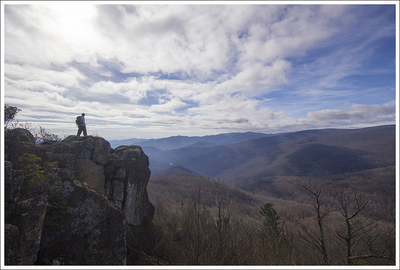
This 6.0 mile hike follows fire roads and trails to the summit of Robertson Mountain – one of Shenandoah’s less visited, more interior peaks. It’s a moderate hike with fantastic views!
The summit of Robertson Mountain is less visited than many peaks in Shenandoah.
Christine Says…
Our traditional Thanksgiving day begins with a hike and ends with homemade pizza and beer. I know it’s not the normal way to celebrate this holiday, but it’s what we’ve done for years now. Eating turkey would just be weird for us! Last year, Skyline Drive was closed for weather, so we had a beautiful short hike along the Appalachian Trail in half a foot of fresh snow. I still remember losing the trail multiple times because branches were so heavily bowed over the path. Thanksgiving of 2015 was quite different! It was so warm and sunny that it felt more like early fall. Even with a brisk breeze, we were able to hike comfortably in t-shirts.
We wanted to hike something new, so we settled on Robertson Mountain. It’s not as well-known or popular as many other Shenandoah trail, but we heard it had nice views of Old Rag and the valley. The hike isn’t listed in any of our hiking guidebooks and most of the online information approaches Robertson Mountain from the Old Rag parking area. That route is known as one of the steepest climbs in the park. We didn’t want to drive all the way around to Weakley Hollow, so we consulted our maps to find a route approaching the summit from Skyline Drive.
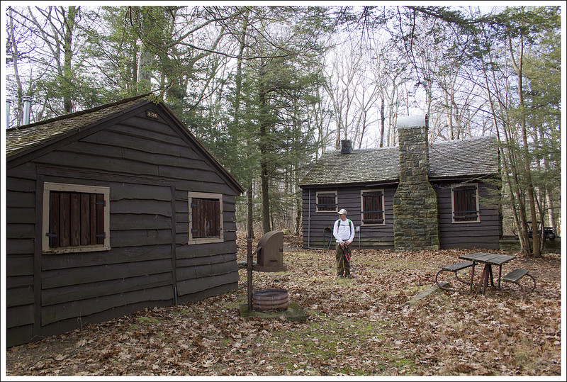
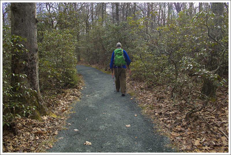
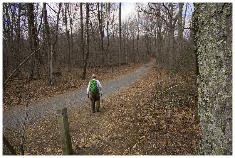
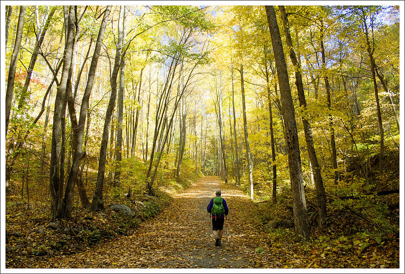
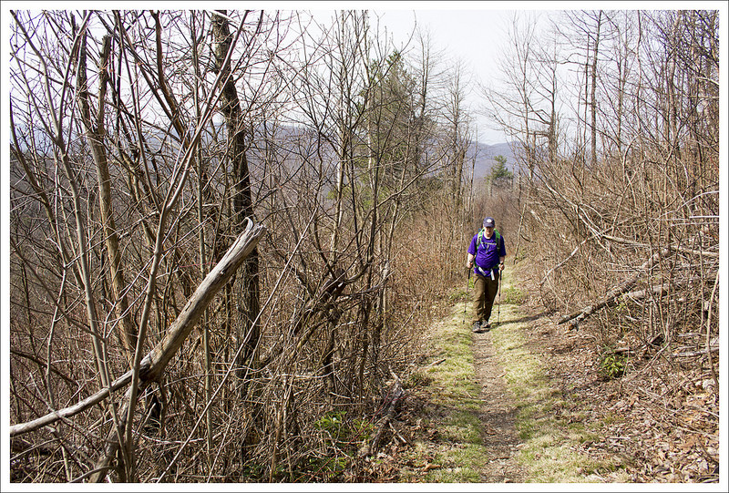
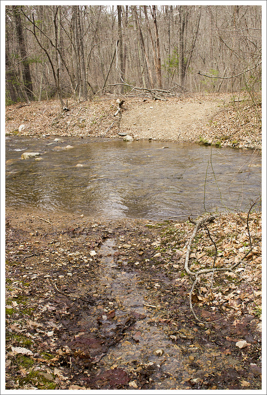
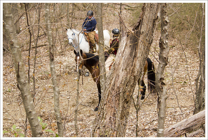
This cluster of buildings is sometimes used for training events or ranger accommodations. It was empty when we visited. Below: The hike started out on the Limberlost Trail; A pretty stream along the way; Most of this hike is walking on a fire road.
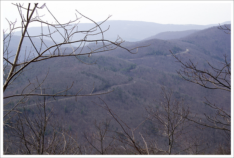
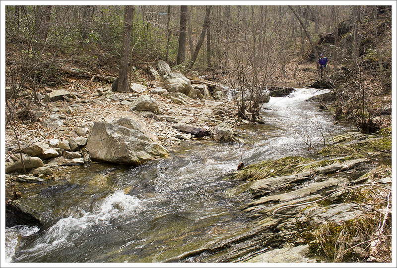
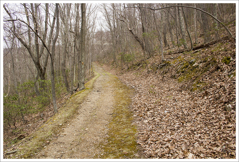
We decided our best option was to park at Limberlost and follow that trail to the junction with the Old Rag fire road. From there, we just followed the Old Rag fire road all the way down to its junction with the Robertson Mountain Trail. At first, the route seemed a little confusing because the fire road and the Big Meadows Horse Trail shared course for a while. Adam will give more specific details about benchmarks and distances in his portion of the post. Most of the walking along the fire road was mundane. We passed a pretty stream early on the route. We also came across a cluster of backcountry cabins. There wasn’t a sign marking them, but apparently they are used for training activities and ranger accommodations. As we descended the fire road, eventually Robertson Mountain came into view. Through the leafless trees, we could see it’s cone-like shape through branches.
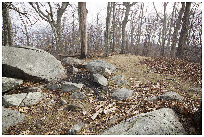
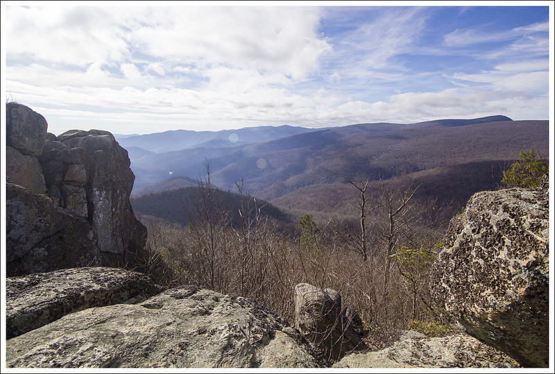
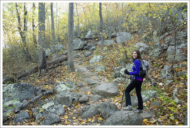
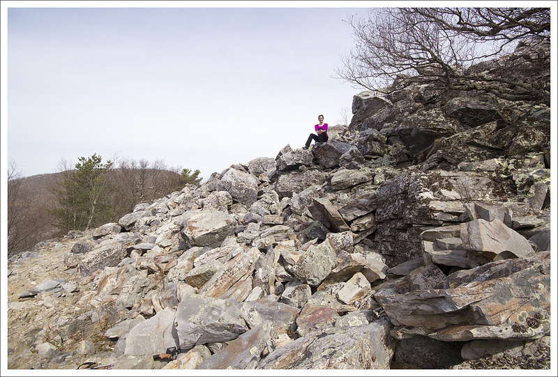
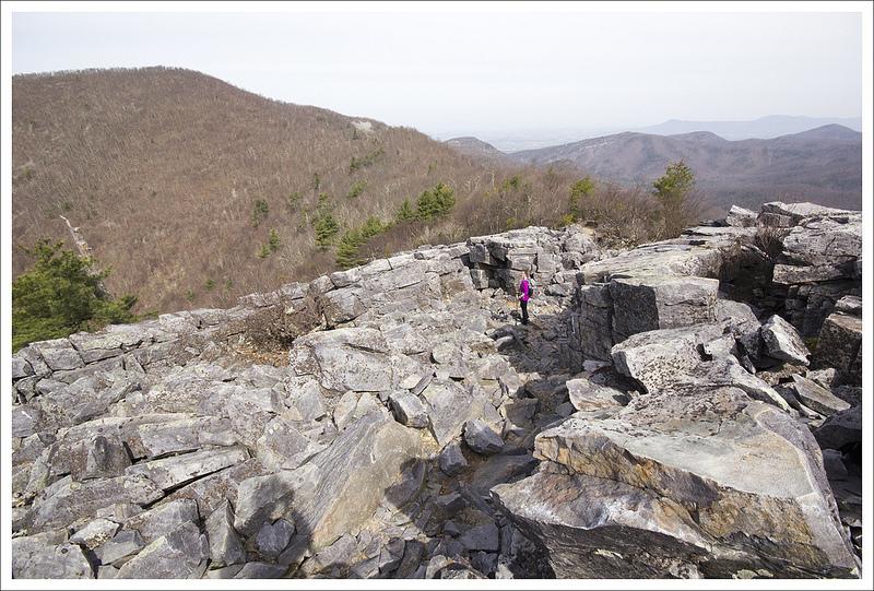
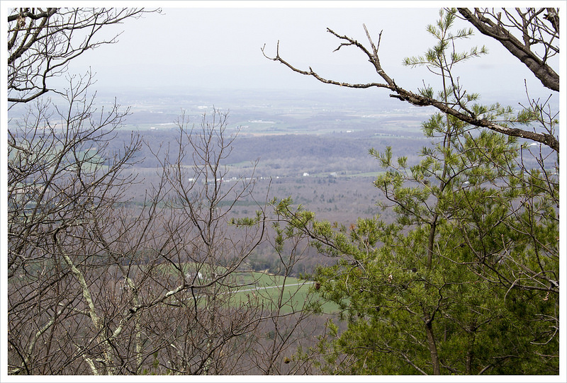
We took a left onto the Robertson Mountain trail. It’s the only ‘real’ section of trail on this hike – the majority is fire road and the graded path of Limberlost. We climbed steadily for about three-quarters of a mile until we reached the top. A side path made it’s way to a rocky outcropping. We had the summit all to ourselves. We enjoyed a light lunch and spectacular views of the mountains. After leaving the summit, we explored a mountain-top campsite. There was definitely enough room for a couple tents, but no water source. Someone had recently put an illegal fire ring in at the site, so we dispersed the rocks before heading back down.
The hike back retraced our steps and was primarily an uphill climb back to Limberlost. If you’re looking for the less steep, easier way to visit Robertson Mountain – this is your route! The approach from Weakley Hollow is about the same total distance, but is a much steeper climb! All in all, this was a pleasant and moderate six mile hike. The route wasn’t very exciting, but the great views more than made up for it. It was the perfect way to spend our Thanksgiving morning.
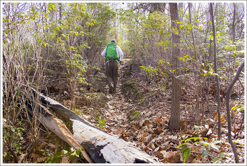
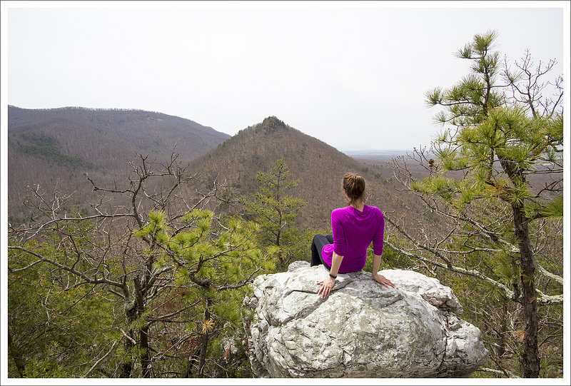
We could see Robertson Mountain looming in the distance. Below: Climbing the Robertson Mountain Trail; A campsite with remnants of an illegal fire near the summit; Arriving at the viewpoint.
Adam Says…
Robertson Mountain is one of those hikes that doesn’t get much publicity, but treats you with a serene view over a mountainous landscape with barely a glimpse of civilization. Because of this, on most days, you will find that you can have this slice of serenity all to yourself.
We started our hike from the Limberlost Trail parking lot. The Limberlost Trail is a small loop, but start heading on the left, clockwise from the parking lot. There are several spurs that lead away from the Limberlost Trail and all of the junctions aren’t easily marked. After going just a couple tenths of a mile, we came to a sign that states “Horse Trail” with arrows to Skyland and Big Meadows (the next trail that comes off the Limberlost Trail Loop is the White Oak Canyon Trail – this is not the trail you want). Take this trail off the Limberlost Trail which is the Old Rag Fire Road. The Old Rag Fire Road starts off mostly flat until the one mile mark. At this point, it will start a steeper downhill. At 1.7 miles, you reach a junction with the Indian Run trail, but stay on the Fire Road. At 2.2 miles, you reach the bottom of the steep decline and reach another junction with the Corbin Hollow Trail. Stay on the Old Rag Fire Road and at 2.3 miles, you will see a small post on the left of the road that marks the beginning of the Robertson Mountain trail.
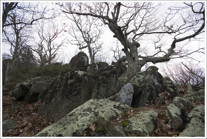
No one else to be seen on the trail on this day! Below: Gnarled trees near the summit; Descending Robertson Mountain; Returning to the junction of the Robertson Mountain Trail and the Fire Road.
Take this trail, which starts off through some thicker underbrush. This trail is much steeper but it is a short climb of .6 miles. The Robertson Mountain trail was very rocky and you think several times that you have reached a false summit, but the trail continues up. At this 2.9 mile marker, there is a small side trail to the right that leads to the summit. From the summit, you will see lots of nice rock outcroppings to enjoy the view. Continue back the way you came to make this about a 6 mile out-and-back hike.
For those that want to bag a few different peaks from this hike, you can reach Old Rag from here also. You could go back down the Robertson Mountain trail and then take a left at the Old Rag Fire Road. Taking this and then joining the Saddle Trail would take another 4 miles to reach the summit of Old Rag. This would give you about a 15-mile hike, so it could make a decent route for an overnight backpacking trip (but there isn’t really a water source) or a very long day hike for those that are very fit. Shenandoah provides a nice, free trail map of this area on their website.
This was a great way to spend a day on a hidden gem of a hike. While the fire road is not overly thrilling to see, it makes for some easy footing. We feel we have done so much of Shenandoah National Park, so we were pleasantly surprised at how this tucked-away hike gave us some of the better views in the park.
Difficulty – 2.5. This was an easy to moderate hike. The climbing was mostly gentle and well-graded.
Trail Conditions – 4. Most of the hike was along accessible trail or fire road. The Robertson Mountain trail was typical Shenandoah single-track.
Views – 4.5. Beautiful and fairly expansive!
Streams/Waterfalls – 2. There was one pretty stream early in the hike.
Wildlife – 3. We saw deer and birds. I am sure some hikers cross paths with bears in this area too. We saw some scat along the fire road.
Ease to Navigate – 4. The junction of Limberlost and the Old Rag Fireroad is not well labeled, but it’s also hard to miss something as wide as a fire road.
Solitude – 4. We saw some people around Limberlost, but nobody after that!
* MapMyHike is not necessarily accurate, as the GPS signal fades in and out – but it still provides some fun and interesting information.
Directions to trailhead: Located in Shenandoah National Park (fees apply). The Limberlost Parking lot is located around Mile Marker 43 on Skyline Drive. Park in this lot. Head left on the Limberlost Trail loop at the end of the parking lot. Coordinates: 38.580055, -78.381473
This is a great alternative to the ‘classic’ ascent of Old Rag. You still get the same stunning summit, but this 5.4 mile route lets you bypass all the road walking, lessens your vertical gain, and skips the famous rock scramble (which can be a good or bad thing depending on how you feel about rock scrambles!)
Adam takes in the view from the Old Rag Summit. Below: Berry Hollow Parking; A golden forest: You reach the Old Rag Day Use Shelter shortly after the fire road junction.
Adam Says…
Old Rag is one of those classic Virginia hikes that most avid hikers in the state want to do at some point. The views are truly spectacular, but the most popular route up Old Rag includes a technical rock scramble with exposed ledges and big drops. Some people might have a fear of heights or not be fit enough to tackle the scramble. The route via Berry Hollow is perfect for people wanting a ‘low key’ route to the peak.
We were on our way to hike White Oak Canyon, but the parking lot was completely full. Not wanting to give up for the day, we consulted our maps and noticed we were right next to Berry Hollow and the alternate route up Old Rag.
We arrived at the small parking lot at Berry Hollow and also found a very full lot. However, after waiting just a few minutes, some hikers came down the trail and said about 3-4 cars would be leaving in the next ten minutes as they were returning from an overnight/sunrise hike. So, we waited and sure enough, several spaces cleared up. I would recommend arriving at the lot early in the morning, because there is only space available for about 12 vehicles.
You begin the hike by making your way past a closed gate. You can see the path marked on the kiosk to the right of the trail. This route starts on the wide Berry Hollow fire road, which goes along the Berry Hollow stream for a while. Hiking the trail during a peak fall day, we were surrounded by brilliant yellows from fallen leaves on the trail and up above. At .8 miles, you reach a junction with the Saddle Trail. Take a right on to the Saddle Trail, which you will take all the way to the summit.
Adam walks the fire road on a perfect fall day. Below: Ascending the Saddle Trail; Large boulders as we climbed; The first viewpoint along the Saddle Trail.
The Saddle Trail is more narrow and rocky, but is mostly a moderate climb. The steepest part of this trail comes between 1.2 and 1.5 miles as you gain about 300 feet of elevation in .3 miles. At 1.4 miles, you will pass by the Old Rag shelter which is only available for day use. At 2.15 miles, the trail gets another steep push to the summit. Continuing up the trail, you will also pass the Byrds Nest Shelter at 2.25 miles, another day use shelter. The trail does start to open up to some views along the way as you’ll pass a couple of rock outcroppings that give you nice views or a good excuse to stop if you need a breather.
You arrive at the base of the summit which is marked by a sign. A short path leads up to the rocky summit. At this point, you can decide how adventurous you want to be at the summit. There are lots of nice ledges to enjoy the views, but some will want to scramble up the boulders to try to get even higher vantage points. Be very careful at this summit, especially if you have kids. People get injured often on this trail, most often at the rock scramble or at the summit.
The wind was incredibly strong on this day at the summit. It is usually quite windy at the summit, but with the colder temperatures, it was freezing at the top. We ate some snacks at the top, trying to shelter us from the wind, but decided quickly to get away from the exposed ledges to try and stay a little warmer.
We headed back the way we came. When we arrived back at our car, the lot was still at capacity, so we did luck out with a spot. After our hike, we went to one of our favorite places to eat, The Barbeque Exchange, in Gordonsville, VA and then hit Horton Vineyard for wine sampling on our way back home.
We were so pleased with this alternate route up Old Rag. I think we will probably use this as our go-to route for future hikes up the mountain.
Christine Says…
I make no secret of the fact that I am not a huge fan of the Old Rag Ridge Trail. Scrambling is not my favorite, but my primary issue is simple trail overuse. I think the park lets too many people hike the trail each day and that the mountain is becoming damaged beyond repair. We’ve hiked Old Rag on days that people are queued up all across the ridge, waiting in line for the people ahead of them to tackle obstacles. I wait in line in daily life enough that I’m simply not willing to wait in line on a mountain trail. It feels wrong! I also don’t prefer the significant amount of road walking necessary to complete the route via Weakley Hollow. In the end, more than half the trail is road walking. That said, I did really enjoy this ascent via Berry Hollow.
It was our anniversary weekend, peak fall color, and a perfect bluebird day to boot. We were sort of nuts to try hiking any of the park’s most popular trails, but somehow we were lucky enough to score a parking spot.
The summit of Old Rag offers spectacular views. Below: Views and crowds!
The walk up Berry Hollow fire road was gorgeous. The sun filtering through the fall leaves made a canopy of warm golden light. The road was carpeted with leaves of every color. We really didn’t see many people at all until we reached the junction of the fire road and the Saddle Trail.
The Saddle Trail is a moderate ascent. There are rock steps and interesting boulder jumbles to admire along the way. Through the trees we could see the rocky summit looming ahead. As we climbed the views became more impressive. After passing the second shelter (Byrds Nest), the trail passes out of tall hardwood forest into stand of stunted, windblown trees and tangled rhododendron.
All we had to do was look up to see all the fall glory! Below: One last view before descending; Trees near the top were already bare from the brisk wind; The shelter closest to the top – Byrds Nest – is also day-use only.
There are a couple nice views from the trail before you reach the actual summit. We took time to enjoy each of them. At the summit, there was a large crowd already congregating. Most people posed for photos and then found places behind the boulders to shelter from the wind. We stayed and enjoyed the summit until it became too crowded.
The way down was quick and easy! We even did our traditional ‘Old Rag Jog’ – it’s basically a slow run to make the fire road terrain pass quicker. On our way out, we stopped by Graves Mountain to get apples, pumpkin, and cider. Then we headed for a big barbecue feast and a wine tasting. It was a perfect fall day and a great way to celebrate our anniversary.
Trail Notes
Distance – 5.4 miles (Check out the stats from Map My Hike)*
Elevation Change – 1725 ft.
Difficulty – 3. This is a solid, moderate hike.
Trail Conditions – 4. The trail was in great shape in most places. There were a few muddy, mucky places between Byrds Nest and the Old Rag Shelter.
Views – 5. Gorgeous views at the top and several nice views along the way.
Streams/Waterfalls – 1. There is one small stream along the fire road.
Wildlife – 2. We didn’t see anything but squirrels, but there is apparently a nuisance bear near the Old Rag shelter.
Ease to Navigate – 4. There is just one well-marked junction.
Solitude –0. It’s Old Rag… expect to see many, many people.
Directions to trailhead: From Madison, VA on Route 29, take US-29 Business Route into Madison, VA. Turn on to VA-231 north. In 5.4 miles, take a slight left on VA-670. Follow this for 3.6 miles and take a slight right on to state route 643/Weakley Hollow Road. Follow this road for about 5 miles, which becomes a gravel, fire road and ends at the parking lot for the trailhead.
* MapMyHike is not necessarily accurate, as the GPS signal fades in and out – but it still provides some fun and interesting information.
This 9.5 mile loop in the southern district of Shenandoah National Park offers vistas, streams and quite a bit of solitude! We think it would make a great short backpacking loop with a beautiful stream-side campsite along Paine Run.
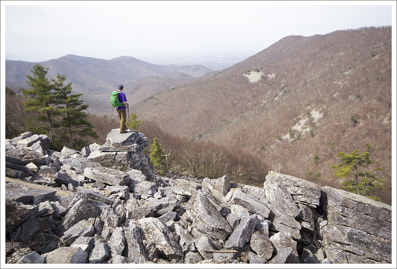
Adam Enjoys Blackrock summit. Below: Adam hikes the Appalachian Trail just north of Blackrock Gap; Christine climbs on the rock pile; Adam spots the spur trail that leads to the Trayfoot Mountain Trail.
Christine Says…
Every weekend this April has provided glorious hiking weather! I’m feeling so grateful that we’ve been able to get out so often and take full advantage of the warm, sunny days. On the Saturday before Easter, we chose to hike the challenging 9.5 mile Trayfoot Mountain – Paine Run loop.
This hike begins at the Blackrock Gap parking area (not to be confused with Blackrock summit parking). From the lot, cross to the eastern side of Skyline Drive and make your way north along the Appalachian Trail. After a couple tenths of a mile, the trail crosses back over the drive and heads steadily uphill for a little over a mile. As you climb, you’ll come to a junction – stay on the white-blazed AT, the turn to the right goes to the Blackrock shelter.
At 1.3 miles into the hike, you’ll reach a cement marker for the Trayfoot Mountain Trail. Do NOT take this turn unless you want to miss the splendor that is Blackrock Summit! Continue another tenth of a mile to the massive jumble of boulders and jagged rocks that makes up this impressive summit viewpoint. We took some time to enjoy the views and climb on the rocks. The views from this spot are probably the best on the entire hike, although there are a couple more nice spots yet to come.
The trail passes through a corridor of rock. Below: Adam passes through the narrow opening; Climbing Trayfoot Mountain; From the ridgeline of Trayfoot there are several openings in the trees that give you views of a distant Skyline Drive.
The Appalachian Trail skirts around the front edge of the summit before coming to a spur trail that leads down to the Trayfoot Mountain trail. The spur descends through a corridor of flat-sided slabs. When spur reaches the junction with the Trayfoot Mountain trail, turn right and follow the trail uphill along an old fire road.
The uphill climb along this section is steady going! Near the top, you’ll pass another marker pointing toward the Furnace Mountain trail. Pass this and continue on the Trayfoot Trail until you reach the cement post marking the summit and high point of your hike. There are no views from this summit, but this starts the beginning of a lovely, easy ridge walk.
The ridge rolls gently along, offering nice views of the Paine Run valley and a distant glimpse of Skyline Drive. The trail eventually begins a long gradual descent to Paine Run. Your last sweeping vista on this hike comes at a pretty outcropping of rocks overlooking pointy Buzzard Rock.
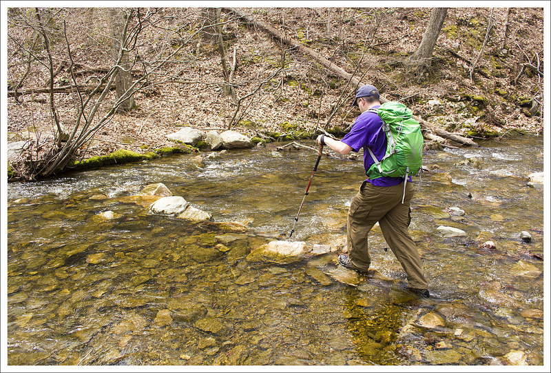
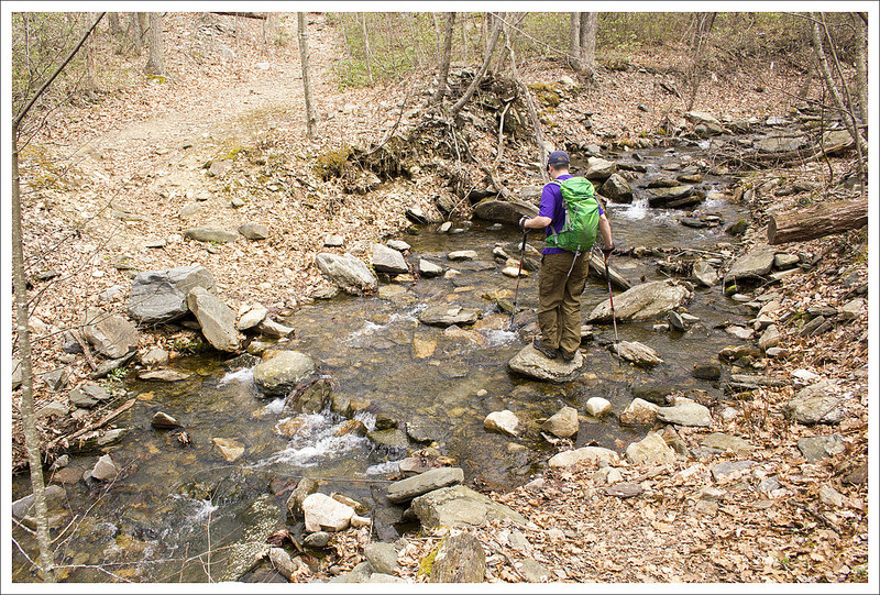
Switchbacks take you swiftly down to Paine Run. Near the first stream crossing, a cement marker points you left onto the yellow-blazed Paine Run Trail, which is essentially an old roadbed. There were several stream crossings on this section of trail. All of them but the second crossing were easy. We found the stream wide and flush with water. Most of the stones people use to cross were underwater. Instead of trying to attempt the rock-hop, we took off our shoes and waded across. Refreshing!
You get a nice view of Buzzard Rock before descending to Paine Run. Below: Some interesting rock formations along the trail; Lunch stop; Glimpses of farm land.
The Paine Run trail is very pleasant for a couple miles – sounds of running water and mountain views through the trees. When we hiked, the stream was flowing with lots of rapids and tiny waterfalls. I imagine it will run low and dry later in the summer. The path climbs so gradually you hardly notice you’re ascending! Eventually, you leave the streamside and head back toward Skyline Drive. After one final sharp switchback, you have one more moderately steep ascent back to your car.
All in all, I was pleasantly surprised with both the views and streams on this route. We had a great time! MapMyHike said this hike is only 9.3 miles, but all other sources put it at 9.7-9.8… so who knows!
Adam Says…
We feel like we have covered so much of Shenandoah National Park on our blog, but it seems there is always another trail or loop that you can try. We talked about a hike to Blackrock summit before in our coverage of an AT segment, but this is a longer loop version that offers a few additional views and a stream to enjoy. Other than the Blackrock summit, you will likely not see a lot of people on this trail. We only saw a few people the entire day, which was a little shocking for a beautiful weekend day that happened to also be a free National Park entry day.
As Christine mentioned, you could skip the Blackrock summit trying to follow the signage, but you don’t want to miss the best part of the hike. When we hiked previously, our route bypassed the spur trail that leads to the Trayfoot Mountain Trail. This spur immediately gives you some additional views and some interesting rocks to scramble around. Most people that are doing an out-and-back just to the summit from the northern approach will miss this area also.
Adam makes a first attempt to cross (with shoes). The second (successful) attempt was barefoot. Below: Adam descending to Paine Run; The shoeless crossing attempt, The trail goes right through the middle of the stream.
One thing that Christine and I both mentioned throughout the day is how this would make for a great overnight backpacking loop. If you choose to do so, I would tackle all of the tough uphill climbing the first night, making your way through the Trayfoot Mountain trail and camp somewhere near Paine Run. This will provide a great water source and there were some nice campsites near the water. The following day, you’ll just have a steady, but not too strenuous hike back uphill to your car.
When we started walking the ridgeline of the Trayfoot Mountain trail, I felt like we stumbled across the best place I’ve ever seen to spot grouse. We encountered three along our walk. A couple of years ago, while hiking in Great Smoky Mountains National Park, we encountered our first grouse on a trail. The beating of its wings created a strange echoing syncopation in our chest which made us both wonder if our heartbeats were going haywire. Seeking sources online, we found it was a common sound for mating grouse. We actually spotted several on this trail and when they took off in flight, we could briefly hear that same noise that perplexed us before. What a relief to actually spot the culprits this time.
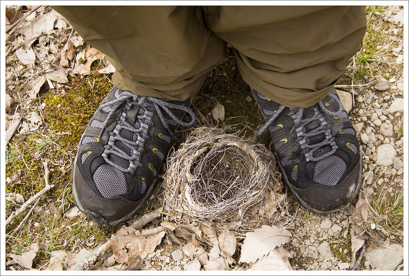
Christine walks the wide, gradually ascending Paine Run Trail. Below: We found several blown-down bird’s nests along the trail; Pretty Paine Run; Another stream crossing.
Further along the Trayfoot Mountain Trail, we climbed up on a few rocks to enjoy our lunch and get some views. I managed to pick some rocks which were not in the least bit contoured to our bodies, which made for an uncomfortable sitting. It reminded me of how fast food chains design their seating area so the chairs are only comfortable for a short amount of time to prevent loitering. We quickly ate and moved on.
Around the 4.0 mile marker, the ridge line ends at a nice rock outcropping which gives you some last views before descending towards Paine Run. Some local families like to park on the western outskirts of the park and hike up to this area for views.
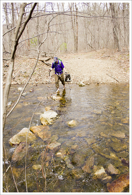
When we reached Paine Run, the water was a little high from the recent rains. There were a few places to rock-hop across. In one spot, we did have to shed our shoes to make our way across. Christine said I looked like a hobbit with my pantlegs pulled up halfway as I crossed. I responded back in my geekiest way, “May the hair on my toes never fall off.” I will say the water was very cold, but it felt so refreshing to my feet. The sensation of the freezing water made me feel as if I had just received a nice massage on my feet. After the refresher, I felt I could hike a lot longer.
The Paine Run Trail is popular with horseback riders. Below: The final ascent to the parking area; We spotted a bear on the drive home; Before we went home, we stopped for famous Shenandoah blackberry ice cream.
The stretch on the uphill Paine Run trail was very gradual. While some people may think this was more of a boring stretch, I enjoyed the views of Paine Run along the side. There were even a few very small waterfalls to enjoy since the water level was high. We also came across a group horseback riding along the trail. All yellow-blazed trails, like the Paine Run trail, in Shenandoah National Park allow horses on the trails. This would be a great trip to take down to the water and let the horses rest and get a drink before returning.
We got back to our car and then heading north along Skyline Drive. Within a few miles, I spotted a young black bear on the side of the road. We were excited to have our first bear sighting of the year. The bear quickly ran away once it knew it was spotted, but we hope we get to see many more this year. We stopped at the Loft Mountain wayside to get our first blackberry milkshake of the year. Appalachian Trail thru-hikers talk about these treats for days in advance of getting to Shenandoah and the hype is worth it. However, their milkshake machine was broken and we had to settle for blackberry ice cream. It was still a just reward for a long hike.
While we realize this hike is longer and not as popular as some of the others in the park, this hike really has some nice gems along the trail. I was pleasantly surprised at what this had to offer!
Difficulty – 3.5. The climbs to Black Rock summit and Trayfoot Mountain can be a little steep, but the climb from Paine Run back to the parking area is very pleasant and gradual. The length adds to the difficulty rating of this hike.
Trail Conditions – 4. The trail was clear and in great shape!
Views – 5. The views from Black Rock summit are spectacular. While the summit of Trayfoot Mountain has no view, there are other nice views from the Trayfoot Mountain trail – especially the outcropping that overlooks Buzzard Rock.
Streams/Waterfalls – 3. Paine Run was surprisingly pretty and broad in the early spring. As we hiked up the Paine Run trail, we had many stream crossings and nice views of the water.
Wildlife – 3. We saw deer and lots of grouse on the trail. We also saw a black bear shortly after leaving the parking area to come home!
Ease to Navigate – 4. There are only a few, well-marked turns on this hike.
Solitude – 4. We saw a few people near the stream that had come in from the western perimeter of the park, a few people on Black Rock Summit, and a trio of women on horses. All-in-all, we enjoyed a lot of solitude for a long stretch of trail on a pretty ‘free park entry’ day!
Directions to trailhead: Located in the Southern Section of Shenandoah National Park. Park at the Blackrock Gap parking lot around MM 87.3. Cross the road and find the cement post for the Appalachian Trail. Take a left, heading north, to start your hike.
* MapMyHike is not necessarily accurate, as the GPS signal fades in and out – but it still provides some fun and interesting information.
We hope you enjoyed our special Great Smoky Mountains Edition! Now we’re back to Virginia! Although… honestly, the heat has kept us mostly off the trail lately.
The 5.5 mile Little Devils Stairs hike climbs through an impressive gorge along Keyser Run and loops back past a family cemetery that pre-dates the park.
it is Adam makes his way past rugged canyon walls on the Little Devils Stairs hike. Below: The parking lot at the end of Keyser Run Rd. provides access to the fire road and the Little Devils Stairs trail; When we hiked in early June, water was still flowing in the stream (but not much); Red columbine bloomed abundantly.
Adam Says…
To try and beat afternoon rain in the forecast, we decided to hike Little Devils Stairs early in the morning. To cut back a little on the distance along fire roads, we decided to start the hike from the perimeter of the park (near Sperryville) rather than from Skyline drive.
The trail begins immediately going into the forest from the parking lot and is a very gradual ascent along Keyser Run. After about .9 miles, the trail then begins to climb more steeply as you are climbing up the “stairs” along the gorge. The climbing can be quite steep, at times requiring you to use your hands to also help balance or pull yourself up. Over the next mile, you gain 1000 feet of elevation on your climb. Along the way up the climb, you will come across several smaller waterfalls and will have to cross over the stream in a few places. At 1.75 miles, the climb tapers off and the trail moves away from the gorge. At 2.1 miles, you reach the junction with the Keyser Run Fire Road. Take a left on this fire road and begin your descent. The road was fairly uneventful, but it is a good place to spot butterflies and you may see a snake sunning itself on a part of the road. At 3.9 miles, the road begins to enter the forest again and you will see some more old-growth hemlocks along the road that create a canopy over the road. At 4.2 miles, you will reach the Bolen family cemetery. Just ahead is the junction with the Hull School Trail, but stay on the fire road veering to the left. At 5.4 miles, you will reach the park boundary and at 5.5 miles, you will return back to your vehicle in the small parking lot.
Adam climbs up the steepest part of the Little Devils Stairs hike. Below: There are many tiny waterfalls along the Little Devils Stairs hike; Christine contemplates the rocky climb through the gorge; Adam makes one of the many stream crossings.
The highlight of this hike is definitely the gorge that was created along this geological fault line that eroded quickly. At one point along the trail, you can see a sheer cliff face of rock. I can easily imagine people rock climbing up this gorge wall with the proper technical gear. I have seen Little Devils Stairs and Big Devils Stairs listed in a book about rock climbing in Virginia, so you may luck out and see some people navigating up to the top.
A sadder note along the trail is the Bolen family cemetery. While we may enjoy the national park that is here, there were many families that were forced to uproot their lives and move out of the area as the government took over the land. The cemetery of the family still stands and was rededicated in 2002.
The largest of the falls was at the very top of the gorge. Below: There are many fallen trees, especially hemlocks in the gorge; We saw a lot of these flowers along the trail; After exiting the gorge, most of the remainder of the trail is along the Keyser Run Fire Road.
Christine Says…
Little Devil Stairs is another hike we’ve had on our list of trails we wanted to add to the website for quite a while. We’ve hiked it before – the last time was probably about a year before we started this website. It’s a decent hike, but I’ll admit it’s not one of my favorites in the park. The section of the hike that passes through the gorge is fun, tough and interesting – but that’s only a little over one mile of the entire five and a half miles. Way more than half of the hike is along a fire road. And if you’ve read our site with any regularity, you know how I feel about fire roads (they’re boring!)
The drive to the trailhead was really pretty. We passed by Luray, over Thornton Gap and down past Sperryville. There were lots of winding country roads, meadow views and meandering stone walls on the way to the parking area. When we got there, we were the only car. I absolutely LOVE having a trail all to myself!
We started off climbing gently uphill through the woods, crossing several spots of dry streambed. The insect activity on this particular day was insane. I alternated walking like a normal person with walking like a crazy person, arms flailing all around my face, trying to bat away the clouds of gnats and midges. Between the bugs, the humidity and the heat – summer hiking can be really tough.
Adam reads headstones in the Bolen Cemetery. Below: The gate leading to the cemetery; A memorial poem from the cemetery’s re-dedication; We saw lots of indian pipes along the hike.
I had been pretty concerned about the dry streambed crossings, but once we reached the gorge, the water flow picked up a bit. Little Devil Stairs is definitely a hike you want to do when there has been a significant amount of recent rain. The primary appeal of the gorge is the constant string of small waterfalls and rapids that pours down the ‘stairs’. When the weather has been wet, Little Devils Stairs is lovely and wild. The sound of running water hemmed in by stone walls constantly surrounds you. However, when the weather has been dry, the hike is nothing but steep uphill through a rugged, overgrown and brushy gorge. The towering rock walls are still impressive, but without running water, something is missing from this hike.
With a thousand feet of elevation gain in just under a mile, the path up can be a real quad-burner if you’re not in decent shape. It’s mostly walking along trail, but there are several sections where you must scramble up over giant stair-like rocks. The top of the gorge is marked by the largest of all the waterfalls along Keyser Run. After you pass the final fall, the trail grade becomes more gentle and passes through pretty, quiet forest. In a short time, you’ll reach the Fourway Junction. People hiking Little Devil Stairs from Skyline Drive will come down the trail at this junction. For us, it was the point where the ‘hike’ ended and the fire road walking began.
We saw lots of butterflies on this hike! Below: I’ve never seen a yellow moth like this one before. I think it’s an Io moth because it had the ‘eye’ marking on it’s wings, though you can’t see them in the photograph; On the drive back through the park we spotted a pair of black bears mid-courtship (this is the male);While eating lunch at Big Meadows we met this cute biker dog.
We considered jogging down the trail to make the distance pass more quickly, but I wanted to keep my camera and telephoto out in case we saw wild flowers, butterflies or bears! The heavy camera kept bouncing on my hipbone, so I had to slow to a walk (I got a huge bruise anyhow). And indeed – there were plenty of butterflies and wildflowers to photograph along the way. We didn’t see a bear on the trail, but we did see one later as we drove back through the park.
The last point of interest along the fire road was the stop at the Bolen Cemetary. It’s a beautiful spot for a final resting place – surrounded by a stone wall and shaded by elegant maple trees planted by the original property owner. It’s one of the more meticulously maintained cemeteries in the park. If you walk amongst the headstones, you can’t help but notice how young most people died. So many babies, children and young adults rest under these markers. When I was researching information about this trail, I came across a wonderful feature article from Blue Ridge Country magazine about the family reunions that still take place at the cemetery. I enjoyed reading all the recollections of Beulah and Mary Bolen about their life in the area before the park existed.
After leaving the cemetery, the remaining distance along the fire road went steeply downhill. We arrived back at our car fairly quickly and headed to Big Meadows to have some lunch in the park. After lunch, the skies opened up and it poured down rain the rest of the day. I’m glad we got a chance to get out before the weather changed!
Trail Notes
Distance – 5.5 miles
Elevation Change – About 1650 feet
Difficulty – 3. The climb up Little Devils Stairs can be strenuous in parts, but the fire road is easy walking.
Trail Conditions – 3. The climb up the stairs is rocky and you do have to cross Keyser Run as the trail criss-crosses over in several places.
Views– 1. From near the top of the gorge, you may get an obstructed view, but nothing spectacular.
Streams/Waterfalls – 3.5. You are walking along Keyser Run through the first couple of miles of the hike. The waterfalls are mostly small, but still nice to see.
Wildlife – 2. There are signs of bear scat in the area, but we didn’t see much wildlife other than a snake along the fire road. You will hear lots of warblers and other birds as you enter the hemlock forest near the end of the hike.
Ease to Navigate – 3.5. The blue blazes for the Little Devils Stairs hike are not as prevalent in some places and may require you to look around for the next one, especially in the fall when leaves cover the trail. Posts at the trail junctions provide some great direction.
Solitude – 3. Except on weekends, I wouldn’t expect to see a lot of people on this trail.
Directions to trailhead: Off of 211 north of Sperryville, take a left on County Road 622/Gidbrown Hollow Road. Follow this road for a few miles and then take a left on County Road 614/Keyser Run Road. At the end of this road, you will reach a small parking lot. The trailhead starts to the right of the parking lot, marked by a concrete post.
This 8.1 mile hike passes an impressive boulder field then climbs along the Gunter Ridge trail for some nice (but obstructed) views.
Adam scrambles around the Marbleyard. Below: The hike begins on the Belfast Trail; Entrance to the National Forest is marked by a placard. The two stone pillars mark an old Boy Scout camp that used to be located in this area. You can still see the footprint of the swimming pool and a few building foundations along the Belfast Trail. The camp was named after Chief Powhatan; Catawba Rhododendron were in bloom everywhere!
Christine Says…
We keep a list of hikes we want to do stuck with a magnet to the side of our refrigerator. The Devil’s Marbleyard hike had been on that list for nearly three years. It kept getting delayed for closer hikes or hikes with better views or taller waterfalls. We finally decided it was time to knock it off the list.
We got up early Sunday morning, grabbed donuts, bagels and coffee en route and made our way down the Blue Ridge Parkway. We got to the trailhead parking area around 10:00 and thankfully found only a couple other cars there. Evidently, cars that overflow the official parking lot are frequently towed. So, if you hike this trail, make sure your car is in the lot or that all four wheels are off the road and not on private property.
The beginning of the trail takes you over Belfast Creek. Below: The bridge over the creek; Adam crossing a small stream early in the hike; All the recent rainy weather made conditions ideal for snails.
After crossing a small bridge over a stream, the trail passes through an old stone gateway that used to mark entry to a Boy Scout camp called ‘Camp Powhatan’. You immediately come to a National Forest/Wilderness placard. At this point, you’re only a little over a mile from the Devil’s Marbleyard. (The sign says one mile, but our GPS and most trail guides seem to say it’s about 1.4 miles to reach the Marbleyard). The trail meanders through the woods, crossing shallow spots on the creek a couple times.
I really enjoyed seeing the blooming azaleas, Catawba rhododendron and mountain laurel. The laurel bloomed so early this year! What I did not enjoy were the locusts! The Blue Ridge Brood of the seventeen-year cicada is currently emerging in our area, and they were everywhere along the Belfast Creek trail. They were screaming overhead in the trees — I likened the sound to the one made by a failing belt tensioner on our SUV a few years ago. It’s a squeal mixed with an undertone of hiss. Not only are the locusts noisy – they’re CREEPY! Sometimes they fly into you. They have red eyes. And worst of all, they leave yellowish-clear, crunchy, empty husks everywhere when they molt. I will be very glad when locust season is over and I can have seventeen years of peace again!
So much stuff was blooming along the trail. Below: Christine checks out the large boulders that make up the Devil’s Marbleyard; Adam climbs back down the Marbleyard to rejoin the trail; A creepy locust husk.
As we came upon the Marbleyard, we crossed paths with the hikers from the two other cars we had seen in the lot. The first was a nice guy from Virginia Beach who was at the tail end of a week-long hiking vacation along the Blue Ridge Parkway. We enjoyed chatting with him and sharing information and tips about favorite hikes. The second was a pair of local kids who warned us of muddy/slippery conditions on the trail ahead. Adam had a little incident there, but I’ll let him share that tale in his portion of the post.
Before proceeding up the trail, we took some time to explore the Marbleyard. Basically, it looks like an immense stone mountain exploded and collapsed into thousands of boulders of every shape and size. If you want to climb to the top of the Marbleyard, you have to do so by scrambling up the rocks. It looks like the trail alongside the Marbleyard reaches the top, but in reality the trail turns slightly away from the boulder field and climbs upward to the Gunter Ridge trail. I imagine most hikers visit the Marbleyard and then head back to their car, making this a short 2.8 out and back. We considered doing this, but since we had already driven so far, we decided to do the full 8.3 mile loop.
After playing on the rocks for a while, we headed along… climbing uphill for a while until we reached the junction of the Belfast trail and the Gunter Ridge trail. At this spot there is a spacious (but dry) campsite.
Christine climbs the steep trail that runs alongside the Marbleyard. Below: The junction of the Belfast and Gunter Ridge trails; Adam spotted a black widow spider along the trail; Christine walks past an especially pretty stand of mountain laurel.
The Gunter Ridge trail was easy walking, but was quite overgrown. Because of the heat and humidity, I had decided to hike in shorts and a t-shirt, so I started to worry about ticks climbing onto my legs from the tall grass. Adam, on the other hand, hiked in long pants tucked into his socks. I’m getting ahead of myself, but guess who came home with six ticks crawling on his clothes – and guess who came home with none crawling on her. I always joke that my husband is a real ‘tick magnet’.
The trail along this section really opens up and provides some nice, but slightly obstructed, views. A forest fire that swept through this area about a decade ago is still very evident. There are no tall trees and charred stumps can be seen peeking up through the brushy vegetation in many places.
After walking along the ridge for a while, you come to a seemingly endless series of switchbacks climbing down the mountain. Eventually you reach a wooden horse gate, and cross out of designated wilderness into standard National Forest. Almost immediately after passing through the gate, you will encounter a stream. We stopped here for lunch. I had been wanting to eat for almost an hour, but this was the first place that really had an opening to sit and eat since the campsite at the junction of the Gunter Ridge and Belfast trails.
A hazy mountain view from the Gunter Ridge Trail. Below: Damage from a forest fire about ten years ago is still very evident; A view of mountains and clouds along the trail.
After lunch, we still had a couple miles of walking along the Glenmont Horse trail. It was easy hiking, but also really boring. It’s the part of the hike where you know you’ve seen all the cool stuff, but you still have several miles of walking along a featureless road/path. It reminded me a lot of all the fire road/paved road walking at the end of the Old Rag hike.
All in all, the hike to Devil’s Marbleyard made for a pleasant day. But, if I were to recommend the hike to others, I’d suggest just hiking to the Marbleyard as an out-and-back. If the rhododendron, laurel and azaleas hadn’t been blooming, I don’t think there was much to see on the rest of the loop.
Adam Says…
It has been about 20 years since I last hiked the Devil’s Marbleyard trail. Those that know me personally or have read this blog for a while know I grew up in Lynchburg. Some of the hikes that are most popular with people around there are Sharp Top, Flat Top, and Devil’s Marbleyard. The first two have great views and are close to Peaks of Otter, a popular picnic area. The last time I did this hike I was with with a group of friends from home. I remember the boulder field seemed so impressive. While there are similar slopes of rock along Furnace Mountain and Hawksbill summit (among others), these boulders are much larger. My friends and I climbed up the boulders from the bottom of the field. One of my friends almost stepped on a rattlesnake that was sunning itself on the rocks. I’m sure a number of rattlesnakes make their home in the cracks between the rocks, so be careful. The climb up to the top takes longer than you would expect and requires a lot of energy to navigate the scramble. Since we planned on hiking a long loop, we opted to just climb around a while on the bottom.
Beautiful mountain laurel along the ridge hike. Below: Stopping to enjoy the mountain laurel; Passing out of the designated wilderness area; Lunch by the stream.
With every interesting geological feature, there seems to be a legend that has been passed down over the years and Devil’s Marbleyard is no different. In the local tale, this area was occupied by Native Americans and the land was supposedly very green and lush. There was a large stone altar at the top of this hill that was used for worship on full-moon nights. A white couple met the Native Americans and they were thought to be spirits since they looked so different than the local tribes. The couple said they were not spirits but they worshiped a higher power. They converted the Native Americans to Christianity. However, the next year brought about a great drought and the Native Americans felt the new God and the missionaries were to be held responsible. They burned the couple alive on the altar. As the flames reached high into the sky, a storm formed. Lightning struck down upon the altar and exploded the rock over the mountainside.
Christine and I talked about this legend on the hike. I guess there can be a few different morals to the story depending on your perspective. From the perspective of the white missionaries, it may be best to not spread your religion to others if you want to stay alive. From the perspective of the Native Americans, it may be to either believe your own gods or keep faith in your new God. It is an interesting thing to think about on this hike, even if there may not be much truth to the origin of the boulder slope.
Walking along the Glenmont Horse Trail gets tedious.
To complete the full loop hike, begin in the parking lot and cross the bridge and take the blue-blazed Belfast Trail. At .2 miles, the trail splits. Bear right to stay on the blue-blazed trail. The trail is a rocky, uphill climb that leads to the Devil’s Marbleyard boulder field at 1.4 miles. Continue up the trail which follows parallel to the right of the boulders up a steep section (which can also be very slippery if there has been recent rain – as I found out with a hard fall onto slick rock). After you near the summit of the boulder field, the steepness of the trail lessens. At 2.5 miles, you reach a junction with the Gunter Ridge Trail and a small campsite. The Gunter Ridge Trail heads off to the left heading down the mountain slightly, but you are mostly following along a ridge line. Eventually, this trail begins to open up to some obstructed but nice views on the ridge. The trail then descends quickly through a series of switchbacks. At 5.8 miles, you will exit the James River Face Wilderness boundary through a gate and cross Little Hellgate Creek. At the 6.0 mile mark, you will reach the orange-blazed Glenwood Horse Trail, a large fire road. Follow this to the left and make your way along this trail that does go slightly uphill until reaching the junction with the Belfast Trail at 7.9 miles. Take a right on the Belfast Trail to reach the parking lot at 8.1 miles.
If you are interested in geocaching, there is one geocache that can be found on the scramble up the boulders at the Devil’s Marbleyard – Devils Marble Yard Cache.
Like Christine, I would probably recommend that if you were coming here to see the best features of the trail, I would just do this as a 2.8 mile out-and-back to the Marbleyard and back. The views from the top of the Gunter Ridge Trail are more obstructed and doesn’t seem necessary when there are many other nice view hikes nearby on the Blue Ridge Parkway.
Trail Notes
Distance – 8.1 miles
Elevation Change – 1510 feet
Difficulty – 3. The climb up past the Marbleyard to the Gunter Ridge trail is steep, but once you gain the ridge it’s most level or downhill. The Glenmont horse trail is wide open and slightly uphill.
Trail Conditions – 3. The trail is in decent shape in most places. It was very slick, steep and muddy climbing alongside the Marbleyard. The Gunter Ridge trail was easy to follow, but very overgrown with tall grasses and brush.
Views– 2. There are plenty of obstructed views on the Gunter Ridge Trail, but nothing spectacular.
Streams/Waterfalls – 2.5. The stream running along the Belfast Trail is small but lovely.
Wildlife – 2. We saw a ton of fence lizards but not much else (unless you want to count the seventeen year locusts)
Ease to Navigate – 3. There are a few turns and trails here are not as well marked as trails in the national park, but if you pay attention, finding your way should be easy.
Solitude – 3 You will likely share the Marbleyard with other hikers, but the rest of the loop does not seem heavily traveled.
Directions to trailhead: From the Blue Ridge Parkway at mile 71, you will see a small road (FSR 35) that is on the western side of the road at a curve. Take this road which leads past the Petites Gap AT parking area. At 4.2 miles, you will see the parking area on the right (just after you start seeing more houses on the road). Make sure you either park in the lot or make sure you park completely off the road or your vehicle may be towed.
This short 2.4 mile loop takes you along the Appalachian Trail, the Neighbor Mountain Trail and the Hull School fire road. The highlight of the loop is a visit to the Byrd’s Nest Day Shelter.
Byrd’s Nest #4 sits in a lovely opening off the Neighbor Mountain trail. Below: Parking is available at the Beahm’s Gap Overlook; the trail begins after crossing the railing; Blooming azaleas along the trail.
Christine Says…
We were supposed to go backpacking, but when we heard terms like ‘flooding rains’, Nor’easter and ‘wash out’, we decided to delay the trip. When Saturday morning dawned, it was sunny and warm and beautiful! I made a trip into town, worked on a photography project in the arboretum, bought a bunch of veggies and strawberries (yay!) at the farmers’ market and got a haircut, figuring that the rain had to be on its way. When I got home, it was still sunny and gorgeous with no sign of the coming deluge. Adam suggested we hop in the car, go for a short hike and then have lunch in the park. It sounded like a great idea to me, so off we went.
We decided on the short Byrd’s Nest #4 loop, starting from the Beahms Gap Overlook. The trail started with a hop over the retaining rail at the overlook – a cement trail marker post will show the spot to cross the rail. The trail goes slightly downhill along a short spur to the Appalachian Trail. Follow the AT north until the junction with the Neighbor Mountain trail. Take a right onto the Neighbor Mountain trail and follow it uphill until you reach a clearing and the Byrd’s Nest shelter. For the return trip, follow the grassy path in front of the shelter downhill. The path quickly widens to the Hull School fire road. After a few tenths of a mile, you’ll come back out on Skyline Drive. Follow the drive south for about a tenth of a mile back to your car.
Adam hikes along a rocky section of the Appalachian Trail.
Although there are no sweeping views or rocky outcroppings, this hike is a lovely leg-stretcher. The Byrd’s Nest shelter is a perfect place to enjoy a picnic lunch. We had planned to relax at the shelter for a while, but when we arrived we found it already occupied by a picnicking couple. Not wanting to infringe on their space, we took a few photos and headed back on the return arm of the hike pretty quickly.
We decided to have lunch at the Big Meadows Wayside. It was packed – more crowded than we’ve ever seen it! They had some new selections on the menu, which was a pleasant surprise. The menu has been pretty much the same for years! I got a grilled chicken sandwich with roasted red peppers, provolone cheese and aioli. It was surprisingly juicy and delicious. You don’t expect amazing food from park concessionaires – but this was actually one of the best grilled chicken sandwiches I’ve ever eaten. Go figure!
It was still beautiful and sunny when we left the park around 2:00 p.m. – but by 4:00 heavy thunderstorms had moved in and it rained pretty much non-stop the next 48 hours. I was glad that we had decided to postpone our backpacking trip.
Adam Says…
I was originally thinking that we would just take a drive on Skyline Drive when I whisked Christine away. But, I decided to bring our Shenandoah National Park Falcon Guide hiking book and had Christine thumb through to find this hike we hadn’t completed yet. We had done the majority of this trail before on our Appalachian Trail hike from Elkwallow to Thornton Gap. The last time we had been on this trail, we saw the post that showed this side trail, but we decided to avoid more hiking. The Falcon Guide book actually mentioned another trail that should have looped back to the AT, but that trail no longer exists (at least the posts have been removed).
A front view of Byrd’s Nest. Below: Adam walking along the Neighbor Mountain trail; A few dark clouds rolled over on the short section of road walking at the end of the hike. They quickly passed and blue skies returned.
The cabin is named for Senator Harry Byrd Sr., who donated four of these shelters for the national park (the other three are at Old Rag, between the Pinnacle and Meadow Spring Trail, and Hawksbill mountains). His name also graces the Visitor’s Center near Big Meadows and he hiked Old Rag annually into his 70s. It appears that the cabin up here must have had a few other buildings or other things nearby since you can see some nearby foundations. I’m not sure if this area once served as someone’s home or if it was an overnight shelter with a spring and a privy. It is listed as a day-use shelter only.
Once we descended from the shelter down the fire road, we both thought we saw a bear dash off into the woods. We saw a black shape and a big crashing through the brush, so we are convinced it was a bear.
The cabin is definitely the highlight of the trail, but we were disappointed that others had taken it completely over to eat lunch. So, we quickly got on our way to not interrupt them. Overall, there are definitely more interesting trails in Shenandoah National Park. But if you want a quick hike with a possible place to eat a packed lunch, this could be one for you.
Trail Notes
Distance – 2.4 miles
Elevation Change –850 feet
Difficulty – 2. There is a substantial amount of uphill climbing, but the overall distance is short.
Trail Conditions – 5. The trail is in excellent shape, like most of the AT through Shenandoah.
Views– 1.5. There is a partially obscured view at the Byrd’s Nest Shelter. It was probably much more panoramic and open when the shelter was originally built.
Streams/Waterfalls –0. There are no streams or waterfalls, but you will pass a spring-fed water source.
Wildlife –3. We heard lots of birds, and *think* we saw a bear.
Ease to Navigate – 2. After leaving the AT and Neighbor Mountain trails, it was all guesswork. Nothing was marked and the description of the trail in our Falcon Guide was inaccurate.
Solitude – 3. This is a fairly popular family hike.
Directions to trailhead: Park at the Beahms Gap Overlook parking lot around mile 28.5 on Skyline Drive. From the lot, you should see a cement post marking the start of the trail on the other side of the log barrier.
We hope you enjoyed our Acadia series… but now it’s time to get back to Virginia hiking. We decided resume our normal posts with an exceedingly well-known mountain – Old Rag. This 8.8 mile loop hike is Shenandoah’s most popular hike. It’s so well-loved and traveled that the official Shenandoah website has a whole section dedicated to hiking this mountain. [View NPS Map for this hike]
Note: Some of the NPS website details (and mileage markers along the actual trail) were a little outdated as of summer 2011, as they refer to the hike distance before the park service closed the upper parking lot in April of 2010.
Large boulders near the summit of Old Rag. Below: Adam walking along the road headed toward the Ridge Trail’s start; Views from the summit of Old Rag; Adam drops down into a narrow passage between the rocks.
Christine Says…
After two and a half years, we’re finally getting around to covering Virginia’s most popular, most well-known hike – Old Rag. I’ll make an outright confession. Old Rag, as beloved as it might be by (seemingly) everyone else, is not my favorite hike. But, when you have a Virginia hiking website, you’re practically obligated to have a write up about this mountain. So, on to the post!
We’d been tossing around the idea of hiking Old Rag for the blog for well over a year. Adam would suggest it and I’d invariably tell him that it was too hot, too cold, possibly wet and slippery, I heard there was ice, my feet hurt, I don’t feel like driving that far, etc. Basically, I floated every excuse in the book to delay the hike. But then I went and did something incredibly stupid and it really blew up in my face! I had a day off work coming up. It was going to be a beautiful August day – crisp and unseasonably cool! I had visions of getting up early, doing a photo shoot in the park, maybe eating some donuts and then taking myself to a matinee movie. But before I could stop myself, I found that I had blurted out “Tomorrow would be a GREAT day to hike Old Rag!” I assumed this was purely hypothetical because Adam had to work. But he immediately responded “Yeah! Let’s go! I’m taking tomorrow off too!” Ugh – I didn’t see that one coming! I don’t like to back out on plans, so the next morning we were up before dawn, snacks stashed and Camelbaks filled.
We got to the parking lot before 8:00 a.m.. Getting to Old Rag early is something I consider to be a necessity. The trail is always crowded – even on weekdays. The Old Rag parking lot is actually my first point of contention with the hike. It used to be if you got up early, you could always get a parking spot in the small upper parking area located right at the trailhead. In April of 2010, a couple years after our last hike up Old Rag (fall of 2008 – see photos), the park service closed the upper lot to all vehicles. Now, all vehicles must park in the lower lot, which is just a shade under a mile from the trailhead. The added mile follows a paved road uphill to the beginning of the Ridge Trail. I’m not going to make any apologies; I just don’t like road walking on outings that are supposed to be hikes.
The first section of rock scramble is just a little sampling of what is ahead. Below: Giant boulders along the trail; Christine climbing up the Ridge Trail; Christine taking in the view; A view of the valley; A dog who has panhandling all figured out!
Once we got to the Ridge Trail, things improved a bit. The trail climbed upward for about two miles. It’s not terribly steep or difficult climbing, but it is steady uphill. There are occasional switchbacks, lots of gigantic boulders along the trail and even some glimpses of views through the trees.
The higher you climb, the better and more open the views become. After the first real panoramic view, you get your first little sample of the extensive rock scrambling you’re about to encounter. The first pass is short, but requires hoisting yourself up through a small opening, then across a flat pancake of rock. At this point, my boot slipped and I almost toppled over backwards. Luckily, I was able to hang on long enough for Adam to give me a hand up.
Shortly after that little scramble, you’ll come to what I think is the nicest view on the hike. Instead of overlooking mountains with a distant peek at Skyline Drive, this viewpoint overlooks the valley below. The vista is dotted with little farms and winding country roads. It’s really pretty! At this point of our hike, we encountered an emaciated, but super-friendly dog. He had a collar but there didn’t seem to be any human to claim him. Dogs are not allowed on Old Rag’s hiking trails, so we figured someone brought a dog up anyhow, and then abandoned him when he could no longer follow along the rock scramble. The dog looked so pitiful and hungry that we ended up sharing some cashews and half a Luna Bar.
The dog followed us along until the scramble began in earnest. He looked sad to see us go, so we decided to report him to park rangers at the end of our hike, in hopes that they could send someone up to retrieve him and lead him back down to the base of the mountain.
After saying goodbye to the dog, we began nearly one-mile of rock scrambling required to reach the summit of Old Rag via the Ridge Trail. Anyone wishing to reach the summit without the scramble can follow the Saddle Trail (accessed by either the Weakley Hollow or Old Rag fire roads). The scramble is the part of this hike that I enjoy most, but also simultaneously fear. I have vertigo, so there are a couple passes that play tricks on my visual and balance centers. Otherwise, the scramble is a lot of fun! It’s almost like a hiking puzzle. You have to look at each obstacle and plan the best strategy for traversing it. The scramble is tough – it’s not so much a cardio challenge as it is a strength challenge. There are lots of places where you’ll rely on both your upper and lower body strength to carry you across the rocks. It’s nice to have at least one hiking buddy to help you along. One particularly steep place, I had to shove Adam up (one hand on each butt cheek) and then he had to tow me up behind him.
Near the beginning of the scramble, you have to drop down into this narrow passage. Below: A variety of obstacles along the rock scramble. Below: Adam shinnies down into the narrow passage pictured above (note the blaze is numbered R22. Each blaze on the scramble is numbered to help rescuers find injured people more quickly); More scenes along the scramble.
The summit of Old Rag is beautiful and decorated with many large and interesting boulders. It’s the perfect place to enjoy a snack while taking in the view. We watched the clouds clearing away, ate cheese and trail mix and watched falcon soaring on the breeze. It may have been a peregrine, as they are known to nest on Old Rag, but we’re really not sure.
After leaving the summit, the hike becomes sort of tedious. Yes, it’s all downhill, and you’ll pass a couple interesting trail shelters (Byrd’s Nest and Old Rag). Both are available for day use only. There is one more decent view. But right after passing the Old Rag Shelter, you’ll reach the Berry Hollow fire road. You’re only on that for a short while, until you meet the Weakley Hollow fire road. You’re on that road for the remainder of the loop until you come back to the paved road at the trailhead. Honestly, everything after the scramble on this hike is just not fun to me – too many miles of featureless road walking. All in all, the Old Rag hike has close to 4.5 miles of road walking (over half the hike). Adam and I were eager to finish up our hike, so we jogged most of the way back along the fire road and paved road.
Adam pretends to balance a giant boulder. Below: More scenes along the scramble.
When we got back to the car, we told the ranger at the check-in station about the skinny dog. She laughed and said “Oh, him! He’s our resident Old Rag beggar!” Apparently the dog belongs to a local family. He likes to take daily hikes to solicit treats from people climbing the mountain. He sure tricked us!
The parking lot had really filled up since we arrived! We were glad to be done, and on out way to get some lunch (fried chicken – yay!).
When I reflect back on hiking Old Rag, and what could be done to improve the experience, I can think of a few things. One idea I think would work well is to issue a finite number of permits per day to hike the mountain. Perhaps limiting numbers on weekends would be enough. I think if they could limit hikers, they could reopen the upper lot and eliminate almost two miles of road walking. Another thought is to limit the number of people allowed per hiking party. So many church youth groups and college clubs hike Old Rag in huge crowds. This causes massive ‘traffic jams’ along the scramble. No fun! I also think that limiting hikers would go along way toward alleviating the trail damage and erosion on Old Rag. The trail is crumbling, lots of rocks on the scramble have been worn to a smooth polish under years’ of boot traffic, and sadly there is garbage everywhere. It’s a trail that would benefit greatly from being enjoyed by fewer people.
That said, I think every lover of the outdoors in Virginia should hike Old Rag at least once! The scramble is truly without compare.
Adam Says…
Well, Christine summed it up nicely describing the pressure that I have been putting on her to tackle Old Rag. We last did this hike together shortly before we started this blog. The logo that we use for the website is actually taken from a photo of Old Rag, so it was a must do. About every year, I put together a list of hikes that we have talked about doing in Virginia and we hang it on our refrigerator. After we finish the hike, we have a ceremonial highlighter that we use to highlight the hikes we’ve finished. For the last few years of printing a new list, Old Rag has been one of the few that has not been highlighted before the latest version is posted. I let Christine do the honors of marking Old Rag off the list – and she was happy to do so.
Adam on the Summit. Below: Summit scenery; Some kind of bird of prey.
I would also agree with Christine that Old Rag is very overused. One thing that makes this hike particularly challenging during the rock scramble is that the rocks are so smooth, you could easily slip. When it has just rained, you know you will have no footing whatsoever. Many of these boulders have no handholds or footholds, so you do have to be creative with how you will get through the scramble. I would recommend that you do this hike with someone else to help you through the scramble. I think Christine especially enjoyed the opportunity of putting both of her hands on my butt and shoving with all of her might. It’s not very often that she gets to do that.
The Old Rag day-use shelter. Below: Adam takes in the last nice view on the way down; The Byrd’s Nest day-use shelter; The crowded Old Rag parking lot.
The hike begins from the parking lot and consists of walking up a paved and then gravel road for about .9 miles until you reach a smaller blocked off gravel lot (with a portable toilet) and a sign for the trailhead to the left. This begins the Ridge Trail. The trail starts off as a gradual ascent through the forest. At about 2.3 miles, you reach the first of several switchbacks. There isn’t a lot of note on the main portion of the trail as you are just walking uphill through the woods, without any notable views. At about 3.2 miles, you reach a nice overlook. As soon as you leave this spot, the rock scrambling will begin. You have about .8 of a mile of rock scrambling until you reach the summit. This path is quite dangerous as you have to navigate down tight crevasses, around boulders open to large drop-offs, and up other boulders with slick surfaces. The summit marker will indicate the end of the tough climbing. There are several places to take in the panoramic views at the top and some of the more adventurous will climb up some of the large boulders at the top. Once you are done taking in the views backtrack to the trail and then take a right on to the Saddle Trail. At about 4 miles you reach, the Byrds Nest Shelter No. 1, a day-use only shelter. Continue down the steep trail and at 4.5 miles, you will reach another day-use Old Rag shelter. Continue down the trail and at 4.9 miles, you reach the junction with the Weakley Hollow fire road. Take a right on this fire road and you have about 3 miles of this fire road to walk down before you reach a few bridges and finally the smaller blocked-off Old Rag gravel lot. Go back the way you came and you should reach your vehicle around 8.8 miles.
I do think we have put a lot of warnings about this hike, but the reason that this hike is likely so popular is due to the challenge and the amazing views. The summit of Old Rag does provide some of the best views in Virginia. Some people even do rock climbing at the top to rappel over the edge and make their way back up. On a clear day, you can see for miles of countryside and layers of mountains. I know most people do put this on their list of must-hikes in Virginia. I recommend to tackle this hike as early in the morning as possible to beat the crowds. If you wait until the middle of the day, you will likely face people-jams as the navigating through the rock scramble takes a while.
For any of those interested in geocaching, there are two geocaches nearby the trail:
I really have to hand it to Christine for confronting her vertigo and facing Old Rag. I told her I wouldn’t bother her again to do the hike since we now officially have it on the blog, but I will probably do it again sometime. I think this hike does have about 1.5 miles of very exciting climbing and wonderful views, but the rest of the hike (especially the way back on the fire roads) seems a little boring and you will look forward to seeing your car in the parking lot after the long hike back. The last time we did this hike was on a fall day at the peak of fall color. If you can find a day like that to tackle this hike, you won’t regret it.
Trail Notes
Distance – 8.8 miles
Elevation Change – about 2600 feet total.
Difficulty – 4. The uphill climbing is gradual and never terribly steep, but the scramble requires good upper and lower body strength.
Trail Conditions – 2. I think the trail is eroded and worn smooth in many places due to years of overuse.
Views– 5. The views are wonderful and include both mountain and valley views.
Wildlife – 3. There have been a fair number of bear sightings on Old Rag. You also have a good chance of seeing birds of prey on the summit.
Ease to Navigate – 4. Follow the signs. This well-traveled trail is well-marked. Distances on the markers are out-of-date and refer to mileage when the upper lot was still open.
Directions to trailhead: From Sperryville, Route 211, turn onto Route 522 and follow it south for .8 mile. Turn right on Route 231, follow 8 miles, turn right onto Route 601 and follow signs to the parking area, approximately 3 miles. From Madison, Route 29 Business, turn onto Route 231 and follow it for 12.8 miles. Turn left onto Route 602.
Follow signs for the parking area. Old Rag parking is approximately 3 miles from the turn onto Route 602.
The Saddleback Mountain Loop is a hike for people that are looking for a convenient day hike of moderate length – about six miles. There aren’t any great views, but it is an enjoyable walk.
Adam walks under a fallen, gnarled tree on the Saddleback Trail.
Adam Says…
Sorry it has been awhile everyone. We’ve had a crazy fall and haven’t been able to get out as much as we had hoped.
We have had a plan this winter to try and do sections of the Appalachian Trail through Shenandoah National Park. We thought we would start with a shuttle trip to cover the section from Swift Run Gap to Lewis Mountain. We made our way up to the Swift Run Gap entrance to Shenandoah Park and talked to the ranger at the gate. He told us that the entire drive was closed, but we could do some day hikes around the area. He said there was snow and ice on the road and they were also worried about more bad weather moving into the area later that night. Boooo! We went back to the car, upset that our plans couldn’t work out the way we wanted. Rather than admitting total defeat, we decided to try a loop hike that included Saddleback Mountain. It was close enough to the entrance gate that we could walk into the park from Route 33.
Skyline Drive Closed for Snow. Below: The trailhead had a small amount of snow; The trees overhead were all bare; We saw a little bit of milkweed still hanging on.
Throughout the hike we got a few glimpses of Skyline Drive through the woods and we never saw any snow. I talked to a friend of mine who is married to a ranger and he said that often they close the road because they don’t want to have people get trapped up there. Then, the rangers have to deal with them, since they typically close during hunting season at 5PM. I also found out they send one ranger north to inspect the Central section and one ranger drives up from Waynesboro to view the Southern section. We found out later that the Southern section ended up remaining open all day, so we could have done a different hike. Oh well, at least we were able to cover something we hadn’t done yet for the blog.
The hike starts where the Appalachian Trail crosses the road at the border between the Southern and Central Districts of Shenandoah National Park. Heading north up the white-blazed trail, the trail ascends steadily. After a few tenths of a mile, you will see an unmarked path to the right that leads to an old family cemetery. It was nice to pay some respects to the families that lived and died here on the mountain. Continuing back on the AT, the trail continued to slowly ascend. At 1.4 miles, you reach a junction with the blue-blazed Saddleback Mountain Trail. Take a right on this trail to make this hike a loop. The Saddleback Mountain Trail goes around the mountain, which was a nice break from climbing uphill. We saw a few nice icy formations and some heavier patches of snow on this shadowy side of the mountain. At 2.6 miles, you will come to a PATC maintenance hut. These huts are scattered throughout the park that serve as places where PATC volunteers can have access to some tools to help repair sections of the trail. There is an open outhouse here and a spring nearby, but we found that the spring was mostly dry. We continued past the PATC maintenance hut for .2 miles on a fire road until we met the junction with the AT. Head south on the AT and you will have 2.7 miles until you reach the original trailhead. As I mentioned before, the Saddleback Mountain goes around the mountain, so when you start the trail you will again be heading uphill until you reach the summit. The summit was not marked, but it was nice to have a downhill trip back to the car.
The shady side of the mountain had a little snow. Below: We took a short side trail to take a look at an old cemetery; Even though there was a little snow on the ground, the morning temps were well above freezing; We saw some recent bear scat and scratches along the trail.
On our way back downhill, we ran into two hikers that were there hoping to catch up to the Valley Hikers group that were evidently doing that hike to South River Falls. They got a late start but said there was a note on a car telling them where they went. We talked to the couple for a while before parting ways. When I got back home, I checked my email and it looks like the Valley Hikers changed their itinerary completely and were not doing the South River Falls after all. I hope the couple didn’t get too discouraged on their trip. Valley Hikers is a great group to join if you are interested in meeting up with some other people in the Shenandoah Valley that enjoy hiking. Members are of all skill levels and they do a good variety of hikes and an occasional backpacking trip. I do belong to the group, but I have yet to meet up with them to do a hike.
When Skyline Drive is open, you can also do a shorter version of the Saddleback trail, starting from the South River Falls picnic area. From that direction, you would have just a few tenths of a mile of an uphill hike to the summit area.
I’m glad we were able to get out and do a hike after our hiatus. Even though this trail doesn’t have a lot of great views, it is a nice walk in the woods and it was good to get some exercise outdoors on a cool winter day.
Christine Says…
With our original plans foiled, we sat in the car for a few minutes and deliberated our options – go home or figure out an alternate hike route that allowed us to walk into the park from outside the pay station. I’m really glad we decided to go for the latter, because the hike (while rather uneventful) turned out to be a pleasant way to spend the morning. It was great to get back out on the trail after a month of sloth (the flu and three weekends of art shows severely limit the ability to hike!)
PATC Maintenance Building. Below: Adam checks out the map at the first trail intersection; Someone left pennies on top of each of the cement trail marker posts; We saw some pawprints in the snow – maybe a fox or bobcat – they were too smudged to determine for sure.
As we started up the Appalachian Trail, I couldn’t help but remember that this was the exact spot we met our friends from The Traveling Circus back in May. The trail looks pretty different now than it did back then – bare trees and fallen leaves instead of a lush tunnel of green. While the woods might be prettier in the spring, summer and fall, there is still something I really enjoy about winter hiking. I like the lack of bugs, the fact that I don’t get sweaty, the solitude and the glimpses of views through the trees that you miss the rest of the year.
A few tenths of a mile up the trail, we took a short spur to take a look at an old cemetery. Headstones we saw dated back to the turn of the twentieth century. Many of the people buried here lived in the park throughout the 1800’s up until they were forcibly removed in the early 1900’s by the US Government. I think there were many older unmarked graves as well, but we took a few minutes to read each of the headstones still left standing.
After leaving the cemetery, the trail climbed gently, but endlessly, uphill to the junction of the Saddleback Mountain Trail. There really wasn’t anything remarkable about the trail to this point – no amazing scenery, just the occasional peek through the trees at the valley and Skyline Drive below. Adam and I laughed at how bare of the snow the drive was every time it came into view. We really don’t understand why it was closed at all.
We turned onto the Saddleback Trail and enjoyed a relatively flat walk skirting around the shoulder of the mountain. Near the end of the trail, we passed a PATC maintenance cabin and a pit toilet.
We stopped to rest a few minutes. I noticed a thermometer on the hearth outside the cabin and saw that it read 40 degrees – pretty balmy for a winter hike! The morning we hiked, a bit of a southerly air flow arrived. The warmer air came in aloft, creating the rare phenomenon that it was much warmer in the mountains than it was down in the valley.
From the PATC cabin, we passed the South River spring (a boxed spring intended as a water supply) and headed up a short fire road to meet back up with the Appalachian Trail. We turned south, and walked along the AT, climbing up to the summit of Saddleback Mountain. The summit of Saddleback is covered with trees and does not offer a view.
After crossing the summit, the hike was an easy, all-downhill stroll back to the car. Even though we didn’t get to hike the route we originally planned, this Saddleback loop made a great substitute and we had a fun morning.
Difficulty – 2 There is some steady uphill, but it is manageable.
Trail Conditions – 3.5. Since most is on the AT, the trail is very well-maintained, but rocky and steep in spots.
Views – 1. We only had a few views through the trees, that I’m sure would not be there when leaves are on the trees.
Waterfalls/streams – 1. Two springs near the shelter.
Wildlife –3.5. We did see deer and heard the echoing sounds of a pileated woodpecker. There was also fresh bear scat in the area and possible tracks in the snow.
Ease to Navigate –4. This is fairly easy to follow if you read the concrete posts at the junctions.
Solitude –4. You may see some hikers on the AT due to the proximity to the South River picnic area.
* MapMyHike is not necessarily accurate, as the GPS signal fades in and out – but it still provides some fun and interesting information.
Directions to trailhead: Once you go through the Swift Run Gap entrance station, park your car across the street from the stop sign. The Appalachian Trail sign is straight ahead and head north.
This 3-mile hike leads to the old Snead Farm. It’s one of the few hikes in the park that really shows off what life at the turn of the twentieth century must have been like for the people who made their homes where the park now stands.
The barn at the old Snead Farm is still in good shape. Most of the other structures are gone, only foundations left. Below: There is a view from the fire road before you follow the final fork to the farm.
Christine Says…
The walk to Snead Farm is really easy and perfect for families. Much of the trail is level and follows a fire road. There are a couple of route options, too. If you start from the visitor’s center, you’ll walk .8 miles on the Dickey Ridge trail before reaching Snead Farm Road. This ends up making a three-mile route, and is the route we followed. You can also start from Skyline Drive, directly on the Snead Farm road. This cuts the route to a mere 1.4 mile out-and-back. Just be sure to follow the correct forks in the road, or you’ll find yourself on a walk to nowhere (like we did… more about that later). Whatever route you choose, the going is easy and relatively level.
As far as I know, Snead Farm has the only remaining barn left standing in the park. In fact, it’s one of the few non-park structures of any kind left standing within the boundaries. The doors are barred closed, so you can’t go inside – but you can peek through windows and gaps in the doors to see the old hayloft up top and animal stalls on the lower level.
Behind a tangle of vines, you can still climb down into the root cellar located behind the barn. The cellar is deep and lined with sturdy shelves, which undoubtedly held stores of food for the farm. The main house’s foundation and several sets of stairs still stand slightly uphill from the barn. The boxwoods that stood on either side of the front door are still there. They have grown tall and wild! The cistern is still there as well. The farm was occupied until the early 1950’s, so the site doesn’t feel as old as some other places in the park, like Pocosin Mission.
Adam Says…
Our hike to Snead Farm ended up being longer than we were expecting. We were using our Falcon Guide Shenandoah National Park book as a guideline and there was misleading information in the book. I’ll try to set things straight with our own directions. From the Dickey Ridge Visitor Center, cross Skyline Drive and walk to the flagpole. Take a right at the plaque with hike information. In .2 miles, you will come to the intersection with the Dickey Ridge Trail. Take a right here and proceed for about .3 miles until you reach a fire road (Snead Farm Road). Take a left on the fire road. In another .2 miles, you will reach a fork on the trail. Stay to the left. In another short distance, you will come to another fork where you will see a concrete post. Go to the right, heading uphill. You will continue this trail for about .5 miles until you reach Snead Farm. You will begin to see the barn through the trees.
We did misinterpret the information in the book since it told us to take a left at the last fork. Since we were going a different way than the book, we ended up second-guessing ourselves. When we thought we had gone far enough, we decided to turn around and take a different fork. When the other fork came to a dead-end at a utility building, we realized we had been going the right way. We went back the way we came, took the correct fork, and made our way to the farm. We ended up adding only an extra mile to our hike, but after doing a couple of other hikes that day, we weren’t in the mood for more miles.
The Snead Farm Fire Road is pleasant walking. Below: The old root cellar is still standing; Another view of the barn.
Christine and I marveled at how well-maintained the barn looks. Since it was abandoned in the 50s, it is clear that the park service has kept up with maintaining the barn and even painting it. I wonder if this will be a permanent part of the hike or if the park service will one day let this building fall prey to the elements and the woods.
Overall, this hike was a decent leg-stretcher and a good family hike.
Trail Notes
Distance – 3 miles
Elevation Change – 300 feet
Difficulty – 1.5 An easy walk down a mostly level trail.
Trail Conditions –3.5. Half of the trail followed the Dickey Ridge trail which was well-maintained and the rest is on fire roads.
Views – 1.5 Some views are seen from the final fork to get to Snead Farm.
Waterfalls/streams –0. Non-existent.
Wildlife –2. You may run into some of the usual park animals like deer and birds.
Ease to Navigate – 2.5. The turns did us wrong, so we’re marking it down.
Solitude – 2.5. This is a popular hike due to the proximity to the Northern entrance to Shenandoah National Park and the short distance.
Directions to trailhead: Follow Skyline Drive to the Dickey Ridge Visitors Center (around mile marker 4.6) Park at the visitors center. The trail begins on the east side of the drive, across from the center.
The hike to Lands Run Falls is a fairly easy 1.6 mile walk down an old park road. The waterfall is not terribly large or impressive, but it’s definitely worth a look if you’re in the mood for a short leg-stretcher.
Adam sits alongside Lands Run Falls. The falls were still a little on the low side despite five inches of recent rain.
Christine Says…
We planned to do a long hike on Saturday, but Adam was having knee trouble. Instead, we waited until Sunday and decided to try doing a few short, gentle hikes in the north district of Shenandoah National Park. It’s been several years since I ventured as far north in the park as Lands Run Falls, so it was a nice change of pace.
The walk to the waterfall stays on a wide gravel road the entire time, so the footing is easy and there is absolutely no place you can possibly take a wrong turn. The only place you might go wrong is by hiking across the top of the waterfall and missing it completely. The falls aren’t marked and they’re really not visible from the trail. You’ll know you’ve reached the falls when you pass over a small stream and culvert. You can also follow the sounds of falling water!
To get a good look at the falls, you’ll need to follow a worn path through the woods down into the ravine. It’s a fairly well-worn path, and the rocks in the ravine sort of form big steps. Be careful on the rocks immediately around the waterfall. They’re very slick and covered with moss and algae.
The last time I visited Lands Run Falls it was winter and there had been quite a bit more rain.
If you hit Lands Run Falls when there has been lots of rain, you’ll be treated to a pretty waterfall with three small, but distinct drops. The first drop of about 20 feet is the most accessible and the most photogenic. The other two drops are mostly obscured by blow-downs and underbrush. If the weather has been dry, Lands Run Falls probably is not worth your time. It frequently dries up completely in the summer.
In Henry Heatwole’s well-known Guide to Shenandoah National Park and Skyline Drive, he stated “This [Lands Run Falls] is an unrewarding experience for most people… This is for the very few hikers who are willing to go to a lot of trouble to find solitude beside a pool on a mountain stream.”
I wouldn’t characterize Lands Run Falls quite so grimly. I mean, it’s not spectacular – but it is definitely worth seeing if the water flow has been nice.
Adam Says…
We started off with this as our first of three short hikes for the day. I was battling some knee issues and Christine thought we should turn around because I was limping the first few steps. I felt I could make it though and luckily my knee felt better on the trip back up from the falls.
You descend 310 feet during this walk down the fire road. While it doesn’t seem quite as noticeable on the way down, you will feel the elevation change on the way back up. Most people should be able to do this hike, but you may need to take your time if the steepness gets to you.
Once you reach the area of the falls, to get the views that we did, you do need to climb down a steep section off the trail that can be slippery. I was able to do it on a bad knee, but you do have to watch your feet carefully. The fire road continues further for another 1.4 miles past the falls, but that only leads to a park boundary and there is nothing of interest to see.
The day was quite brisk with temperatures in the upper 40s. I initially wished that I had brought a fleece along, but once the blood got pumping I was fine in my T-shirt and shorts. The leaves were just starting to turn color – I think we’re still two weeks before peak season on Skyline Drive and higher elevations.
The Lands Run Fire Road descends about 300 vertical feet over .6 of a mile to the falls.
The trail was a nice quick view to a waterfall. I believe it is a somewhat popular trail, but that is largely due to the number of people that are driving down from Northern Virginia and are looking for a close waterfall hike. The falls themselves are pretty but they are not as impressive as many others in the park.
Trail Notes
Distance – 1.6 miles out and back
Elevation Change – Around 300 feet
Difficulty – 2. Relatively easy, but definitely uphill on the return trip
Trail Conditions – 4.5 The trail is a well-maintained fire road
Views – 0. The trail stays in the woods and does not offer any panoramic views
Waterfalls/streams –3. Lands Run Falls is small but pretty. It does dry up when there hasn’t been much rain
Wildlife – 2. You’ll likely see the usual park specimens along this trail – birds, squirrels and deer
Ease to Navigate – 4. The fire road doesn’t have any turns. Be careful not to miss the falls – you walk over a small stream and the waterfall cascades below the trail.
Solitude – 3. We saw a couple groups, but for a beautiful fall day, the traffic was light.
Directions to trailhead: Follow Skyline Drive to mile marker 9.2. Park in the lot on the west side of the drive. The hike starts at the south end of the lot.