NOTE: Parking at Edith Gap was greatly restricted starting in fall 2020. If you attempt to park there, be sure to pay attention to the the new ‘No Parking, Tow Away’ signs. Unless you are very certain you are legally parked, we suggest following the updated route outlined below, starting from the horse trailer parking area for the Stephens Trail about a mile lower on the mountain.
Kennedy Peak is an beautiful seven-mile out-and-back hike in the Lee District of George Washington National Forest. It gives hikers gorgeous views of the bends in the Shenandoah River.
The view from atop the Kennedy Peak Tower
Christine Says…
I love this hike. We’ve hiked it in winter and fall before, but this was the first time we’ve hiked it in the spring. Sunday afternoon was the kind of day that is custom made for hiking. It was dry, sunny, breezy and in the low 70’s. The trail was lined with brilliant, pink rhododendrons. All the trees were covered with new, spring green leaves and/or blossoms. Butterflies were fluttering all around the trail, taking pauses on the blooming trees and wildflowers. It was, in a word, idyllic.
Box Turtle, Swallowtail on Rhododendron, Indigo Bunting
We began in the Stephens Trail/horse trailer parking area on VA675. The Stephens Trail departs from the back of the parking area. You should look for the orange-blazed Massanutten Trail at the head of the parking lot. The trail climbs moderately uphill for .9 miles. At the top of the climb, you’ll exit onto VA675 at Edith Gap (the old parking area). On the road, take a sharp left, staying on the orange-blazed Massanutten Trail.
Hiking uphill along the Massanutten Trail, headed to Edith Gap.
The part of the trail starts off as a wide, almost road-like track. This part of the hike is extremely easy – climbing just a couple hundred feet over the next 1.75 miles.
At around mile 2.65, the trail takes a sharp, hairpin turn and begins to climb more steeply over increasingly rocky terrain. At this sharp switchback, you may be tempted to continue straight along a visible path, but be careful to make the turn and follow the orange blazes uphill. This slightly tricky misdirection has been blocked off by logs and rocks, but enough people have missed the turn that the false path remains well-trodden. We once followed it out of curiosity and it doesn’t lead anywhere. It eventually fades out into the forest.
Don’t miss this switchback!
After the switchback, the trail continues uphill for another half mile. There is a small outcropping on the left with a obstructed views and a tiny campsite (room for a hammock or a one-person tent). After you pass this spot, continue a couple tenths of a mile to the junction with the Stephens Trail. (Note: If you want to make a longer day, adding about two more miles to your route, you can descend back to your car via the Stephens Trail. We’ve heard it’s not very scenic and is often muddy and manure-covered, so we chose the out-and-back.)
At the junction, you will turn right and follow the signs toward the fire tower. The tower is a little over .2 miles from the junction. The last stretch to the fire tower is steep and rocky. It’s really the only challenging section of the hike. The tower is a sturdy one-story structure with great views looking into the valley and Shenandoah National Park beyond.
When we got to the summit, we had the observation tower all to ourselves. We watched birds in the treetops, spotted lizards climbing around on the rocks and took in a fantastic view of the Shenandoah River and the Page Valley. It was one of the least hazy days we’ve had in a while, so we could clearly see Shenandoah National Park from this summit. Lots of vultures were soaring overhead, and even though they’re kind of creepy, they were casting cool bird-shaped shadows onto the mountain top. I always like it when they do that.
The trail is pretty rocky for the last half mile.
Sunday was the only time we’ve hiked Kennedy Peak in the afternoon. Adam and I tend to be morning hikers — it helps us avoid the crowds. But, the light is definitely prettier in the afternoon on Kennedy Peak. If you hike it in the morning, the sun shines right in your face at the summit. That makes it hard to appreciate the great view, and makes it nearly impossible to get any decent photos.
Adam Says…
This is one of our favorite hikes. This hike is not very steep and the payoff is wonderful. This is a good multi-use trail, since there are campsites and good footing for horses. There are a couple of campsites at the beginning of the trail, near the road. The nicest campsites are further up the trail. Once you are on the fire tower trail, you will find a couple of places where you can have some nice lookouts over the valley and the Shenandoah River. From some points, you can see several bends in the River. Once you reach the top, there is an observation tower where you can chill for a while before heading back down.
Views from the other side of the tower.
If you are into geocaching, look for the Presidential Peek Cache! After your hike, be sure to visit Camp Roosevelt – a great spot for a picnic.
Trail Notes
Distance – 7 miles round-trip
Elevation Change – 1300′
Difficulty – 3. The trail for the first miles is moderately uphill. The next two miles are either flat or gentle rolling terrain. The last third of a mile up to the observation tower is steeper, but very manageable.
Trail Conditions – 3. The trail is well-maintained, but there are a lot of rocks, so you’ll need to watch where you step.
Views – 4. You can really see some nice views close to the top.
Waterfalls/streams – 0. This trail is dry as a bone.
Wildlife – 2. Seems like a great bird-watching area. We saw an Indigo Bunting, Goldfinch, Wood Thrush, and Eastern Towhee. Also spotted a box turtle and Eastern fence lizard. We saw a bear when we hiked it in spring 2017.
Ease to Navigate – 4. Other than the one tricky spot at the switchback, it would be nearly impossible to get lost.
Solitude – 2. This trail is well-loved by a lot of locals, but the bulk of area tourists stick to the trails in Shenandoah National Park. You may see a few groups of hikers along the way, but it’s rarely a crowded trail.
All Photos
Directions to trailhead: The parking lot is the Stephens Trailhead on VA675. Coordinates: 38.72795, -78.51536
This 9.5 mile loop in the southern district of Shenandoah National Park offers vistas, streams and quite a bit of solitude! We think it would make a great short backpacking loop with a beautiful stream-side campsite along Paine Run.
Adam Enjoys Blackrock summit. Below: Adam hikes the Appalachian Trail just north of Blackrock Gap; Christine climbs on the rock pile; Adam spots the spur trail that leads to the Trayfoot Mountain Trail.
Christine Says…
Every weekend this April has provided glorious hiking weather! I’m feeling so grateful that we’ve been able to get out so often and take full advantage of the warm, sunny days. On the Saturday before Easter, we chose to hike the challenging 9.5 mile Trayfoot Mountain – Paine Run loop.
This hike begins at the Blackrock Gap parking area (not to be confused with Blackrock summit parking). From the lot, cross to the eastern side of Skyline Drive and make your way north along the Appalachian Trail. After a couple tenths of a mile, the trail crosses back over the drive and heads steadily uphill for a little over a mile. As you climb, you’ll come to a junction – stay on the white-blazed AT, the turn to the right goes to the Blackrock shelter.
At 1.3 miles into the hike, you’ll reach a cement marker for the Trayfoot Mountain Trail. Do NOT take this turn unless you want to miss the splendor that is Blackrock Summit! Continue another tenth of a mile to the massive jumble of boulders and jagged rocks that makes up this impressive summit viewpoint. We took some time to enjoy the views and climb on the rocks. The views from this spot are probably the best on the entire hike, although there are a couple more nice spots yet to come.
The trail passes through a corridor of rock. Below: Adam passes through the narrow opening; Climbing Trayfoot Mountain; From the ridgeline of Trayfoot there are several openings in the trees that give you views of a distant Skyline Drive.
The Appalachian Trail skirts around the front edge of the summit before coming to a spur trail that leads down to the Trayfoot Mountain trail. The spur descends through a corridor of flat-sided slabs. When spur reaches the junction with the Trayfoot Mountain trail, turn right and follow the trail uphill along an old fire road.
The uphill climb along this section is steady going! Near the top, you’ll pass another marker pointing toward the Furnace Mountain trail. Pass this and continue on the Trayfoot Trail until you reach the cement post marking the summit and high point of your hike. There are no views from this summit, but this starts the beginning of a lovely, easy ridge walk.
The ridge rolls gently along, offering nice views of the Paine Run valley and a distant glimpse of Skyline Drive. The trail eventually begins a long gradual descent to Paine Run. Your last sweeping vista on this hike comes at a pretty outcropping of rocks overlooking pointy Buzzard Rock.
Switchbacks take you swiftly down to Paine Run. Near the first stream crossing, a cement marker points you left onto the yellow-blazed Paine Run Trail, which is essentially an old roadbed. There were several stream crossings on this section of trail. All of them but the second crossing were easy. We found the stream wide and flush with water. Most of the stones people use to cross were underwater. Instead of trying to attempt the rock-hop, we took off our shoes and waded across. Refreshing!
You get a nice view of Buzzard Rock before descending to Paine Run. Below: Some interesting rock formations along the trail; Lunch stop; Glimpses of farm land.
The Paine Run trail is very pleasant for a couple miles – sounds of running water and mountain views through the trees. When we hiked, the stream was flowing with lots of rapids and tiny waterfalls. I imagine it will run low and dry later in the summer. The path climbs so gradually you hardly notice you’re ascending! Eventually, you leave the streamside and head back toward Skyline Drive. After one final sharp switchback, you have one more moderately steep ascent back to your car.
All in all, I was pleasantly surprised with both the views and streams on this route. We had a great time! MapMyHike said this hike is only 9.3 miles, but all other sources put it at 9.7-9.8… so who knows!
Adam Says…
We feel like we have covered so much of Shenandoah National Park on our blog, but it seems there is always another trail or loop that you can try. We talked about a hike to Blackrock summit before in our coverage of an AT segment, but this is a longer loop version that offers a few additional views and a stream to enjoy. Other than the Blackrock summit, you will likely not see a lot of people on this trail. We only saw a few people the entire day, which was a little shocking for a beautiful weekend day that happened to also be a free National Park entry day.
As Christine mentioned, you could skip the Blackrock summit trying to follow the signage, but you don’t want to miss the best part of the hike. When we hiked previously, our route bypassed the spur trail that leads to the Trayfoot Mountain Trail. This spur immediately gives you some additional views and some interesting rocks to scramble around. Most people that are doing an out-and-back just to the summit from the northern approach will miss this area also.
Adam makes a first attempt to cross (with shoes). The second (successful) attempt was barefoot. Below: Adam descending to Paine Run; The shoeless crossing attempt, The trail goes right through the middle of the stream.
One thing that Christine and I both mentioned throughout the day is how this would make for a great overnight backpacking loop. If you choose to do so, I would tackle all of the tough uphill climbing the first night, making your way through the Trayfoot Mountain trail and camp somewhere near Paine Run. This will provide a great water source and there were some nice campsites near the water. The following day, you’ll just have a steady, but not too strenuous hike back uphill to your car.
When we started walking the ridgeline of the Trayfoot Mountain trail, I felt like we stumbled across the best place I’ve ever seen to spot grouse. We encountered three along our walk. A couple of years ago, while hiking in Great Smoky Mountains National Park, we encountered our first grouse on a trail. The beating of its wings created a strange echoing syncopation in our chest which made us both wonder if our heartbeats were going haywire. Seeking sources online, we found it was a common sound for mating grouse. We actually spotted several on this trail and when they took off in flight, we could briefly hear that same noise that perplexed us before. What a relief to actually spot the culprits this time.
Christine walks the wide, gradually ascending Paine Run Trail. Below: We found several blown-down bird’s nests along the trail; Pretty Paine Run; Another stream crossing.
Further along the Trayfoot Mountain Trail, we climbed up on a few rocks to enjoy our lunch and get some views. I managed to pick some rocks which were not in the least bit contoured to our bodies, which made for an uncomfortable sitting. It reminded me of how fast food chains design their seating area so the chairs are only comfortable for a short amount of time to prevent loitering. We quickly ate and moved on.
Around the 4.0 mile marker, the ridge line ends at a nice rock outcropping which gives you some last views before descending towards Paine Run. Some local families like to park on the western outskirts of the park and hike up to this area for views.
When we reached Paine Run, the water was a little high from the recent rains. There were a few places to rock-hop across. In one spot, we did have to shed our shoes to make our way across. Christine said I looked like a hobbit with my pantlegs pulled up halfway as I crossed. I responded back in my geekiest way, “May the hair on my toes never fall off.” I will say the water was very cold, but it felt so refreshing to my feet. The sensation of the freezing water made me feel as if I had just received a nice massage on my feet. After the refresher, I felt I could hike a lot longer.
The Paine Run Trail is popular with horseback riders. Below: The final ascent to the parking area; We spotted a bear on the drive home; Before we went home, we stopped for famous Shenandoah blackberry ice cream.
The stretch on the uphill Paine Run trail was very gradual. While some people may think this was more of a boring stretch, I enjoyed the views of Paine Run along the side. There were even a few very small waterfalls to enjoy since the water level was high. We also came across a group horseback riding along the trail. All yellow-blazed trails, like the Paine Run trail, in Shenandoah National Park allow horses on the trails. This would be a great trip to take down to the water and let the horses rest and get a drink before returning.
We got back to our car and then heading north along Skyline Drive. Within a few miles, I spotted a young black bear on the side of the road. We were excited to have our first bear sighting of the year. The bear quickly ran away once it knew it was spotted, but we hope we get to see many more this year. We stopped at the Loft Mountain wayside to get our first blackberry milkshake of the year. Appalachian Trail thru-hikers talk about these treats for days in advance of getting to Shenandoah and the hype is worth it. However, their milkshake machine was broken and we had to settle for blackberry ice cream. It was still a just reward for a long hike.
While we realize this hike is longer and not as popular as some of the others in the park, this hike really has some nice gems along the trail. I was pleasantly surprised at what this had to offer!
Difficulty – 3.5. The climbs to Black Rock summit and Trayfoot Mountain can be a little steep, but the climb from Paine Run back to the parking area is very pleasant and gradual. The length adds to the difficulty rating of this hike.
Trail Conditions – 4. The trail was clear and in great shape!
Views – 5. The views from Black Rock summit are spectacular. While the summit of Trayfoot Mountain has no view, there are other nice views from the Trayfoot Mountain trail – especially the outcropping that overlooks Buzzard Rock.
Streams/Waterfalls – 3. Paine Run was surprisingly pretty and broad in the early spring. As we hiked up the Paine Run trail, we had many stream crossings and nice views of the water.
Wildlife – 3. We saw deer and lots of grouse on the trail. We also saw a black bear shortly after leaving the parking area to come home!
Ease to Navigate – 4. There are only a few, well-marked turns on this hike.
Solitude – 4. We saw a few people near the stream that had come in from the western perimeter of the park, a few people on Black Rock Summit, and a trio of women on horses. All-in-all, we enjoyed a lot of solitude for a long stretch of trail on a pretty ‘free park entry’ day!
Directions to trailhead: Located in the Southern Section of Shenandoah National Park. Park at the Blackrock Gap parking lot around MM 87.3. Cross the road and find the cement post for the Appalachian Trail. Take a left, heading north, to start your hike.
* MapMyHike is not necessarily accurate, as the GPS signal fades in and out – but it still provides some fun and interesting information.
This 7.2 mile hike takes you to the summit of Mt. Moosilauke – Dartmouth College’s ‘home mountain’. It’s also the first place in New Hampshire where Appalachian Trail hikers walk above treeline in the alpine zone.
Adam enjoys the summit of Mt. Moosilauke. Below: Damage from Hurricane Irene forced the rerouting of trails; Adam climbs the Gorge Brook Trail; Open views along the ‘balcony’ section of the hike; The area right below treeline was thickly forested with evergreens.
Christine Says…
For the final hike of our granite-state adventure, Adam and I chose to hike the western-most of New Hampshire’s 4,000-footers – Mount Moosilauke. At 4,802 feet, Moosilauke is the first spot northbound Appalachian Trail thru-hikers truly walk above the treeline. Yes… there are balds and high grassy meadows in the south, but those are not created by the unforgiving alpine climate it takes to truly create areas above the treeline.
There are several different routes up Moosilauke. We chose a 7.2 mile loop following the Gorge Book Trail, the old Carriage Road and the Snapper trail. It’s probably the most popular route for dayhikers.
We started off from the Moosilauke Ravine Lodge. Before I get started talking about the actual hike, I wanted to take a moment to talk about how much I enjoyed visiting the Ravine Lodge. The lodge and several surrounding bunkhouses were built in the late 1930’s and were originally used as a hub for competitive skiers. Nowadays, the lodge is owned by Dartmouth College and run by students. You can stay the night or just come in to enjoy a hearty home-style dinner. The lodge is everything you would imagine a rustic mountain cabin to be – antique skis, old trail signs and mooseheads adorn the walls. There’s a big stone fireplace (yes… a fire was necessary and burning cheerfully on this chilly August morning) and an old piano along one wall of the dining room. There’s even a cozy library on the lower level! The lodge windows and back porches also offer stunning views of its namesake mountain.
Dartmouth College owns and runs the Moosilauke Ravine Lodge. Below: The lodge is very rustic and comfortable. It was even cool enough in August to have a fire in the fireplace; The food at the Ravine Lodge is supposed to be pretty good!; Adam checks out out route.
Now back to the hike… our route started off behind the lodge. We almost immediately crossed the Baker River on a nice, sturdy bridge. The Gorge Brook trail climbs uphill gradually over rocky terrain. We soon came to a sign announcing a reroute of the Gorge Brook Trail. Evidently, the heavy rains from Tropical Storm Irene caused rock slides and irreparable damage to part of the original route. A group of Dartmouth students built the Wales Carter Connection, a short section of trail that bypasses the damage. The connection eventually came back out on the Gorge Brook trail near it’s junction with the Snapper Trail. We continued gradually uphill on Gorge Brook. Much of this section of trail followed a pretty stream. After passing a memorial plaque and a sign for ‘last sure water’ we moved away from the stream and into forest increasingly made up of evergreens.
At 2.3 miles, we got our first open views of the hike. Through a wide opening in the trees, we could look across the valley in the direction of Mount Cardigan – our first hike of the trip! Around this part of the hike, we came across our first human company! One group of three was carrying on a loud and detailed conversation about the best spots to get clear 3G service in the wilderness. Another group, maybe a father/daughter, was arguing about the nature of God – whether he’s benign and quietly observes suffering or if he’s like a menacing boy who enjoys pulling the legs off of bugs to watch them struggle. I think we overheard them talking about Shakespeare, too, but I can’t be certain. Usually when Adam and I talk on the trail, we talk about the scenery/wildlife or we just walk in companionable silence. It made me curious… are you a chatty hiker? What are your typical trail topics?
Adam climbs the rocky Gorge Brook Trail. Below: Beautiful stream scenery; The Gorge Brook trail was very rocky; Our first views along the way.
After the first view, the trail got a bit steeper and the trees a bit sparser. We enjoyed several nice views from a section of the trail called ‘The Balcony’. After climbing the massive stone steps along the Balcony, we dipped in and out of thick stands of evergreens. It was almost like walking through an overcrowded Christmas tree farm.
We soon stepped out into the alpine zone – the barren rocky expanse that exists above the treeline. We could see the rocky path winding across the bare terrain toward a copse of rocks a top the summit of Moosilauke.
As soon as we were in the open, I had to dig my fleece out of my backpack. It was a good 15-20 degrees colder (and much windier) on the summit. We enjoyed a snack, took our photos at the summit sign and marveled at the views. I especially liked looking across and seeing the Kinsmans, Franconia Ridge and the distant Presidentials.
Mt. Moosilauke is the first New Hampshire peak on the Appalachian Trail that includes an alpine zone. Below: Coming out of the trees; The final push to the summit; At the summit marker.
Leaving the summit, we briefly followed the white-blazed Glencliff trail (which is also the Appalachian Trail across this mountain) to its junction with the Carriage Road. This section of trail was almost perfectly flat and went through more areas that resembled large groupings of Christmas trees. We could have taken a detour to visit the South Peak of Moosilauke, but we decided to skip it.
The Carriage Road was wide and graveled, but a little steep. I can’t imagine people coming up this route in horse-drawn carriages! This part of the hike was pretty uneventful, and we were glad to finally reach the Snapper Trail.
The Snapper Trail descended gradually through stunningly beautiful New England woods. There were thick beds of moss, peeling white birches and several small bubbling streams. It was a lovely way to bid farewell to New Hampshire trails. Before we knew it, we were back at the Ravine Lodge and finished with a productive week of hiking!
Adam Says…
Mt. Moosilauke was one of the three hikes we most wanted to do in New Hampshire. Having hiked Mt. Washington and Franconia Ridge earlier that week, we were feeling a little tired and sore but we decided to press on to cover Mt. Moosilauke. We try to get a lot accomplished on our vacations, so we didn’t want to have any regrets of not doing a certain hike. We always say that we can be tired when we go back to work, so we run ourselves ragged on our vacations.
Parking at Mt. Moosilauke can at times be a challenge. There is one long gravel road and during the summer, you will likely see cars lining one side of the road, parallel parked. We had to drive to the end of the road and then turn around and backtrack, but we were able to find a decent spot since we left so early in the morning.
We first visited the lodge and you can just imagine the history here. The lodge is rustic but has that snuggle-by-the-fire cozy feel to it. Since this is maintained by an Ivy League school, my mind began to wonder if there were academic secret society meetings held here or if famous alumnus, Robert Frost penned any of his poetry here. All I witnessed were a few students playing Magic: The Gathering in the basement.
The first trail we used for our descent was the Appalachian Trail, also called the Glencliff trail in this area. Below: Christine makes the descent; Looking back through the pines toward the summit; Alpine zone marker.
The trail had us a little confused to start off on the right path. My recommendation would be to go to the back of the lodge and as you are looking into the backyard, head down the lawn towards the right. You will soon come to a path that will lead you to the Baker River. In a short distance, you will cross the bridge over the river. The Gorge Brook Trail starts off to the left. The trail takes a right turn in a short distance and you begin a moderate ascent through a very rocky trail. You’ll hear the sounds of the Gorge Brook to the left of the trail at times as it carries water to the Baker River. As you keep climbing, at .6 miles you will reach the junction with the Snapper Trail, your return route. The trail has been rerouted at this point with the Wales Carter Connection. Follow the signs through this .5 mile connection to continue along the Gorge River Trail. The trail continues to ascend through a steeper section of trail through the woods.
At 2.3 miles you reach a break in the trees and can see your first views of Mount Carr, Mount Cardigan, and Mount Kearsarge. The trail continues to ascend and then loops back around to the northwest as you gain some more views from the area known as The Balcony at 3.0 miles. The views were quite delightful and gave us something else to focus on as we labored up more rocky steps. The trail then ducks away from the views and you find yourself soon immersed into a dense forest of spruce and fir as the trail snakes through. You will see signs reminding you to stay on the trail to protect the fragile vegetation. At about 3.25 miles, you will come out of the trees and into the open alpine area. Large cairns are placed on the side of the trail. The summit looks misleadingly close, but due to the open nature it still takes about 10 minutes to reach the summit at 3.5 miles.
At the summit, the wind had picked up quite a bit across this vast, open area. We found lots of people huddled up against rocks, trying to protect themselves from the wind. We ate some lunch on the trail, snapped a few photos from the summit, and made our way back on a different set of trails.
The Snapper Trail was delightfully green and shady. Below: Adam descends the Old Carriage Road; The Snapper trail was mossy; Water crossing on the Snapper Trail.
From the summit marker, we followed the signs for the Glencliff Trail (also known as the Appalachian Trail) southwest of the summit. This trail started off as a ridgeline hike which gave us even more views along the way to start our hike. At 4.4 miles, the Appalachian Trail ducks off to the right to take you to the South Peak summit. We stayed on the main trail which is the Moosilauke Carriage Trail, which drops steeply down the rocky “road”. The trail was fairly uneventful, but the downward climb can be hard on the knees. At 5.7 miles, we reached a junction and took the Snapper Trail. This trail was thickly wooded and had lots of beautiful fern along the trail. At 6.4 miles, we rejoined the Gorge Brook Trail and made our way back to the lodge, which we reached at 7.2 miles.
The trail returns to the Ravine Lodge. Below: Looking back toward Mt. Moosilauke; A pleasant patio spot to take in views of the summit; Lodge decor
One thing that amazed me about this hike is how Dartmouth College has integrated with and adopted this mountain. They maintain and run the lodge and the network of trails is maintained by students in the Dartmouth Outing Club. We had the opportunity on our visit to New Hampshire to step on the campus and actually walked into the Dartmouth Outing Club building. Yes, this college has a building designated for this club and they even post information for Appalachian Trail thru-hikers to get them connected to where they could stay for the night. I was amazed at how the students have made this a strong tradition of caring for the mountain and environment. They even hold freshman pre-orientation trips where they all meet up at the Ravine Lodge. I wish more colleges and universities had more intentional connectivity with the outdoors.
What a great last hike for our trip to New Hampshire! We felt so blessed to have great weather for the entire week and our hiking adventures whetted our appetites for more trips in the future.
Directions to trailhead: From Interstate 93, take exit 32 for NH-112 toward North Woodstock/Lincoln. Follow NH-112 West for 3.2 miles. Take a slight left onto NH-118 S/Sawyer Highway. Follow this for 7.1 miles. Take a right on to Ravine Road. Follow this gravel road for 1.5 miles. The entrance to the lodge is on the left. Go behind the lodge across the lawn to the right to start the hike.
* MapMyHike is not necessarily accurate, as the GPS signal fades in and out – but it still provides some fun and interesting information.
This 5.8 mile out-and-back hike along the Blackbird Knob trail gives you a sampling of many of the beauties offered by the Dolly Sods Wilderness area. While you don’t get any high-up, panoramic vistas, you still get amazing views across the high plateau.
Dolly Sods is spectacular in the Fall. Below: Trailhead along the forest road; Off to a chilly start! The morning was breezy and in the 30s; Dolly Sods is famous for turning crimson in the fall.
Adam Says…
Fall is here! At least it has arrived in Dolly Sods. For those that haven’t been to visit out this wilderness area on the eastern side of West Virginia, you will be impressed by the terrain. I have read many times that the terrain and climate up here is more similar to Canada than the surrounding areas of West Virginia and Virginia. You will quickly notice that the vegetation is just different here – you’ll see spruce and conifers in one direction and blueberry bushes and boggy areas in another.
After hyper-extending my knee on our last backpacking trip, I was thinking another trip the next weekend would be a little too much of a re-injury risk. But, we wanted to do something fun since it was Christine’s birthday, so I suggested that we spend the weekend in Canaan Valley to enjoy some of the early fall color. The last weekend of September is usually the Leaf Peepers Festival in Canaan Valley, but we were hoping for some fall color the week before and we weren’t disappointed.
Wookie rests on a warm rock in the sun. Below: Christine checks out a trail marker. There are very few signs and no blazes in Dolly Sods; Fall color is starting to pop; Walking past a colorful maple.
I feel it is necessary to put out a few warnings about Dolly Sods. First, the trails are not well-marked. They typically will have some trails marked at intersections, but there are no blazes on the trails and if you wander off on something that looks like a trail, you could become lost. Second, the road to get to and through Dolly Sods is very rough. You won’t see many Toyota Prius-like cars on this road. We approached it from Canaan Valley and there are some scary roads to drive up. You are on a road barely able to fit two cars with a large drop-off on the side. We were almost hit by some locals barreling down a blind curve on the road and they only missed hitting us by a couple of inches. The road through Dolly Sods is also extremely rough and filled with potholes. We’ve gotten a flat tire up here before and hope to never experience that again. You’ll need to drive very slowly and steer away from any potholes or sharp rocks sticking up. Four-wheel drive is not completely necessary, but it may give you ease of mind. Third, good maps are hard to find. As I mentioned on our Rohrbaugh Plains post, probably the best maps are available online. If you are looking for printed maps, we’ve bought quadrant maps of the Dolly Sods area from the nearby Seneca Rocks Discovery Center, but I’ve found some flaws with these marking trails properly (the quad for Blackbird Knob showed the knob on the wrong side of the trail). The online maps area also from 2006 and the quads are mostly from 1995.
For the hike to Blackbird Knob, we parked on the eastern side of the road just north of the Red Creek Campground area. You should see the large trailhead sign on the western side of the road just past the campground area. You quickly cross a boardwalk over a boggy area and then you will pass a large open area of pine forest to the right. In .3 miles, you will come to a grey sign that shows the trail goes to the left deeper into the woods. You may not see a trail to the left, but follow the sign and you will begin to see cairns that will lead you back to where the trail is more apparent. At .5 miles, the trail opens up to a larger field with nice views around you. The trail begins to descend at this point, but you will still see some views as you are walking through an open field. At mile 1.1, you reach Alder Run, which requires a small rock-hop to get across. You will then go slightly uphill through the forest again, but it will soon open up to more views. The trail then goes back into the woods and you will arrive at Red Creek at 1.6 miles. You will need to do more substantial rock-hopping to get across, but we didn’t have any trouble. The trail goes steeply uphill at this point. At 1.8 miles, the trail again opens up to spectacular views. You will shortly come across a junction with the Upper Red Creek Trail at 1.9 miles. Stay straight on the trail and you’ll duck back into forest. At 2.1 miles, you’ll reach another junction with the Red Creek Trail, which leads back to the campground. Stay straight again and it will finally open up to spectacular views. You are then making your way along the circumference of Blackbird Knob. Gorgeous fields with ridge views to the left give you many options to take in the sites. There are boulders on the hillside that seem to be placed by nature as auditorium seats to enjoy this area of wilderness. We continued along the trail until about 2.9 miles, when the trail was going to continue back into the woods. We turned back and returned the way we came.
Color everywhere! Below: Fall foliage scenery along the Blackbird Knob Trail. Below: Enjoying the fall color.
Time for a few confessions. We had packed our bags fairly quickly to head out for our hike. I forgot to pack the lunch that we were going to eat on the hike. All that I brought with us was a small bag of nut-heavy trail mix. Christine has a mild nut allergy, so we were a little concerned about food. I remembered that I left some Combos in the car, so we were saved with that. But, I need to learn to be a little better prepared when going into this area. As I mentioned before, maps of Dolly Sods are hard to find and trails are not marked very well. We were surprised how many people just came out here and were hiking without maps. We ran into a few guys that were unsure of where they were going. I showed them where we were on our map and they said they would just go on ahead and hope they can catch a trail that will eventually loop them back to where they were. Not the smartest strategy.
We really enjoyed our trip to Dolly Sods to explore this area. Since we hadn’t received much fall color yet in Virginia, it felt like we had a private advanced screening of the color that we’ll experience here in a few weeks.
Christine Says…
Dolly Sods is somewhat of a phoenix that has risen from the ashes. Its rugged beauty is actually a mask that belies years of abuse and damage. Until 1930, Dolly Sods was heavily logged. Entire mountainsides were stripped bare of their pristine, old-growth forest. The largest tree ever harvested in West Virginia came from this area – a magnificent white oak – about 1000 years old and nearly as big as a Giant Sequoia. Once the hillsides were barren, woodchips, fallen pine needles and small trees dried in the sun and became perfect fodder for catastrophic fires. Flames consumed more than 24,000 acres, scorching the earth down to bare rock. After the logging industry closed up, the government purchased the land. In the 1940s, Dolly Sods was used as a training range for the military. As recently as 2006, a significant amount of unexploded ordnance was still being found along trails.
Red Creek gets its red color from tannins. Below: Adam and Wookie cross; Fall color and a rocky stream bed; Trail marker in Dolly Sods.
Despite all the damage the land has endured, it is still one of the most breathtaking places in the entire mid-Atlantic. I don’t think it’s hyperbole to say that there is nothing else like it. We were lucky enough to visit this fall on one of those perfect, technicolor, early fall days. The sunshine was sparkling, the sky was crystal clear and deep blue. Already, maples were turning to flame-color and entire hillsides of fern were glowing and golden. While Dolly Sods is rugged as a whole, the Blackbird Knob Trail is gentle and without much change in elevation. Because it was an easy hike, we decided to bring Wookie along. He was so excited to finally be on a hike!
We started out along a clear path through the woods, but at the first trail sign, we became a little confused. The obvious, worn path led in the opposite direction of the directional marker on the trail sign. We sat and pondered for a moment. We consulted a map. We didn’t see any sign at all of a trail leading in the arrow’s direction, so we assumed a prankster had turned the sign. We took the trail a short way uphill before it dead-ended in a thicket of laurels. We backtracked and followed the arrow’s direction. For a short while, we were just walking through the woods, but eventually we spotted the cairn and then finally we were back on worn trail. This is very typical of Dolly Sods!
The first open view came shortly after our brief detour. From a pile of rocks, we could see all across the high plateau. Distant hillsides were already covered with red foliage. The open meadows were covered with crimson berry bushes and tall, tawny grass. We all stopped to enjoy the perfect fall day – I snapped photos and Wookie stretched out on a warm rock. After a brief stop, we continued along. A few minutes later, we passed a pair of backpackers. Then we passed three more. Then we passed five more. Passing backpackers became pretty much the ‘norm’ for the rest of the hike. All in all, I’m sure we saw thirty or more people out for the weekend. Typically, I think of Dolly Sods as being rather remote and isolated. On this particular weekend, it was not the case. People were everywhere!
It was a technicolor day in Dolly Sods. Below: Adam hikes across the open terrain; Fall color all along the hillside; Christine enjoys the fall color.
Throughout the hike, the trail passed in and out of trees and open spaces. We crossed Alder Creek and Red Creek. Both were running, but on the low side. I’ve heard that streams are often uncrossable in Dolly Sods in the spring. It’s hard to imagine that when you see them running so meagerly in the early fall. Red Creek was especially lovely. Tannins give the water a rich, reddish color. I suppose the name ‘Red Creek’ is very well-suited for this body of water!
When we reached the end-point of the hike, we stopped for a snack. As Adam mentioned, he forgot our lunches. So, he ate peanuts and cashews, while I picked all of the remaining M&Ms out of the trail mix. It was enough to tide me over for the walk back to the car. Honestly, it was such an easy hike that it really didn’t require that much energy. It also left me nice and hungry for an early dinner at Hellbender Burritos. For a tiny town, Davis, WV has two very good restaurants (the other is Sirianni’s Pizza Cafe). At Hellbender, I got my favorite Gendarme burrito. It’s basically a steak and cheese in a bowl – medium rare chunks of steak, smothered with grilled onions and peppers and then doused with queso. Yum! And even better (or worse… depends on how I look at it), I discovered Harpoon Pumpkin Cider. I’m a very picky beer person, but I really like most hard cider, and this seasonal pumpkin cider might be the best thing I’ve ever had to drink! Sadly, it’s very, very hard to find in our area. Even the local beverage shop can’t special order it and it’s nowhere to be found in stores.
Wookie Says…
Sometimes the tail says it all. What I mean by that is that on this hike for most of the way, my tail stayed nice and curled. When I get tired, it tends to start drooping like a flag slowly being brought down the pole. But I really enjoyed myself in Dolly Sods Wilderness. This was my first trip out there. Christine and Adam often call me, “Wilderness Wookie”, but this was the first time I have been in true designated wilderness area.
Wookie crosses the stream. Below: Adam and Wookie hike on the return leg of the out-and-back; Adam enjoys fall color; Don’t miss a visit to Bear Rocks when you’re in Dolly Sods.
My highlights of the trip were when first reached the open field around .5 miles. I spread out on a nice rock, sniffed the brisk, fall air and enjoyed the views. I also really enjoyed eating a few cashews from the base of Blackbird Knob. Christine poured a little rock in a natural bowl in the rock and Adam gave me some nuts to help me re-energize for the return trip.
My lowlights of the trip were crossing Red Creek and the initial boardwalk. The boardwalk made me a little uncomfortable since there were spaces where my paws could have slipped through. Crossing Red Creek was a little more troublesome. I really don’t like getting my feet wet. But, I took a wrong step and got my front paws wet. I jumped back away from the water and then made a successful second pass. My tail immediately went down to let Adam and Christine know that I didn’t like getting wet. I don’t mind mud as much and my feet did get quite muddy along the trail. But by the time that we got back to the car, most of the mud had come off.
Going almost six miles is a little taxing for a pug. For some reason, I don’t see a lot of other hiking pugs out there. When we got to the car, I immediately fell asleep and was snoring loudly by the time that we got moving. Of course, when we got back home I had to strut my stuff and tell my brothers, Yoda and Mojo, that I went on a great hike. I’m glad it’s finally getting a little cooler again so I can get back on the trails. Wilderness Wookie is ready to do some more fall hiking!
Difficulty – 1.5. The trail is not that steep at all, so most people should be able to handle it.
Trail Conditions – 3. The trail was in decent condition and was not overly rocky or muddy today. I do think mud could be a problem after larger rainfalls though.
Views – 3. While you don’t get views from a big overlook, the scenery along the way is quite gorgeous. Open fields and views of mountain ridges in the distance give you a lot to see.
Waterfalls/streams – 4. Red Creek gives you a reliable water source and picturesque stream views. There are plenty of backcountry campsites near the stream if you are planning an overnight backpack trip.
Wildlife – 3. While we didn’t see any large wildlife on this trip, the area has plenty of wildlife.
Ease to Navigate –2.5. As we’ve mentioned, trails are not blazed and only some junctions are marked with signage.
Solitude –2. We saw over 30 people on the trail. Most of these were backpacking groups. If you go on a nice weekend from Spring-Fall, expect to see others.
Directions to trailhead: From Seneca Rocks, go North on WV 28 for 12 miles. Take a left on Jordan Run Road. Go one mile up Jordan Run Road and take a left on to Forest Road 19. In 6 miles, Forest Road 19 comes to a T on to Forest Road 75. Take a right, heading north on the gravel Forest Road 75. Drive for five miles until you pass the Red Creek Campground parking on the left. Park on the opposite side of the road where the grey trailhead marker is located.
* MapMyHike is not necessarily accurate, as the GPS signal fades in and out – but it still provides some fun and interesting information.
Bear Church Rock is a 8.5 mile hike that leads to gorgeous, mountain views. The hike passes alongside two rivers, waterfalls, and a PATC cabin. You can also reach this beautiful overlook from Skyline Drive (Bootens Gap).
Adam enjoys the view from Bear Church Rock. Below: The tall, straight trees along the Staunton River trail were very beautiful; Azalea blooming near the top of Jones Mountain; The last push to the rock almost killed Adam.
Adam Says…
Bear Church Rock is a hike that has it all – nice trail alongside a stream, a few small waterfalls, a visit to a PATC cabin, and a great view at the top. The views are completely of mountains with rarely a sign of civilization. I always feel like I am truly getting away when I don’t have to see houses or roads dotted across the landscape. You can easily see Fork Mountain and Doubletop Mountain nearby, but past that ridge, you can also get glimpses of the ridge that makes up Skyline Drive.
The hike starts off on the Graves Mill Trail, which is a flat walk that runs along the Rapidan River. At .5 miles, you reach a junction with the Staunton River Trail. Take a left at the junction to follow the Staunton River Trail, which runs along the Staunton River. Shortly after you join the trail, you will come across a beaver dam on the river and you’ll notice several stumps of trees that have been gnawed by beavers. At 1.1 miles, you will see a small waterfall leading into a small pool off the trail that is worth a stop. At 1.8 miles, you will see on the left side of the trail some piles of stone and on the right you’ll be able to see another small waterfall through the trees. At 2.7 miles, you reach the junction with the Jones Mountain Trail. Take a left on this trail. The trail becomes very steep at this point and will remain so until you reach the top. At 3.1 miles, you reach the junction with the McDaniel Hollow trail. Take a left here to follow the Jones Mountain Trail. At mile 3.4, you reach a junction that leads to the available-to-rent PATC cabin. If you stay relatively straight on the trail, it leads to the PATC Jones Mountain Cabin. We took this trail which starts off flat, but then descends rather steeply. After visiting the cabin, return to reach the junction with the Jones Mountain Trail and head up the steep incline until you reach Bear Church Rock. Continue back the way you came, but your return trip will be shorter if you have already visited the Jones Mountain Cabin. The total trip should be 8.5 miles.
You could also approach this hike from Skyline Drive for a longer hike, following the Laurel Prong Trail to Cat Knob Trail to Jones Mountain Trail. My guess is it would be about a 10 to 12-mile round-trip to approach it from that direction.
Adam pauses to look at distances marked on the Staunton River trail sign. Below: Parking for this hike is at Graves Mill; The lovely Rapidan River; Trillium were still blooming along the trail, but were nearing the end of their peak.
On our way up the Jones Mountain Trail, we ran into a few PATC volunteers that were working on maintaining the trail. Some PATC members volunteer to help maintain the trails that run through Shenandoah National Park, the Appalachian Trail, and other regional trails. One of the workers has been working on improving this trail for the last five years. At the time that we saw them, they were working on building in some water bars through the trail that helps pull the water off the trail to prevent erosion. They were digging drainage ditches, placing some dead black locust tree logs across the trail they had cut, refilling with dirt, and then mounding the dirt in a way that it was unnoticeable to hikers. We learned that the black locust trees were great trail logs because they don’t rot. We thanked them for helping to improve the trails and we plan on getting in touch with them to help them some weekend in the future. We both feel that as much as we enjoy hiking, it would be nice to give back.
This was the first of many small waterfalls we saw along the Staunton River trail. Below: Another waterfall; There were many remnants of stone walls and stone structures in the woods along the trail; Adam stops to consult the map at the junction of the Staunton River and Jones Mountain trails.
At one moment when we were hiking up the Jones Mountain Trail, I decided to take a break from the climb and sat on a log on the side of the trail. As I was relaxing, a piece of the log broke off, causing me to hit myself in the head with one of my trekking poles. I felt like I was in the Subway commercial of fat people breaking things. Embarrassing, but funny.
This was our first time hiking this trail, but Christine and I both think this is one of the best trails in Shenandoah National Park. If you can handle the distance and the steep climb, this should be on your “must” list. For further reading about this area, check out Lost Trails and Forgotten People: The Story of Jones Mountain. I think I would like to pick up a copy and learn more about this area, since it was such an amazing hike.
Christine Says…
Another weekend, another backpacking trip cancelled due to rainy weather – what can I say? When you’re a fair-weather backpacker, lots of spring trips end up delayed. We were pretty glad we postponed again, because the thunderstorms that passed through overnight on Saturday were pretty fierce and torrential. I would not have enjoyed being in our tent during those winds and rains! Fortunately, Sunday morning dawned dry, but foggy with a forecast of dissipating clouds followed by brilliant sunshine. We decided to tackle the 8.5 mile route up Jones Mountain to Bear Church Rock. It’s a hike we’ve been meaning to do, especially after seeing it covered by PATC – Charlottesville Chapter and Hiking Upward.
The hike vastly exceeded my already high expectations. I had the BEST time! Without a doubt, this hike has cracked my top-five list of hikes in Shenandoah National Park (along with Riprap, Mary’s Rock from Pinnacles, Rapidan Camp and the Rose River Loop). This hike had it all – gorgeous river scenery, waterfalls, fantastic trail conditions, a rustic cabin, spectacular views and plenty of opportunities to spot wildlife.
We saw this impressive beaver dam on the Staunton River. There were lots of gnawed trees (inset) around the water. Below: Showy Orchis is a common wildflower seen blooming along the trail; Everything was so lush and green; You may notice Adam’s pants tucked into his socks to avoid ticks. Ticks are out in force this year!
We started out around 10:00 a.m. from the Graves Mill parking area. The lot is small; with room for about 8-12 cars at most. It was already mostly full when we arrived. The hike starts off on the Graves Mill trail – a flat section of trail running parallel to the Rapidan River. Within a half mile, the Graves Mill trail meets the Staunton River trail. This trail is a gentle uphill grade, following within sight or earshot of the water. One of the first interesting things we passed was a series of several beaver dams spanning the river. I don’t know if they’re active dams or long abandoned. We saw plenty of gnawed tree stumps, but no sign of beavers or any fresh activity. A little further upstream, we passed the first of a series of small waterfalls. All of the falls and cascades along the Staunton River are beautiful! If you’re a photographer and like shooting long exposures on moving water, this river is a goldmine. I’d love to return on an overcast day after there has been plenty of rain. I think this trail would also be popular with people in search of the perfect summertime swimming hole. There were so many deep, quiet pools between the faster moving cascades.
After about a mile and a half along the Staunton River trail, we reached the junction with the Jones Mountain trail. Adam took a brief break at this point to consult the map. We quickly figured out that we were about to start climbing. Overall, the path to Bear Church Rock requires about 2200 feet of elevation gain.
PATC volunteers have been working on the trails in this area for over five years, spending 1000+ hours of their time.
After just a few minutes of walking, we heard voices and the sound of tools coming through the woods. Shortly later, our paths crossed with a PATC trail crew hard at work installing water bars. We learned from the crew that they’ve done over 1000 hours of work on this particular section of trail over the past five years. No wonder the trail is in such magnificent shape. Everyone who hikes in Shenandoah and enjoys the fantastic trail conditions owes a debt of gratitude to volunteer trail workers. They do mind-boggling amounts of backbreaking labor to make the trails nice for everyone else.
After chatting with the trail crew for a few minutes, a couple came down the trail. They mentioned that they had seen a bear with two tiny cubs just a few minutes earlier. We were excited and hopeful that we might spot them too. Unfortunately, we weren’t that lucky!
Eventually we reached a ‘Y’ in the trail, with one arm leading .3 of a mile down to the Jones Mountain cabin and the other arm leading a half mile up to Bear Church Rock. We decided to visit the cabin first, and then enjoy lunch atop Bear Church.
The trail to the cabin led rather sharply downhill, first passing through an ancient, gnarled stand of mountain laurel. The curly branches practically formed a tunnel over the trail. All along the final descent to the cabin were stacks of firewood – also courtesy of PATC trail crews. Apparently, there is a significant problem with cabin renter chopping down live trees near the cabin to use as firewood. I find that SHOCKING! What is wrong with people? Who goes to a National Park… and chops down living trees (especially when deadfall is so abundant in the park)?
The Jones Mountain cabin sits in a peaceful opening in the woods. Below: Christine walks through a tunnel of ancient mountain laurel on the path down to the cabin; Christine has new hiking shoes – Montrail Mountain Masochists (very comfy!); Christine enjoys the wilderness views from the rock.
After rounding a final bend, the roof of the cabin comes into view. The Jones Mountain cabin is adorable – two stories with a big front porch. We peeked in through an opening in the shutters and saw a big fireplace, a rustic wooden dining table and a sunny loft on the top level. A privy and a spring are both located near the cabin. What a great place to hike in and camp for a couple nights!
We didn’t stay long at the cabin because we were hungry for lunch and wanted to enjoy Bear Church Rock before any other hikers arrived. The climb back up to the trail junction was pretty steep, but didn’t take too long.
The toughest climbing of the day came along the final push up to the rock. After a few switchbacks, the trail went straight up the mountainside. At the top, a little unmarked (but highly visible) path cuts through the vegetation onto a large rocky outcropping. The trail continues past the little spur trail to the rocks, so don’t miss it! If you continued along the trail, you’d eventually come to trails in the vicinity of Camp Hoover.
The view from Bear Church Rock is fantastic! Instead of looking down into a valley full of roads, farms and small towns, you look down into wilderness. You see nothing but trees and a line where the river cuts through the forest. If you have a map, you can identify some of Shenandoah’s other peaks from this spot. We hit this spot on a perfect spring day. We had bluebird skies with only occasional puffy clouds. The progression of spring was evident in the mountains – vibrant green climbing its way up toward the still barren mountain tops. We enjoyed our lunch and relaxing in the sunshine.
Just some more beauty shots from atop Bear Church Rock.
The hike back down went quickly – with a descent so steep it was easier to run than to walk! We made the return trip to the car in about half the time it took us to climb up. In the end, the entire hike took us about four hours, including stops at the cabin and half an hour for lunch.
Bear Church Rock is definitely worth doing! What a beautiful day!
Trail Notes
Distance – 8.5 miles
Elevation Change – 2210 feet
Difficulty – 4. The parts near the Rapidan and Staunton Rivers are very flat, but the uphill climbs are very steep.
Trail Conditions – 4. The trail is wide during much of the trail where you could even walk side-by-side with someone if you wanted. The trails are well-maintained thanks to our PATC volunteers and it is not very rocky through most of the hike.
Views– 4. The view from Bear Church Rock is amazing. It’s not a 360-degree view, but you can see mountains for miles and little sign of civilization.
Streams/Waterfalls – 4.5. The rivers are nice to walk alongside. You also have a beaver dam and a few small waterfalls on this trail.
Wildlife – 4. We saw some snakes by the river and on the trail. We saw deer by the Jones Mountain Cabin. People coming down the trail when we were coming up had just seen a mama bear with two cubs.
Ease to Navigate – 4. While the trail does have a few turns, it is well marked with concrete posts to help give you direction.
Solitude – 3.5. We had the view to ourselves by going early in the day, but this is a fairly popular hike.
Directions to trailhead: From Route 230 near Wolftown, VA turn on to Route 662. Continue to follow the signs for 662. In about 6 miles until 662 ends at a parking lot. The trailhead is visible from the parking lot.
This short 2.4 mile loop takes you along the Appalachian Trail, the Neighbor Mountain Trail and the Hull School fire road. The highlight of the loop is a visit to the Byrd’s Nest Day Shelter.
Byrd’s Nest #4 sits in a lovely opening off the Neighbor Mountain trail. Below: Parking is available at the Beahm’s Gap Overlook; the trail begins after crossing the railing; Blooming azaleas along the trail.
Christine Says…
We were supposed to go backpacking, but when we heard terms like ‘flooding rains’, Nor’easter and ‘wash out’, we decided to delay the trip. When Saturday morning dawned, it was sunny and warm and beautiful! I made a trip into town, worked on a photography project in the arboretum, bought a bunch of veggies and strawberries (yay!) at the farmers’ market and got a haircut, figuring that the rain had to be on its way. When I got home, it was still sunny and gorgeous with no sign of the coming deluge. Adam suggested we hop in the car, go for a short hike and then have lunch in the park. It sounded like a great idea to me, so off we went.
We decided on the short Byrd’s Nest #4 loop, starting from the Beahms Gap Overlook. The trail started with a hop over the retaining rail at the overlook – a cement trail marker post will show the spot to cross the rail. The trail goes slightly downhill along a short spur to the Appalachian Trail. Follow the AT north until the junction with the Neighbor Mountain trail. Take a right onto the Neighbor Mountain trail and follow it uphill until you reach a clearing and the Byrd’s Nest shelter. For the return trip, follow the grassy path in front of the shelter downhill. The path quickly widens to the Hull School fire road. After a few tenths of a mile, you’ll come back out on Skyline Drive. Follow the drive south for about a tenth of a mile back to your car.
Adam hikes along a rocky section of the Appalachian Trail.
Although there are no sweeping views or rocky outcroppings, this hike is a lovely leg-stretcher. The Byrd’s Nest shelter is a perfect place to enjoy a picnic lunch. We had planned to relax at the shelter for a while, but when we arrived we found it already occupied by a picnicking couple. Not wanting to infringe on their space, we took a few photos and headed back on the return arm of the hike pretty quickly.
We decided to have lunch at the Big Meadows Wayside. It was packed – more crowded than we’ve ever seen it! They had some new selections on the menu, which was a pleasant surprise. The menu has been pretty much the same for years! I got a grilled chicken sandwich with roasted red peppers, provolone cheese and aioli. It was surprisingly juicy and delicious. You don’t expect amazing food from park concessionaires – but this was actually one of the best grilled chicken sandwiches I’ve ever eaten. Go figure!
It was still beautiful and sunny when we left the park around 2:00 p.m. – but by 4:00 heavy thunderstorms had moved in and it rained pretty much non-stop the next 48 hours. I was glad that we had decided to postpone our backpacking trip.
Adam Says…
I was originally thinking that we would just take a drive on Skyline Drive when I whisked Christine away. But, I decided to bring our Shenandoah National Park Falcon Guide hiking book and had Christine thumb through to find this hike we hadn’t completed yet. We had done the majority of this trail before on our Appalachian Trail hike from Elkwallow to Thornton Gap. The last time we had been on this trail, we saw the post that showed this side trail, but we decided to avoid more hiking. The Falcon Guide book actually mentioned another trail that should have looped back to the AT, but that trail no longer exists (at least the posts have been removed).
A front view of Byrd’s Nest. Below: Adam walking along the Neighbor Mountain trail; A few dark clouds rolled over on the short section of road walking at the end of the hike. They quickly passed and blue skies returned.
The cabin is named for Senator Harry Byrd Sr., who donated four of these shelters for the national park (the other three are at Old Rag, between the Pinnacle and Meadow Spring Trail, and Hawksbill mountains). His name also graces the Visitor’s Center near Big Meadows and he hiked Old Rag annually into his 70s. It appears that the cabin up here must have had a few other buildings or other things nearby since you can see some nearby foundations. I’m not sure if this area once served as someone’s home or if it was an overnight shelter with a spring and a privy. It is listed as a day-use shelter only.
Once we descended from the shelter down the fire road, we both thought we saw a bear dash off into the woods. We saw a black shape and a big crashing through the brush, so we are convinced it was a bear.
The cabin is definitely the highlight of the trail, but we were disappointed that others had taken it completely over to eat lunch. So, we quickly got on our way to not interrupt them. Overall, there are definitely more interesting trails in Shenandoah National Park. But if you want a quick hike with a possible place to eat a packed lunch, this could be one for you.
Trail Notes
Distance – 2.4 miles
Elevation Change –850 feet
Difficulty – 2. There is a substantial amount of uphill climbing, but the overall distance is short.
Trail Conditions – 5. The trail is in excellent shape, like most of the AT through Shenandoah.
Views– 1.5. There is a partially obscured view at the Byrd’s Nest Shelter. It was probably much more panoramic and open when the shelter was originally built.
Streams/Waterfalls –0. There are no streams or waterfalls, but you will pass a spring-fed water source.
Wildlife –3. We heard lots of birds, and *think* we saw a bear.
Ease to Navigate – 2. After leaving the AT and Neighbor Mountain trails, it was all guesswork. Nothing was marked and the description of the trail in our Falcon Guide was inaccurate.
Solitude – 3. This is a fairly popular family hike.
Directions to trailhead: Park at the Beahms Gap Overlook parking lot around mile 28.5 on Skyline Drive. From the lot, you should see a cement post marking the start of the trail on the other side of the log barrier.
The Edith J. Carrier Arboretum is a 125-acre botanical preserve located within the city limits of Harrisonburg on the campus of James Madison University. There are between three and four miles of interconnecting trails through the arboretum. (Maps) Spring is a fabulous time to visit this special spot and witness flowers opening and the forest coming back to life again!
Spring is a gorgeous time of year to visit the Edith J. Carrier Arboretum. Below: The paths in the arboretum are all well-maintained; Adam hunts down a geocache; Enjoying the labyrinth.
Christine Says…
What do you do on a morning you want to get out into nature, but you don’t have time for a longer hike in the national forest or Shenandoah National Park? If you’re anywhere near Harrisonburg… you go to the Arboretum. It’s a beautiful, lush, wooded spot in the middle of Harrisonburg. Trails covered with wood chips or gravel wind their way through the forest. There are two ponds where you can spot ducks — usually mallards, but sometimes wood ducks if you’re lucky. Squirrels crunch through the understory, woodchucks duck into holes when they hear approaching footsteps and birds sing in the trees overhead. There are even a few hawks that call the Arboretum home, so be on the lookout for them!
Beyond the wildlife, the Arboretum has abundant plant life – both wild natives and cultivated species. In the spring, flowering trees – redbuds, dogwoods and magnolias – burst with color. One section of the trail passes through an area populated by hundreds of daffodils. Bleeding hearts bloom in quiet corners. Trillium, Virginia bluebells, snowdrops, hellebore and even some yellow lady slippers can be found along the paths. There is always something new and different blooming, so it’s a place we visit time and time again.
Daffodils are abundant and impressive at their peak! Below: Adam checks out the arboretum map.
On this particular morning, Adam and I hiked the path along the perimeter of the arboretum. We walked through the daffodils, passed the quiet, smaller pond near the greenhouse and then climbed into the natural wooded section. On the return half of the walk, we stopped at the labyrinth and spent a little time walking the maze. All in all, we walked about two miles. We could have walked more if we had taken all of the side paths and connectors, but on this morning, two miles was enough. It was a beautiful morning!
This should probably be listed as a “hike” with the quotation marks since it is more of a walk through a nice arboretum. We do like to cover hikes for all different types of abilities and this should be one that most people can do. There is even a wheelchair-access ramp down to the pond, so anyone can enjoy this. You will likely see several families here on pretty days by the lake or perhaps see some wedding or family photos taking place nearby. This is a place to stroll through and enjoy the scenery.
Turtles can usually be spotted basking in the sun. Below: A mallard swims in the pond.
One thing that is exceptional here is all the beautiful flowers. At this time of year, everywhere you turn your head you’ll be greeted with vibrant colors from the blooming trees and flowers. You can read more about the history and flora on their website. There are probably a few key highlights of the arboretum. The most prominent is the pond. You will most likely see mallards floating on top and a coin-operated machine to purchase feed for the ducks. At certain times of the year, there is also a poet-tree where the Arboretum hangs a wicker basket. People are invited to write a poem and leave it there for others to read. Another highlight is the rock labyrinth that is located off a trail. While it is not a labyrinth created to the level that you may have seen in The Shining, it is a path made with rocks in the ground that produces a zen-like rock garden feel.
We started from the northern parking lot and made the large loop around the perimeter of the park, starting near the picnic pavilion. The end of the perimeter loop brought us by the education center, to the lake, and back to the parking lot. We then walked around the upper terrace Caroline Sinclair Memorial Garden. With everything blooming typically in April-June this is a great place to visit in the spring!
This 6.1 mile segment along the Appalachian Trail was relatively short and easy – a perfect first hike after a long break from the woods. Although there aren’t any views or noteworthy stops along this section of trail, it’s a nice walk.
Wookie and Adam make their way along the trail. We saw quite a few people along the segment of AT that makes up the Rip Rap circuit.
Christine Says…
Hooray – our first ‘real’ hike since Thanksgiving Day. We decided to knock off another little section of the Appalachian Trail in Shenandoah National Park. It was a fun hike, but an uneventful one.
For some reason, Adam wanted to hike southbound even though I pointed out that it was a lot more uphill. He didn’t think the elevation profile looked substantially different in either direction, but he was wrong (as he’ll admit in his write-up). He told me I can choose the direction on our next hike. 🙂
Honestly, it really didn’t matter one way or another to me. The hiking wasn’t steep or challenging by any stretch of the imagination. Even though the hike was mostly uphill, it was gentle uphill.
Wookie and Adam climb uphill. Below: Wookie is always very eager to get started; Adam checks out trail mileage at the junction of the AT and the Riprap trail.
There really weren’t any views or distinct stops along this section of trail, but it was still good to be out and about. I will say, this section of trail is GORGEOUS in late spring when mountain laurel is in bloom. When we hiked Riprap a couple years ago, the section of AT joining the Rip Rap trail and Wildcat Ridge trail was abundantly in bloom. It was like a tunnel of flowers. So, if you want something to see – hike this trail section in May/June!
Oddly, we didn’t see (or even hear) any wildlife the entire hike. Usually we see a deer or two, or at least hear a few birds singing in the trees. This hike was practically silent. The closest we came to wildlife was a ‘problem bear’ sign near the Wildcat Ridge trail junction.
All in all, this was a pleasant outing with nothing special to report. Hopefully, we’ll be hitting the trails a bit more frequently as spring approaches.
Adam Says…
Well, it has been a while since we’ve been out on the trail. Actually, this has been the longest gap since we started this blog. It was great to get back on the trails again. We decided to continue working on covering the Appalachian Trail through Shenandoah National Park. We bought a second park pass last year, so we could be able to cover this with some shuttles.
Christine and I had talked about how we were going to cover the trail. We had some differing opinions on whether to do this northbound or southbound. I wanted to do the southbound way because I would prefer to not have an uphill climb at the end of the trail. However, going southbound ended up being uphill most of the way until the very end.
There was one road crossing on this section of trail. Below: Problem bears!
The white-blazed Appalachian Trail starts off uphill going about .7 miles and covering 300 feet of elevation until you reach the junction with the Riprap Trail. Stay on the AT and the trail does go back downhill for the next .5 mile until you reach the nearby Riprap parking lot. The trail continues a steady incline over the next few miles. If you hike during the winter you will have some obstructed views of the rocky ledge of Calvary Rocks to the east, but there aren’t any good overlooks on the trail. The trail then meets up with the Wildcat Ridge Trail at mile 4.2. Continue on the AT for a short incline. You will cross Skyline Drive around mile 4.4. The trail finally levels off and eventually leads downhill until you reach your second car at mile 6.1.
Despite it being a little break since we had been hiking, we still felt like we were in decent enough shape to handle the hiking without much problem. We were surprised to run into several groups of people along this trail, but I think it is largely due to the access to the nearby Riprap and Wildcat Ridge Trails we have covered in the past. That set of trails are some of the best hiking in the southern section of Shenandoah National Park.
Wookie Says…
It’s been a while since I’ve been hiking, too! What you might not know is that I had surgery shortly after my last hike. While I’m fit and trim for a pug, my soft palette had become thicker and longer in my middle years. Any time I became excited or exerted myself, I would faint. I don’t remember much – I would be happy and spinning around, then I would see stars and find myself lying on the ground wondering what the heck happened. My masters were very frightened for me and took me right into the vet. After a simple surgery and a month of recovery, I’m as good as new!
This was a fun hike for me! I kept up pretty easily and even met several intimidating dogs along the way. I think they were friendly, but you can’t be too safe around strangers, so I mostly hid behind Christine. As a treat for doing so well on the hike, I got to eat two chicken nuggets when I got home!
Trail Notes
Distance – 6.1 miles
Elevation Change –about 850 feet
Difficulty – 2.5. The hike was fairly easy. If you would like less uphill walking, follow the trail northbound instead.
Trail Conditions – 4. The trail was in great shape after our mild winter.
Views– 0. Nothing to see here.
Streams/Waterfalls – 0. None
Wildlife – 0. We barely even heard the chirp of a bird along this hike. We did see a ‘problem bears’ sign near Rip Rap, but no sign of them.
Ease to Navigate – 4.5. Just follow the white blazes and sign posts. The trail is very direct. When crossing parking lots and the Skyline Drive, keep your eyes peeled for cement trail markers to continue your hike.
Solitude – 2. This hike passes along a substantial section of trail used as part of the Rip Rap circuit, so expect to see plenty of people.
Directions to trailhead: Park one vehicle along the side of the road at MM89 on Skyline Drive. You will see the AT crossing. Park a second car at the Turk Gap parking area (This is where the Turk Mountain hike begins)
This 7.1 mile hike picks up right where we left off on our last Appalachian Trail segment. It turned out to be an easy section of hiking with many sweeping, panoramic views.
The view from Loft Mountain is one of the nicest in the park. Below: Wookie perches on the tool chest at the Ivy Creek maintenance hut; Taking in the view from the first eastern-facing overlook. You’ll pass this spot on the initial climb up Loft Mountain.
Christine Says…
When we got to the Loft Mountain Wayside to begin our hike, the temperature was hovering right around 40 degrees and the wind was howling through the trees, making it feel quite a bit colder! I donned a fleece pullover, gloves and a hat for the first time since last winter. It was kind of nice to bundle up for a change. I actually enjoy cold weather and snow (although I dislike the short, dark days and bare-limbed trees that winter brings.) This was the valley’s first real cold-snap of the fall season, and I was glad we had a chance to get out for another hike. Since the hike was not too long or hard, we brought our pug, Wookie, along for the trek.
The hike started off with a climb back up the Patterson Ridge trail and past the Ivy Creek Maintenance Hut to reach the point of the Appalachian Trail where our last segment left off. Most of the early part of this section is a gradual hike up Loft Mountain. After about a half mile of walking, I had already warmed up enough to ditch the hat and gloves. Climbing uphill is a great way to heat yourself!
Christine and Wookie enjoy the windy view on Loft Mountain. Below: From Loft Mountain you get nice views of Massanutten peak and Skyline Drive; Wookie stays hydrated.
I went into this section only expecting two nice views – the same ones we had seen when we hiked the Loft Mountain Loop a couple years ago. So, I was pleasantly surprised that the open vistas occurred pretty regularly throughout the entire distance of the hike. Instead of cutting a straight line through the middle of the camping area, the Appalachian Trail swings a wide arc around the area, adding distance but keeping the trail more scenic. In fact, some of the nicest views came from rocky ledges not far off the trail behind the Loft Mountain campground.
When we got to one of the overlooks near the campground, and I had a vivid flashback to my childhood. My family camped at Loft frequently when I was in elementary school. I remember our run-down, brown pop-up camper and the smell of bacon cooking over the campfire in the mornings. I remember my dad’s goofy-scary ghost stories, making s’mores and going for family hikes on the AT. So many fond recollections! But this rocky overlook stirred a memory that wasn’t so pleasant! I remember once when I was maybe seven or so, my parents let my brother and I go unsupervised to the overlook. It was only a hundred or so yards from our campsite and we were well within earshot of mom and dad. For some reason, I decided to sit right on the edge of the rock shelf and dangle my feet over the edge. It was all lots of fun, until it was time to swing my legs around and stand back up. When I tried to get up, I couldn’t do it. I was suddenly and utterly paralyzed with a fear of falling off that rock ledge. I screamed and cried and sent my brother running to get my dad. He dashed down, grabbed me under my armpits and yanked me back from the edge. I had really forgotten about that moment until we passed the spot on this hike. Looking at it again, it wasn’t quite as scary or precipitous as I remembered.
This tree looked like one of J.R.R. Tolkien’s Ents (see the eyes, nose and mouth?) Below: Butterflies were abundant, but they were all weak and slow due to the cold temperatures.
After leaving the Loft Mountain area, the trail is really easy. It’s either downhill or relatively flat for the remainder of the miles. We covered the distance at a really good clip. We passed quite a few other people out dayhiking – especially in the vicinity of the Doyles River-Jones Run trail. We saw a lot of dogs out hiking, too. All but two were leashed! This was unusual and very welcome! Wookie is always one of the smallest dogs on the trail, and big dogs sort of frighten him a bit when they come bounding up freely.
Near the end of the hike, the trail crosses a scenic overlook along Skyline Drive. Basically, you walk across the overlook and pick the trail back up on the south end of the paved area. A few tenths of a mile after that, the trail crosses to the west side of the Drive for the last mile of walking.
Our other vehicle was parked at the end of the segment – in the Brown Gap parking area. Good hike!
Adam says…
This section of the Appalachian Trail can look misleading on a map. On the road, it passes from mile marker 79 to 83, but the distance is longer on the actual trail since this section separates from the road to the east and winds around Loft Mountain and the Loft Mountain campground before rejoining the proximity of Skyline Drive again. We left one vehicle at Brown Gap and parked our first vehicle at Loft Mountain.
Some great views are a short walk from the Loft Mountain Campground. Below: Another nice view; Walking through the fallen leaves.
To make sure we cover every inch of the AT through SNP, we started off our trail by going down the fire road on the north side of the Loft Mountain wayside, across from the street. You hurdle a small chain blocking off the fire road and then shortly take a right to head down the fire road. You will pass the Ivy Creek Maintenance Hut and spring after about .3 miles. At .6 miles, this fire road joins the white-blazed Appalachian Trail. Take a right to head south and begin your climb up Loft Mountain. At 1.1 miles, you reach a nice view to the east and at 1.6 miles you reach a few nice views to the west (along with an intersection with the Frazier Discovery Trail). The trail then begins to take on a quick descent from Loft Mountain. At 2.7 miles, you reach a post that shows a short side-trail to reach the Loft Mountain camp store. At this point, you will begin to make your way around the Loft Mountain campground. There are even a few trails to the campground, but you will see tents on a busy weekend through the trees. Around 4.0 miles, you will also find some nice views if you step out on to the rocks near the campsites. The trail begins to descend again. At 6.1 miles, you will cross Skyline Drive and at 7.1 miles you should reach your vehicle at the Brown Gap parking lot.
Wookie was pretty happy with the hike. Below: As soon as the car started moving, he fell asleep.
This section of the AT had several great viewpoints. The views from the top of Loft Mountain are in my opinion the best views from hiking in the southern section of SNP. You’ll get to see views of mountains for miles and you can even glimpse Skyline Drive snaking through the mountain ridge. It was also great to smell campfires from the Loft Mountain campground. The smell of campfires on a cool day defines outdoors in the fall to me.
The day that we hiked this section happened to be JMU’s Homecoming. Since we graduated from there a while ago, most of our close friends no longer return. So, we typically try to avoid Harrisonburg that weekend, since it is packed with people at the restaurants, grocery stores, etc. When we were just about a mile from the end of our hike, a group was coming up the trail and I heard someone say “Adam”. It turned out to be a student assistant for our office and one of our JMU tour guides (of which, I used to serve as an adviser). He was backpacking for a few days with some other students in his law program at the College of William & Mary. It was great to catch up with him for a few minutes and it gave me a sense that we had our own version of Homecoming out on the trail.
Wookie Says…
It was great to get outside and do a hike. On most trails, I tend to not be very confident with where I’m going. I typically have Christine walk me, but I heel closely right behind her ankles with Adam walking behind. This gives me a good buffer against anything we may come across on the trail. But, if we are doing an out-and-back hike, on our return trip I remember where we’ve gone before, so I’ll walk proudly in front. Since we did this with one car serving as a shuttle, I stayed in the middle on the hike.
The hike wasn’t too tough, since I’m in pretty good shape for a pug. However, with about 1.5 miles left I started kicking my back foot out a little and was kind of limping along. When Adam noticed this, we stopped. It turns out I just had some mud between my pads which was making me step a little funny. They don’t make hiking shoes for dogs like me, so occasionally this happens.
I did enjoy this hike, taking in the views and sniffing near the campgrounds for the smells of hot dogs cooking on the fire. When we stopped for a quick break, I even found some peanuts on one of the rocks, left behind by some careless hiker. I tried to wolf down before Adam & Christine noticed, but they were quick to grab me before I did. I did have a few bowls of water to keep me hydrated and I got to eat some extra food when I got home.
Trail Notes
Distance – 7.1 miles
Elevation Change – about 800 feet
Difficulty – 2. The hike was really pretty easy, but 7 miles might be long for some people.
Trail Conditions – 4. The Appalachian Trail is typically in good shape, but this section was especially nice and not too rocky at all.
Views– 5. Many excellent places to take in the scenery below.
Streams/Waterfalls – 0. None
Wildlife – 1. We didn’t see anything beyond birds and squirrels.
Ease to Navigate – 4.5. Just follow the white blazes and sign posts. The trail is very direct. When crossing parking lots and the Skyline Drive, keep your eyes peeled for cement trail markers to continue your hike.
Solitude – 2. This hike passes Loft Mountain Campground and the very popular Doyles River-Jones Run trail, so you’ll like see quite a few people.
Directions to trailhead: Park one vehicle at Brown Gap, near mile marker 83 on Skyline Drive. Then drive up to the Loft Mountain wayside, near mile marker 79 on Skyline Drive. The trail begins across the street on the north side of the wayside.
This post covers the ten miles from Powell Gap to Loft Mountain, with an overnight stop at the Pinefield Hut. Sleeping inside a hut is typically something reserved for people out on multi-night trips, so we tented in a spot uphill from the hut. Hut sites offer the convenience of a spring-fed water source or stream (usually), a picnic table to cook on, a place to have a campfire (the only permissible place in Shenandoah’s backcountry) and access to a privy (no catholes to dig).
There was a nice group of eight people camping in or around the Pinefield Hut – our stop for the night. Below: Pretty mountain layers as seen from the Ivy Creek overlook; Our tent site was on a hill above the hut. You can see the roof of the hut through the trees; Adam climbing the trail upwards from Simmons Gap.
Adam and Christine Say …
We’ve found that with our backpacking trips, it’s usually easier to combine our thoughts into one large post. Here we go!
Even though this backpacking trip was scheduled weeks ago, we weren’t sure until the last minute that we were actually going to pull it off. It rained all week, Adam was having back spasms, our friends couldn’t make the trip and we were both coming off a particularly busy week at work. Sitting in the air-conditioned house, pajama-clad, and watching TV from the couch seemed quite a bit more appealing than heading out into the damp, buggy woods with 30+ pounds of gear strapped to our backs.
The thing that ultimately tipped the scale in favor of hitting the trail for an overnighter was actually all the 9/11 anniversary coverage. When Friday morning rolled around, Christine was feeling overwhelmingly sad. All week long, virtually every news outlet had been covering 9/11 – bringing all the horrific imagery and stories back to the forefront. Remembering and paying tribute is important to her, and she felt drawn to having a quiet, peaceful place to reflect without seeing any more images of people dying or cities burning. We both wanted to be in the woods – away from the TV, away from the internet, away from the radio.
Adam takes in the view after the first climb out of Powell Gap. Below: There is not a paved parking lot at Powell Gap. Instead, you can leave a car in the grassy field next to the trail entrance.
We had a leisurely Saturday morning. Christine made a big breakfast with eggs and biscuits (for Adam), blueberry pancakes (for herself) and bacon (for both of us). After cleaning up dishes, Christine packed our camp food into Ziploc bags and put together bathroom kits. Adam worked on loading our backpacks. We decided to eat lunch at home and then headed off to the park around 1:00. We chose to hike south along the Appalachian Trail from Powell Gap to Loft Mountain, with an overnight stop at the Pinefield Hut. We brought two cars into the park to make the trip logistically easier, parking the return car at the Loft Mountain wayside.
We left one car in the grassy field next to the trail entrance at Powell Gap. After doing last minute pack checks, we headed off. The trail climbs immediately upward from the gap. You gain about 300 feet in just a few tenths of a mile. Within the first half mile, you pass a pretty eastern-facing view of the valley below. We stopped and made some pack adjustments. Adam insisted on taking over the burden of carrying our extra water. The south district of Shenandoah is famously dry, so we hauled a 3 liter Nalgene canteen so we’d have plenty of water for cooking and hiking on Sunday. Even with all the rain, we weren’t sure if the spring at the hut would be running. Christine bickered with Adam over the extra weight of the water, because she didn’t want him to make his back pain worse. In the end, he won and we headed down the trail with the extra 6.6 pounds of water hooked and freely swinging from a carabiner on the back of his pack. He was definitely carrying too much and it did slow his pace down a bit!
We spotted a young bear on a hillside before the descent to Simmons Gap. Below: Stopping for a snack and map break at the Simmons Gap crossing; Our trekking poles make backpacking trips so much easier; Monarch butterflies were everywhere!
The Appalachian Trail between Powell Gap and Pinefield Hut is pretty uneventful. There are a few road crossings, several climbs and descents, and just the one open view. Most of the trail is just typical walking along a forest trail – pretty, but not remarkable.
On the descent toward Simmons Gap, a black shape caught Christine’s eye. She turned back and mouthed ‘BEAR!’ to Adam. Sure enough, a handsome yearling bear was perched on the hillside, quietly watching us pass. She managed to get an OK photo of the bear, but he was really too far up the hillside for our pocket camera’s zoom capabilities. We stood still and had a little stare-down with the bear for a few moments before he turned and lumbered up the hill. We’ve decided the park has two kinds of bears: 1) indifferent bears and 2) scared bears. The scared bears run as soon as a human comes into view. Indifferent bears may cast you a sidelong glance, but otherwise ignore you and continue along with whatever they were doing before you spotted them. We like the indifferent bears; they’re easier to photograph! We’ve never come across an aggressive bear in Shenandoah – thankfully.
At the trail crossing near the Simmons Gap Ranger Station, we stopped and had a snack of cashews. The cement post indicated that we had 2.2 miles to cover before reaching Pinefield Hut. We figured we’d make it there well before dinner time. As we were sitting on the grass eating cashews, another backpacker came up to us and asked which way it was to reach Brown Gap. We pointed the way (12 miles to the south), rested for a few more minutes and then continued. The trail climbing out of Simmons Gap was probably the hardest climbing of the day, but still fairly moderate. Christine noticed that Adam was really struggling with his pack weight, so we made some more adjustments and she took the big Nalgene canteen back.
We saw this timber rattler after climbing out of Simmons Gap. Below: A good look at the rattle.
As we continued climbing, we spotted the hiker headed toward Brown Gap stopped in the middle of the trail. We didn’t see anything, so we continued climbing until we were right behind him. He turned and said ‘There’s a rattlesnake on the trail!’ Christine replied ‘Ooooh, where?’ But as soon as she peered over his shoulder, she immediately saw the large snake laid out, almost completely spanning the trail. He wasn’t moving or rattling. We speculated that maybe he was dead or in a state of torpor. We stood and looked at him for a good five minutes. Finally Adam climbed off the side of the trail, making a wide arc around the snake (since he is definitely more fearful of snakes than Christine). Christine followed suit, as did the other hiker. As soon as we all passed, the snake slowly slithered off the trail and coiled up in the leaves about a foot off the path. We got a few exciting photos of the snake before we headed off to finish our climb uphill.
Eventually the trail leveled off for a while before gently descending to Pinefield Gap. Climbing downhill, we both noticed how much bear scat there was along the trail. This area obviously has a pretty healthy population of black bears. After one final road crossing, we had just two tenths of a mile left until we got to the shelter.
Pinefield Shelter lies just a couple hundred yards off the AT. As we were walking down the side path to the shelter, we heard voices and laughter. We were greeted at the shelter by six other hikers – a mix of thru-hikers, section hikers and weekenders. Peak use of AT shelters happens May- June, so we were a little surprised to see so many people at Pinefield. Everyone was really friendly and they already had a great campfire going. We chose a tent site up the steep hill behind the shelter.
We quickly set up the tent, inflated our sleeping pads and fluffed our bags before heading back down to the shelter to socialize and cook dinner. We had a repeat favorite dinner from Backpacker’s Pantry – Pad Thai and Chocolate Cheesecake for dessert. Two of the others hikers in for the night, Brendan and Ayla, had purchased a bag of marshmallows and were roasting them over the fire. Talk centered heavily on food for much of the evening. If there is one thing hikers have in common, it’s hunger! We set our camp chairs near the fire and enjoyed an evening of conversation and a little music. Ayla had a flute and Brendan carried a small guitar. It was a pleasant evening, and you really can’t beat a good campfire!
Adam relaxes by the fire. Below: A comparison – the first photo is the park’s representation of Appalachian Trail backpackers. The second and third photos are what backpackers really look like! Sometime soon, I think Adam and I are going to pose to recreate the park’s image – spacy expressions and all!
Sometime after dark, we climbed back up the hill to our tent by the light of Adam’s headlamp. Christine listened to the new book in the Game of Thrones series on her iPod and Adam continued to read his John Muir book. As we relaxed in the tent, we began to notice that our tent site wasn’t quite flat. It was on just enough of a slope that you can feel, even if you can’t see it!
Christine had a decent night of sleep – occasionally waking to the hoot of an owl or the sound of Adam thrashing around next to her. He didn’t sleep well at all! He still hasn’t figured out the best way to get comfortable with his sleeping set-up. In the morning, everything had shifted to the downhill side of the tent. Adam was crammed up along the tent wall and Christine was practically on top of him!
Almost everyone was up early, cooking breakfast and packing up their gear. We took down our tent and shoved everything back into our packs. We fired up our JetBoil and made oatmeal and coffee. We didn’t even use all the extra water we had hauled down to camp, so we shared with everyone else. Incidentally, the spring was running at Pinefield so we didn’t even need to carry all that extra water. Oh well… better safe than sorry.
Our second day of hiking was a little tougher, but a little more rewarding in terms of views and scenery. Ivy Creek, which we passed near the end of the hike, was actually running much more than usual Our packs were lighter, since most of the food and water were gone. The forest was beautiful and misty, with golden sunrays cutting down between the trees. Spider webs covered with dew glistened in the morning sun. We crossed paths with the hiker we had met at Simmons Gap the day before. He was headed north, and looking for water. We were kind of surprised, because he must have passed at least three decent water sources that morning returning from Brown Gap.
We got a great view of Skyline Drive and the mountains beyond on our second day. This view looks to the west. Below: Morning fog created some nice sunrays in the forest; Ivy Creek was running nicely; Spider webs glistening in the morning light.
We reached the junction of the AT and the trail down to the Ivy Creek maintenance building around 10:15 a.m. It was a quick downhill walk of .6 miles back to Skyline Drive. We got to the Loft Mountain Wayside around 10:30. Even though it was still on the early side, we wanted lunch! The cook behind the counter was nice enough to make us fries and grilled ham and cheese sandwiches even though they were technically still serving breakfast. It really hit the spot!
After lunch we passed through the gift shop and picked up a couple 75th Anniversary Shenandoah souvenirs – a magnet and a Christmas ornament. We’d been meaning to get something from the anniversary all season. Park shops are only open for a few more weeks, so we figured it was now or never.
Lunch at the Loft Mountain Wayside. Below: Our hike down to Skyline Drive from the Appalachian Trail took us past the PATC’s Ivy Creek trail maintenance building; Adam crosses Skyline Drive and heads toward the Loft Mountain Wayside where we left our car. Unfortunately, someone whacked our car pretty hard while we were away. We have a huge dent and a paintless streak on the passenger side now. Boo!
We were back home before 1:00, which was perfect! We had the rest of the day to relax and clean up before heading back to work on Monday.
Trail Notes
Distance –10 miles
Elevation Change – 2500 feet over five different climbs
Difficulty – 3. Mostly uphill climbing on this hike.
Trail Conditions – 4. The trail was in pretty good shape. Some areas were slightly overgrown and there were a few tree blowdowns, but otherwise, it was fine.
Views– 3.5. Some nice eastern views on the climb up from Powell Gap and nice western views near the Rockytop overlook.
Wildlife – 4. We saw many signs of bears along the trail (and saw one), we saw our first timber rattlesnake, and several pileated woodpeckers.
Ease to Navigate – 4. Not many turns on the Appalachian Trail, but a few turns to make it to the Loft Mountain wayside.
Solitude – 4. You will likely see people near Powell Gap and Loft Mountain, but not a lot in between.
Directions to trailhead: Mile 70 on Skyline Drive, park in the large field. You’ll see the post for the Appalachian Trail from the lot and head south.


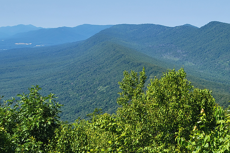
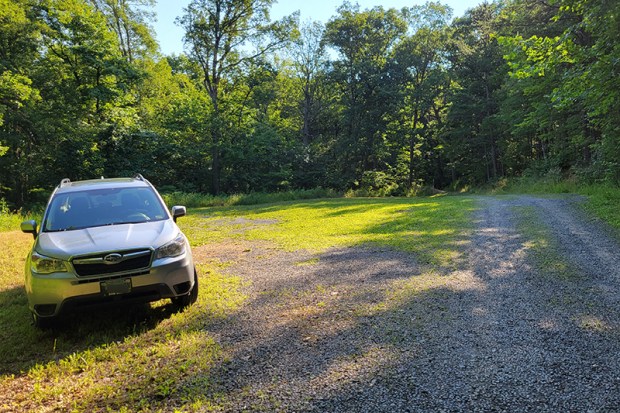

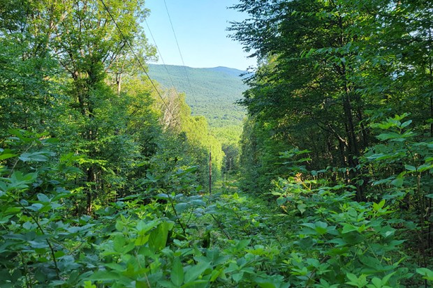
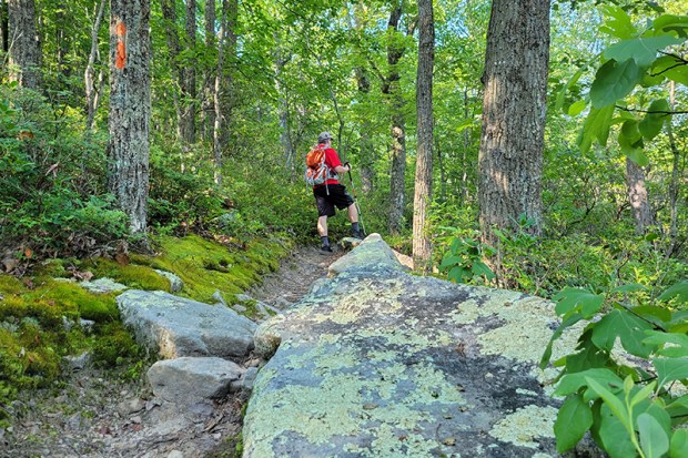


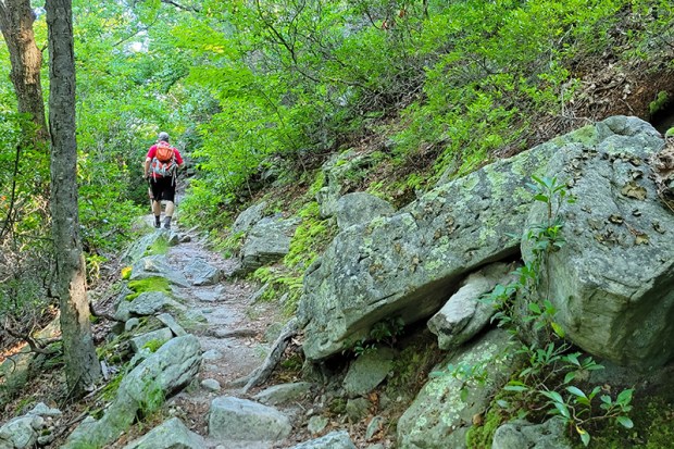

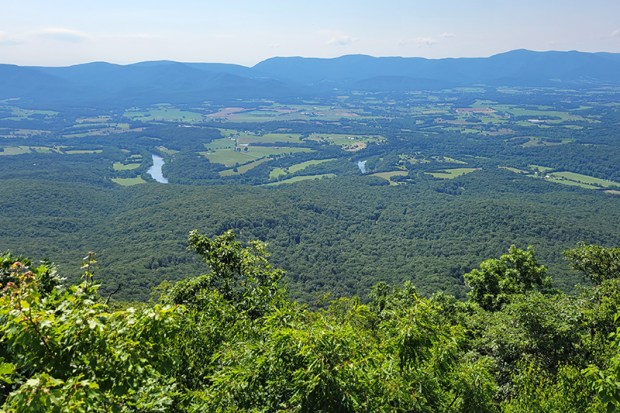


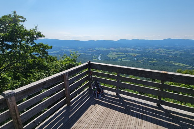
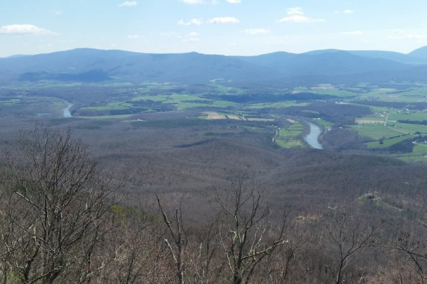

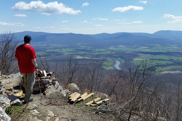
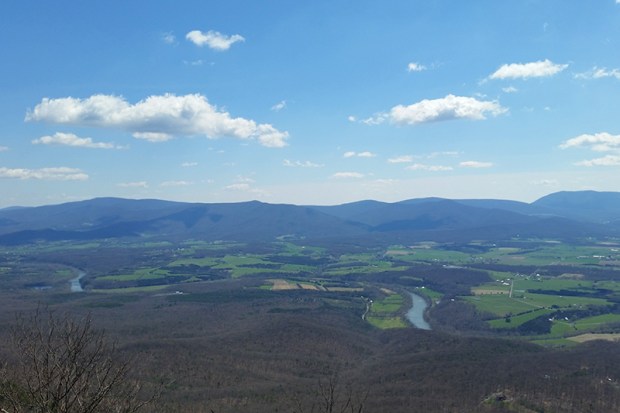
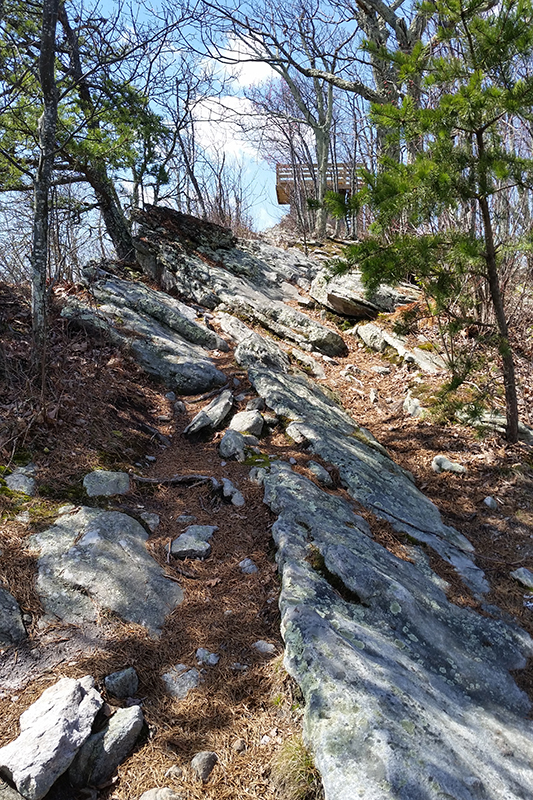
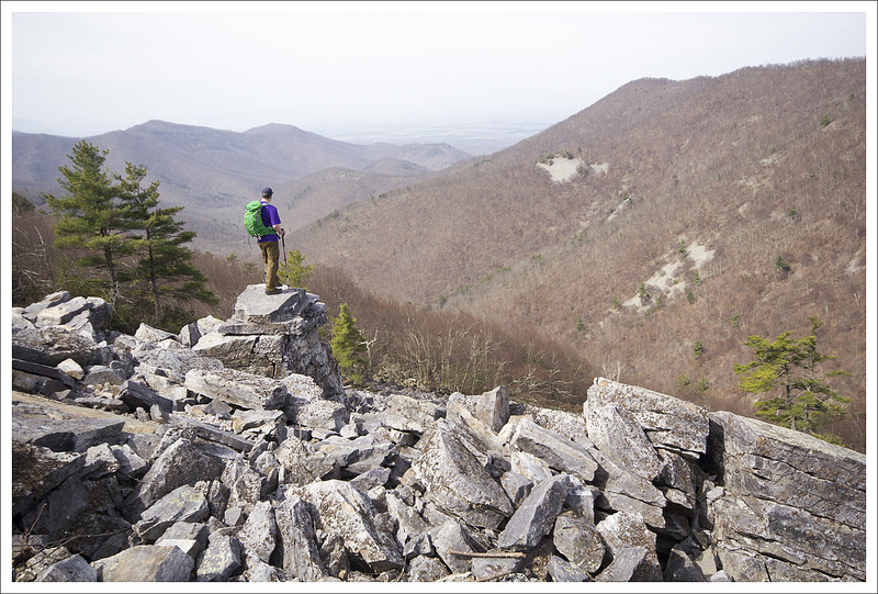
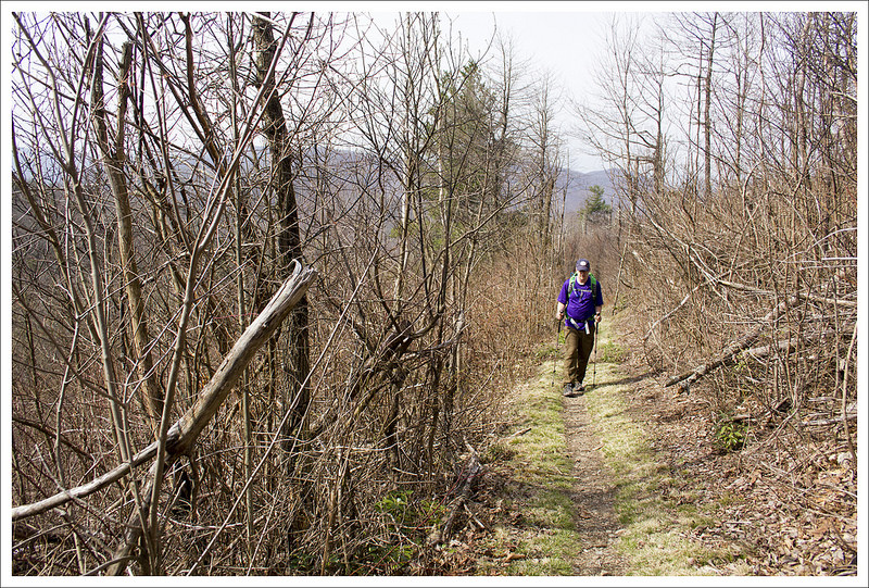
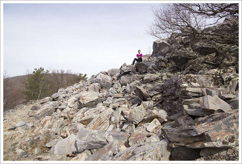

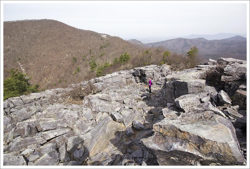


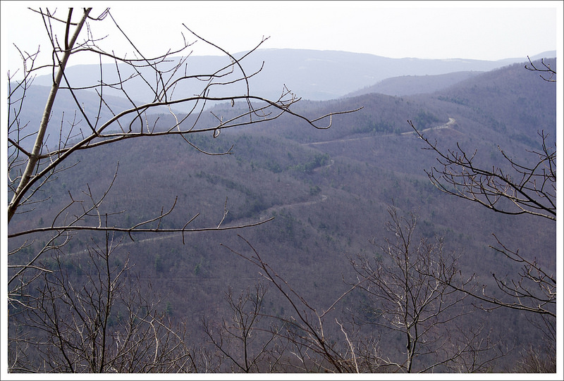
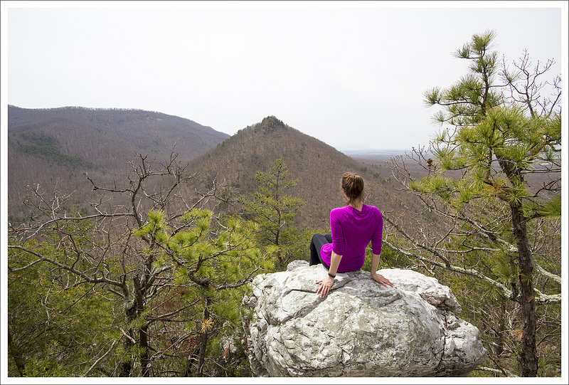


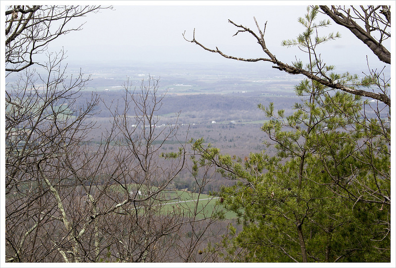
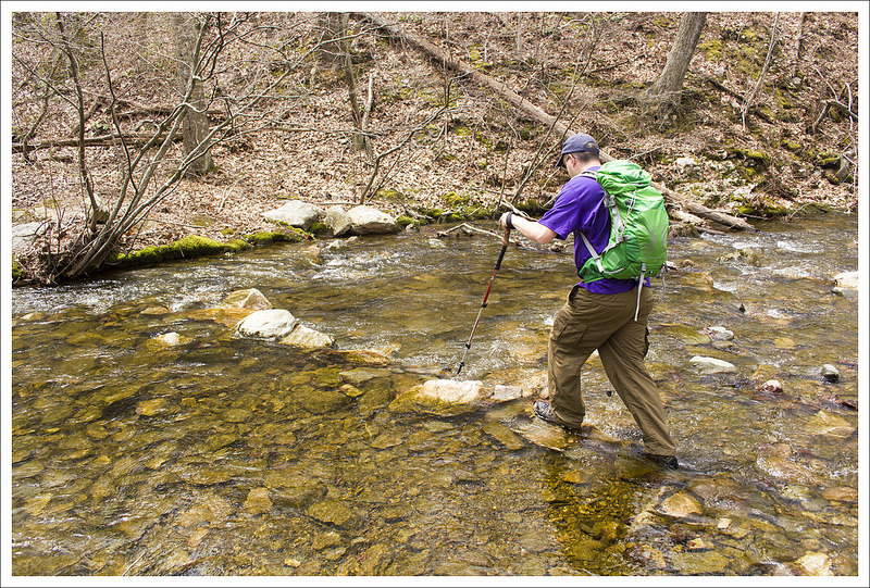

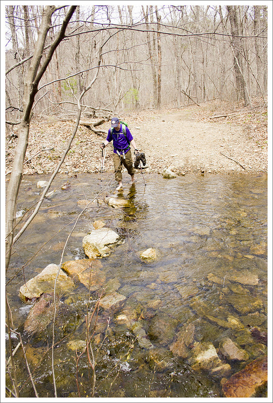
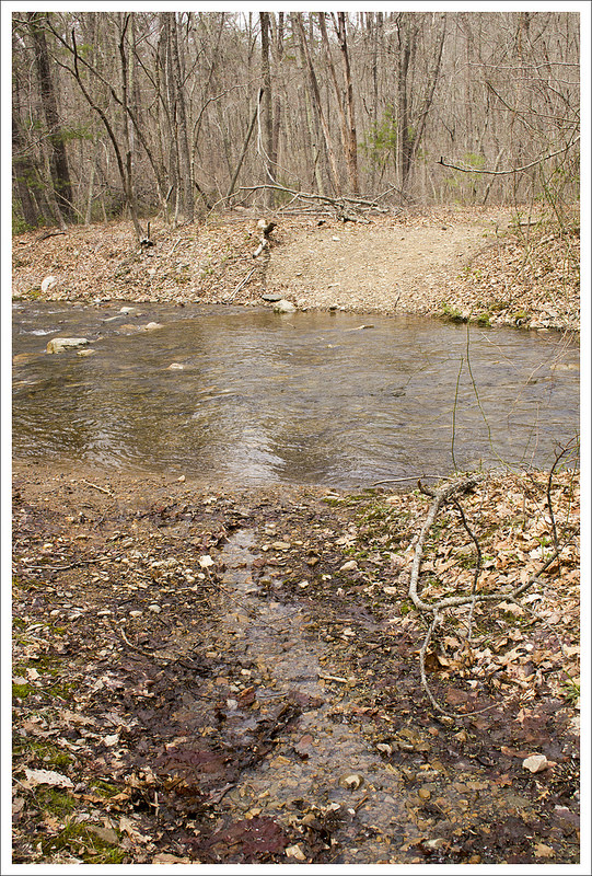

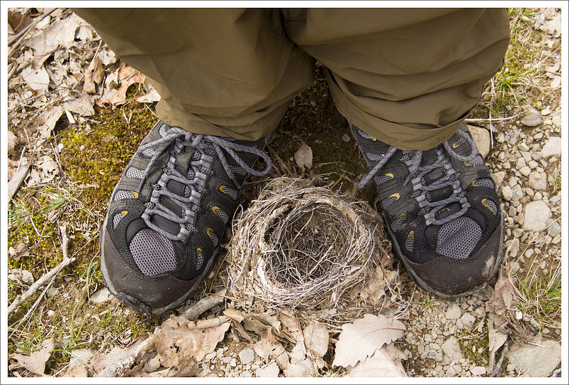
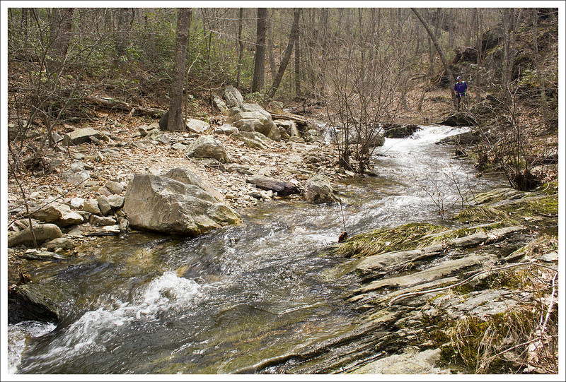
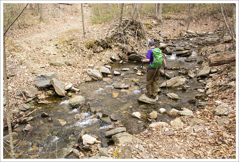
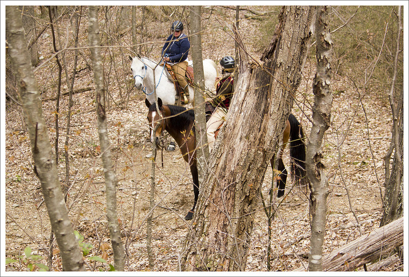
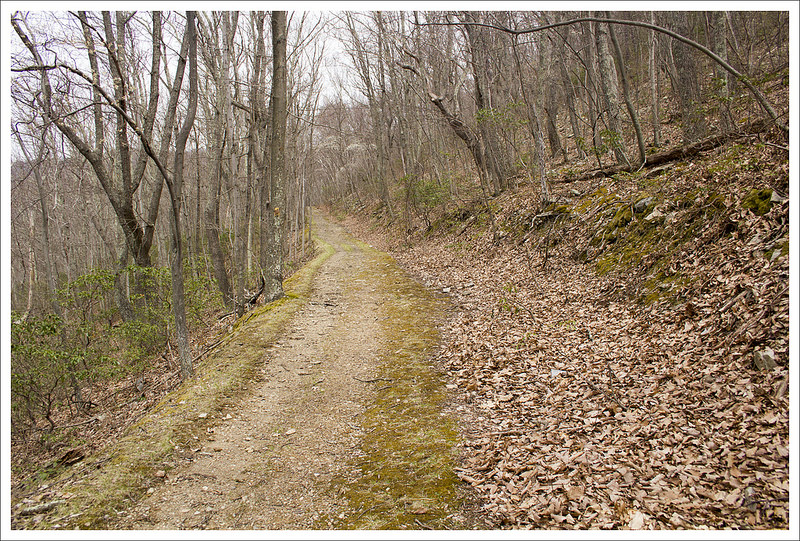


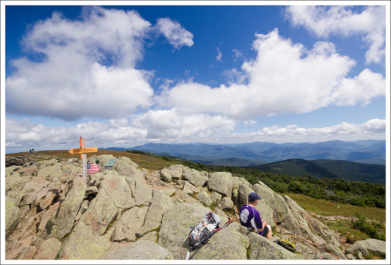

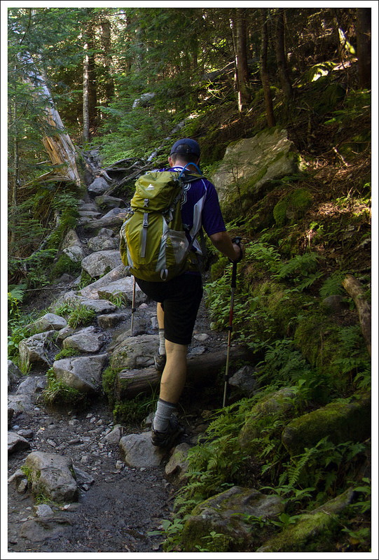


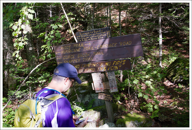


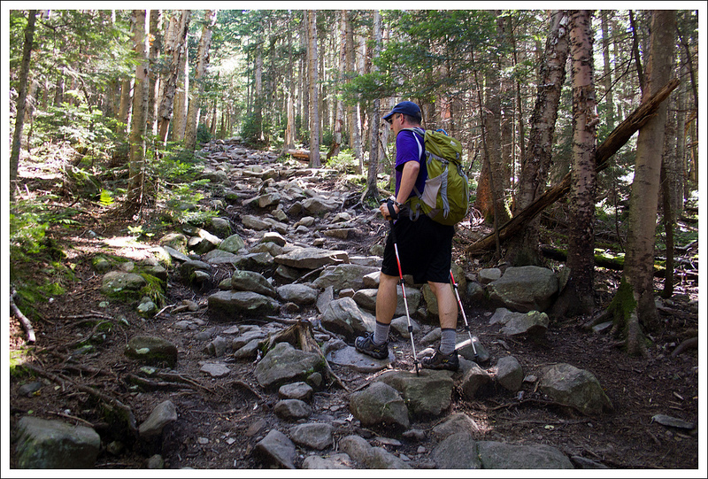


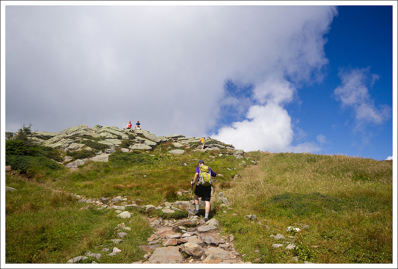

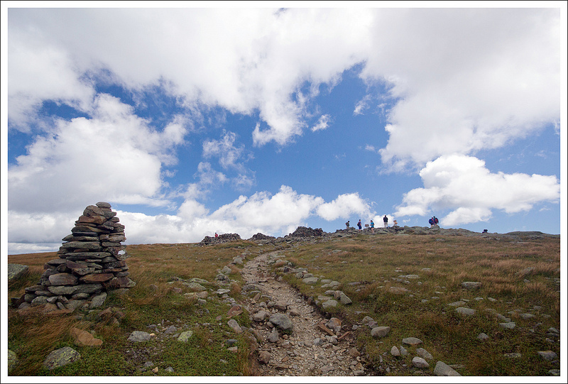


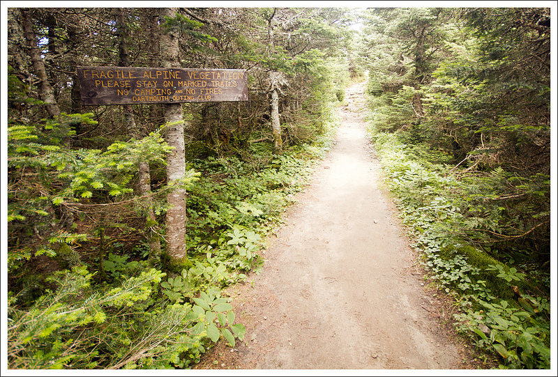
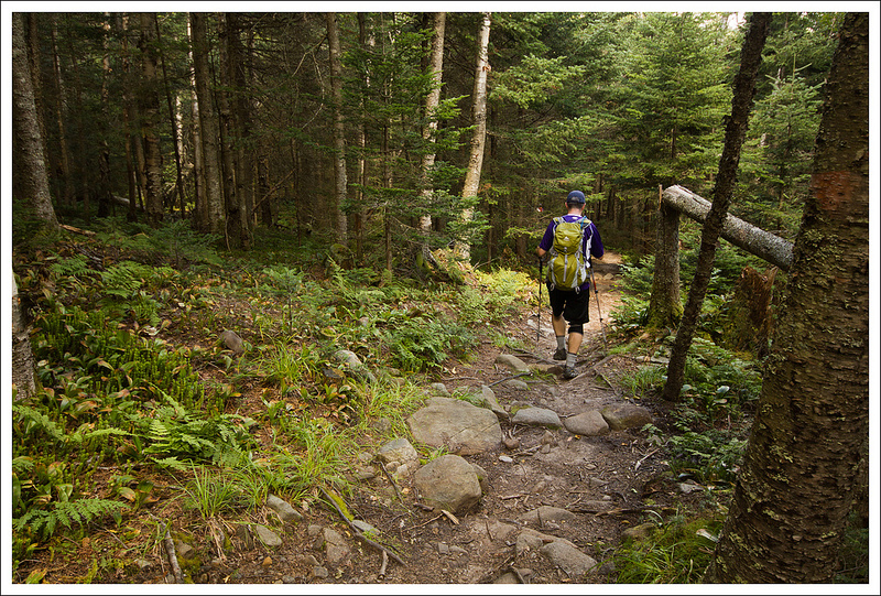


 Wookie Says…


