Sky Meadows Loop

This 5.5 mile loop through Sky Meadows State Park offers spectacular valley views and the opportunity to hike in high, open meadows.

Adam Takes in the View from the Piedmont Overlook
Adam takes in the view from the Piedmont Overlook.  Below: Mt. Bleak House was built in 1843 and is open for tours; An Appalachian Trail Thru-Hiker makes his way down the trail (he is in the far left of the photo, beyond the dogwood trees); A cute village in the valley below.

Mt. Bleak House AT Thruhiker Cute Town in the Valley Below

Adam Says…

This hike was amazing!  I can’t believe that we had never been to Sky Meadows State Park until now.  Each year, Christine and I pull a list of hikes together that we want to try and cover.  When I was looking through the Falcon Guide Hiking Virginia book, they mentioned under “other hikes” to try the Sky Meadows State Park.  I am shocked that the authors didn’t feature a trail through this area rather than leaving it as a footnote.  I think this is one of the best hikes in Virginia for views.  I would liken the scenery and open views to those you would find at Cole Mountain or Grayson Highlands/Mount Rogers.  Put this on your list of “must hikes” – you won’t regret it!

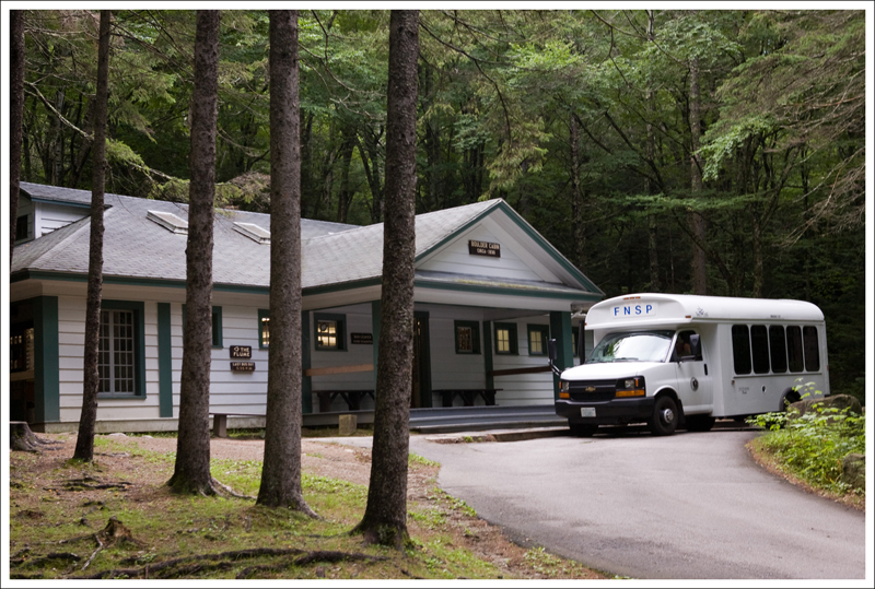
Across from the Visitor Center, you will see the Park Office on the hillside.  Walk past the large board showing the map of hiking trails and walk up the gravel path that leads into the woods.  Once you reach the fork, take a left and continue down the gravel Boston Mill road.  Continue on this road, passing by the junction with the Gap Run trail, until you come to the junction with the South Ridge trail at .45 miles.

The Chimney at the Snowden Ruins
The Snowden House ruins. Below: We crossed this small stream early in the hike.  It’s probably dry most of the year;  Adam makes his way up the South Ridge Trail; Adam reads information about Snowden; Dogwoods were at their peak.

Stream South Ridge Trail Snowden Ruins Sign Big Dogwood

Take a right on to the yellow-blazed South Ridge Trail.  The trail begins to quickly climb up the steep hillside.  At .5 miles, there is a short spur trail to a nice view.  At .58 miles, you will come to the Snowden Ruins.  You’ll see the foundation of the old homestead along with what is left of a stone chimney.  Further up the trail, you will come to the South Ridge overlook which sits under a dogwood tree.  Continue along the trail which tends to ascend most of the way.  At 2.2 miles, you will reach a junction with the North Ridge trail.  Take a left up the blue-blazed North Ridge Trail.  At 2.6 miles, you will reach a junction with the white-blazed Appalachian trail.  Take a right, heading north on the Appalachian Trail.  At 3.5 miles, you will come to a fork.

Take a right at the fork to go on to the light blue-blazed Ambassador Whitehouse trail.  At 3.9 miles, you will come to the Paris overlook viewpoint, which also provides gorgeous panoramic views.  After this viewpoint, the trail descends back through the woods.  At 4.53 take a left back on to the North Ridge trail, but in just a few feet you will take a left up the red Piedmont Overlook trail.

Adam under the Dogwoods
Adam under the Dogwoods. Below: Hepatica; Tiger Swallowtail; Mayapple Flower

Hepatica Tiger Swallowtail Mayapple

The trail ascends through a steep section here, but you will climb up a few stairs and then reach a wider trail that leads to a few benches and the Upper Piedmont Overlook.  Enjoy the views here and as you climb down to the Lower Piedmont Overlook.  After passing by an old farm building, you will climb over a few stairs and then down until you come back to the Boston Mill Road at mile 5.1.   Take a left on the road and you should be making your way back to your vehicle and the Visitor Center.

The land that became Sky Meadows State Park was donated by Paul Mellon (son of Andrew Mellon – U.S. Secretary of State from 1921-1932), a famous philanthropist, art collector, and Kentucky Derby-winning horse owner.   He donated 1132 acres of the land in 1975 and later more donations (including the land for the Appalachian Trail) have taken it up to the current 1862 acres.  The history of the land also dates back to Lord Fairfax and previous owners had ties to Belle Grove.

This really was a perfect day to do this hike!  We started off the day with a trip through Shenandoah National Park to view some early morning wildlife and to take in some breakfast at Skyland.  We then made our way to Front Royal and headed to Sky Meadows State Park.  The weather was perfect for hiking with highs in the 70s and a breeze throughout.  The sky was very clear with a few clouds, but no threat of rain.  The views were extraordinary and I can’t wait to come back some time.

Adam find the Hiking Upward Cache
Adam find the Hiking Upward Cache.  Below:  Lunch on the trail; Turning onto the AT; Making our way across the high meadows.

Lunch High Meadows

If you are interested in geocaching, there are several geocaches to find on this loop:

Christine Says…

Last Saturday was a perfect spring day.  We got up before sunrise and drove through the central and north districts of Shenandoah National park en route to Sky Meadows State Park for a day of hiking. (Passing through Shenandoah, we saw a bear and had a good breakfast at Skyland!)

Sky Meadows was established in the early 1980s and is home to a beautiful restored Civil-war era farm and twelve miles of hiking trails – including a little snip of the Appalachian Trail.  Sky Meadows is unique in that its campground has no car access.  Anyone wishing to stay overnight has to hike in to their campsite.

We parked at Mt. Bleak House.  From there, we hiked down a gravel path leading to the park’s network of trails.  Finding the trail we wanted to start on was a little tricky, because park maps were not to scale.  After a little fumbling around, we were on our way up the South Ridge Trail.  The trail climbed slowly and steadily uphill, past the ruins of Snowden – another old farm within the park’s boundary.  All that’s left standing of Snowden is a crumbling chimney and a number of foundations from outbuildings.  The site has a plaque describing the house and the people that lived there many years ago.

From Snowden, the path ascended continually passing through open meadows and pretty forest.  The dogwoods and redbuds were all near their peak of spring glory.  The flowers on the trees were truly spectacular against the perfect blue sky.  The breeze kept bugs (and sweating) at bay!  It really was ideal weather to be outdoors.

Leaning Redbud
A Beautiful Redbud along the trail. Below: A view into the valley from the Piedmont Overlook;  More Views; A spectacular dogwood.

Piedmont Overlooks Piedmont Overlook Beautiful Dogwood

For a while, the trail was pretty level as it passed through thicker woods.  We startled a turkey and watched it fly off, chortling and gobbling in dismay at being disturbed.  I must say… turkeys look really funny in flight.  The trail in this area was lined with lots of tiny wildflowers – mostly violets and hepatica.

Eventually, we started climbing again and came to the junction of the North Ridge and South Ridge trails.  We contemplated stopping for lunch at this point, but decided to press on, following the North Ridge trail to where it meets Appalachian Trail.  Another nice thing about Sky Meadows… there are benches at most trail junctions and overlooks.  It’s nice to have a comfortable place to sit and eat lunch – away from ticks, poison ivy and other crawly things.  We ended up using the bench along the Appalachian Trail for our picnic spot.

For lunch, we feasted on sandwiches, brownies, grapes and cheese.   Adam was eating his cheese and looking especially contemplative, when he turned and asked me “What kind of cheese is this?”  I responded “It’s mozzarella and cheddar twisted together.  You don’t like it?”  He said “No, it’s really GOOD… it sort of tastes like lobster dipped in melted butter!”  It’s weird, but he was actually kind of right – something about the texture of warmish mozzarella blended with the flavor of sharper cheddar ended up tasting remarkably like lobster. We’ve taken to calling this particular cheese snack ‘Lobster Cheese’.

While we ate lunch, we watched several other groups of hikers pass by.  No one really seemed to know where they were going.  Someone asked us if Harper’s Ferry was where the Appalachian Trail began.  Someone asked if they were already in Shenandoah National Park.  Two guys with cigarettes, sodas and no hiking gear contemplated aloud to one another “Should we go to Shenandoah or Harper’s Ferry?” (they were 20+ miles from either destination.)

After lunch, we headed north along the Appalachian Trail for a short while.  Along the ridge, the forest completely opened up to high meadows with amazing views into the valley below.  We were walking along the trail, chatting, when a fast hiker snuck up and passed us from behind.  He turned out to be the first AT thru-hiker we’ve seen in Virginia this year.   He’s definitely ahead of the pack!

Old Barn
We passed this old farm building on the hike down the Piedmont Overlook Trail. Below: A pretty lone tree; Adam stands in the middle of a huge four-trunked tree.

Lone Tree  Giant Four Trunk Tree

We really enjoyed walking across the open meadow terrain.  Most hikes we do are through thick forest, so this was a welcome change of pace.

At the junction of the Ambassador House Trail, the Appalachian Trail continued north and we turned right to make our way across more meadows and downhill to the Piedmont Overlook Trail.  We dipped back into forested area and passed a really cool four-trunked tree.  It was big enough for Adam to stand inside between all the trunks.

We took the optional arm of the trail uphill to get to the actual Piedmont Overlook, which was beautiful!  I loved seeing all the little houses and farms below in the valley.  From the overlook, the remainder of the hike was steeply downhill across open meadow.

Mt. Bleak House Grounds
Mt. Bleak House Grounds.  Below: A couple other shots from the Mt. Bleak grounds.

Summer Kitchen Barn on Mt. Bleak Farm

We arrived back on the gravel road and made our way back to the Mt. Bleak House area.  We stopped in the gift shop and chatted with the ranger.  We overheard her asking everyone walking in “Did you hike today?” and pretty much everyone answered “No – we’re just here to picnic!”  So, I made a point to tell her that we had hiked, had a great time and thought the park’s trail system was fantastic and very nicely maintained.  Adam got his passport book stamped and got credit for finding the state park’s official geocache.  We took a few minutes to poke around the farm and talk to two historical interpreters – one of them in a wonderful Zouave uniform.

We enjoyed our day in Sky Meadows very much.  It’s definitely a park we’ll visit again.

On our way home, we stopped briefly in Linden, Va to buy apple butter-cinnamon donuts from the Apple House.  If you’re in the area – you should do the same – they’re delicious!

Trail Notes

  • Distance5.5 miles.
  • Elevation Change – 1100 feet with one large climb in the beginning of the hike.  It’s mostly downhill or flat afterwards.
  • Difficulty –2.5. The beginning section is the toughest and is not for every person, but if you take it slow most people will be fine.
  • Trail Conditions – 4. It is very well-maintained.  The only rocky section was the .3 mile section on the North Ridge Trail.  The trail is wide in most places for two people to walk side-by-side.  Some sections you are even walking on soft grass.
  • Views5. You have lots of views along this hike of the valley and farm below.  On a clear day, you can see for miles!
  • Waterfalls/streams – 1. You cross one small stream in the beginning. It’s probably dry most of the year.
  • Wildlife – 2. We only saw one wild turkey and some other birds (there are bluebird boxes along the road).  They have spotted golden eagles in the area recently.
  • Ease to Navigate – 3. There are many options and junctions with other trails and the trails are not that well marked along the way.  While I don’t think a lot of people get lost up here, I do think some people take wrong turns before deciding they may have not gone the best way.
  • Solitude – 2. You will likely see people along the trail.  However, I think most of these people will be within a mile of the visitor’s center.  While we did see several people, you should be able to find your peace along the trail to soak in the views.

Directions to trailhead: From Route 17, turn on to Edmonds Lane as you see the sign for Sky Meadows State Park.  Follow this road until you reach the parking lot in front of Mt. Bleak House.  Park your car here and then walk past the large billboard with hiking trails on the small gravel path near the Park Office House.  All of the hiking trails start once you reach the junction on the edge of the woods.  Take a left to start your hike.

Beaver Lake Trail

The Beaver Lake trail is a 2.5 mile loop around a 24 acre (and shrinking) lake in Pocahontas State Park.

Reflections on Beaver Lake
Reflections on Beaver Lake.  Below: Some of the trail around the lake is traversed by boardwalks; Two docks overlook the lake; a shallow stream feeds the lake.

Boardwalk Around Beaver Lake Dock Shallow Stream

Christine Says…

We happened to be in Richmond for the CAA Men’s Basketball Tournament (JMU lost in the first round – Boooooooo!) last weekend.  Since we had some free time on Saturday morning, we headed over to Pocahontas State Park for a short leg-stretcher hike.  It was a warm, but cloudy, day – spring is definitely in the air.  On our way to the park, we even saw some cherry trees starting to flower.

I was surprised by how big Pocahontas State Park is – especially so close to Richmond.  As it turns out, Pocahontas is actually Virginia’s largest state park.  After paying our $5.00 parking fee, we headed over to the CCC Museum and Nature Center area, where our trail began.

The hike traces the perimeter of Beaver Lake, using a series of gentle paths and boardwalks.  We followed the trail counterclockwise.  The near side of the path was relatively flat, while the far side climbed up a small ridge and followed a series of easy ups and downs.

Adam finds a geocache
Adam finds a geocache.  Below: Trails in the park are clearly marked; Fallen trees have been carved into chairs; An abandoned beaver dam.

Trail Marker Tree Chair old beaver dam

Beaver Lake is slowly being consumed by the landscape around.  Erosion and plants are reclaiming the water, and turning the area into a freshwater marsh.  There wasn’t much growing when we visited, but in the spring and summer, the area is covered with water lilies, cattails, and other aquatic plants.  We saw a few buffleheads on the water, but they were too far off to get a decent photo.  We also saw evidence of beavers – an old dam and lots of gnawed trees.  Though, I doubt any beavers still live in the lake.  It’s probably too shallow.

One of the things I really liked along the trail were the tree stumps that had been sawed into chairs.  What a clever way to make use of a fallen tree!

The hike was short and easy, so we were done within the hour.  I’m really looking forward to nicer weather, longer hikes and hopefully several overnight backpacking trips.  On the way back to the hotel, we even got the chance to stop by REI!  That was a real treat for us because we only have one very small outdoor store in our area.  We were able to pick up some new backpacking gadgets and I got a new pair of hiking shoes.  I can’t wait to try them out!

Adam Says…

When we were thinking about checking out the CAA Men’s Basketball Tournament, I suggested that we try to find a hike in the area.  I had been a few years ago to Pocahontas State Park and thought it would be a great place to start.

It is great that Richmond has a nice park just about 20 minutes away in Chester, VA.  This park is quite popular with people trying to get outdoors without having to drive too far.  This park is definitely a multi-use area.  We saw lots of mountain bikers through the park and we saw several trail runners on the Beaver Lake Trail.  The footing is perfect for trail running and only has a few hills, making it great exercise or cross-country training.

Buffleheads
Buffleheads on the lake. Below: The park has a lot of holly growing; The first buds of spring; The trails are popular with bikers.

holly tree bud Bikes

We parked at the nature center and found the signs for the blue-blazed Beaver Lake trail. The trail passed by an old furnace and then descended until you reach the lake.  At the lake, there is a nice pier to view the water and do some birdwatching.  We then took the trail counter-clockwise, which went around the lake.  During most of the beginning of the trail, the lake was in view.  We were serenaded by frogs in the lake, which reminded us both of the sounds of didgeridoos.  Along this northern part of the lake, there are a couple of places to get close-up views of the lake.  After about .75 miles, the lake shows evidence of being shrunk from what it once was as a boardwalk leads you across the swampy, marshy remains of the lake.  I can only imagine the mosquitoes along the marsh during the summer.

After reaching the halfway point, the trail begins to climb up the hillside, being rather steep in some sections.  The trail winds around and crosses a small stream at 1.5 miles.  The trail then climbs up the hillside until views of the lake are seen again around 1.75 miles.  You will then descend for a short distance and continue the trail walking along the southern side of the lake.  Around 2.1 miles, you will come to a nice view of a dam at the lake.  After crossing the bridge at the bottom of the dam, you will take a short ascent.  You can either make your way back to the pier at this point or take the orange-blazed spillway trail back up, passing by the CCC museum, before reaching your vehicle.

Dam and Spillway
There is a dam and spillway at the end of the lake.

For any geocachers, there were two geocaches to find along this trail:

I enjoyed our trip to Pocahontas State Park.  If you’re ever in the area and want a decent leg-stretcher, try out the Beaver Lake Trail.

Trail Notes

  • Distance2.5 miles
  • Elevation Change – Maybe 150-200 feet
  • Difficulty – 1.5. There are several easy climbs on the ridge side of the lake.
  • Trail Conditions – 4. The trail is very well-maintained and easy to walk on.
  • Views3 The lake views were lovely.
  • Waterfalls/streams – 3. The stream through the woods was pretty and the dam creates a nice waterfall at the end of the lake.
  • Wildlife – 3. This seems to be a good place to see water birds.
  • Ease to Navigate –5. The trail is a well-marked loop.
  • Solitude –1. This park is located next to densely populated Richmond. We saw lots of trail runners, hikers, bikers and dog-walkers.

Directions to trailhead: From Route 10/Iron Bridge Road in Chester, VA turn on to Beach Road/State Route 655 (near shopping center).   Continue on this road following the signs for Pocahontas State Park.  Enter the main entrance on State Park Road.  Pay the parking fee ($5 on weekends) and park at the nature center.  You should be able to start seeing signs from the parking lot to the Beaver Lake Trail.

Snowshoe Trek on the Middle Ridge Trail (WV)

With all its snow, Canaan Valley provides wonderful opportunities for southerners to try out snowshoeing.  The 2.5 mile Middle Ridge trail in Canaan Valley State Park is a pleasant trek through the woods.

Doe in the Woods
A whitetail doe watches us in the woods.  Below: Adam walks along the trail, being careful not to ruin the cross country ski tracks; The Blackwater River is covered with snow and ice; A sign cautions cross country skiers to take care on the steep hill.

Walking Along Along the Blackwater River Steep Hill Caution

Adam Says…

We wanted to go snowshoeing at least once this winter.  We enjoyed going to Canaan Valley last year, so we decided to take another trip to the high country of West Virginia.  There are several short trails throughout Canaan Valley State Park that are suitable for snowshoeing or cross-country skiing.

Snowshoes can be rented for a day behind the Canaan Valley Lodge near the ice rink for $20/adult.  You can also pick up a map and trail guide of the Canaan Valley Resort area at the lodge.  The last two times we had rented more modern, aluminum snowshoes; this time, they had the traditional snowshoes with rawhide webbing.  While we felt the traditional snowshoes seemed a little heavier initially, I actually found they were a little easier to use.  The snow tends to not get piled on the top as often as with the modern snowshoes, making them feel a little lighter while on the trails.

Tubbs Snowshoes
We rented snowshoes from Canaan Valley State Park.

We left the rental center and drove to the Balsam Swamp Overlook.  From here, the trail starts cutting down across the meadow.  At .2 miles, take a right on the green-blazed Middle Ridge Trail.  This trail starts off with a short, steep uphill before easing to a gentle incline for the first mile.  You then go down a steep hill until you reach the view of the Blackwater River at 1.2 miles.   This area along the river has the best views of the meadow and the mountain ridges in front of us were covered with rime ice.

The trail takes a sharp left at this point and you follow the river for about .1 mile.  At 1.3 miles, you reach a junction with a spur trail to the Railroad Grade Trail.  Ignore this spur and continue on the green-blazed Middle Ridge Trail.  You will begin your ascent.  The trail ascends about 150 feet over the next .7 miles.  While the map made it look quite tough, I felt that the elevation was not too bad.  Near the crest, the trail tends to wind through the forest.  You will then start your descent.  At 2.1 miles, you will reach another junction leading to the Ridge Top Trail.  Ignore this trail also and just stay on the Middle Ridge Trail.  You will then steeply descend the Middle Ridge Trail.  Stay straight on the trail until you reach your vehicle at the Balsam Swamp Overlook.

Rest Stop at the Trail Junction
Adam takes a rest stop at the trail junction.

This snowshoe trip was more challenging than the Deer Run-Mill Run trails that we did last year, but it was worth it.  The snow tends to keep people away from many of the hiking trails, so I really find it quite peaceful when all you can hear is your breath and the light crunching of the snow below you.

We finished up our trip with a short drive to Sirianni’s Cafe in Davis, WV.  It is probably our favorite pizza place on the planet and you shouldn’t miss it.  If you have the option, try to get a seat near the back left of the restaurant and read the notes/business cards placed under the glass-covered tables.

Christine Says…

I love making a quick trip over to West Virginia for a day of snowshoeing.  It’s become one of my favorite winter traditions!  We chose to go on a weekend right after the area received a little over a foot of new snow.  The conditions were great – the snow was a bit heavy and soft, but it was still fresh and pristine – a real winter wonderland.

I liked the traditional showshoes we rented.  They were made by Tubbs and looked like snowshoes that explorers or fur trappers in the 1800’s might have used.  The trail we chose didn’t offer any grand views or spectacular scenery, but it was a beautiful walk through the woods.  The few trails we’ve showshoed on before were completely flat, but the Middle Ridge trail has a couple “easy” climbs.    I say easy in quotes because climbing in showshoes is always harder work than walking on a dirt trail.  It’s also tough to snowshoe across deep, unbroken snow.  Even though the snowshoes hold you aloft and prevent you from having to go post-holing through deep snow, you’ll still sink a little bit if the snow is deep and soft.

Trees and Snow
The trees and fresh snow made a beautiful and stark landscape. Below: Adam looks down on the trail from the Balsam Swamp parking area; Walking uphill across the open meadow; The snow was heavy and deep.

Adam looks at the trail Walking Uphill Deep snow

We really tried our best to stay off the cross-country tracks, but in some places the trail was too narrow or the tracks were already trashed by other walkers.  I have to admit, I was thankful whenever we got a chance to walk on already-broken snow!

The lowest point on the trail is along the Blackwater River.  We couldn’t see the river at all under all of the ice and snow.  It looked more like an open field than a river basin.  After leaving the river, we had a slow and steady uphill back to the top of the ridge.

I enjoyed coming across a lone doe making her way through the deep snow.  Deer in the Canaan area are very accustomed to humans, so she made no effort to run when she saw us.  It gave me the opportunity to get a couple photos.

The rest of the hike along the ridge and back down to the parking area was easy and quick.  After changing clothes and turning our snowshoes in, we headed over to Davis, WV for our pizza lunch.  Sirianni’s was recently named West Virginia’s best pizza by USA Today.  In addition to great food, I love the atmosphere in their little restaurant.  It’s such a warm and cozy place!

Sirianni's pizza
We got to sit in our favorite little corner booth at Sirianni’s – best pizza in West Virginia.  Below:  People from all over have written notes to tuck under the glass tabletops in the back corner of Sirianni’s – such fun to read!;  Sirianni’s is right on the main street through Davis, WV.

Table notes at Sirianni's Davis WV

Trail Notes

  • Distance – 2.5 miles
  • Elevation Change – about 300 feet total.
  • Difficulty – 2. The snow makes this easy trail a little more challenging. Take some breaks when you’re tired, but overall, this trail is quite manageable for most people.
  • Trail Conditions – 3.  While there were cross-country ski tracks, we tried to avoid those at all times for other people.  Walking on snowshoes and establishing new tracks can be challenging, so it is best if going with others to alternate who is breaking the trail.
  • Views –2. The only views are of the meadow and mountains near the Blackwater River.
  • Waterfalls/streams 2. You have views of the Blackwater River, but you won’t be getting too close to the river from the trail.
  • Wildlife –3. You are likely to see some deer on this trail any time of year.
  • Ease to Navigate – 3. Without any previous tracks, this could be challenging, but look for the green blazes on the trees.
  • Solitude –5. We were the only ones on the trail, but this trail is used somewhat often by cross-country skiiers.  If you’re going when it is not snow-covered, I would lower the solitude rating, since it is a popular, short hiking trail.

Directions to trailhead: The Canaan Valley State Park is located off Route 32.  For snowshoe rentals, follow the signs from the entrance to the Canaan Valley lodge.  This trail takes off from the Balsam Swamp Overlook.

The Basin & Kinsman Falls (NH)

Special: New Hampshire Edition

Introductory Guide to Visiting the White Mountains

The Basin  and Kinsman Falls is a short 1.2 mile out-and-back walk to a lovely waterfall in Franconia Notch State Park.  The trail follows Cascade Brook and passes many beautiful (and popular) water features.  The falls are also called Tunnel Falls.

The Basin
The Basin is a beautiful glacial pothole at the base of this hike. Below: Kinsman Falls is a pretty 20 foot waterfall that plunges into a wide pool at the bottom; Many of the streambeds look sculpted.

Kinsman Falls Water Features along the Trail

Adam Says…

We had visited the Basin last year, but it is always worth a quick stop off I-93.  It takes only .1 mile to reach it from the parking lot.  You will see signs to lead you directly to the Basin.  The Basin was formed about 15,000 years ago as an ice sheet eroded the pathway.  According to the plaque at the site there, Henry David Thoreau wrote “this pothole is perhaps the most remarkable curiosity of its kind in New England.” Samuel Eastman called this area, “One of the most beautiful haunts of Nature, a luxurious and delicious bath fit for the ablutions of a goddess.”

There are several paths to walk along in this area to explore streams and small waterfalls.   If you go back the way you came, you will see a larger junction with a sign for Kinsman Falls being .5 miles away.  The path up to Kinsman Falls was filled with roots and rocks, so you do need to continually watch where you are stepping.  Shortly up the ascent, you will see several spots to your left along the way of the river.  These are good places to soak in the sun or to wade in a small pool.  Be careful about footing if you venture into the water, since the water does rush through these areas rapidly. Getting back on the trail, you have more of an ascent, but you will quickly come up to the sign pointing to Kinsman Falls.  The falls were very impressive as they plunged into a serene pool at the base.

View of the Mountain from Cascade Brook
View of the Mountain from Cascade Brook.  Below:  Colorful fungus on the trail;  Christine’s dad and Adam climb back up from the base of the falls.

Orange Mushrooms Along the Trail Climbing Back up from the base of the falls.

I definitely recommend checking out these areas if you are taking a trip through the White Mountains. Most people just view the Basin and some of the swimming holes along the way and don’t venture any further, but it is worth the hike up to Kinsman Falls and most families can easily make the trip.

There are several geocaches in the area:

Christine Says…

We planned to do lots of family hikes on this visit to New Hampshire, but about a week before the trip an MRI revealed that my dad had torn his meniscus.  His doctor told him to be careful and to limit activity that could extend the tear.  Sadly, this put most of his hiking plans on hold for the time being.  He did decide that he felt up to joining us on the short hike past the Basin and up to Kinsman Falls.

Like Flume Gorge, this little hike packs in a lot of impressive scenery over a very short distance.  Also, like the Flume, it is extremely popular and crowded.

The Basin is such a gorgeous spot.  I love how the water curls through the rock formation.  The rock walls of the Basin are smooth and sculpted – they almost look unnatural. The water is blue-green colored and crystal clear.  It’s one of those spots you’ll never forget!

After the Basin, the beautiful water features keep on coming!  There are so many small waterfalls and cascades along the trail, that you always hear the pleasant sound of rushing water.  A sign marks the way to Kinsman Falls, but honestly, we could say “just follow the water uphill” and you’d find your way there.

The trail was rocky and root-y.
The trail was rocky and root-y. Below:  The base of the falls was a nice place to stop and contemplate nature; Cascade Brook rushes over the rocks.

Dad on the rocks Water flowing along Cascade Brook

The trail followed alongside Cascade Brook for a half mile.  There were many little side-trails leading to scenic spots along the brook.  Dozens of people reclined on the rocks while kids used the streambed like a natural waterslide.  One mother remarked to us that her family had visited the spot two days in a row, and both her boys had worn through the backsides of two sets of swim trunks.

The trail is muddy, with a mix of gnarled roots and slick granite underfoot.  It’s all uphill, but it’s never steep.  It really is an ideal family hike.

A small sign announces Kinsman Falls.  From the trail, you get a view of the falls from above.  The twenty-foot waterfall crashes into a large, round pool in a chasm below.  There is a rough footpath down to the base of the falls – take care if you climb down – it’s slippery with numerous rocks to scramble over.

There are lots of big rocks to sit on around the edge of the pool.  It’s a nice place to relax and enjoy feeling the mist from the falls spray your face.  We were really surprised to have the falls all to ourselves.  Even though there were many people in the area, no one else was at the waterfall.  Odd – but very welcome!  On our return trip, we passed quite a few people hiking up, so I suppose we just had fortuitous timing.

Trail Notes

  • Distance – 1.2 miles out-and-back. Plus a couple additional tenths of a mile to get to and from your car.
  • Elevation Change –Around 300 feet
  • Difficulty 2. The hike is all uphill over slick granite and gnarled roots, but it is short and never steep.
  • Trail Conditions 2. The trail is extremely rocky, muddy and covered with gnarled tree roots.
  • Views –2. From the Cascade Brook streambed, you get a decent view of the mountains.
  • Waterfalls/streams 5. Nothing short of spectacular!
  • Wildlife 0. A few squirrels and chipmunks.
  • Ease to Navigate 4. After walking uphill from the Basin, look for the sign to Kinsman Falls and follow the blue blazes uphill.
  • Solitude0. This area is extremely popular.  We saw dozen of people along the way, but surprisingly had Kinsman Falls all to ourselves.

Directions to trailhead:
From I-93N. Once you enter the Franconia Notch area, take the Basin exit.  The area is well-marked and has ample parking.

Flume Gorge Loop (NH)


Special: New Hampshire Edition

Introductory Guide to Visiting the White Mountains

Located in Franconia Notch State Park, this two-mile path around the Flume Gorge showcases a lot of beautiful scenery on a short and easy walk.  If you crave solitude, this is not the place for you.  But if you don’t mind crowds and want to see some unique scenery, don’t miss a visit to this area.

Scenes from the Flume
The Flume is a beautiful and unique place. Below: Avalanche Falls is located inside the Flume; Liberty Gorge Cascade is also impressive; The trail is lined with large boulders called glacial erratics; The Sentinel Pine Covered Bridge is for pedestrians only.

Avalanche Falls Liberty Gorge Cascade Glacial Erratic Sentinel Pine Bridge

Christine Says…

Last year, when we visited New Hampshire for the first time, we went to Flume Gorge with my parents.  It was insanely crowded, unusually hot and glaringly sunny on that visit, so we decided to make a return visit on this trip – hoping that the clouds and cooler weather would keep the crowds at bay.  There were definitely fewer people this time, but that’s not to say we had solitude.  Flume Gorge is an extremely popular area. There will always be hordes of people, no matter the time of day, week or year you visit.

It’s no surprise the area draws such large crowds – it packs an amazing amount of unique scenery into an easy, two-mile loop.  For anyone who doesn’t want to walk the two miles, there is a bus that will take visitors to a drop-off point at the Boulder Cabin.  This option substantially shortens the distance and climbing necessary to see the gorge.  However, bus riders miss seeing a lot of the other impressive scenery along the loop.

The two-mile loop starts off along a shady, wooded path that climbs down to the Pemigawasset River.  In .25 miles, there is a bright, red covered bridge across the water – the bus goes through the bridge, but pedestrians cross a walkway attached to the side of the bridge.  After a short uphill, both the bus riders and the walkers arrive at the Boulder Cabin.  The building is full of exhibits – both historical and natural.

Covered Bridge
The first covered bridge in Flume Gorge is brilliant red. Below: Table Rock;  The path through the woods is peaceful and shady; Bear Cave is located near the top of the Flume; The side view of Avalanche Falls.

Table Rock Shady Trail Bear Cave Avalanche Falls

After passing the cabin, the path follows alongside an area called Table Rock.  The water in the river passes thinly over a wide, smooth expanse of granite.  A sign announces the beginning of the Flume.  The Flume is a fascinating geological area – a narrow slot canyon carved out from thousands of years of river flow over the rock.  Wooden walkways are attached to the sheer canyon walls and allow people to climb through the gorge using a series of ramps and steps.  Near the top of the Flume, visitors are treated to views of the crashing water of Avalanche Falls.  The falls take several directional turns through the Flume – each angle makes it look like a completely different waterfall. After passing the waterfall, be sure to take a quick peek inside Bear Cave.

At the top of the Flume, the trail has two options – one returns people to Boulder Cabin and the bus stop, the other follows a trail for a little over a mile back to the main entry.  If you’re able, it’s definitely worth following the longer route to see Liberty Gorge Cascade, the Pool, The Sentinel Pine Covered Bridge, the Wolf’s Den and several impressive erratics along the trail.

Water Under the Sentinel Pine Bridge
My favorite view along the trail came at the spot overlooking the Sentinel Bridge. Below:  The river under the bridge is very scenic; The Pool is a wide, still spot on the river.

River under the Sentinel Bridge The Pool

One of my favorite views along the trail was looking back at the Pool and the Sentinel Covered Bridge from a little spur trail to an overlook.  From this point, the walk back is steeply uphill for a short while.  Once you gain the ridge, the path levels off and you get a nice view of Liberty Mountain.  A short while later, you arrive back at the visitor’s center – where you can treat yourself to an ice cream cone.

Even though Flume Gorge is crowded and rather expensive to visit, it’s still very worthwhile.  Not many short two-mile loops pack in quite so much scenery into a pleasant, easy-to-walk package.

Adams Says…

After dropping off our thru-hiker friends, The Traveling Circus, we headed off to hike around Flume Gorge.  We did this trip last year with Christine’s parents, but thought it was worth a second trip.

This is a very popular attraction and is definitely one of the highlights of the Franconia Notch State Park.  Similar to many areas of New Hampshire, it requires a fee (in 2010, it was $13 for adults).  The visitor center has a theatre that shows an informational film throughout the day and a few exhibits around the entrance.  The snack bar is also fully equipped to provide enough refreshment and food for a lunch or snack.

Cascade near table rock
The entire Flume Gorge area is loaded with small waterfalls and cascades. Below: Tree roots grow over rocks; The crowds at Flume Gorge are always thick;  Ramps and stairs allow people to climb easily through the gorge; We saw lots of chipmunks and red squirrels.

Tree growing over rock The Flume
The top of Avalanche Falls Chipmunk

This hike packs a lot of features into one short hike.  The covered bridge was built in 1886.  While you can’t walk inside since it is for bus traffic, it does provide a nice photo opportunity.  Table Rock is a large rock outcropping where Flume Brook slowly glides over the water.  The rock is 500 feet long and 75 feet wide.  The Flume Gorge is quite impressive.  You walk along a boardwalk that clings to one side of the gorge.  The Conway granite walls rise on either side 70-90 feet as you see the brook rush out of Avalanche Falls and down the brook.  We were impressed to see all of the small trees and moss that grows amazingly out of the cliff walls.  The Flume was discovered in 1808 by a 93 year-old woman while she was fishing.  Signs describe a large boulder that was suspended between the walls of the gorge but a storm in 1883 swept it away and no signs of the boulder have been spotted since.  Avalanche Falls is an impressive 45-foot waterfall that you can see from several angles while along the boardwalk.

After walking another .5 miles from Avalanche Falls, Liberty Gorge is your next stop.  There is a nice overlook to see the water flow through this gorge.  After a few tenths of a mile past Liberty Gorge, you will come across the Pool overlook and another covered bridge.   Shortly after the covered bridge, you have an option to join go through the one-way Wolf’s Den, but it does require crawling on your hands and knees to make it through the cave.  We continued pass the Wolf’s Den, to catch the additional overlook of the Pool.  We thought this was a better view of the covered bridge and the Pool.  Continue from here to arrive at the Glacial Boulder garden to view some nice erratics.

While there aren’t any geocaches inside the gorge, there are a few outside the area:

Trail Notes

  • Distance – 2 miles
  • Elevation Change 400 feet
  • Difficulty 1.5. There are some steps and hills, but most people should be able to do this without too much effort.
  • Trail Conditions 4.5 The trail is covered in small crushed gravel, allowing for easy footing.
  • Views – 1. You do get one view of Liberty Mountain, but otherwise you won’t see many far-off views.
  • Waterfalls/streams 5. Great views of Avalanche Falls and much of the trip is in sight of water.
  • Wildlife 1.  We saw a few red squirrels and chipmunks, but this is so popular with tourists, you won’t see a lot of wildlife.
  • Ease to Navigate 5. The area is secluded from other areas, so you can’t get lost.  You just have options to cut distance off of the trail.
  • Solitude0. You will always find lots of people here.

Directions to trailhead:
From I-93, once you enter the Franconia Notch area, take the Flume Gorge exit.  The area is well-marked.  Park at the Visitor’s Center.  The trail starts from the Visitor’s Center.  Purchase tickets and proceed.

Flat Run Trail

Flat Run Trail is a short, fairly easy hiking and mountain bike trail in Douthat State Park.

Mountain Bike
A mountain bike works best on this trail. Below: The trail crosses the creek a couple times.

Bridge on the Flat Run trail

Adam Says…

After our hike up Beards Mountain, we decided to try out a short bike ride.  Douthat State Park is known to many bikers for having some great mountain bike trails and is host to the Middle Mountain Momma Bike Race.  We did see a couple mountain biking on our hike to Beards Mountain.  The man was looking happy at the top of the trail and the woman was pushing her bike up the hill looking miserable (I’m sure they had an interesting car ride home).

The Flat Run Trail is only a five mile out-and-back trail.  I would strongly suggest having a mountain bike for this trail.  Christine started off on her hybrid bike, but she didn’t enjoy jumping over the rocks in the creek without suspension.  I continued on the trip solo since I do have a mountain bike.  I found the trail to be fairly easy for mountain bikers.  There are a few large rocky creek beds to cross as the trail goes in between the main road and Wilson Creek.

After your first few creek crossings, you will come across a bridge pictured above at about the .5 mile point.  At the 1 mile mark, you should be able to see some great fishing spots to your left of Wilson Creek.  At 1.5 miles, you will see the swinging bridge that leads to the Brushy Hollow Trail.  At 2.25 miles, you will see the beginning of the Stony Run trail. At mile 2.5, you will reach the end with a trail that connects to a parking lot a few feet ahead to the right.  This marks the end of the trail, so you can return the way you came or bike along the road back to your vehicle.

While it was a short bike trail, I did enjoy seeing the creek along the way.  The trail wasn’t too bumpy (except for crossing the creeks) compared to other mountain bike trails I have done.

Christine Says…

I don’t have a mountain bike, so after two seconds of jarring bumps, I cut through the woods and continued riding on the road. That’s all I have to say about that.

Trail Notes

  • Distance – 5 miles
  • Elevation Change – Negligible.  Hardly any elevation change.  It is called Flat Run for a reason.
  • Difficulty – 2. Hiking or mountain biking it should be fairly easy. Most mountain bikers would give this a 1.
  • Trail Conditions – 3.5 A few creek sections to cross, but other than that, it’s well maintained.
  • Views0.  The trail is scenic in spots along the creek, but there isn’t anything very scenic on this trail.
  • Waterfalls/streams – 2. The path does run along Wilson Creek for part of the trip.
  • Wildlife – 1. You may see fish and minnows in the creek if you stop by to look.
  • Ease to Navigate – 4.5
  • Solitude – 4.  I  didn’t see any people on the trail.  I think for mountain biking, people do most of the more serious trails over this one.

Directions to trailhead: Take I-64 to exit 27 near Clifton Forge, VA heading north on state route 629.  Continue on this road until you enter the park.  In Douthat State Park, the trail begins about .25 miles south of the park office before the fee station.  However, you do need to pay the fee before parking and using the trails.  There is a parking lot and sign for the beginning of the trail.

Beards Mountain

Beards Mountain is a hike within Douthat State Park that provides lake and mountain views at various stages of the trail.

View of Douthat Lake from Beards Mountain
A view of Douthat Lake from the trail. Below: The trails in Douthat State Park are clear and well-marked.

Trail Signs

Adam Says…

This was our first trip to Douthat State Park and we were quite impressed.  The park contains over 40 miles of hiking trails.  The origin of the name “Douthat” is from a land patent given to Robert Douthat from the Governor Robert Brooke.  Part of this land makes up the park today.  The best guess as to how to pronounce the name I found was “dow-thut”.

Like most state parks, you have to pay $3 on the weekends to enter.  We went to the park office first to talk to someone about the two hikes we were contemplating – this one and Blue Suck Falls.  The Blue Suck Falls hike is close to 10 miles, so we opted for the shorter hike on this particular day.  Before we started, I wanted to check out two new programs that state parks are now offering.  The Trail Quest Program is something created to replace the state park passport program.  This program allows you to track the state parks you have visited online and there are some pins given as rewards based on how many you visit.  I started the passport system a while ago, which I have enjoyed, but I think this program is also a great idea.  The second opportunity is now all of the Virginia state parks are sponsoring geocaches.  Each park has a multi-stage geocache that leads you to a wildlife card for each park.  When you collect a number of these cards, you can also get some prizes.

View from the Trail
Most of the views along the hike were peeks through the trees. Below: Another glimpse through the trees; the stream along the Beards Gap Trail was made up of interesting terraced rocks; another view of Douthat Lake

Due to the tricky network of trails, I would recommend picking up a map at the park office.  The hike up Beards Mountain starts to the right of the park office entrance by taking the blue-blazed Beard’s Gap Trail.  This trail starts off relatively flat and crosses a creek a few times (it was dry when we crossed) before it starts an uphill climb with several switchbacks.  While I normally don’t enjoy switchbacks, this trail was well planned and it really takes the difficulty out of the elevation gain.  At 1.2 miles you will reach a trail junction and a hut that was created as an eagle scout project.  Take a left on this trail to join the yellow-blazed Mountain Top Trail.  At 1.7 miles, you will reach a junction of three trails.  You will see the Buck Hollow Trail and the Mountain Side Trail to the left, but you will just head straight continuing on the yellow-blazed Mountain Top Trail for the toughest climb of the trip.  At 1.8 miles, you will take a sharp right on a switchback and be able to see Douthat Lake below through the trees.  There are better views ahead.  The hike continues to climb up, leveling off around 2.0 miles, until you see a marker for the forest boundary around 2.5 miles.  At the marker, you will take a left to stay on the yellow-blazed Mountain Top Trail.  Around 2.7 miles, the trail begins to descend steeply.  Around mile 3.1 the woods will open up to reveal a very nice view of Douthat Lake below.  Around mile 3.4, as you are descending, you will come to another junction of trails.  Take a left on to the Mountain Side Trail.  This will continue be a fairly level trail that will eventually give you a third lower view of Douthat Lake around the 3.7 mile marker.  After the view, you will have a slight ascent back up to the familiar junction with the Mountain Top Trail.  At this junction, you will take a right down the blue-blazed Buck Hollow Trail.  Around the 4.7 mile marker, you will see a branched path that is marked as an Overlook Trail.  We did not go down that path this time, but it adds an extra .5 mile on to your trip.  Around the 5.4 marker, you will reach a junction and take a left on the white-blazed Wilson Creek Trail and you will cross a small bridge.  Shortly after rounding the corner, you will see a water tower that is on a gravel road.  Just cross the road and stay on the white-blazed trail.  The trail will eventually pass a few staff houses and a stone chimney around 6.9 miles.  Just travel the last .1 miles to reach the park office and your vehicle.

While we felt the views weren’t exceptional, we did really enjoy this hike.  We had a perfect hiking weather day with a cool breeze to keep from sweating profusely and to keep the bugs away.  We definitely plan on returning to visit and explore this park some more.  Most of the people that come here seem to come for fishing, picnics, and camping but I do think the trails we saw were very enjoyable.  While it was a longer hike, it wasn’t too tough to handle if you’re in decent shape.

Christine Says…

Beards Mountain was an enjoyable hike for a blustery spring day.  For a seven-mile hike, it was relatively easygoing. Most of the steep climbing was in the first third of the loop, which allowed for very pleasant downhill or level walking for the last two-thirds of the hike.

This was by far the windiest day I’ve ever been out in the woods – gusts were easily 45-50 mph.  The wind was really roaring through the mountains, catching on all the newly leafy trees.  Any time I looked up, I could see the treetops swaying and swirling dramatically above our heads.  Every now and then, we would hear branches snap – but thankfully none fell close to the trail.  It was nearly impossible to talk over the wind, so Adam and I hiked in silence most of the way.

Hiking Upward gave this trail a five-star rating for views, so I was really hoping there would be a pretty overlook to stop and eat our picnic lunch along the way.  Unfortunately, all of the views were merely small openings in the trees along the trail.  None of the viewpoints really had an off-the-trail space to sit and take in the view.  We ended up eating lunch along the ridge of Beards Mountain, near the National Forest border marker.  We love Hiking Upward, but have found that our opinions sometimes differ on what makes a five-star view.  For me, a top rated view has to be panoramic, unobstructed, offer a deep view into the landscape beyond and have a nice place for a couple people to sit and enjoy the vista. The views on this hike were nice, but I wouldn’t give them top marks.

Snake Along the Trail
We saw so many reptiles along the hike. Below:  The Visitor’s Center is both the start and end point of the hike.

Visitor Center

The descent on this hike was long and followed a (usually) gentle grade.  The one thing that made it tricky was the dryness/looseness of the soil and the narrowness of the trail.  There were a couple spots along the Mountain Side Trail that had precipitous drops on the downhill side.  For some stretches, the trail was only 12-18 inches wide – not even wide enough to use trekking poles.  Every now and then, a rock would slip off the edge of the trail, and bounce endlessly down the steep mountainside.   It made me think that someone could get hurt pretty badly if they took a wrong step.  On these sections, I just kept my eyes straight ahead on the trail and my feet.  If I looked downhill, I felt dizzy.

I think in early June, a lot of this loop hike will be extremely gorgeous!  I noticed a lot of the trail was lined with mountain laurel.  When it blooms in a few weeks, it should be amazing.

All in all, I was really impressed with Douthat State Park.  The trail system there is pretty expansive and well-maintained.  I’ll look forward to visiting the area again sometime.

Trail Notes

  • Distance – 7 miles loop
  • Elevation Change – around 1400 feet
  • Difficulty – 3.  Some sections are tougher than others, but we still felt it was fairly challenging.  The first couple of miles are the toughest.
  • Trail Conditions – 3.  The trails were in decent shape, but some were a little overgrown and there were some areas affected by landslides that made for a narrow trail and careful footing.
  • Views3.  The views are nice, but they are obstructed.  You won’t find overlooks with expansive views on the trail, but you do see pretty mountainous scenery through the trees throughout your hike.
  • Waterfalls/streams – 1.5 There are some streams that might be really beautiful in times with lots of rain.  The water was down to a trickle when we visited.
  • Wildlife – 2. We saw a couple of snakes on the trail, a few fence lizards, and some different bird species.
  • Ease to Navigate – 3.  The trail is well-marked, but there are a lot of intersections and different trails to make this a loop.
  • Solitude – 3.  We were surprised since it was a state park, but we only saw one hiker and a couple of mountain bikers on the trail.

Directions to trailhead: Take I-64 to exit 27 near Clifton Forge, VA heading north on state route 629.  Continue on this road until you enter the park.  Pay your fee at the gate and park at the park office just ahead on your right.  The trail starts to the right of the park office entrance.