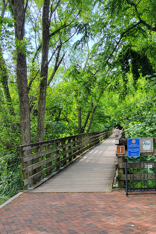
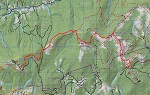
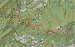
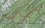
The Virginia Creeper Trail is a picturesque rails-to-trails path that winds its way for thirty-four miles through the Mount Rogers recreational area. The trail starts in Whitetop and ends in Abingdon, with Damascus sitting right in the middle.
We biked the Creeper section from Whitetop to Damascus on a rainy day many years ago. We planned to do the whole thing that day, but the rain became a heavy downpour and it was too muddy to enjoy biking. We tried to come back a couple times to bike the second half, but were foiled by more rain and tornado damage. Last summer, we finally made it back to officially finish the remaining 16 miles between Abingdon and Damascus.
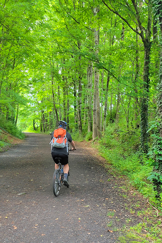
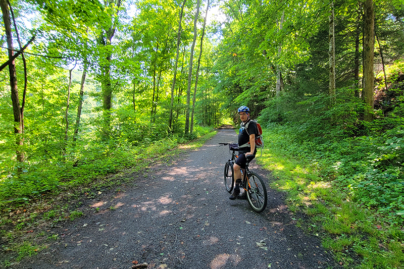
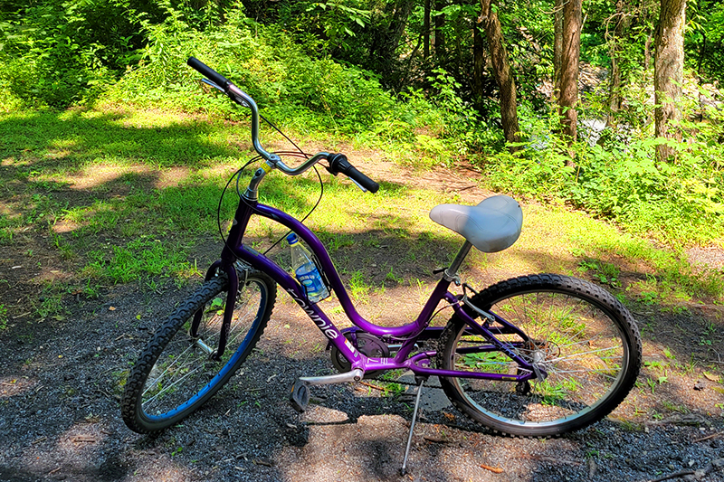
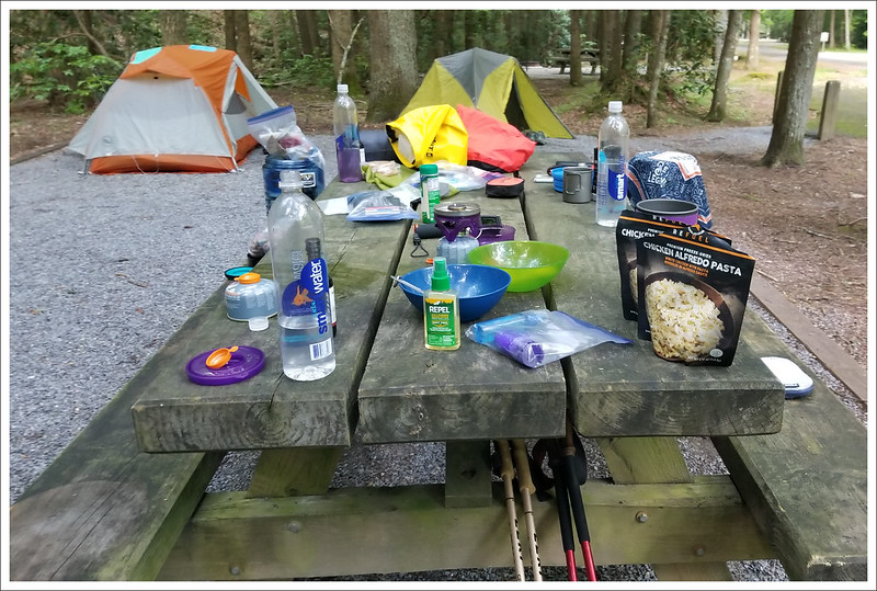
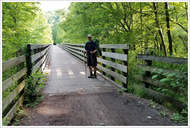
We have our own bikes, but they were badly in need of tune ups, so we left them home and rented from Blue Blaze Bike and Shuttle in Damascus, Va. Adam rented a mountain bike and I decided on a cool, purple cruiser. The trail’s terrain is generally smooth and covered with small gravel, so I decided to go with plush comfort rather than more rugged equipment. The rental shop was affordable and their bikes were impeccably maintained.
We booked seats on their first shuttle van of the day, and ended up being the only riders. Our driver was fun to talk to and was a regular hiker and biker. The shuttle took us from the shop back to mile zero in Abingdon, Va. From there, it was a mostly flat 16 mile ride back to their shop.
The section from Whitetop to Damascus is far more popular than the section we did this time – it’s a little more scenic and it’s all downhill, so it requires very little exertion. Our ride was still very easy, but we did have to pedal! The nice thing about biking the less popular half on a weekday was that we practically had the whole trail to ourselves. We saw just a handful of other runners and cyclists. The Creeper can get very crowded and congested, so this was a treat!
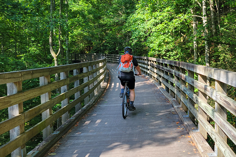
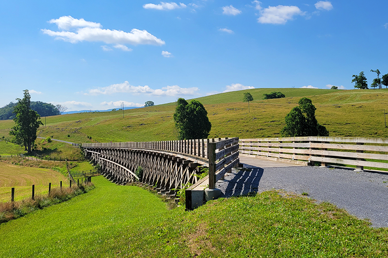
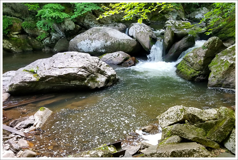
The main things to see along the Creeper Trail are beautiful waterways and railroad trestle bridges. The section we rode passed mostly through farmland, whereas the other half is more wooded. It was still really pretty, and the breeze from riding the bike made the heat bearable.
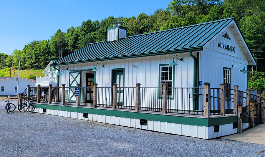
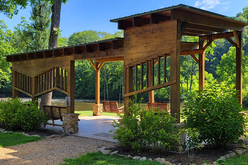
We stopped for a short snack and drink break at Alvarado Station about 8.5 miles into our ride. The station was once a railroad stop halfway between Abingdon and Damascus. It is the only stop for snacks and restrooms on this half of the trail. Across from the restroom building, there was a nice trailside park with a pavilion and porch swings. We sat by the river and enjoyed the view. We even saw a heron!
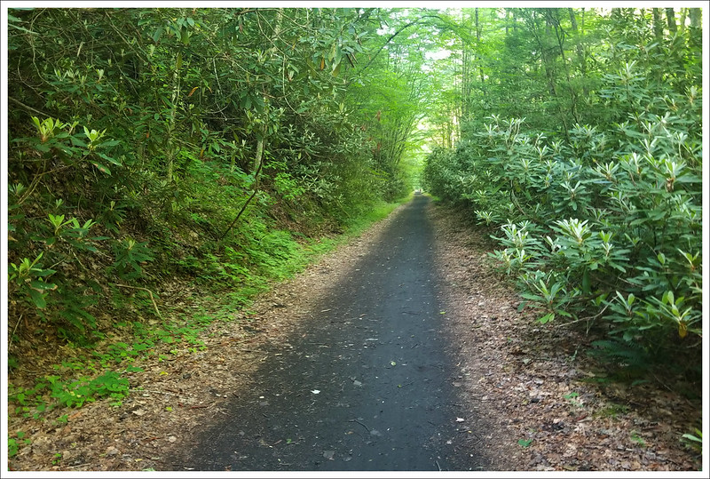
After our break we pedaled the remaining seven-ish miles into Damascus. The last mile or so follows the main road into town, so there are more road crossings and car noise. The nicest thing about trails like this is that the mostly keep car and bike traffic separated, so you always feel safe riding.
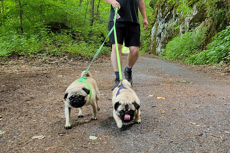
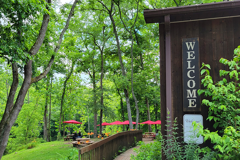
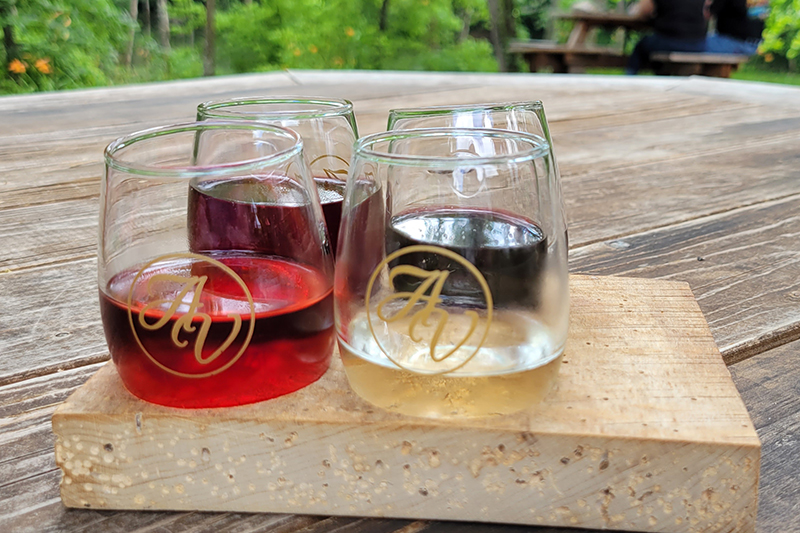
We got back into town, returned our rentals, got some lunch at Wicked Chicken Winghouse – another decent lunch stop in Damascus. Afterwards, we drove back to our AirBnB and picked up the dogs and took them for a two mile walk along the Creeper. After we got them nice and tired, we headed to Abingdon Vineyards to try some wine. The winery is dog friendly and has lots of outdoor tables along the stream. The day finished up with desserts from Anthony’s Desserts in Abingdon. If you’re in the area, this place has the most amazing sweets – don’t miss it!
More Photos
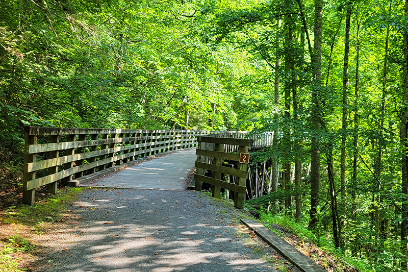
Trestle #1 on the Virginia Creeper
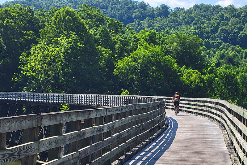
Biking on the Creeper
Crossing railroad trestles
Trestle #2 – they are all numbered and there are over 35!
Pretty farmland
Adam biking along
Taking a break in the shade
Alvarado Station park
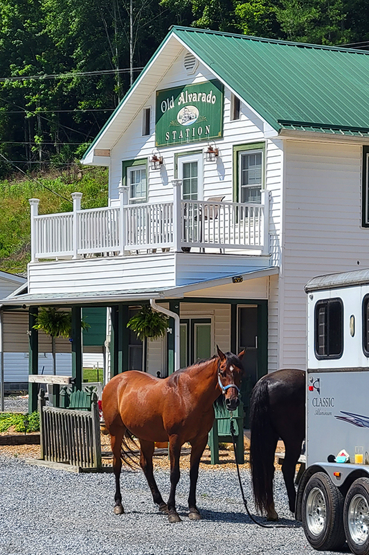
Horses are welcome and common on the Creeper
My sweet purple cruiser
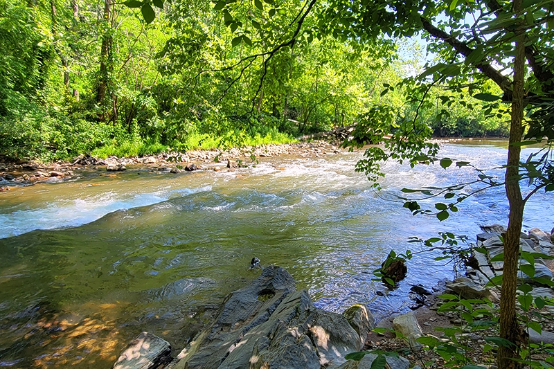
Some small rapids near Damascus
Pretty blooms along the trail
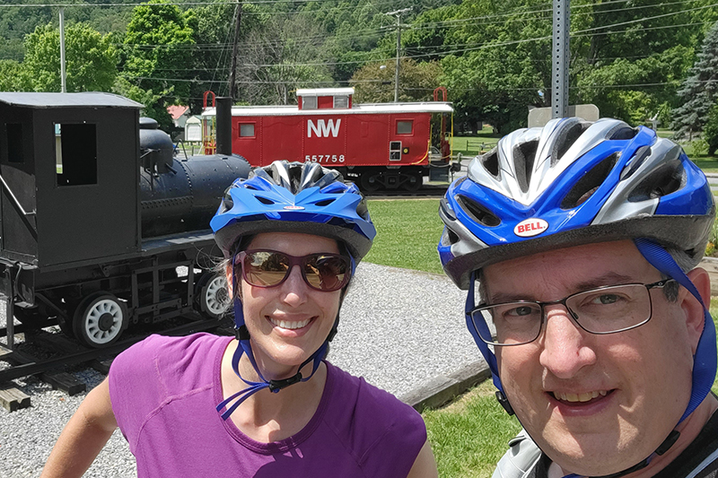
Bike selfie back in Damascus
Pugs on the Creeper!
Abingdon Vineyard
Wine flight
Don’t miss Anthony’s Desserts in Abingdon
Seriously – don’t miss Anthony’s Desserts! This is just half the case!
This 56-mile backpacking trip traverses some of Virginia’s very best Appalachian Trail scenery! There are panoramic vistas, windswept balds, meadows full of wildflowers, pretty streams, and even wild ponies. We were lucky enough to have six days of nearly perfect weather and not a single drop of rain!
We hiked across an open pasture full of cattle. Below: Mt. Rogers Outfitters provided safe parking and shuttle service for our trip; Crossing the footbridge over the South Fork of the Holston River; Signing the log book as we begin our hike.
Day One – South Fork Holston River to Hurricane Creek Campground (9 miles) – Christine
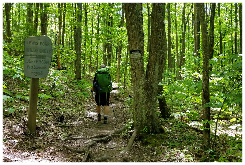
Bright and early on Monday, May 20, we piled into our car and made the three and a half hour trip down to Damascus, Virginia. Town was busy with many thru-hikers still lingering after Trail Days (the huge, annual hiker festival and party hosted by the town.) Knowing we had six days of oatmeal and trail mix ahead of us, we enjoyed a fresh lunch at Mojo’s Trailside Cafe. Their food is excellent and the place has such a cool hiker vibe. After eating, we drove over to Mt. Rogers Outfitters to meet our ride. Our shuttle driver turned out to be a local woodworking artist named Matthew Newman (he has a gallery in town.) He was right on time and the trip to our start point flew by as he shared stories about the area’s history and geology. The Appalachian Trail crossing of the South Fork of the Holston River is in the middle of nowhere – just a tiny one-car pullout along a lonesome back road. We crawled out of his van, made sure we had all our stuff, and hit the trail. It was already 1:30 and we had nine miles to go before we reached our first camp stop.
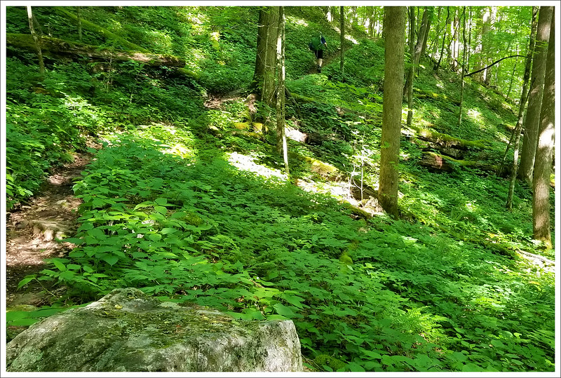
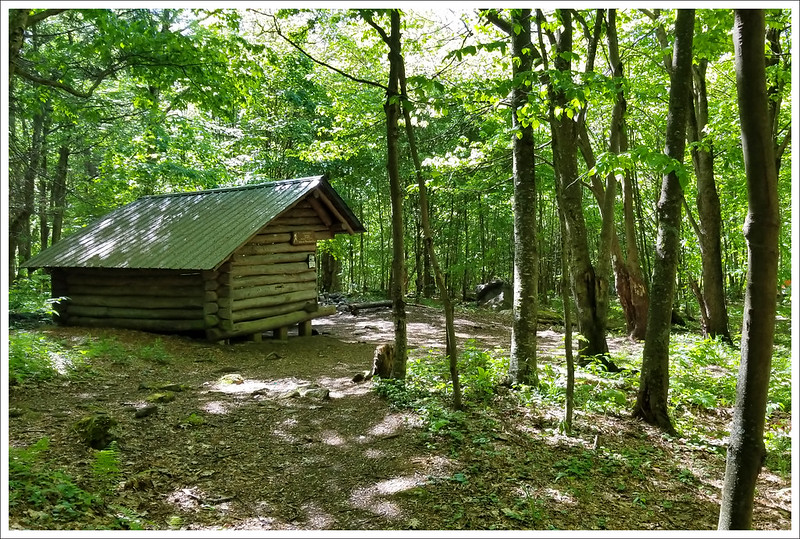
We signed the wilderness-area logbook and crossed the wooden footbridge over the Holston River. We immediately started a gentle climb uphill through the woods. Eventually we reached a gravel road that paralleled a farm field. We climbed over a stile into a livestock pasture. The cows were completely indifferent to us, grazing and swinging their tails to swat flies away. The trail climbed steadily across the open terrain. We had some nice views of mountains behind us, but the sun felt hot and strong. We were glad to get to the stile on the south end of the pasture and duck back into the shade. After leaving the pasture, we had almost four miles of non-stop climbing. It wasn’t terrible uphill, but it was steady. Kris and I took a detour and visited Trimpi Shelter about a mile into the climb. It was a cute shelter with a center aisle, indoor stone fireplace, and abundant flat space for tenting around the shelter. Even though it was only a bit after 2:00, there were already a few hikers stopped for the day.
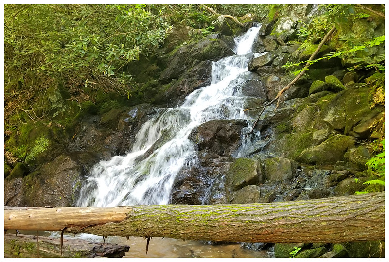
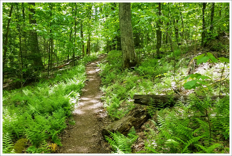
Comer Creek Falls was small but pretty. Below: Blooming Catawba Rhododendron; Abundant ferns along the trail; The AT is like a ribbon through the woods.
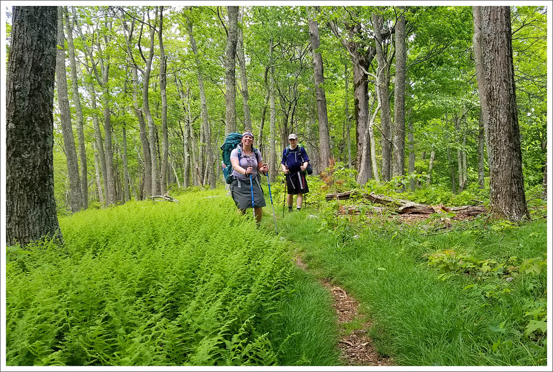
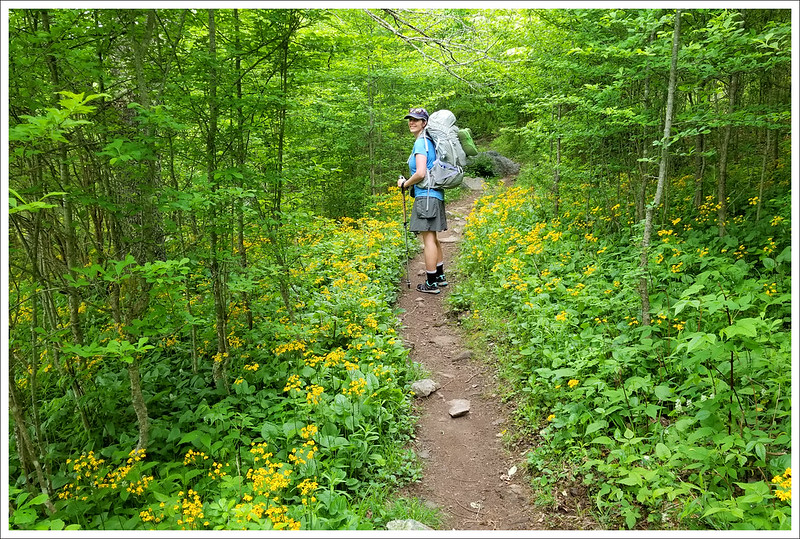
We climbed for another three miles. At the end of the ascent, we had a gorgeous, flat ridgewalk through lush fern. We trekked along until we reached the junction with a blue-blazed side trail that leads down to the forest service campground at Raccoon Branch. We stopped at the junction for a snack and gave Kris a chance to check on her feet. She was feeling a few hot spots in her new hiking boots and was dismayed to find several big blisters already forming just several miles into our hike! From there, we had a long meandering downhill to Dickey Gap. We passed lots of blooming flame azaleas and Catawba rhododendrons – and even a few early mountain laurels. We got to Dickey Gap a bit after 4:30. We chatted with a couple thru-hikers sitting in the shade under kiosk at the road crossing. They asked about the terrain headed north and indicated that they were going to try and make it to Marion (which was still 14 miles away!) You really have to admire thru-hikers’ ability to crush big miles like that.
The trail sign on the other side of the road said we had about 2.5 miles to go to reach our first campsite of the trip. About a mile later, we found ourselves at the base of Comer Creek Falls. The bridge across the creek was partially sealed off with yellow hazard tape. A sign indicated that the bridge was closed and hikers should backtrack and follow the detour indicated on the map. Well… we were all tired, Kris’s blisters were excruciating, and Adam was having back spasms. We just wanted to get to camp. We made a joint judgment that the bridge looked sturdy enough and decided to cross it one by one. Clearly, since I’m now writing this post — we lived! It really wasn’t all that dangerous. And, I guess sometimes you have to break the rules and live on the edge.
It’s nice to have a private campsite with your own picnic table. Then you’re free to spill your food and gear out everywhere and take up the whole table. When you’re at a shelter with others, you have to be nice and share space. Below: The bath-house at Hurricane Creek; One of many beautiful campsites at the campground.
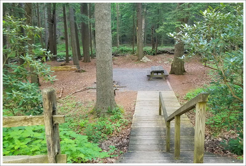
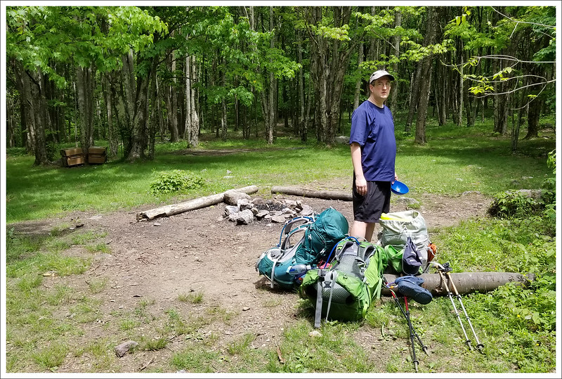
A mile later, we found the spur trail down to Hurricane Creek Campground – one of the USFS campgrounds in the area. We had already paid for a site ahead of time, but found the entire campground pretty much empty. We easily could have claimed any of the walk-in, first-come-first-served sites. I chatted briefly with the campground host. He handed me a pamphlet and told me a bear had been opening car doors and stealing food. He recommended we store our food in the locked trunk of our vehicle. Hmmm… I guess he didn’t really notice that we all showed up on foot!
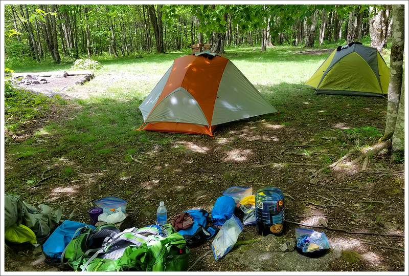
One of the perks of staying at the campground instead of an AT shelter was the fact that the campground had hot showers. I don’t need a shower every day on the trail, but any time I can get one, it’s a nice morale boost. It feels good to be clean when I crawl into my sleeping bag at night. We made a campfire, cooked dinner, and did our best to dodge the thick clouds of mosquitoes swarming around. Adam wrote a hilarious rap tune for our section hike, and each night during the trip he added and performed a new verse about our adventures for the day. After discussing the bear issues in the area, we ended up storing our food inside the vault toilet building across from our campsite. The door to the bathroom latched securely and the campground was empty, so it seemed like the best option. We ended up staying up until almost 10:00 – way past typical hiker midnight. Eventually, we headed to our tents and drifted off to sleep.
Download DAY ONE Maps and Elevation Profiles
Day Two – Hurricane Creek Campground to Old Orchard Shelter (8.7 miles) – Adam
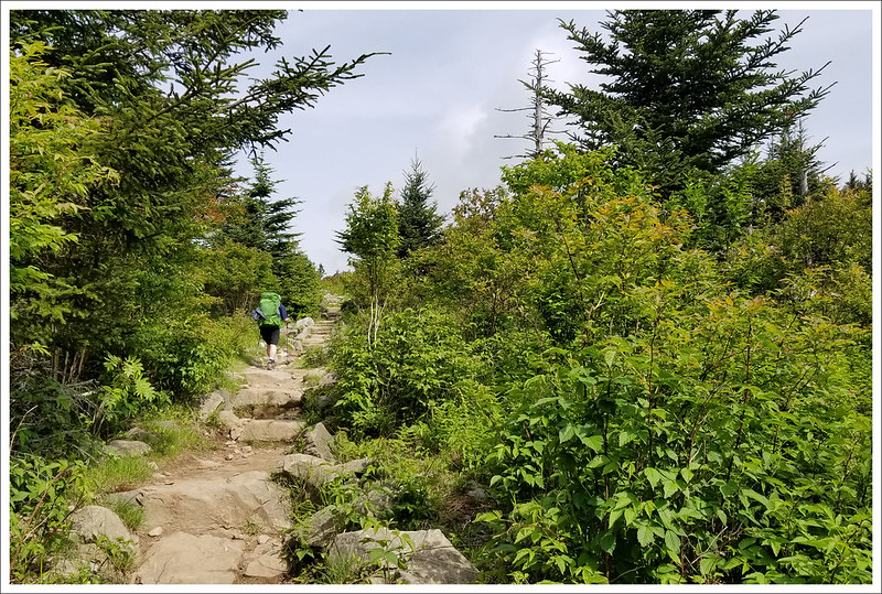
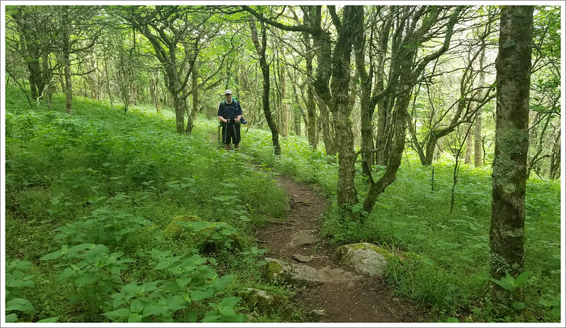
Day two was completely in the green tunnel – no views. If you look closely, you can see Adam making his way uphill. Below: Hurricane Mountain Shelter; Taking a break from the heat and the strain of carrying packs; More trail scenery from the second day.
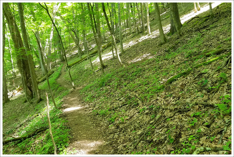
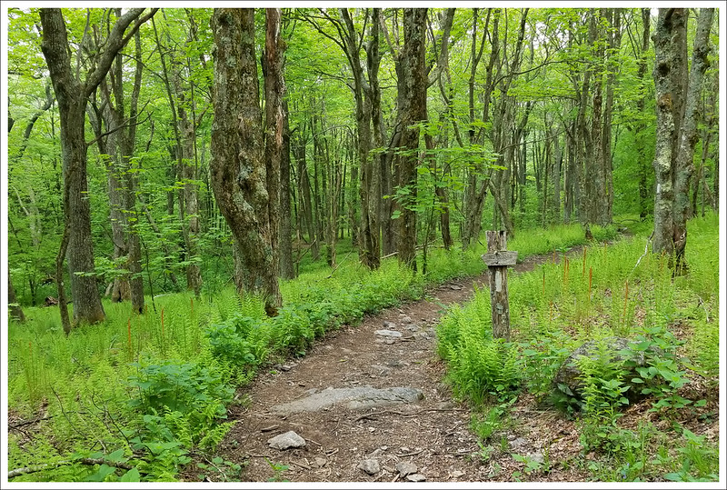
We started off day two from the campground, following the spur trail for about .7 mile back to the junction with the Appalachian Trail. Most of the day consisted of uphill climbing, but fortunately there were many water sources, so we didn’t have to carry a large (and heavy) amount of water.
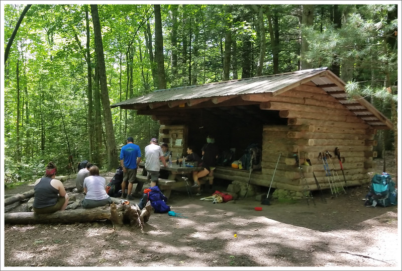
About 1.5 miles into our walk, we passed through a beautiful section of trail surrounded by blooming rhododendron and azaleas. For a while, the trail was rolling and easy, but at the junction with the Hurricane Creek Trail, the trail took a turn steeply uphill along a wide, road-like section. Around the 3.9 mile mark, we took the .1 mile side trail on the right that led us to Hurricane Mountain Shelter. It was a nice place to eat a snack and stretch out our legs and backs (and tend to our feet). After the shelter, we had just over a mile more of steep climbing to reach an area known as Chestnut Flats. We had climbed about 1400 feet already; this wasn’t that bad over a long stretch, but there were some short steep sections along the way. At this top bump, the AT also reaches a junction with the Iron Mountain trail. We passed lots of hikers sitting trailside, using their phones. This was one of the few spots on the hike that actually had cell reception. Lots of people were catching up with texts, calls, and social media. We also came across a thru-hiker that told us there was some great trail magic ahead. That is always a motivator to any backpacker – you want to move quickly so you don’t miss out.
Trail Magic provided by Greybeard and Been There. Christine is eating a hot dog and Kris is using some of the first aid supplies to fix her feet. Below: The footbridge over Fox Creek; Our last climb of the day; Dropping packs at our selected campsite for the night.
It was a steep downhill for the next mile and a half, but we soon reached Fox Creek, VA 603. As soon as I crossed the road and parking lot, I saw a sign in the tree pointing to Trail Magic. When I walked into the area, I was blown away by the setup. There were two guys, Greybeard and Been There, that had set up a large trail magic area. They said all hikers – thru and section – were welcome. They had grilled hot dogs, marinated chicken, a tub of fruit, homemade pie, cold sodas, and tons of snacks to take with you. They had a table filled with medical supplies for the taking and a handwashing station. They even had camp chairs (with backrests – a true luxury) and a campfire. Greybeard has been setting up here for years on the week after Trail Days. He runs a GoFundMe page for contributions to buy all of the food and supplies. Been There was helping out with cooking and making sure everyone was in good health and spirits. It truly restores your faith in humanity to see people out there caring for other hikers and it was great to relax and talk trail with everyone there. Greybeard left camp while we were there because he found a stuff sack of food that one of the thru-hikers had left behind. He went further up the trail to leave it at a shelter the hiker would find – it would stink to leave days worth of food behind. They also told us the previous night they had a bear come into camp. After not getting food near the tents and campfire, he ambled over to the nearby parking area and broke into a trailer. Apparently, he made off with a full case of hot cocoa packets before moving on to steal feed from the horse camp across the road.
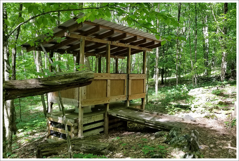
The nice people we shared a campfire with at Old Orchard. Below: Our lovely campsite under the shady tree canopy; Old Orchard Shelter; The privy at this shelter was huge and airy.
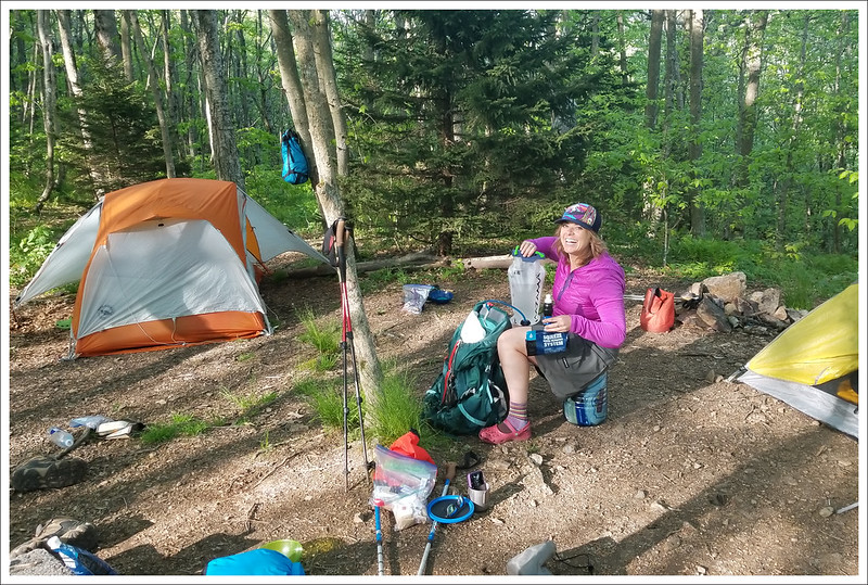
While it was tempting to stay near the trail magic camp, we pressed forward to our planned stop. We had another steep climb to reach our endpoint, but we felt renewed from our brief respite. At 8.7 miles, we reached Old Orchard Shelter. We were one of the first groups to arrive for the day, so we staked out a prime spot on in a flat grassy area – taking care to avoid the abundant poison ivy. Over the course of the evening, more than 20 people arrived and set up their own tent sites. The water source was a bit of a walk from the right side of the shelter, but was flowing nicely. We set up camp and then began to make some dinner – PackIt Gourmet Kickin’ Chicken Wraps. There was an odd-acting person at the shelter, so we ended up having about 14 people come sit at our campfire. We joked that we felt like the “cool kids” since everyone came to hang out with us. You always meet interesting people on these hikes. We met a Texas acupuncture doctor (who I discovered knew a mutual friend), a woman that was flying home to get married in just a few days, a woman from Germany out with a guide, a college professor hiking with her niece, and a couple of fire fighters from New York that drove down to do a section. It’s crazy how so many different people can come together over a fire that all share a passion for hiking. We had a great night talking with everyone and were excited about the next couple of days on the trail.
Download DAY TWO Maps and Elevation Profiles
Day Three – Old Orchard Shelter to Massie Gap (8.7 miles) – Christine
Adam climbs the Appalachian Trail leaving Old Orchard Shelter. Below: The gate at the top of Pine Mountain; Sunshine on Pine Mountain; Descending toward Scales Livestock Corral.
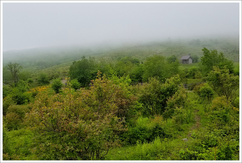
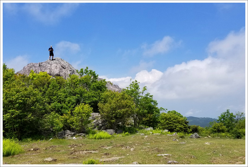
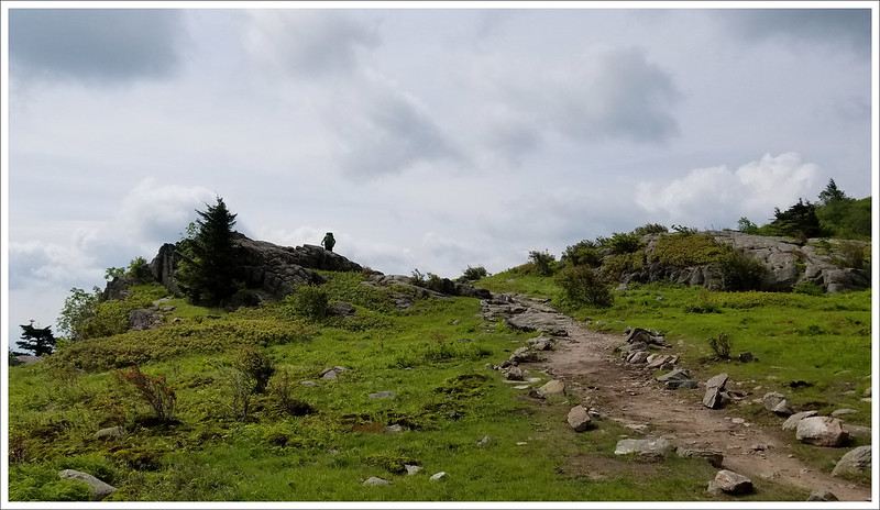
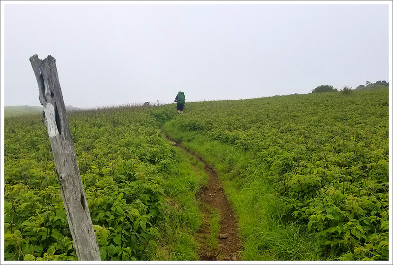
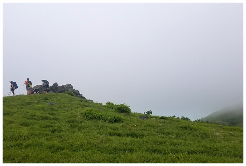
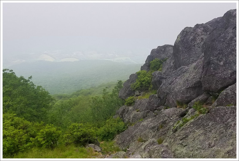
Our miles for the day started with a thousand foot climb to the summit of Pine Mountain. At the top of the mountain, we passed through a gate and followed the edge of a sunny meadow for a short distance before going through another gate where the trail went back into the woods. We descended through pretty forest for about a mile – there were pine roots, ferns, and abundant yellow flowers. As the trail leveled out, we found ourselves walking in a cloud. The sunshine we’d had back at the top of Pine Mountain had given way to low clouds settling between mountains. Through the mist, we could see a small building on a hillside off in the distance. At first I thought we were coming up on Wise Shelter, but I soon figured out the shelter was still miles away. What I actually saw was the vault toilet building at Scales Livestock corral. It has to be the most scenic privy in Virginia!
Adam hikes toward Scales Livestock Corral. Below: The prettiest pit toilet in Virginia; Fog on Stone Mountain; Flame Azalea.
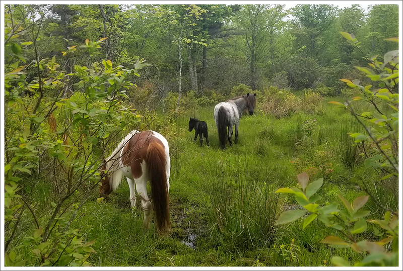
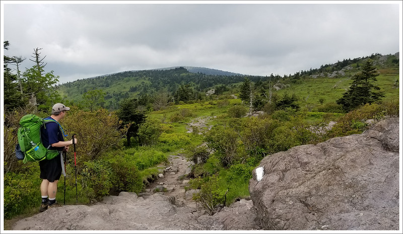
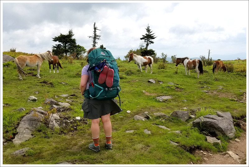
After Scales, we had a short but steep uphill to the top of Stone Mountain – the four mile mark for our day. The long, pleasant ridge-walk should have offered beautiful views, but we were still socked in by heavy clouds. It was cold and windy along the summit walk. After a gradual descent of Stone Mountain, we entered Little Wilson Creek Wilderness. It was lovely and green. At 6.2 miles, we reached Big Wilson Creek and the junction with the horse trail. We crossed the stream on a wooden footbridge and went over another stile. I was paying close attention to my footing as I crossed a rocky area. Adam looked back at me from ahead and nonchalantly said, “Hey… I’m going to stop here and take photos of some ponies.” PONIES! I thought he was kidding at first. I didn’t expect to see ponies until day four. But sure enough… there was a band of six ponies grazing in marshland along the trail. Adam stepped slightly off trail to get a better view when suddenly a tiny black foal popped out of the deep grass. He couldn’t have been more than a week old and he was beautiful! The three of us all greatly enjoyed spending time watching these wonderful animals. The ponies eventually wandered deeper into the marsh, and we continued another .2 mile to Wise Shelter – our lunch stop for the day.
Our first Highlands ponies of the trip. We loved the tiny foal. Below: Little Wilson Creek Wilderness; Watching the rocky footing right before seeing ponies; What a gorgeous pony; Wise Shelter – our lunch stop.
We decided to take a long break and enjoy a hot lunch. We had some extra food to use up since we had a trail magic lunch the day before. Kris made a salmon pesto meal and Adam and I shared a package of Good To Go Mushroom Risotto (one of our favorites!). We had delightful lunch companions – two women from Sweden, a man from Kentucky, and a British guy – all thru-hikers. After they hiked on, we were joined by a man who was less-than-pleasant company, so we packed up and made our way into Grayson Highlands State Park. The park’s boundary is just south of the shelter.
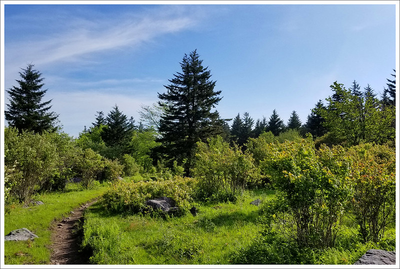
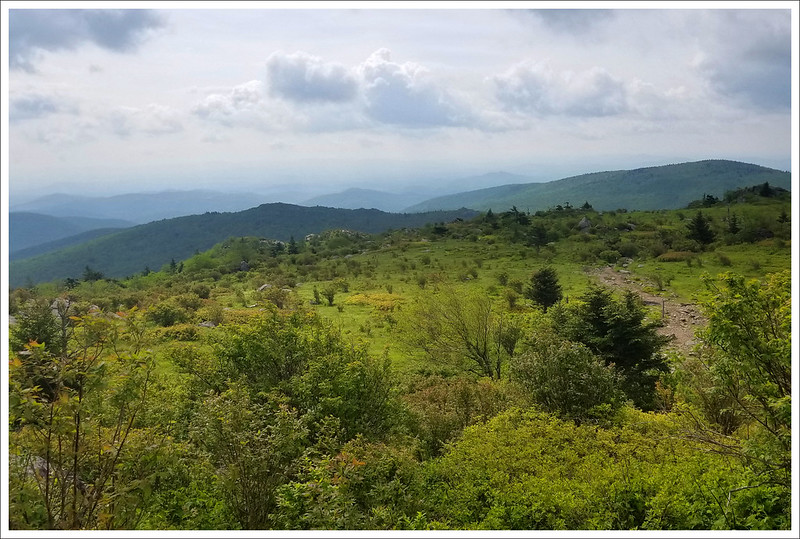
From the shelter, we just had about 1.5 miles of climbing to reach the spur trail to the parking area at Massie Gap – our end point for day three. That 1.5 miles was incredibly scenic. The area is covered with only low shrubs and small pine trees, so the views are open in every direction. There are rock formations, wide meadows, ponies grazing, and (if you’re lucky like we were) blooming rhododendrons. We took tons of photos, watched ponies frolic, and enjoyed the magnificent views. It was everything we hoped the trip would be!
Approaching Grayson Highlands. Below: Adam is on top of the world; Blooming rhododendron; More beautiful ponies.
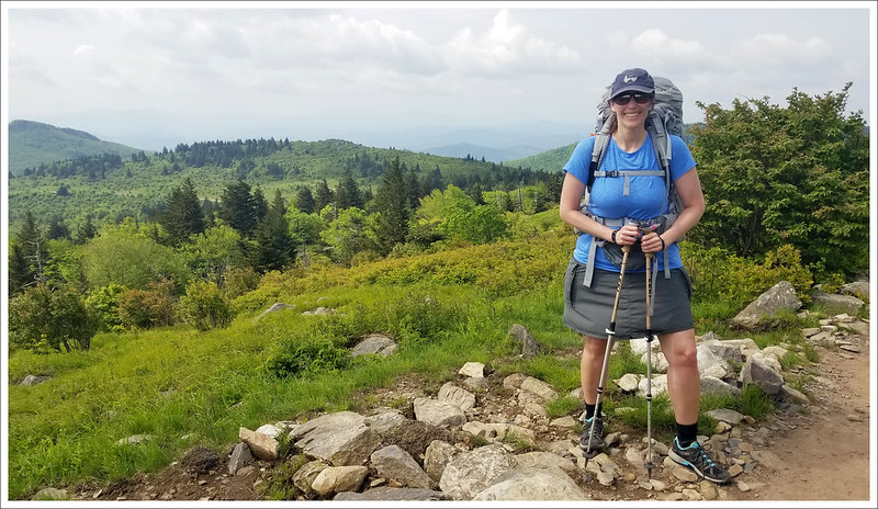
Around 2:30, we made our way down to Massie Gap where we were meeting the owner of the Grayson Highlands General Store and Inn. We had called him from the junction of the AT and the spur trail down to parking. After about 15 minutes of waiting, Dennis came along in a truck and whisked us away for a night of hiker-luxury. We had reserved the inn suite for the three of us. We also sent a resupply box with food for the second half of our trip. Carrying a full week of food is very heavy (backpackers typically carry 1 – 1.5 pounds of food per day), so it’s a treat to be able to resupply every 3-4 days. At the inn, we enjoyed pizza, beer/wine, and ice cream! Our suite had two bedrooms, a kitchen, a bathroom, and even a washer/dryer. We were all able to shower and wash our sweaty clothes. We spent most of the evening relaxing and repacking our bear canisters. It was nice to sleep in a queen size bed – so spacious compared to the floor space in our tiny tent! I would highly recommend the Grayson Highlands General Store for anyone who wants a night off-trail in the area. The accommodations are simple, but they’re very clean, affordable, and comfortable. Also, the staff at the inn takes great care of hikers! We really enjoyed our stay.
Waiting for our shuttle Below: Grayson Highlands General Store and Inn; Great hiker supplies; Cheers with a Wolf Hills ‘White Blaze Honey Cream Ale’!
Download DAY THREE Maps and Elevation Profiles
Day Four – Massie Gap to Whitetop (10 miles) – Adam
Day four was the highlight of the entire trip. It turned out to be the toughest day physically, but everything we saw helped make the pain bearable. We started off our morning with breakfast at the inn. Kris and I had french toast with bacon and Christine had a grilled bacon and cheese sandwich. We also got some deli sandwiches to pack for lunch on the trail. Dennis, the inn’s owner, gave us a shuttle ride back to Massie Gap parking. We had about a mile walk back up to where we rejoined the Appalachian Trail.
We started day four of our hike in Grayson Highlands State Park. Below: Massie Gap in Grayson Highlands State Park; The rocky trail through Grayson Highlands; Storm clouds and windswept terrain.
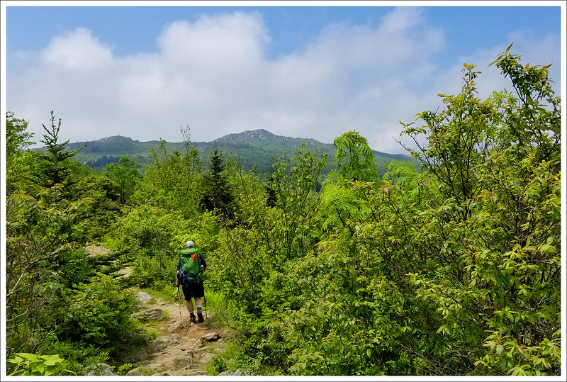
We took a left and headed south on the AT. The climb was steep and slow going at the beginning, but we were soon greeted with expansive views all around. It was quite easy to just say that you were stopping to take photos when you really needed to catch your breath. The terrain was relentlessly rocky and rugged. The clouds that were hanging above the mountains added to the visual drama. We thought we were going to get stormed on, but luckily the rain held off all day. The one thing that amazes me about this area is how fitting the word “Highlands” is to describe the terrain – in this area you may feel like you are walking in Scottish Highlands.
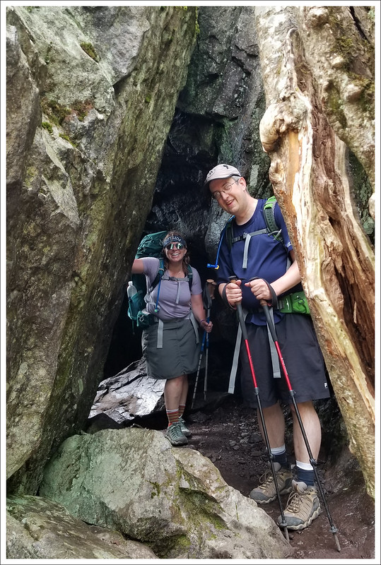
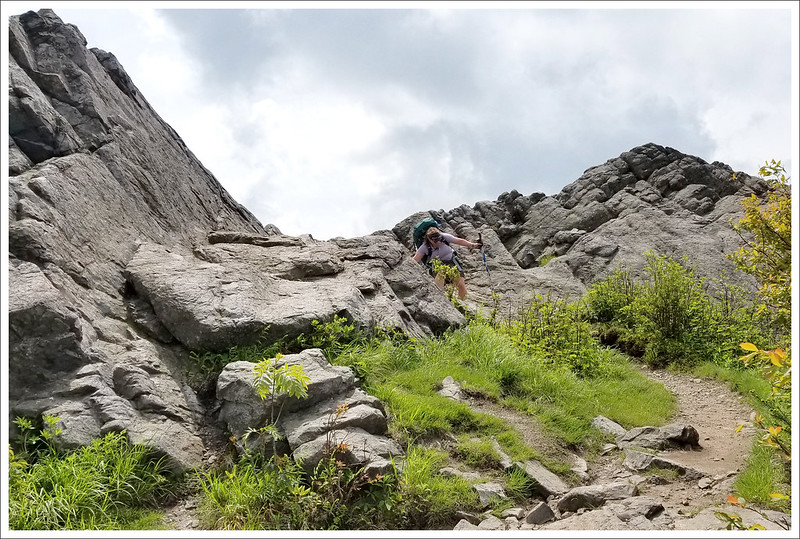
The Grayson Highlands are like no other place in Virginia. Below: Kris scales a steep rocky section; Christine scrambles along the trail; The Fat Man Squeeze.
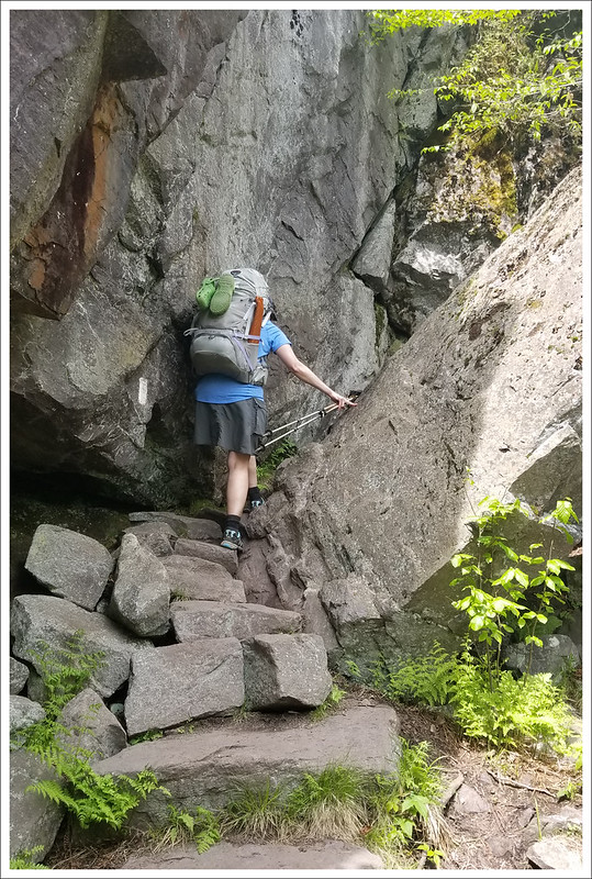
At about the 1.5 mile mark, we reached the southern edge of Grayson Highlands State Park, marked by a turnstile to an open field. From here we went back onto national forest land. The trail climbs up steeply and we reached a spot called ‘Fatman Squeeze’ at 2.2 miles. It is an interesting rock formation that you can climb through. It wasn’t that much of a squeeze, but if you don’t want to risk humiliation or don’t like the claustrophobic feel there is a path that loops around the feature.
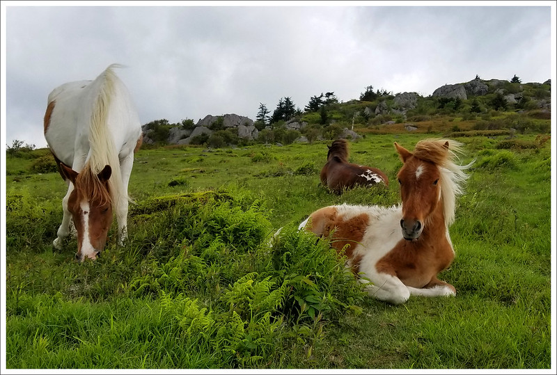
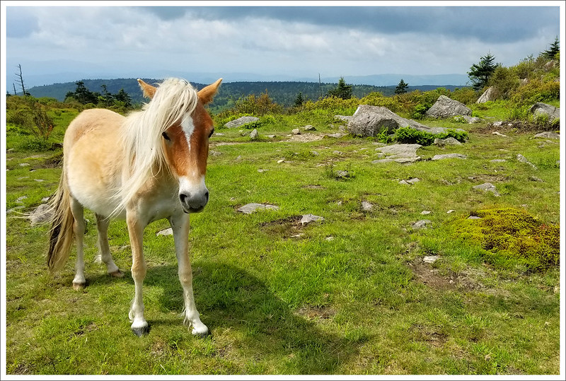
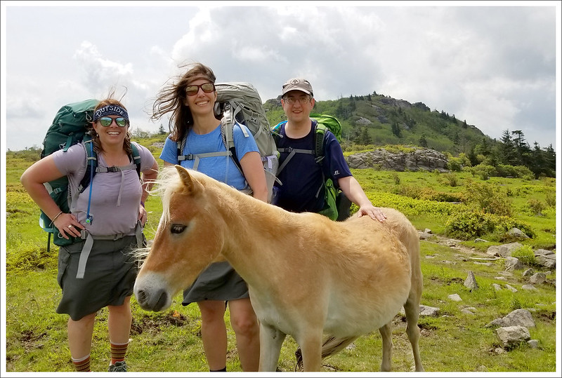
After the Squeeze, we reached Wilburn Ridge at 2.5 miles. As we crossed over the bump, we spotted another band of ponies lounging next to the trail. While they call these “wild” ponies, they are accustomed to people and may try to grab some food from an unattended backpack. The ponies all have such interesting markings and we talked about which one was our favorite. The trail had another short uphill bump before we came to Rhododendron Gap and a junction with the Pine Mountain Trail. On the ground, someone had arranged rocks into “500” noting the 500 mile mark of the Appalachian Trail for northbound hikers. There is another bit of fairly easy walking on this ridgeline – and the views keep coming if you’re lucky to visit on a clear day.
This area is known as the crest zone. The views are open and the ponies like to hang out in this area. Below: PONIES, PONIES, PONIES!
At 4 miles, we reached the Thomas Knob shelter. As I approached the shelter, I paused to take a photo and startled a retired police officer eating lunch there. Just a minute before I arrived, a bear had come right up to the shelter where she was sitting. She thought I was the returning bear. We stopped to eat lunch and heard more from the woman about the bear. The shelter log said that at night, gleaming bear eyes can be seen in the nearby trees, watching the open shelter.
Adam hiking in one of Virginia’s most scenic places. Below: The crest zone is the open area all along the ridge leading to Mt. Rogers; Christine enjoys the majestic views; Thomas Knob Shelter.
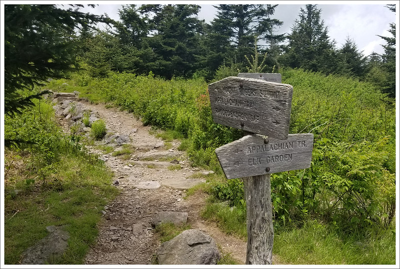
The area has been extremely problematic for aggressive bears over the last couple years. In 2018, several miles of AT in this area were closed to camping after tents were shredded and over 70 hikers’ food bags were taken by a bear. Now, there are bear lockers installed near the shelter, so be sure to store food and other ‘smellables’ securely if you decide to stay near Thomas Knob. Despite the addition of bear lockers, some hikers are still continuing to sleep with food in their tents and in the shelter, so bear problems have persisted into the 2019 season. After lunch, we continued on and just a short distance along the trail we reached a junction with a spur trail that leads to the summit of Mt. Rogers (we wrote about this in another post – no views but something worth doing if you want to bag the highest peak in Virginia).
It was sad to leave the beautiful Mt. Rogers and Grayson Highlands. Below: This spur trail leads to the summit of Mt. Rogers – Virginia’s highest peak; As you descend from the Highlands, the forest changes quickly to pines; The descent from the crest zone was very rocky.
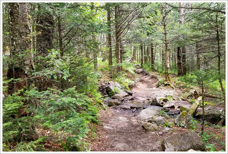
After the Mt. Rogers junction, the trail descends steeply over rocky terrain until you reach Deep Gap at 6 miles. We saw dozens and dozens of northbound thruhikers coming the opposite direction as we descended from Grayson Highlands. More than a few mentioned that they were not enjoying the big climb and asked if the scenery ahead was as amazing as reputed. We assured everyone that the big climb was totally worth the payoff at the summit.
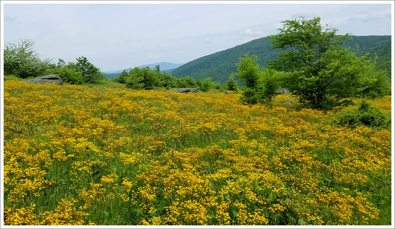
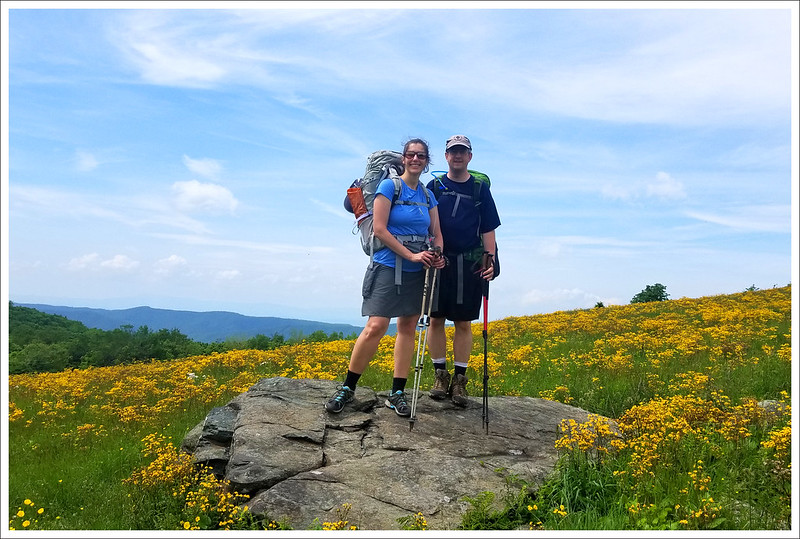
We took off our packs for a break, but we knew we still had more miles to cover. Continuing on, we kept descending and reached the beautiful mustard fields of Elk Garden. It was hot in the open sun. We crossed VA 600 at 8 miles and ran into a grandfather that was hoping to meet his thru-hiking granddaughter along the trail. We hadn’t seen her yet (we would the next day), but we rested again for a bit as we reentered the woods.
Elk Garden was a meadow of golden flowers. Below: Christine and Adam pose for a photo in the meadow; The climb up Whitetop Mountain; The last uphill of the day.
The day had already been tough and we had a big climb ahead of us. We debated stopping there for the night, but decided to camp where we had originally planned. We summoned what little strength we had left and pressed on to the end. We had 2.4 miles of an uphill climb to make it to the end of our day and it was all fairly steep. We hiked separately, setting our own paces, with Christine in the lead.
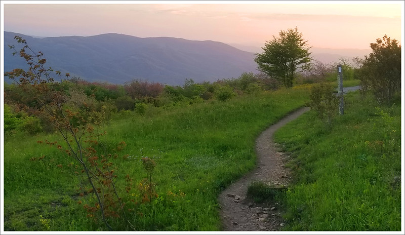
When we got to the high point on Whitetop Mountain, almost all the campsites had been taken, but Christine managed to grab the last decent one when she arrived. It was probably the worst of the campsites that we had for the trip, but it was still fine. Lots of other hikers ended up squeezed into tilted rocky sites that couldn’t have been comfortable.
This soft glowy light was a true reward at the end of the day. Below: This sign made us all thankful because we knew the climb was ending; Kris filtering water at camp; More beautiful evening scenery.
Water was quite a distance from camp, but on our way to the source we enjoyed great views along an open ridge. The water source was a piped spring that came out of the mountainside. It gushed ice cold water and might be one of the nicest water sources we’ve ever seen. Christine and I both doused our heads and splashed our faces and rinsed away a lot of the day’s salty sweat. We made PackIt Gourmet All American Cheeseburger Wraps for dinner – maybe our new favorite backpacking meal. They were delicious! After brushing our teeth and finding a good place to wedge our bear canisters, we watched sunset from the open ridge, and then went to bed before 9:00. We were all exhausted. It had been an amazing, but tiring, day.
Download DAY FOUR Maps and Elevation Profiles
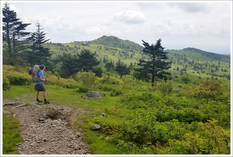
Day Five – Whitetop to the Virginia Creeper Junction (8.5 miles) – Christine
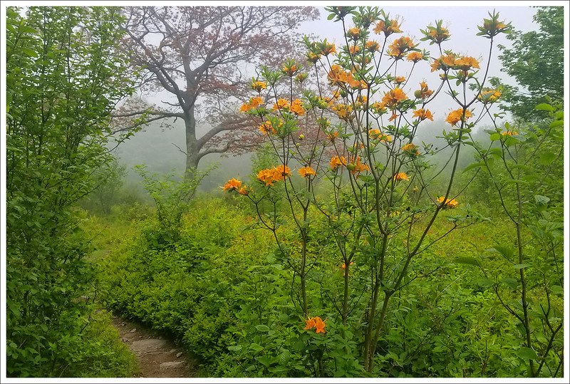
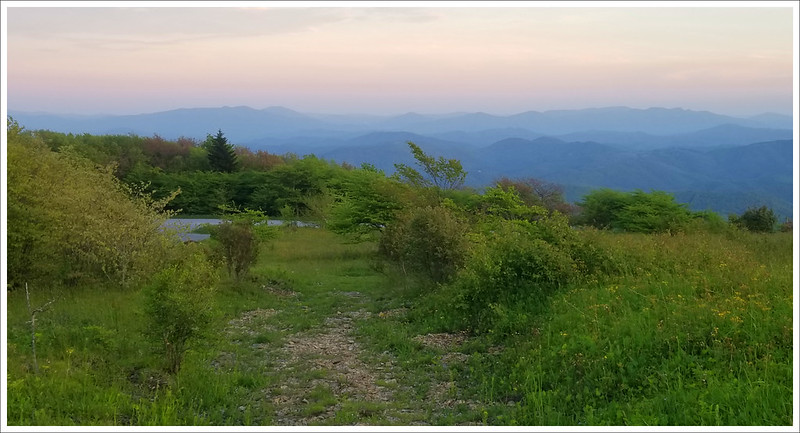
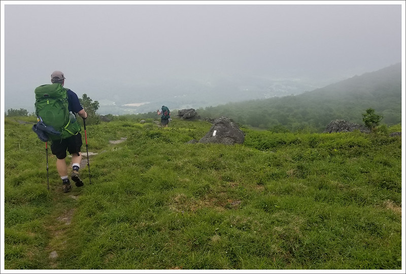
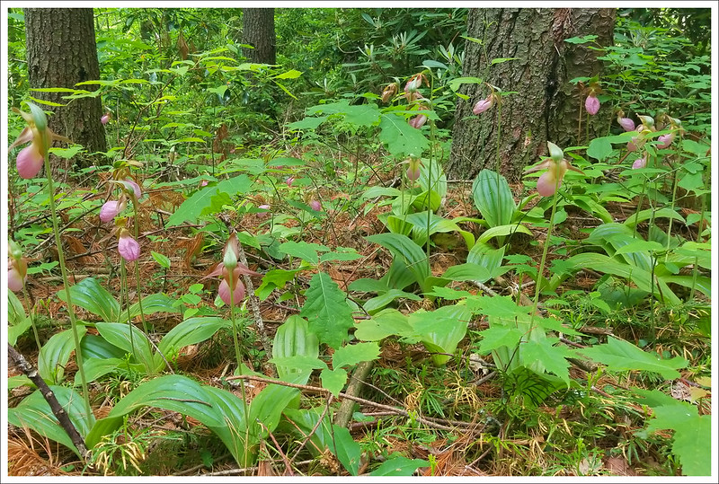
Day five dawned with our high-elevation campsite blanketed in fog. We hoped enough of the mist would lift to allow us to enjoy the views from Buzzard Rock, but with only a mile to cover, we were at the vista about twenty minutes after hiking out of camp. At the viewpoint, we found ourselves still standing in the middle of a cloud. Luckily, we could still make out faint views of the valley below. Even veiled, Buzzard Rock is a gorgeous spot – and also our last opportunity to enjoy the highlands on this trip. Shortly after the viewpoint, the trail takes a steady 3.8 mile downhill drop from 5,080′ all the way down to 3,160′. At the beginning of the descent, we saw the fading final red trillium of spring and at the bottom of the descent, we saw abundant pink lady’s slippers. The drop in elevation let us see both early and later bloomers on the same day!
Adam climbs through the fog to Buzzard Rock. Below: Buzzard Rock outcropping, Faint views into the valley below; Adam and Kris leave the Virginia high country for lower altitudes.
At the bottom of the descent, we crossed Route 58 and made our way back uphill for a mile to reach Lost Mountain Shelter. The lower elevation brought on the extra heat and humidity. Paired with the exertion of climbing, we were all pretty hot and tired when we arrived at the shelter for lunch. The area was crowded with a crew of volunteer maintainers from the local trail club and about ten thru-hikers in for a mid-day break. The trail club kindly carried out everyone’s garbage! It’s such a small thing, but to have a day hiker offer to take your trash out is true trail magic! We collected water and decided to make our PackIt Gourmet cheese spread for lunch. It’s a really delicious meal, but I think everyone was too hot to really be hungry. We couldn’t finish everything, so we passed our leftovers on to a thru-hiker from Colorado.
The terrain and trees changed vastly over the course of the day. Below: Lush green forest; A fading red trillium near the top of the day; Pink lady’s slippers near the low point of the day; Lost Mountain shelter; Descending toward camp; The trail followed a pretty stream at the end of the day.
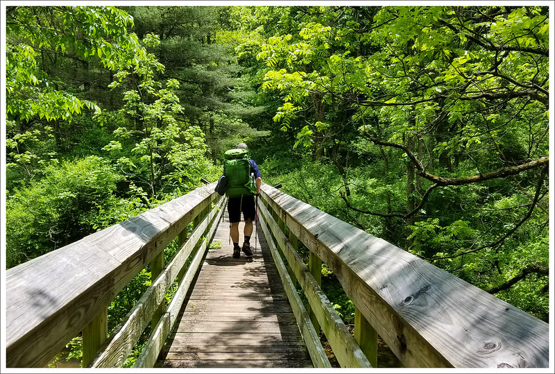
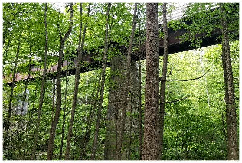
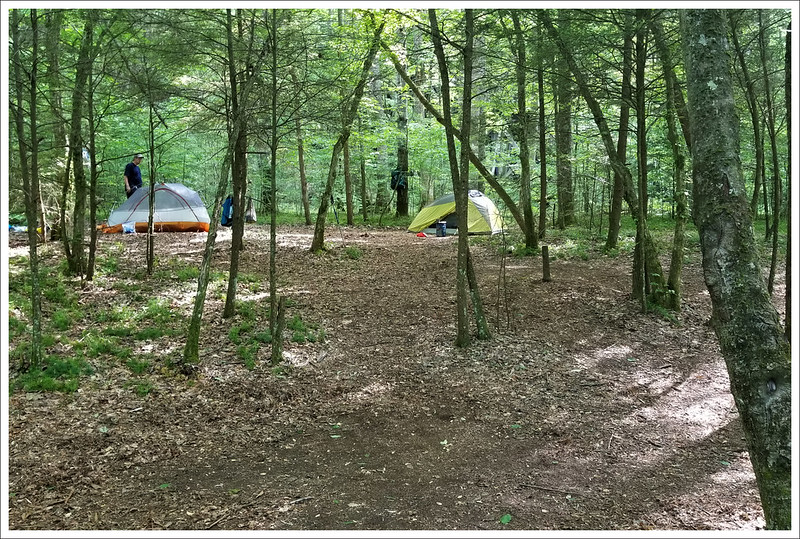
After lunch, we had a tiny bit more uphill climbing before the trail switchbacked downhill for 1.8 miles to its junction with the Virginia Creeper Trail. The Creeper is and old railroad grade converted to a multi-use trail. It’s most heavily used by bikers, but also by equestrians, hikers, runners, and even the occasional dog-sledder in the winter! Kris was about fifteen minutes behind us, so Adam and I sat on the Luther Hassinger Memorial Bridge and waited for her to catch up. While we waited, we noticed that there were several really nice streamside campsites under the bridge.
When Kris caught up, we had a team meeting and decided to camp under the bridge instead of hiking another 2.3 (mostly uphill) miles to our planned campsite. We were all hot and tired, and the campsite ahead sounded not-so-great (stagnant, mosquito-laden pond nearby) according to accounts in our Guthooks AT App. We set up camp, waded in the stream, played cards, and had a relaxing evening at camp. We even met a couple guys fishing nearby, and they kindly shared a couple cold beers with us.
The Luther Hassinger Bridge is where the AT and Virginia Creeper meet and share course for a while. Below: Our campsite for night five; Our water source was a lovely stream; We used the trestle bridge to bear hang a bag of garbage.
Over dinner, we discussed altering our plan for days six and seven. We tossed around the idea of finishing in one day instead of two and following the Creeper Trail instead of the AT. We agreed to sleep on the plan and make a decision in the morning. It was really a fantastic campsite and everyone slept so well with the sound of rushing water nearby.
Download DAY FIVE Maps and Elevation Profiles
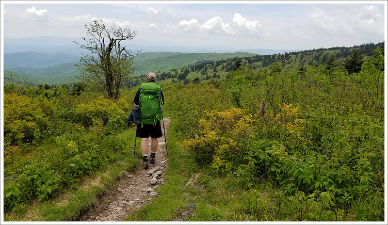
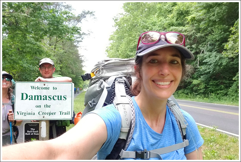
Day Six – Virginia Creeper Junction to Damascus (11 miles) – Adam
We woke up early and discussed our plan for the day. Kris’ feet were in pain and we knew the elevation gain and rough terrain were going to be hard on her blisters. The initial thought was that I would stay on the AT, while Christine and Kris would walk back along the Creeper Trail, but meet up along a spur between the two trails to camp together. After looking at our AWOL guide and the Guthooks app, there was no solid information on how the spur trail would connect or how far it would be. I ultimately made the call to stick together and finish in one day via the Creeper Trail back to Damascus. I am probably more of an AT purest and want to hit every blaze, but Christine was fine just getting to Damascus another way. But, she promised to come back together and do the AT miles to appease my desire to see every white blaze. Sticking together was definitely the best call for everyone’s safety and peace of mind.
We started the final day of our trip on both the Appalachian Trail and the Virginia Creeper Trail. Below: Adam crosses the Hassinger bridge; A beautiful cascade on Whitetop Laurel Creek; Easy terrain on the Virginia Creeper Trail.
The AT parallels the Creeper Trail for a good portion, but it is much higher in elevation and there aren’t really any easy access points between the two trails. Going back the way of the Creeper Trail also meant that the entire hike was either flat or downhill and the footing for trail conditions was much easier on injured feet (the AT section would have added about 1800 feet of climbing and a couple more miles).
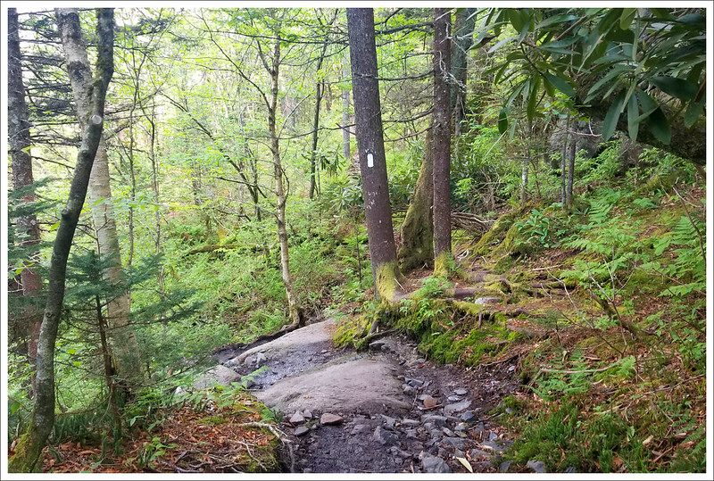
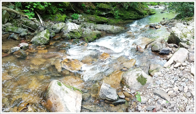
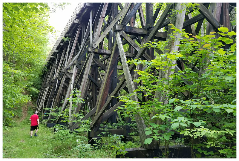
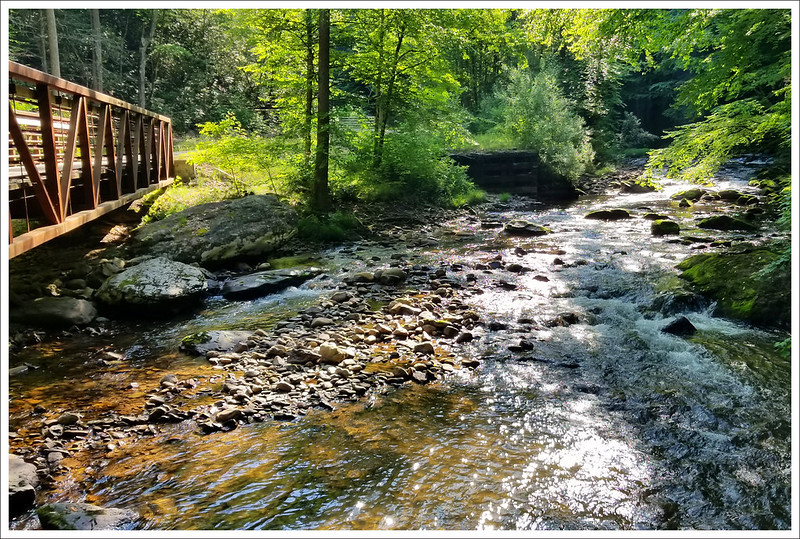
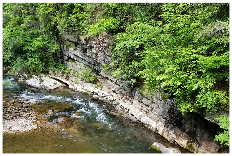
We packed up camp and were on our way. We crossed the Hassinger bridge, where the AT and Creeper begin to share trail for about .7 miles until the AT takes a hard right up the mountainside. We stayed on the Creeper Trail, crossing 21 trestle bridges and enjoying gorgeous stream scenery along the way. When we biked this section many years ago, it was raining which forced us to rush along the trail, so it was nice to take in the sights at a leisurely pace. Much of the Creeper Trail follows Whitetop Laurel Creek – one of Virginia’s largest and most pristine trout streams.
There were a good number of bikers out for the Memorial Day weekend, so we got used to hearing “ON THE LEFT” as they sped past. A few cyclists paused and gawked at us carrying our gear. For some of these casual family bikers I guess we seemed like hardcore professional athletes. People randomly applauded and one woman said she was ‘in awe of us.’ It was funny!
Whitetop Laurel Creek is one of the best trout streams in Virginia. Below: One of the many bridges over the stream; Crossing open farmland; Rock walls along the stream.
Overall the Creeper Trail is fairly shady, but we also passed by farm houses and through wide pastures. The sun was quite hot in open areas. After finishing a long sunny stretch, we stopped in the shade along a roadside. A father and son were fishing nearby. When they saw us, they offered us a cold Mountain Dews and homemade cookies from their truck. We never stop being amazed by the kindness of strangers. We eventually managed to motivate ourselves to get back up and shoulder our heavy packs.
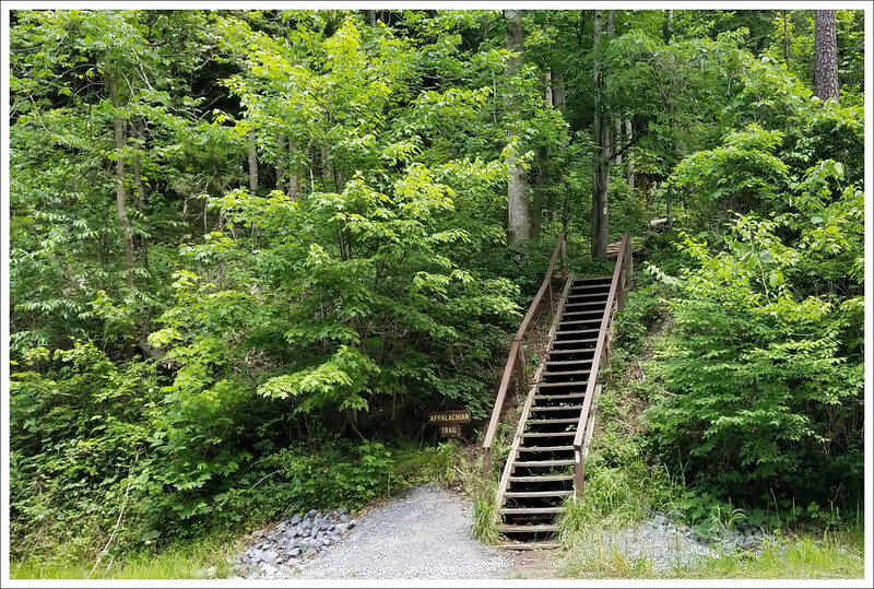
As we drew closer to town, there were billboards on the side of the trail advertising places to eat and drink in Damascus – they helped motivate us to finish. We ended up crossing US-58 on the outskirts of Damascus. The Appalachian Trail comes down a steep set of stairs on the right and rejoins the Creeper Trail again as it passes through town. We finished our hike walking alongside the road in the blazing sun. Kris had a near brush with danger as a kid on a bike carelessly ran her off the side of the trail. That was a real issue near the congested town section, since many bikers may not be as well-trained on etiquette or skilled enough to avoid others. We talked to another couple that had been hit twice by inexperienced cyclists on their run.
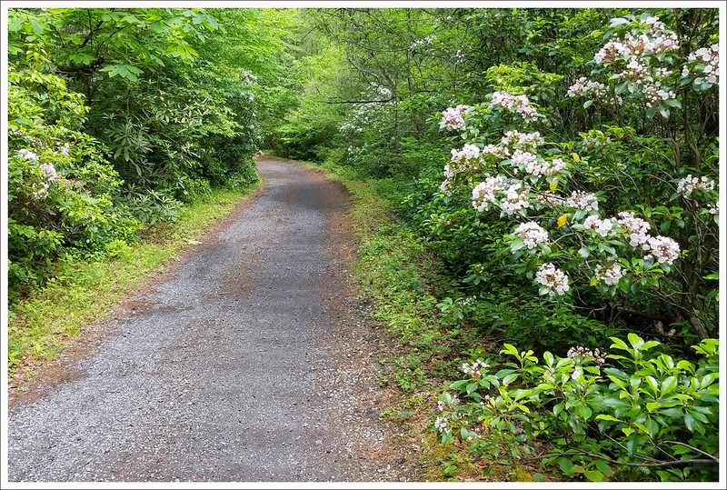
After eleven miles of hiking we made it back to Damascus. Below: Blooming mountain laurel along the trail; Billboards advertising food and drink along the trail; The Appalachian Trail rejoins the Creeper Trail just north of town; Our lunch stop and hike’s end… cheers!
We made it back into town and ate at Wicked Chicken Winghouse & Tavern. There was a guy outside singing and playing guitar and a ton of people enjoying the music, food, and ice cream. We ate inside the air-conditioned restaurant and had some great wings and beers from Damascus Brewery. When we were finished eating, I walked a few tenths of a mile back into town (following the Creeper Trail further into town and then going down Shady Ave to get back to Mount Rogers Outfitters) to pick up our car. Christine and Kris stayed at the restaurant and finished their beers before I picked them up. Before we headed home, we stopped and got some souvenirs from Sun Dog Outfitter.
We had an amazing trip and shared a lot of good memories together while covering a bunch of miles. Everything isn’t always easy when you do a longer section of trail like this, but we felt very accomplished and glad to have each other to help us get through.
Download DAY SIX Maps and Elevation Profiles
Trail Notes
Distance – 56 miles
Elevation Change – 11,095 ft. (daily gain is included on each profile download)
Difficulty – 3. Most of the terrain is moderate and uncomplicated.
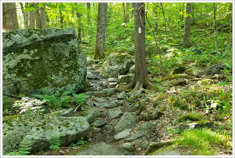
Trail Conditions – 4. The trail was clear and easy to follow. Bridges and footing were mostly in passable condition. The bridge at Comer Creek Falls was technically closed when we hiked. We had one tough blowdown to negotiate in Little Wilson Creek Wilderness.
Views – 5. We had spectacular views on three of the six days of the trip.
Streams/Waterfalls – 4. There were many beautiful cascading streams along the route. Comer Creek Falls was small, but lovely.
Wildlife – 5. High chances of seeing bears along this section. Even though the ponies aren’t technically wild, we count them as wildlife.
Ease to Navigate – 5. The trail is well marked and easy to follow.
Solitude – 0. This is a very popular section of Appalachian Trail. We maximized crowds by 1)Joining the thru-hiker bubble 2) Starting the day Trail Days ended 3) Hiking over a holiday weekend. If you choose a different time of year, you might have significantly more solitude.
Directions to trailhead: We left a car in Damascus at Mt. Rogers Outfitters. We used their shuttle service to drop us off at the Appalachian Trail Crossing at the South Fork of the Holston River. GPS coordinates for our start point are: 36.7631, -81.4939.
This 9.8 mile circuit hike offers all the best of Shenandoah – panoramic views, bubbling streams, a swimming hole and even a nice final stretch along the Appalachian Trail. It comes close to our 10 mile limit for a day hike, but it’s definitely well worth the effort.
The view from Chimney Rock is very pretty on a clear day.
Christine Says…
The Riprap trail has long been on my list of hikes to tackle in Shenandoah National Park. Last Friday, we finally got around to it. I have to admit, the nearly ten-mile length and over 2,300 feet of elevation gain intimidated me just a little. The hikes we’ve completed that are close to that length (i.e. McAfee Knob or Mount Rogers) both have substantially less elevation gain. But, we had a free day and beautiful weather, so we decided to go for it. I’m so glad we went because the scenery on this trail showcased everything I love about Shenandoah. And, honestly… hiking 9.8 miles really wasn’t that hard.
We started the hike from the Riprap parking area at mile marker 90. We turned right at the end of the parking lot and followed the Appalachian Trail uphill for about a third of a mile. At the intersection with the Riprap trail, we turned left. The trail went alternately downhill and uphill for about three-quarters of a mile. We passed around a talus slope and came out to a viewpoint near Calvary Rocks. This was a great place to pause and take in the panoramic scene of the valley below. About a third of a mile downhill past Calvary Rocks, we arrived at Chimney Rock. I found this to be the prettier of the two views – but they were both very nice. The trail was especially pretty in late May because of all the blooming mountain laurel, wild azaleas and rhododendron. There were some sections that were so lush, I felt like I was walking through a tunnel of flowers.
Wild Azaleas, Rhododendron and Mountain Laurel. Below: The view near Calvary Rocks; Adam taking in the view from Chimney Rock.
From Chimney Rock, the trail follows a ridge for a while, with many nice views between the trees. There is still quite a bit of evidence of forest fire damage from the late 1990’s in this area. The mountainside is still rather barren and charred stumps are visible. Slowly, the trail descends into Cold Springs Hollow. We passed through some of the densest mountain laurel along this section. We saw and heard so many beautiful birds – everything from American Redstarts to Rose-Breasted Grosbeaks.
Near the bottom of the hollow, we started to pick up the stream. It started off as a trickle, gaining volume and speed as we climbed continually downward. There were a few small, unremarkable waterfalls in the gorge, but we didn’t stop walking until the first stream crossing. Adam and I sat on a couple big boulders in the middle of the stream and ate a few handfuls of trail mix.
The swimming hole displayed beautiful rhododendron reflections and was full of brook trout. Below: The trout were hard to photograph through the water, but you get the point.
We stopped again just a couple tenths of a mile later at my very favorite spot along the trail – a wide, green swimming hole shaded by the forest canopy. We sat along the pool for a long while. We watched colorful brook trout lolling in the water. Every now and then, one would splash up and break the quiet surface of the water. The water was so clear. We could see reflections of the rhododendron on the surface and big, round stones at the bottom of the pool. The spot is made even more beautiful by the gentle slide waterfall that cascades down and fills the pool.
After leaving the pool, we had almost about three-quarters of a mile of level walking and a couple more stream crossings. A post marks the intersection with the Wildcat Ridge Trail. We turned left, and enjoyed our last little bit of flat walking for a while. We decided to stop and eat lunch before the big uphill climb began. We had ham and cheese on crackers, chips and some candy – perfect to give us lots of energy!
Climbing along Wildcat Ridge is a steady uphill for almost three miles, but the grade is generally moderate. There were several more decent views through the trees along this section of trail. And of course, more mountain laurel! I think I must have said “This is SO PRETTY!” to Adam a dozen times as we walked through the flowers. This section is where we saw our only other hikers of the day – a young couple hiking the loop in the opposite direction. We got to the junction with the Appalachian Trail faster than we thought we would. We were anticipating another .7 miles of uphill climbing when we reached the marker post. It’s always such a pleasant surprise when an uphill climb ends earlier than you thought it would.
Adam and I both enjoyed the more level terrain along the Appalachian Trail.
We took a left onto the AT for the final 2.8 miles of the hike. This section was typical Appalachian Trail in Shenandoah – rolling hills, nothing too steep. We saw a brief glimpse of a bear diving into the mountain laurel about a mile into this stretch. After about an hour of walking on the AT, we arrived back at our car. My feet were a little sore and tired, but other than that I still felt pretty energetic. Riprap now claims the spot for the longest hike I’ve ever done in a day! The 9.8 mile circuit took us just under six hours – including our very frequent snack and photography stops. On the way home, we stopped and rewarded ourselves with Lime Cream Slushes from Sonic – my favorite post-hike treat.
Adam Says…
This may also be the longest hike I have done but it was well worth it! This hike really does have it all and we hit it at a great time of year. The mountain laurel and rhododendron were at peak on this trail and we often felt like we were in some type of fantasy land while being surrounded by pink flowers.
The views from Calvary Rocks and Chimney Rock give you some great 180 degree views to the north of the mountains. I was a little worried that the payoff for this hike was going to be over in the first couple of miles of the hike, but I was glad to be wrong. After we continued the descent from Chimney Rock, there were still some open views along the way. Once we reached the bottom of Cold Springs Hollow, we saw a glimpse of a waterfall along the way. Shortly after the falls and after crossing the stream you come to the beautiful swimming hole that Christine mentioned above. This was a great spot to relax and enjoy seeing the fish, or you could take a quick, refreshing dip.
View Along the Riprap Ridge. Below: The swimming hole is such a beautiful place – even though we constantly had to bat the bugs away. Note the slide falls coming down to the pool.
Once we were done with relaxing, we took the hike up the Wildcat Ridge Trail. This is a constant uphill for about three miles and does include a couple of switchbacks on the trail. However, we felt that the terrain wasn’t too steep. You continue to observe nice views as it hugs closely to the side of the mountain. Once we met up with the AT, the trail didn’t have a lot of elevation gain/loss. I do suffer from plantar fasciitis, so my feet were quite sore on the rocks of this section of the trail.
Butterfly on Mountain Laurel. Below: Adam hikes through the mountain laurel along the Appalachian Trail.
For those interested in geocaching, I did place an earthcache at the overlook for Calvary Rocks. This is a way to learn about the geology of the area and there are a few steps to get credit for the cache:
I definitely enjoyed my first trip of the Riprap trail, but I know it won’t be my last. This would also be a great place to do a backpacking trip, since there is a reliable water source at the bottom of the trail. We really felt like it was one of the prettiest trails we have done in all of Shenandoah National Park. Part of that largely is due to the abundance of blooming wildflowers, but another part was the views. The Riprap trail really has it all!
Trail Notes
Distance – 9.8 miles
Elevation Change – Around 2300 feet. The hike is a mix of uphill and downhill, with one long, steady uphill stretch of about three miles.
Difficulty – 4.5 While the elevation gain is substantial, the trail is rarely steep. Grades are moderate. We scored the hike a 4.5 mainly due to the length.
Trail Conditions – 4 Nice trail to walk along! The stream crossings are easy.
Views – 4. You get the best views from the Chimney Rocks and Calvary Rocks overlooks.
Waterfalls/streams –3 The stream was on the low side when we hiked, but was still pretty. The swimming hole at the bottom of the hollow is very beautiful.
Wildlife – 4 We saw lots of brook trout, a little toad, many bird species and we even caught a glimpse of a black bear’s rear end diving into the laurel thicket.
Ease to Navigate – 2 A few turns to make along the way. There are a few false trails leading away from the main trail and also one tricky turn after a creek crossing.
Solitude – 3 We saw only two other people on the entire loop. We hiked it on a beautiful Friday in late spring. I imagine the trail is much more crowded on weekends. It’s a very popular short backpack loop.
Directions to trailhead: From Skyline Drive, park on the western side at mile marker 90. There is a parking lot specifically for Riprap hikers.
This 5.4 mile loop hike takes you to the beautiful double summit of Mount Pleasant, across Pompey Mountain and then back down to your car.
NOTE (2/26/17): A recent hiker reported that the fall forest fire in this area did severe damage to this trail system. He reports that many of the blazes have been destroyed and the trail is hard to follow.
Adam enjoys the vista from the west summit of Mount Pleasant. Below: Moss was still the only greenery along the trail. Leaves are still a few weeks away; The sign at the trailhead marks the loop at 5.2 miles. Our GPS marked it at 5.75, so we’ll split the difference in mileage for this blog post.
Christine Says…
When we hiked the Cole Mountain trail last fall, we made a mental note to return to the area sometime to do the Mount Pleasant hike. We’re so glad we did. The hike up Mount Pleasant provides gorgeous views from both its east and west summits. We had a crystal clear day and could see for miles in every direction.
We started out on our hike a couple hours later than we normally do. The delayed start turned out to be quite fortuitous. As we drove down Wiggins Spring Rd toward the trailhead, we saw 15-20 cars parked near the AT crossing and Cole Mountain trail. We assumed that they were a group camping and hiking on the Cole Mountain trail and were thankful not to sharing trail with such a large crowd. A little further down the road, the Mount Pleasant parking lot was empty with the exception of one frost-covered car that had obviously been left there overnight.
We started down the trail. It was icy and muddy, but pleasantly flat for the first mile. After we crossed a small stream, the upward climb began in earnest. It wasn’t terribly difficult or steep climbing, but it was constant for the rest of the way to the summit. Much of the trail was wet/soupy and covered with a thick layer of leaves. There were several places that the trail was tough to follow, but I imagine that once more hikers pass this way, the trail will become clear again.
These could be the poster children for the defiance of Leave No Trace principles. This was just a portion of the group we encountered.
At around the 1.5 mile mark, we started hearing distant voices in the woods – lots of distant voices. I looked at Adam and said “I don’t think all those people are on Cole Mountain after all.” At 1.9 miles we came to a trail junction being used as a rendezvous point for about 30 kids on a church youth group trip. I have never heard people being so loud in the woods. One group of three boys thought it was hilarious to repeatedly scream “NINKOMPOOP” at the top of their lungs as they headed down the trail.
After we cut through the crowd, we took a right turn and followed the spur trail up to the mountain top. On the way up, we passed about 20 more hikers from the same youth group. As I mentioned earlier, it was lucky we started our hike late, or else we might have been sharing the beautiful mountaintop with 50 shrieking kids. As it turned out, we had the view all to ourselves.
At the summit, there was a small sign with arrows pointing to the east summit and the west summit. We headed west first. The west summit is on a dramatic outcropping of rocks. It provides an expansive, layered mountain vista, including a great look at the bald summit of Cole Mountain. The east summit is also lovely, albeit a little less dramatic. The view is mostly valley and farmland.
We stayed at both summits longer than we normally would. We wanted to put some time and distance between ourselves and the youth group. We took in the view, had a snack and a drink and took a few photos.
The hike back down from the summit brings you back to the trail junction, where instead of turning left to hike back down the way you came up, you continue straight on the Henry Lanum Loop Trail. This trail will almost immediately begin to climb upward again – over the summit of Pompey Mountain. There are no views from this mountain. After reaching the peak of Pompey, there is a short, but steep downhill. The trail from this point on is a mix of uphill and downhill walking until you’re eventually returned to your car. On this loop, you definitely spend more time hiking uphill than you do hiking downhill. If you want less climbing, I recommend hiking this as an out-and-back. It won’t make the hike much shorter, but will significantly cut down on the climbing.
Adam Says…
The summit provides a beautiful view of distant mountains. Below: A telephoto shot of the Cole Mountain summit from the west side of Mt. Pleasant; The eastern summit is beautiful, albeit a bit less dramatic.
The hike up Mount Pleasant is one of the better hikes for views in Virginia. If you have a few days to spend in this area, I would also recommend doing this and the Cole/Cold Mountain hike. This area has some gorgeous mountains around you and the reason for the town nearby to be named Buena Vista. When you combine both views from the two overlooks at Mount Pleasant, you get nearly a full view of the area around you.
The hike was not too difficult. I would recommend that if just want to see the views, complete this hike as an out-and-back hike. When we did this hike as a loop, we added on the trip up Pompey Mountain, but there are not any scenic views or much of note on the way back.
One interesting note about this trail is that you may see some remnants of fallen American chestnut trees throughout your hike. They once covered this area until a fungal blight wiped out their population. It is interesting to think how different these views would have looked in a canopy of chestnuts.
To know which way to start the hike can be a little tricky. There are lots of paths away from the parking lot, including two blue-blazed trails marking the Henry Lanum Trail. You will start the hike at the blue-blazed trail that starts off very flat. The other blue-blazed trail looks clearly uphill and is the path that you will return. We felt this trail was a little hard to follow at times and could have used a few more blue blazes painted. There were times we were unsure if we were still on the correct trail.
The trail starts off relatively flat or going downhill for about the first 1.5 miles. Around 1.3 miles, you see a wooden sign that reads “Trail”, but other than that it is fairly easy to follow. Keep following the blue blazes and you will eventually need to cross a couple of areas that may include small streams. We didn’t have any trouble hopping across and I’m guessing that most of the year, it is relatively dry. After you cross the stream, the trail will lead to the climb up to the summit. Around 2.0 miles you will reach a junction sign that shows the Mount Pleasant Summit Spur Trail to the right. This summit trail continues for about .4 miles until you reach the saddle. A sign at the junction here shows there are overlooks to the West and East. The western summit takes about .1 mile to reach and you will need to climb up the rock outcropping for the great views. The eastern summit is closer and doesn’t require any climbing, but we were both more impressed with the views from the western summit. Once you take some time to soak in the views, go back the way you came to reach the junction sign for the Summit Spur Trail. If you want to continue the loop back to your car, you will continue straight on the Henry Lanum Trail. This leads you through the forest for some more uphill climbs over Pompey Mountain. From the junction sign, it is about 1.9 miles back to your vehicle.
Luckily, we were able to avoid the crowds of screaming teenagers that clearly don’t understand Leave No Trace principles. Once more of the leaves start spreading their leaves, the summit overlooks will give you absolutely amazing views.
Trail Notes
Distance – 5.4 miles – loop.
Elevation Change –1350 feet.
Difficulty – 3.5 This loop has long, moderate uphills and shorter, steeper downhills. It’s one of those trails that makes you feel like you’re always walking uphill.
Trail Conditions – 3. The trail is in decent shape. There was a lot of mud when we hiked.
Views –5. The east/west double summit of Mount Pleasant is magnificent
Waterfalls/streams –1. There is a small stream in the woods on the departing arm of the loop.
Wildlife – 0. Nothing, but doubtlessly the large church group scared any wildlife away. We did see lots of juncos along the trail.
Ease to Navigate – 2.5. In several spots, the trail was hard to find under thick leaves and blowdowns. Some blazes are starting to wear away and it might be easy to miss turns. I think ease of navigation will improve as spring/summer approach and hikers wear the path down.
Solitude – 3 . For today, we had a 0 for solitude, but we just had a bit of poor timing. Being the namesake hike for this area, you will likely run into some other people on the hike.
Directions to trailhead: Follow I-81 to Buena Vista (exit 188A). After passing through the town of Buena Vista, follow US60/Midland Trail for 9.5 miles. Take a left on Coffeytown Rd. Follow Coffeytown for just under two miles. Take a right on Wiggins Spring Rd. Follow Wiggins Spring for 3 miles. This road will turn to a rugged gravel road. Follow the signs for the Mt. Pleasant trailhead. There is a small parking lot at the trailhead.
This 4.2 mile hike leads you to a PATC cabin as well as a cabin once owned by a family from the mountain.
The Corbin Cabin sits alongside the Hughes River in what used to be known as Freestate Hollow.
Adam Says…
It was great to finally get out and do some hiking after the harsh winter! I think it had been since November since we were able to actually enjoy a hike. After some debating on which trail would be “less muddy”, we decided to try this hike. We were surprised that the ground was actually in good shape and not muddy like we were expecting. The hike’s main draw is the historical interest. The Corbins and Nicholsons were two families that lived in this area since the end of the Revolutionary War until the park authorities made them leave.
You begin the trail from the cement post across from the parking lot. You start the trail walking through an area of mountain laurel that will bloom nicely in the Spring. The trail descends through an elevation loss of 1500 feet over 1.4 miles. Around the first half of a mile, you will begin to see a stream off to your left. At .9 miles, you will come across some of the remnants of the families that inhabited this hollow through views of a rock wall to your right. Downhill to the left you will see ruins of John “Russ” Nicholson’s cabin. At 1.4 miles, you will hear the rushing of the Hughes River and see the ruins of an old cabin to the right that belonged to John T. Nicholson. You can walk over to this area and peek inside to see the small one-room dwelling. There is lots of glass and rusty metal, so be careful if you inspect this area. You will see the Corbin cabin across the river. You will need to rock-hop across the river, which is usually not too difficult. This time, the water was higher than normal and we only had to partially put our feet in the water to get across.
The Corbin cabin is available to rent from the Potomac Appalachian Trail Club. There are access points here to connect to Old Rag. We plan on trying that out in the future sometime for a weekend of living like mountain folk.
The Nicholson Cabin is across the river from Corbin Cabin. It’s slowly sinking back into the forest.
After you cross the creek to the cabin, take a right to join the Nicholson Hollow Trail. After a short distance, you will have to do a little more rock-hopping as it crosses Indian Run. You will start your steep ascent back up to Skyline Drive and at 3.6 miles you will reach the road. When you come to Skyline Drive, take a left, heading south for about 75 yards. You will cross the road and join a short spur trail. After less than .1 mile, you will come across an intersecting trail with a cement post. This is the Appalachian Trail. Take a right, heading North on the Appalachian trail, you will descend and ascend for another .6 miles until you reach the parking lot.
Christine Says…
While this hike doesn’t offer any waterfalls or sweeping views, it does provide one of the park’s best peeks into area history. The trail begins steeply downhill for about a mile until you reach the bottom of the hollow. It’s a big drainage area with many small streams that pour into the Hughes River.
I love seeing all the remnants of old homesteads tucked into the woods. The main homesite, which lies on both sides of the Hughes River is such a perfect and idyllic spot. If I were to choose anywhere in the park to build a home, I think it would be right here. I can understand why John Nicholson was so heartbroken to leave. I love to imagine what it would be like to go to bed each night listening to the bubbling sounds of the river and see the sun rise each morning between the mountain folds visible from the front porch.
We had the homesite to ourselves for a little while. Fifteen minutes later, a couple guys with fishing poles arrived and we were on our way. The long arm of the loop starts from Corbin Cabin and climbs steadily uphill for about two miles. Most of it is moderate uphill climbing, but one section that passes through a thicket of mountain laurel is quite steep. The final .6 miles of the hike follows the Appalachian Trail.
On the AT, we encountered a lost beagle. She leapt out of the woods at us, probably expecting to see her people. She had a collar, an identification tag and the remnants of a broken/frayed leash. As soon as she realized she didn’t know us, she darted back into the woods.
We love dogs, and there was no way we were going to leave the beagle behind. We tried to corral her in, using low voices and lots of “Good dog!” calls. However, she was obviously terrified of strangers and started howling pitifully. Bit by bit, we were able to get closer and closer to her. We were just about to catch her when heard voices shouting down the trail, and the dog sprinted away. Thankfully, this time she was running toward the call of her owners. They were all happily reunited. It turns out the dog broke her leash four hours earlier when she chased something away from camp.
I guess even when they’re leashed, dogs can get into trouble in the park. I’m always surprised how many dogs we see running free with hikers. It’s both good practice and park policy to keep dogs leashed on park trails.
Since this was our first real hike of the season, we were both pretty tired at the end. We’re definitely looking forward to hitting the trails more regularly now that the weather is turning warmer.
Trail Notes
Distance – 4.2 miles – loop.
Elevation Change –1500 feet.
Difficulty – 3.5 The hike descends and ascends fairly steeply.
Trail Conditions – 4. The trail is in good shape. There were a few blown-down trees covering the trail due to the winter. Leaves on the trail make for a slick surface when going downhill.
Views –0. You are deep in the woods for the entire hike.
Waterfalls/streams –2. Near the cabins, you have a nice opportunity to see the Hughes River.
Wildlife – 1. We didn’t see anything alive, but found remnants of deer that didn’t survive the winter. Expect to possibly see bear in the area. Heard pileated woodpeckers and saw juncos.
Ease to Navigate – 4. Trails are clearly marked.
Solitude – 3. This trail isn’t the most popular due to the steep terrain, so you should likely only encounter people around the cabin and river.
Directions to trailhead: From Skyline Drive, park on the western side at mile marker 37.9. Cross the road. The trailhead begins at the cement post across from the parking lot.
This 4.6 mile hike leads you along the South River to an impressive waterfall that plunges deep into a canyon. When the park has experienced lots of rain, this waterfall hike is one of the nicest Shenandoah has to offer.
The South River is impressive in times of heavy rain.
Adam Says…
We have kept with a tradition the last few years of doing a hike on Thanksgiving morning. It’s a great way to appreciate nature and try to do something active before a big meal. This year, we decided to break the tradition of having a huge Thanksgiving meal with turkey and all the trimmings. We decided to have an easier meal that we would both enjoy – homemade pizza.
We’ve hiked South River Falls before, but we’ve never had as much water in the falls before. We thought it would be impressive, since we could hear rushing water through the South River a lot earlier than normal. Waterfall hikes in Shenandoah National Park tend to be fairly tough ones. Since you park on Skyline Drive at a high elevation, you have to hike down to the valleys where the falls are created. What makes it difficult, at least psychologically, is that you get to the payoff fairly easily and then have to do the hard work on your way back to your vehicle.
The beauty of the South River is found mostly in its small details. The cascades and little falls leading the large waterfall are prettier than the main waterfall. Pictured below: South River Falls from the overlook at the top of the canyon; the falls from the base. You’ll see neither vantage point of the waterfall is terribly photogenic (especially after the leaves have come down). Both of the small photos below are from another date. This time, the falls were much bigger – but it was too sunny to photograph them.
The hike begins at the South River Picnic Area. Look for the large sign about the hike on the northeastern side of the picnic area. At slightly over .1 mile, you will cross the Appalachian Trail. You will continue your descent and around 1 mile, you will rock-hop across a small creek that drains into the South River. Usually this is not much of a challenge due to the water, but we found the water was higher than normal this time. At 1.3 miles, you will come to a nice overlook for the South River Falls. You really get a great view of the 83 foot waterfall. It plunges to a rocky ledge and splits in two about half of the length of the waterfall. If you continue on the trail for another .2 miles, you will arrive at a cement post and join a spur to the South River Fire Road. If you continue on for another .2 miles, you will descend even further and arrive at another cement post. Following the path from the cement post for another .1 mile, you will arrive at the base of the falls. For any adventurous shutterbugs, there are ample opportunities near the base of the falls for long-exposure photography. Make sure you have your strength up, because you have 2.2 miles to hike at a steady incline back to your vehicle.
To follow the trail as a loop as we did, once you make your return from the base of the falls, go .7 miles until you reach the cement post and the junction with the South River Falls Trail. Stay on the fire road instead and after .4 miles more, you will reach the yellow-blazed South River Fire Road. Take a left on the road. In about a mile, you will reach the junction with the Appalachian Trail. Take a left on the white-blazed AT, heading south for about .4 miles. You will then reach the junction with the South River Falls Trail and only have about .1 mile to reach the picnic ground.
The hike was a tough one, but it was nice to get some exercise. The thought of carving into our pizza helped us muster the energy to make it back.
Christine Says…
This was a great trail to burn off Thanksgiving calories! The terrain is rugged and the return arm of the loop is nothing but steady, tough uphill climbing. Even Wookie, who is normally a bundle of boundless energy, got quite tired on this hike. By the time we got to the Appalachian Trail junction, his corkscrew tail was completely unfurled. Even though there are some hikes in the park with more elevation gain, I think the 1300+ feet on the South River trail provides some of the park’s tougher climbing. Anyone looking for an easier version of this hike should consider doing the short loop (3.2 miles) that returns after the overlook at the top of the falls. By taking that route, you reduce the elevation gain to a very manageable 850 feet.
Despite the hard work required to get there, I really enjoyed seeing the South River and its namesake falls so flush with water. The Shenandoah area has had over five inches of rain in the month of November – more than double the normal amount. All of the park’s streams, rivers and waterfalls are flowing beautifully right now. It’s a great time to get out and enjoy the scenery and the less-crowded conditions in the park.
There are many small, but beautiful, waterfalls along the trail. Pictured below: Another pretty spot along the river.
I had hoped to get some photo opportunities along the river on our Thanksgiving hike. I did take a few shots, but the weather was less than cooperative. It was too sunny to take shots of the moving water. Every now and then, I found a shady spot down in a deep ravine. I did a bit of bushwhacking to get to a few pretty spots, but overall I don’t feel like I came home with any special photos.
Honestly, while South River falls is probably the park’s most impressive waterfall, it is not one that translates nicely on film. The falls plunge into an enormous natural amphitheater. The sheer rock walls are amazing, but they aren’t photogenic. I’ve seen a few nice shots of South River Falls in the spring, when the water is flowing and the falls are surrounded by the lush new green of the trees and plants. In the late fall and winter, the falls are really scrubby and barren looking.
I think some of the prettiest and most dramatic places along the South River come at the bottom of the falls. In the last .1 mile of the trail, leading to the base of the falls, the water tumbles over a hundred feet down over giant boulders. There are many small, beautiful waterfalls to enjoy before you get to work climbing back up to your car.
When we got home from our hike, we found several TICKS! Can you believe it – ticks in late November; ticks after the mountains have had snow and temperatures at night are regularly below freezing? These were tiny ticks – about the size of a pinhead. We pulled one off Adam’s sweatshirt and two off of Wookie. I hate having to watch for ticks year round, but it seems that we must.
Wookie Says… Hey all of you fellow hiking dogs. It’s been a while since I’ve been hiking, so I’m going to let you know what I thought of the trail. I enjoy getting the chance to get in the outdoors and I usually run laps around the house when my masters ask, “Would you like to go on a car ride?”
The hike on South River Falls was pretty fun for the most part. I enjoyed going downhill until I reached the stream to try and rock-hop. I’ve done this hike before with my masters, but there was a lot of water this time around. I don’t really like to get my feet wet and when I see any water on the hike, I try to take the driest option. After Adam crossed the creek, I really didn’t want to follow him. Only after Christine gave me a little nudge with her trekking poles, did I take the plunge and hop across the rocks.
Wookie enjoyed the hike, but was exhausted the rest of the day.
All the rushing water on the trail, really made me need to go to the bathroom. I tried to make my mark as much as possible to let all my fellow canines know that Wookie was here. The hike back from the falls was pretty brutal for a small dog like me. My tail was down a lot of the trip back, because it was exhausting. At least I got some pizza scraps and a taste of sausage instead of turkey scraps this year. For that, I was truly thankful.
Difficulty – 3. The return arm of the circuit climbs steeply uphill along a fire road for two straight miles.
Trail Conditions – 4. The trail is in great shape.
Views –0. You are deep in the woods for the entire hike.
Waterfalls/streams –4. In times of heavy rain, the South River is an impressive stream.
Wildlife – 0. We didn’t see *anything*, but over the summer there was a bear with three cubs in the area.
Ease to Navigate – 4. Trails are clearly marked.
Solitude – 2. This trail’s proximity to a park entrance makes it a popular hike.
Directions to trailhead: From Skyline Drive, follow the drive to the South River Picnic Area (near mile marker 62). The trailhead is located at the back end of the picnic grounds, across from the restroom facilities.
The Virginia Creeper Trail is a picturesque rails-to-trails path that winds its way for thirty-four miles through the Mount Rogers recreational area. The trail starts in Whitetop and ends in Abingdon, with Damascus sitting right in the middle. The area caters to bikers, offering plenty of opportunities for shuttles, bike rentals and food along the way.
Adam crosses one of the many old railroad trestles along the Virginia Creeper Trail.
Adam Says…
The Virginia Creeper Trail is something we’ve wanted to do for years. It is very well known in the biking world as being one of the best rails-to-trails in the east.
The origin and history of the name has to do largely with the train that used to ride this route. The train was called the Virginia Creeper due to the slow churning of the train. The trail was also partly named in honor of the native vine that you will normally see turning crimson as an early sign of fall. The train ran its last trip in 1977 and it was converted and opened as a multi-use trail in 1984.
We were expecting rain that day and wanted to hit the trail as early as we could. We arranged for a shuttle to take us to Whitetop Station to begin our trip. We recommend the Virginia Creeper Trail Bike Shop. They are located in Abingdon and run a shuttle to Whitetop and will even pick you up in Damascus if you are thinking about only doing half of the trail. After we were dropped off, we decided to not lollygag, since the rain was imminent. We got through the first couple of miles of the trip with only a few errant raindrops, before the heavier rain started.
Despite the rain, we really enjoyed the beauty of the trail. There are 47 trestles and bridges that pass over the Green Cove Creek and the Whitetop Laurel Creek. You get gorgeous views of the rushing water in the creeks; pass by quaint, country farms; and canopy forests. We picked a perfect weekend to do this trip to see the beautiful fall foliage. The trail is shared by bikers, walkers, runners, horses, and even an occasional dog sledder in the winter.
Here are a few highlights along the way. There are also several information signs along the way that provide valuable insight into the history and nature of the area. You will see mile markers along the way to help point the way.
Mile 34 – The Whitetop Station to park your car. Bathrooms are available. Highest point on the trail at 3576 ft.
Mile 30.5 – Green Cove Station sells a lot of essentials and souvenirs. Bathrooms are also available.
Mile 27 – Creek Junction – Parking and Bathrooms are available. 563 foot trestle.
Mile 23 – Taylor’s Valley – Parking available. Daniel Boone campsite.
Mile 20.7 – Straight Branch – Parking and Bathrooms are available.
Mile 20 – Whitetop Laurel Falls – when you see a large overhanging rock, the falls are down a small path on the right side of the trail.
Mile 16 – Arrive at the town of Damascus. Railroad exhibit is available.
There are so many beautiful farm and stream scenes along the trail. The huge Christmas Tree farms along the way are lovely. Pictured Below: The trail follows a rushing stream with many small waterfalls; The fall color was spectacular in Mid-October.
For those that are interested in geocaching, there are a ton on this trail.
We definitely plan on coming back in the spring and tackle this another time. The rain got us fairly wet and also covered us with “Creeper Streak” – the streak created on your back from the wet dirt being kicked up from our back tire. We decided to stop after the halfway point and catch the shuttle back to our car. While the rain was annoying and kept us from relaxing and enjoying the trail as much as we wanted, we still felt the scenery around us made up for it.
Christine Says…
I woke up early the morning of our Virginia Creeper bike ride, peeked out the hotel window and started silently chanting the mantra “please don’t rain, please don’t rain, please don’t rain”. The sky was that heavy gunmetal gray that promises rain is coming sooner rather than later. It wasn’t supposed to start raining until the evening, but I was fairly certain that we were going to be in for a soggy bike ride.
Nevertheless, I donned my new padded bike pants and a fleece top and headed over to the bike shop to catch our shuttle ride out to Whitetop Station. The shuttle services for the Creeper Trail are a great idea, as they let bikers enjoy the whole trail without making a return trip over repeat scenery to get back to your car. I think most people just bike half the trail – Whitetop to Damascus, but we were really hoping to do the full 34 miles back to Abingdon.
The van ride out to the trail’s end was pretty long – about an hour along winding mountain roads. The driver shared lots of trail trivia and helpful tips to kill the time. Some of the things he shared:
Celebrities like to bike the Virginia Creeper (Clint Black, Troy Aikman, Emmitt Smith, some NASCAR driver I don’t remember). Apparently, Brad Pitt even has a home near Whitetop and has been spotted fishing the area’s rivers. (although I can’t find any evidence to corroborate this as fact)
Most of the accidents (75%) along the trail happen to males between the ages of 13 and 21. Boys on bikes are reckless, I suppose.
It’s a very bad idea to slam on your brakes when crossing wet railroad trestles. You WILL wipe out. I can vouch that this tip is quite true. We saw the same poor woman wipe out on two separate occasions – both times she was on a wet trestle.
The trail is probably the only 34 mile bike ride that you’ll actually gain weight on. There are snack shops, coffee house, bakeries, ice cream parlors and full service restaurants all up and down the trail.
The trestles along the trail are very picturesque. Pictured Below: We were lucky enough to bike the trail during the peak of fall color; The trail is a multiuse trail and is also used by pedestrians and equestrians.
On the ride out, the sky started spitting a bit of rain. It had stopped again by the time we were dropped off at Whitetop Station. We kept our fingers that it would continue to hold off. Adam and I don’t like biking or hiking in crowds, so as soon as we got our bikes off the trailer, we raced off to get a jump start on the crowd of bikers arriving at the trailhead. Our driver told us that on nice weekend days, the trail might see upwards of 2400 riders. Area bike shops have 1800 bikes available, and frequently sell out of rentals. I was a bit surprised that more people rent bikes than bring their own. Maybe most people don’t own bikes these days.
The trail was gorgeous – a leaf-covered pathway under an endless tunnel of fall-colored trees. Every now and then, we’d pass an opening that provided a view of the mountains or one of the area’s many vast Christmas tree farms. Around Green Cove Station the rain started in earnest, and never let up again. I had to put my camera in a trashbag I had packed in my bike rack. There were so many scenes along the way that deserved to be photographed with care. Sadly, with the rain, all I was able to do was take a few quick snapshots.
Even in the rain, the ride was incredibly beautiful. I loved crossing the old railroad trestles and riding alongside the rushing streams. We biked the entire stretch from Whitetop to Damascus in about ninety minutes. I would have loved to take more time to enjoy the scenery, but it was cold, wet and windy. I started thinking less about scenery, and more about a mug of hot chocolate and a steaming cup of soup.
In short order, we arrived in Damascus. We decided to try lunch at one of the places our shuttle driver had pointed out. He had mentioned that In the Country and Fattie’s Diner were both really good. I saw “Hot Soup” on In the Country’s sign, and I was sold.
The trail offers many charming places to stop for a delicious lunch or snack. Pictured Below: We had a fantastic lunch at “In the Country”; The only red train car along the trail is located in Damascus.
The staff at the restaurant was so friendly and welcoming. They didn’t even flinch when we walked in through their front door, soaking wet – covered with mud and trail grit. My ponytail felt like I’d dipped it in wet concrete and my legs were coated with black sludge from my ankles to my knees. Adam even had mud splashed up and down his cheeks. They invited us to eat inside in the warmth, but I felt too guilty about my filthiness and chose a picnic table under their covered porch.
Adam and I both got their boxed lunches which included a sandwich, side, drink and dessert. I chose their potato soup as my side. It totally hit the spot. Lunch was washed down with hot chocolate and followed up with delicious homemade pumpkin squares. We sat on the porch after lunch, watching others from our shuttle group pass by on their way to the pick-up point. I think most bikers take about two and a half hours to bike the Whitetop to Damascus section.
The rain was still falling steadily, and although we wanted badly to see the rest of the trail, we decided to call the bike shop and let them know we’d be joining the shuttle in Damascus. We met up with everyone at the red train car in the middle of Damascus. Everybody looked cold, dirty and tired. The heated shuttle van was such a welcome sight.
It was a real disappointment to miss the second half of the trail, but it’s also a great motivator for us to make a return trip to the area in the spring. I’ve heard the rhododendron and mountain laurel bloom along the Creeper is amazing!
Trail Notes
Distance – 18 miles for this segment
Elevation Change – From Whitetop to Damascus, you lose 1646 feet in elevation
Difficulty –1.5. You hardly have to pedal at all on this stretch of trail, so it is suitable for bikers of all fitness and skill levels
Trail Conditions –3.5. The trail is in good shape. There are some errant holes and jutting rocks to watch out for. Entrances and exits from the trestles can be jarring if you’re going moderately fast.
Views – 3. While the views aren’t high and lofty, they are still beautiful and showcase Virginia’s most picturesque scenery.
Waterfalls/streams -4. The two streams that flow along the trail are gorgeous and include many small waterfalls.
Wildlife –1. We didn’t see anything, but our shuttle driver told us people regularly spot deer and the occasional bear.
Ease to Navigate – 5. The trail is very simple to follow.
Solitude – 0. People love the Creeper! On nice days in the spring, summer and fall, the trail can see over 2000 bikers in a single day.
Directions to trailhead:
We recommend hiring a shuttle service in either Abingdon or Damascus. For a reasonable fee, they will drive you and your bikes to White Top Station. This lets you enjoy the entire trail without having to backtrack on the return trip to your car.
Molly’s Knob is the best known hike in Hungry Mother State Park. On a clear day, views of Mount Rogers can be seen from the summit.
Adam takes a look at Molly’s Knob from the viewing platform lower on the trail.
Adam Says
On our way down to Abingdon for a weekend of hiking and biking in the Highlands, we decided to stop by Hungry Mother State Park. There is an interesting legend surrounding the origin of the park’s name. Native Americans destroyed many settlements south of this park on the New River. Molly Marley and her child survived the raid and were taken captive. Eventually they escaped the raiders. They wandered through the wilderness until Molly finally collapsed. Her child wandered away, hungry and alone. Eventually the child was found by residents of a small settlement near where the park stands today. All the child would say was “Hungry Mother”. A search party went out to find Molly, but they were too late. There are some variations to this legend, but it is an interesting tale.
The colors of the fall leaves were really quite gorgeous in the park, so we decided walk around a bit. Of course, the hiking enthusiasts that we are, we decided to try the hike up Molly’s Knob.
We parked in a small lot on the northeast side of Hungry Mother Lake. We left the car and began walking the Lake Trail Loop, giving us glimpses of the beauty of the lake. After .5 miles, this joined the blue-blazed Ridge Trail. We continued on this up a steady uphill grade for .2 miles until we reached the viewing platform pictured below. With the beautiful colors on the mountain of Molly’s Knob in view, we decided to take the remaining trip to the summit. We continued up the white-blazed Molly’s Knob Trail for .9 miles. The trail was marked as a black diamond trail, but we didn’t find this portion to be too difficult. After the .9 miles, we began the fuchsia-blazed Vista Trail. This was the steepest portion of the hike, but once we got to the top, we were quite impressed by the view. While I scurried around looking for a geocache, Christine enjoyed taking a few pictures of the views. We shortened the trip back by just following the Molly’s Knob Trail to our car. We were worried about the hike taking too much out of us for our trip to Mount Rogers the next day, but it was worth the risk to see these views.
There are several geocaches to find in Hungry Mother State Park, but here are the few that I located on the trail:
The forest was filled with foliage of every color. Pictured Below: The golden foliage along this trail was especially spectacular. Adam even found several geocaches along the way.
Christine Says…
Going on this hike was completely unintentional. We wanted to drive through Hungry Mother State Park just to see what the park had to offer. But the foliage along the lake was so pretty, that we felt compelled to get out of the car and walk a bit. I thought a short stroll along the level Lake Trail would be pleasant and scenic.
After a short bit of walking, we reached the junction of the Ridge Trail, and decided to turn there to make a short 1 mile loop back to the car. At the top of the ridge, we saw the platform overlooking Molly’s Knob off in the distance. Next to the platform, a sign indicated that the summit was only 1.3 miles further. The short distance made the summit far too tempting, and we were on our way. I kind of regretted not changing clothes before we hiked. The impromptu nature of this hike had me wearing jeans, a dressy shirt and my hair was down. About halfway up the steep climb, I would have traded just about anything for a ponytail holder. As luck would have it, someone left a pack of hair elastics in one of the geocache boxes Adam found. I was much more comfortable with my hair up, but hiking in jeans is never fun.
The view from the top was obscured by fog and clouds, but it was still beautiful with all the fall color. Pictured Below: You get some nice views of the lake along the trail.
There were some steep sections of trail, but the fall colors were so beautiful I hardly noticed the climb. We had almost the entire trail to ourselves, too. We saw just two other solo hikers near the beginning of the hike, but after that we didn’t encounter a single soul. The wind was rustling through the treetops, sending colored leaves falling down all around us. Plumes of fog curled around the folds of the mountains. Off in the distance, we could hear a pileated woodpecker cackling. In no time, we reached the summit and its beautiful view of the valley. There were two benches built into the summit, so it was a perfect place to rest before hiking back down.
The trail down was so steep in some places, that momentum had us practically running downhill. The final stretch back gave us a very pretty view of the lake and the beach below. This hike turned out to be a great surprise!
Trail Notes
Distance – 3.8 miles the way we went making a partial loop. You can shed .4 miles off, by cutting out the Lake Trail Loop trail and Ridge Trail
Elevation Change –1000 feet
Difficulty – 3. The steepest parts were the Ridge Trail portion and the Vista Trail, but we found it to be a moderate hike.
Trail Conditions – 4 The trail is well-maintained and traveled. We found the Vista Trail to be a little slippery during the rain due to some clay surface.
Views –3.5. Great views from the summit and Hungry Mother Lake. On a clear day, you should be able to see Mount Rogers.
Waterfalls/streams –2. You do get some nice views of the lake. Since it used to be a stream before it was dammed, we thought it was worth mentioning.
Wildlife – 1. We saw a pileated woodpecker, but nothing else. There is some good birding in the area.
Ease to Navigate – 4. There are a few switches in trails during the path we chose, but everything was well-marked.
Solitude – 4. We only saw two people on the trail on a Saturday afternoon, so I’m guessing it is not very well-traveled. During heavy camping weekends, I would expect more traffic.
Directions to trailhead:
On I-81, take exit 47 and then take 11 South. After a little over a mile, take a right on to 16. Follow this into Hungry Mother State Park (fee required of $2-$3). Take a right immediately after the P6 lot and continue on the road until you reach a cul-de-sac parking lot. The sign for the Lake Trail Loop is at the end of the cul-de-sac.