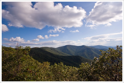
Millers Head is a beautiful little hike that starts out from the amphitheater at Skyland Resort. There are three nice overlook spots along the way.

Christine Says…
Millers Head is a perfect leg-stretcher with wonderful scenic payoffs. It’s also a bit of an oddity for Shenandoah hiking. One unusual thing about this hike is that the trail is mostly downhill as you walk out to the observatory. In Shenandoah, it’s very uncommon to have a steady descent on hikes that offer panoramic vistas. In fact, I can’t think of a single other “view hike” that goes downhill quite as much as Millers Head. Another interesting fact about this trail; it’s one of only three places in the park that are authorized launch points for hang gliders. If you’re lucky, you might get to see some gliders taking off and sailing over the valley.
The first of the viewpoints comes atop Brushytop Mountain, just .2 miles into the hike. There is a lovely shady spot with large boulders to sit and take in the view. Near Brushytop, you’ll also get a nice look at Skyland Resort built into the mountainside to the east. In the afternoon, the sun hits the lodge beautifully and Stony Man looms impressively over the resort area.

I wasn’t so lucky with the lighting conditions for photography on the day we hiked. The clouds were dark and moving quickly across the sky. Whenever the sun came out, it was fleeting. I missed the afternoon light on Skyland by mere moments.
In my opinion, there are two viewpoints even nicer than Brushytop on this hike. One is an unnamed rock ledge close to the Millers Head observatory. It’s not marked, but you can’t miss the well worn footpath up to the rocks. It looks back to the east. The other is right at the end of the trail and includes a stone observatory deck built by the CCC. The observatory is starting to crumble and the handrail is loose and rusty. Nonetheless, the views are wonderful from this spot. If you’re into photography, I’d recommend (unlike us) doing this hike in the morning. I had to shoot right into the sun on this particular day, and didn’t really get any nice photos at Millers Head.
On the hike back, I was really cold! I can’t remember ever being cold on a September hike before. We’re having such odd weather this fall, but odd in a good way. I love the crisp snap in the air after the heat of summer. Without a doubt, this is my favorite time of year to hike.
Adam Says
This was a great hike that we combined with the Traces Trail in the North District to get a couple of short hikes in one afternoon. For the shortness of the hike, you really do get some nice views.
The fall leaves provided a gorgeous blanket of color on the trail. Fall hiking is some of the prettiest hiking when you have a nice clear day for views. However, leaves can also cover trails easily, so you have to be aware of where you are. I don’t think anyone could get lost on this particular trail, but it is something to keep in mind while hiking.

Once you start the hike, you will go up a short distance until you reach a building that I think was either a radio tower or weather station. Shortly after that at .2 miles, you will come to a cement post. Heading straight ahead for a few feet will lead you to the Brushytop overlook. From here, you will get nice views of farmlands and small communities in the Shenandoah Valley. Backtrack to the post and head down. You will pass by a few boulder falls along the side. There are a few views off to both sides of the trail along the way before you reach the observation outpost at .8 miles. We had some overhanging clouds from the storm front that was slowly moving through, but we still were able to get gorgeous 180 degree views to the east. We were also fortunate enough to see a peregrine falcon swoop by, reminding us of our Hawksbill Summit Loop hike.
This is another good hike for families or with pets. While the trip back from the observation outpost was more uphill, it was easier to do than we thought it would be. I would recommend this hike to anyone looking for a short hike with a decent payoff for views.
Trail Notes
- Distance – 1.6 miles out and back
- Elevation Change –475 feet
- Difficulty – 1.5. There are some rolling ups and downs on this trail, but overall it’s an easy walk.
- Trail Conditions – 3. The trail is well-maintained, but rocky. When we hiked the trail, it was covered by a lot of wet, slippery leaves.
- Views –3.5 The view from Millers Head is beautiful. You also get a pretty view of the valley and Skyland Resort from atop Bushytop Mountain, located .2 miles into the hike.
- Waterfalls/streams –0. Non-existent.
- Wildlife – 0 We didn’t see anything.
- Ease to Navigate – 4. Just stay straight on the trail.
- Solitude – 2. This trail’s short length and proximity to Skyland Resort make it quite popular.
Directions to trailhead:
Follow Skyline Drive to the Skyland Resort area, between mile markers 42 and 43. Pass the Skyland stables and continue up the road until you reach the amphitheater. You’ll see a sign for the Millers Head Observatory next to the theater.


One thought on “Millers Head”