This 20.5 mile Appalachian Trail section had some views and a ton of pleasant ridge walking! We joined up with our friend, Kris, and tackled it on an unseasonably hot spring weekend. Adam will cover day one and Christine will take over with day two!
View the Full Album of Photos From This Hike

Day One (12.3 miles)…
This section of the Appalachian Trail had us doing something we had not done before – arranging a shuttle. We have covered most of the AT within an hour or two of where we live using our own two cars to shuttle. But as we hike further from home, self-shuttling has become inconvenient and costly. If you are thinking of covering any sections of the AT, I would strongly recommend picking up the latest version of The A.T. Guide by David “AWOL” Miller (often referred as the AWOL Guide). It’s a must-have for planning purposes. Included in the book are elevation profiles, things to see along the trail, road junctions, as well as information on nearby towns, where to find the post office, grocery stores for resupplies, laundromats, hostels, and shuttle providers. This book is updated yearly, so the information provided is very current and helpful. Many thru-hikers carry these books along and they will often rip out pages of the AT once they have covered them, hopefully finishing the trek with nothing more than the binding. I will admit that it felt a little odd to call a number of an individual that I found in a book to find a ride, but these shuttle providers are some of the unsung heroes of the trail, helping to make the logistics of the trip much easier along the way. We worked out a pick up time and agreed on a price.
I arranged for our shuttle driver to meet us at Bears Den. We got there early, so we were able to explore a bit before our shuttle arrived. Bears Den is a hiker hostel, providing showers, lodging, and mail drops for long-distance AT hikers. Day-use hikers pay $3 to park in the lot. Bears Den looked like a stone cottage you would find in Europe. The grounds were kept up nicely and we were excited that this would be the endpoint on the trip. We met up with our shuttle driver, who took us on a scenic, horse-country drive to Harpers Ferry. The shuttle driver used to be the manager of Bears Den, but now just lives nearby. In addition to being a shuttle driver, he’s also a former thru-hiker (as many of these shuttle drivers are – after hiking, shuttling is one way they give back and keep in touch with the AT community.) On the ride, he told us about his favorite parts of the trail, what we would see, and even some tales about other shuttles he had provided. He explained that he had gotten one call in the wee hours of the morning recently to pick up a hiker that had been bitten and sprayed by a rabid skunk. Too say the least, these trail angels really go the extra mile for the hiking community.

We asked to be dropped off at the Appalachian Trail Conservancy & Visitor Center in Harpers Ferry, WV. Thru-hikers and section hikers typically stop by the ATC Visitor Center and have a photo taken in front of the building. ATC staffers take a photo, assign you a hiker number, and have you write information about yourself on the border before adding it to a photo album. You can go back years later and check out all the people that have made it this far along the trail. Since this was the section that brought us through Harpers Ferry, it was time for us to have our photo done. Our trail names are “12th Man” (for my love of the Seattle Seahawks) and “Sugar Rush” (for Christine’s love of candy before tackling a big climb). It was fun to finally be officially added to the hiker album.
We had looked in advance and had seen the ATC was having the Flip Flop Kick Off weekend event. The hope was to have the hikers split their trip at this halfway point in WV to keep hikers from clustering together too much. One example would be north-bounders going from Georgia to Maine to stop here at this midway point and then go up to Maine and hike back down to WV. They had a cookout, vendors, games, and wildlife exhibits along the back lawn (throughout the weekend they were hosting pack shakedowns, talks, and bands). When we walked through with our backpacks, we heard a few people getting excited that ‘hikers were coming’. I didn’t have the heart to tell them we were just out for the weekend, but based on how clean and fresh-smelling we were, I’m sure most of them could have guessed we weren’t out for the long haul. We didn’t stay long at the event, since it was getting close to 11AM and we hadn’t even started our hike yet.
One of the volunteers pointed us to a blue-blazed trail that led to the Appalachian Trail. On our way to meet the AT, we walked across the grounds of former Storer College, a historically black college that opened its doors as a school to educate freed slaves. Open for 88 years, Storer’s funding was cut in 1955 after the Brown v. Board of Education ruling came in to desegregate public schools. The school was forced to close. The blue blazes continued down a series of steps and before we knew it we were on the Appalachian Trail. We turned right to head south along the trail, heading downhill. The trail came to a quick road crossing and then headed up to the large bridge along US-340 that crosses the Shenandoah River. We walked along the roadside on the bridge with cars whizzing by, but the view off the side of the bridge was breathtaking. This river is dotted with large and small boulders in the rapid-infused river, causing this to be a hotspot for kayakers.

At the end of the bridge, the trail leads down stairs and goes under US-340 to the other side. The trail then begins its steepest climb in this section as you ascend towards Loudoun Heights. At 1.4 miles, you cross over WV 32 and at 2.0 miles, we reached the top of Loudoun Heights and a sign for the VA-WV border. Take a right to stay on the Appalachian Trail. The trail goes downhill and levels out for an easy walk and we had our lunch along the side of the trail. At 4.4 miles, we came to some power lines, which created some open views to the side. The trail begins to climb slowly. At 5.9 miles, we arrived at Keys Gap parking lot and took a short break to fix a blister forming on Kris’ foot. We crossed over WV 9 and continued our slow ascent. At 8.9 miles, we reached the side trail that led to the David Lesser Memorial Shelter. This shelter was a nice stop and there was even a swing to kick our feet up and enjoy a snack. We were tempted to stay here for the evening, but decided to push onward. At 9.4 miles, we reached a small side trail that led uphill a short distance to a view at Buzzard Rocks.

Getting back to the trail and pushing on, we came to the Laurel Springs boardwalk at 10.4 miles. This was a long stretch of planks to walk on, which protects the trail from getting too harmed during wetter times. After the boardwalk, the trail continues to climb. Around 12 miles, there is a small trail to the right which gives you the best views of the day. At 12.1 miles, we reached the junction sign that pointed us to the Blackburn AT Center. As we descended the steep trail, we became worried as we saw lots of tents along the hillside (most belonging to a large group of Boy Scouts), wondering if we would have a place to camp. We found the last open site and set up our camp.

I struggled a lot this day. About four weeks earlier, I had pulled a muscle in my back. My doctor said it could take a few months to heal. I had been taking muscle relaxers and alternating ice and heat on my back for weeks. While I felt I could do this trip, I was dealing with a pinching pain with every step and it hurt even worse whenever I was going uphill. This challenge took a lot out of me and by the end, I had enough and wasn’t enjoying myself. Sometimes you just hit rock bottom.
Kris had told us a story about five miles into the trip about how after an extremely long bike ride how she had gone into a store and drank a soda and how great it tasted. Well, that thought of a refreshing, cold soda lasted with me for the rest of the day. After we set up camp, we walked steeply down to the Blackburn AT Center to get water. We talked to the caretakers, Chris and Sandra, for a while and they pointed out where we could fill up our water from their well. Sandra then went into her kitchen and said, “Can I get you a cold soda?” I can only imagine what my face would have looked like at that moment, but I felt such euphoria. The soda tasted like sweet ambrosia to me and their kindness had fully restored my faith in humanity. The caretakers were so nice to us and great conversationalists. They maintain a lot of the trails throughout this area also. The Blackburn AT Center is definitely a place I would like to visit and possibly stay again.
We made our way back up to our campsite for the evening and cooked our meals. We set up a small fire and talked until it got dark. We retreated to our tents, sleeping under a full moon. It was a tough day, but we made it.
Day Two (8.4 miles)…
I love the feeling of being naturally awoken by the rising sun and sound of singing birds. When morning came on this trip, I peeked out the mesh of our tent door and saw the pinks, purples, and golds of dawn spreading across the valley below our campsite. It was gorgeous! The Boy Scouts camped nearby were starting to stir – lots of muffled voices and tent zippers unzipping.

Adam, Kris, and I were all awake and out of our tents a little before 7:00. I went and got our bear hang down and started deflating my sleeping pad and pillow. We collectively decided to pack everything up and take our stove and food bags down to the Blackburn Trail Center for a civilized breakfast. The picnic table and comfortable seating were more inviting than sitting in the dirt near our fire pit.
Adam had oatmeal and a jumbo honeybun. I had oatmeal, coffee, and cheese sticks. Kris tried a Mountain House egg dish and declared it ‘odd and spongey’ – most of it ended up in the compost pile. After finishing our meal, we said a regretful goodbye to Blackburn. What a great place to camp for a night!

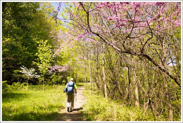
After the short, steep climb from the trail center back to the Appalachian Trail, the first few miles of hiking for the day were pleasant and fairly flat. We made quick progress – enjoying abundant wildflowers and blooming trees. We passed through Wilson Gap before reaching the northern end of the ‘Roller Coaster’ four miles into our hike for the day. The Roller Coaster is 13.5 miles of steep, closely-spaced, rocky ups and downs. (we just did the northern portion of the roller coaster on this section… more to come on our next section south.)
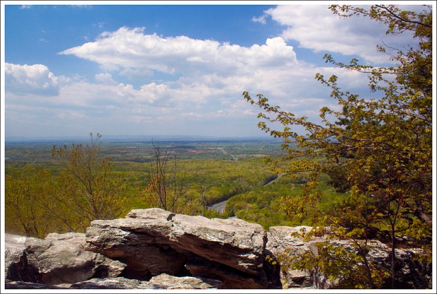
A little over a half mile into the Roller Coaster we reached the spectacular viewpoint of Raven Rocks. There were already plenty of dayhikers enjoying the view, but we found our own little spot to rest. We all took our packs off and reclined on the rocks. It was a beautiful spot with panoramic views. We were lucky enough to visit when the native Pinxter azaleas were in bloom.

After leaving Raven Rocks, we had a steep rocky descent that led to a shallow stream crossing. After the stream, there was another steep climb and another steep descent to another shallow stream. I guess it’s called a roller coaster for good reason! Ups and downs, followed by mores ups and downs. By the time we got to this part of the trail, the day had already become fairly hot and humid, and we all felt pretty tired on the climbs. It’s always a little surprising how much tougher climbing can be in the direct sun and heat with a large pack. The oddest part of this section was all the blood we saw on the trail. For about 2-3 miles there were fresh droplets of blood on the ground every 5-6 feet. I guess someone really had a bad day on the roller coaster!
At about 7.5 miles into our hike we descended to Snickers Gap. We stepped out of the woods onto busy Route 7. Cars were flying by at 55-65 mph. We had to cross the road and then walk up the shoulder of the road until reaching the trail again. When your legs are fatigued, it’s hard to run fast across a four lane highway. It was like Frogger with backpacks!

On the other side of Route 7 was our last climb of the day! We walked uphill for another .6 miles to the rocky outcropping of Bears Den Rocks. We spent some time relaxing and enjoying the view before walking a few more tenths of a mile to the Bears Den hostel where we had left our car parked. We posed for a group victory photo in front of the hostel, took off our boots and packs, and sunk into the wonderful air-conditioning of the vehicle.
We were all starving, so we stopped for a quick lunch at the Horseshoe Curve Restaurant right out on Route 7. The restaurant had been advertised in our AWOL Guide and on the back of the trail information kiosk at the road crossing, so we decided to give it a go. Sandwiches, french fries, and cold drinks definitely hit the spot! Even though we were all filthy and tired, we also decided to make a stop at Veramar Vineyard to share some wine and toast our hike. We got a bottle of their Seyval Blanc and found a few Adirondack chairs with a view of the ridge we had just traversed.
It was a great weekend for our first backpacking trip of the season. Honestly, the more I backpack, the more I WANT to backpack! I love being out on the trail!
Trail Notes
- Distance – 20.5 miles
(Check out the stats from Map My Hike [Day One] [Day Two])* - Elevation Change – 3882 ft.
- Difficulty – 3.5. The distance makes this tough, but overall is manageable.
- Trail Conditions – 4. The trail was in great shape. We only came across one tree blowdown the entire trip.
- Views – 3. The best views of the trip were from Bears Den rocks at the end of the trip.
- Streams/Waterfalls – 2. There weren’t any streams and only one reliable water source on the first day (at the Blackburn AT Center). The second day, there were several streams through the area of the Roller Coaster.
- Wildlife – 2. We didn’t see much wildlife on this section. There were lots of pretty songbirds at the Blackburn AT Center.
- Ease to Navigate – 3.5. Pay attention to signs for the AT. It should be fairly easy to follow.
- Solitude – 2. We saw a good number of people throughout the trail, but most were where you would have expected them – the shelters, hiking a short distance from Harpers Ferry, and at Bears Den Rocks. We also saw several trail runners on the Roller Coaster.
* MapMyHike is not necessarily accurate, as the GPS signal fades in and out – but it still provides some fun and interesting information.
Download a Trail Map (PDF)
Directions to trailhead: To get to Bears Den to leave one car, from I-81, take exit 315 for VA-7 E toward Berryville. Turn left on VA-7 E and go 17 miles. Turn right on State Route 601 and go .4 miles. A sign shows you are entering Bears Den. Go to the second parking lot and leave a car there. Be sure to pay for your day-use fee.
For the second vehicle: Head out of Bears Den and turn left on State Route 601. In .4 miles, take a left on VA-7 W. In about 4 miles, take a right on to State Route 612/Shepherds Mill Road. Follow this for 4.3 miles until it ends at US 340. Take a right here and continue to follow US 340 N for 14.6 miles through Charles Town and approaching Harpers Ferry. At the Econo Lodge, take a left on to Union Street. Follow that .4 miles and take a right on to Washington Street. Follow that .2 miles to reach the ATC Center. If someone is not dropping you off, you should ask inside where you could leave a car overnight, since there are parking restrictions near the center.


Thanks for the great detail! I was planning to take my 16 year old son on this segment for a two day hike. Is there a better segment to hike for a 1 night, 2 day hike?
LikeLike
Hiw far are you willing to travel? This section is nice, but there are definitely more scenic sections.
LikeLike
Thanks for such a detailed write up! All the pictures are really helpful as well. I’ve been wanting to do this section for a long time. Planning to head out there this spring. Thanks!
LikeLike
Old post but wanted to say what an accurate and quality post. Great section to hike, i enjoyed Keyes Gap to Blackburn. Very rocky though, I hiked this in 3 out & back ‘sections’ & if I didn’t trip on a rock sobo I would definitely get it nobo *sigh*….amazed I never fell on my face! Thanks, what a great site and write up
LikeLike
Christine, could you tell me how much the shuttle driver was from Bears Den. We are doing a 4 day/3 night hike from Harper’s Ferry to Ashby Gap and were planning on taking two cars and leaving one at Ashby Gap. Trying to figure out if a shuttle driver would be more beneficial.
Dixie
LikeLike
Hmmm… I’ve been in so many shuttles that I can’t remember with 100% certainty. I’m pretty sure we paid $45 for a ride from Bears Den to the ATC Headquarters in Harpers Ferry.
LikeLike
Christine, once again you guys rock this world! I’ve got maps covering the entire VA section of the AT, but had not purchased the book yet till reading this blog. Thanks so much. BTW, we are the family the you suggested the MT Rodgers hike to over this past Columbus Day. That rocked as well.
Dixie
LikeLike
I remember you from our Mt. Rogers discussion, Dixie! I’m glad we can help. 🙂
LikeLike
One of your best writeups yet. You almost made me forget how much I hated this trail section when I hiked it 3 summers ago! I remember lots of loose rocks north of Keys Gap. Anybody thinking of doing a thru-hike would be well served to hike the northernmost 40 miles in Virginia first – I think that is why you see so many DC-area Scout troops on the trail up that way; they are all training for a backpacking trip in BSA’s Philmont Reservation in New Mexico and the leaders want to make sure the boys get through that experience remembering the training as the hardest part of the journey.
LikeLike
Thanks, Jeff! It was a very rocky section, for sure – and I am glad to have it behind me. I think the passage of time always improves the recollections of a tough/unpleasant part of the trail. 🙂
LikeLike