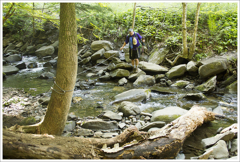
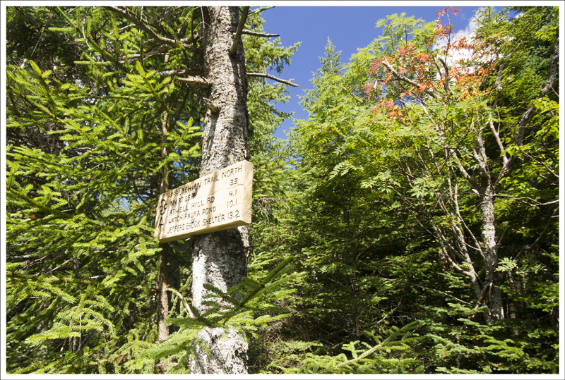
We did this 27-mile Appalachian Trail section over three days at the tail end of summer 2017. The trail was beautiful and quiet with lots of interesting things to see along the way. We camped one night and spent the other luxuriating at Woods Hole Hostel. This may have been one of Christine’s favorite sections yet!
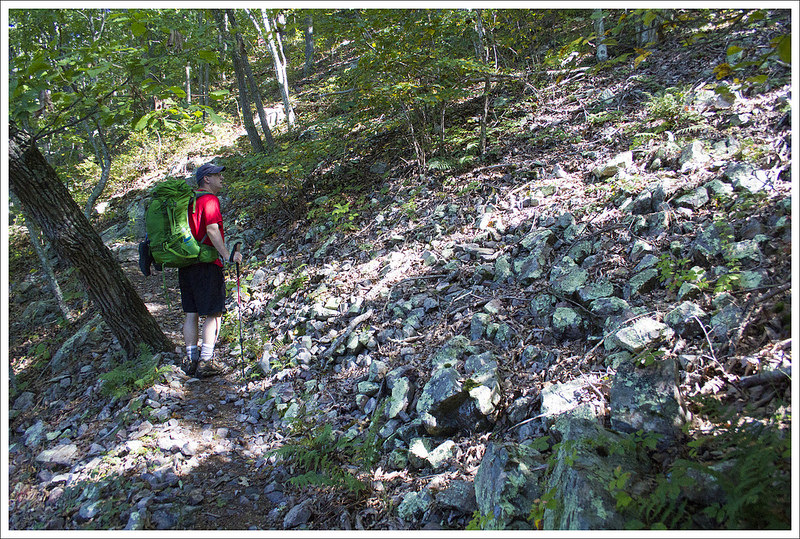
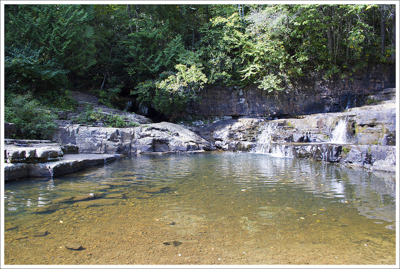
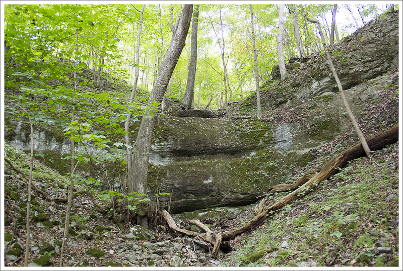
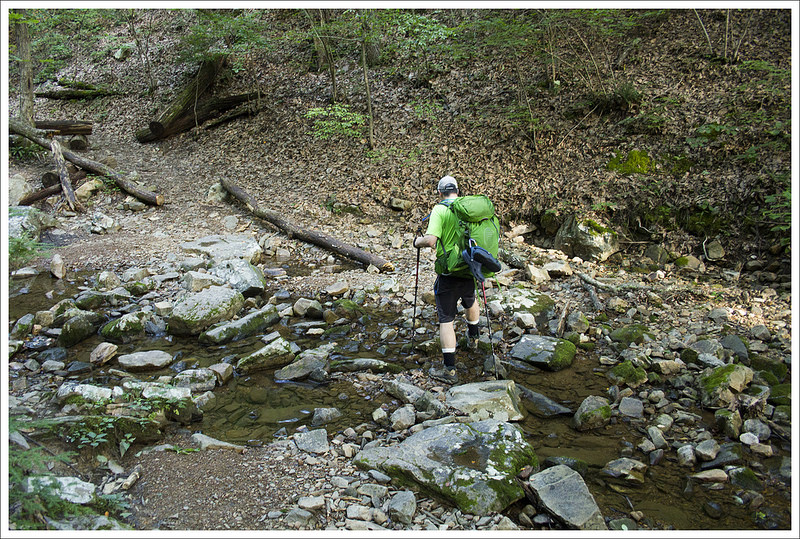
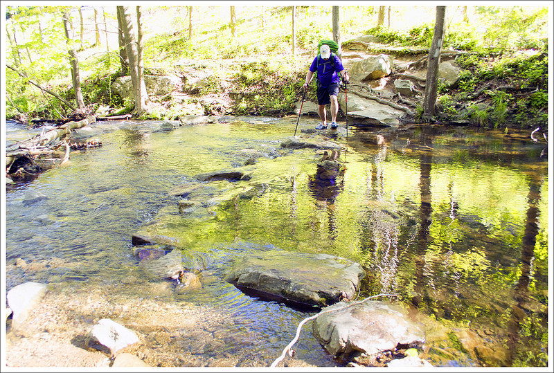
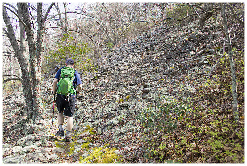
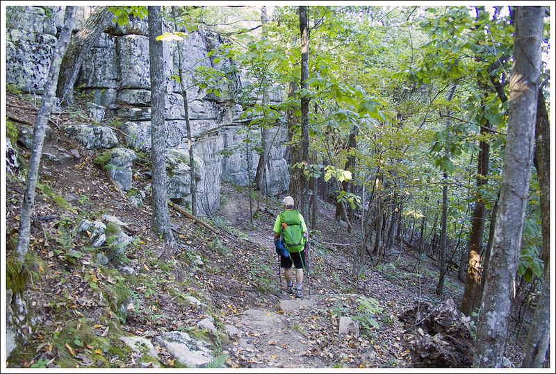
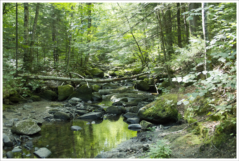
Kimberling Creek is beautiful, but not safe to drink from. There is a lot of cattle farming along the stream. Below: Some rocky slopes along the trail; The spur trail to Dismal Falls is well worth the detour; Shallow pools and flat rocks leading up to the falls.
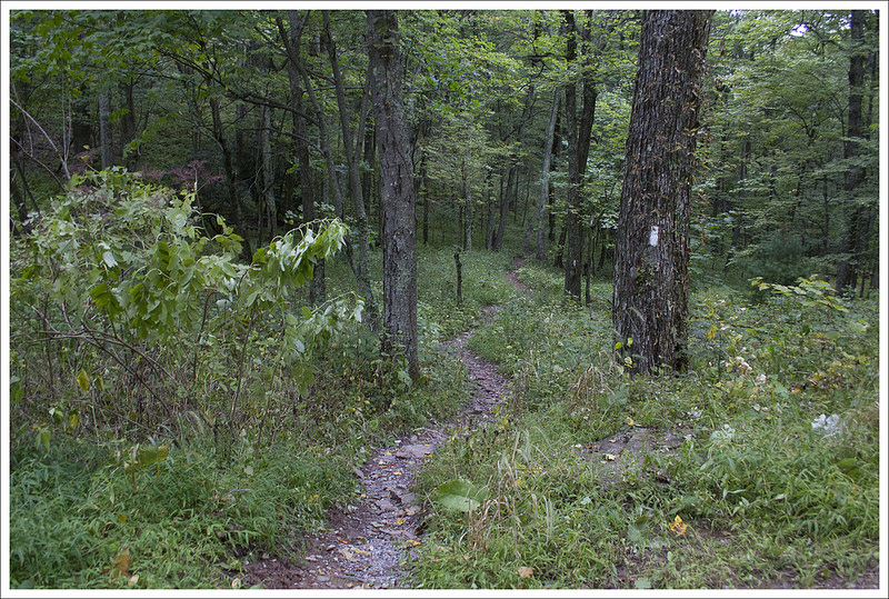
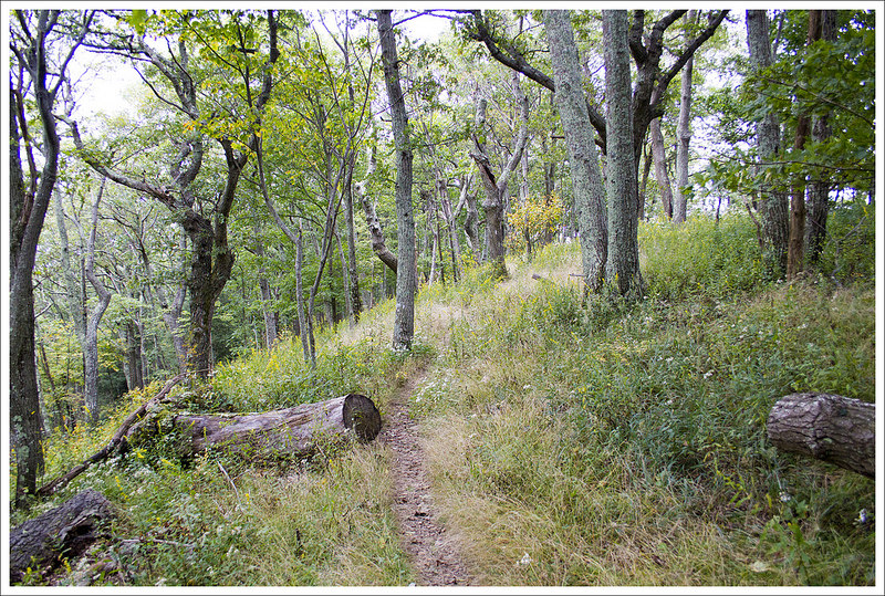
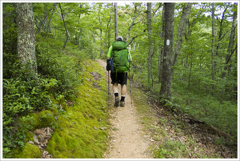
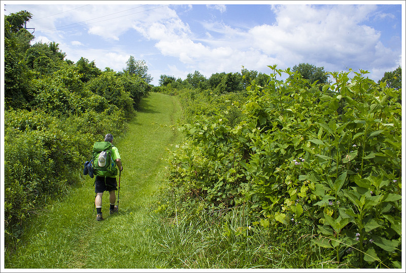
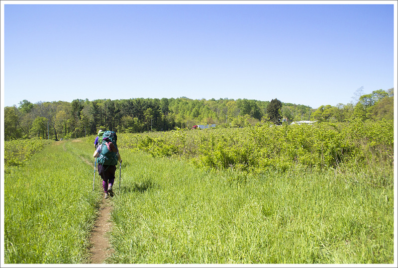
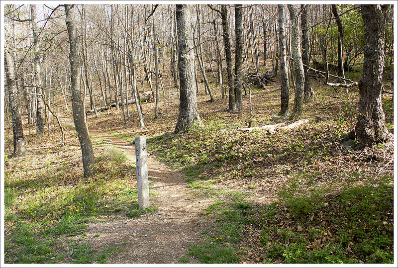
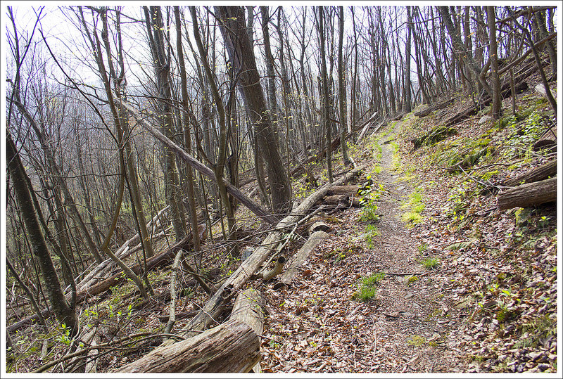
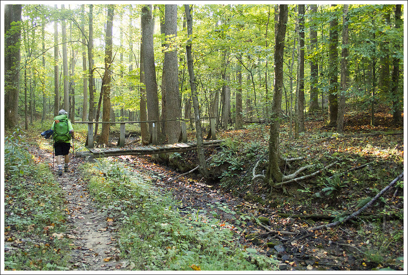
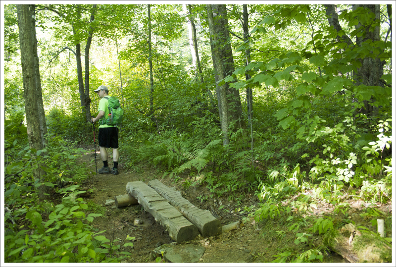
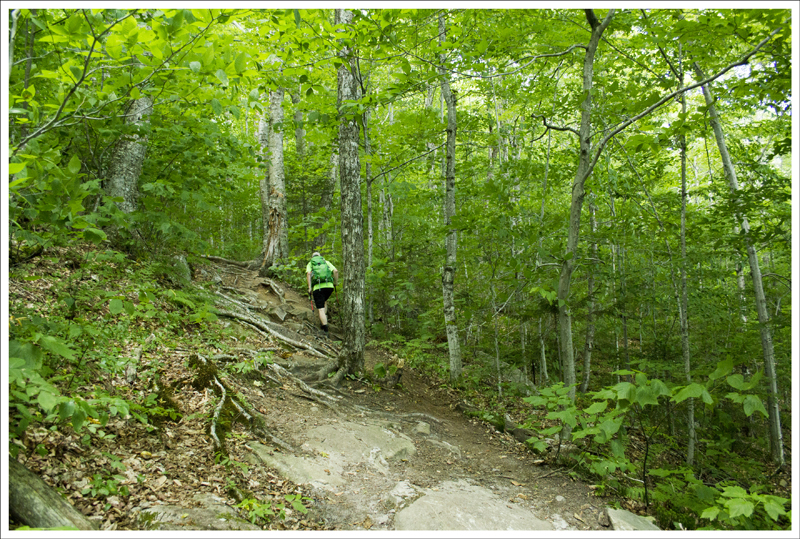
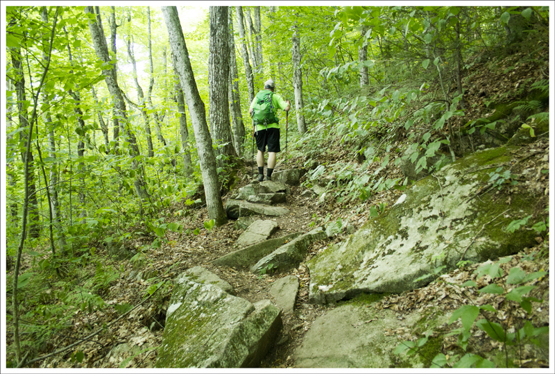
We decided to celebrate Christine’s birthday by completing a section of the Appalachian Trail over a few days. I had a couple of surprises for her along the way which hopefully made it an even better trip for her. I arranged a shuttle driver to meet us at a parking lot off Narrows Road near Pearisburg, VA. We loaded up and he drove us on some beautiful back roads until we got to our dropoff point at Kimberling Creek. There was a small parking lot here and a suspension bridge that spanned the creek. We took a few pictures, crossed the road, and then started our trip north on the white-blazed Appalachian Trail on a two day trip back to our car. The trail started off with a bit of a steep climb, which is always a quick reminder of the weight you decided to pack in your backpack.
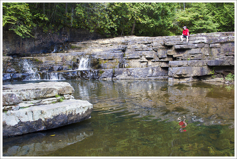
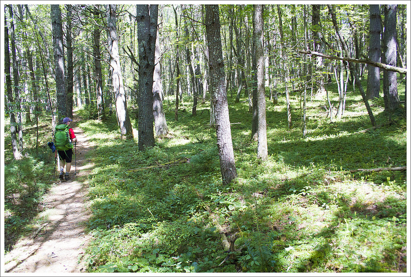
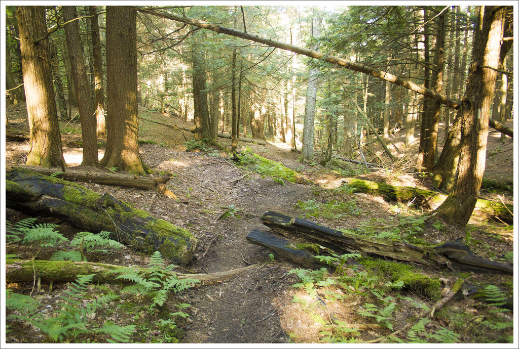
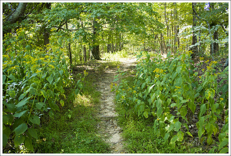
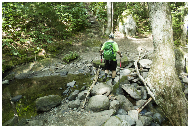
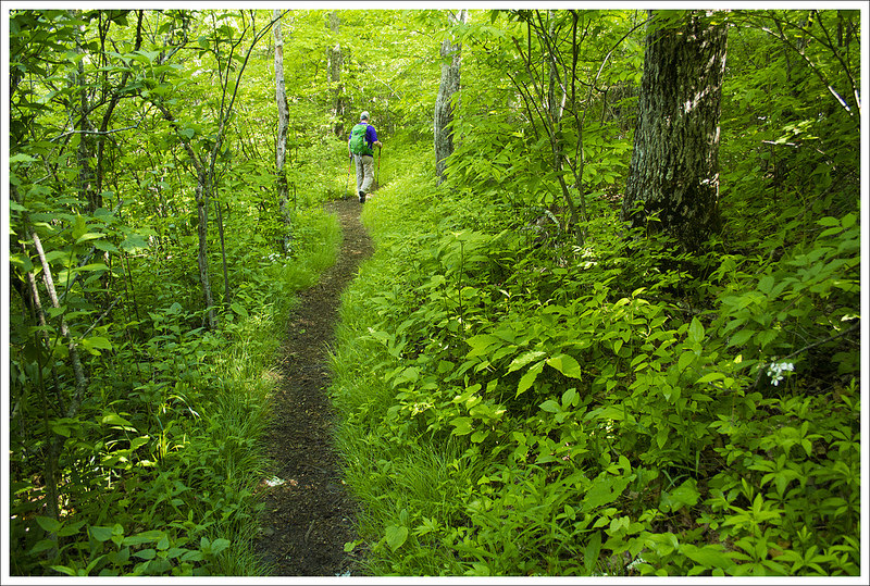
The water level was very low, but Dismal Falls was still beautiful. Below: Another angle on the falls; This area has tons of rhododendron tunnels; Walking through beautiful open forest.
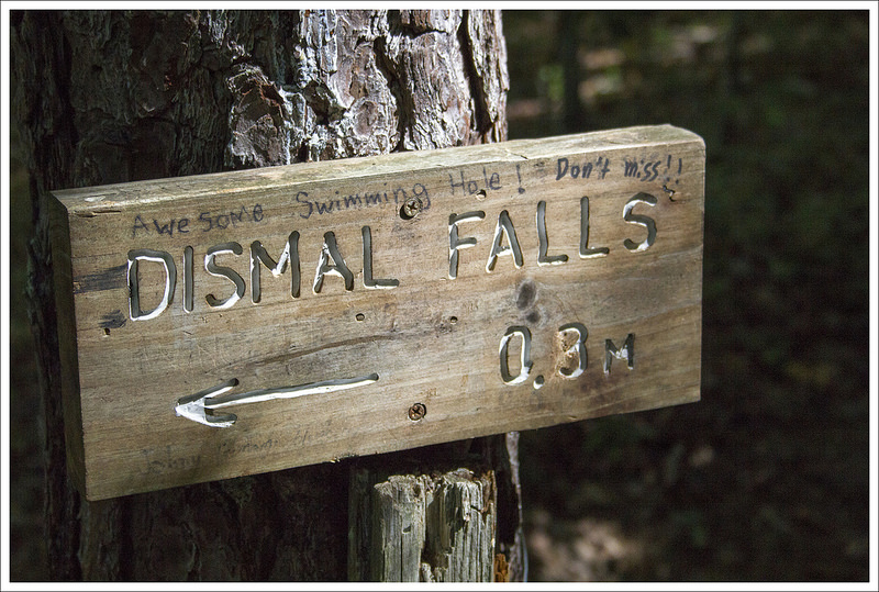
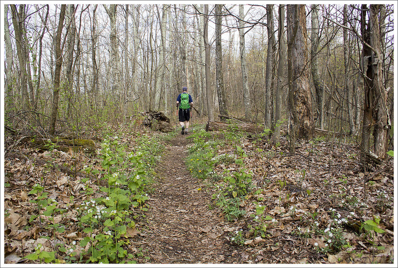
The climb was short-lived and after about a mile, the trail started to slope back downhill. At 1.8 miles, we reached a side trail that showed that Dismal Falls was just .3 miles away. Since it was early in the day, we decided to check it out and we were so glad we did. Dismal Falls was one of the more picturesque waterfalls I have seen and the setting just invites you to waste some time there. Even with low amounts of water falling, it is a great swimming hole area with great places to perch above and watch the water. We ate some snacks, explored the nearby area, and took many pictures before deciding to head on. While we were there, we only had a few other people that came by and they all approached it from the roadside that we could see in the distance behind the waterfall. We were glad we put the effort to see such a beautiful place. We grabbed our stuff and then headed back to rejoin the AT, bringing our mileage to 2.4 miles.
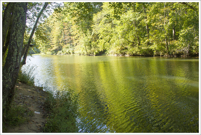
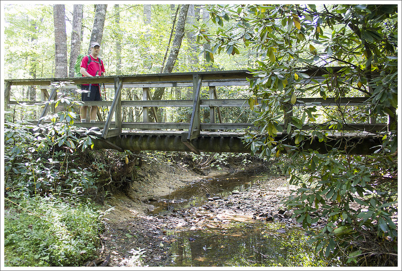
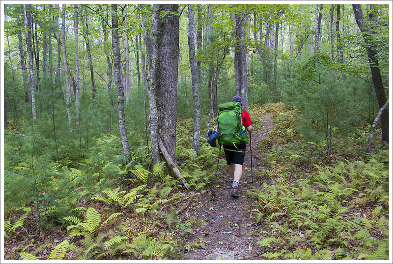
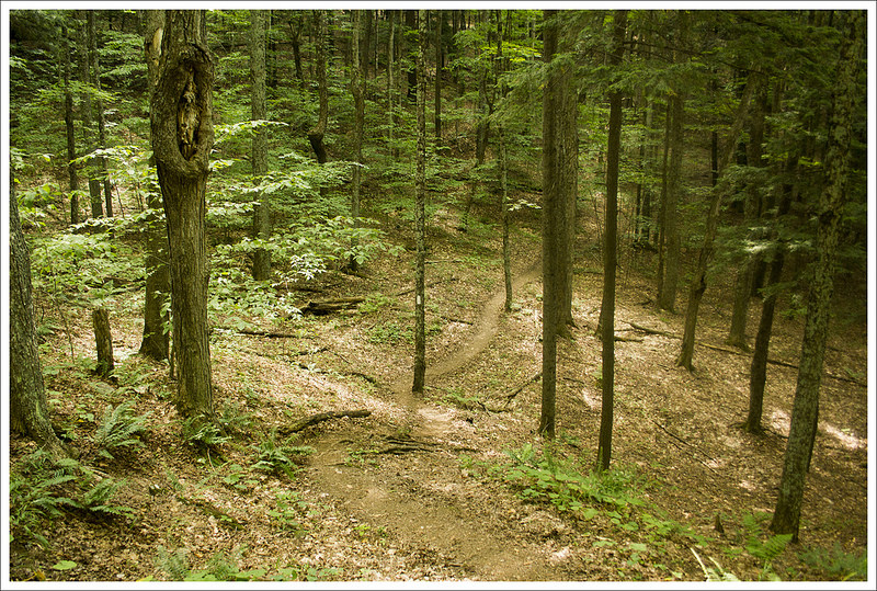
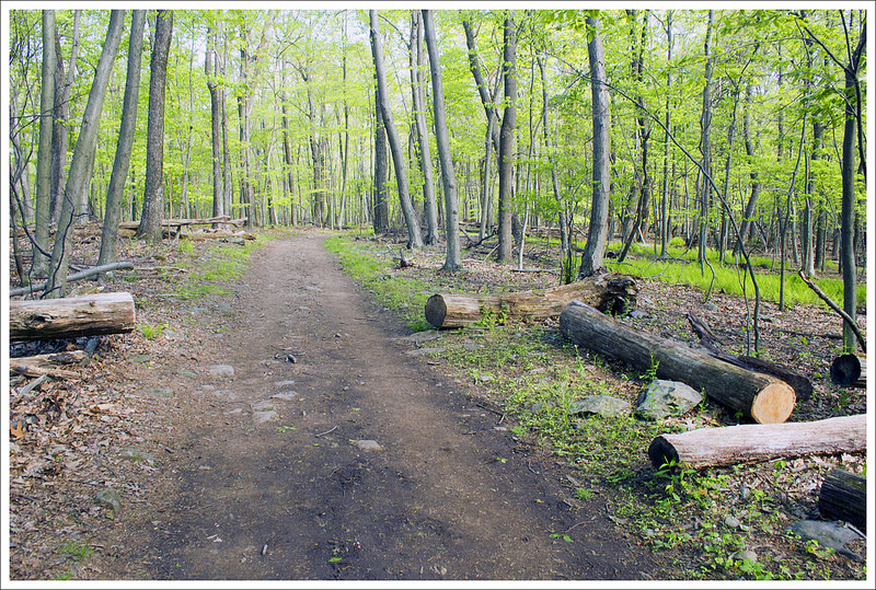
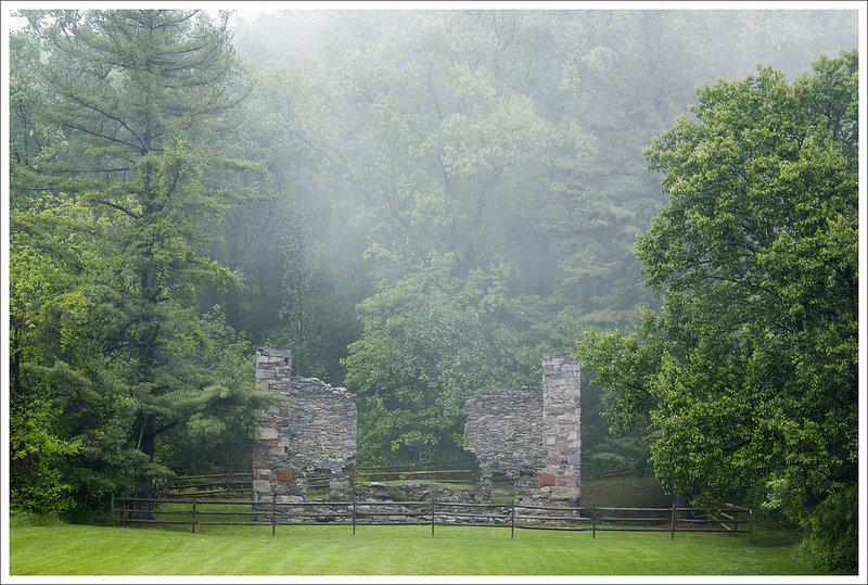
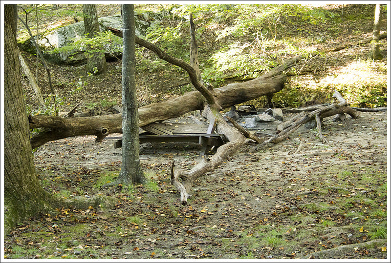
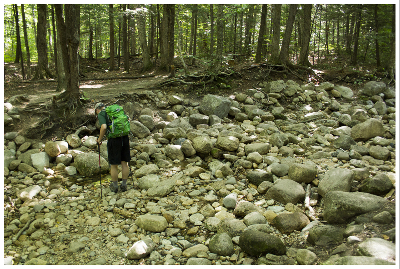
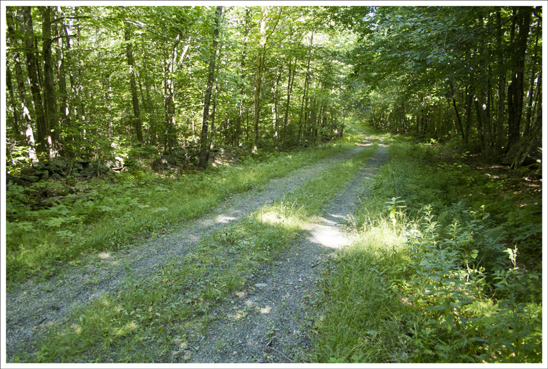
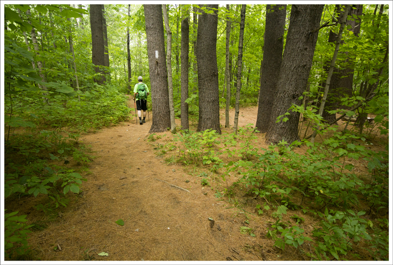
This pond was a scenic spot along the trail. Below: While the trail was very dry when we hiked, this stretch has lots of bridges and planks to cross wet areas; The Waipiti Shelter used to be along this fire road. It was demolished after a couple hikers were murdered. A new shelter was built a little ways north; More beautiful forest.
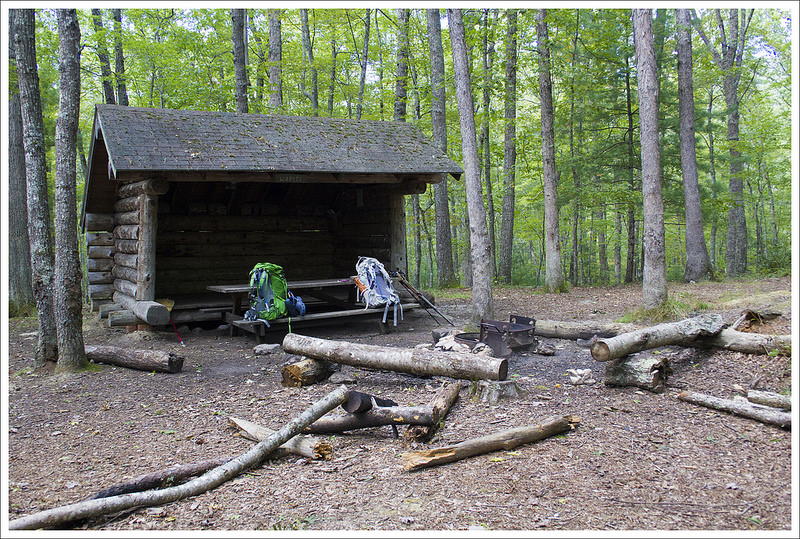
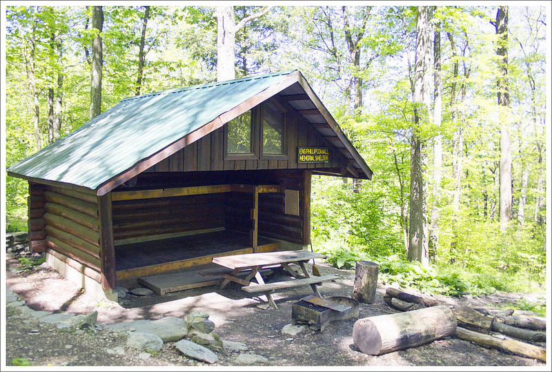
Continuing on, most of the hiking for this day was rather pleasant – there was a slight uphill climb but overall was not too tough. There were lots of footbridges and water crossings along the way, so this was not a day where we felt like we needed to carry much water since we weren’t terribly far from a water source. Eventually, we hiked next to a large, scenic pond that joined up to a dirt road at about 8.4 miles. From here, it was just a couple of tenths of a mile to our first stop on our trip, Wapiti Shelter.
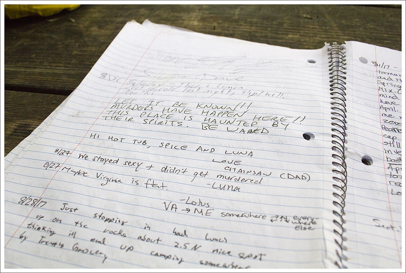
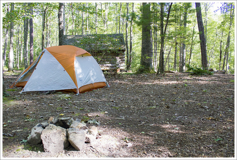
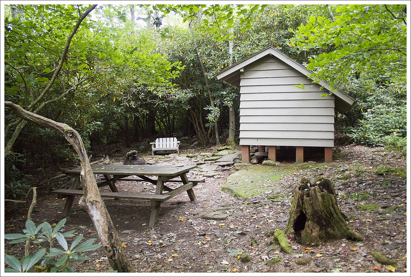
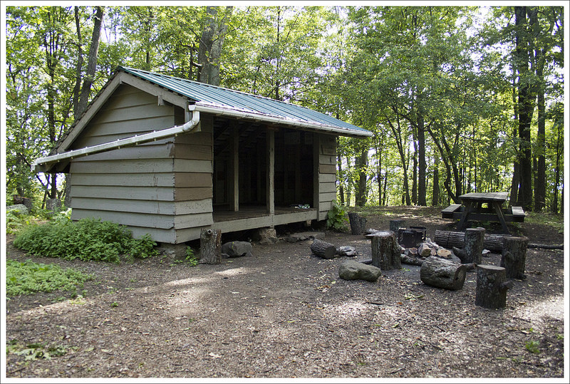
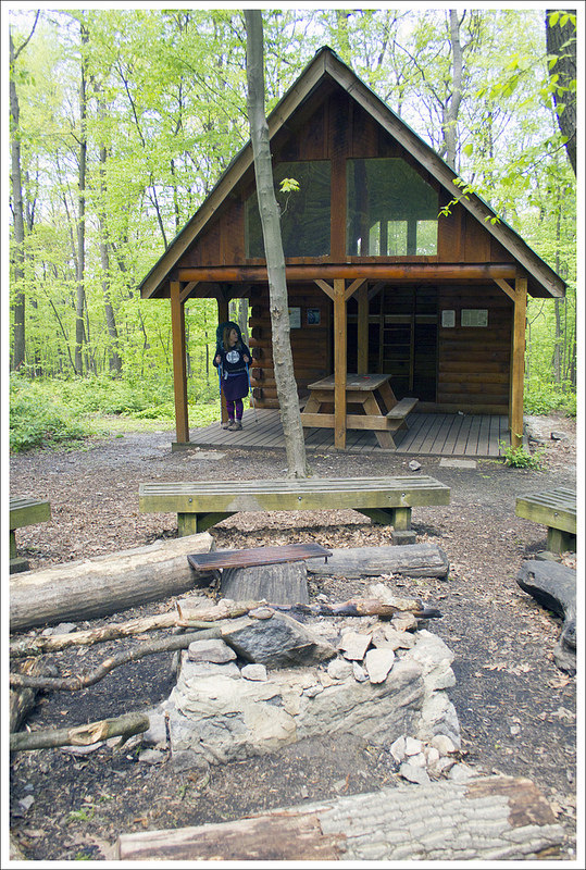
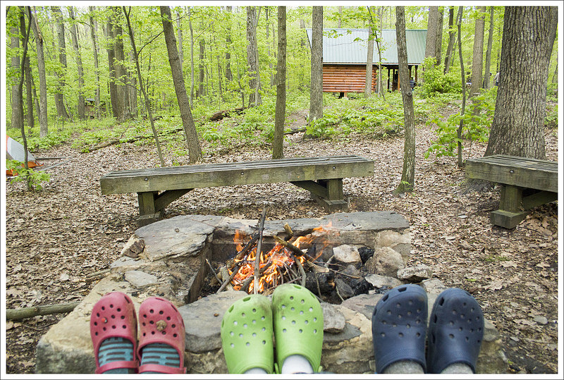
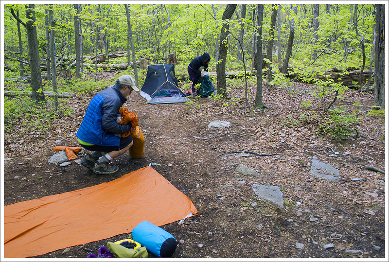
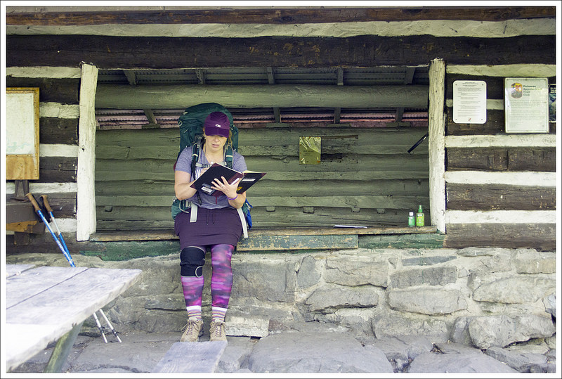
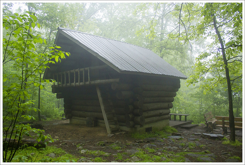
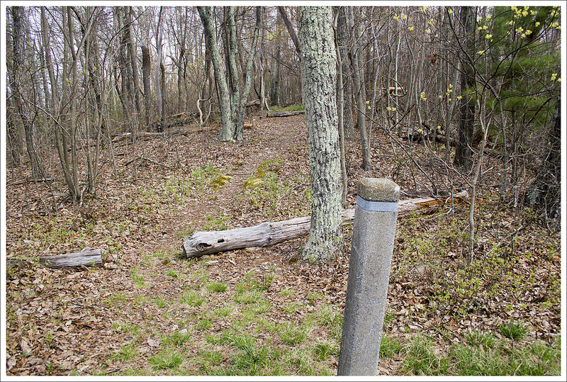
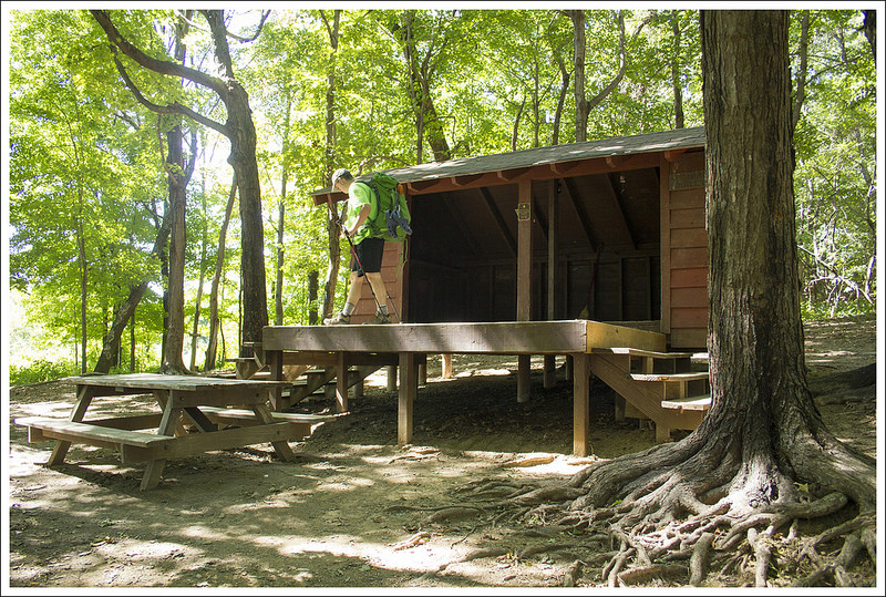
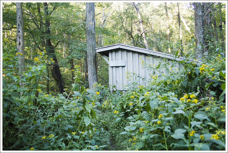
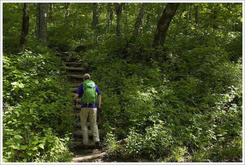
Our camp stop for the first night was the Waipiti Shelter. Below: The turn-off from the AT; Lots of entries in the log make mention of murders and hauntings, but this is not where the crime happened; Our tent site behind the shelter.
Wapiti Shelter has some dark history to it. Christine had already heard the story before, but she waited to tell me about it until we got there. The old Wapiti shelter was the place where a couple of murders had taken place in 1981. A man named Randall Lee Smith befriended a couple of hikers and then murdered them in their sleeping bags that night. Smith was captured and imprisoned, and then met parole to be released in 1996. In 2008, Smith returned just a few miles away and tried to kill two fisherman but wrecked his truck in the getaway and died from the injuries he sustained when he was taken to prison. If you want to read more about this story, check it out here. Keep in mind, that the shelter today is located a couple miles away from where the murder happened, so ghost stories that the trail journals would like you to believe are simply not true.
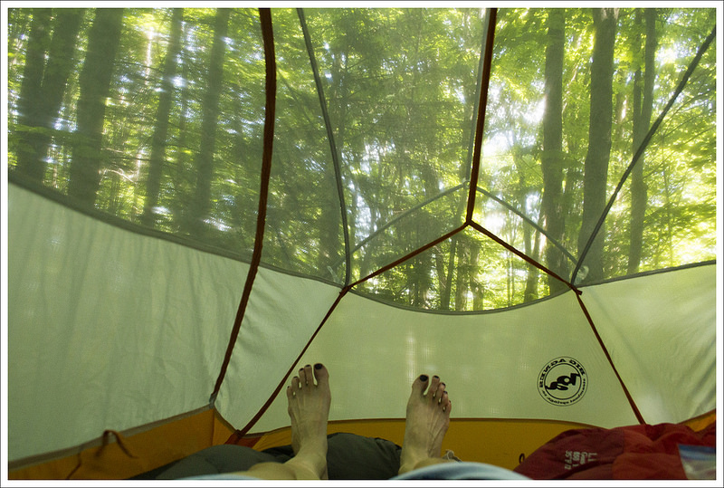
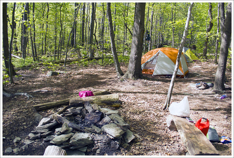
As we were setting up camp, I surprised Christine with an additional camp pillow for a birthday present. She had been complaining recently about how she wish she had multiple pillows when backpacking, because one inflatable pillow just wasn’t enough. She was thrilled when I brought the extra one out of my pack. We set up our tent not far from the shelter and a bit later, we were eventually joined by other hikers, including two from Australia and one from Germany. The best water source at this campsite was back the way we came at the bottom of the hill. We told the other campers about the murder story but only after they asked specifically about it after reading logbook entries. I think everyone slept well that night despite the ghost tale.
Christine Says: Day Two – Wapiti Shelter to Woods Hole Hostel (7.8 miles)
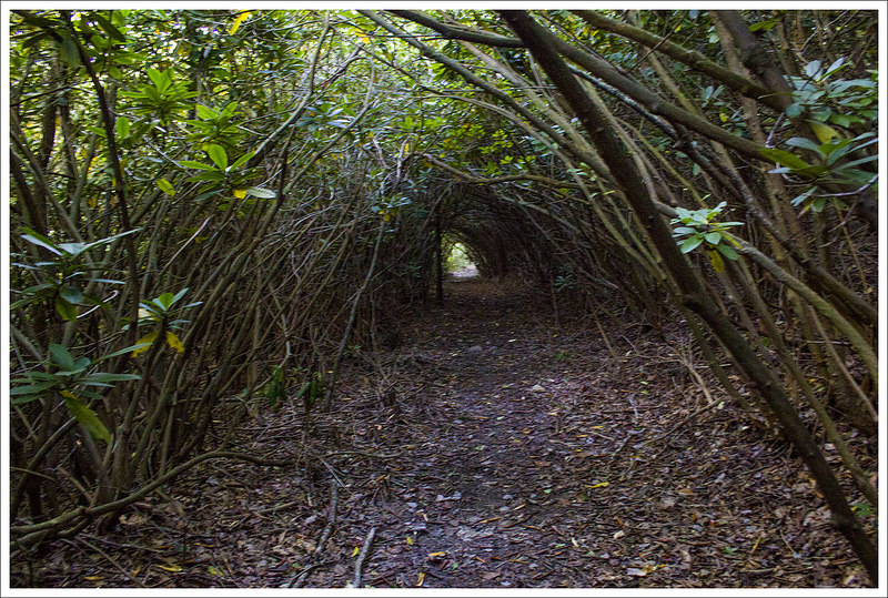
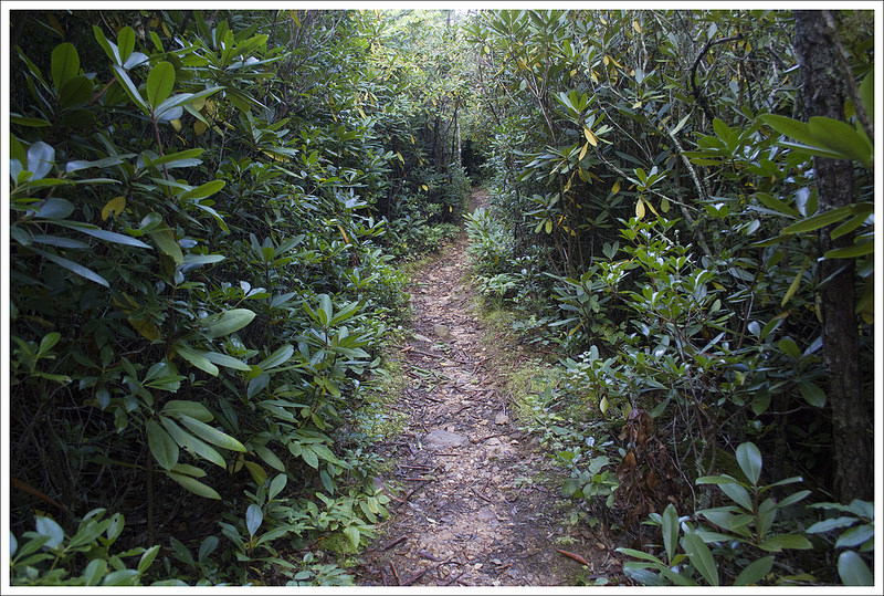
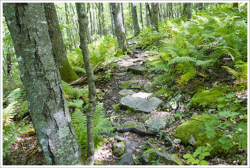
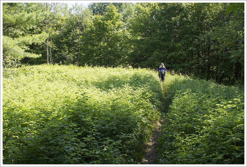
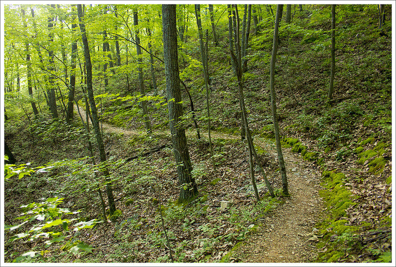
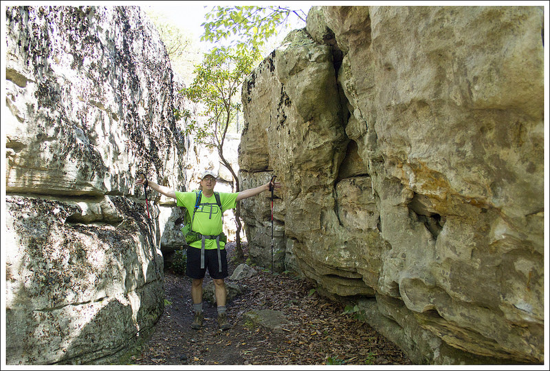
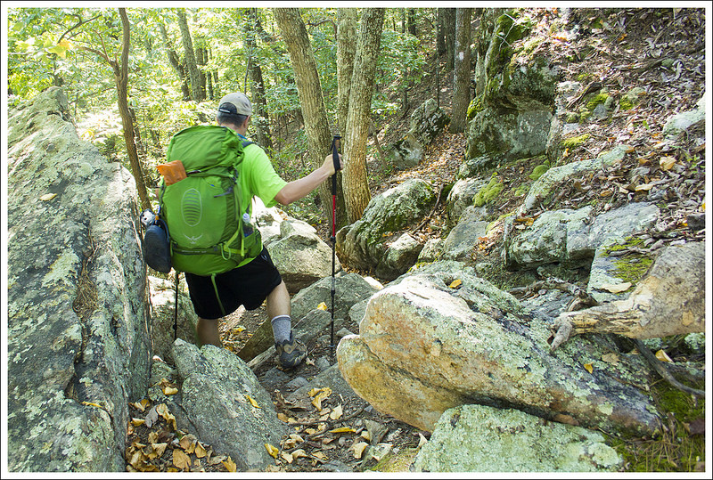
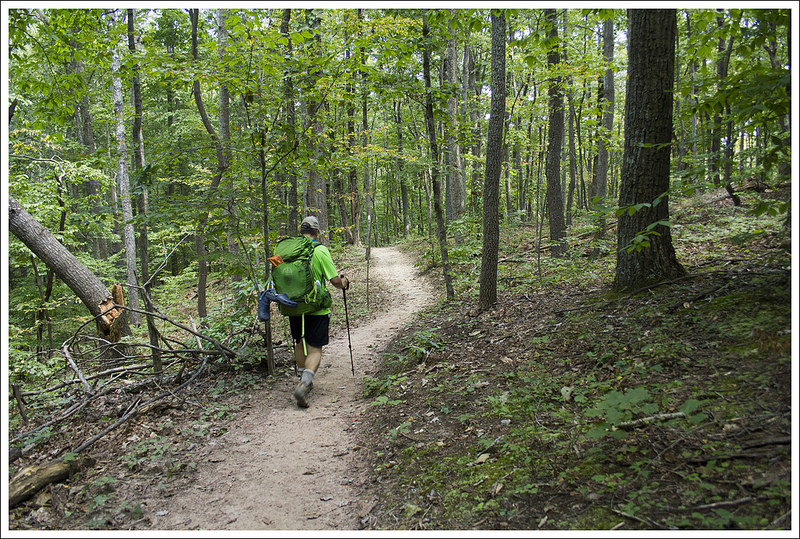
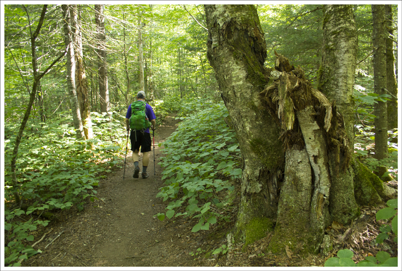
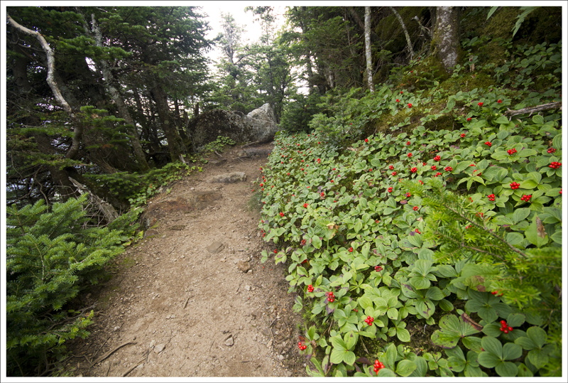
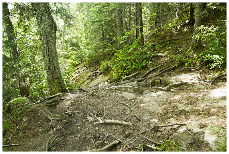
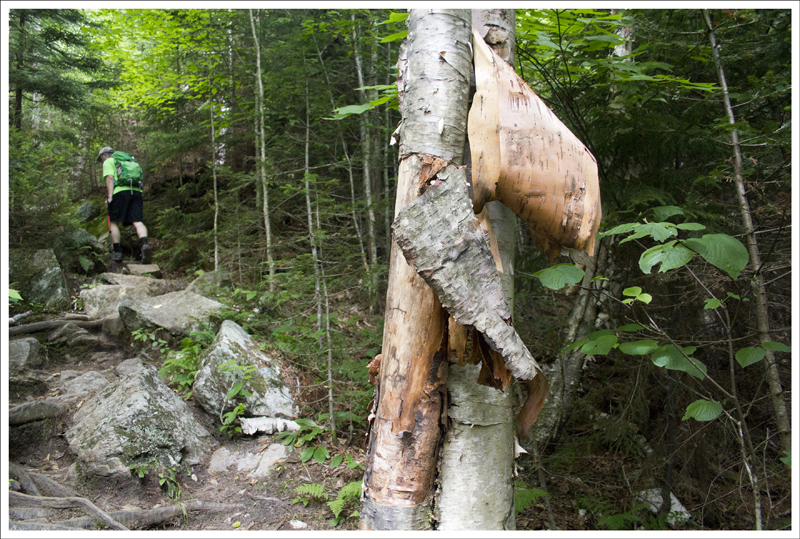
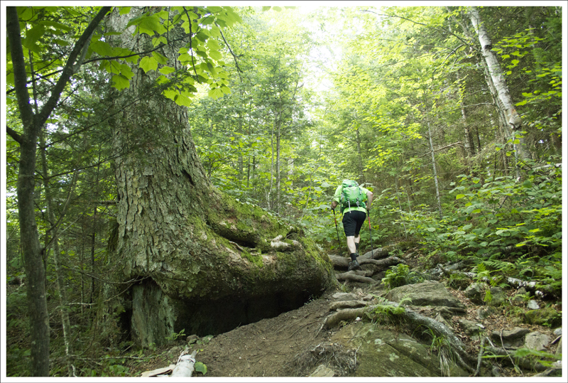
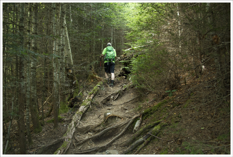
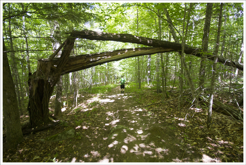
This section of Appalachian Trail had so many long, dark rhododendron tunnels. Below: Even when the rhododendron wasn’t a full tunnel, it was still very dense; The footbed was almost paved with flat, shale-like rock; I love trees with ‘arms’
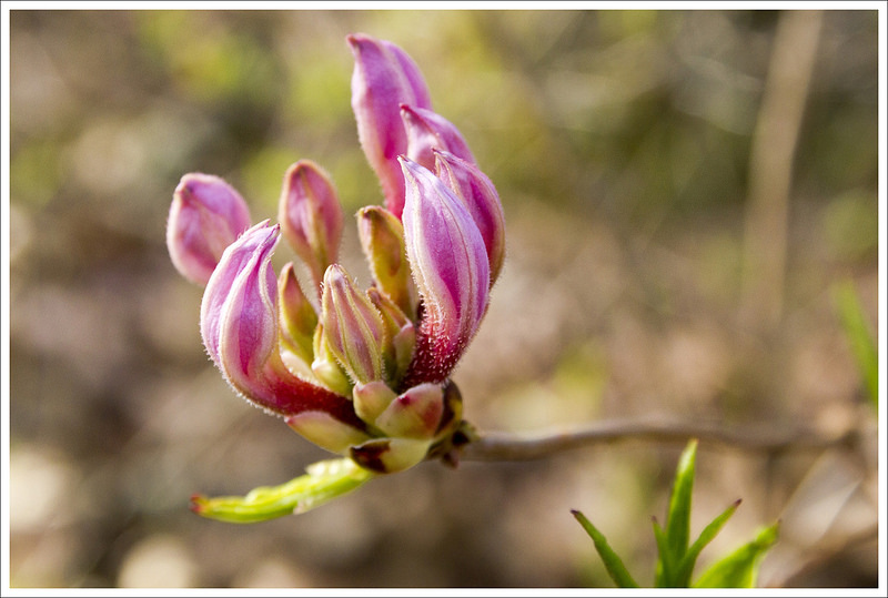
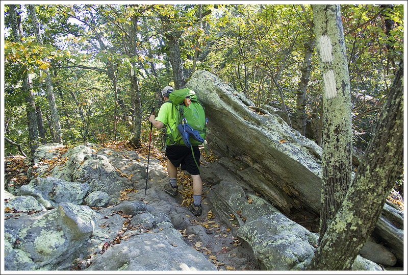
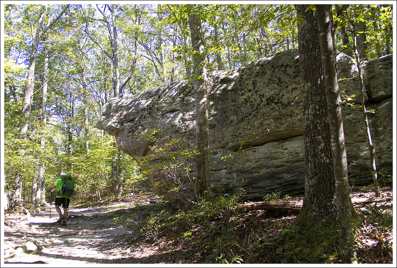
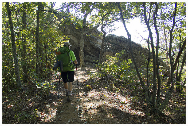
Brrr – that was a cold night! I was glad to have spent it bundled up in my warmer sleeping bag with two pillows. Eventually we got moving, packed up, ate breakfast, and started our hiking for the day. We had all day to go eight miles, so we set out at a leisurely pace. We had about three straight miles of moderate uphill to our first view of the day. The trail was all green tunnel. We passed through thickets of mountain laurel and rhododendron and traversed lush beds of ferns.
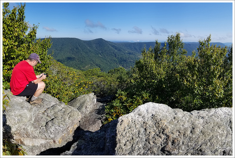
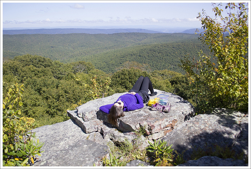
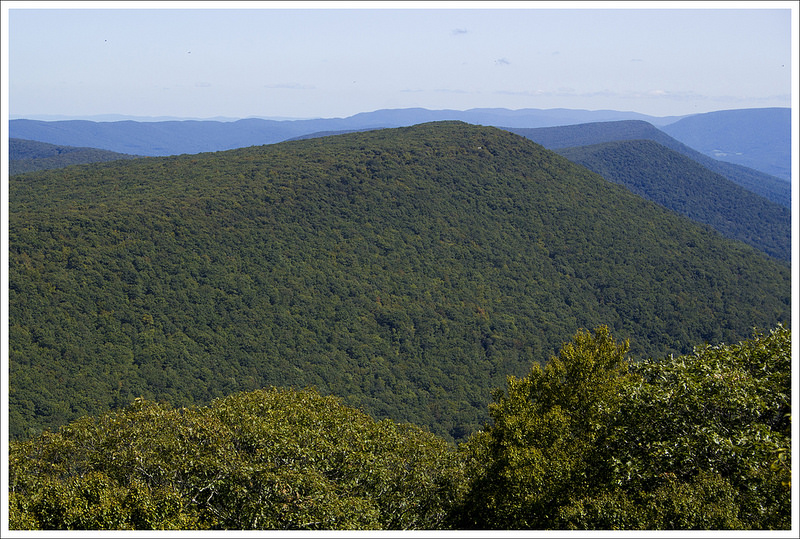
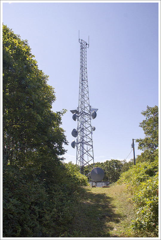
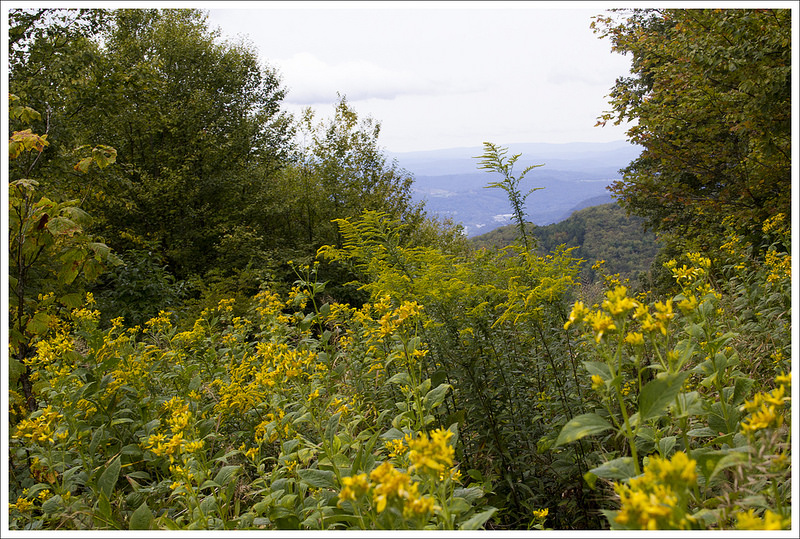
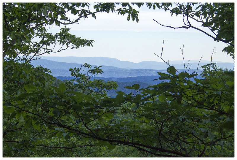
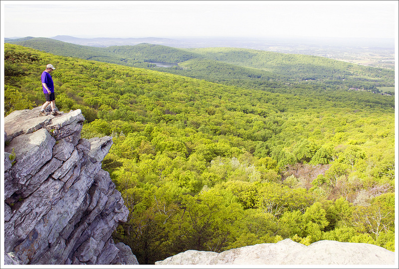
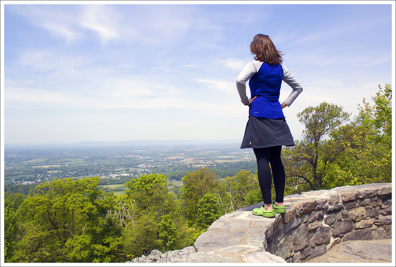
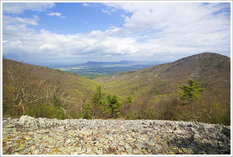
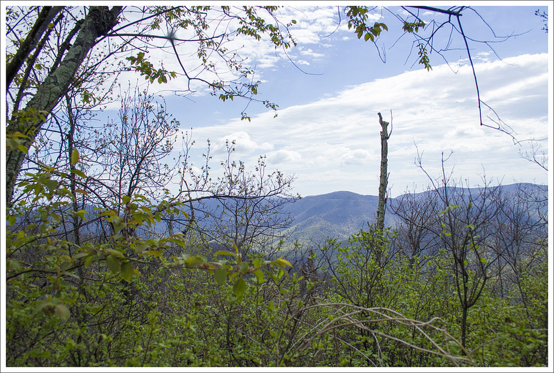
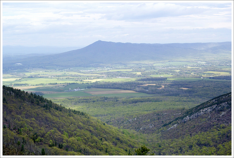
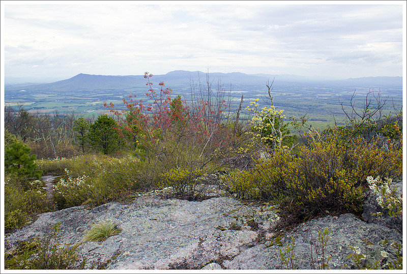
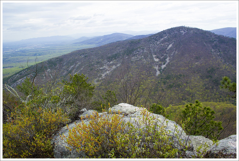
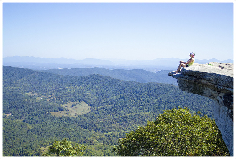
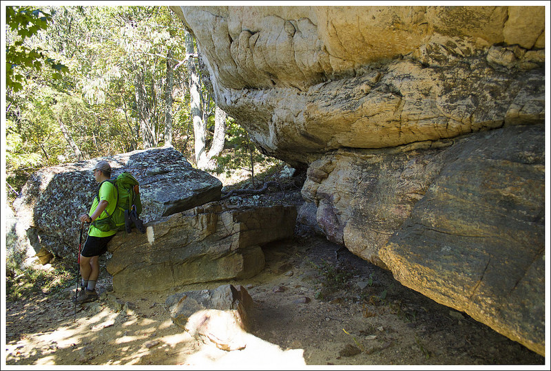
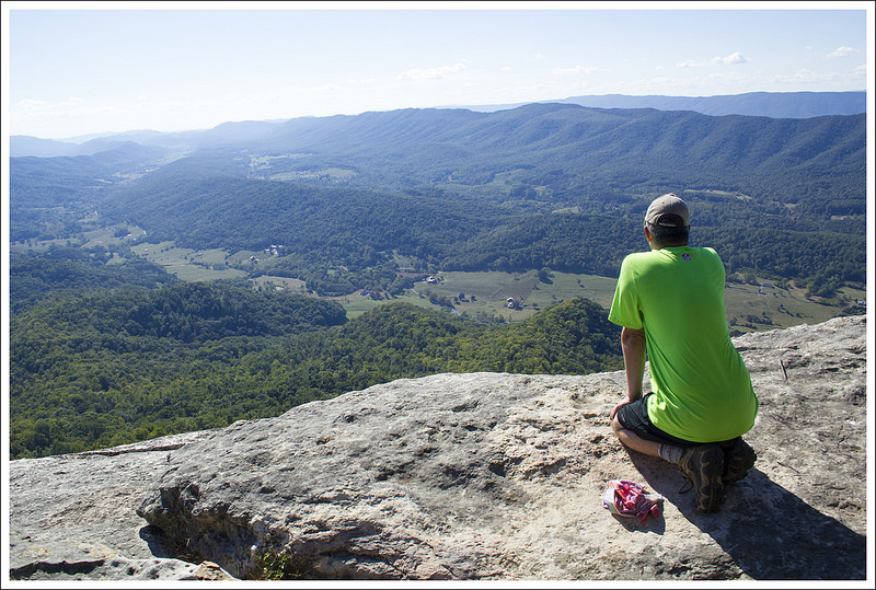
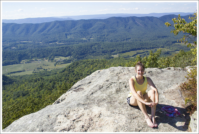
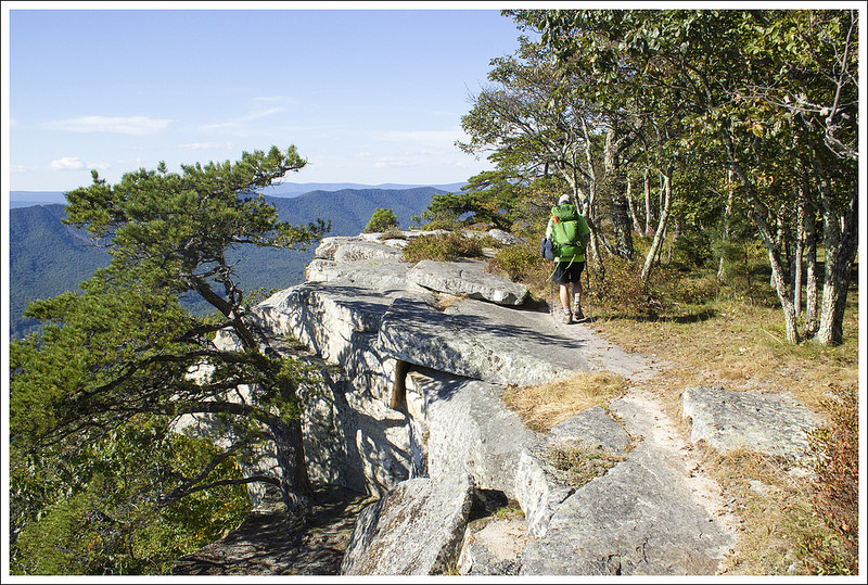
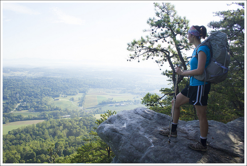
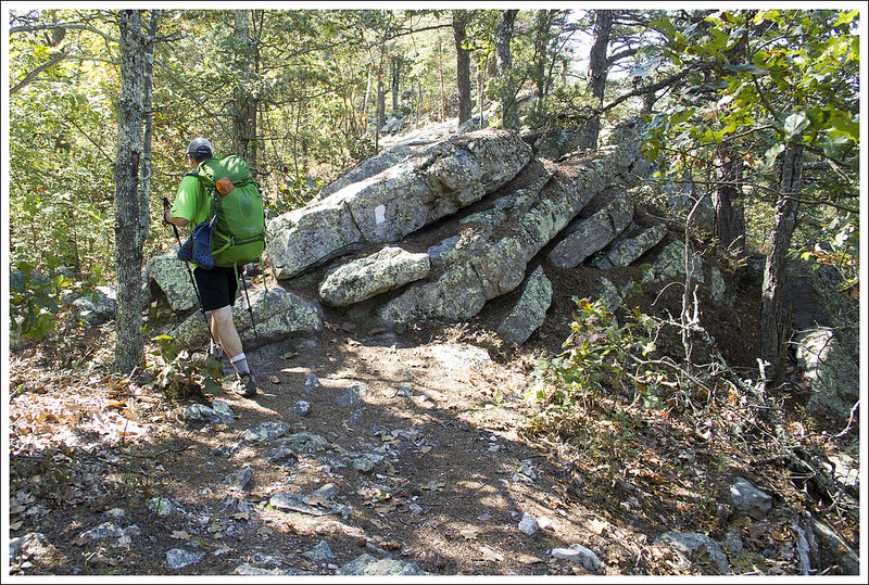
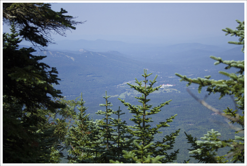
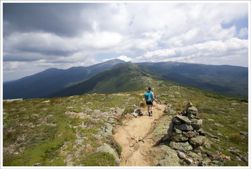
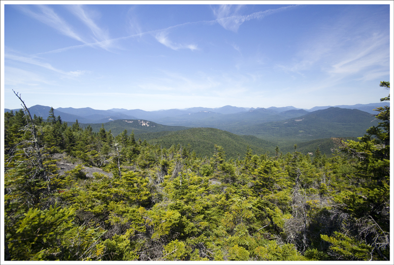
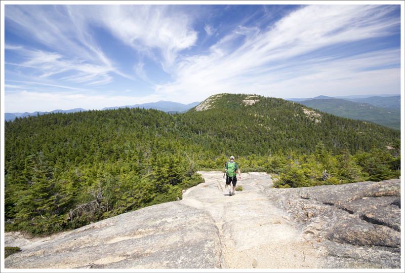
At 2.7 miles in we reached a pretty outcropping of rocks with a great view of the valley below. We stopped briefly to enjoy the vista, but weren’t ready for a snack or a long break. The next 2.3 miles covered rolling terrain with lots of small ups and downs. The trail was pretty, but not remarkable. At five miles into our day, we reached the radio tower on Flat Top mountain. The tower viewpoint is about .1 miles off the trail and worth making the small detour. Behind the tower, there is a series of small cliffs with a commanding view. It’s the perfect place to take a lunch break.
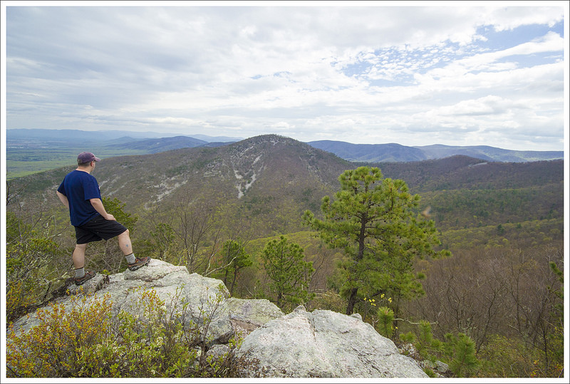
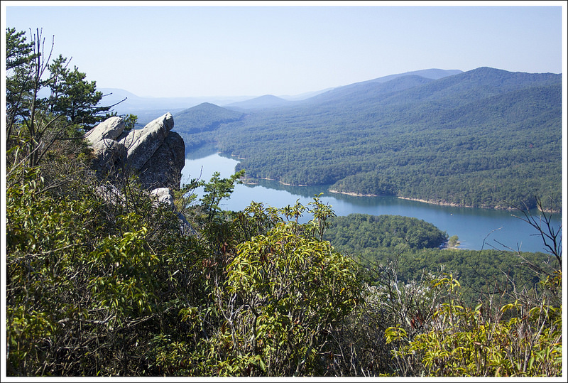
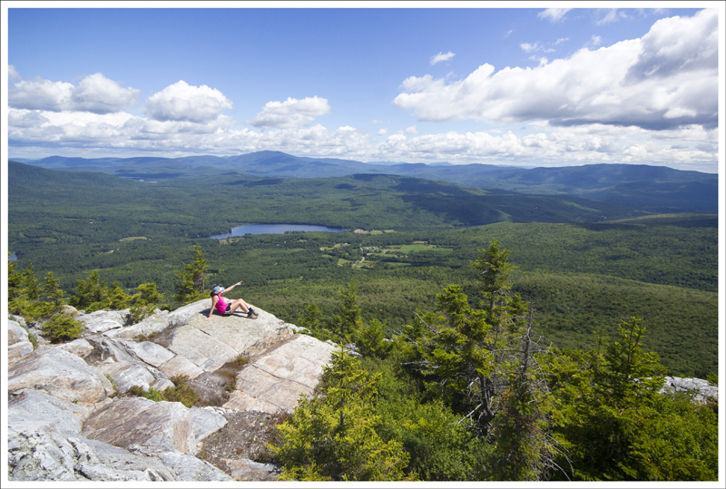
There were several nice views near between Waipiti and Woods Hole. Below: Views from the trail.
The day had warmed up a bit and we were both running really low on water. Thankfully, we had enough to make Pack-It Gourmet cheese spread for lunch. We had cheese and crackers with candy and dried fruit for our mid-day meal. We also took a good long break and rested atop the rocks. It was peaceful to watch hawks and buzzards soaring on the breeze.
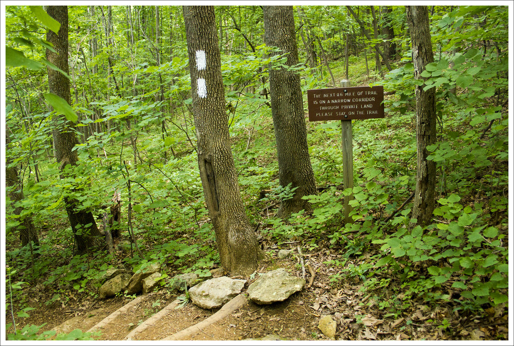
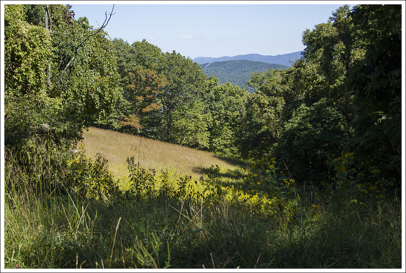
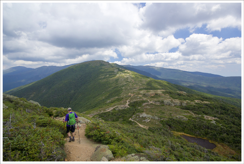
After a full hour of resting, we packed back up and set out to cover our final 2.8 miles of the day. The rest of the route was mostly downhill with only a few brief bumps to climb. In about .7 miles, we crossed the Ribble Trail. The sign indicated that supplies (like propane) were available somewhere down the Ribble Trail, but I would think most people would just continue on to Woods Hole or even Pearisburg if they needed something. Apparently, there is also a nice AT-Ribble Trail loop that is popular with locals. If we were to have followed the Ribble Trail, it would have rejoined the AT near Waipiti shelter, where we spent the prior night. Maybe one day, we’ll go back and explore the area more.
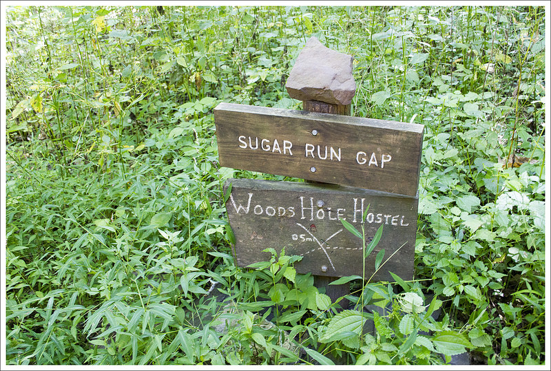
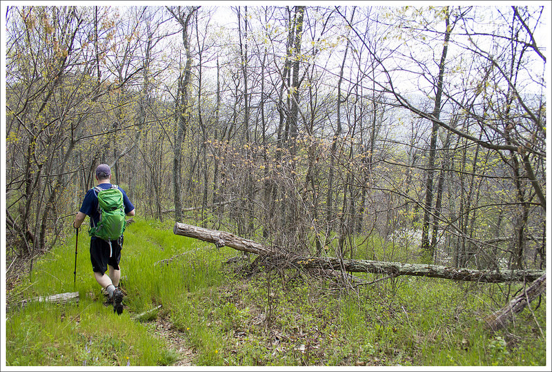
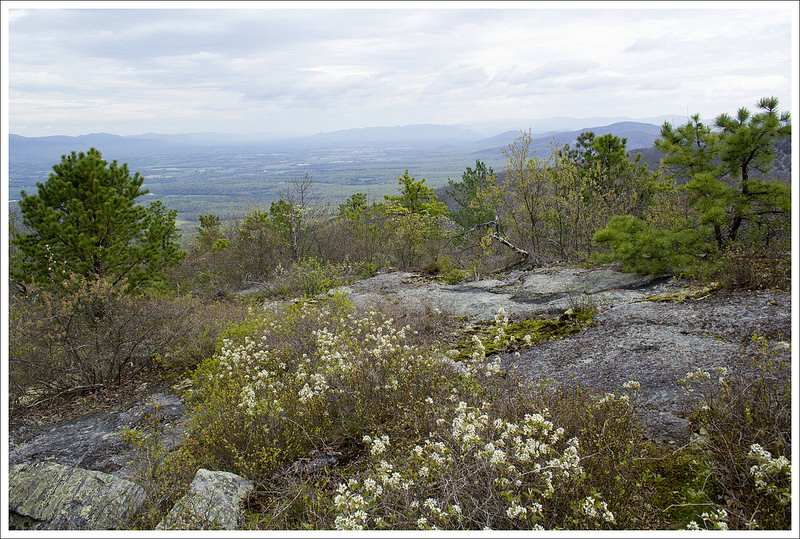
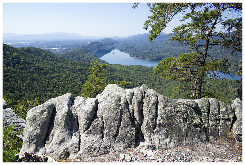
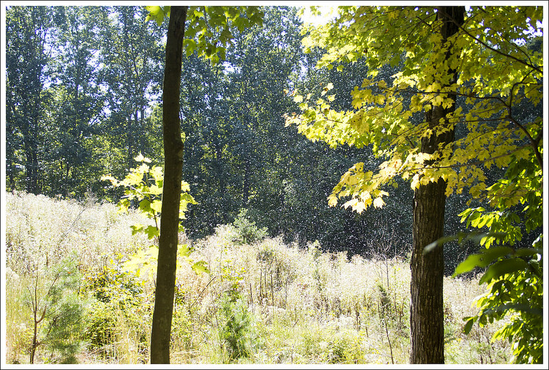
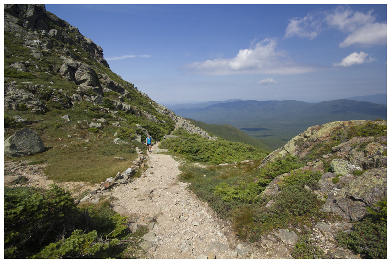
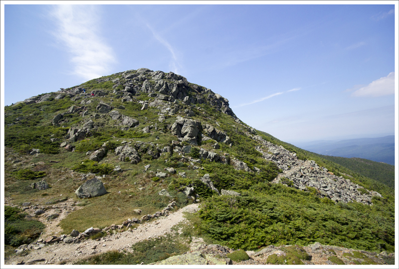
As long as you don’t look behind you, the view is pretty and pristine. Below: Descending toward Sugar Run Gap.
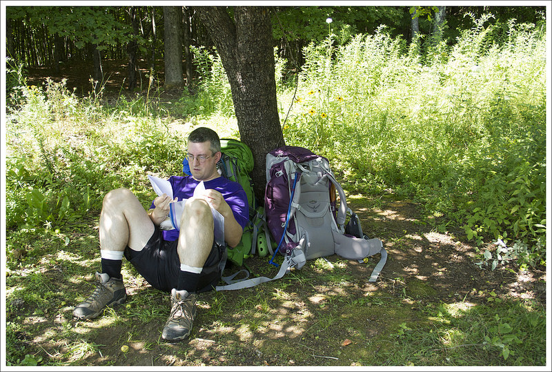
After crossing the junction with the Ribble Trail, we continued downhill; crossing Big Horse Gap/USFS 103 just a tenth of a mile later. In another 1.2 mile, we crossed another forest road. From this point, the last .5 miles of hiking went steeply downhill. The trail was a bit rocky and overgrown. At this point, I was starting to hit a wall. I was out of water and feeling really parched. We hadn’t passed a spring since first thing in the morning and the sun had been beating down on us all day. I told Adam I wanted to rest at the road crossing before we hiked down to Woods Hole Hostel – our destination for the evening. He said to me ‘But wouldn’t a massage be way more relaxing?’ It turned out he booked an hour long massage for me at the hostel. Say no more – I was up and ready to cover that last .5 miles of road walking to get to Woods Hole.
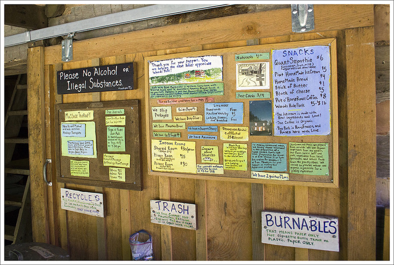
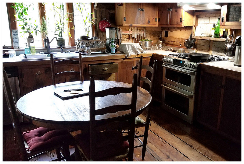
Normally, we wouldn’t stay at a hostel on a two-night backpacking trip, but Woods Hole is special. Family-run for decades, the quaint, old farmhouse is an Appalachian Trail legend and a beloved tradition for many hikers. The old farmhouse opened its doors to hikers in the 1980s. The hostel was originally run by Tillie and Roy Wood, but was taken over by their granddaughter Neville in 2007. Since then, she and her husband Michael have expanded on the hostel’s offerings, creating a mountain oasis that is simultaneously rugged and luxurious. There’s no television or cell phone signal, but there is beautiful organic food (that you get to help prepare!), massage services, and group yoga.
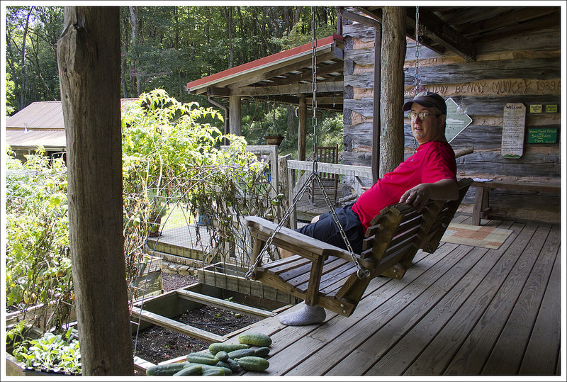
What a welcome site! Woods Hole Hostel was a luxurious stop on our backpacking trip. Below: Woods Hole scenes.
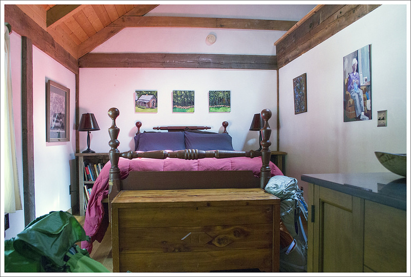
We arrived at the hostel around 2:00 p.m. Neville was still working on cleaning the house, so we bought a couple soda’s from the bunkhouse fridge, and settled into the swing on the front porch. We played with the dogs, said hello to the roaming duck, and peeked into the goat and pig sheds. The garden was still beautiful and abundant in late summer – tons of peppers, tomatoes, and squash. If you stay at the hostel, you can camp, stay in the bunkhouse, or stay in a private room inside the farmhouse. We chose to stay in ‘Tillie’s Room.’ It had a comfortable queen bed, private sink/vanity, and shared full bath. It was quite luxurious for trail accommodations. Even if you choose the more humble bunkhouse, it is still comfortable and neat as a pin. There are beds with fresh linens provided, a big common area with a couch, and a nice offering of snacks and supplies available for purchase. There are also shower and laundry facilities available for those staying in the bunkhouse.
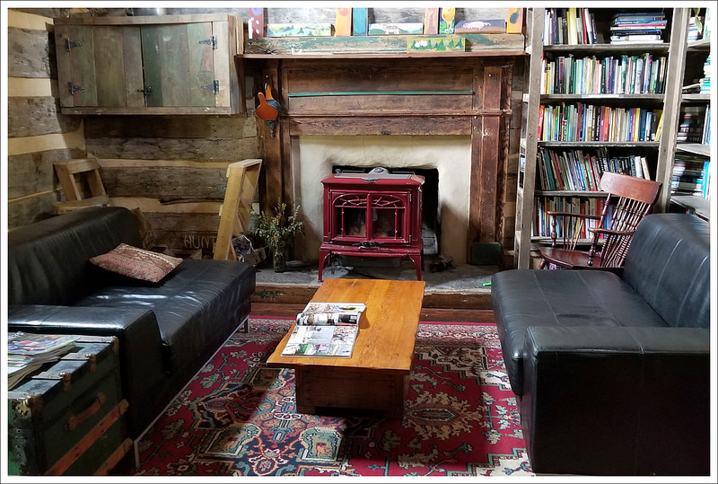
We visited during a really quiet time of year. There was a smattering of SoBo thru-hikers on the trail, but in mid-September we had the entire house to ourselves. Once we got checked in, I decided to shower and spend some time in the farmhouse’s library. It was full of all kinds of books and mementos. I especially enjoyed looking through scrapbooks chronicling the hostel’s history over the years. Around 5:00, Neville said she was ready to do my massage. It was a wonderful treat and felt fantastic on my tired shoulders and calves.
Aumakua – one of Woods Hole’s sweet dogs. Below: Our comfortable lodging.
After the massage, we started to think about dinner! In the meantime, one southbound thruhiker arrived and booked a bed in the bunkhouse. Neville’s husband had errands to run, so it was just four of us for dinner. Neville and Michael typically prepare community meals with the help of hikers staying for the night. Everyone has a task and chips in to prepare and clean up after the meal. We had an amazing tomato-pepper-cucumber salad, homemade bread with aioli, locally raised pork, and a flavorful yellow Thai vegetarian curry for dinner. Everything was delicious, but the salad was a favorite and is something I’ve made at home ever since. Dessert was Neville’s homemade vanilla ice cream.
After dinner, Adam and I relaxed in the library and read until it was time for bed. It was lovely being lulled to sleep by the sound of a breeze in the trees outside. We both slept great!
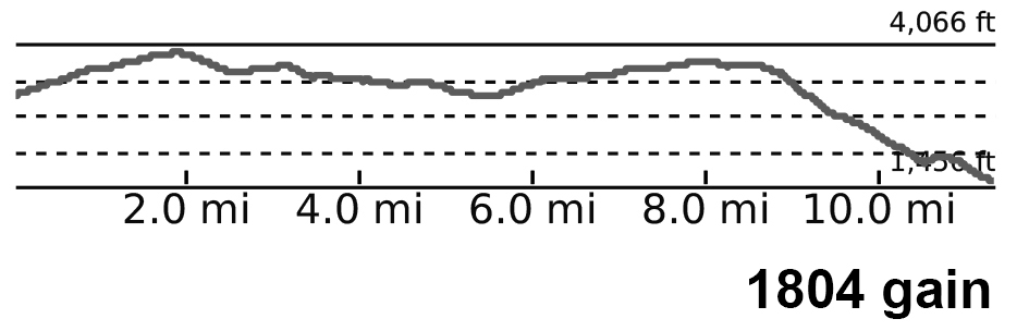
Adam Says: Day Three – Woods Hole Hostel to Narrows (11.8 miles)
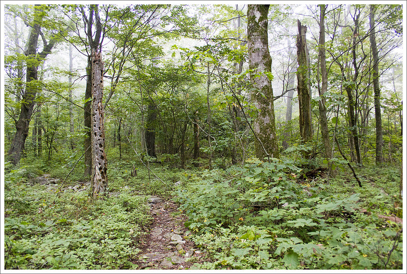
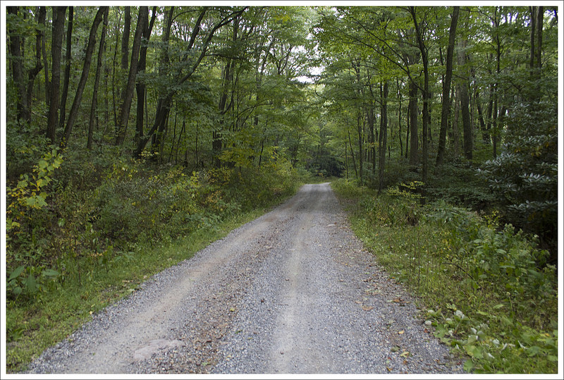
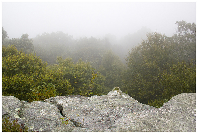
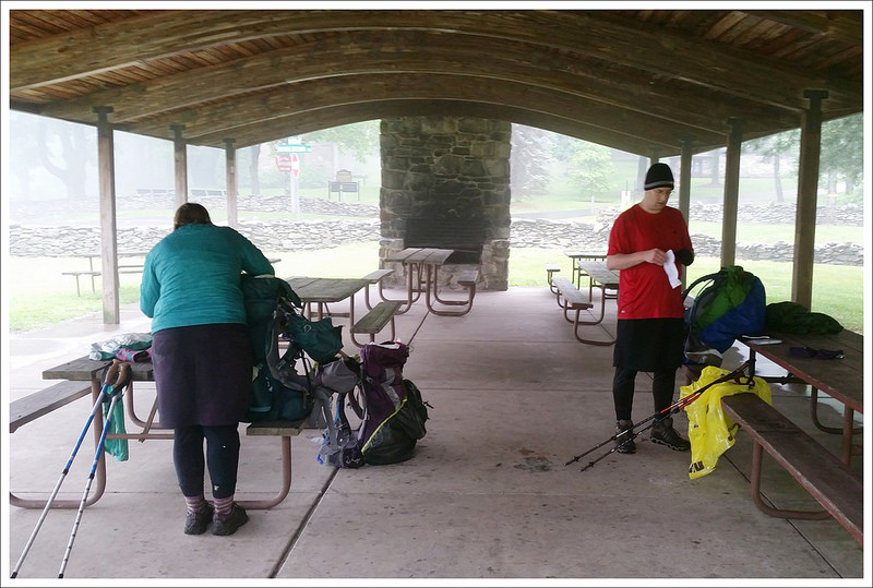
Our last day of hiking started in a blanket of fog. Below: Hiking up Sugar Run Road; The Appalachian Trail; Foggy views
We had our longest day on the trail ahead of us with the third day. We got up, packed up our gear, and enjoyed a wonderful breakfast prepared by Neville. We had asked if we could leave most of our gear there during the day to be able to “slackpack” without the weight. We carried water, some lunch, and a few layers of clothes but we were able to dump out so much of the weight. With this extra added comfort, we started on our hike for the day. We climbed up the steep gravel road and we quickly were so thankful we had dropped off our weight. We rejoined the AT at .5 miles and began our hike.
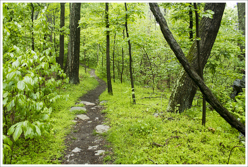
As we climbed higher the view opened and the fog lifted. Below: Docs Knob Shelter; Views from the trail; Thick overgrowth.
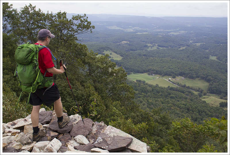
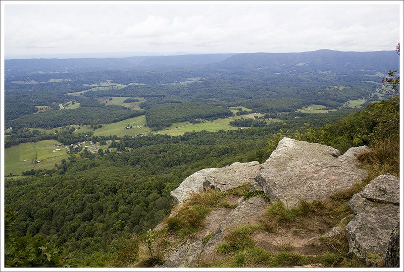
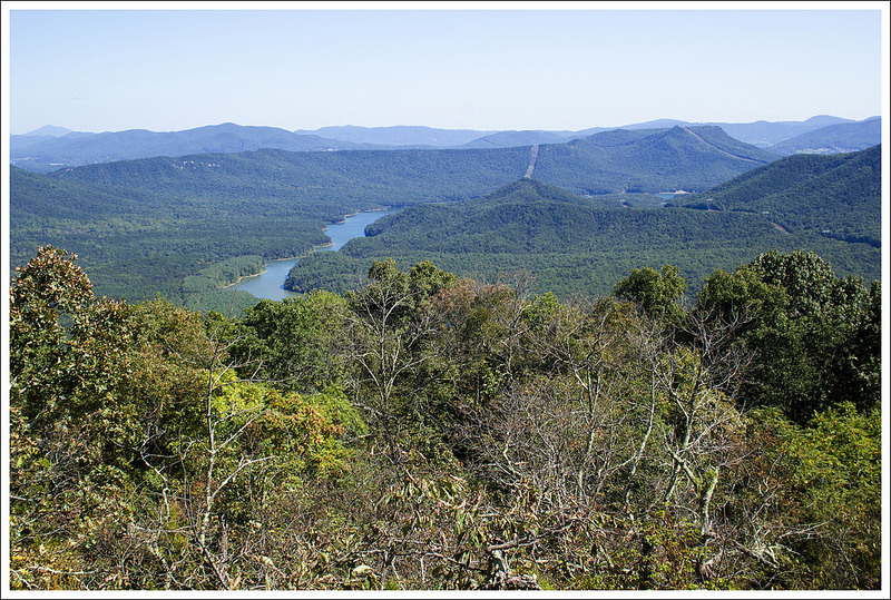
The morning started off foggy and cold and the section of AT started off uphill. At 1.9 miles, we reached a viewpoint, but it was completely socked in the fog so there was no point staying. The trail then took a descent and at 2.8 miles, we came upon Docs Knob Shelter. It was a nice shelter, but we were glad we had luxurious accommodations at Woods Hole Hostel the night before. The trail was up and down for a bit, before rising a bit to a nice viewpoint at 6.5 miles. The fog had lifted so we enjoyed nice views of the river cutting through a scenic mountain view. We stopped and ate some lunch here, but had to eat a bit away from the viewpoint since there were strong, cold winds. We pushed on as the trail became to climb very slowly and at 8.6 miles we reached another viewpoint. This was probably the nicest one in our opinion of the trip, since you had panoramic views of farmlands and mountains around you.
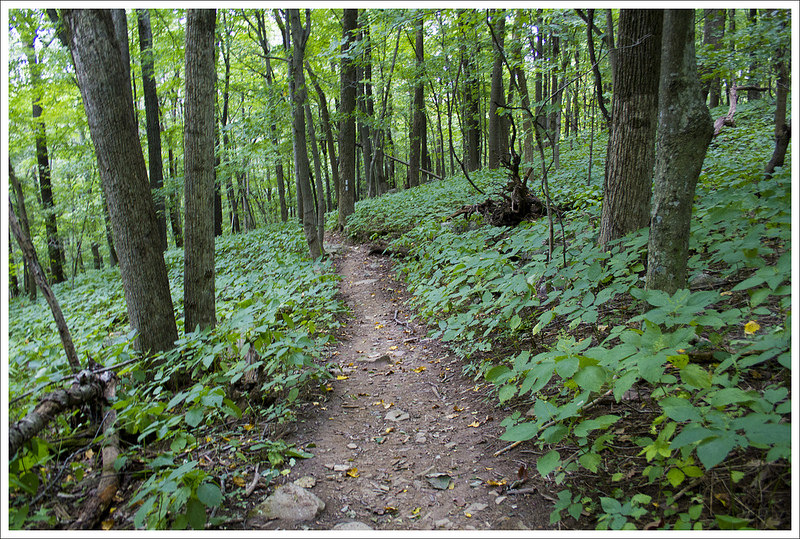
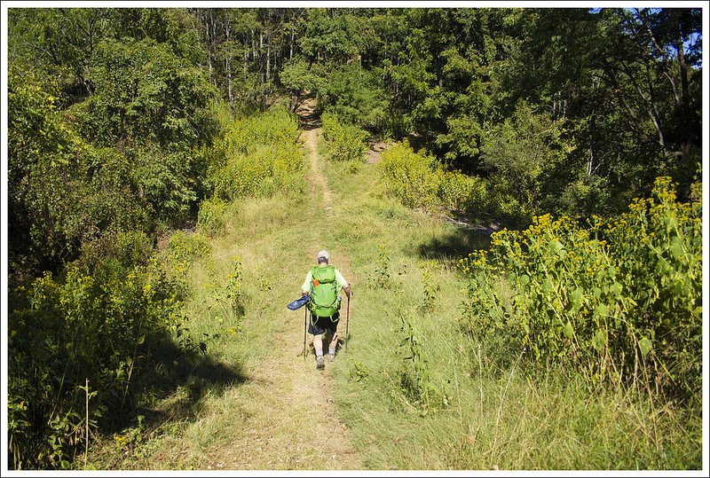
We had miles of easy walking along a ridge. Below: Late summer vegetation; Views from the trail; Descending to Angels Rest.
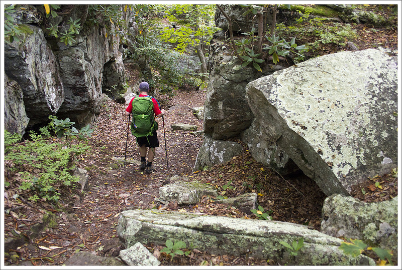
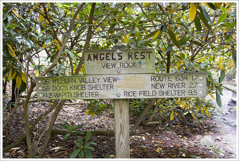
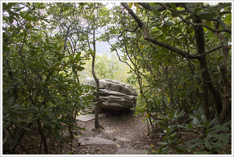
We continued the pleasant ridge walking and eventually the trail began to descend through an area that cut a path between very large rock boulders. We reached a sign that pointed to Angels Rest (a short .1 mile sidetrail) at 9.2 miles. Angels Rest is a large boulder that requires you to scale up it to get the view. We climbed up and the view is being combated by growing trees. The view in the distance is nice, but in my opinion the eyesore of looking down on a town (and correctional facility to boot) isn’t one that I particularly enjoy. I know lots of people hike up to this point from Pearisburg and return, but the better view would be if people would just continue a bit further. We climbed down disappointed this was the last view and then rejoined the trail.
Angels Rest and a view into Pearisburg. Below: New signage around Angels Rest; The rock at Angels Rest; Descending into Pearisburg.
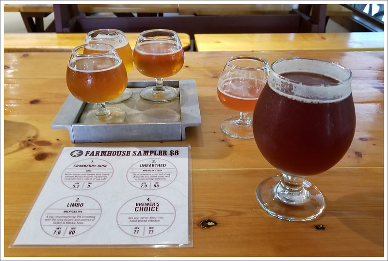
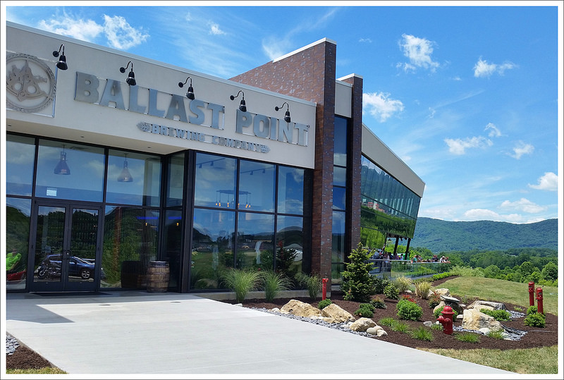
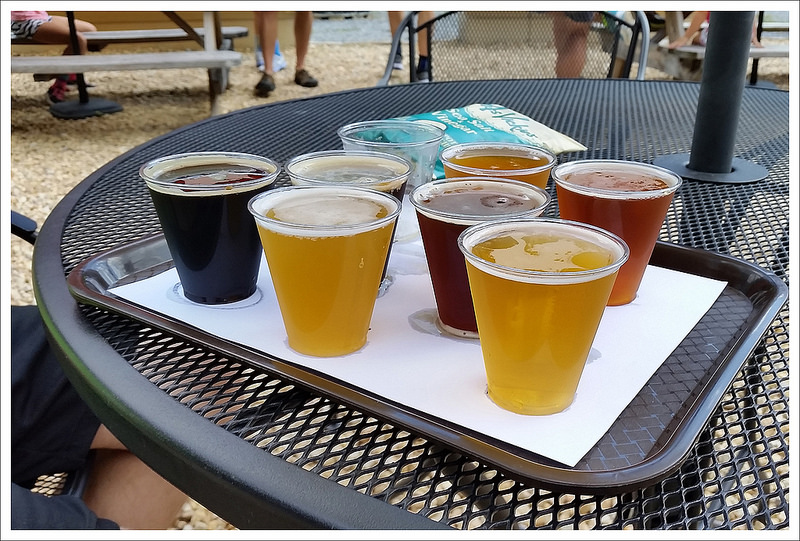
The hike down from Angels Rest was extremely steep. We made the downward trip the rest of the way fairly quickly. At 11 miles we crossed over Cross Avenue, VA 634. We then crossed over Lane Street at 11.4 miles and then made it to Narrows Road and our car at 11.8 miles. When we got back to our car, we drove back to pick up our gear at Woods Hole Hostel (and also bought a nice soup bowl crafted by the owner) and then made our way to Ballast Point for some post-hike dinner and flight of beers. It was such a great birthday celebration and we had a wonderful experience!
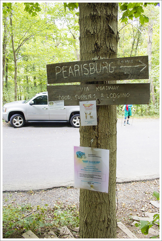
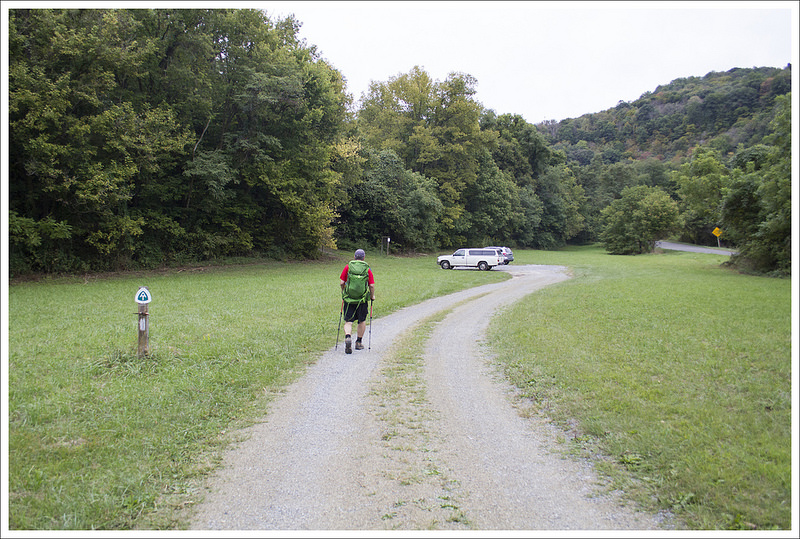
The road to Pearisburg. Below: The trail between Pearisburg and Narrows; Parking.
Trail Notes
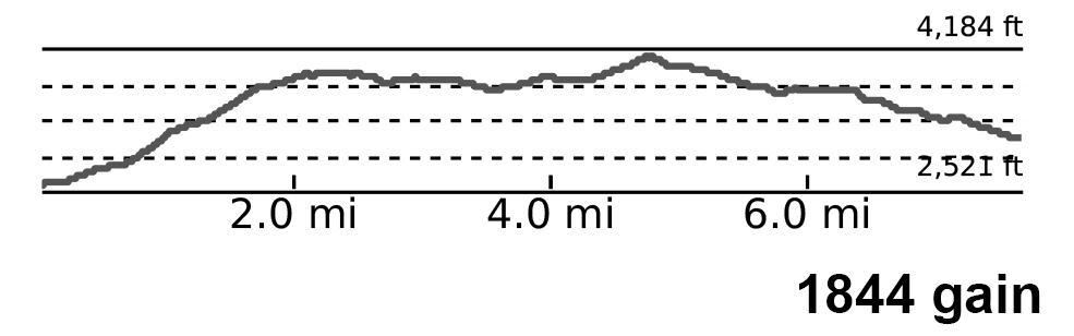
Distance – 27 miles (plus a couple extra miles to access views, shelters, and Woods Hole Hostel) (Check out the stats from Map My Hike* [Day One] [Day Two][Day Three])
Elevation Change – 4,885 feet
Difficulty – 3.5. The second day was the toughest climbing. Overall, it wasn’t very tough, but it was 27 miles.
Trail Conditions – 3.5. Some of the trail was overgrown in parts, but overall was fairly maintained and footing was reliable through most of the hike.
Views – 4. The view leading up to Angels Rest was the best.
Streams/Waterfalls – 4. Lots of stream crossings, but the highlight was early in the hike with Dismal Falls.
Wildlife – 2. We didn’t run into many signs of wildlife on the trail, but did see an occasional deer.
Ease to Navigate – 4. Sticking to the AT, you just look for white blazes. The side trails we took were well marked.
Solitude – 4. We had most of the trail to ourselves. Expect people at Dismal Falls and Angels Rest and not much in between.
* MapMyHike is not necessarily accurate, as the GPS signal fades in and out – but it still provides some fun and interesting information.
Directions to trailhead: Coordinates to drop off car and meet shuttle: 37.3341, -80.7553 (Narrows AT Parking Lot Off road, room for quite a few cars.) Shuttle drop-off/hike start coordinates: 37.1757, -80.9083 (Kimberling Creek Suspension Bridge has a a small parking area along VA606)
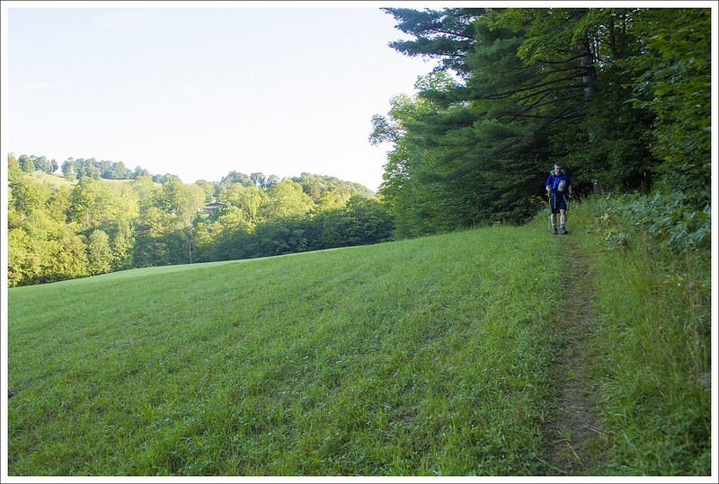
We tackled this 24.5 mile section of Vermont’s Appalachian Trail during a spell of very hot, dry weather – especially by New England standards. The route has quite a bit of road-walking and traversing open fields in full sun. We’ll admit… it wasn’t one of our favorites.
This is the first section of Vermont’s Appalachian Trail that we have attempted. We looked at a few different routes but decided on this short three-day trip. We were staying with Christine’s parents in central New Hampshire and wanted to start tackling some miles nearby since they could watch our dog, Wookie, while we were backpacking. Another great thing about staying with them is they offered to provide the shuttle for us. Probably like most family members, they don’t quite understand what we were doing since they have never done a backpacking trip. We are often riddled with questions about where we are going, preparations, how we use different equipment, etc. They tried on our weighted packs and didn’t understand how we could walk for miles with these strapped to our backs and make decent time. They followed us in their car and we parked at our end destination. We then shuttled back in their car to Hanover, NH.
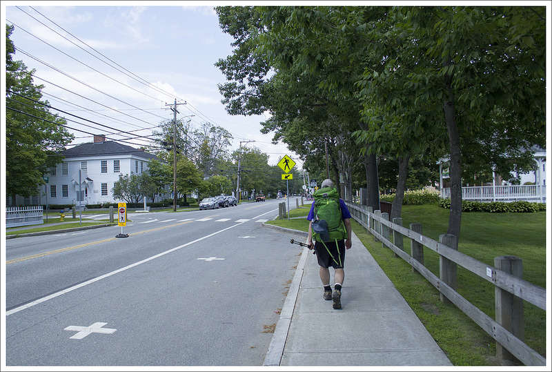
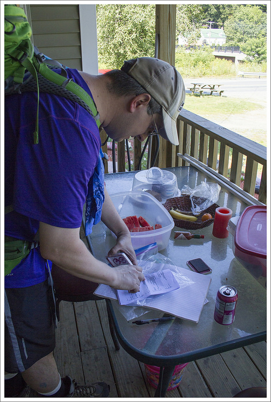
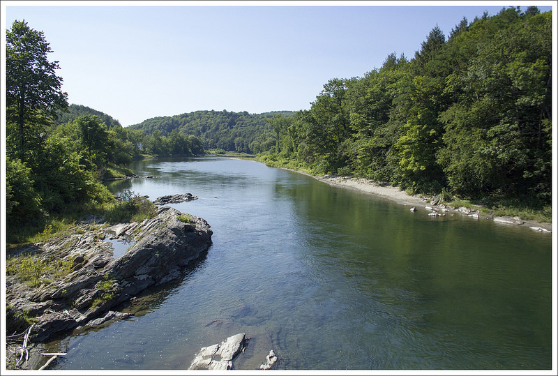
Shortly after leaving downtown Hanover, you cross the Connecticut River which is the state line between New Hampshire and Vermont. Below: the Connecticut River is a significant body of water; Hiking into Norwich, Vermont; Just a couple miles in to our hike, we were already in need of shade and a cold drink.
Before we began our trek, we had lunch with her parents at Molly’s in the heart of Hanover. They have great American fare and a trip to Molly’s has been an annual tradition for us for the last several years. We ate an early lunch, got our backpacks out of the car and started walking towards Dartmouth College on Main Street. The Appalachian Trail cuts right through the heart of Hanover, NH. It may be a rarity in most small towns to see people walking through your downtown with large backpacks, but Hanover is a classic hiker-friendly town. People would whisper as we walk by and take photos, making you feel like a celebrity more than anything. Of course, we had not walked all the way from Georgia to this point, but people are fascinated with long-distance backpacking. We took a few pictures on Dartmouth College’s quad lawn called The Green, walking by an admissions tour group, before turning down Wheelock Street/SR10 after just a few tenths from Molly’s to keep south on the Appalachian Trail. The white blazes that signify the AT trail markers through towns typically are blazes painted on lampposts or backs of signs.
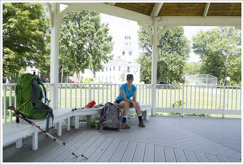
The day was hot – abnormally hot for the summer in Vermont. The day was approaching 90 and we were walking on open road with no shade so we quickly got overheated. SR10 crossed over the Connecticut River and you see a sign halfway across the bridge that signifies the state border between New Hampshire and Vermont at .8 miles. With more road walking, we reached Norwich, VT and began to climb up a steeper section of sidewalk. With the sun beating down and the uphill climb, it was quite unbearable. At 2.7 miles, we rested at a gazebo in front of a church. Christine couldn’t take much more sun, so we threw our backpacks off and I went searching for places to buy some cold drinks in fear of losing all of our water in just a short amount of time. I found a nearby deli shop and got some cold drinks. We had trouble finding the blazes at this point so I also looked around for blazes (which ended up being on the opposite side of the road). Luckily, the road that I found the deli was also where the AT turned down Elm Street.
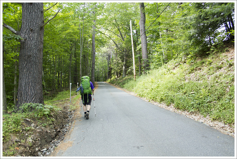
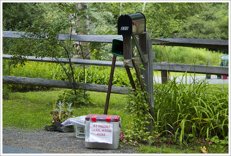
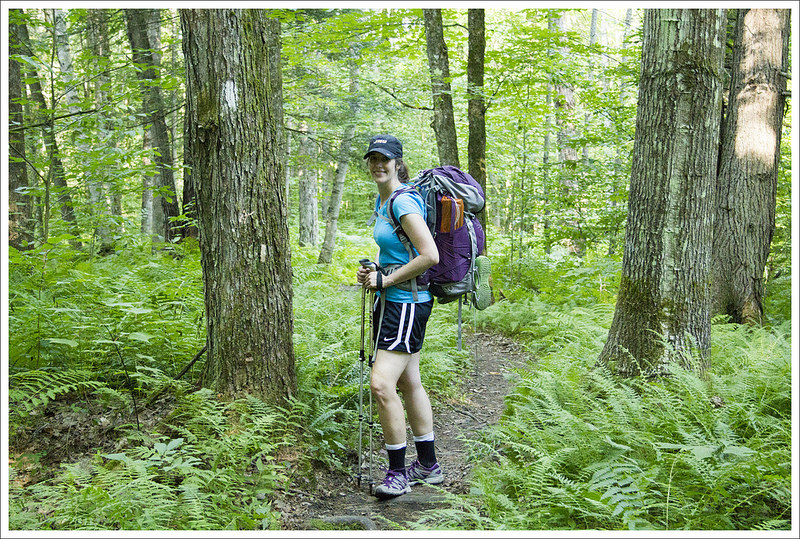
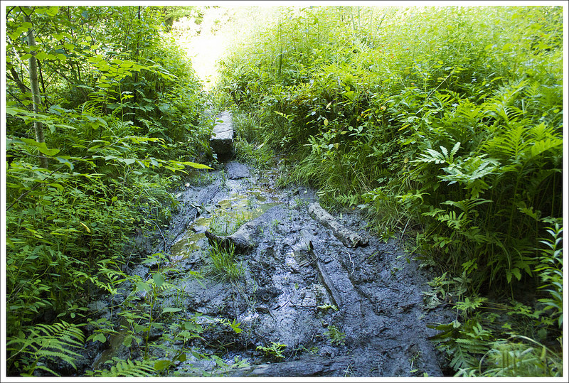
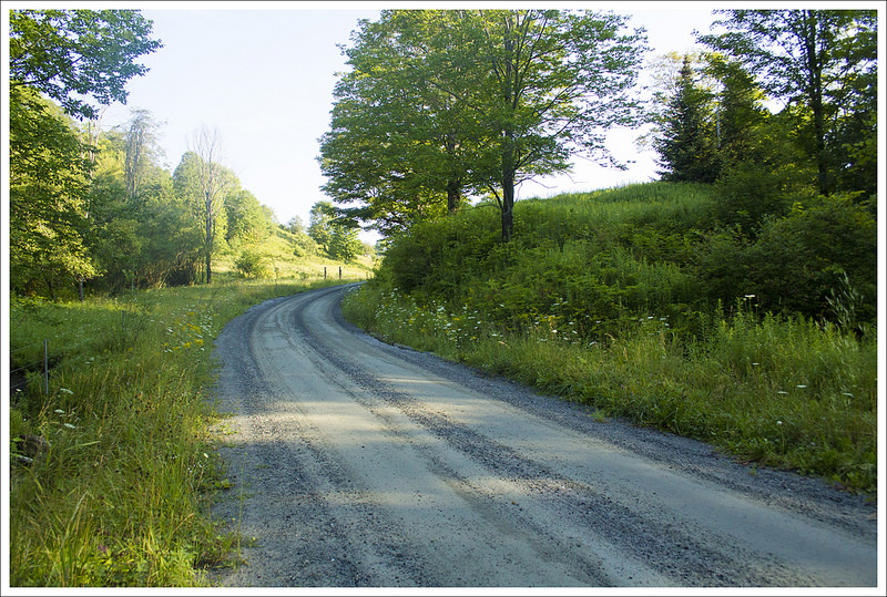
Vermont had so much road walking in the open sun. It was tough going! Below: Some nice people in the houses along the trail had cold drinks and ice; Finally some woods and shade; A tiny bit of “Vermud” – we had the mixed blessing of hiking during a drought-y time.
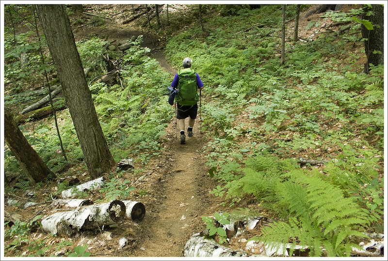
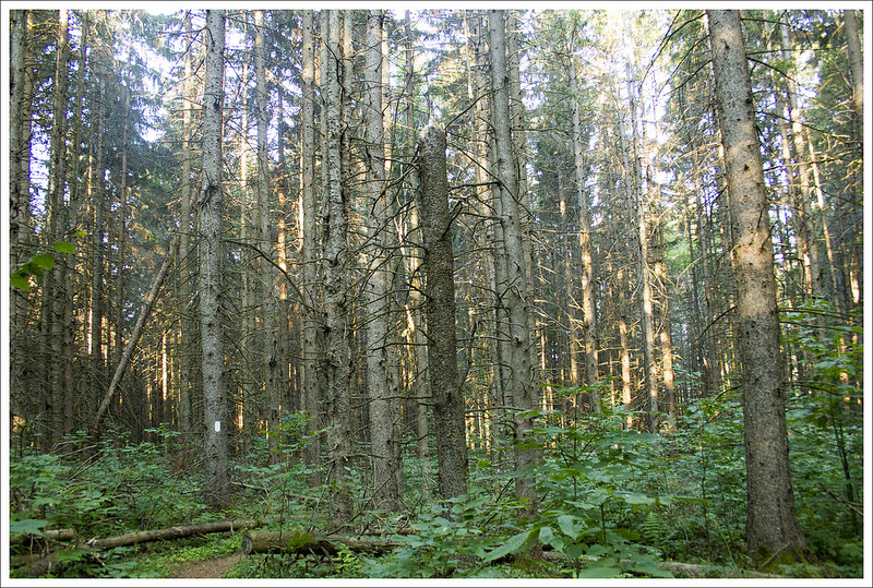
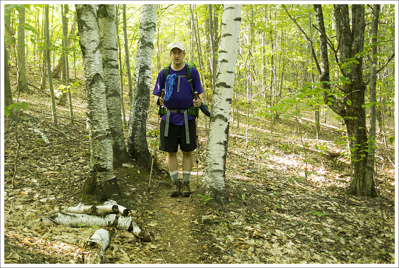
We continued on Elm Street going steeply uphill. There were several houses along the way that had trail magic – cold drinks and snacks in coolers or places to get a new paperback to read for the trail. I stopped again on our climb and took advantage of some ice cold water to drink and poor over my head to keep my body as cool as possible. We eventually came to a large kiosk (adorned with Uber business cards to avoid the road walking and get right into Hanover) where the AT finally entered into the woods and we had a bit of shade from the trees. The trail passed by a small stream (which was dry) and continued uphill. Overall the trail to our first shelter was mostly non-descript but serene. There was a brown path cutting through the sea of fern around us with pine, oak, and birch trees around us.
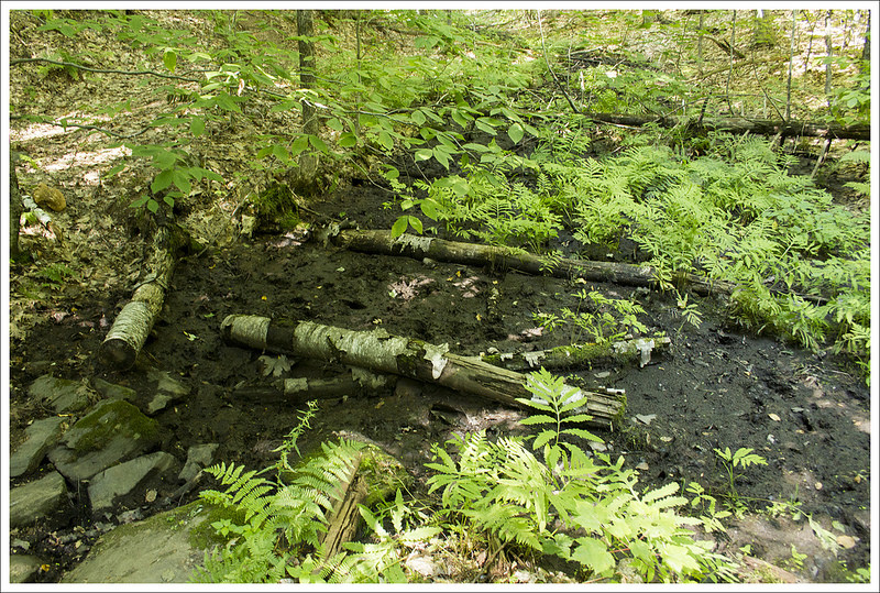
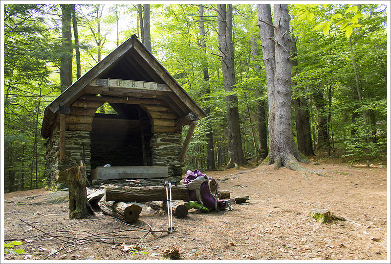
Happy Hill Shelter was cute, but lacked a consistent water source. We had to dry camp and fill up a couple miles into the next morning.
The trail crossed over a woods road at 4.5 miles and continued slightly up and down until we reached a junction with the blue-blazed Tucker Trail at 5.9 miles (a trail that also leads to Norwich, VT in 3 miles). From this point, it was just another .3 miles until we reached the sign that marked the side trail to the Happy Hill Shelter which was just less than a tenth off the main trail. We stopped for the night and were soon joined by some other hikers, including one of our favorites, Hobbes the dog, who had been suffering like all of us in the heat. He collapsed on the soft ground telling his owner, trail-named Calvin, that he was done for the day. He rolled onto his side while Calvin peeled off his doggy pack with no help from Hobbes. We talked while eating some dinner about things we had seen on the trail. We learned a bit about porcupines from one thru-hiker that told us that they mostly climb in trees during the day and are active at night. They gave us a warning to hang our poles because they like nibbling on the cork handles. We set up camp and tried to go to sleep but it was too hot of a night and everything felt clammy and sticky.
Christine Says: Day Two – Happy Hill Shelter to Thistle Hill Shelter (9.6 miles)
Our night at Happy Hill was kind of hot and fitful. Neither of us slept well. The tent was stuffy and I kept thinking I heard animals walking around the tent (porcupines!) The sun comes up so early in the New England summer that we were awake and packing up our gear before 6:00 a.m. We knew we had another hot day ahead of us, so getting an early start was important.
Our first stop of the day was 1.7 miles into the hike. We stopped to filter water from a unnamed small stream along the trail. Since the water source at the shelter had been dry, it was nice to replenish our Camelbaks.
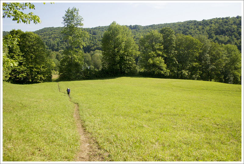
The second day of hiking was a mix of forests, fields, and meadows. Below: Fields, fields, fields; Filtering water for the day; Pretty ferns!
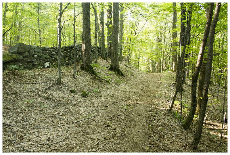
Our first four miles of the day were mostly downhill and under the shade of the forest canopy. We walked through beds of fern, small meadows, and across a couple small streams. It was how I imagined Vermont would be.
At 3.4 miles into the day, we came out onto pavement and crossed under I-89. It’s always strange to step out of the woods and see 18-wheelers zipping by on a four-lane highway. The next mile of ‘hiking’ was over paved town roads heading into West Hartford. It was still pretty early, but the sun was already high in the sky and beating down full force on the asphalt. We were both red-faced and drenched with sweat.
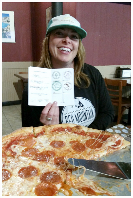
The Harts provide support and kindness to all hikers. Adam got his AT passport stamped there. Below: Crossing under the interstate; The West Hartford Library; Bridge crossing over the White River.
We arrived to the main part of town right at 9:00 a.m. – which happened to be the same time the community library opened. The library door had a ‘hikers welcome’ sign, so we figured we’d go in and make use of their facilities. Even after one night in the woods, it’s wonderful to be able to wash your hands with soap and running water. The library attendant told us to make ourselves comfortable and to help ourselves to coffee or water from their cooler. We sat in the air conditioning and chugged a couple bottles full of chilled spring water. After about 45 minutes, we decided we should probably move on because the day was only going to get hotter.
We had only been walking about 50 feet when a woman starting waving and shouting to us from her front porch – “Hello hikers!! Come on over!” Adam and I always stop to chat with people and explore towns along the trail, so we made our way over to the house. It turned out we were at the Hart’s residence. The Hart’s are a well-known and valued provider of trail magic. She offered to cook us breakfast – there were eggs, pastries, muffins, watermelon, and cold sodas. We weren’t hungry, but we gratefully accepted a cold soda and stayed to chat for a while. People along the Appalachian Trail are always so kind and generous. Finally, we said farewell and made our way across the bridge over the White River and back into the woods.
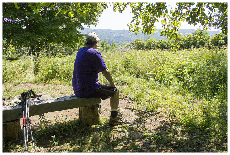
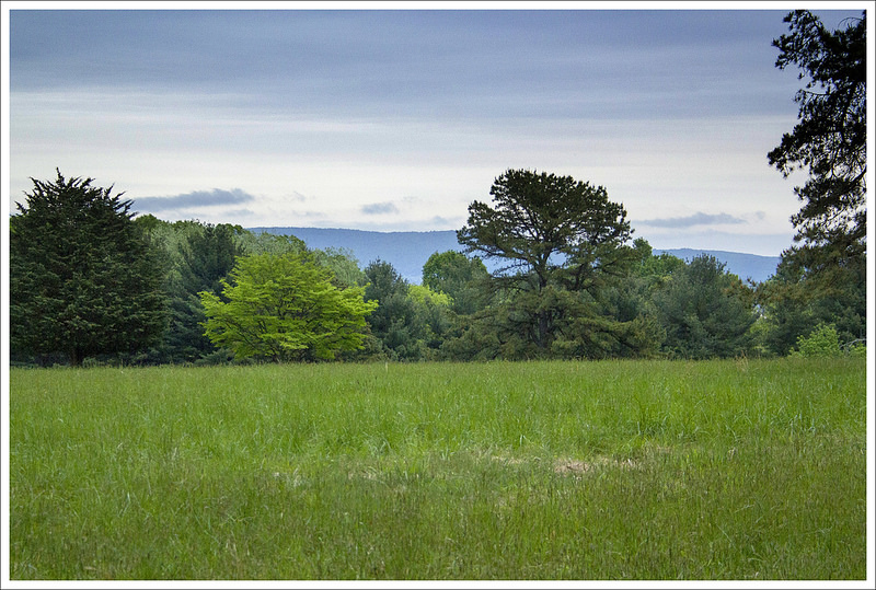
Our first view of the trip. Below: A little mud; Another overgrown field; Resting in the shade.
The shade of the woods was short-lived and all the remaining miles of the day were uphill and mostly crossing open fields and forest with thin canopy. It was blazing hot. We took lots of breaks to cool off. We came to a partially obstructed view at 5.2 miles into the day. There was a bench shaded by an apple tree at the vista.
We took our lunch break at a forest road crossing at 7.5 miles into our day. We sat in the dirt and ate crackers and cheese, candy, and nuts. We were both running low on water, but figured we could make it a couple more miles to the water source at the shelter. While we ate, we checked out the large sugaring operation in the woods around us. It looked like there were miles of tubes to collect sap from the maple trees. It was neat and something we never see in Virginia.
After lunch, we made the final push to Thistle Hill shelter. There were so many open fields to climb across. It was in the mid-90s, breezeless, and the sun was unrelenting. I could feel my skin burning despite multiple applications of sunscreen. We both ran out of water and were so totally ready to be done for the day. As it so often goes, you reach camp just when you think you can’t take another step. We were so thankful to reach the spur trail to the shelter.
We were baking in the sun for much of day two. Below: Thistle Hill Shelter; Tent resting; Even Rosco was tired from the heat.
Adam probably had heat exhaustion and was badly dehydrated. He collapsed into the shade of the shelter to rest. I went about setting up camp while he took a break. After some time resting, we went to collect water. The source was really nice – a lacy little waterfall pouring over mossy rocks. I mixed electrolyte drinks and tried to get Adam to drink more. Several southbound thru-hikers we’d met the night before (and Rosco the dog) rolled into camp over the next hour.
We had an early dinner at the shelter. Everyone talked about the heat and the brutality of the five+ mile uphill climb. We retreated to our tent a little before sundown. Adam still didn’t feel well and I started to worry that it might be more than dehydration. At one point, I said to him, ‘We have cell service, we can call for help if you need it.’ He refused and fortunately started to feel better as the day cooled and the fluids started to rehydrate him.
More and more hikers arrived at camp as nightfall approached. I think there were probably close to 25 people camped at Thistle Hill by the time it was dark. A few more even stumbled in by headlamp as late at 10:00 p.m. We left our rainfly off the tent to catch the cross breeze, so every headlamp at camp woke us up. It was still a cooler, more comfortable night than we’d had at Happy Hill. We both got a decent night of rest in advance of our final day of hiking.
Adam Says: Day Three – Thistle Hill Shelter to Woodstock (8.7 miles)
With our last day ahead of us, we got up with the sunrise, used the neat screen-porch privy at the shelter, quickly packed up camp, and were on our way. I think only one thru-hiker made it out of camp before us. The heat was tough on a lot of us.
From the shelter, the trail descended. At 1.8 miles, we came to a junction marking a trail to the Cloudland Shelter (.5 miles west of the trail). This shelter used to be maintained by AT volunteers but was now on private land. Hikers can still stay there and it is owned by the owners of Cloudland Market. For the past two days we had been asking northbound hikers about Cloudland Market. It had been closed on Sunday and Monday when we started our hike but this was Tuesday and we had read in our AWOL thru-hiking guide that it was open on Tuesday. One guy had told us it was also closed Tuesday, but we had heard how great the shop was and thought a cold soda or snacking on some Vermont cheese could be nice. When we reached Cloudland Road at 2.3 miles, we saw a note taped to a sign stating that is was closed on Tuesday also, so we missed out.
The third day started off almost cool. Below: Tall, straight pines; Farm field; Old country road.
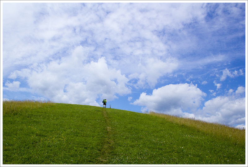
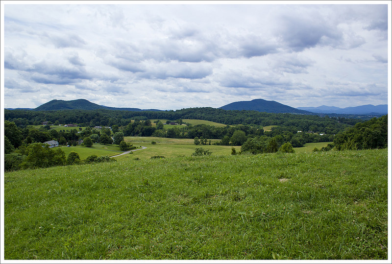
We crossed Cloudland Road and had a very steep climb up an open field of grass and wildflowers to reach a hilly summit at 2.9 miles. This was probably the nicest view on the trail and gave us a glimpse of Vermont farms and mountains in the distance. We stopped for just a short time because the sun was beating down again, whipping us to push on for shade. The trail descended from this point and then we had another short uphill to reach another small view at 3.7 miles. We could see ski slopes off in the hazy distance. From this second viewpoint, it was a steep downhill until we reached the paved Pomfret Road at 4.1 miles.
This was the best/prettiest view on the trip. Below: White birches; The trail followed an old road bed; Another view with ski slopes.
On the other side of the road, was a small brook and we filled up water while talking with a bunch of northbound thru-hikers. They were having a debate on who would win in a fight between a horse and a cow and asked us for an opinion. We debated with them on why we felt a horse would win (because it had more speed and agility and could also pull off a painful kick or bite). It was a fun conversation and reminded me that when you don’t have the depressing world news to hear every day that these common topics were more enjoyable than the nightly newscast. Conversation with hikers that are going the opposite way are your version of the internet. You get information about trail conditions, water sources, sights to see, and how much uphill is ahead (its always stated that its not too bad even if it is). We also heard from other hikers that this section of Vermont that we had picked was probably the least beautiful of any of the sections of Vermont. While it was disheartening to hear, it at least renewed our opinion that the rest of Vermont would have nice streams, views, and farmlands fit for a postcard and we should do more of it another year.
A stream crossing. Below: Pretty trail; So many fields; Huge broken tree.
After taking a short break and filling up with water we pressed on. We crossed another small stream and reached the gravel Bartlett Brook Road at 5.7 miles. At 6.5 miles, we crossed Totman Hill Road and reached another stream at 7.0 miles (where was all this water earlier in the trip?). At 7.3 miles, we reached Woodstock Stage Road and Barnard Brook. We had one less-steep climb up, a one mile climb up Dana Hill before descending again. On our final descent, we saw a black bear foraging off to the side that took off running when we got close. It was very exciting to finally see some wildlife and was a reward for the end of our journey! We finally reached our final road crossing at 8.7 miles, Barnard Gulf Road, and got back to where we had parked our car. We made it! We had been so hot and miserable for most of the trip we wondered if we would make the entire section. Filled with pride it was now time to fill our stomachs. We drove to nearby Long Trail Brewery for some cold beers and amazing food to toast our accomplishment.
The last big climb was a tough one! Below: Our final descent – close to where we saw the bear; Some well earned beers at Long Trail Brewery.
Trail Notes
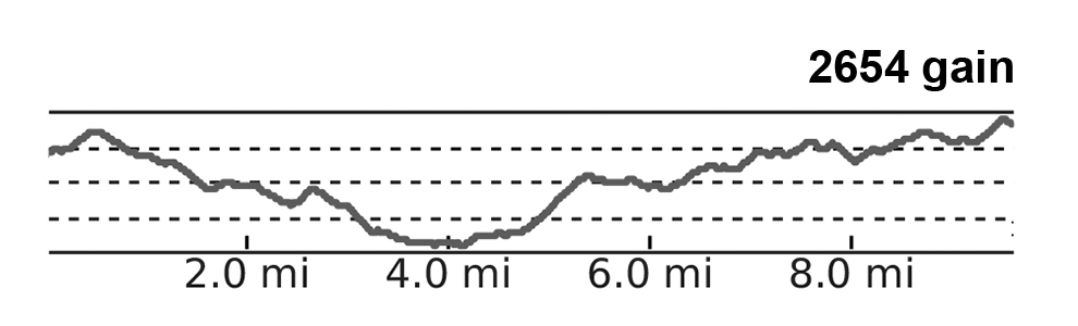
Distance – 24.5 miles
Elevation Change – 6,341 ft
Difficulty – 4. This section had tons of steep, unrelenting ups-and-downs (most without a view payoff). It was similar to a bigger, badder version of Virginia’s roller coaster.
Trail Conditions – 3.5. The trail was generally well maintained, but there were some very overgrown sections. There was also a bit of mud and erosion in places.
Views – 2.5. There were a couple nice views from high meadows. They were pretty, but not spectacular. Many were partly obstructed.
Waterfalls/streams – 3. There were streams for water sources and several larger rivers to cross (on bridges).
Wildlife – 4. Other hikers near us saw porcupines and we saw a bear!
Ease to Navigate – 4. The trail was easy to follow with adequate blazing and signage.
Solitude– 3. Surprisingly, we saw very few people on the trail, but campsites were moderately crowded.
Directions to trailhead: The parking lot that we left our car was at 43.6552N 72.5662W on Barnard Gulf Road on VT 12. From here, we made our way to Hanover, NH by heading south on VT 12 for 3.7 miles. We turned left when reaching to town of Woodstock to stay on VT 12 for .6 miles before turning left on to US-4 east. Stay on US-4 East for 9.4 miles and then merge on to I-89 South. Stay on this for 3 miles before taking the I-91 exit towards Brattleboro/White River. Keep left at the fork and follow signs for I-91 North. Stay on I-91 North for a little over 5 miles before taking exit 13 for Norwich. Take a right to merge on to 10A/W. Wheelock Street. Follow this for .8 miles before turning right on to Main Street. Parking is available hourly behind a lot of the restaurants/shops but is a good dropoff point for a shuttle.
* MapMyHike is not necessarily accurate, as the GPS signal fades in and out – but it still provides some fun and interesting information.
This 13.7 mile stretch of Appalachian Trail is mostly a walk through ‘the green tunnel’. There isn’t any grand or memorable scenery, but as you approach Troutville, there are some pretty rolling meadows with mountain views.
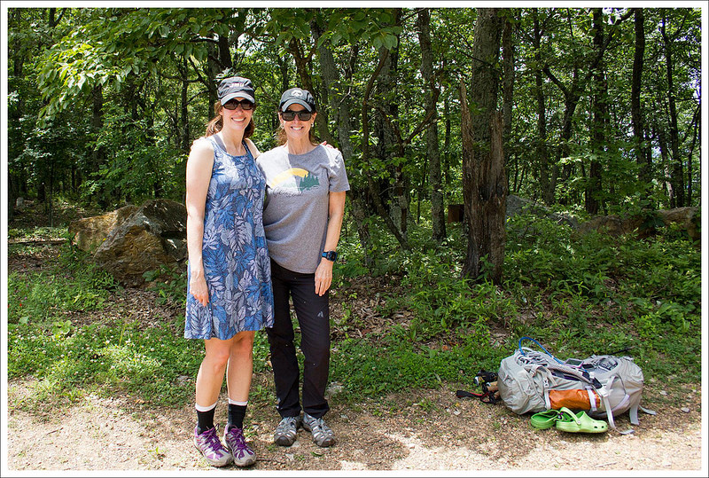
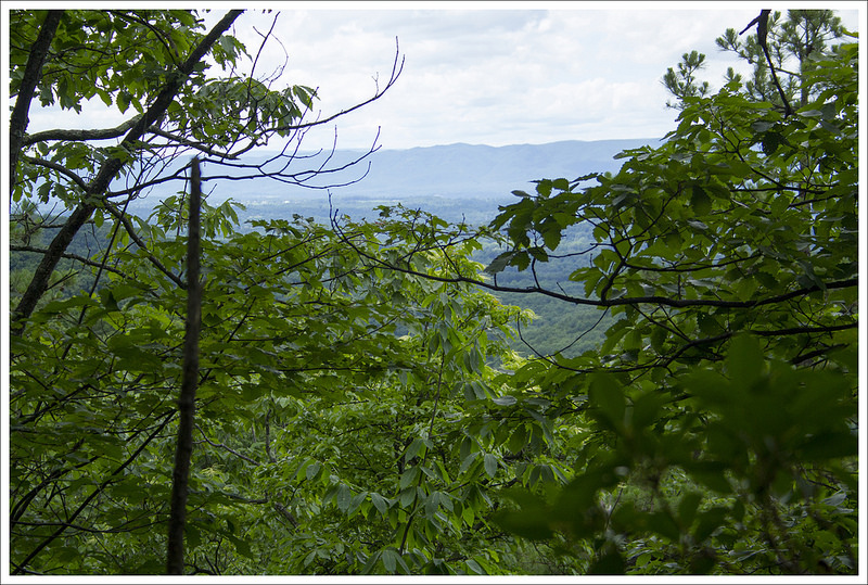
Adam walks along the Appalachian Trail. Below: We had lunch and beers at the brand new east-coast Ballast Point before setting off on our hike; Amazing Trail Angel, Molly, met us for lunch and gave us a ride; Glimpses of views through the trees.
Christine Says: Day One – Blackhorse Gap to Trailside Campsite (4.2 miles)
For quite a while, we’ve had this 13.7 mile section of trail standing out as ‘unhiked’ in the almost 360 mile unbroken stretch of Appalachian Trail we’ve completed so far. The section between Black Horse Gap and Daleville doesn’t offer any great scenery, so we never felt rushed to get out there and tackle the miles. Doing it as a day hike would have required four hours of driving and a shuttle service. The logistics of hiking it seemed like a hassle, so we filed it under ‘later’.
In late June, Adam and I were driving into work together and making weekend plans. It went something like this…
Adam: What do we have planned for the weekend?
Me: Nothing. Want to hike?
Adam: What’s the weather like?
Me: Gorgeous!
Both: Hey… let’s backpack that odd section we have left to finish!
After making the decision to go, plans fell quickly into place. Our pet sitter was available. We had plenty of trail food left from our Maryland hike. Then, after a chat on Facebook, my friend Molly said she could shuttle us! The final icing on the cake was the fact that the new east coast Ballast Point brewery had just opened in Daleville. On Saturday, we met Molly at Ballast Point and had lunch before hitting the trail. People may go to the Ballast Point for the beer, but they’ll walk away remembering the great food. I had the best kale-quinoa-avocado chicken salad. I still daydream about it a month later.
After lunch, we left our car at Valley Cleaners in Daleville and Molly drove us to our start point at Black Horse Gap. I’ve been online friends with Molly for a while, but this was our first in-person meeting. She was just like I imagined she would be – friendly, enthusiastic, outdoorsy, and all-around awesome! I love all the people I’ve met through the Appalachian Trail community! We said our good-byes at the trailhead. Adam and I headed south, descending gradually but steadily.
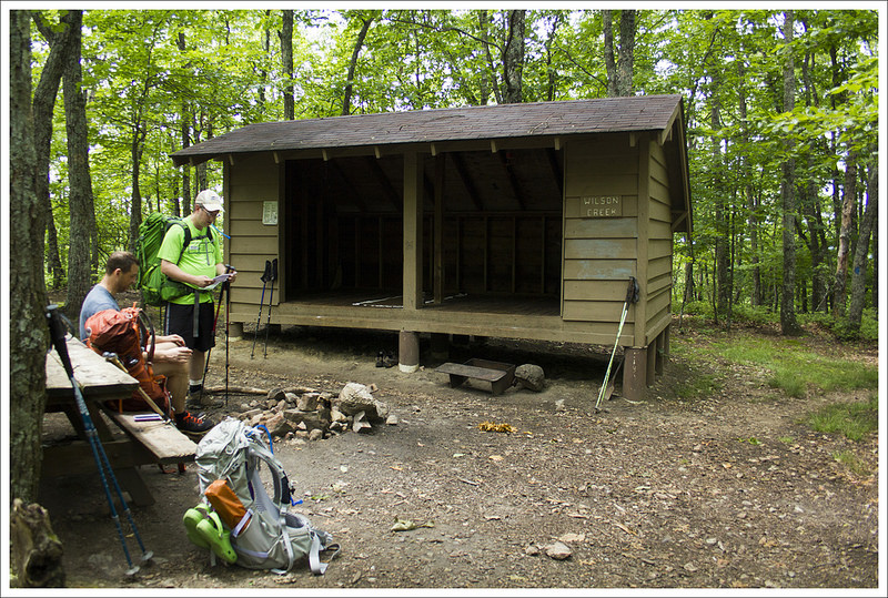
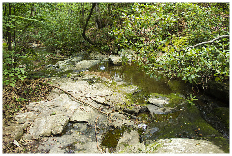
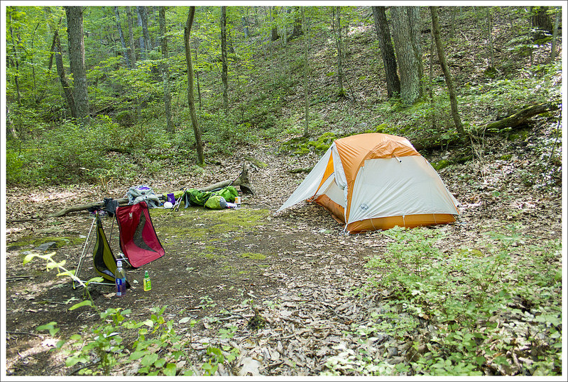
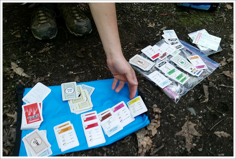
We reached Wilson Creek shelter really quickly. It was too early to stop and make camp, so we decided to push on and find a trailside campsite. Below: Wilson Creek; We found a nice campsite along a small, unnamed stream; Cards at camp.
The trail was really narrow and built into the shoulder of the mountainside. In 2.4 miles, we reached Wilson Creek shelter. It was only 2:00, but there were already a few hikers at the shelter, settled in for the night. We asked a couple northbounders if they’d passed any nice trailside campsites in their last few miles. Everyone said they remembered sites, but not specifically how far away they might be. Adam and I decided to continue hiking and gamble on finding a place to camp somewhere in the next couple miles.
After the shelter we decended another half mile down to Wilson Creek. There was a campsite, but it was literally right on the trail, so we kept hiking. After crossing Wilson Creek, we had a bit of uphill for about a mile. It wasn’t tough uphill, but it was still tiring in the mid-afternoon heat and humidity. At 4.2 miles, we reached an unnamed stream marked in our AWOL guidebook. There was an established campsite a couple hundred feet off the trail. It was the perfect site for the night – flat and close to water.
We set up camp, collected water, and spent the afternoon playing cards. We cooked dinner and spent the evening talking and reading. Before it got too dark, we set off to find a perfect tree for our bear hang. it turned out to be the one thing our otherwise perfect site was lacking. We did the best we could with a branch that was a little bit low and flimsy. Sometimes you just have to settle for the best possible option and hope that determined bears stay away from your campsite.
We got into the tent around 8:30, just as the woods were getting dark. It was a warm and sticky night, so we left the vent and the rainfly wide open. We both left our sleeping bags home on this trip and used lightweight quilts instead. It was a good decision and we both stayed warm (maybe a bit too warm) during the night. We eventually drifted off to the sound of distant owls and whippoorwills.
Adam Says: Day Two – Trailside Campsite to Daleville (9.5 miles)
The next morning, we ate breakfast, packed up camp, and were back on the trail in under an hour. We had a very steep but short section of uphill to climb to start things off. We were breathing deep, but we quickly reached the apex of the hill just about .2 miles in. The trail descended just as steeply and we arrived at Curry Creek at .8 miles. At the creek, there was a Curry Creek Trail to the west of the trail, but stay on the white-blazed AT. From the reliable water source of Curry Creek, we began to climb again up another steep section of trail. At the 1.9 mile mark, we reached an area where the trail then began to descend again. The trail descended for about a mile and then rose up again with a steep climb to reach the junction with the Fullhardt Knob Shelter at 4.4 miles. We took the side trail for .1 miles to reach the shelter. We stopped and ate a snack here, knowing that most of the climbing was behind us.
The Appalachian Trail climbed the mountain on a series of curves and switchbacks. Below: We saw a lot of views through the trees; Crossing Curry Creek; A whitetail deer watching us from the woods.
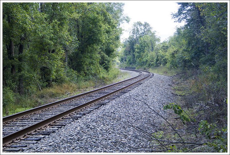
While we were at the shelter, we were joined by a couple that was working on section hiking the AT and we enjoyed talking about some of the things we had both seen along sections of the trail. At the shelter, there is a privy and a cistern behind the shelter to get water (water should still be treated before drinking). We were good on water, so after relaxing a few minutes, we pushed on. We rejoined the AT at 4.6 miles and began our big descent. The trail had a few switchbacks on the way down and it was rather steep in sections. We came across a sign stating that the trail soon passes through private lands and to stay on the trail. At 6.5 miles, we passed through a fence, beginning the start of some of these private lands. We had a short bump to climb before we reached VA 652/Mountain Pass Road at 6.8 miles. This bump however was the prettiest part of the trail as you ascend over a large field and have nice mountain and farmland views all around you from the top. A few tenths of a mile later, we went through another fence stile. We then crossed over another road, over train tracks and then US 11. At 7.6 miles, we passed underneath I-81 by walking on VA 779 underneath the interstate.
There were a couple moderate climbs in the morning.
The sun was hot and beating down on us. We were desperately hoping to find some shade, but most of the hike from here on is out in the open. We were at least glad we got an early start. The trail ascended to the left after the overpass and led us through a grassy swath of land that cut through some of the brushy area around it. Around the 9.5 mile area, we finally arrived at US 220 and Daleville, Va. We crossed the road to get back to our car that we had left at Valley Cleaners. When we got back to the car, it was right around noon. Whenever we go through Daleville around lunch, we always stop at Three Li’l Pigs barbecue. We were hot, tired, and hungry so it was a great place to cool down and eat some amazing food. Our waitress could see that we were hikers and we talked to her about what we were doing. While we chatted, she brought us an endless stream of Diet Dr. Pepper refills. She said she was hoping to do some AT hiking, but hadn’t decided if she wanted to do a section or the entire thing. As we continued to stuff our faces, she came over with a bowl of banana pudding. She told us that AT hikers get a complimentary serving of banana pudding. While I think this is more intended for thru-hikers, we didn’t turn it down!
The open meadows near Troutville were beautiful. Below: Posing at the road crossing; Open views from the meadow’s high point; Crossing the train tracks.
We then decided to bookend the trip with another visit to Ballast Point. We got to sample a few beers before we had started, but since they had over 20 on tap, we decided to get sample pours of a couple of others. We then made our way back home. We were very glad to finish this section of elusive trail.
The home stretch into Daleville. Below: The I-81 underpass; More open meadows before Daleville; Piney woods.
Trail Notes
Distance – 13.7 miles
Elevation Change – 2810 ft.
Difficulty – 3. This was a pretty easy backpacking route. The switchbacks early on day two were pretty long and steep, but it was the only challenging part of the hike.
Trail Conditions – 4. The trail was in typical Appalachian Trail shape for this part of Virginia – well maintained and nicely graded.
Views – 2. The rolling meadows near Troutville were lovely.
Streams/Waterfalls – 0. This is a quite dry stretch of trail. There is a small, low-flow spring at Bobblets Gap and a seasonal stream at Bearwallow Gap. There is NO WATER SOURCE at the Cove Mountain Shelter, so plan ahead.
Wildlife – 3. We saw several deer. At night we heard a barred owl and several distant whippoorwills.
Ease to Navigate – 4. The trail is well marked and easy to follow. There are road crossings, but the white blazes are easy to follow in most places.
Solitude – 3. We actually saw very few people on this hike considering the beautiful weather and its proximity to the parkway.
* MapMyHike is not necessarily accurate, as the GPS signal fades in and out – but it still provides some fun and interesting information.
Directions to trailhead: We parked our end point car at Valley Cleaners in Daleville. It’s along Route 220 where the Appalachian Trail crosses. Please ask the cleaners for permission to park here and park where they tell you to. Parking here is a courtesy provided to hikers that can be rescinded at any time if people take advantage. Coordinates for the dry cleaners are: 37.393538, -79.906817. From there, we took a shuttle to Black Horse Gap on the Blue Ridge Parkway. Coordinates for the hike’s start point are: 37.424611, -79.757202. Head right and start on the trail.
This 42-mile Appalachian Trail segment traverses the state of Maryland – starting at PenMar Park and heading south to Harpers Ferry. The section generally consists of easy terrain with a few moderate, rocky stretches. We enjoyed taking our time hiking over five days of beautiful views and interesting history. Ambitious hikers can definitely cover Maryland in less time, but a leisurely pace seems to suit this section with so much to see!
We started our day off at the Harpers Ferry National Historical Park. The HFNHP allows you to leave a car overnight for up to 14 days. Knowing the limited parking in the area, we decided to take advantage of this service. We paid the fee and completed the form for overnight parking. Our friend Anthony offered to shuttle us up to PenMar Park, named because it sits right on the border of Pennsylvania and Maryland. He dropped us off across from PenMar park at the overnight parking lot. We thanked him and set off. We weren’t entirely sure where the Appalachian Trail crossed the park, but we made our way past a kiosk and soon came upon a nice overlook with a pavilion, a sign showing the split of the AT, and restrooms. We took a few minutes to enjoy the view and hit the restrooms before we started. We headed south on the white-blazed AT, which soon ducked into a wooded area. The trail looked flat and soft. We had heard how nice the AT was in Maryland and we were hoping this would stay this way. There were pink azaleas blooming alongside the trail and we were excited to take on this section. Soon, there was a sign to the left of the trail showing the AT going uphill. We took this left and we had a short uphill. In just a short distance, the trail turned into a rocky mess. There were large boulders and the trail became very hard to follow with limited blazes. I was leading the way and trying to go with leaves that were more trampled underfoot to be the sign that we were still on the trail. There were a few times that we got off the trail for a few feet (Christine found a sweet pair of mirrored sunglasses on one of our ‘detours’), but we managed to find a white blaze by looking around to get back on the trail. Through a lot of the rocky area, the trail seemed to be marked by small ground flags rather than blazes.
The graffitti covered viewpoint at High Rock offers a great view of farmland. Below: Our start point at PenMar; The climb up to High Rock was very rugged and rocky; The hang glider launch.
Around 2.2 miles, we reached a very steep section of rocks to traverse. At 2.8 miles, our climbing ended and we reached a junction where you can take a side trail that leads to High Rock. Knowing we could loop right back to the AT, it was an easy decision to check this out. In just a tenth of a mile, we came to a road and parking lot that led to the High Rock overlook. My first thought when approaching it was disgust from all the graffiti. However, this overlook is so covered in graffiti that it almost approaches art – clearly the idea of “take only pictures, leave only footprints” is alien to the people that contributed to this. The view from High Rock, which also serves as a hang gliding launch, was gorgeous and the scenery with the graffiti made for some interesting photos. We then put our packs back on and found the spur trail that joined back to the other side of the Appalachian Trail. In a tenth of a mile, we were back on the AT to continue our journey.
The trail was relatively flat for the rest of the day and we reached a junction that led us west for a tenth of a mile to the Raven Rock Shelter at 4.8 miles, our stop for the night. It was still in the early afternoon, but we were trying to have an easier first day. We were the first ones there and found a great campsite just a few hundred feet away from the shelter. There were tent pads and a circle of benches with our own fire pit and picnic table. While Christine and Kris started working on getting things set up at camp, I trekked off to the water source. The water was located about .4 miles away down a steep path a little over .3 miles from the junction in the opposite direction from the shelter. It was tough to haul a bucket of water back up the trail and back to camp, but I didn’t want to go multiple trips to carry what we needed for the night and next morning. We highly recommend the Sea to Summit ultra-sil bucket for collecting water to use at camp. It weighs next to nothing and saves you from making multiple trips.
Raven Rocks Shelter and its nearby campsites are beautiful and spacious. Below: Pinxter azaleas were abundant along the trail; Fly Girl (Kris) reads and signs the shelter log; It was a cold night, so we all enjoyed the campfire.
We finished setting up camp and took some time to read through the shelter log. It wasn’t long before others started arriving at camp. There were probably close to 15 other people there by the end of the evening. Little did we know that most of these people were with us for the rest of the journey. There were nine others that had started on the same day as us and were doing the exact same trip, at the same exact pace. We kept to ourselves for the night and enjoyed a nice campfire before the freezing temperatures set in for the night.
Our second day started with a very frigid morning. None of us wanted to get out of our tents, preferring to stay warm and snug in our down sleeping bags. But, we had a ten mile hike to our next camp stop and wanted to get an early start. After coffee and two packets of oatmeal each, we packed up and headed out of camp. In .7 of a mile, we reached the rocky outcropping known as Raven Rock Cliff. The view was partially obstructed, but offered a nice peek at expansive farmland in the distance. From there, the trail descended through a boulder jumble to Raven Rock Road and Little Antietam Creek. The logbook at the last shelter had indicated that the creek had been hip-high rapids the day before, so we were exceedingly relieved to find the water level had come back down to an ankle deep rock-hop. A lot of the stepping stones were underwater, so we all took a minute to change into our Crocs for the crossing. After crossing, we climbed up and down a steep knob in the terrain. This is a common feature of the Appalachian Trail called a ‘PUD’ or a pointless up and down. Basically, something steep that seems to serve no purpose and offers no scenery. At two miles into our hike we reached Warner Hollow, where we crossed another small stream. This one had a double plank laid across the water as a bridge. The boards were halfway submerged, but still offered enough footing to cross without having to take our shoes off again.
Just a few days earlier, this stream was hip-deep rapids. Below: The view from Raven Rocks Cliffs; One of several meadow crossings; Ensign Cowall.
After Warner Hollow, the trail ascends steadily uphill through varied terrain for 1.8 miles. We passed under powerlines and back into the woods for a surprisingly rocky section. The trail was covered with slabs of stone and followed a small cliffside for a short while. We passed an abandoned Big Agnes tent sitting about 15 feet off the trail. From the wear and tear on the tent, we could tell it had been left in the woods for quite a while. It was a bit eerie and none of us chose to look inside. The trail crossed a pretty, open meadow before reaching Foxville Road, at 3.6 miles into the day’s hike. On the other side of Foxville Road, we found a crate full of gallon jugs of fresh, filtered water. In a state known for its tendency to run dry, clean water is a welcome form of trail magic. We weren’t sure what the water source would be like at our lunch stop (it was described as a ‘somewhat stagnant boxed spring’), so we all topped off with enough water to get us through a few more miles. At five miles into the day, we reached our mid-day rest-stop at Ensign Cowall Shelter. It was early, but we decided to go ahead and eat lunch. Adam and I brought a few Packit Gourmet meals for lunches on this trip, including their Smoked Cheddar-Jack Cheese Spread. It rehydrated with just two ounces of cold water. The spread was both convenient and delicious. We enjoyed it on some brioche crisps we brought from Trader Joe’s. As it turned out, lunch also came with some entertainment! We met Pennsylvania brothers and section hikers, Blackbeard and Weird Harold. Then we met thru-hikers Wonder Woman and Peace Walker, who serenaded the group with a ukelele. We always meet the most interesting people at shelters.
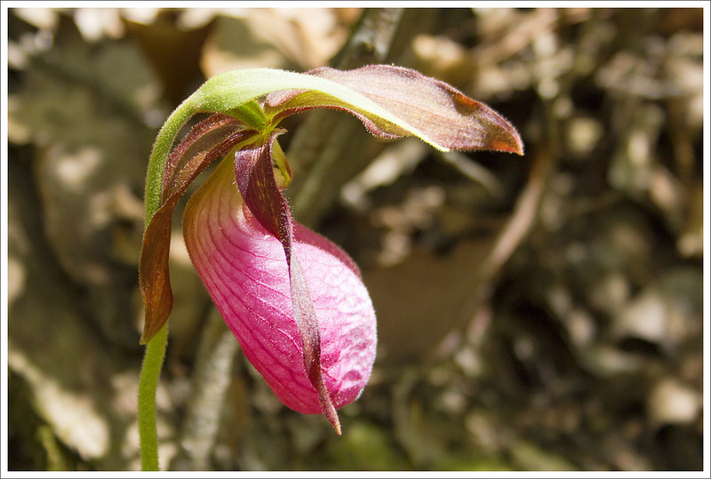
After lunch, we had a short and rather steep climb uphill to Wolfsville Road. After crossing the road, our AWOL Guide showed a flat walk for the last 4.8 miles to camp. What the guide did not indicate was how rocky the trail would be. It said there would be lots of poison ivy, but not a word about the jumble of ankle-turners that comprised most of the trail. It was slow-going over mostly exposed terrain. Adam and Kris paused to de-layer to cooler clothing, but I decided to keep my long sleeves and tights as sun protection. There really wasn’t much interesting to see along this section of trail – lots of pink ladyslipper flowers being the exception. We marched along, passing the miles, until we finally reached our stop for the second night – Pogo Memorial Campsite.
One of the many pink lady’s slippers we saw along the trail. Below: Much of the day covered rocky terrain along a ridge; There were big rocks and little rocks; Our camp at Pogo Memorial.
Pogo does not have a shelter or a bear pole/cables, but it has a privy, a water source, and tons of tent sites. None of the tent sites are particularly flat and there aren’t a lot of suitable trees for making a bear hang. We figured bigger groups would take the large areas close to the trail and the privy. Also, the privy at this site was especially foul, so we wanted to put a lot of distance between us and the smell. Our spot was at the upper reaches of the campsite and had a nice firepit with a bench. It was still a shabby site compared to the luxuries of Raven Rock, but we made do! Pogo was definitely my least favorite camp stop on the trip.
We had lots of time to relax at camp, so we collected firewood, filtered water, and chatted. As the afternoon went on, more and more people filed into camp, including a huge group of teachers and students from an alternative program high school. They were loud and active, so I was even more glad we had selected a site near the back of the tent area. The second night was cool, but not frigid like the prior night. We stayed up a bit later, talking and tinkering with the campfire. As the sky darkened, we retreated to our tents to get some rest for day three.
Day Three was probably the highlight of the trip. We started off our morning early, but there were still others that beat us out of camp. The hike started off by heading uphill. In just .2 miles, we crossed over Black Rock Creek. At .6 miles, to the left of the trail was a short scramble that took us to a small overview called Black Rock Cliffs where there were a couple of rocks to sit on to take in the view. From here we continued on the AT for a flat section and came up to a junction at 1.6 miles for Annapolis Rocks. We took this side trail that led us past a large caretakers tent (someone who monitors the activity here and can call for assistance) and then past a series of other backcountry campsites. At .25 miles off the trail, we came to the magnificent viewpoint known as Annapolis Rocks. When we arrived, there was a group of students that were learning how to rock climb (Annapolis Rocks being a popular destination for Maryland rock climbing). Not so ironically, there was also a group of firefighters that were up there to train on how to rescue someone that had fallen. It was interesting to talk to them to see how they prepare and see the equipment needed to attempt a rescue. People have died from falling at this spot, so please be careful. The large cliffsides of Annapolis Rocks provides some stunning views and the rock jutting out over a canvas of trees makes this quite the picturesque spot. Annapolis Rocks is an extremely popular day hike; while you may see lots of people, the rock edge is large enough where you will likely be able to find an unobstructed view.
We enjoyed spectacular views from Annapolis Rocks. Below: Tearing down our campsite at Pogo; Christine on Black Rock Cliffs; The trail was a wide, flat road.
After taking a long break at Annapolis Rocks, we headed back to the AT junction to bring our total up to 2.1 miles. We took a right and continued south on the AT. The trail continued to be flat and we came across a PATC volunteer that was doing some trail work. We thanked him for his hard work and continued on. The trail started to descend about a mile after Annapolis Rocks and at 3.7 miles we reached the junction with the Pine Knob Shelter. The shelter was just .1 off of the trail, so we decided to explore it. Pine Knob Shelter has campsites around it, a privy, and reliable water (a piped spring is next to the shelter). We returned to the AT junction the way we came for another .1 miles to take us up to 3.9 total miles. The trail sloped downhill and then we came to the I-70 footbridge, an ivy-covered footbridge over the interstate. It made me sad to see all of these people flying by in their rat race of a hectic life when I was out here enjoying the tranquility of nature. These moments always make me feel lucky that I can have these moments to get away from it all. After we crossed over I-70, we had a short uphill climb. At 4.1 miles, we passed through a junction with the Bartman Hill Trail (which made me think of the old Simpsons song, “Do the Bartman”) and at 4.5 miles, the AT passes through a residential area.
The trail was relatively flat for the next bit and then had a short climb down until we reached some power lines at 6.3 miles. From the power lines, we had a steep climb up for about .3 miles until we reached a side trail for the first Washington Monument. We took this short side trail and were at the monument in just .1 miles. This Washington Monument was completed in 1827 and is a 40 foot stone tower that overlooks the area. You can climb to the top through a winding, dark (and somewhat creepy) spiral staircase. After getting a few pictures, we decided this was a perfect spot to have lunch. We sat down and chatted with a couple that we had been camping near the last few nights and finally had a chance to introduce ourselves. They were from Florida and were enjoying this section as much as we were.
This was the first monument built to honor George Washington. Below: Fly Girl signs the logbook at Pine Knob Shelter; We cross the I-70 footbridge; A nice view from the Washington Monument.
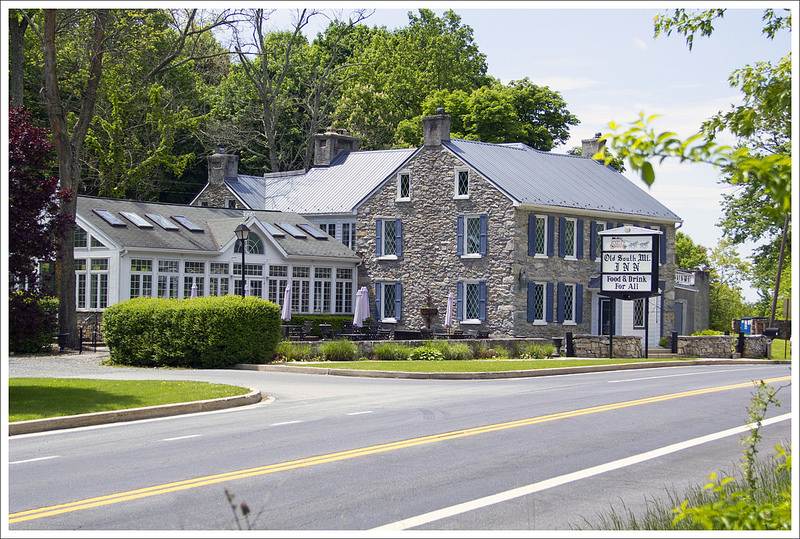
After leaving the Washington Monument, we rejoined the AT and started to head down a steep trail. On the left of the trail were signs that detailed some moments of George Washington’s life and career as the first President of the U.S. We were getting the story in reverse, but it was a good way to refresh on history that I had long forgotten. At the bottom of the hill, we reached Washington Monument State Park. We were able to take advantage of a water pump next to the trail to refill our water bladders and restroom facilities were just a short walk away. The trail descended to the left down the edge of the park and crossed the park road before re-entering the woods. We crossed Monument Road at 7.1 miles and then had another climb through open forest. The sun was quite hot, but it was a pretty scene. The trail then continued downward on a steady descent and we passed by Dahlgren Chapel. The Chapel is a picturesque church that was built in the late 1800s by Madeline Dahlgren, wife of Admiral John Dahlgren. We reached Turners Gap Road and saw the Old South Mountain Inn directly across.
Dahlgren Chapel is a beautiful spot. There is a great view right behind the chapel, too. Below: At the last road crossing before our campsite, we passed the Old South Mountain Inn; At dinner time we hiked back and ate crabcakes, filet mignon, creme brulee, and wine; After dinner we walked back to our campsite at Dahlgren Backpack Campground.
Once we crossed the road, we followed the AT for just a few tenths of a mile before we came to the Dahlgren Backpack Campground off to the right of the trail. The campground had several gravel pads to pitch a tent with a picnic table and firepit at each site. At the campground there are also bathrooms with free showers and a tap for water at the back of the building. There are also outlets to charge your electronic devices. We set up camp and then had decided to go to Old South Mountain Inn for dinner. They allow hikers to visit as long as they shower and men don’t wear tanktops. So, after taking showers we walked up to the inn as soon as they opened. The staff were very hiker-friendly and put us in a comfortable sunroom. We were joined by our Florida hiking companions and sat down to a meal with crabcakes, filet mignon, wine, beer, and creme brulee for dessert. Sorry, Mountain House dehydrated meals, you lose to this fine dining. We stuffed our bellies and then made our way back to camp. We played a round of Rage, a fun card game of betting on tricks you will win, before hanging our smell-ables on a nearby bear hang and retiring for the night. What a wonderful day on the trail! We knew heavy rain was in the forecast for our fourth day, so we went to bed feeling a touch anxious about the next day’s plan.
Ah… it was a deluge! Everyone who had camped at Dahlgren was awake and stirring before it was fully light. People were skipping their cooked breakfasts and packing gear as quickly as possible, in hopes of beating the impending rain. We stuffed our faces with peanut butter pie cookies and were packed and hiking before 7:00 a.m. We all decided to start with packcovers on and rain gear within easy reach. It was a good plan, because the downpour started before we’d even made it a mile out of camp. At .8 miles, we crossed Reno Monument Road. More appropriate to a nice, sunny day, there’s a homemade ice cream shop (South Mountain Creamery) just .2 miles east of the trail. I might be the world’s biggest ice cream fan, but even I don’t want it on a wet, windy, 48 degree day.
After crossing the road, we had a one mile gradual uphill climb to Rocky Run Shelters. Typically, we stop at every shelter to report on the facilities, but my camera was stowed away in my dry bag, and no one wanted to add the extra .4 mile round trip on to go visit the shelters. Notice I said shelter(s)? Rocky Run actually has two separate structures. One is a traditional old log and mud shelter and the other is a new shelter similar to the one at Raven Rock. Reportedly, the old shelter has a more reliable water source.
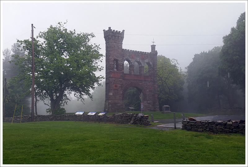
Day four was a deluge! We ended up calling the day short at Gathland State Park The photo above is the War Correspondent’s Arch. Below: We left camp early with pack covers on; The last dry moment came in the first half mile of hiking; Thank goodness for a picnic shelter.
After passing the spur trail to the shelter, we had another 1.4 mile climb up to Lambs Knoll. We crossed the paved Lambs Knoll Road and ascended the mountain. We saw a small sign indicating a side trail to visit a view tower. We were in dense fog and pouring rain, so we made a collective ‘nope!’ to visiting the view. Another .2 miles past the tower, there was another view at White Rock Cliff. It was all fog and rain, so we kept moving along the trail. It’s amazing how fast you can hike when it’s cold and wet and there’s nothing to see! After White Rock Cliff, we had a gradual 3.2 mile descent to Crampton Gap Shelter. The descent followed a rocky ridgeline. It would probably have been beautiful on a nicer day. Kris and Adam were moving a bit slower due to the slippery footing. I wanted to go faster to stay warmer, so I pressed ahead. Being cold and wet is one of my outdoor fears (just behind Lyme Disease), so I was doing everything I could to keep my blood pumping. At the spur to Crampton Gap Shelter, we discussed altering our plans for the day. Our goal was to make it to Ed Garvey Shelter (4.1 miles ahead on the trail). It was only 9:45 in the morning, so we knew we’d be there by lunch. We also discussed whether or not we really wanted to spend all day holed up in our tents or the shelter. The alternative would have been a long, cold, miserable, viewless 18 mile day into Harpers Ferry. We agreed to give the matter some thought and re-discuss it when we reached the picnic shelter at Gathland State Park.
Gathland is just .4 miles past Crampton Gap Shelter, and we arrived a little after 10:00 a.m. The park is the former estate of George ‘Gath’ Townsend, a war correspondent during the American Civil War. Visitors can tour the grounds and see the ruins of his mansion, a mausoleum, a museum, and the War Correspondent’s Arch. The park also has a picnic pavilion, which became our refuge from the rain. At our stop, we collectively decided that we didn’t want to spend the day hunkered down in a shelter with tons of other hikers. But, we also didn’t want to hike 18 miles or miss the views from Weverton Cliffs. Fortunately, there is cell phone service along most of the AT in Maryland, so I was able to call the Teahorse Hostel in Harpers Ferry. We asked their shuttle service to pick us up at Gathland and take us into town for the night. We decided to rent bunks in their hostel and finish our last 12 miles the next day (which was forecast to have much better weather.) It was a great decision.
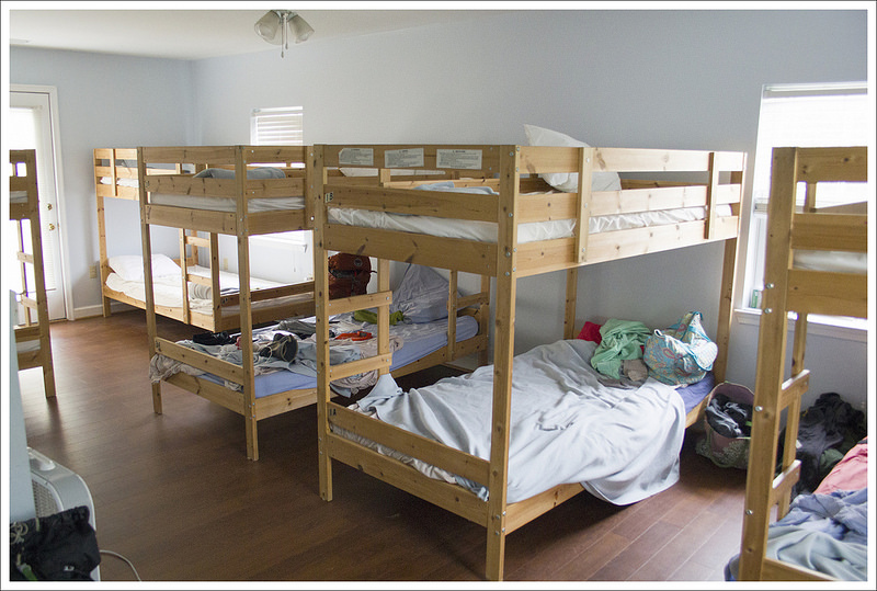
After we got settled into our hostel, we ate at Mena’s Pizza. Below: Scenes from the Teahorse Hostel in Harpers Ferry.
Within twenty minutes, the three of us were all loaded into a toasty warm Honda and motoring into Harpers Ferry. Since we were so cold and wet, the hostel proprietor let us into the bunkroom before check-in. The hostel was cozy, comfortable, and very clean! We had a chance to shower, wash our muddy clothes, and get warm. While Kris and I showered, the shuttle driver took Adam over to Harpers Ferry Historical Park where we had left our car. The hostel invited us to leave our car in their parking lot so we could slackpack (hike without our heavy camping/cooking gear) our final day.
Our day at the hostel was a lot of fun! It was a full house because of the rain, so we met lots of other hikers. We had good meals at a couple different Harpers Ferry restaurants, relaxed, and had a Connect-4 Tournament. Adam took a couple thru-hikers to WalMart to resupply. During the course of the evening, we reflected several times on how glad we were to not be sitting in a cold, wet shelter. Staying at the hostel turned out to be the perfect fun surprise to mix-up our hiking plan.
The next morning we were treated to breakfast of waffles, coffee, orange juice, and fresh bananas by the hostel staff. We had arranged for a shuttle back to the trail at 8:00 a.m., (accompanied by thru-hiker Norseman who wanted to take advantage of some easy slackpack miles back to the hostel). We left our car at Teahorse Hostel so we could slackpack back to our car. Getting dropped back at Gathland State Park, we were able to see some of the surrounding buildings that we could barely make out in the downpour and fog the previous day. The trail crossed from the pavilion where we had ‘evacuated’ the trail the previous day. It passed by a few historical buildings before ducking into the woods. The trail was fairly muddy and beat up from the previous day of hard rain. Our thoughts were filled with curiousity about how the rest of our fellow section-hikers were doing. We were worried about how everyone held up because we felt some of the group was struggling even before we added the extra challenge of bad weather.
Hiking in the green, foggy forest was amazing! Below: More history at Gathland State Park; Hiking into the fog; Ed Garvey Shelter.
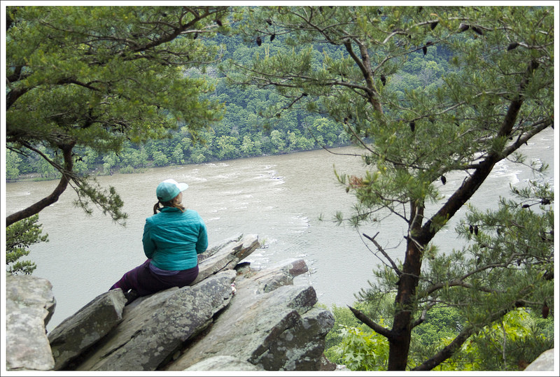
The trail was fairly flat for most of the day. We reached Brownsville Gap at 1.9 miles and then continued on a flat, but gorgeous green trail through the woods until we came to the Ed Garvey Shelter at 3.7 miles. We ran into a pair of siblings that were the last to leave the shelter and we asked about the other groups we had met on our section. Almost everyone had stayed there the previous night, but it sounded like everybody hunkered down grimly in their tents and had a rough night. They told us that one family we had met, the parents had bailed out and called for a ride into Harpers Ferry while the sons continued on (they were thinking about hiking parts of the AT in sections as a family). I guess everyone’s spirits were beaten down from the weather, which made us feel guilty for a brief second that we had made the call to get to the hostel and enjoy showers and hot food. The Ed Garvey shelter is a two-story shelter that had an AT symbol formed out of the railings in the loft looking down from the top story. We signed the log, ate a quick snack and then continued. A short time away, we ran into Medicine Man, one of the AT thru-hikers that stayed with us at Teahorse Hostel and had started early to go northbound for the day. Medicine Man was a retired pharmacist (fitting trail name) and one of the most genuine, friendly people you will meet. We wished him luck for the remainder of his hike and continued on. At 5.8 miles, we had caught up to the siblings at the junction with the side trail to Weverton Cliffs. The side trail led down a couple of tenths of a mile down to a large outcropping that overlooks the Potomac River. We could soon hear the sounds of a train going by below us. While the day was hazy and a bit cloudy, we enjoyed watching the river flow below us. This was the last of our scenic views, so we stayed here a while to capture some memories and reflect on all we had done so far.
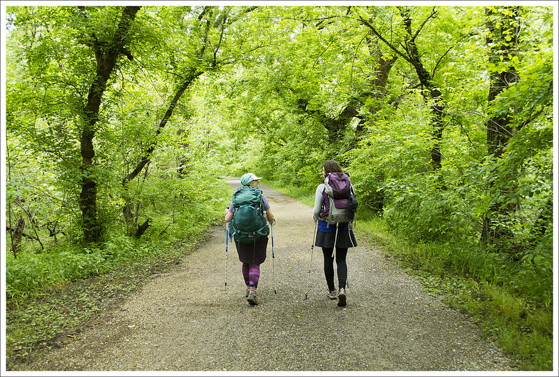
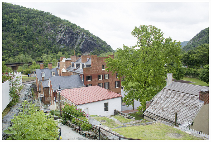
Enjoying the view of the Potomac. Below: Walking the C&O Towpath; Crossing the pedestrian bridge into old town Harpers Ferry; A view of all the historical buildings.
The remaining “home stretch” of the trip consisted of us rejoining the AT and then hiking down a steep section of switchbacks until we came down to Weverton Road at 6.2 miles. We crossed the road and followed the white blazes until it joined the C&O canal towpath, a converted rails-to-trails biking and walking path. We turned right on the perfectly flat, C&O towpath which coincides with the AT to Harpers Ferry. This part of the hike was honestly a bit boring as we were walking on a wide fire road for miles. On the right, we had a passenger train pass by us, with people waving to us like they were wishing us bon voyage or gawking at us like we were novelty safari animals. On the left we soon came to scattered views of the Potomac River. The water was high from all the rain, but there wasn’t much activity on the river. Driving through this area to visit family, we often see kayaks or whitewater rafts on the river, but I’m sure the water was too dangerous for those escapades. At long last, we finally reached the edge of Harpers Ferry at 8.8 miles. We climbed up a staircase and crossed over the Potomac River via the Byron Memorial Footbridge, marking the border between Maryland and West Virginia. When we reached the other side of the footbridge, we came to another AT sign and then came into what is known as the historic Old Town part of Harpers Ferry. The trail walks you right by John Brown’s fort, the site where John Brown and several of his followers barricaded themselves inside in 1859 to initiate a rebellion against slavery in his famous raid.
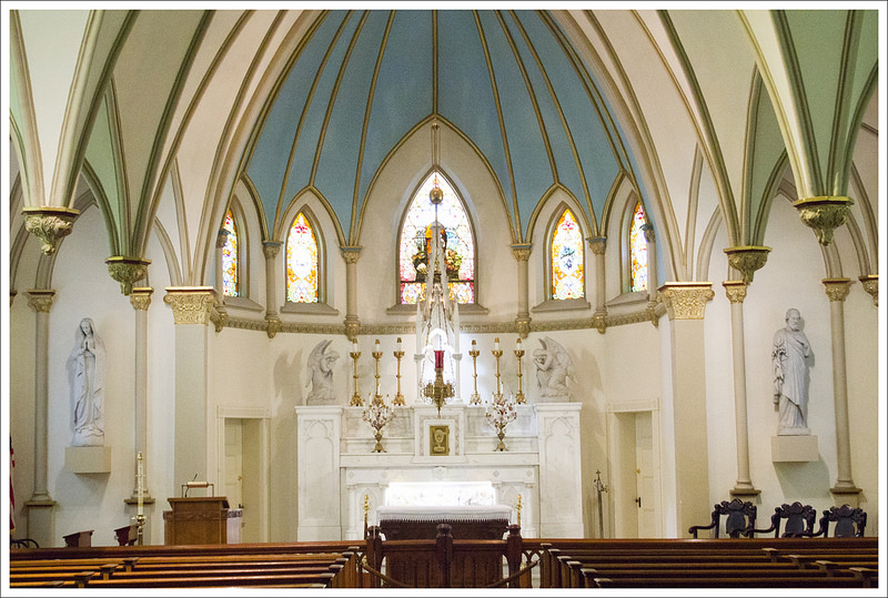
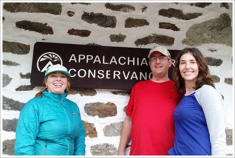
Beautiful St. Peter’s Roman Catholic Church is in old town Harpers Ferry. Below: We were surprised that the trail went back into the woods after old town; At the Appalachian Trail Conservancy; Of course, we ended with beers.
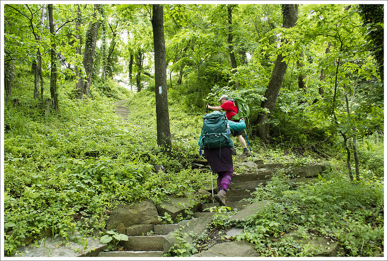
After the fort, the trail is marked by white blazes carved into lightposts through town. Much to our dismay, the AT through Harpers Ferry has you going continually upward over many steep stairs. We passed by St. Peter’s Roman Catholic Church and went inside to see this quaint but stunning church that was built in 1833. It was the only church to survive destruction in the Civil War. From here the trail then skirts a hillside until you reach Jefferson Rock at 9.3 miles, a rock named because Thomas Jefferson stood here in 1783 and noted “this view is worth a voyage across the Atlantic”. I don’t know if I would personally agree with him today, but it is a spot to see the Potomac and Shenandoah Rivers join. From here, we had more climbing to do until we finally reached a spur trail that led us to the Appalachian Trail Conservancy (marked on the sign as the Appalachian Trail Visitor Center). The trail goes through the campus of Storer College, a school that was founded originally as a freedmen’s school to educate black people and once had Frederick Douglass as a trustee. The school was shut down due to funding cuts in 1954, but you can learn about its history on plaques throughout the campus.
We stopped by the ATC and Kris got her section hiker picture taken. We then had about a mile more to walk before we reached Teahorse Hostel and our car. It was a long day, but we felt so accomplished. We drove into to Frederick, MD to eat some celebratory barbecue at Black Hog and then met up with Anthony (who provided our shuttle to start our hike) and his wife, Suzanne, at Flying Dog Brewery. We toasted with beers as we recounted our journey to our friends. It was a wonderful several days on the trail that gave us so many memories that we will remember for some time. While our mileage may seem like child’s play to thru-hikers, we felt accomplished that we had knocked off an entire state in one fell swoop. Some AT thru-hikers go through Maryland as part of a four-state challenge, where they start in Virginia, go through West Virginia and Maryland, and end in one day in Maryland for a total of about 45 miles in one day. I’m glad we did it they way we did. We took a leisurely trip with a decent amount of miles each day, but the goal was to have fun and spend some time together sharing the journey.
Trail Notes
Distance – 42 miles
Elevation Change – 6057 ft.
Difficulty – 3. None of Maryland is really tough. The first 15 miles are rocky, rolling terrain.
Trail Conditions – 4. The trail gets a lot of attention from PATC. The heavy rains made the trail very wet and muddy the last two days, but there’s nothing you can really do with that much rain.
Views – 4. There are nice views in many places along the trail. Most look into farmland and suburbia, so they’re not as impressive as other mountain views.
Streams/Waterfalls – 2. There are a couple small creeks to cross along the way. We found adequate water sources, but during dryer weather, we’ve heard water can be a challenge on this section.
Wildlife – 2. We saw and heard lots of bird, squirrels, and chipmunks. We also saw one deer.
Ease to Navigate – 4. Other than one tricky part between PenMar and High Rock, the trail was well blazed and easy to follow. The spur to Weverton Cliffs is unmarked, but so well-established that you can’t miss it.
Solitude – 3. There were a lot of people on the trail despite us avoiding the weekend. There were probably more section/day hikers than thru-hikers at camp each night and we traveled at the same pace as three other section groups.
Directions to trailhead: We left a car at Harpers Ferry National Historical Park and had a friend shuttle us to PenMar Park. Parking coordinates to Harpers Ferry are 39.315802, -77.756453. Parking coordinates for PenMar are 39.717725, -77.508274.
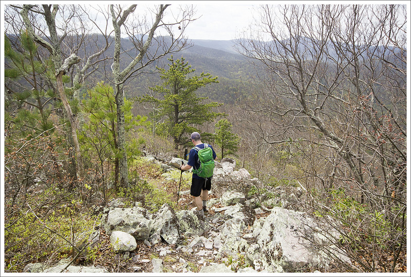
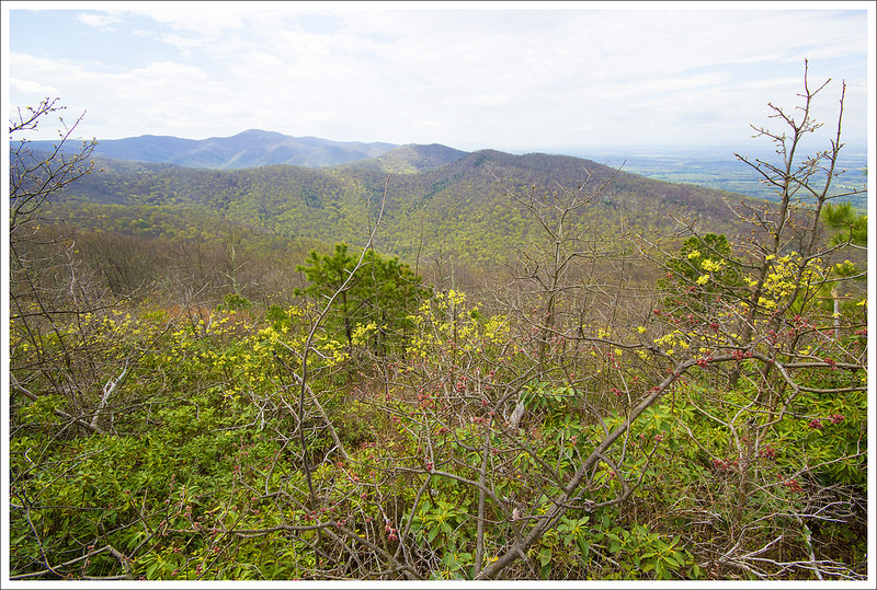
This nine mile hike is not very well-known, but it’s truly one of the park’s most scenic summits. Past fire damage has left the summit open, with views in every direction. We hope sharing this post won’t spoil the solitude we enjoyed on this hike.
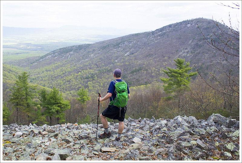
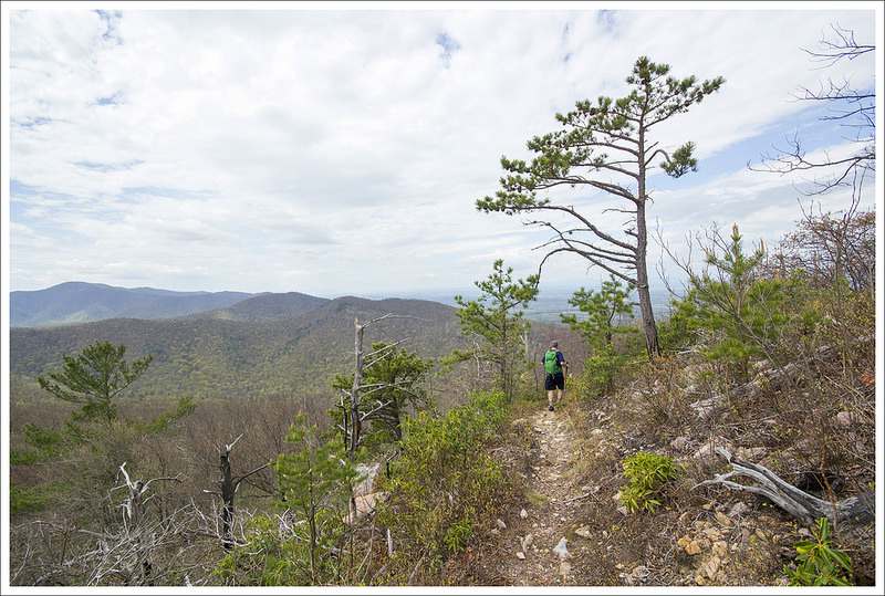
This beautiful view is about half a mile from the true summit, but it was too beautiful to pass up! Below: The hike starts northbound on the AT at Browns Gap; Pink azaleas were just starting to bloom; Adam hiking on the Big Run Trail.
Adam Says…
How has this hike escaped us before? We’ve covered most of what Shenandoah National Park has to offer, but this was a hidden gem that we are so glad we did. While this hike is about 9 miles, the elevation gain feels fairly minimal considering the distance you are covering. We were getting ready to do a multi-day backpacking trip in a couple of weeks and we wanted to get some training in before we hit some bigger miles with heavy packs. Christine had seen a few photos from the viewpoint and mapped out this possibility of a hike.
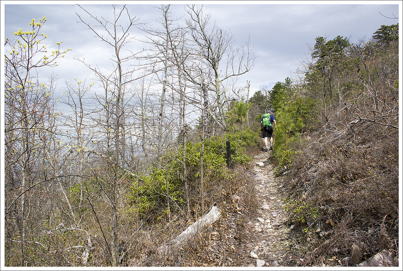
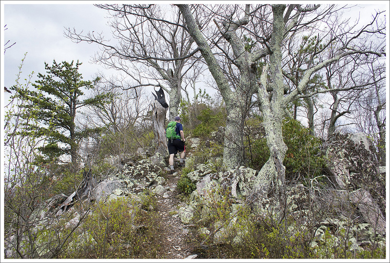
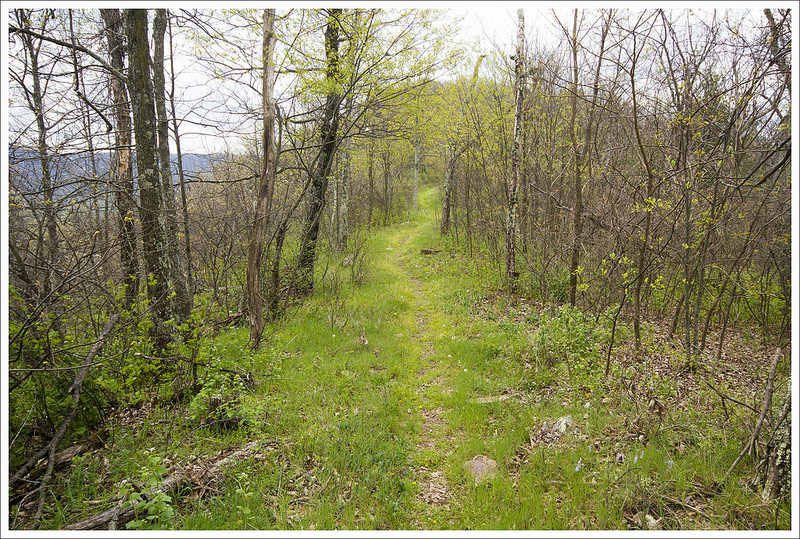
We saw a ton of these Dwarf Irises on the hike. Below: Early spring on the Rockytop Trail; Adam crossing talus slopes on Rockytop; Everything in bloom!
The hike starts at Browns Gap (the sign reads “Brown Gap”, but maps of the area show “Browns Gap”), at mile marker 83 of Skyline Drive. We parked our car and found the Appalachian Trail post from the parking lot and headed north on the white-blazed AT. The trail climbs a bit from the beginning and parallels Skyline Drive. At .5 miles, you come to the junction with the Big Run Loop Trail. Take a left here to join the blue-blazed Big Run Loop Trail. At 1.1 miles, you come to a four-way junction where the Big Run Loop Trail breaks off to the right and the Madison Run Spur Trail heads to the left. You will just stay straight. At 1.5 miles, the trail reaches another junction with the Austin Mountain trail bearing to the left; bear to the right to join the Rockytop Trail. Around 2.3 miles, you will pass along a rockier section of trail as it passes through some large talus slopes. At 3.4 miles, you reach the Lewis Peak Trail junction. Take a left at this junction to make your way to Lewis Peak. The trail descends at this point, At 3.6 miles, you reach a great viewpoint off the trail to the right. There is a large talus slope here that opens up into views of a valley between two mountains and Massanutten Mountain perfectly framed at the center in the distance.
The ridgeline on the Rockytop Trail provided nice views. Below: Mountain view from the ridgeline; Spring blooms; Junction of the Rockytop and Lewis Peak trails.
The trail continues to descend from this viewpoint until you reach 4.0 miles and then the trail begins to climb again. At 4.2 miles, you reach the junction with the Lewis Peak Summit Trail. Take this trail to the right and you will climb rather steeply to the summit through a series of switchbacks that will eventually wind around until the trail reaches its end and the summit at 4.5 miles. A forest fire from 2006 has destroyed a lot of the taller trees in the area, but it has created a very nice viewpoint from the summit.
We stopped here and ate a snack while enjoying the expansive views all around us. Clouds were starting to roll in, but we had the stunning panoramic views all to ourselves. When reflecting upon this hike, Christine and I both think that it may arguably have the best views from the southern district of Shenandoah National Park. We made our way back the way we came. There is some steep climbing on the way back, but most of the steep stretches are short-lived. If you can handle the distance, put this on your upcoming hiking agenda.
Christine Says…
For the last week of March and the first three weeks of April, I was bed-ridden from a severe allergic reaction to antibiotics. I burned with fever, my skin blistered and peeled, I itched all over, and struggled with excruciating nerve pain. As the weeks passed, I thought I would never be well enough to hike again. When I finally started feeling better, I went for short, easy walks around my neighborhood. But pretty soon, I felt a strong draw to get back to the ‘real’ trail. I don’t know what made me think a nine mile hike with 1500′ of climbing was a good idea for a ‘first hike back’.
This spectacular view is just a short distance from the junction of the Rockytop and Lewis Peak trails.
I’m not going to lie – I really struggled on this hike. My endurance definitely took a hit from spending a month in bed. On top of that, it was a hot, humid day. My doctor had directed me to fully cover up with long sleeved Capilene, long pants, a hat, and sunscreen to protect my healing skin. I felt like I was sealed in plastic wrap. I just couldn’t cool off. The whole hike, I had a mantra… ‘just take the next ten steps.’ Fortunately, taking ten steps over and over again eventually adds up to a nine mile hike.
Despite the physical challenge, there were some memorable high points on this hike. When we first set out we met a neat retired couple – Swallow and Blind Pig. They were section hiking Virginia’s Appalachian Trail. They were from Oregon and had previously finished hiking the Pacific Crest Trail. We talked to them about the park, the AT, gear, food, and wildlife. I hope when Adam and I are retired we’ll still be having adventures like Swallow and Blind Pig.
Lewis Peak is steeper, rockier, and pointier than most mountains in Shenandoah. This are was burned out by a forest fire in 2006. Below: Views from the Lewis Peak summit are amazing! Clouds moved in on our hike, but on a clear day, you can see for miles!
I also really enjoyed all the signs of spring emerging in the park. Most of the high elevation trees were still leafless, but we could see the brilliant green of emerging leaves creeping up the mountainsides. There were a few azaleas starting to bloom, spring beauties were abundant, and we passed several large patches of dwarf irises. Spring is my favorite season. I love seeing color and life waking back up after dull winter.
A significant part of this hike followed a ridge, so we enjoyed views through the trees. The open vista of Massanutten from the Lewis Peak trail was simply spectacular. The mountains in the foreground perfectly framed the distinct peak of Massanutten.
A great view from the Lewis Peak summit. Below: The views descending Lewis Peak were excellent, too! The area is so cleared out that you can see views in almost every direction.
When we started making switchbacks toward the summit of Lewis Peak, I knew we were going to have even more amazing views. The entire summit climb was open and there were wide open looks at mountains and the valley in every direction. The summit itself is sharper and pointier than almost any other peak in Shenandoah. The end of the trail has a wide sweep of rock to sit upon while you enjoy the view. There were berry bushes growing all over the place. In mid to late summer, this would be a good place to pick wild blueberries.
We enjoyed the view and a couple snacks before heading back the way we came. The hike back had a couple steep climbs that challenged me. I hadn’t remembered any of the downhills feeling steep on the outward hike, so the uphill climbs surprised me on the way back!
The hike back was beautiful!
I was quite glad when we got back to the Appalachian Trail and the final gentle descent back to the parking area. After our hike, we stopped for lunch at the Loft Mountain wayside – grilled cheese sandwiches and our first blackberry milkshakes of the season. It was great to be back on the trail!
Trail Notes
Distance – 9.1 miles roundtrip
Elevation Change – 1527 ft.
Difficulty – 3. The mileage is a little long for most people for a day hike, but with moderate climbs if you take your time it should be doable by most.
Trail Conditions – 4. The trail was in great shape. There was one larger blowdown on the Rockytop Trail we encountered, but otherwise was well maintained.
Views – 4.5. Amazing views from the summit and the viewpoint over the talus slopes just .5 miles from the summit.
Streams/Waterfalls – 0. non-existent.
Wildlife – 3.5. This area is a bit remote, so you may see some deer and bears on your hike. Watch out for rattlesnakes, especially if you venture onto any of the talus slopes.
Ease to Navigate – 3. There are a number of turns to get to Lewis Peak on this hike, but all of the junctions are marked with concrete posts.
Directions to trailhead: Located in Shenandoah National Park (fees apply). You will park at MM 83 on Skyline Drive at the parking lot marked “Brown Gap”. Parking coordinates are: 38.240652, -78.710379
This 20.5 mile Appalachian Trail segment crosses the most photographed spot on the entire trail – McAfee Knob. Even though the view from McAfee is fantastic, there are great views all along the section. In fact, we think the view from Tinker Cliffs rivals the majesty of McAfee.
Last fall, I told Adam I wanted to backpack McAfee Knob and Tinker Cliffs for my birthday. We planned our mileage, picked our meals, and hired a shuttle driver. When the Friday of our hike arrived, it was forecast to be blazing hot. The area was also experiencing a prolonged drought. The water sources along this stretch are typically reliable and we thought being on a high mountain ridge would cool things off a bit, so we loaded up and headed out.
On the way to our start point at Catawba, our shuttle driver (Homer Witcher – we’ve used him before and he’s a fantastic part of the Appalachian Trail community) told us that just a few days earlier, a woman and her daughter were crushed under a falling tree at one of the campsites along the route. He had assisted EMTs with the rescue operation. Fortunately, the daughter escaped with minor injuries and the mother recovered after a hospital stay. Scary!
The climb was a little steep and rocky in the beginning. Below: Parking on Route 311; Johns Spring Shelter; Catawba Mountain Shelter.
Homer dropped us off at Catawba parking around 9:30 a.m. Despite it being early(ish) on a Friday, there were already numerous cars in the lot. This is an extremely popular area for hiking and the lot frequently fills and overflows by mid-morning, especially on the weekends. There are strict regulations for where you can park, and cars are frequently towed from this area. Take these rules seriously! You can read more about parking issues in the Roanoke Times article.
The northbound Appalachian Trail starts on the other side of route 311. We crossed and immediately began an ascent over dry, dusty terrain. Just a mile into the hike, we passed Johns Spring Shelter. It’s a typical AT shelter and has space for six people. There are a few tent sites and a privy nearby. The water source near this shelter is usually small, but it was bone dry on the day we hiked.
In another mile, we passed the Catawba Mountain Shelter. It’s a similar set-up to Johns Spring in terms of space. There are also several nice campsites with metal fire pits just north of this shelter. After passing this shelter, there is a steady 1.7 mile climb to the view at McAfee Knob. On the way to the top, you’ll cross a fire road. Stay on the white-blazed Appalachian Trail. Near the top, you’ll pass through an impressive jumble of truck to cabin sized boulders. The overlook is a couple hundred feet to the left of the trail and is marked by a small sign.
The view from McAfee Knob is gorgeous! Below: Before you reach the knob you pass under powerlines; Rock formations before McAfee Knob; It’s a tradition to sit on the edge of the overhanging rock.
Views from the overlook are majestic and expansive. The long ridge on the the right carries the Appalachian Trail over to Tinker Cliffs. On a clear day, you’ll see the cliffs shimmering in the distance. When you’re at McAfee, don’t miss the opportunity to sit on the ledge with your feet dangling into the abyss. It’s a tradition and isn’t as scary as it looks.
After leaving the viewpoint, you’ll descend steeply into a maze of giant boulders. There are narrow openings in the maze, making it a fun place to explore. A half mile later, there is an open meadow under powerlines and a nice view of the distant mountains. The descent continues for about 1.2 miles. At the bottom, you’ll reach the Pig Farm Campsite and shortly after that – Campbell Shelter. The shelter is on an elevated platform and there is a privy, picnic table, and bear locker at the site. The water source, located about 150 yards to the left of the shelter, was also dry!
After leaving McAfee, you descend through a maze of boulders. There are many interesting rock formations on this section. Below: An eastern fence lizard; Campbell Shelter; The weeds were hip to shoulder high along the trail; A nice shady spot to rest; We got one distant look at the reservoir on the first day; After descending into this grassy area, you begin the tough climb to Tinker Cliffs.
After the shelter, the trail follows rolling terrain for 3.1 miles until you reach a grassy opening at Brickeys Gap. There is a trail to the left, but you’ll stay on the white-blazed Appalachian Trail and begin a steep uphill climb toward Tinker Cliffs. The ascent goes on for 1.8 miles. On this particular day, the climb was especially rough. We were both tired from the heat and running low on water.
Navigating the trail as it heads up Tinker Cliffs is a bit tricky. Look carefully for white blazes and arrows. There will be openings in the rocks that look like trail, but they’re not. Most of these openings are blocked by branches dragged across the ground, but if you’re not paying attention you might head the wrong way. When we finally made it to the top of the cliffs, the views made all the effort worthwhile. We had the entire overlook all to ourselves! I thought the views from Tinker Cliffs were even better than McAfee Knob. I took off my shoes and socks and let myself bake for a few minutes in the late afternoon sun. It was probably still in the low 90s – such a hot day for late September!
It was clear that many people had camped at the top of Tinker Cliffs, camping is strictly prohibited on top Tinker Cliffs. We made our way along the open cliffside for about half a mile before descending back into the trees.
The view from Tinker Cliffs was as nice as McAfee. Below: On the climb up you get a nice meadow view; The trail is a little tricky so pay attention to signage and look for logs blocking the wrong way; It was still around 90 degrees when we got to the top of Tinker (notice the beet red face); Adam walks along the cliffside; Descending beneath Tinker Cliffs; the final mile into camp was easy terrain.
The trail passes beneath the cliffs and then rambles downhill for about a mile until it reaches Scorched Earth Gap and the junction with the Andy Layne Trail. From there, we had an easy .6 mile stroll to our campsite at Lamberts Meadow Shelter. When we arrived, there was one other section hiker already there. We picked a campsite across the ‘stream’ from the shelter. Note, I put stream in quotes because when we visited it was nothing but a series of shallow muddy pools.
We got the tent set up and changed into camp clothes. It took us a full hour to filter four liters of water! First, we had to scoop water into our bucket. It was full of mud, pebbles, mosquito larvae, and algae, so we had to filter that water through a bandanna into our Sawyer bags. The we squeezed the water through the Sawyer into our Camelbaks. It was the color of weak tea, so I chose to treat it with Aquamira on top of the filtering. It was nasty!
We made it to camp at Lamberts Meadow Shelter! Below: We set up camp on the opposite side of the stream; The lousy, dank water source.
We set aside a couple cups of the water to make dinner, leaving us each with just under two liters of water for the next day. It took so long to deal with water, that it was almost dark when we headed up to the shelter to cook. By then, a couple other section hikers had arrived at the shelter. They were former military and had done a lot of the trail. We chatted about gear and favorite spots along the AT. They told us a tale about finding a body near Tinker Cliffs on a hike fifteen years earlier. They had become lost on the trail headed up the cliffs and found a body from the 1940s or 50s in the woods under the cliffs. It was a crazy story!
After dinner, we headed back down to the tent. It was still too hot to make a fire and we were both pretty tired, so we turned in early. It was a stuffy, fitful night in the tent. It’s hard to get comfortable when you’re sweaty and stuck to your sleeping pad. Still… it had been a beautiful day with lots of amazing scenery.
Day Two (9.5 miles)…
We woke up at daybreak and knew it was going to be a hot day. The temperature was already in the mid-70s. We didn’t have much water to drink or cook with, so we opted to eat some Little Debbie Peanut Butter Pies for breakfast. They are good calorie bombs for some fast energy and didn’t require any water. This was definitely the scariest water source we have had to use, so conserving water until we found something else was our plan. We packed up camp quickly and then made our way back on the Appalachian Trail, heading north to make our way back to our car.
In .3 miles, we came across the Lamberts Meadow Campsite, which also had no water in the stream next to the campsite. We saw the fallen tree that had smashed through the picnic table. Homer had told us that if that picnic table hadn’t been there, it would have likely fallen directly on the tent. He was planning in another week to build and bring another table down there to replace the one that had been smashed. Since there isn’t great access to this area except for a long hike, I can’t imagine hauling a big table through the woods like this, especially at Homer’s age (in his 70’s). Homer is the true definition of a trail angel and has helped so many AT thru-hikers and others along the way.
We set off early. The morning was already hot and humid. Below: This huge tree fell and injured two hikers the weekend before we hiked; A beautiful farmland view on day two; There was not a lot of climbing on day two, but the terrain was rockier.
From the campsite, we continued on the AT. At 2.5 miles, we reached a junction with a blue-blazed trail that led to a nice viewpoint to the west. The trail began to slope downwards and at 4.3 miles we reached Angels Gap. The heat continued to increase and we were already extremely thirsty. We drank when we felt we needed to, but we both were already running low on water. The sun was beating down since the area was more open. At 4.7 miles, we first heard the buzzing of a powerline and soon it came into view. At 5.5 miles, we reached Hay Rock. We skipped climbing up the rock, since we were already getting good views of Carvins Cove Reservoir all along the trail. Many people do Hay Rock as a day hike coming from Daleville.
The trail stayed relatively flat, but was rocky and exposed us to the sun for a bit. We crossed over an open field with tiny little seed pods that were blowing in the hot wind. It looked like snow that was coming down, but the temperature told us otherwise. We had just watched Stranger Things on Netflix and it reminded us of something supernatural or alien that was happening in this area. We came to another powerline at 6.7 miles, but this one gave us wonderful views. We didn’t stay long since we wanted to get out of the direct sun. Christine had run out of water, but I had saved a bit for her to have.
Christine enjoys a view on day two. Below: Adam approaches Hay Rock. There’s a nice view of the reservoir from the top, but we skipped climbing it; More rocky terrain; Carvins Cove reservoir.
Shortly after we left these views from the power lines, the trail finally ducked back into the woods and began a descent. We ran into a Ridge Runner on the trail that was talking to hikers and seeing if they were alright with the heat and lack of water. Ridge Runners are paid to monitor the trail and assist hikers. I would have loved some water, but we knew we could make it just a few more miles. We told him about the lack of water on the trail, so hopefully they came across others that were in bigger need. We crossed powerlines again at 7.5 miles, 8.3 miles, and 8.9 miles. Shortly after this last powerline, we crossed over some railroad tracks and a bridge. It was only a few more tenths of a mile and at 9.5 miles we made it back to our car exhausted and thirsty.
A beautiful view of the Carvins Cove Reservoir. Below: A lot of day two was unshaded; We passed through a meadow with seed pods flying everywhere in the breeze – it was like being in a snowglobe; The descent was welcome as the day got hotter; We crossed railroad tracks; A pretty section of pines; We met this blacksnake.
When we got back to our car, our first order of business was to get something to drink. We hopped in our car and jumped into a gas station across the street and downed some Gatorades in record time. We decided we wanted to eat some barbecue and drink some beer to celebrate. Since we had made an early start to our day, it was just a little after noon when we got off the trail. We made our way to Flying Mouse Brewery (this brewery closed at the end of 2018) and our Maps app on our phones said that it would be closed when we arrived. We thought we would give it a shot anyway in the off chance it was open. As we were driving up, I saw signs for Virginia Momentum and saw runners. Virginia Momentum is a company started by a friend of mine that holds races across Virginia that helps support local charities. When we got to Flying Mouse Brewery, they were hosting a brewery-to-brewery race there, so it was open. We felt that someone was looking out for us and went inside to get a flight of beer samples and enjoyed talking to our friends that were participating. While running these long races is impressive, we did earn some props by just having come off the trail carrying some heavy weight. After some tasty beverages, we made our way to Three Li’l Pigs BBQ, which always has amazing food and is perfect for a post-hike stop.
This backpacking trip had some other significance to us as well. While it was Christine’s birthday, McAfee Knob was one of the first posts that started Virginia Trail Guide. We’ve learned a lot along the way about how to tell our story of the trails. If you’re looking for one of Virginia’s most famous hikes to serve as a backpacking route, try this one out. McAfee Knob is the most photographed spot on the entire Appalachian Trail. We enjoyed taking the ceremonial pictures at the top. We even mimicked the A Walk in the Woods movie poster shot of Robert Redford and Nick Nolte to show how the scale was wrong for that poster. While we had hiked McAfee Knob before, this was our first trip to Tinker Cliffs and we both thought this was something not to be missed. This route makes up two-thirds of Virginia’s Triple Crown (with the other third being nearby Dragon’s Tooth) and it is definitely worth the hype. Just go on a cooler day and pray for better water sources.
You have to finish with a cold beverage!
Trail Notes
Distance – 20.5 miles Check out the stats from Map My Hike [Day 1] [Day 2]*
Elevation Change – 3400 ft.
Difficulty – 4. Day one is the tougher day with about 2500 feet of climbing. Day two is significantly easier with just over 900 feet of elevation gain.
Trail Conditions – 4. The trail was in great shape and beautifully maintained by the RATC (Roanoke Appalachian Trail Club).
Views – 5. The views here are iconic, magnificent, and they just keep coming!
Streams/Waterfalls – 1. There are small springs and streams adequate for a water source for cooking/filtering, but there was nothing really scenic.
Wildlife – 4. A yearling bear hung out between Lamberts Meadow shelter and Lamberts Meadow campsite for much of the evening. We also saw fence lizards and deer in a couple places.
Ease to Navigate – 4. The trail is well-marked and easy to follow.
Solitude – 1. This is one of the most popular stretches of trail in the area, so expect to see many people – especially if you go in fair weather. Campsites can be crowded and parking is an issue on the Catawba side. Note: Parking regulations were recently changed. Do not park along the road, or you will be towed.
Special regulations for this area:
Maximum group size, day hikes: 25
Maximum group size, backpacking/camping: 10
No alcohol
Dogs must be kept on leash at all times
No camping or campfires outside of seven designated areas (north of Va 624/Newport Rd, the only legal campsites are Johns Spring Shelter, Catawba Shelter and campsites, Pig Farm campsite, Campbell Shelter and Lambert’s Meadow Shelter and campsites)
No camping or campfires on McAfee Knob or Tinker Cliffs
* MapMyHike is not necessarily accurate, as the GPS signal fades in and out – but it still provides some fun and interesting information.
Directions to trailhead: GPS coordinates for the parking area to start this hike are 37.380125, -80.089694. You will park at the McAfee Knob trailhead parking area on Rt. 311 in Catawba. You must park in the lot. Roadside parking is prohibited and cars will be towed.
This 6.6 mile route is one of the fastest, easiest ways to get above treeline in the Presidentials. The trail is rocky (like everything in this area), but the climb is very moderate by White Mountain standards. Trivia: This peak was named Mt. Pleasant until after President Eisenhower’s death in 1969.
The Summit of Mt. Eisenhower. You can see Mt. Monroe and Mt. Washington off in the distance.
Adam Says…
We have made it up to New Hampshire the last several years. Each year we try to do at least one of the Presidential peaks – big, granite mountains named after our country’s past presidents. This year, we decided to tackle Mt. Eisenhower by way of the Edmands and Crawford Paths. We read in our Falcon Guide to Hiking New Hampshire that this trail route had a moderate grade and the footing was “pleasant”
We have learned to not trust New Hampshirite descriptions with regard to grade or footing. From a Virginian’s standpoint, most of the hiking in the White Mountains is so much tougher than anything we experience in our state. Your body will pay a price and you may end up cursing the granite you walk upon.
So, they said the grades were moderate and called the footing pleasant. The rock jumble pictured above is the actual trail. Below: Adam makes his way along the easy old road grade seen early in the hike; The climbing got much rockier and steeper as we went along.
Over the first 1.4 miles of the Edmands Path, you gain about 650 feet of elevation, but in the last 1.5 miles, you gain 1750 feet. The first half of the outgoing hike is a steady climb, but the steeper grade and bigger steps on rock and gnarled roots take over pretty quickly!
As we huffed and puffed up the mountain, we eventually got some views through the trees and knew that our hard work was going to pay off. Through some of the openings we could see the red roof of the grand Mount Washington Resort below, which gave some perspective of how far we had come.
It’s always fun to get your first views from the trail. You can see the red roof of the Mt. Washington Omni between the trees. Below: Scenery as we reached the treeline.
We eventually came across a U.S. Forest Service Alpine Zone sign warning us that we were entering an area with some of the worst weather in the world. This is definitely a sign to heed on rough weather days, but we had a gorgeous day of mostly clear skies above us. We arrived above treeline and were soon on a rocky path that skirted the shoulder of Mt. Eisenhower. At 2.9 miles, we reached the junction with the Crawford Path (the name given to the Appalachian Trail through these parts) and took the first right on the Eisenhower Loop Trail, which leads to the summit. The views from the junction were phenomenal as we were looking right at Mt. Monroe with Mt. Washington in the distance behind it. The path to the summit zig-zagged up some switchbacks on a skinny path that mostly had nice footing and in about .4 miles we had reached the summit.
Climbing to the junction with the Crawford Path. Below: The junction of the Edmands Path and the Crawford Path; More open views.
When we got to the top, we found lots of people that had hiked over from Lakes of the Clouds Hut or Mizpah Spring Hut. We ate our snack while taking in views in all directions. We took a ton of photos to capture the vast landscapes and beautiful partial cloud coverage.
We made our way back down the same way we came up, reaching the Crawford Path junction quickly. We then took the Edmands Path back down to our car. We paused for a few moments before ducking back in below treeline to soak up some last views of the majesty of mountains and valleys below us. It is moments like this that we revisit in our minds to help us get through the stress of work and life through the rest of the year.
On our way up Mt. Eisenhower. The Eisenhower loop trail branches off the Crawford Path to give you an opportunity to see the summit. Below: Scenery climbing up to the summit of Mt. Eisenhower.
If you’re interested in visiting these high peaks, you can do a multi-day backpacking trip that is called a “Presidential Traverse”. The route connects Mt. Jackson, Mt. Pierce, Mt. Eisenhower, Mt. Monroe, Mt. Washington, Mt. Jefferson, Mt. Adams, Mt. Quincy Adams, and Mt. Madison. Hikers typically stay at the AMC huts along the way. This route is nice, because you only have to climb up from the valley floor once! The rest of the traverse is tough, but the bulk of the big climbing is done on the first day. The Presidential Traverse entails additional perils because the constantly changing weather can put you at risk for getting lost in the fog or pinned down by storms. We hope to do a Presidential traverse someday to take in the full experience, but for now we have settled for day hikes. We’ve enjoyed the majestic views, but we have had to work a little harder for each one (climbing all the way from the bottom to reach each summit).
Christine Says…
Mt. Eisenhower was a great choice for our 2016 Presidental climb! We had gorgeous, clear views and the mountain’s lofty elevation gave us a little bit of relief from the brutally hot summer day in the valley below. The area broke a heat record on August 11 – close to 100 degrees at the base of the mountain. The normal high is usually closer to 80.
We got an early start and arrived at the Edmands Path parking area before the crowds. We paid $3.00 for our WMNF one-day parking pass and set out on our way up the mountain. (There is a self-service parking fee station at one end of the lot.)
Like Adam said, nothing in Virginia really compares to the rigors of a New Hampshire climb, but this route was definitely a more moderate climb than others we’ve tackled. Today’s hikers can thank revolutionary trailbuilder J. Rayner Edmands for many of the gradual, meandering trails in the White Mountains. Edmands, one of the founding members of the Appalachian Mountain Club, modeled his eastern trails after the livestock trails he had climbed as a young man in the Rockies. He believed in the philosophy of “always climbing, never steeply” when it came to trail design.
There were a lot of people on the summit of Mt. Eisenhower. Below: Summit scenery.
He spent time surveying each mountain to find the best grades and the most favorable terrain to reach the summit. He built each trail like a puzzle; using large boulders, extensive cribbing, and selective tree clearing. His philosophy differed greatly from other well-known New Hampshire trail builders of the time; most of them opting for the shortest routes, regardless of steepness or terrain. Built in 1909, the Edmands Path was one of the last trails Edmands built before dying of a stroke at the age of 60 in 1910.
If we’re being completely honest, we have to say that there’s no truly easy way to hike to mountain summits in the Presidentials. Even with Edmands’ thoughtful design, you’re going to get a solid cardio workout climbing to the summit of Mt. Eisenhower.
Great views occur everywhere above treeline. Below: Making our way back down the mountain.
Since it was a hot day, we took many water breaks as we worked our way uphill. Despite the effort, I still thought the tough climbing over boulders and roots went by quickly. I was actually surprised when we reached the alpine zone sign… “Here? Already?” The last bit of the Edmands Path before we reached the junction with the Crawford Path was almost flat and passed through a lush bed of alpine mosses and wildflowers. After we cleared that last swath of green, the view gave way to a theater of bare granite mountains.
The last tenth of a mile before the junction with the Crawford Path was a jumble of football-sized rocks along an exposed cliffside. When it’s wet, a stream flows over these rocks, but on this day it was thankfully bone dry. In the winter, this particular spot is known for being treacherously icy and windy. I’m glad we only visit New Hampshire in the summer. Virginia winters are tough enough for me!
We saw interesting Alpine plants. Below: More scenery on the descent: Lunch afterwards at Moat Mountain Brewery & Smokehouse.
The last .4 miles of trail from the Crawford Path junction to the summit of Eisenhower follows the Eisenhower loop – essentially a spur trail that detours people from the Crawford Path over the summit. Most of the mountains in this area have an “over or around” option. No matter which option you pick, you’re going to have SPECTACULAR views if you hike on a clear day. The majesty of the Presidentials is without compare – so much rugged beauty. It takes my breath away every time!
The hike down simply retraced our steps. As we descended, we could feel the heat and humidity of the lower elevations closing in around us. I was glad we finished hiking rather early in the afternoon, as it gave us time to make a couple more stops before heading back to my parents’ house. First we detoured into Jackson. We stopped at a great bakery for cold drinks and cookies and paid a visit to the White Mountain Puzzle Company. If you enjoy working jigsaw puzzles, they make a great variety! After Jackson, we hit one of our favorite lunch spots in the area – Moat Mountain Brewery and Smokehouse. A tasty lunch and cold craft beer made the perfect ending to another excellent New Hampshire day.
Trail Notes
Distance – 6.6 miles
(Check out the stats from Map My Hike)*
Elevation Change – 2800 ft
Difficulty – 4.5. The hiking may be moderate by New Hampshire standards, but it is a tough hike and you should be in decent hiking shape to tackle it.
Trail Conditions – 2. While the trail was well maintained, the boulders of rock that you have to climb in the last 1.5 miles of the Edmands Path makes it tough climbing.
Views – 5. The 360-degree views from the Presidential Range is hard to beat anywhere on a clear day.
Waterfalls/streams – 1. You cross over a small stream early in the hike, but otherwise there wasn’t much water to see. However, we visited in drought conditions. In a normal to wet year, stream crossings may be more numerous and/or more difficult.
Wildlife – 1.5 Squirrels scampering and birds chirping will give you sounds along the way, but don’t expect anything once you go above treeline.
Ease to Navigate – 4.5. There is just one turn from the Edmands Path to reach the summit, so it should be very easy to follow.
Solitude– 3. We didn’t come across many on the Edmands Path, but on a beautiful summer day, the summit had a lot of people.
Directions to trailhead: Parking Coordinates: 44.248988, -71.391665. The trailhead is on Mt. Clinton Road, off U.S. 302 near the AMC Highlands Center. The parking area requires a White Mountain National Forest parking pass. You can buy an annual pass or use the self service station to pay the $3 day fee. For more information about parking passes, visit the national forest website.
* MapMyHike is not necessarily accurate, as the GPS signal fades in and out – but it still provides some fun and interesting information
This 7.2 mile hike takes you to a rocky summit with a 360 degree view of New Hampshire’s mountains and lakes. Chocorua is the easternmost peak in the Sandwich Range and stands at just 3,490 feet. It’s not one of New Hampshire’s famous 4,000-footers, but we found the views were spectacular and the summit offered unique terrain. The trail is mostly moderate but requires some trickier rock scrambling near the summit.
When we visited New Hampshire in August 2016, we got to chatting with a couple locals on the summit of Mt. Cube. They were surprised that we’d hiked so many lesser-known trails in the area, but had somehow overlooked popular Mt. Chocorua. We’d passed the trailhead many times, but had no idea it offered such spectacular views. Adam had taken to calling it Mt. Cocoa Puffs, which is significantly cheerier than the legend of how the mountain got its name.
Supposedly, in the 1720’s a Native American man named Chocorua had a son who was accidentally killed after drinking poison on a white settler’s farm. He took vengeance and killed the farmer’s wife and children. The farmer shot and wounded Chocorua, but he escaped up the mountainside. From the summit, he cursed all white settlers, their livestock, and their crops; and then leapt to his death. Like most legends, there are no records to authenticate the tale, but Wikipedia listed a couple different versions of the curse he made.
“May the Great Spirit curse you when he speaks in the clouds and his words are fire! Lightning blast your crops! Wind and fire destroy your homes! The Evil One breathe death on your cattle! Panthers howl and wolves fatten on your bones!”
We hiked this peak on a hot, humid day during an extremely droughty New Hampshire summer. The trail started off at the Champney Brook – Bolles Trail parking lot along the Kancamagus Highway. During fair weather, the parking lots fills by lunchtime so plan to get an earlier start. There is also a small recreational use fee ($3 in 2016) for parking. Payments are made at a self-service envelope station, so you will need small bills/cash to pay for parking.
The White Mountains are in drought conditions. Twin Brook was completely dry where it crossed the trail. Below: The early trail was a mix of roots and dirt; Constructed stairs on the trail at the junction to visit Champney Falls and Pitcher Falls (we skipped the falls, assuming they’d be dry); The trail crew working that day was hoping for tips!
The hike begins on the Champney Brook Trail. You’ll almost immediately cross Twin Brook. There used to be a wooden footbridge over the brook, but it washed away in March of 2013 during heavy rains and snowmelt. Crossing was no problem when we visited – the brook was bone dry and nothing but a bed of cobblestones. At .1 miles, you’ll pass the junction with the Bolles Trail. Pass this and continue following the Champney Brook trail. At .25 miles, the trail will meet up with the brook. The trail and brook run parallel for about a mile. At 1.3 miles, you will reach a junction with the Champney Falls/Pitcher Falls spur. The spur trail departs to the left and follows the water more closely before rejoining the main Champney Brook trail once again about .3 miles later. Since everything was so dry, we decided to bypass the two waterfalls and continue our climb up the mountain.
Once you pass the waterfall spur trail, the climbing becomes significantly steeper and rockier. The terrain is made up of a mix of boulders, cobbles, and slabs of granite. At around the 2.4 mile mark there is a good view to the north on the right side of the trail. If it’s clear, you’ll have nice views looking toward the Presidentials. We spent some time relaxing and enjoying the sun on this ledge. After leaving this view, you’ll ascend seven steep switchbacks over about half a mile up to the junction of the Champney Brook trail and the Middle Sister Trail. Bear to the right, staying on the Champney Brook trail for .1 mile where you’ll reach its terminus at the junction with the Piper Trail.
Our first views through the trees. We’re pretty sure the tallest peak is Mt. Washington. Below: As we ascended the trail became significantly rockier. The terrain was a mix of cobbles and slabs.
Follow the yellow-blazed Piper Trail for .6 miles over open rock ledges and crags. Some parts will require scrambling on your hands and knees to negotiate the climb. The view keeps getting better and better as you go. I personally found some of the rock scrambling to be a bit frightening. I have some vertigo issues and there were several places I felt like I might fall backwards and go tumbling down a cliffside. My hands were shaking and I felt panicky. But, Adam (and most of the other normal people) seemed to have a fun time climbing, so clearly this is a ‘me issue’.
At the top, we enjoyed a fantastic view of what seemed like all of New Hampshire. We could see many lakes and peaks in every directions. The day we hiked was pretty clear, so we even had a great view of distant Mount Washington. The hike down came a lot easier for me and I enjoyed the wide, theatrical presentation of mountain scenery on the descent. We soon dipped back into the woods and made quick time climbing down to the parking area. On the ride home, we passed through Holderness where we stopped at Squam Lakeside for lime cream slushes and lobster rolls – a treat well-earned by a couple of tired hikers!
A View of Middle Sister. Below: Nice views from a ledge below Middle Sister Mountain; Making our way up to the summit of Chocorua.
Adam Says…
We love hiking in New Hampshire! There are so many amazing hikes to do up there and this one has to be one of my favorites for views in the “Live Free or Die” state. We picked a perfect summer day to hike this which gave us clear skies to take in the sprawling majestic landscape around us.
Climbing Mt. Chocorua. Below: More scenes from the rocky climb to the top.
As Christine mentioned, the trail had a moderate climb through the bulk of the hike. As with most hikes in New Hampshire, you can’t escape the roots and rocks on hikes in this area which make for tougher climbing than what we are used to in Virginia mountains. It was a bit of a slog uphill, but quite manageable. When we got to the view below the Middle Sister, we were impressed with how high we had come up and the views from the open ledge were already magnificent. Within a short distance from this overview, we reached the junction with the Piper Trail and made our way to summit Mt. Chocorua. The hike up to the summit is quite tricky. While Christine talked about how it was scary to her, it was a challenge to get to the summit. The blazes at times were a little tricky to follow and you had to use handholds and footholds to navigate up some of the tricky rock scrambles to get to the summit. When we were able to first see the rocky slabs of the climb up, we thought it was a short distance to the summit, but it was a false summit – you get to the top of this first outcropping and then you can see the true summit further up. This would fall in the category of hikes that you hear those warnings of not being for the “faint of heart”. But I will say that if you can muster up the courage, you will be rewarded. From the north, on a clear day you can see Mount Washington sitting atop the Presidential range and from the west, you can see the Tripyramid, Mount Tecumseh, and Mount Whiteface.
The 360 Degree View from Mt. Chocorua. Below: Summit scenery; A look back at the summit from below; Making the descent.
Another thing I discovered when researching this hike was there used to be a three-story hotel called the Peak House that sat at the base of the summit. It was built in the late 1800s and served meals and provided lodging for those that were hiking Mt. Chocorua. It was, quite literally, blown off the mountain in September of 1915 from heavy winds (keep in mind this isn’t far from Mt. Washington which is known for some of the highest recorded winds in the world ever). Supplies for the Peak House were brought up by oxen, horses, or manpower and the blueberry pies made from blueberries picked on the mountain, were legendary to visitors. Nobody was staying in the house when it was blown over. The Chocorua Mountain Club then built a structure to replace it in 1924, but that was also blown over by wind in 1932. The U.S. Forest Service built the Liberty Cabin there in 1934, a smaller structure, that remains today (access is on the Liberty Trail) and can sleep 6 people on a first-come basis. The roof of the Liberty Cabin is draped by heavy chains to keep it from blowing away, similar to what you see in structures at Mt. Washington. This story reminded me of Monty Python and the Holy Grail, where the father is telling his son about the castle that was built on a swamp and kept getting destroyed. I guess there is some stubbornness that sets in when people want to keep some semblance of the past.
I had to do some encouraging to Christine to make her want to fight through her vertigo and reach the summit, but I think she felt the journey was worth it and I was so proud of her for fighting through to make it to the summit. Once she made it to the top, we enjoyed taking in the views and the climb back down was even more spectacular. For hikers like us, it doesn’t get any better than spending a day in this scenery.
The hike down was just as beautiful. Below: Scenes from the descent; Post-hike lunch of lobster rolls!
Trail Notes
Distance – 7.2 miles
(Check out the stats from Map My Hike)*
Elevation Change – 2100 ft
Difficulty – 4.5. Much of the trail is moderate, but the scramble at the top increases the difficulty factor a little.
Trail Conditions – 3.5. The trail is well maintained, but rocky like most of New Hampshire. Crews were out doing maintenance on the day we hiked.
Views – 5. One of the nicest views from a smaller mountain. It’s truly a 360 degree view.
Waterfalls/streams – 2. This score may very well have been higher, but we visited during a period of severe drought. The streams and falls were dry. Champney Falls has a reputation for being pretty during spring snow-melt, but is generally considered underwhelming compared to other falls in the area.
Wildlife – 3. We saw lots of birds and red squirrels.
Ease to Navigate – 3. There are a few turns to pay attention to, also the scramble to the top is not well marked and it can be tricky to find the best hand and foot holds.
Directions to trailhead: Parking coordinates are: 43.990146, -71.299888.The trailhead is on the Kancamagus Highway near Albany, NH. Look for the sign marking the Champney Brook Trail – Bolles Trail parking area.
* MapMyHike is not necessarily accurate, as the GPS signal fades in and out – but it still provides some fun and interesting information.
This is a beautiful section of Appalachian Trail with spectacular views from the two-summit peak of Mount Cube (2,909′). The round-trip is just over seven miles and traverses moderate terrain (by New Hampshire standards). It’s a worthwhile day hike in the area, especially if you want to escape the crowds.
Christine Enjoys the North Summit of Mt. Cube – views look toward Upper Baker Pond and Mt. Moosilauke.
Adam Says…
As we slowly work on trying to cover the entire Appalachian Trail, piece by piece, we are always looking through our AWOL AT Guide to come up with day hikes when we are near the trail. The AWOL guide is a great handbook to get elevation profiles, campsites, water sources, and local amenities for places along the Appalachian Trail. The AWOL guide uses camera icons in the book to denote great view places that are worth taking pictures. The guide tends to be pretty stingy with giving out these icons, so seeing two camera icons on this trail, we knew it would be worth checking out. We had a gorgeous summer day to do this hike and we had a feeling the scenery would be stupendous, but we were even more surprised when we reached the top.
We parked alongside the road of NH-25A and then found the AT trailhead marker heading south (see directions below). The first .4 miles of the hike are relatively flat. We passed a campsite fairly early on. After .4 miles, the trail begins to climb at an easy climb and at .6 miles, we crossed a forest road. At .8 miles, we crossed a mostly-dry stream and at 1.7 miles we crossed over Brackett Brook, which was the only reliable water source we found on the trail. After crossing the brook, the trail really begins to increase elevation and will get your heart going. We always find that conversation tends to die down on the big uphill climbs.
There were several nice campsites along this stretch of Appalachian Trail. Below: Trail signage; Crossing what would be a marshy area; Forest road crossing.
It was a tough slog for the next 1.5 miles of switchbacks up the mountain, but at 3.3 miles the climb levels and we reached a sign at an intersection. We took a right to check out the northeast summit of Mount Cube first. The trail is a little tough to follow to the summit. Follow the sparse blazes through the woods and the trail opens up to above treeline. Walking on the rocky surfaces made it hard to find the proper path, but we would pick up a blaze eventually and knew we were on the right path. At 3.55 miles (just .25 miles from the junction), we reached the northeast summit. The views were phenomenal and we found ourselves surrounded by wild blueberries on the shrubs around us, which made for a snack among the majestic views. We spent a long time on the rocky ledges overlooking the valley, with views of Mt. Moosilauke in the far distance.
We were impressed we had the views entirely to ourselves, but we made our way back to the intersection to see what the southern main summit of Mt. Cube would give us. At 3.8 miles, we reached the intersection and continued on the AT to the summit of Mt. Cube just .1 mile away from the intersection. At the main summit, there were several people at the top. While we found these views nice, we were at tree level and we felt if we were just about 10 feet higher the views would be more impressive. We talked with a few people at the top and told them they shouldn’t miss the views from the northeast summit. We ate a snack here and then made our way back to the intersection and back down the mountain the way we came.
Brackett Brook was the only water source still running along this stretch of trail. Below: Crossing the brook; Scenes from the steeper part of the climb.
When we got back to the road, we saw an older hiker waiting at the bottom of the trail. Christine had thought it was Warren Doyle, a well-known AT hiker and supporter of others on the trail. I told her I would find out and asked the gentlemen if he needed a ride. He declined, since he was waiting for a friend to pick him up and I slipped the name “Warren Doyle” cleverly into the conversation to see if he would react. He said that he knew Warren and he was actually going to get some help from him a little further up the trail and had been part of one of Warren’s fabled AT hikes years ago. So, while we were wrong, it was still interesting to make that connection.
Mount Cube was a wonderful pick and the camera icons didn’t lie. This is definitely worth doing on a nice spring/summer/fall day, but the ripe blueberries in August made this for a classic day in New England.
Christine Says…
While Mt. Cube isn’t a 4,000-footer, it still offers lofty views from two distinct summits. It’s a great dayhike if you’re in the area and looking to escape the thicker crowds around the Presidential peaks. We hiked Cube on an absolutely gorgeous Sunday morning, and saw just a handful of other hikers – most of them Appalachian Trail thru-hikers nearing the end of their long voyage north. We hiked southbound on the AT, starting from the road-crossing near Orford, NH.
There were many beautiful birch trees on the climb. Below: The rocky, rooty climb continues; The junction for trails to the north and south summits.
The first mile and a half of hiking was beautiful and easy. We climbed gently uphill and passed through a mixed hardwood and pine forest. The overhead canopy kept the trail shady and cool, even on this rather warm summer day. Our guidebook marked a stream about 3/4ths of a mile into the hike. When we got there, we found a southbound section hiker filtering what amounted to a mud puddle. He was worried about running out of water and didn’t want to pass any source without gathering what little he could. Last summer, New Hampshire experienced serious drought conditions. Many streams that normally flow year-round were reduced to a trickle, so I understood his concern.
We reached the second stream marked in our guide, Brackett Brook, and found it was still flowing with clear, clean water. Side note: I love how New England has brooks and notches instead of creeks and gaps. As a southerner, they just sound more exotic and picturesque. After crossing the brook, the climb became a bit steeper, but remained uncharacteristically smooth and uncomplicated. We stopped to chat briefly with another thru-hiker. I said something to him about how nice the terrain had been along this stretch of trail and he just replied ‘Ugh‘ and shook his head. I thought to myself, ‘Hmmm… maybe there’s something I don’t know?’
Soon after that, the trail went from mostly dirt tread to a steep mix of roots, rocks, and log steps built into the earth. It still was pleasant terrain compared to most of what you see in the Whites, but I get the origin of the thru-hiker’s Ugh! Near the summit, the trail leveled out through a stretch of hemlocks and pines. The footing was a mix of fallen needles and granite sand.
North Side Summit of Mt. Cube. Below: More of the north summit
At the top, we decided to check out the north summit first. To get to the north summit, you follow a spur trail that departs the AT. It was gorgeous – ledges and blueberries and views for miles and miles! Upper Baker Pond added a lovely water feature to the vista. The pond is home to vacation cottages and a summer camp called Camp Moosilauke. We spent lots of time enjoying the solitude, taking photos, and eating our lunch. Eventually we made our way back to the junction and followed the trail a few tenths of a mile to the south summit.
It was also beautiful, but lacked the majesty of the north summit. We chatted with a few fellow hikers, including two women from the area. They gave us some hiking recommendations, but it turned out we had already hiked most of them. The one we hadn’t yet hiked was Mt. Chocorua. They told us it was a ‘must hike‘. (so, we hiked it – and it will be our next post).
The South Summit of Mt. Cube. Below: South summit scenes; The return hike to the start point.
After leaving the summit, we made quick work of the descent. With about a mile and a half left, I started having horrible foot and toe cramps. I hobbled along for as long as I could before I finally sat down in the middle of the trail and told Adam I had to take my shoe off immediately. Once I massaged it a bit and did some foot stretches, I was able to continue. The injury has continued to plague me ever since this hike. It stinks, but I’ve been able to manage the pain and hike through it.
After we got back to the car, I kicked off my trail runners and switched into my Oofos flip flops. They’re the best for sore feet! On the way home, we found a little country store that had a dozen different flavors of whoopie pies. I tried a gingerbread-lemon pie that was so delicious. It was the perfect way to wrap up another excellent day of New England hiking!
Trail Notes
Distance – 7.2 miles
(Check out the stats from Map My Hike)*
Elevation Change – 2025 ft
Difficulty – 4. Everything is a little tougher in New Hampshire, but we were able to take our time and enjoy it.
Trail Conditions – 4. The trail was well-maintained and not very overgrown. We didn’t experience any blowdowns.
Views – 4.5. The expansive views from the northeast summit of Mt. Cube are not to be missed.
Waterfalls/streams – 1.5. We did find a water source on Brackett Brook, but most of the streambeds we saw were bone dry in the summer.
Wildlife – 1. We didn’t spot anything other than some squirrels and chipmunks. There were a few juncos and chickadees at the summits.
Ease to Navigate – 3.5. Overall, the trail was easy to follow, but we are marking it down due to the lack of blazes leading to the northeast summit.
Solitude– 3. We were pleased to find nobody on the northeast summit, but there were several at the southern summit. There is room to spread out, so if you want to avoid people, you can.
Directions to trailhead: GPS coordinates: 43.9013 -71.9838 Take Route 1 25A East out of Orford, NH. Pass through Orfordville in 2.5 miles and continue up the northern shoulder of Mount Cube, whose summit ledges are visible above the trees. After 8.3 miles, at the height-of-land, pass Mount Cube Farm and former governor Mel Thompson’s famous pancake house. Continue on Route 25A and descend steeply to Upper Baker Pond. Just before crossing a steel highway bridge, 10.2 miles from Orford, the AT south leaves from the right hand side of the road. Park in the parking lot across the bridge.
* MapMyHike is not necessarily accurate, as the GPS signal fades in and out – but it still provides some fun and interesting information.
Hiking from Wayah Gap to Wayah Bald is a fun, moderate 8.5 mile hike. The view from a top the stone observation tower has to be among the best in the area.
The view from Wayah Bald is majestic! Below: The Appalachian Trail cuts like a ribbon through the green of the forest; Adam looks at the rhododendron tunnel; Stairs climb back up to the trail after crossing a forest road.
Adam Says…
This hike was a true gem! When you are just reading text about a hike, you can’t get a great idea of how wonderful a hike will be (hopefully this write-up and pictures will help). What we couldn’t believe through the day was how uncrowded this trail was, especially at the fire tower. We went on a perfect weekend day and you can even drive up to the very top if you want to skip the hike but still get the views. Having a spot like this to yourself just doesn’t seem right.
“Wayah” comes from the Cherokee word for “wolf”, since red wolves were once part of this area. The tower was built in 1937 by the Civilian Conservation Corps and used as a lookout for fires in the area.
As we were driving on Wayah Road making our way to the top, we were both thankful that the drive up would take a lot of feet off the elevation. The road winds around the mountain as it is taking many switchbacks to get up to the top. At the crest was the sign for the Wayah Bald Fire Tower and a small parking lot to the side. We started on the white-blazed Appalachian Trail going north (the same side as the sign and the parking lot). You climb up a few water-bar stairs and then come to a sign for Wayah Gap. The trail runs parallel to a national forest road on the left for the first portion of the trail (this is the same forest road you can drive to get to the top without hiking).
There were many wildflowers and blooming trees along the trail. We enjoyed seeing red trillium, even though they were fading. Below: Flame azalea; Mountain Laurel; Something white?
The trail was filled with wildflowers and greenery everywhere you looked and overall the uphill climb was quite manageable. At 1.75 miles, you make a steeper climb up to a forest road (the same forest road leading to the top). The trail picks up on the other side, but there is a spring to the right of the trail if you need to refill water. Crossing the road, you head up some stairs and up a steeper section looking down on the fire road, before it resumes the gradual climb.
At 2.15 and 2.35 miles, you will see junctions with the yellow-blazed Bartram Trail (a 110 mile trail that goes from Northern Georgia into Southwest North Carolina) and a forest road on the left side. This trail loops around for an extra 5.4 miles, but stay on the main white-blazed Appalachian Trail. Since the Bartram Trail joins the AT through this section, you will often see yellow and white blazes together. At 2.5 miles the trail levels out and then starts to descend.
The Bartram Trail shares course with the Appalachian Trail for a while. We though the joint blazes looked like a beer with a foamy head. Below: The junction of the AT and the Bartram Trail; There is a nice campsite near the junction; Views from the trail from an old burn.
Descending through the forest, the trail then begins to skirt along the mountainside. The trail became narrow and overgrown as you walk through some high grass and brush. But, you do get some more open, yet obstructed views of the valley between the mountains. At 3.5 miles, the trail reaches its bottom and then begins to ascend again. At 3.8 miles, you cross the forest road again and at 4.15 miles, you reach the final junction with the paved forest road. Going to the right leads to a picnic area with nice views (and a bathroom if you need it). Heading to the left from the junction, leads to the Wayah Bald fire tower which we reached around 4.3 miles.
The views from the fire tower were amazing! Some fire towers are rickety and you wonder if all the bolts have been screwed and tightened in the last few decades. This structure was a nice stone fire tower with a few steps to the top. From the top of the tower are maps that will help you identify the mountains in the ranges around you. If you go on a clear day, you should be able to see for quite a distance.
We stayed at the top for quite a while and this was definitely my top hike from this trip. We ate our packed lunch and talked to the few people we saw at the top, but it was hard to pull me away from the stunning landscape around me. If you aren’t capable of doing the hike, this is still a place to visit on a trip in North Carolina.
Christine Says…
This was another hike I mapped out using my AWOL Guide for the Appalachian Trail. You can practically drive up to the tower, but we wanted to put in longer trail miles, so we opted to start at Wayah Gap, about four miles south of Wayah Bald.
It turned out to be a beautiful hike! There were tons of blooming wildflowers, a crisp breeze, abundant sunshine, and pleasant temperatures. I was thrilled to see the last few red trillium blooms and the first of the flame azaleas lighting up the forest. The hike was perfectly timed to see lots of wildflowers.
The view from the Wayah Bald Tower is almost 360. Below: The views are also nice from the Wayah Picnic Area; The tower; Inside the Wayah Tower.
We started early and had most of the trail to ourselves. Just a few tenths of a mile after starting, we passed a very early-season southbound thru-hiker. I didn’t know it at the time, but we learned later that he was Mountain Man – possibly the oldest person to ever complete a winter thru-hike. He finished about ten days after our paths crossed.
The terrain on the way to Wayah Bald was pretty gentle – moderate climbs and descents and lots of easy walking. We passed several really nice campsites along the way, with the largest and nicest being located at the junction of the AT and the Bartram Trail.
We walked through an area that was recently burned, leaving behind some open views and lots of fast-growing tall grass to wade through. Most of the sunny spots on the trail were pretty overgrown.
When we arrived at Wayah Bald, we took a wrong turn and ended up walking up to the picnic area. It was a lucky mistake, because the picnic area offers a second beautiful vista. Once we realized we were in the wrong place, we turned around an walked the opposite way up to the tower.
We never get tired of looking at our beautiful, velvety rolling mountains. Below: No idea why there were so many worms/grubs in a pile. It was gross and fascinating; We liked this lone tree in a small meadow we passed; Post-hike lunch at Big Wesser Brew & BBQ at the Nantahala Outdoor Center – one of our favorite riverside lunch stops.
There were only three or four other people at the tower, despite it being a beautiful holiday weekend. We climbed to the top and ate a snack. We loved looking at and identifying the other mountains that made up the panoramic vista. One of the most recognizable was Siler Bald – identified by the wide grassy swath leading to the summit. We spent a bit more time enjoying the spectacular view before making our way back.
After the hike, we decided to go to one of our favorite places – the Nantahala Outdoor Center. The place was hopping with Memorial Day activities, but we were still able to find a parking spot and a table at Big Wesser Brew & BBQ.
Difficulty – 3. The length makes this rated a 3, but the overall climb was manageable.
Trail Conditions – 3. The trail was well-maintained, but very overgrown from the junction with the Bartram Trail leading up to the summit. There weren’t many rocky sections, so it made for nice footing most of the trail.
Views – 5. Panoramic, 360-degree views from the Fire Tower on a clear day.
Streams/Waterfalls – 1. There were two adequate springs to use as water sources along the way.
Wildlife – 2. Nothing spotted on this trail.
Ease to Navigate – 4.0. As long as you follow the white blazes for the Appalachian Trail, you should be in good shape.
Solitude – 4. Maybe we hit this on an odd day, but we had a lot of solitude on a “should have been busy” day and even had the fire tower to ourselves for about 15 minutes.
Directions to trailhead: GPS coordinates for this trailhead are 35.153662, -83.580462. From Highway 74 in North Carolina (near Cherokee/Bryson City) take the US23 S/US 441 S exit for Dillsboro/Franklin/Atlanta. Follow this road for 20.4 miles to the junction with US64 W. Follow 64W for 3.7 miles. Take a right on Patton Road. Follow Patton for .3 of a mile and then turn left on Wayah Road. Follow Wayah Road for 9 miles until you reach the well-marked trail crossing. Follow the Appalachian Trail north from this point.