This 7.3 mile loop has a bit of everything – views, waterfalls, history! The route takes you over Hazeltop Mountain, along several streams and past President Hoover’s Rapidan Camp.
View the full album of photos from this hike
View a short video clip of Adam crossing the stream below Big Rock Falls
Christine Says…
We love hiking in this part of Shenandoah! It’s the area we typically choose when we have out-of-town friends who want to visit Shenandoah National Park. It’s also a likely choice when we’re hitting the trail with hiking newbies. Why? Well… we think it’s pretty much perfect. The climbing isn’t difficult, so it helps convince non-hikers that hiking isn’t just torturous uphill climbing. This area is great for spotting wildlife. (In his portion of the post, Adam will tell you more about the exciting wildlife experience he shared with his office.) It’s also scenic, with lovely streams and a waterfall along the route. There is even a significant piece of American history sitting in the middle of the forest – the Rapidan Camp, which served as Herbert Hoover’s presidential retreat.
Our normal route in the area is a relatively easy 4 mile out-and-back to ‘Camp Hoover’. For this post, we decided to go the long way and make a 7.3 mile loop incorporating the Appalachian Trail, the Laurel Prong Trail and the Mill Prong Trail. This longer route added a nice view, many stream crossings and a bit more elevation gain.

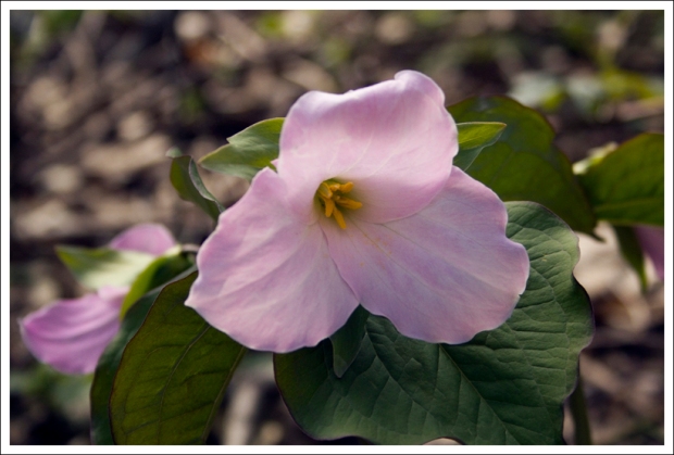
We parked at Milam Gap. The hike started across Skyline Drive on the AT, headed southbound. Almost immediately, the trail began a long, gentle ascent to the summit of Hazeltop Mountain. The AT is so well-worn into the mountain that the path looked like a ribbon of dirt through the bright green of spring grass. On this particular May morning, the trail was abundantly lined with my favorite wildflower – Trillium. They were everywhere with big showy flowers in pink and white. We also saw (and heard) many birds. The prettiest songs came from the eastern towhees. This type of towhee has striking orange, white and black markings, which makes them easy to spot.
After almost two miles of climbing, we reached the high point of the hike on Hazeltop Mountain. There was one nice place to take in the view. It was really windy on the rocky outcropping, but I enjoyed looking out over the spring-green valley. From the viewpoint, we hiked downhill for almost half a mile to reach the junction of the AT and the Laurel Prong Trail.
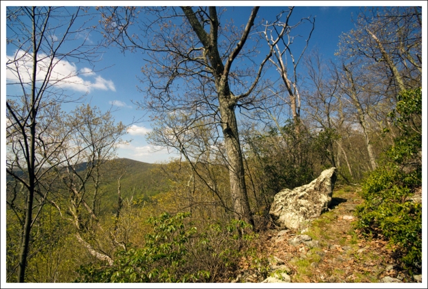
The Laurel Prong trail descends all the way to Camp Hoover. Along the way, you’ll get some obstructed views from the trail, especially when trees are without their leaves. There are lots of rocks and boulders lining the path, especially right at the beginning. The lower parts of the Laurel Prong trail pass through a mix of open forest and mountain laurel thickets. As you approach the low point of the hike, you should begin to hear the sounds of water. Most of the time, streams along this trail will be shallow to non-existent. When we hiked, it was after several days of heavy rain. Single-step crossings became multi-rock hops and in many places the trail was under several inches of rain. It was fun to cross so much water!
At around the 5.25 mile mark, we reached Camp Hoover. It was a great spot to eat lunch, soak in the sunshine and enjoy the sound of rushing water. The camp is built at the headwaters of the Rapidan River, making it an ideal fishing spot. Most of the buildings that made up the camp have been lost to the ravages of time, but several cabins, including the president’s personal residence, have been renovated and preserved and are now open to the public (check park schedules for tour opportunities!).
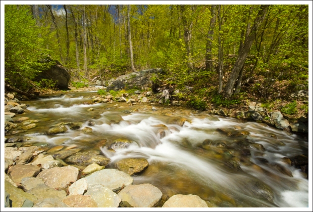
While Adam napped in the sun, I went and did battle with my new carbon fiber tripod. It’s really light and stable, but it’s like an engineering puzzle to get it initially set up! I may have threatened to throw the tripod into the river. I guess I should look at this hike as the tripod’s dress rehearsal. It can prove its true worth on another hike. Besides, it really wasn’t a good day for taking photos of moving water (too sunny), but I think I was able to capture the impressive flow we witnessed on this day. I’ve never seen the streams around Camp Hoover flowing so powerfully! There were rapids and small waterfalls in places I’ve never seen them before. It was beautiful!
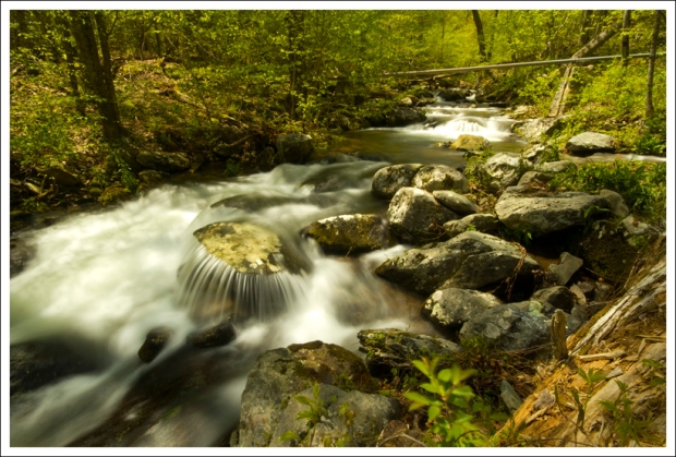
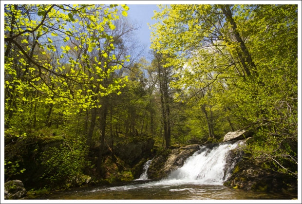
After leaving Camp Hoover, we walked the trail along the Mill Prong. There is one spot where the trail crosses the stream (right below Big Rock Falls). We probably could have rock-hopped if we were careful, but both Adam and I decided to take off our boots and put on our Crocs to wade across the stream. The water came over my knees, which is really high for this spot.
After crossing, we took a few minutes to enjoy Big Rock Falls and then made our way back toward Milam Gap. For much of the way, the trail stayed close to the stream. We had several more stream crossings to complete, but none that required a shoe swap. The last couple miles of the hike went quickly, and we were back at the car by early afternoon.
We were surprised by how few people we ran into on the hike. I would have expected big crowds on a perfect, sunny Mother’s Day, but we really only saw a handful of people – a few backpackers making a short overnight of the loop and a pair of birders at the camp. I suppose we saw a few more people as we hiked back up the Mill Prong trail, but overall the crowds were light.
If I were to recommend a version of this hike – the 4 mile out and back or the 7.3 mile loop, I think I’d probably stick with the shorter version. The longer version is nice, and great if you’re looking to pick up some mileage, but there’s really not a lot to see on the Laurel Prong and it can sometimes be really muddy. The main reasons to hike in this area are Camp Hoover and beautiful stream scenery; and you get both of those on the shorter out-and-back.
Adam Says…
The hike down to the Rapidan Camp is always one of our favorites in Shenandoah National Park. We have taken several groups of people down to this area. When I talk to people about Shenandoah National Park, they have no idea that a Presidential retreat was once here and how this helped to establish a national park in Virginia. This route adds a view to the hike for an extra bonus.
We’ve seen that on Hiking Upward and in our Hiking Shenandoah National Park Falcon Guide the hike was done in the reverse direction that we did the hike. But, our way has less of a continuous elevation climb and it puts Camp Hoover in the last third of the route (save the best for last!). We started off from the Milam Gap parking area and crossed Skyline Drive near the southern entrance to the lot to start on the Appalachian Trail. Heading southbound on the white-blazed AT, we quickly came across the junction with the Mill Prong Trail. This is your return route, so continue to go straight. The trail gradually climbs up a total of 450 feet. You reach a nice viewpoint to the right of the trail around 1.8 miles before you reach the Hazeltop summit in 1.9 miles.
The trail then begins to descend and at 2.6 miles, you reach the junction with the Laurel Prong Trail on the left. Take this blue-blazed trail which continues to descend. At the 3.6 mile, you will pass a junction with the Cat Knob Trail but stay on the Laurel Prong Trail. At 4.9 miles, you reach another junction with the Fork Mountain Trail, but again stay on the Laurel Prong Trail. The trail changes to yellow-blazed at this point, since it is now accessible to horses. At 5.3 miles, you will pass by a fire road on the left and then come up to a side trail for Five Tents. The Five Tents location was where some of the staff would stay at the Rapidan Camp, but there is no longer a building there. Christine took this route, but I stayed straight and we met up shortly at the Rapidan Camp, entering near the Prime Minister’s Cabin.
Upon leaving the Brown House at Rapidan Camp, we caught the trail heading past the Creel Cabin. Crossing the fire road, we picked up the yellow-blazed Mill Prong Trail which gradually ascends most of the way. At 5.5 miles, you will cross Mill Prong (which may require you to wade across the water after heavy rainfall) and reach Big Rock Falls on the other side. At 5.9 miles, you reach a junction with the Mill Prong Horse Trail. Continue straight instead of taking this trail, but the blazes change to blue as it is no longer a horse trail. The trail crosses Mill Prong again and then you will have a gradual climb back up. At 7.3 miles, you reach the Appalachian Trail junction again. Take a right and in a short distance you’ll reach the parking lot.
Last year, I brought a few of my co-workers down to the Rapidan camp for a team-building retreat. I felt that if it was good enough for the President, it should be good enough for us. When we arrived, a volunteer who stayed at the Creel Cabin, gave us a tour of the Brown House, where President Hoover stayed. We learned a lot about Hoover, the problems he faced during his presidency, and his relationship to Franklin D. Roosevelt. After the tour, we did some team-building and communication exercises to learn more about how to work best with each other. While we were in the middle of making some breakthroughs, a small snake fell down off the roof just a few feet from where we were working. One of my co-workers, who is not a hiker by any definition, jumped out of her seat and was constantly looking around for other animals. After we made our way back up, we were talking along the way. I heard some people say, “Adam, look out”. I nearly walked right into a mama bear with three cubs. The family of bears quickly took off up the hill. I had told my co-workers that I’m usually pretty good at finding bears and we may see some. They were thrilled to see the cubs, as a few of them had never seen a bear cub before.
Along with the possibilities of seeing bears, you can usually find this trail to be an excellent trail for birding. The Laurel Prong and Mill Prong trails were filled with beautiful songs as we hiked along. A couple that was hiking near us also recognized the song of a blackburnian warbler.
If you’re up for a longer hike to the Rapidan Camp, I would suggest this route. The views from near Hazeltop summit were expansive, you get to see a nice waterfall, hear the songs of birds, and learn about the history of one of our Presidents and how it helped create a national park in Virginia. This hike does have it all!
Trail Notes
- Distance – 7.5 miles
(Check out the stats from MapMyHike)*
- Elevation Change – 1330 ft
- Difficulty – 3. This hike is not steep or difficult, but some hiking novices might find the 7+ mile distance a little challenging.
- Trail Conditions – 4. The trails were in great shape, despite being underwater in several place. We didn’t see any blowdowns or sloppy areas.
- Waterfalls/streams – 4. Big Rock Falls, the Rapidan River, Mill Prong and Laurel Prong are all lovely and offer lots of water scenery along this hike!
- Wildlife – 4. We didn’t see much on this particular day beyond birds, but we’ve seen lots of deer and bears on past trips.
- Ease to Navigate – 4. Trail directions are clearly marked at junctions with cement markers.
- Solitude – 2. This is a popular hike, both as a day trip and a short overnight loop.
Directions to trailhead:
The hike starts at mile marker 53 on Skyline Drive. Park in the Milam Gap lot, then cross the drive. The trail picks up on the other side of the crosswalk.
* MapMyHike is not necessarily accurate, as the GPS signal fades in and out – but it still provides some fun and interesting information.


Hi, today we did the hike you have recommended. It was a great experience, very nice view, not steep, and I definitely recommend it. Thank you for sharing it. Happy hiking.
LikeLike
Great – so glad you enjoyed it! We hiked a little of that loop today, too! Our route to Bearfence followed Laurel Prong from the AT over to Cat Knob. It was a beautiful day to hike!
LikeLike
Hi, great website you have. Thinking of doing a short overnight on this trail with my wife. Do you know or have you noticed good spots for pitching tents along this route? How far off the trail do you have to go. Getting back into backpacking after decades-long absence and was looking for a route that “has it all”. Thanks!
LikeLike
Hi Tom – there are definitely good places to pitch tents along this route! I remember seeing several established campsites near the river on the Laurel Prong trail. As a matter of fact, this loop is often selected by the PATC as the overnight hike for their Backpacking 101 course. It will be a great short overnight!
LikeLike
I love this hike. I brought my mom on this loop on year for Mother’s Day, and it was absolutely delightful. The azaleas at the summit of Hazeltop were in bloom, the Trillium carpeted the understory, and I found the elusive Showy Orchid along the Laurel Prong trail.
We stopped for lunch at Rapidan Camp. It really is the perfect lunch spot. In fact, on a warm sunny spring day, it’s a great place for a mid-afternoon nap. The camp is so relaxing and serine, I really didn’t want to leave. I can see how President Hoover found solitude at this place.
Thanks for sharing.
LikeLike