
Introductory Guide to Visiting the White Mountains
This moderate 3.2 mile hike in Franconia Notch takes you to a spectacular viewpoint overlooking Kinsman Ridge and the Lakes Region.
View the Full Album of Photos From This Hike


Christine Says…
The day before this hike, we made a quick trip over to Burlington, Vermont. We sampled beers at a couple breweries, stopped at a craft cider maker, toured a chocolate factory, ate lots of good food, enjoyed Lake Champlain, indulged in Ben & Jerry’s, and visited the chapel at Dog Mountain. It was an all-day trip with lots of miles in the car. When we woke up the next morning, we wanted to hike, but we wanted something that wouldn’t require a lot of time in the car. We also knew that thunderstorms were due to pop up starting around lunchtime. So, we chose the nearby and short hike of Mt. Pemigewasset.
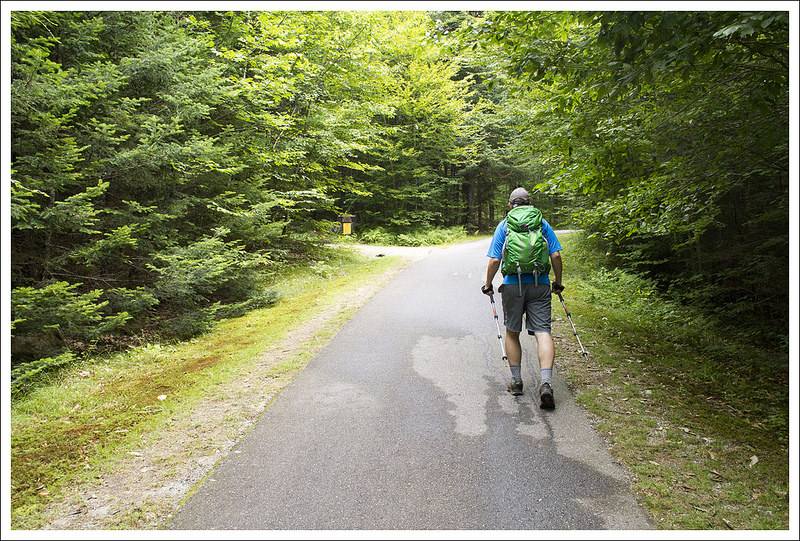
There are two routes up Mt. Pemigewasset (also known as Indian Head because of its distinct, face-like profile). One is the Indian Head Trail which departs from a gravel parking area across from Indian Head Resort. We chose the Mt. Pemigewasset Trail that begins at the northern end of the Flume Gorge parking area.


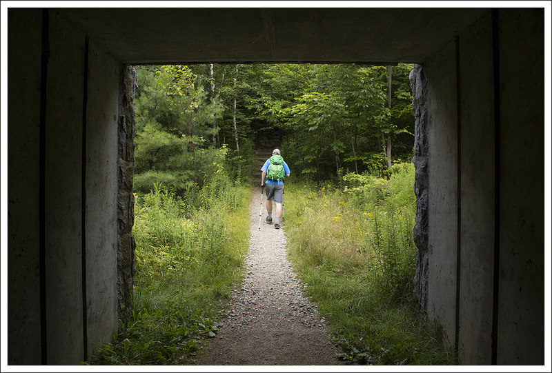
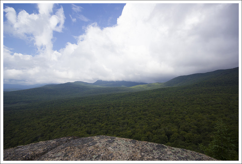
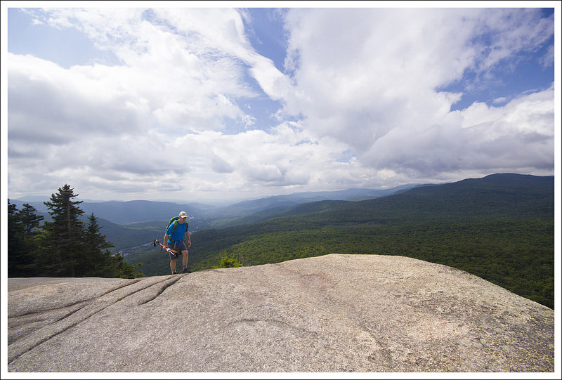
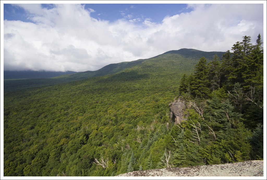
To start the hike, we followed the bike trail for a short distance before turning left onto the official trail. The trail started off relatively flat, and passed through three tunnels – one under Route 3 and two more under I-93. After a couple small stream crossings, the trail climbed steadily but moderately uphill. Like most New Hampshire trails, the way up was rocky and rooty. Near the top, the Indian Head Trail merged with the Mt. Pemigewasset Trail before emptying us out onto a smooth, wide ledge of granite. The drop-offs here are very steep and the granite can be slick/smooth, so take care!
When we reached the summit, it was still fairly early, so we only shared the vista with one other couple. We spent some time enjoying the views through the notch and watching the dramatic clouds swirling over Kinsman ridge. After about 20 minutes, more people started to arrive to the summit, so we made our way down. We were back at the car before noon. Since it was so early in the day, we decided to get some lunch at White Mountain Bagel Co. (great deli sandwiches) and see a matinee of Guardians of the Galaxy. While we were at lunch, a pressing cold front passed and it started *pouring*! The cold front was a welcome change, as it brought a forecast of clear, pleasant days – perfect for tackling bigger things! After a nice low-key day on Pemigewasset, we were definitely feeling ready to tackle some above-treeline Presidentials! Stay tuned!

Adam Says…
The names of places in New England (and particularly New Hampshire) always fascinate me. A lot of Native American names are used for mountains, towns, and rivers which leads to a lot of mispronunciations. Mt. Pemigewasset is named after the nearby river, the Pemigewasset River. It is an Abenaki word meaning “where entering current is”. A common joking name you hear is the “Pemi-gee-whats-it”, but many people don’t even attempt to try and pronounce it and just call it “The Pemi” for short.
The hike started at the northern end of the Flume Gorge parking area. You walk on the designated bike path for 150 yards and then you see the trailhead to the left. Take this and you will walk over fairly flat land as you go through three tunnels that go under US-3 and I-93. After the last tunnel, you begin your climb up the trail. Most of the trail is typical of the terrain in New Hampshire, with some rocky steps and roots to navigate. The overall terrain wasn’t too steep, but it is a constant uphill climb. At 1.7 miles, you reach a junction with the Indian Head Trail. Continue to the left and you gain the summit in another .1 mile.

The summit is a huge rock outcropping that allows for views of other mountains, including Mt. Lafayette, Mt. Lincoln, the Tripyramids, and Mt. Moosilauke. The edge of the rock is a sheer cliff face, so be careful if you are approaching the edge, especially when it is wet.
Mt. Pemigewasset is a hike that should be possible for most people if you take your time. It is definitely easier than most of the hiking we have done in the White Mountains. One thing that played into our decision to do this hike was that we saw high clouds in the Presidential range. We felt this mountain, lower in elevation, would allow for some views down below and we predicted correctly. We were also able to do this hike fairly quickly based on the short distance and were back in our car before lunchtime.
Trail Notes
- Distance – 3.2 miles
MapMyHike Stats * - Elevation Change – 1350 feet
- Difficulty – 2.5. The climbing is steady, but easy to moderate.
- Trail Conditions – 3. There are rocks and roots, but generally this trail is easily walkable and in nice condition.
- Views – 4.5. Beautiful views, but not quite full panoramic.
- Waterfalls/streams – 1. There are several small streams to cross.
- Wildlife – 2. We heard a lot of birds and saw several red squirrels.
- Ease to Navigate – 4. The trail is easy to follow. The only place to go wrong would be turning onto the Indian Head Trail.
- Solitude – 1. Because of its location, length, and moderate challenge, this trail is very popular.
Download a trail map (PDF)
Directions to trailhead: From I-93: Take Exit 34A for Franconia Notch State Park. The trailhead is begins from the northernmost point of the parking area.
* MapMyHike is not necessarily accurate, as the GPS signal fades in and out – but it still provides some fun and interesting information.

This was the first mountain I hiked in the Whites! It was on my honeymoon. It had rained on and off all week, but the day we climbed was beautiful. 🙂 It was my dog’s, Sidekick Pauli’s first big mountain hike too! She was about a year old and had a lot to learn about being a trail dog!!
LikeLike
Pemigewasset is such a great introductory hike in the Whites! Thanks for the visit.
LikeLike