
Introductory Guide to Visiting the White Mountains
This 5.6 mile route to Zealand Falls is one of the easiest hikes we’ve done in New Hampshire. Most of the footing is smooth, soft, and flat! It was a real treat after climbing Pierce and Madison.
View the Full Album of Photos From This Hike

Christine Says…
The hike to Zealand Falls is doubtlessly the easiest ‘hut hike’ in the White Mountains. The elevation gain is barely discernible until the last couple tenths of a mile. The route offers mountain views, waterfalls, stream scenery, and lovely ponds. Guidebooks say it’s a great place to bird-watch and spot a moose (though I have my doubts about the actual likelihood of seeing a moose!)
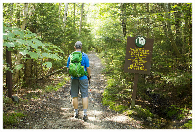
The hike starts out at a parking area at the end of Zealand Road. It’s a fee area, so make sure you bring cash to pay at the self-service parking station.
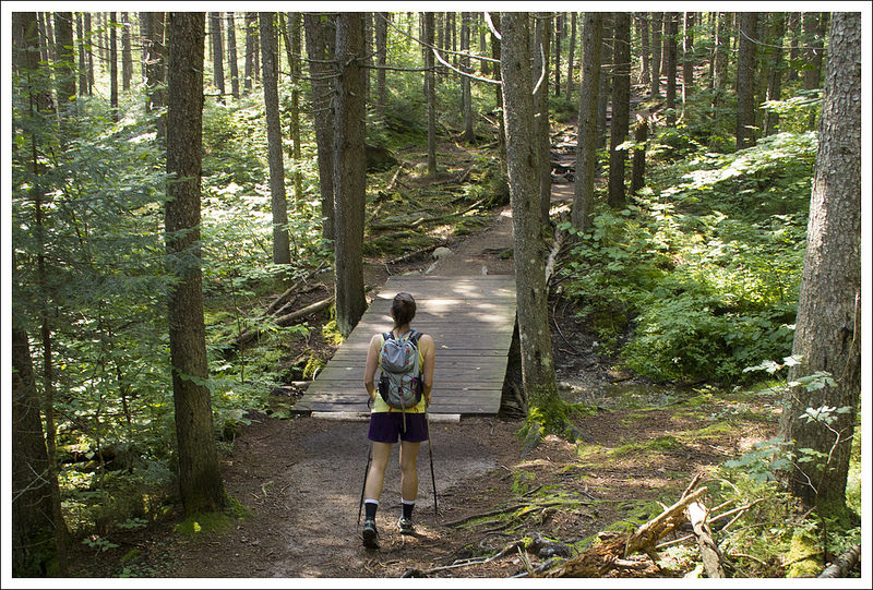
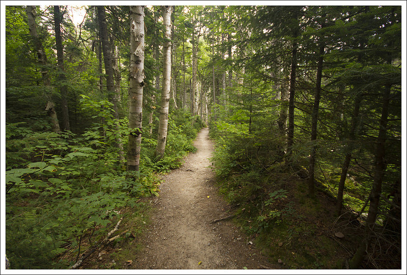
We made our way along the trail, marveling at how smooth and soft the footing felt. There were certainly some spots with roots and rocks, but generally the trail was level and covered with a bed of pine needles. We could hear the Zealand River, but didn’t reach a close view of the water until .8 miles into the hike. When we hiked (early August), the water was low, clear and running quietly along. Almost all of the water crossings we encountered on this trail were assisted by wooden footbridges – no wading and very little rock hopping necessary!

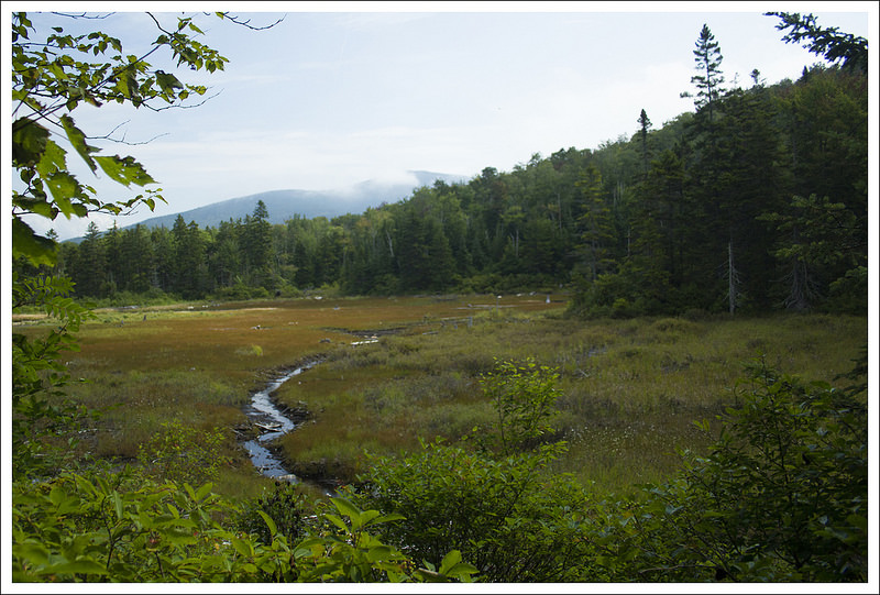


As we walked along, the terrain became marshier. At about 1.8 miles in we passed a lovely beaver pond. We could see the dam from the trail, but didn’t see any beavers. The reflections of trees and mountains in the water were especially beautiful! With all the wetlands, I expected biting flies, mosquitoes and gnats to be a major issue, but we didn’t have any trouble at all. Maybe there was just enough of a breeze to keep the bugs at bay.
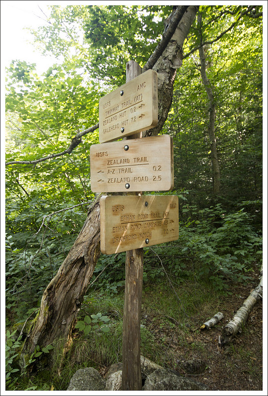
At 2.3 miles we passed the junction with the A-Z trail, where we continued on the Zealand Trail. A couple tenths of a mile later, we passed Zealand Pond and reached the junction with the Twinway (which is also the Appalachian Trail in this area) and Etlan Pond Trails. The last couple tenths of a mile to the hut follow the Twinway Trail.
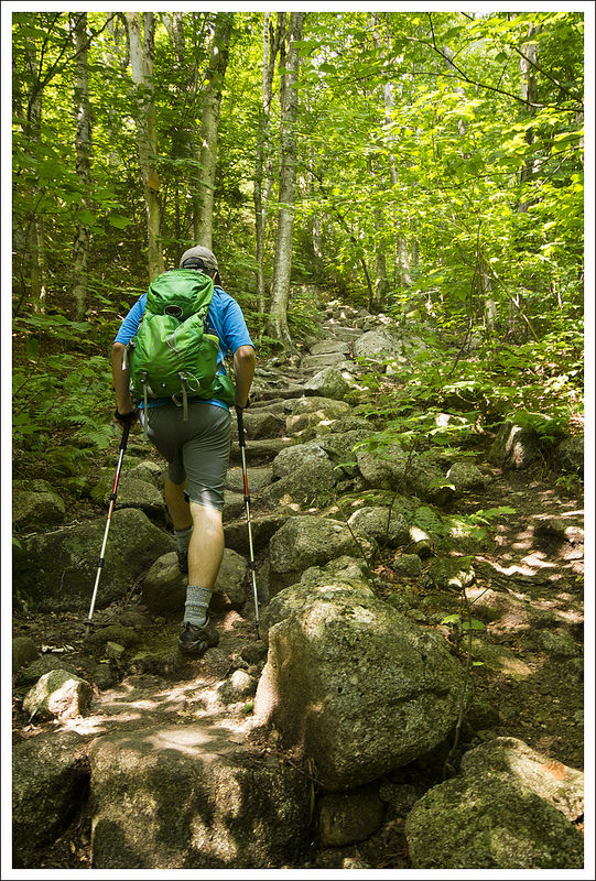
Almost immediately after the junction, we reached the bottom of Zealand Falls. The water was running low, but it was still beautiful. There are two places to stop and admire the falls on the way up. The first stop is a view of the gradual, slide-like lower falls. The view of the upper falls is a bit more dramatic. The rocks around the falls are blocky and reddish-orange in color. The water comes plunging steeply over a cliff-side. The last tenth of a mile up to the hut is steep and rocky – honestly, it’s the only challenging part of the hike.


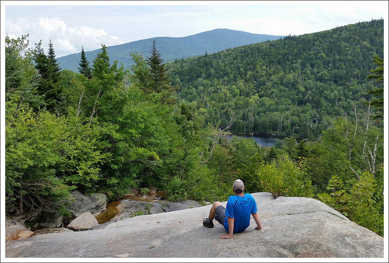
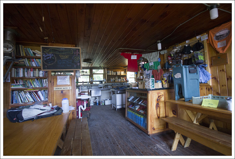
Zealand Falls Hut enjoys a lofty perch looking out across two notches. You can see the Bonds and Mt. Carrigain. There’s even a bench available for anyone who wants a nice seat to enjoy the view. We spent some time poking around the hut. The Croo had just made cinnamon rolls and purple frosted blueberry cake, but we weren’t quite ready for a snack. Instead, we decided to take the little side trail to the ledges of Whitewall Brook. It’s just a 25-30 foot walk through the trees. The brook passes over immense slabs of rock. It’s a nice place to sit, soak in the sun, and enjoy the view of the pond below and distant mountains beyond.
After spending some time enjoying the hut, we returned the way we came. The walk back was all downhill, so we made quick work of it. I would highly recommend Zealand Falls to anyone looking for a low-key hike without much climbing. In fact, we gave it such glowing reviews that my parents tried the hike a few weeks later. They enjoyed it and felt it was very approachable for hikers of any level.
Adam Says…
When we go about trying to cover a lot of hiking mileage on our vacation trips, we like to alternate some easier hikes with the tougher ones. Since we had just climbed Mt. Madison, our feet and joints were happy that we chose this easier leg-stretcher.
Christine and I do like to hike with goals in mind. Since we have climbed a few of the 4000-footers in New Hampshire (there are 48), we have thought about possibly trying to bag all of those peaks. Last year on our visit, I picked up AMC’s Passport to AMC’s High Huts in the White Mountains. That book describes each of AMC’s huts through the White Mountains and details the history, features, and interesting stories about each of the huts. It also serves as a passport that you can have stamped at each location to mark that you have been there (you can even earn a patch when you’ve visited them all). This was definitely enough of an incentive to try and reach all the huts.


As Christine mentioned, this trail had nice footing compared to what we were used to in the White Mountains. The trail was fairly smooth as it started through the woods mixed with pine and birch. The trail eventually opened up into some great views over marshy ponds. There was a large boardwalk to walk across that I thought would be a perfect vantage point for spotting a moose. There were such nice views over the dammed-up ponds and it reminded me that we were in a state filled with lots of lakes, ponds, and streams. We took a while to enjoy the scenery around us. The trail continued to give us lots of similar views and short step-offs to pond views. The trail eventually goes back into the woods as you get closer to Zealand Falls Hut.
At 2.3 miles, we reached the junction with the A-Z trail, which I came to realize after looking at our map that it connects the Avalon and Zealand trail, hence the A-Z name. At 2.5 miles, we reached a short side trail to check out Zealand Falls. The falls here were a nice place to get sidetracked. We crossed a few rocks and enjoyed climbing around the rocks at the base of the falls. Looking up towards the top of the fall is where this hike ends, but you should stick to the trail rather than trying to climb up the falls.
We continued our last piece of the hike, which was a steep and rocky .2 miles until we reached the Zealand Falls Hut at 2.8 miles. There were a few day-hikers at the hut, recounting tales of all the places they had visited around the world. We decided to take the short trail from the hut to the streambed of Whitewall Brook, which is the top of the falls we had seen below. Christine got a lot of pictures while I walked around climbing on some of the rocks and collecting a few blueberries from the nearby bushes. We then found a picturesque spot on the large rocks to take in the view of mountains ahead and the waterways below.


We stopped back in to the hut to talk to the Croo members who were cleaning up breakfast and starting to prepare some food for lunch. I know they have some busy days, preparing meals, cleaning the hut, and transporting supplies on their backs to and from the hut. I talked to one of the members about how this hut was so much easier to reach than most of the others we had seen. I wondered if there was a selection process that was made to match up Croo members to the huts or if they even had a choice. It seems like maintaining this hut and transporting supplies would be made for those that wanted or needed an easier experience. We made our way back to our car the same way we came up.
I would recommend this hike to anyone that would like to see what one of the AMC huts looks like. It is the easiest one to reach, so people of most abilities should be able to attain the top. This is one I could see us doing many times in the future due to the ease and the serenity that the scenery of the marshes and waterfall evokes.
Trail Notes
- Distance – 5.6 miles
MapMyHike Stats * - Elevation Change – 650 feet
- Difficulty – 2. This is a pleasant, easy walk until the last couple tenths of a mile. The last push to hut is short but steep.
- Trail Conditions – 4. The trail is so nicely built and easy to walk. Most of the water crossings and marshy areas are traversed by sturdy bridges and boardwalks.
- Views –3.5. Views from the hut and Whitewall Brook are nice, as are several views across the wetlands, but generally the views here are less dramatic than other spots in the White Mountains.
- Waterfalls/streams – 4.5. The river, pond, wetlands, brook and waterfalls are all lovely!
- Wildlife – 3. It’s supposed to be a nice area to spot wildlife, but we just saw birds and squirrels.
- Ease to Navigate – 4. Trail junctions are clearly marked and easy to follow.
- Solitude – 3. We saw relatively few people, but we hiked on a weekday in August. I think this is generally a popular trail.
Download a trail map (PDF)
Directions to trailhead: From I-93: Take Exit 35 for Twin Mountain. Follow 3N for 10.4 miles. Turn right onto 302E for 2.2 miles. Turn right onto Zealand Rd. and drive about four miles. The road will turn to gravel. The parking area is at the dead end of the road. There is a $3/day fee to park at the trailhead.
* MapMyHike is not necessarily accurate, as the GPS signal fades in and out – but it still provides some fun and interesting information.
