Spruce Knob – Seneca Creek (WV)

This 16.5 mile overnight backpacking trip has cooler temperatures in the summer, beautiful streams and waterfalls, high mountain meadows, abundant berry bushes, and even an old plane wreck to explore. It’s a great change of pace from hiking the Appalachian Trail.

View the Full Album of Photos From This Hike

Hiking Along the Huckleberry Trail
The high meadows along this hike were beautiful! Below: Backpacks in the car; Everyone checks out the information at the trailhead; Suzanne picks ripe blueberries along the Huckleberry Trail; The Huckleberry Trail passes through several small meadows; Spruce-shaded areas on the Huckleberry Trail; Signage along the way.

Backpacks in the Car Getting Started Blueberry Picking
Views from the Huckleberry Trail Spruce Trees in the Sun Trail Sign

Day One…

Initially, we  planned on doing very little hiking in July this year.  Our goal was to stay out of the heat and to rest up a bit so we wouldn’t overdo things before we tackle our trip to New Hampshire later this summer.  But the weather was too nice and we had lots of invitations to go hiking.  Over the 4th of July weekend, our friends Anthony and Suzanne suggested we go on a backpacking trip together.  We always enjoy hiking with them, so plans were made to hike in the Spruce Knob area.  This was actually the second 4th of July weekend we’ve spent on the trail with Anthony and Suzanne.  A couple years ago, we did a trip to Dolly Sods.

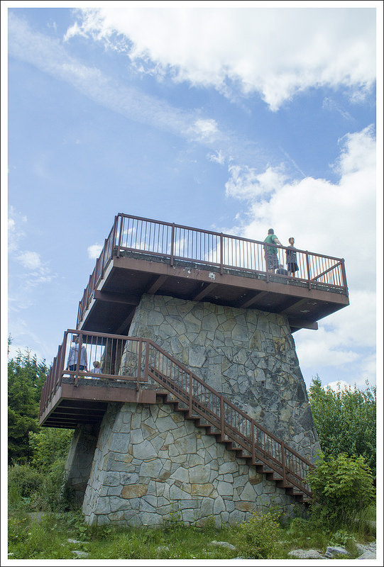
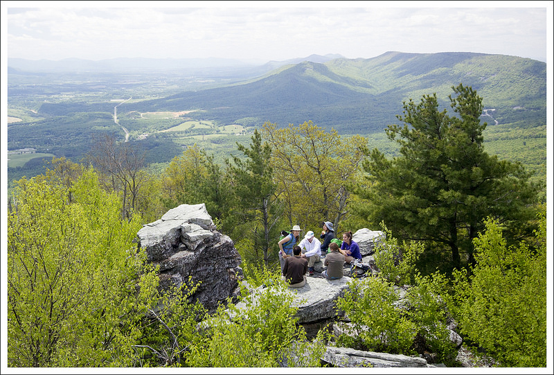
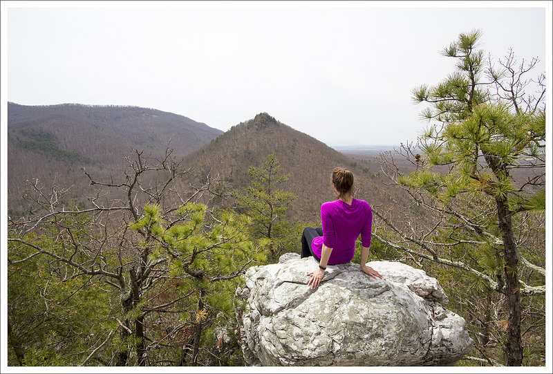
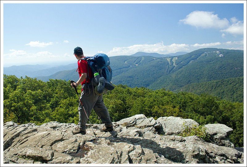
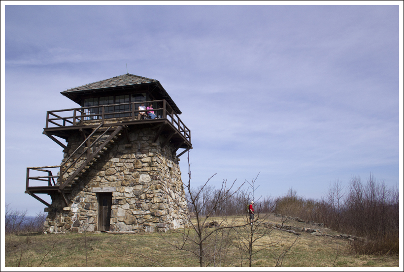
Our friends came down and spent the night before the trip at our house. We divided up some group gear and then packed the car and headed out fairly early to start our trip.  We arrived at the trailhead mid-morning.  We saw the short trail to the Spruce Knob summit fire tower, but we decided to visit that at the end of the loop the next day to feel like we had truly earned it.  Spruce Knob is the highest peak in West Virginia.

The printed maps we have found of this area are fairly outdated and online maps also don’t have the trails completely accurate.  The best map I have found of the entire area has been from Mid-Atlantic Hikes and it may be helpful to bring that along since there are lots of trail options here.

Descending to Junction
Adam descends to our junction with the Lumberjack Trail. Below:  Anthony makes his way along the Lumberjack Trail.  The trail has a reputation of being sloppy/muddy, but it wasn’t too bad when we visited; Someone moved a piece of the plane from the wreck site up to the trail – probably to mark the spot; Even after 4+ decades on the mountainside, the plane wreck is still mostly intact.

Walking the Lumberjack Trail Plane Window Fuselage
Mud Nettles First Large Meadow

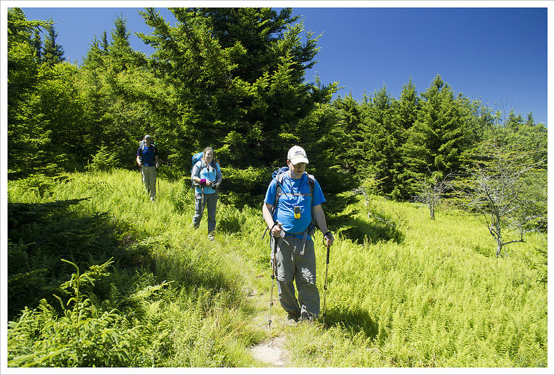
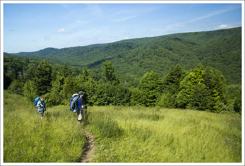
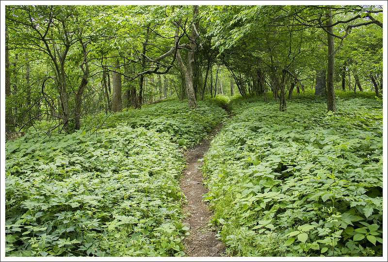
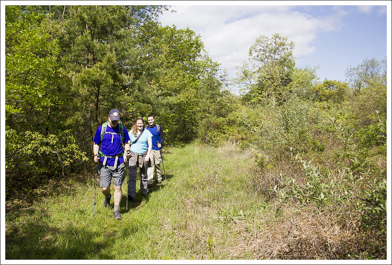
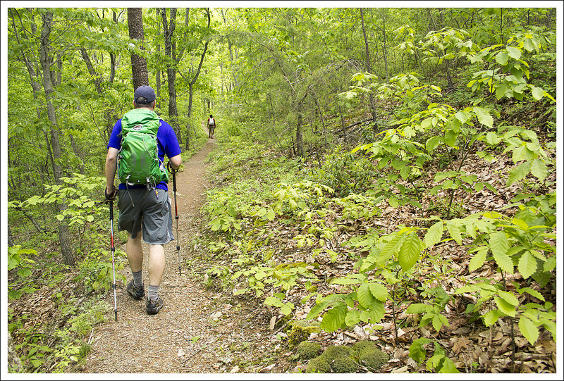
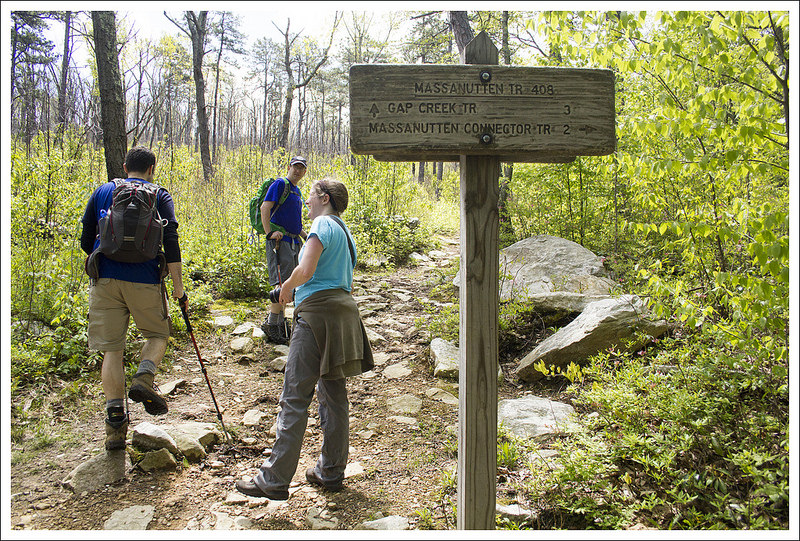
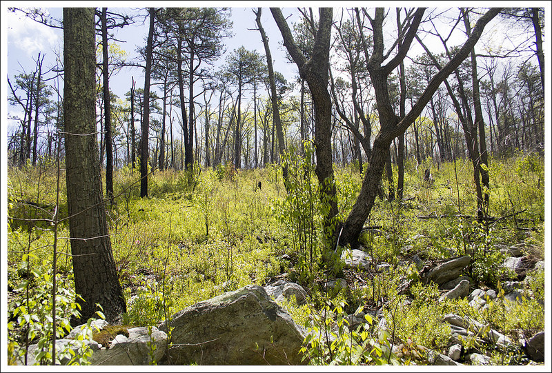
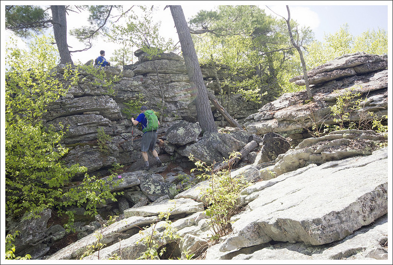
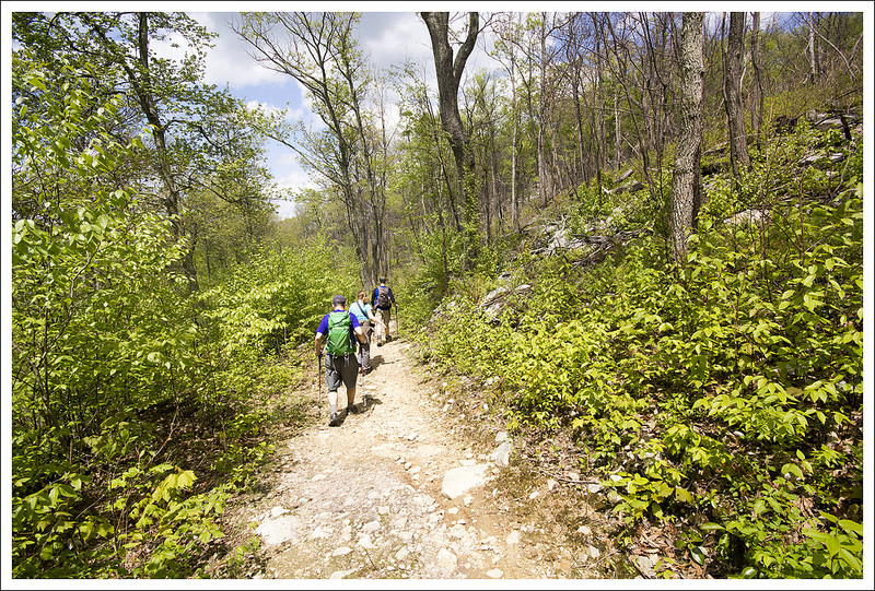
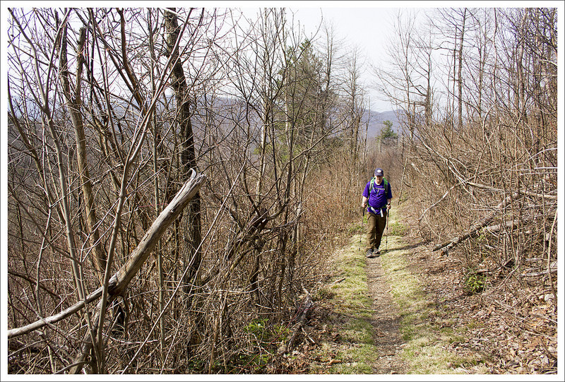
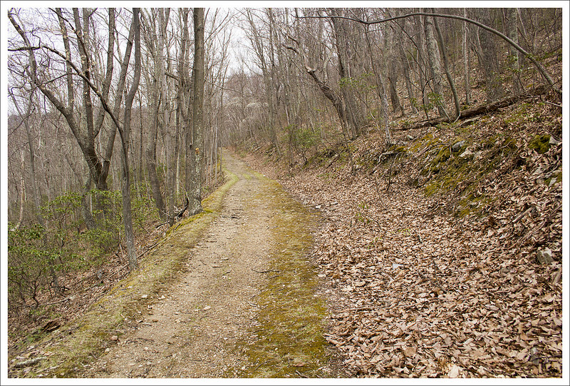
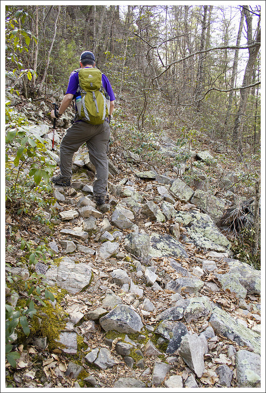
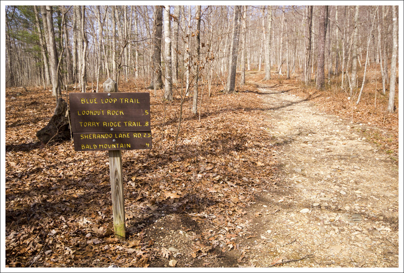
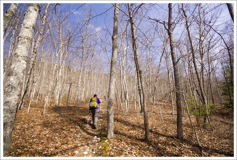
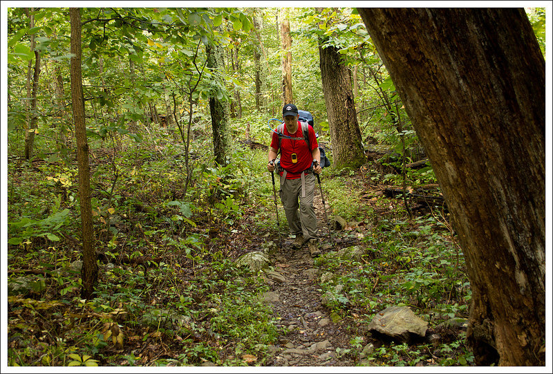
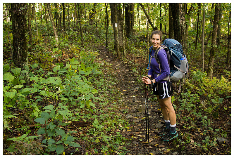
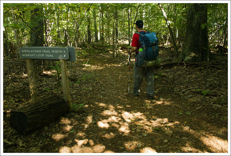
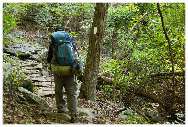
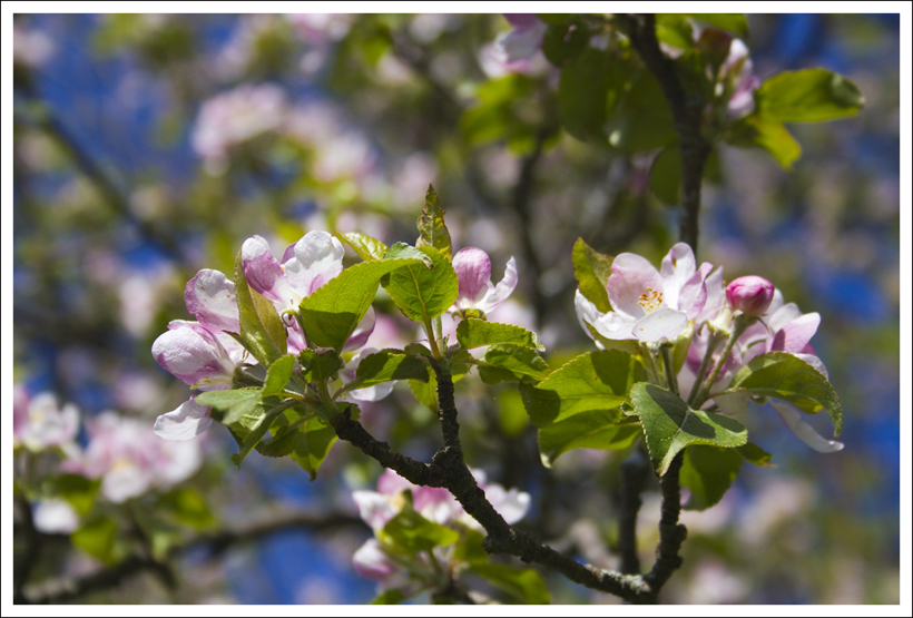
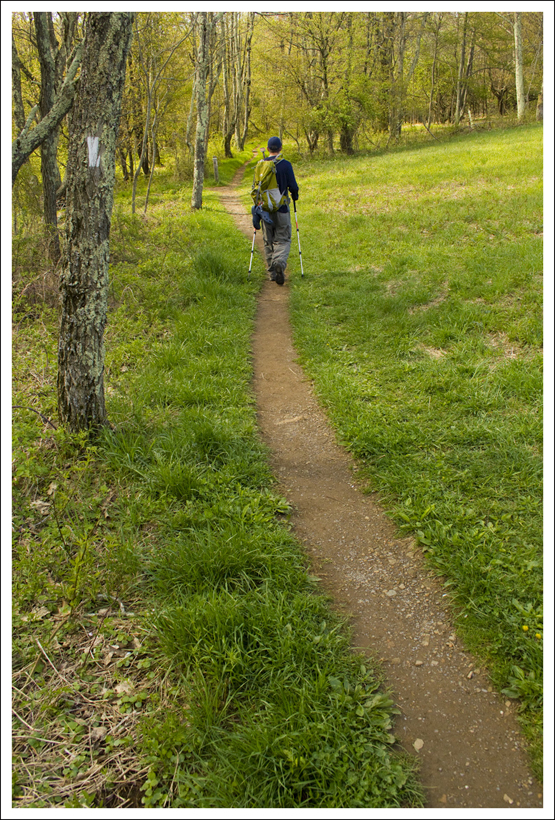
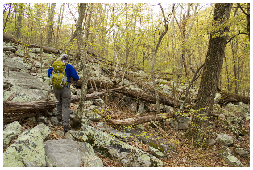
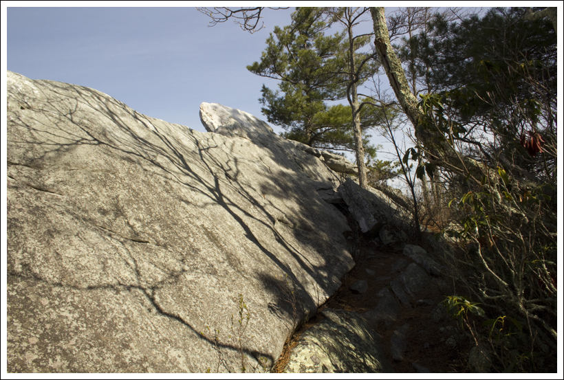
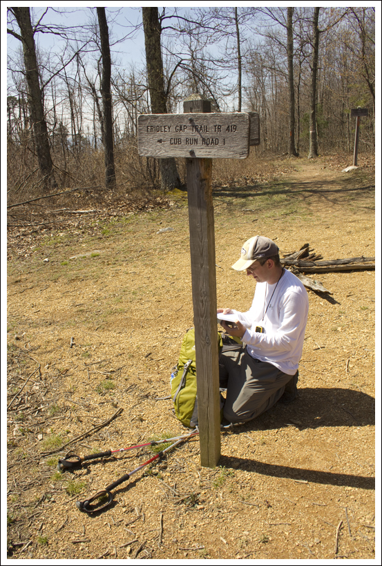
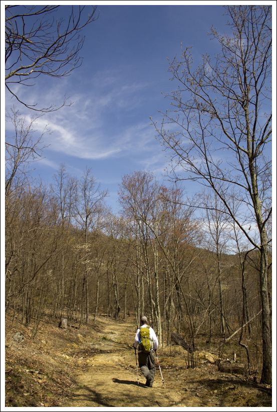
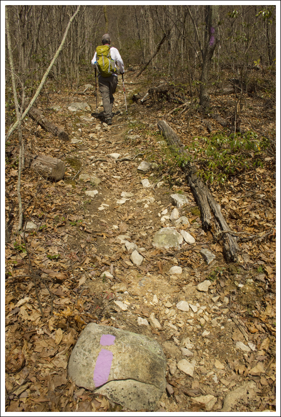
We started off our first day of the hike on the Huckleberry Trail (TR533).  The trail starts off with a little bit of crushed gravel on the trail, but that goes away in a short distance.  This first section of the trail was fairly flat or downhill and alternates from going from dense Spruce forests to more open fields. There are numerous dry campsites along the trail. In the fields, we found tons of blueberries that were just starting to ripen.  We stopped along the way for a few handfuls before pressing on.  At 3.4 miles, you will reach a campsite and a sign that points to the trail going right.  Follow this trail and in another short distance, you’ll come to another sign pointing you to go left as the trail winds around a dense forest area.  You’ll soon reach another sign that shows that the Lumberjack Trail is .4 miles away.  The last .4 miles of the Huckleberry trail drops rather steeply to the large trail junction at 4.7 miles.  Take a right at this junction to join the Lumberjack Trail (TR534).

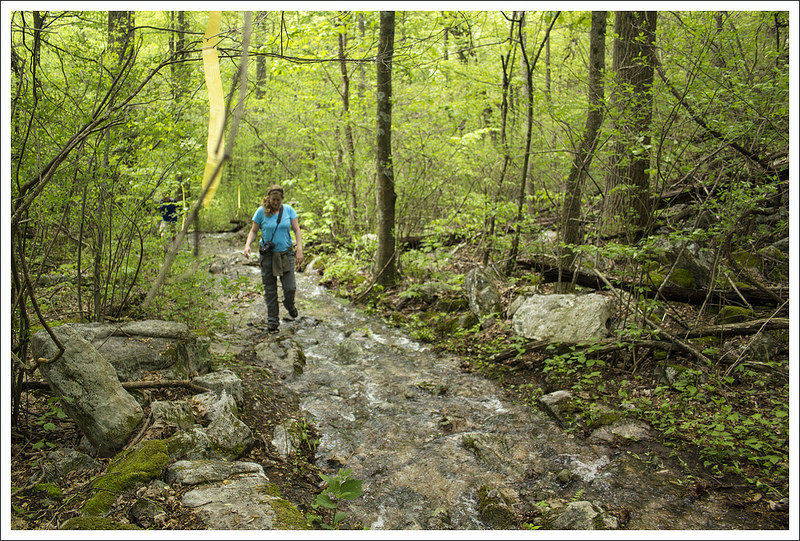
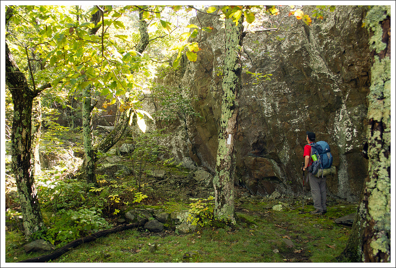
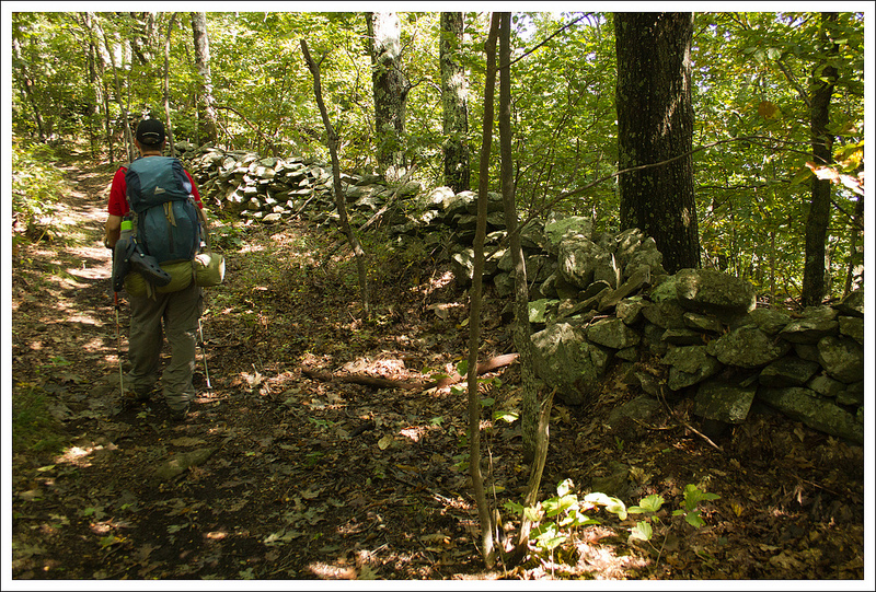
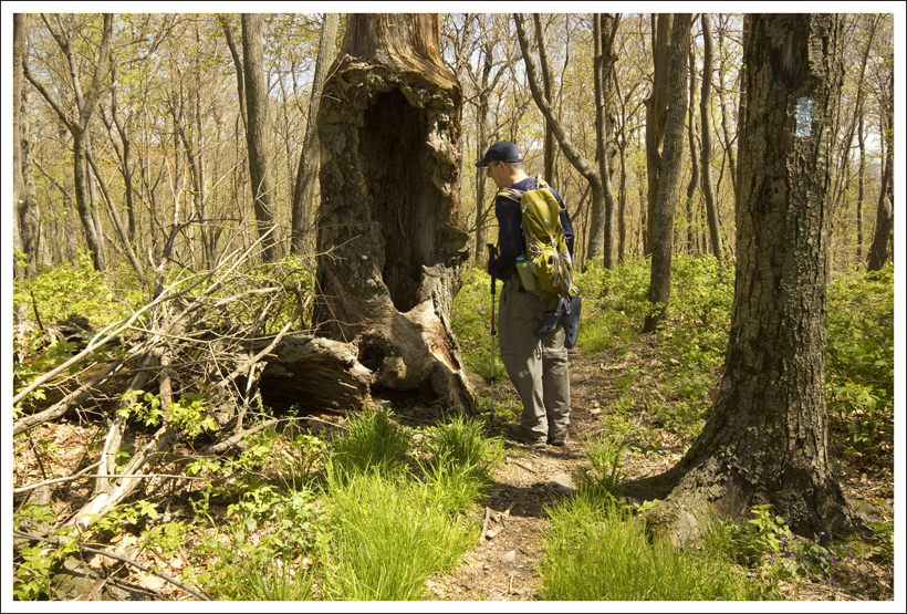
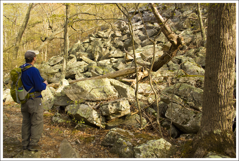
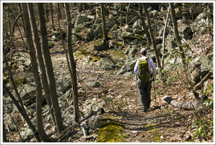
The Lumberjack Trail is a relatively flat trail.  We were warned that it can be very muddy and wet, but we found that even after some recent heavy rains there were only a few 20-foot sections that had mud to slog through.  Most of the trail had rocks or logs placed that saved us from having to get our shoes wet or muddy.  Around mile 5.8, we saw a plane door hung on a tree and a short, yet steep trail that led down to plane wreckage (a Piper PA-23 that crashed here in 1973 with two casualties).  Be respectful if you decide to visit this site.  We stayed on the Lumberjack Trail until it came to a junction with the High Meadows Trail at mile 6.7.  Take a left to join the High Meadows Trail (TR564).

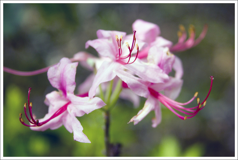
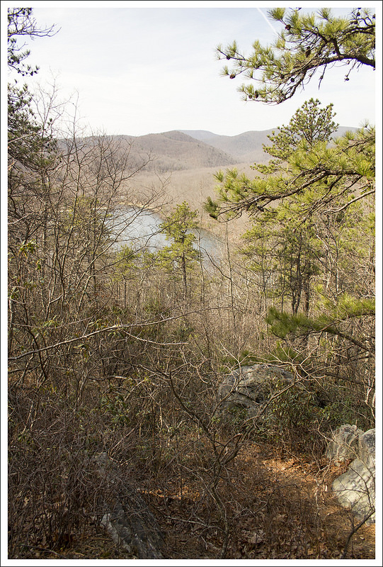
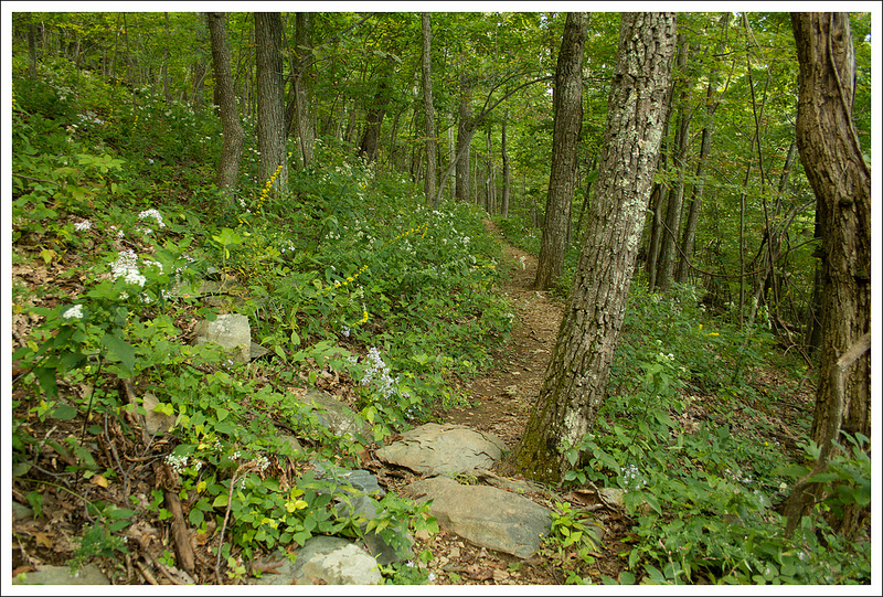
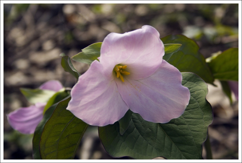
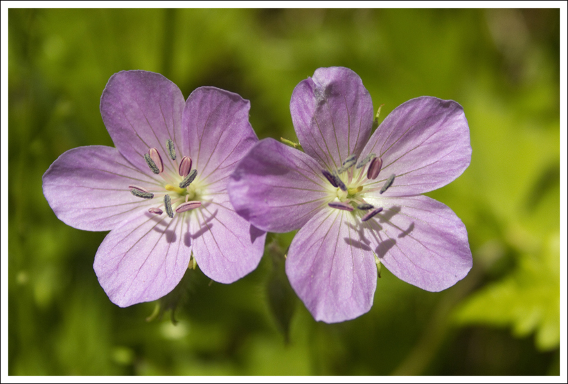
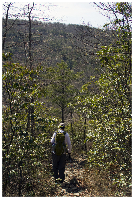
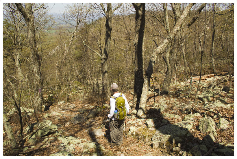
The High Meadows Trail was the most overgrown trail we came across.  There were times that it felt like we were bushwhacking.  There are stinging nettles everywhere along the trail and grass was up to our knees in some portions.  The High Meadows Trail also has alternating landscapes; you will go from dense forests to large open meadows several times.  Keep an eye out for blue blazes on posts or trees as you navigate through these high grass areas.  The trail descended through these gorgeous meadows and it is not surprising that we were thinking of the Sound of Music when we were walking through these fields surrounded by mountains.

High Meadows
The high meadows on this hike were so beautiful!  Below: Adam admires the high meadows; Grass in the meadows was tall;  There were several meadows separated by short sections of shade;  Most of the shady spots were densely overgrown with berry brambles; Black-eyed susans; Adam crosses out of the final meadow.

Adam in Meadow Meadow Walking Shade Between Meadows
Overgrown Susans Leaving the Meadows

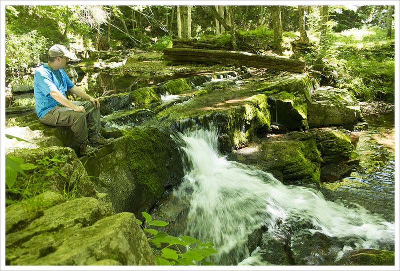
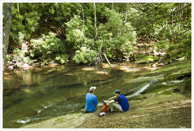
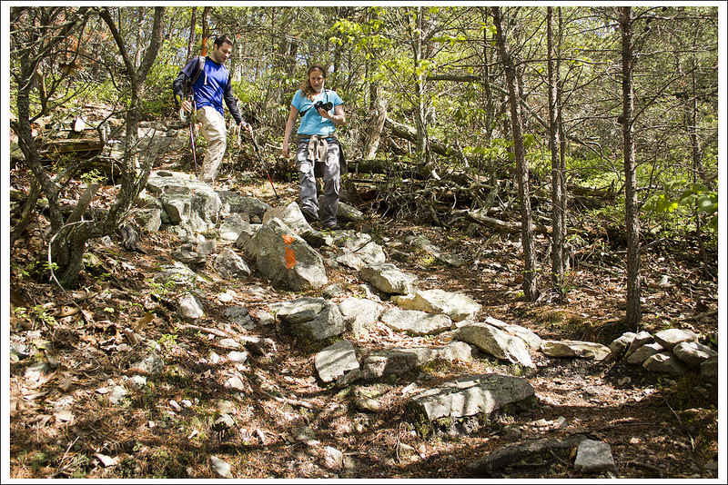
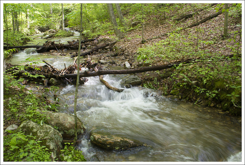
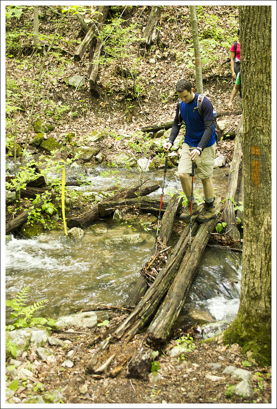
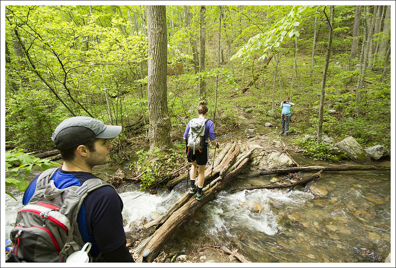
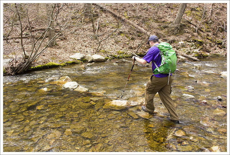
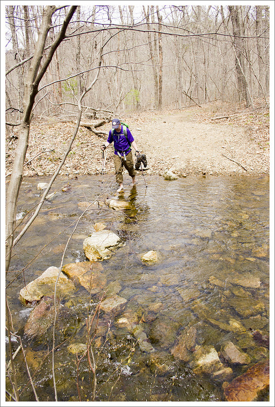
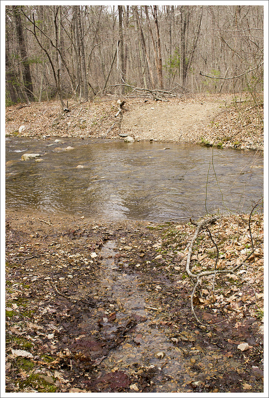
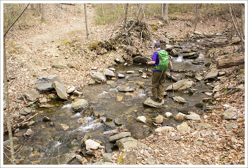
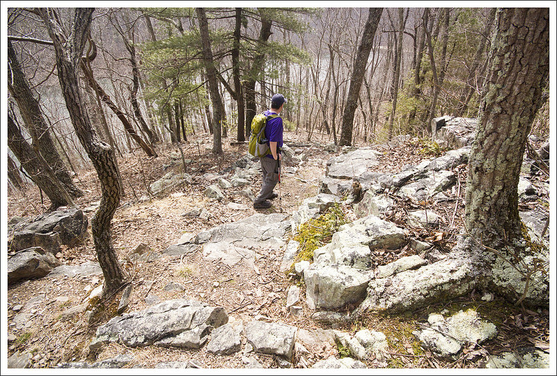
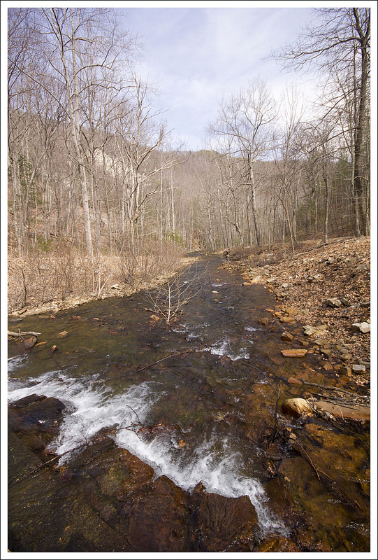
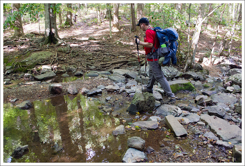
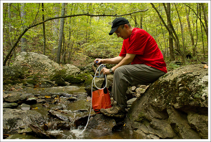
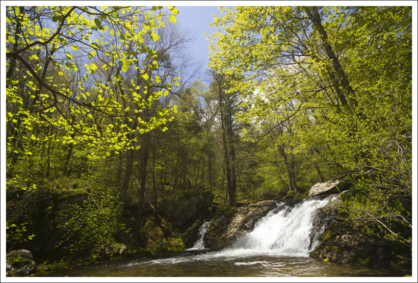
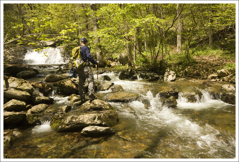
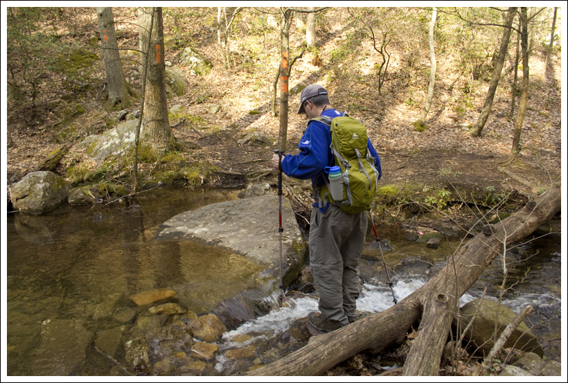
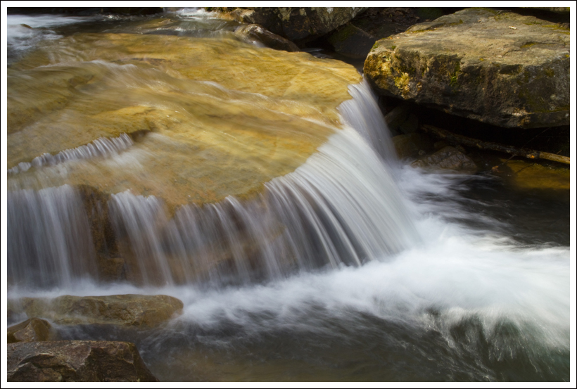
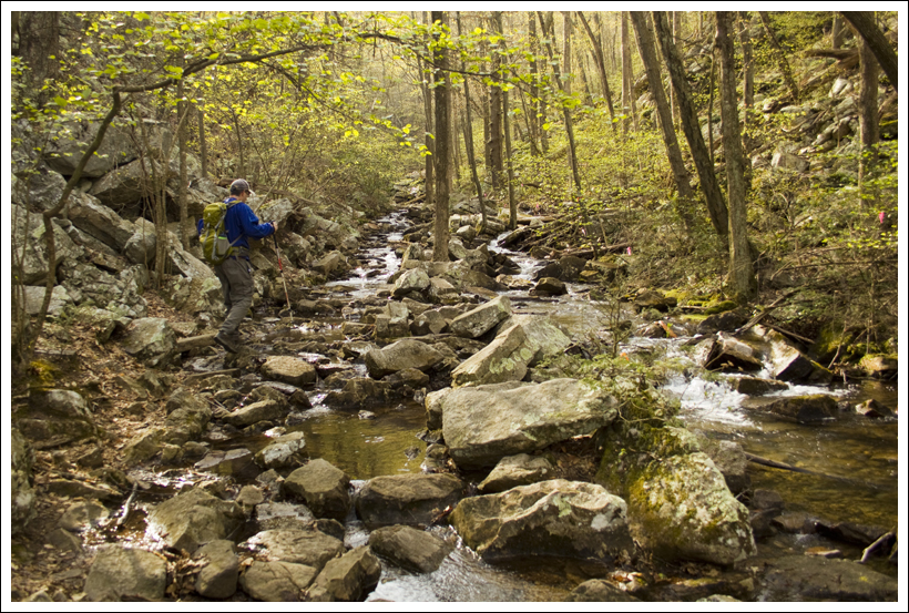
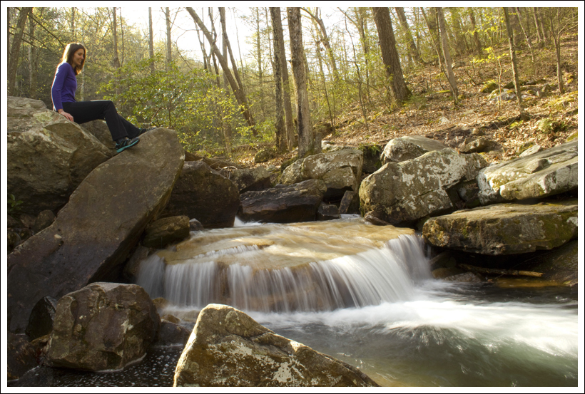
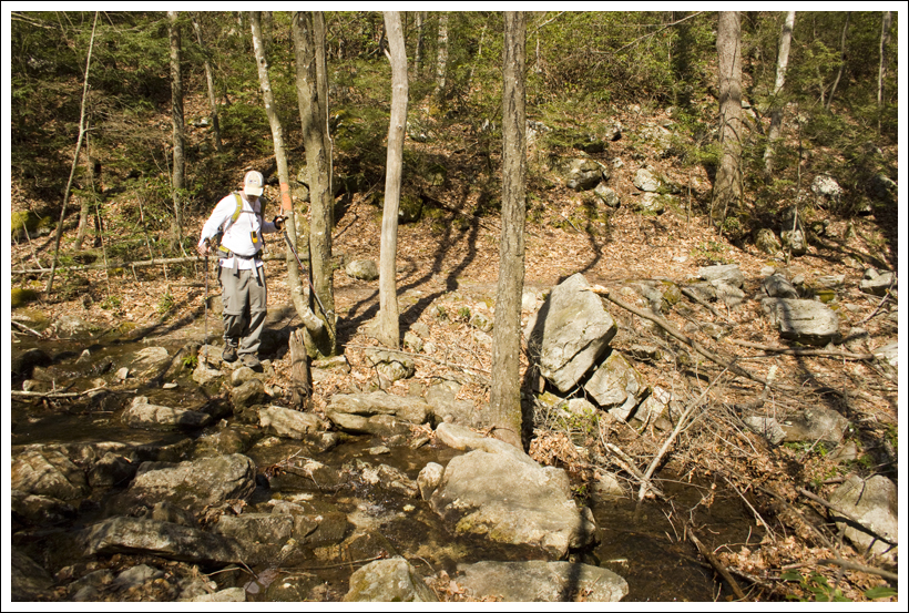
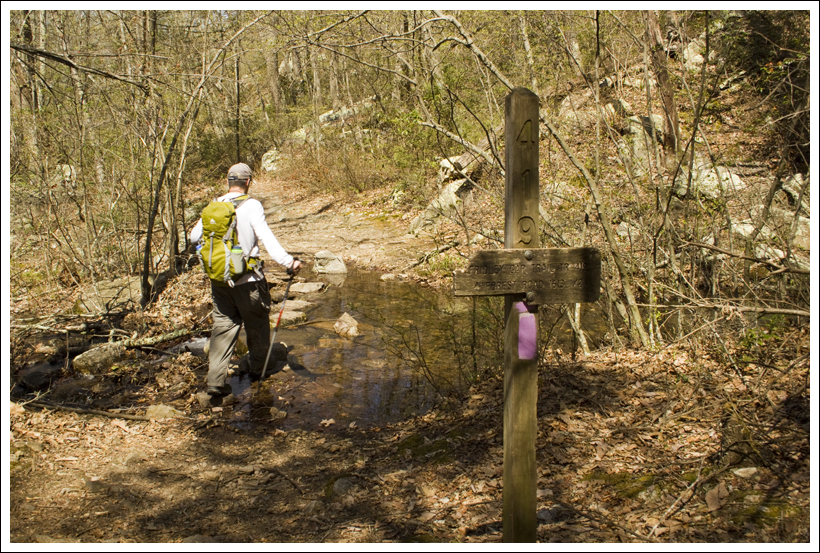
Eventually, you will enter into the woods again and cross a small creek.  At 8.6 miles, you will reach another trail junction. Take a right here and you will descend even more as you make your way through a scenic forest landscape.  You will soon hear water flowing from Seneca Creek below you.  The trail crosses the creek and comes to a junction with the Seneca Creek Trail at 9.1 miles.   At this point, you will cross Seneca Creek to reach the trail on the other side.  The water was flowing to make a nice small waterfall.  Before we crossed, we ventured just a short distance (about 75 yards) to the right down the Seneca Creek Trail and came across one of the most beautiful waterfalls/swimming holes I’ve seen – Seneca Falls.  We dropped our bags on the trail and scrambled down to reach the base of the falls.  There was a large cavernous rock overhang to the right of the falls.  In the water, we could see brook trout swimming around, occasionally breaching the water to catch flies that were dancing along the water surface.  Once we climbed back up from the basin, another group came down to the falls jumped into the swimming hole at the base of the falls.  From the screams when they jumped in, we could tell the water was extremely cold.  We made our way back to our original junction and then determined the best place to cross the creek was at the very top of the small waterfall.  We all made it across safely.

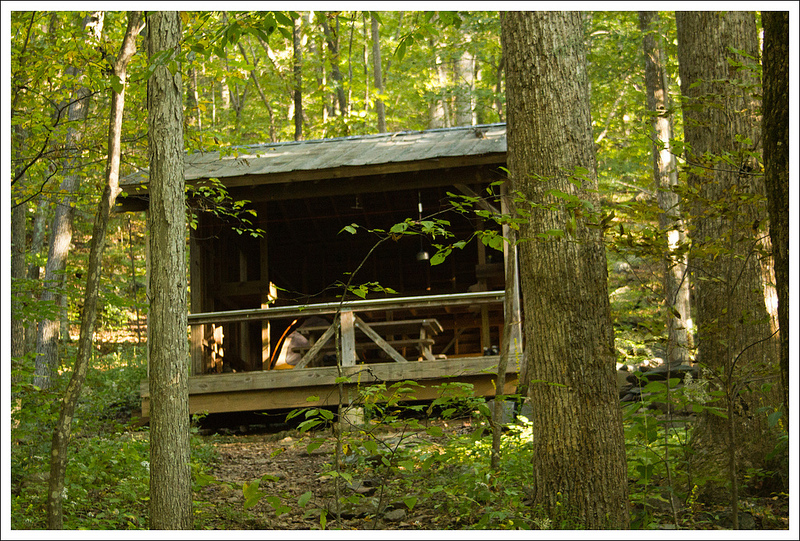
Christine hit a wall with her energy level, so we stopped a few minutes to eat a snack on the opposite side of the creek at a nice campsite.  Knowing we still had a distance to go, we pressed on further.  The Seneca Creek Trail went to the side of Seneca Creek for the entire way.  We crossed the creek in a couple of places.  Around mile 10.4, we began to see a ton of campsites.  We were surprised to see that there were so many people that were camped here overnight.  When we kept passing people on the trail, we felt that we would have our picks of campsites, but we didn’t realize how many people come here a different way (mostly from the lower Spruce Knob parking lot and taking the Seneca Creek Trail to these campsites).  Anthony and Suzanne hurried ahead, while I waited a while for Christine to try and regain her strength.

Seneca Falls
Seneca Falls is an impressive waterfall with an emerald green plunge pool. Below: Leaving the high meadows for Seneca Creek; A small waterfall above Seneca Falls; A side view of the falls; The trickiest of the stream crossings; Pretty wildflower; Lovely Seneca Creek.

Start of the Seneca Creek Trail Small Waterfall Seneca Falls
Crossing Wildflower Seneca Creek

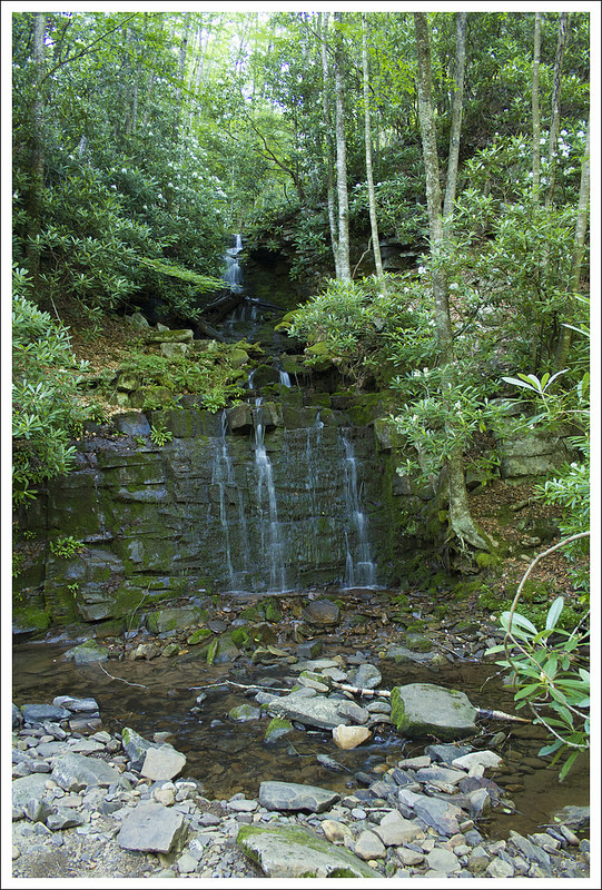
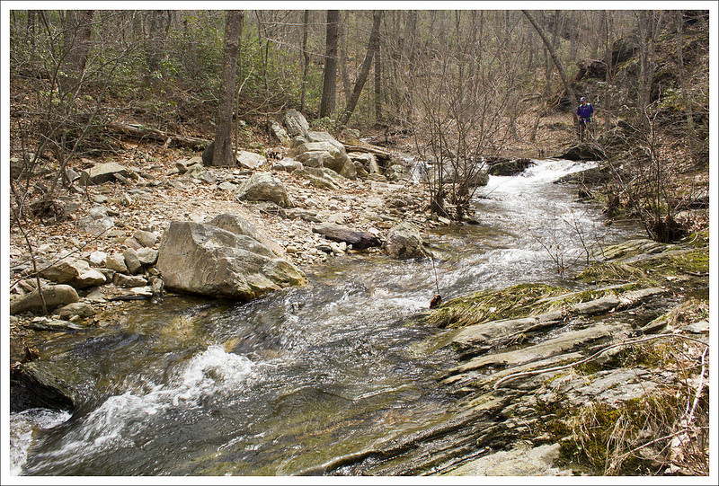
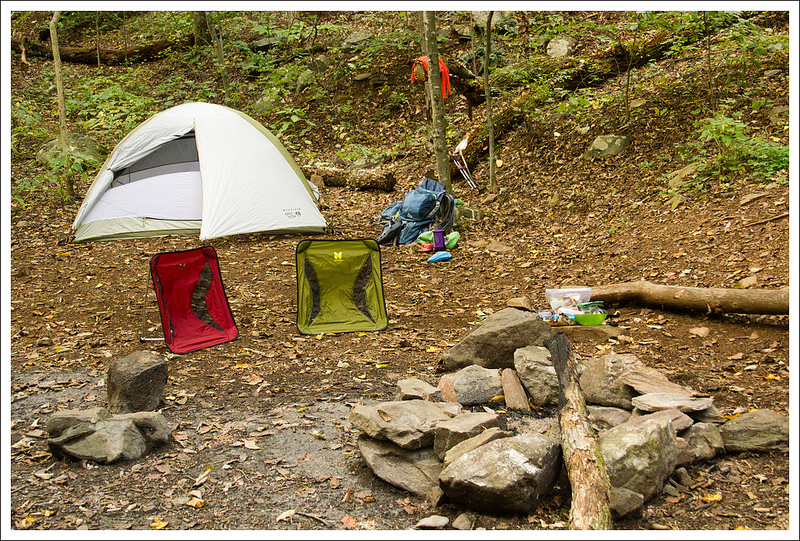
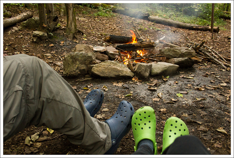
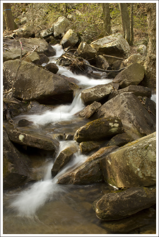
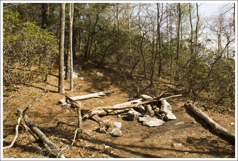
We caught back up with our friends soon and they had claimed a gorgeous campsite (even though it was hard to imagine a bad one here) at 10.6 miles that was near a waterfall that plunged into the creek.  While there were lots of larger groups out here, we found a nice, secluded campsite that had a nice waterslide that created a babbling brook sound throughout the night.  We set up camp and started to make some dinner.  I always enjoy bringing a card game with us when we do an overnight backpack and this time I brought the game Hike.  It was pretty brainless fun and plays similar to Uno with specialty cards that create twists in the game.  It was starting to get dark, so we created a small, but nice fire in the pit.  Once the sun set and the fire died out, we retired to our tents.  It may have been the sound of the brook, but I probably slept the best I have ever slept backpacking that night.  What a great first day!

Campfire
The evening concluded with dinner, card games and a great campfire. Below: There were abundant rosebay rhododendron all along the stream; Our campsite had nice, flat space enough for 2-3 tents; We also had a pretty waterfall and pool for our water source.

Rosebay Camp Filtering

Day Two…

As usual on backpacking trips, we both woke up right around first light. We spent a little while longer in our sleeping bags, chatting and stretching.  It was a chilly morning, so we weren’t quite ready to climb out into the cold.

Eventually we emerged from our tent to start the day.  I put on gloves and a light jacket and  headed downstream to take a few photos of the big waterfall at the next campsite over.  The folks camping there had packed up and departed very early.  Adam went to get the bear bags down while I took photos.

Campsite Falls
One lucky group gets to camp on a site right across from this pretty waterfall.  Below: Our campsite in the morning; You can see smoke from other campsites downriver; Crossing the footbridge across Seneca Creek before our big uphill climb.

Campsite in the Morning Downriver Footbridge

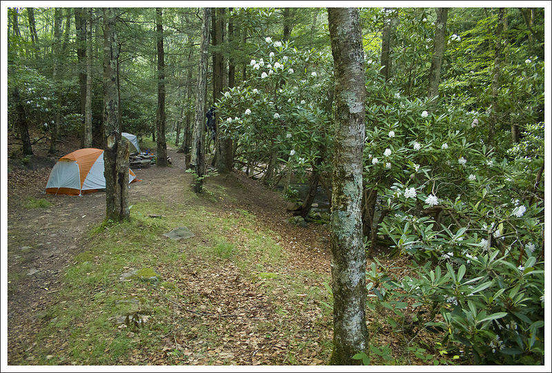
We got everything out for breakfast and started taking down our tent, rolling up sleeping pads and stuffing our sleeping bags back into compression sacks.  I decided that I was going to eat a huge breakfast, so I wouldn’t bonk again on our second day of hiking.  Adam didn’t go into much detail in his day one post, but right around mile ten of our hike the day before, I hit a wall – HARD! It was right after we visited Seneca Falls and crossed the stream.  I sat on the ground and told everyone that I was feeling really lightheaded and sick.  I didn’t feel hungry.  I had been drinking water all day.  Regardless, my legs just felt like jelly and I just didn’t want to walk another single step.  Adam, Suzanne and Anthony all told me that they thought I needed to eat.  Turns out they were right – I had been hiking for ten miles with a 25 lb. pack on under 700 calories.  I guess I just didn’t realize how little I had eaten until I did the calorie math.  My appetite always goes away when I’m doing strenuous activities.  Usually, it doesn’t cause problems and I just eat when I get to camp.  I guess this time I just expended all my short term energy before we finished for the day.  I need to do a better job forcing myself to eat enough.

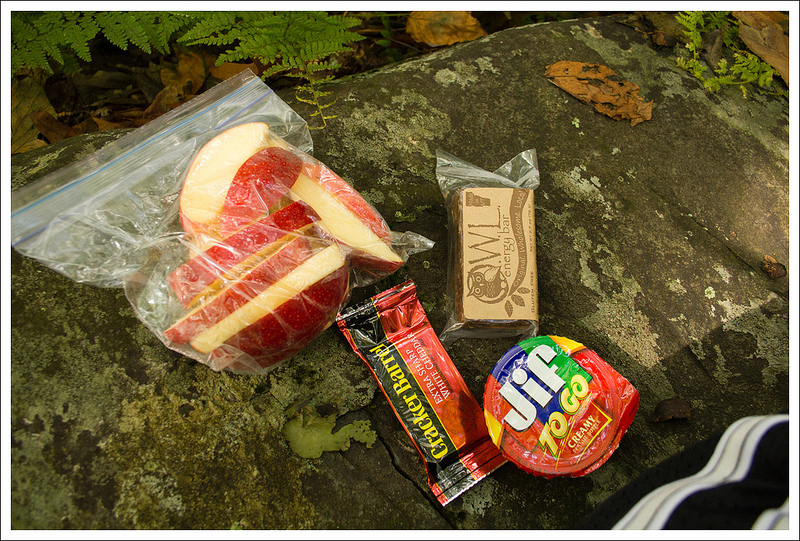
Alright… off that tangent and back to breakfast!  As promised, I ate a large breakfast – oatmeal, cheese, a honeybun and coffee.   It was about 600 calories of food and much more in line with my energy needs for a tough uphill and 6 miles of hiking.  Everyone had eaten and packed up camp by around 9:45 and we were on our way again.

Final Meadow
Adam climbs steeply uphill across our final large meadow of the hike.  Below: Anthony and Suzanne take a look back toward Seneca Creek;  We had spectacular skies; Making progress back to our start point.

One Last Look Toward the Creek Beautiful Skies Trail Sign

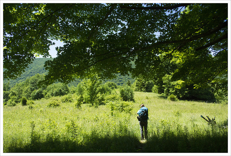
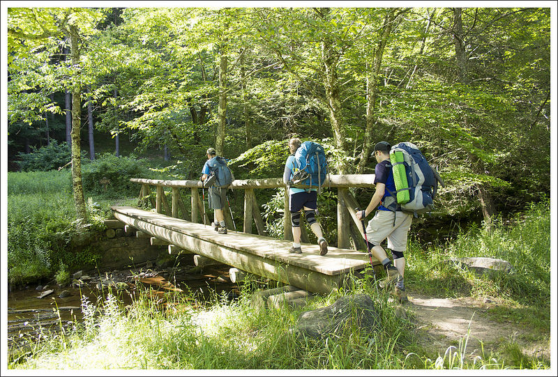
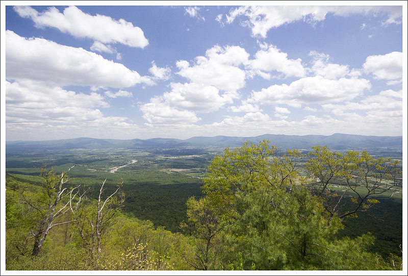
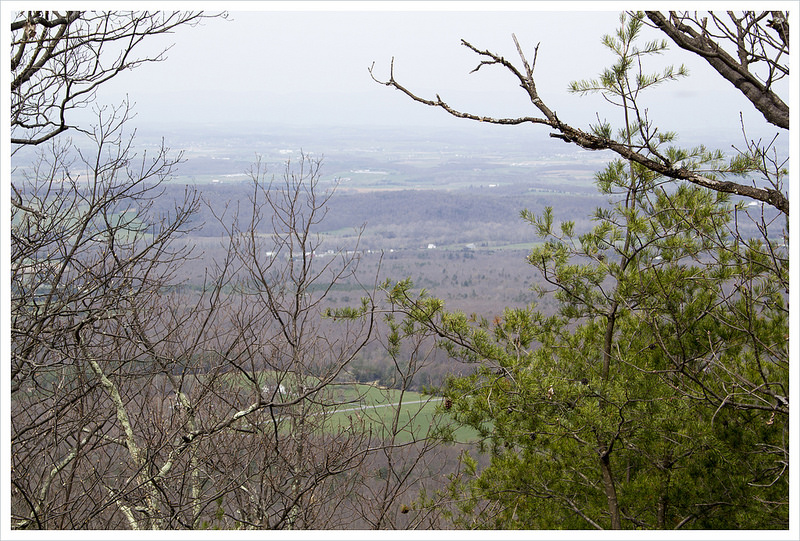
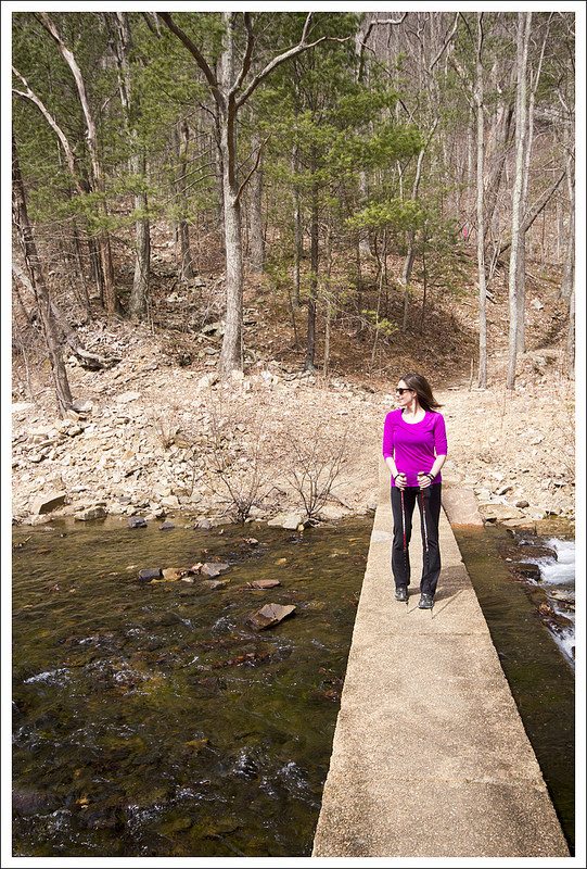
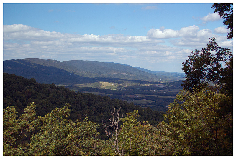
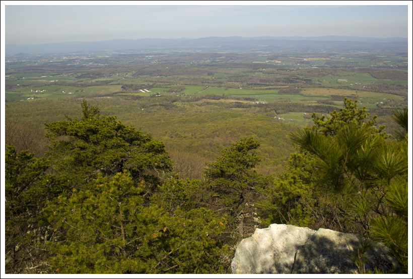
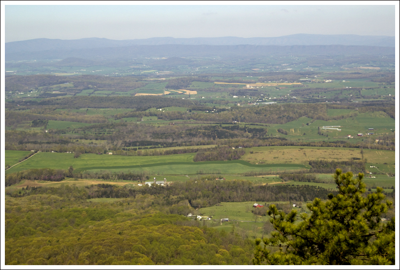
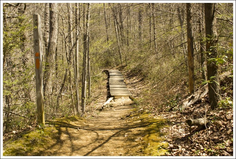
We had a short distance left to walk along Seneca Creek.  Within about a quarter mile, we reached a small wooden footbridge across the stream.  We crossed and continued uphill on the Seneca Creek Trail.  The steepest climbing was across a beautiful, expansive meadow.  We got great views of the valley and our last glimpse into the Seneca Creek watershed.  The high meadows on this hike are truly majestic and are definitely one of the trip’s highlights.

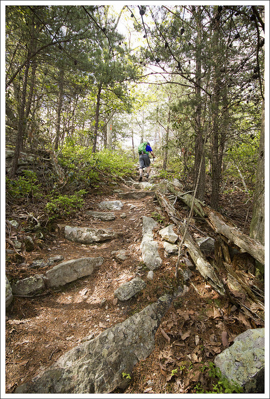
After crossing out of the meadow, we continued uphill through the woods back to the four-way junction of Seneca Creek/Lumberjack/Huckleberry.  Staying straight took us back onto the Huckleberry Trail.  From there, we retraced our steps from the day before.  It was a little slower going and felt longer on the second pass.  It was all uphill and everyone was a little tired.  It’s always funny how different the same four miles can feel under different circumstances.

Adam on the Huckleberry Trail
Hiking the Huckleberry Trail reminded us of hiking in New England.  Below: More lovely views from the Huckleberry Trail;  The trail was often paved with rock; A well-appointed campsite on the Huckleberry Trail; Ripe berries; A view from the talus slope.

Huckleberry Views Laurels Campsite
Ripe Berries Talus

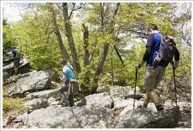
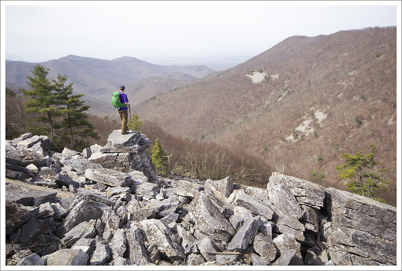
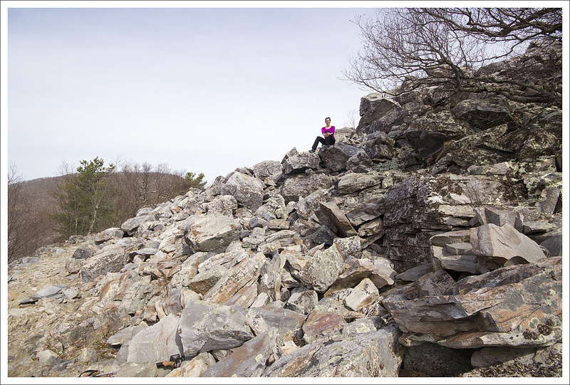
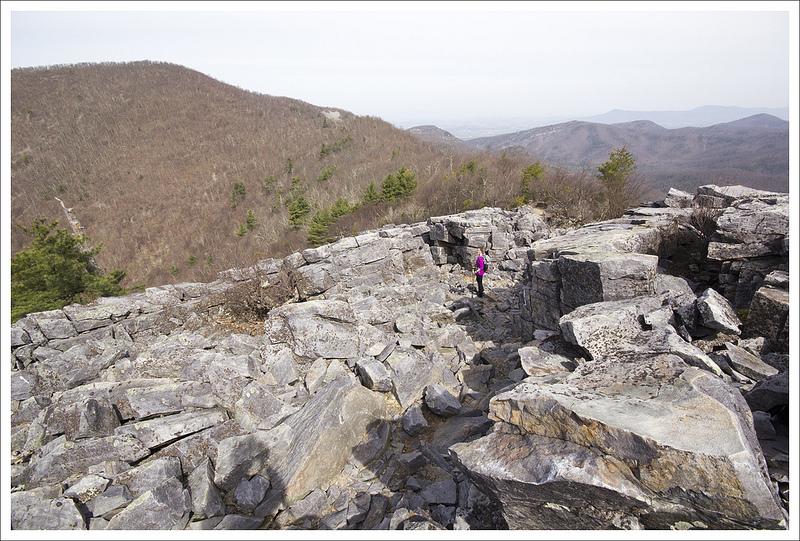
We enjoyed the sunny, unseasonably cool July weather.  We stopped and picked many blueberries along the walk back.  I also took a little side trail from one of the meadows and found a talus slope with nice views across the mountains.

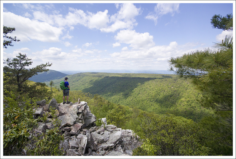
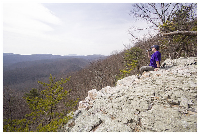
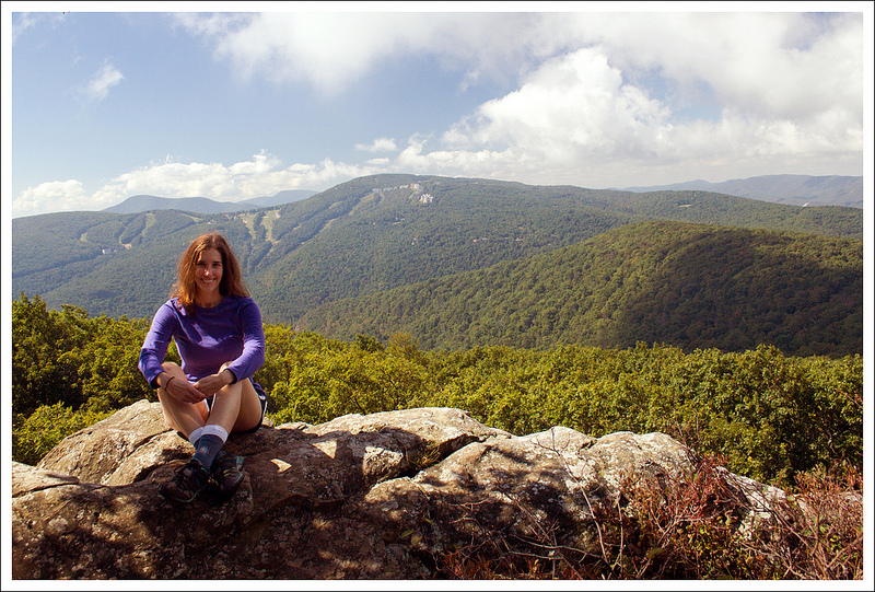
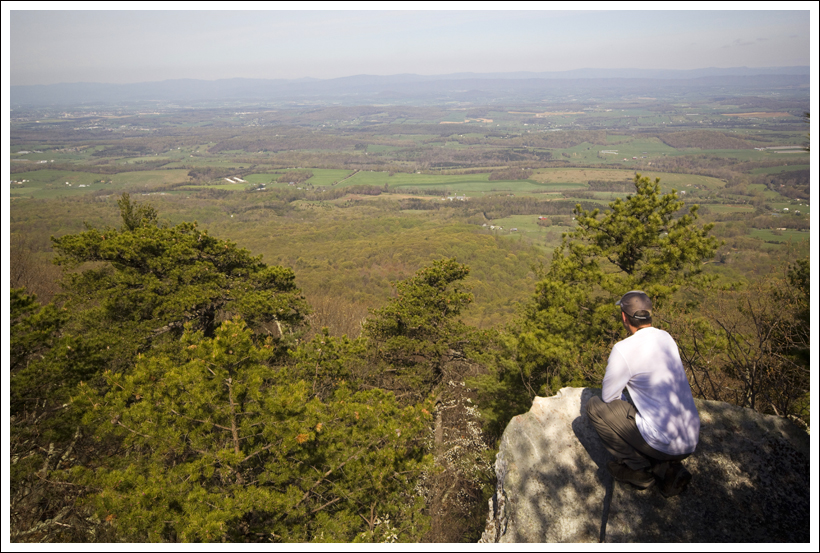
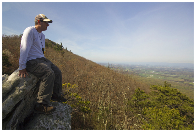
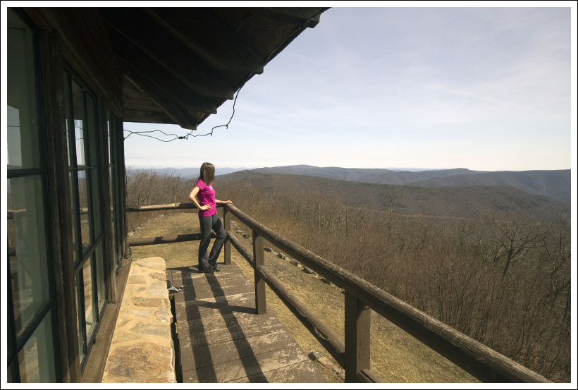
We got back to the car around noon.  We threw our packs into the back of the car and took the short, flat walk to check out views from the observation tower atop Spruce Knob.  It’s just a short quarter mile walk and well-worth the extra time and steps.  We spent some time enjoying the lofty views and cool breezes.  Anthony, Adam and Suzanne decided to walk to one more nearby viewpoint on the Whispering Spruce Trail.  It was just a tenth of a mile down the trail and provided even more spectacular views.  I headed back to the car to eat some more candy and switch my trail shoes for flip flops.

Tower Views
Anthony and Adam take in views from the observation tower on Spruce Knob.  Below: Views from the tower; The hiking crew; Views from the Whispering Spruce Trail; The tower.

Views Hikers Whispering Spruce
Observation Tower

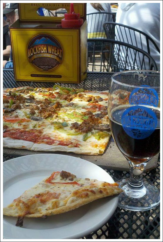
After a few minutes, everyone was back at the car and we were on our way back to Harrisonburg for a celebratory meal and beer.  We all decided that Jack Brown’s was the best spot for lunch.  They have fantastic gourmet burgers and a great beer list.  It’s a perfect post-hike indulgence.

We couldn’t have asked for better weather, scenery, or company for this 4th of July weekend backpacking trip.  After lunch, we bid farewell to Anthony and Suzanne.  They’re such great hiking buddies and we always feel lucky when we get to hit the trail together.

Trail Notes

  • Distance – 16.5 miles [Day One] [Day Two]
  • Elevation Change – About 2300 ft.
  • Difficulty –  4.  The distance makes it fairly tough and the second day has a lot of uphill on the trail. 
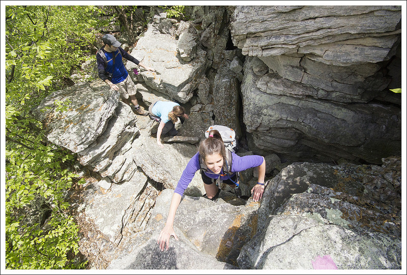
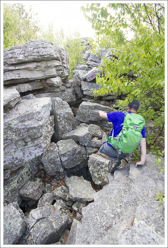
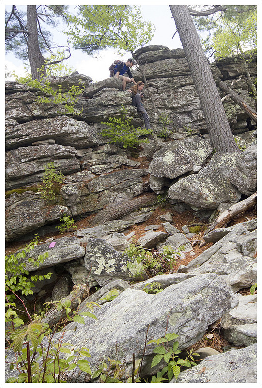
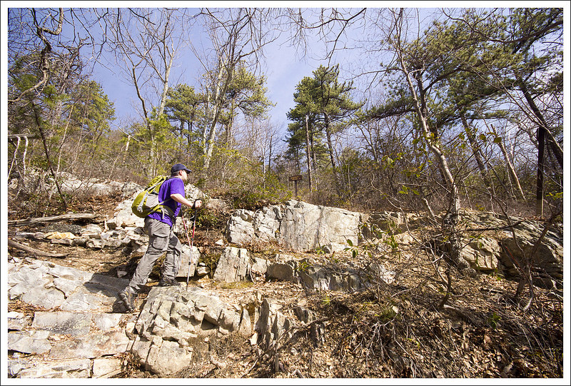
  • Trail Conditions – 3.  Most of the trail was well-maintained.  The High Meadows Trail was quite overgrown.  There are some rocky, loose sections on this trail too, which can be a little rough on the feet.
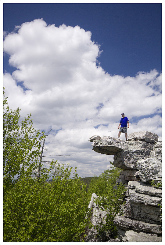
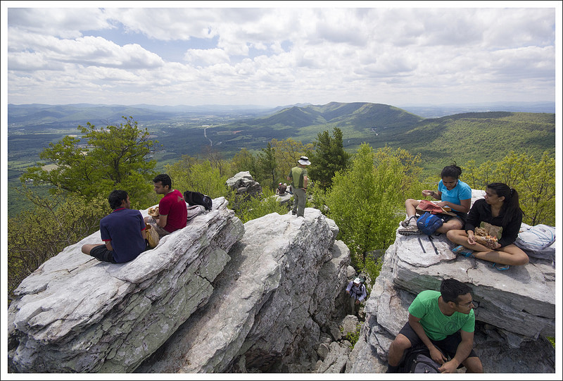
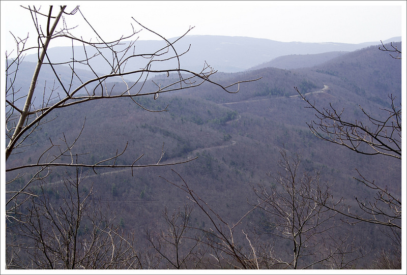
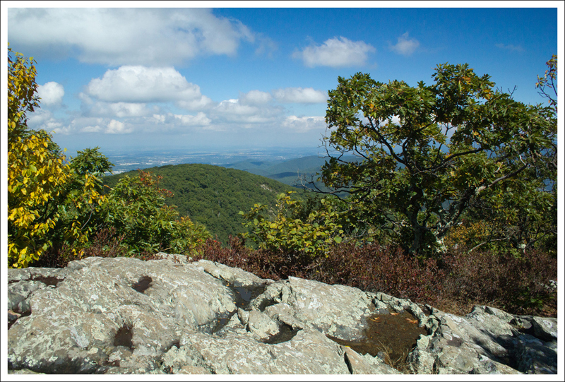
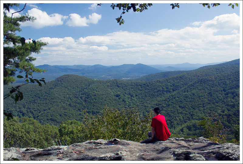
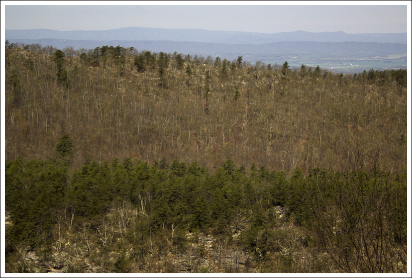
  • Views – 5.  The best views are from the Spruce Knob trail near the fire tower.  The fire tower has wonderful views, but once you take the .5 mile trail around the fire tower, you will have gorgeous, breathtaking views from the highest point in West Virginia.  The views along the main backpacking trip were mostly during the High Meadows Trail.  There are gorgeous mountain views and no sign of civilization. 
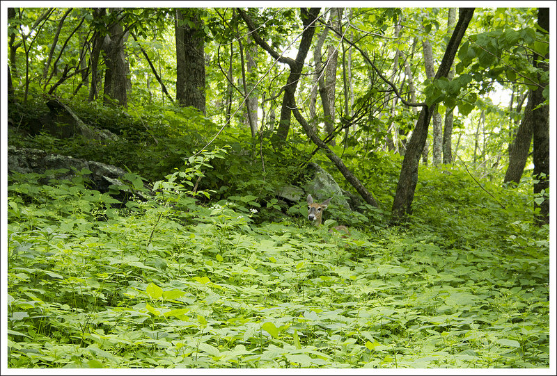
  • Wildlife – 3.  There were lots of birds to be found on the High Meadows Trail.  We did have a deer visit us several times at camp. 
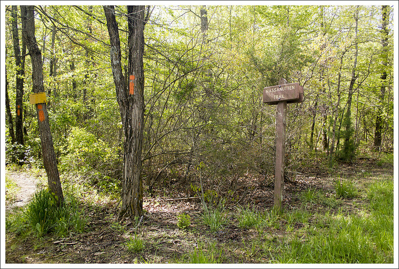
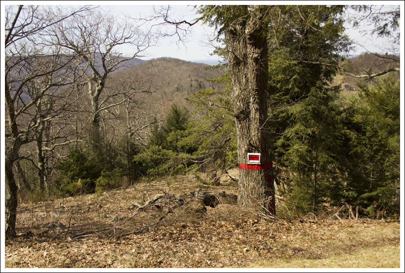
  • Ease to Navigate – 2.  The Huckleberry Trail and High Meadows Trail could use more signage.  I would suggest printing out our step-by-step desciption and bringing the midatlantichikes map to help guide your way. 
  • Solitude – 2.  This is a popular spot for people to do overnight camping.   Expect to see lots at the campsites, but you will have more solitude until you get to Seneca Creek. 

Download a Trail Map (PDF)

Directions to trailhead:  Directions vary so greatly depending on the direction you’re coming from.  Please refer to the trailhead marked on the map below to determine your best route.

Bear Church Rock – via Bootens Gap

This 10.2 mile hike to Bear Church Rock from Bootens Gap (on Skyline Drive) is a great alternative to the route that begins down in the valley at Graves Mill.  While this route doesn’t include the scenic Staunton River or the Jones Mountain Cabin, it crosses some of the deepest, least traveled parts of Shenandoah National Park.  And in the end, you reach the same great viewpoint.  While this route is a little longer than the alternative, it has less climbing and feels a little more moderate.

View the Full Album of Photos From This Hike

View from Bear Church Rock
The view from Bear Church Rock reveals nothing but wilderness. The Staunton River flows through the valley below.  Below:  The hike begins on the AT northbound at Bootens Gap;  Christine passing large boulders on the Laurel Prong trail; Mountain laurel starting to bloom.

The AT at Bootens Gap Boulders on Laurel Prong TrailBoulders on Laurel Prong Trail Mountain Laurel Starting to Bloom

Adam Says…

Bear Church Rock really impressed us when we hiked it a few years ago, approaching it from Graves Mill.  However, we were thinking it would be nice to take a different route that would be more accessible from Skyline Drive.  This approach is a bit longer, but it has 400 fewer feet of elevation gain, making this an overall easier climb.

We started off from the Bootens Gap parking lot at Mile Marker 55 on Skyline Drive in the Central District of Shenandoah National Park.  We took the Appalachian Trail from the parking lot, heading north.  In .5 miles, we reached the junction with the Laurel Prong Trail.  We took a right to join this trail.  The Laurel Prong Trail ends up going through a relatively steep decline through a loose, rocky section.  The trail eventually bottoms out and you reach a junction with the Cat Knob Trail at 1.5 miles.  We took the Cat Knob Trail and began a steep incline.  The trail hits another junction with the Jones Mountain Trail at 2.2 miles.  Take a right on the Jones Mountain Trail.  At this point, the trail is relatively flat or downhill for most of the way to Bear Church Rock.  As you near your goal, you’ll see some pretty amazing standalone boulders along the trail. You will know you’re getting close to the viewpoint when the trail takes a sudden, precipitous downhill drop.  At 5.1 miles, you will reached an unmarked side trail that takes you up a about ten feet through the laurels onto a large rock outcrop with majestic, wilderness views.  Return the way you came to make this a 10.2 mile out-and-back.

Adam Hiking the Jones Mountain Trail
The Jones Mountain Trail traversed an expansive bed of lush, green ferns.  Below: Adam climbs Cat Knob – one of the few steep portions of the trail;  Park boundaries were well marked; One of many pink ladys slippers along the trail.

Climbing Cat Knob NPS Boundary Marking Pink Lady's Slipper

One thing to note on the trail is you do come across several times where the National Park crosses back and forth across boundary lines with the Rapidan Wildlife Management Area.  You may see some US Boundary markers in several places that marks the portion that is under National Park control versus Virginia control.

When we reached the highest point of the Cat Knob Trail, we found the largest concentration of pink lady slippers I have ever seen.  Everywhere we turned, we kept seeing more and more and they were at the peak of their bloom.  That was such a nice reward by coming this route.

Many Lady's Slippers
Usually photos of lady’s slippers are close-ups. This wider shot gives a better idea how these wildflowers are situated in the forest.  Below:  The portion of the trail outside the park is blazed differently;  The Rapidan Wildlife Management area; Adam makes the last final, steep descent to Bear Church Rock.

Blazes Wildlife Management Descent to Rock

Somewhere along the Jones Mountain Trail as we were making our approach to Bear Church Rock, my knee buckled and gave me a lot of pain for the rest of the day.  One hard part about hiking is if you get injured, you don’t have a lot of choice but to keep going.  I stopped about .25 mile before we reached the summit and rested.  I wasn’t sure if I would be able to make it all the way.  Christine went ahead to scout the way and see how much further.  Not wanting to be separated too long, I pushed myself onward and found her at the rock overlook.  We stayed there to rest for a while and we had the rock all to ourselves.  We were joined in about 20 minutes from a man from China who had come up the route from Graves Mill.  He didn’t speak English and we heard him on his walkie-talkie talking to someone that we presumed to be his wife.  We were guessing she was farther behind and he was assuring her he made it.  The climb the other way is quite steep, so I wouldn’t be surprised if she had either turned around or was just taking longer to get to the rock.

The views were spectacular.  While we had a bit of a cloudy day, it was nice to see the shadows from the clouds creeping along the mountain ridges in the distance.

We decided to make our way back.  I felt like the time at the viewpoint allowed me to rest my knee enough to make the return trip. I was hobbling slowly, but I had to keep pushing forward.  We got back to the car and I was glad to not have to take any more steps.

Christine Says…

It was National Trails Day, the weather was great – and even though neither of us was in the mood to go on a long car ride to a distant trailhead, we had to get out and hike! We settled on the hike from Skyline Drive to Bear Church Rock – mostly because it was close to home, but also because we’d never hiked it before. A few years ago, we hiked from the valley bottom in Graves Mill up to Bear Church Rock. That was a challenging and beautiful hike, so we thought it would be fun to visit the rock from the other approach.

From the parking lot at Bootens Gap, we headed north on the Appalachian Trail, gradually ascending Hazeltop Mountain. I was amazed by how lush and green everything in the park looked. It almost looked as green as the Smokies! Our last hike in the park had been in late April, before the leaves fully emerged. Spring always take a long time to fully arrive in the mountains.

After a short, easy stretch on the AT, we reached the junction with the Laurel Prong Trail. We turned right onto the trail and followed it downhill, over many rock jumbles along the shoulder of the mountain. In a saddle between two mountains, we reached the junction with the Cat Knob Trail.

Taking in the View at Bear Church
Adam takes in the view at Bear Church Rock.  Below: You’ll pass these rock formations on the final descent to Bear Church;  The rocks were covered with blooming mountain laurel;  There were also lots of ripening blueberries.

Rock Formations Mountain Laurels Blueberries

That trail climbed steeply over Cat Knob before reaching the junction with the Jones Mountain Trail. The Jones Mountain trail bears to the right. This section of trail actually departs Shenandoah National Park and enters the Rapidan Wildlife Management Area. You’ll notice park boundary signs and different orange/red blazes (as opposed to Shenandoah’s blue blazes) when you’re on this part of the hike.

This section of trail is incredibly beautiful! We enjoyed the expansive understory of ferns and countless pink lady’s slippers. The mountain laurel was just starting to bloom. The terrain along the Jones Mountain trail was rolling – lots of ups and downs, none of them too steep.   This route to Bear Church is probably less popular than the route from Graves Mill, so the trail was narrow and overgrown. Tall grasses brushed our legs all along the way. Adam said, “All I can think of is ticks. I feel like I’m crawling with them!’ Luckily, the permethrin we’ve been using on our clothes and gear really seems to be working. Neither of us found any ticks during a thorough post-hike check.

Around 4.9 miles into the hike, the trail took an incredibly steep downward turn. We lost about 200 feet of elevation in just over a couple tenths of a mile. We passed a few rocky outcroppings that looked like they might potentially have views, but they all turned out to be obscured by trees. Watch carefully for the spur trail to Bear Church Rock. It’s not a marked spur, so one could easily miss it.

On the hike, Adam had begun to wonder if we passed the view or if maybe it had been closed in by trees. I told him that it was a really open, spectacular view and that it had to be nearby. I told him I’d scout ahead and shout back if I found it. I ended up walking almost another half mile before I reached the spur trail! The distances in our guidebook were way off on describing the last mile of the hike to the viewpoint. Other sources I checked afterwards all put the distance anywhere between 9.5 and 11 (rather than the 8.5 miles indicated by our book).

Lush Green
Everything was so abundant and green on this pretty June day.  Below: Adam makes the steep ascent on the return from Bear Church Rock.  Fortunately it is only this steep for a short time; Coming off Cat Knob; We spotted a doe and fawn in the understory.  The fawn was pretty well hidden.

Steep Climb Coming Off Cat Knob Doe

There was a large hiking group on the rock, so I felt weird about shouting for Adam. They told me they were headed out the way we came and would send Adam down when they passed him. But, just as the final hiker departed, Adam arrived.

We had lunch on the rock and enjoyed the unspoiled, pristine views of the park. One of the nice things about Bear Church is that you really don’t see civilization from the viewpoint. You get great views of Fork Mountain, Cat Knob and the Staunton River Valley – but no roads or houses or farms. It’s beautiful! The mountain laurel around the rocky viewpoint were in full bloom and quite spectacular!

After a nice rest, we hiked back the way we came. Most of the return trip was uphill, but other than a short section of climbing right after leaving Bear Church it was very moderate, gradual climbing. The last little bit along the AT was smooth downhill. We saw a doe and fawn hiding in the ferns right before we got back to the car. Once we were back in the car, we decided to head up to Big Meadows for blackberry milkshakes (yay!) and to say hello to our PATC friends. We were glad to catch up with the pair of PATC volunteers who led our Backpacking 101 course several years ago. Good day!

Trail Notes

  • Distance10.2 miles
  • Elevation Change – About 1800 feet
  • Difficulty – 4.  The climb down and back up are not overly tough, but the distance gives it an above average difficulty. 
  • Trail Conditions – 2.5.  The rocky slope climbing down the Laurel Prong trail did have some loose rock.  The Jones Mountain Trail was quite overgrown along the way and we were walking through a lot of knee-high grassy areas.  Wear bug spray and check for ticks afterwards.
  • Views– 5.  Great mountain views from Bear Church Rock. 
  • Streams/Waterfalls – 0.  Non-existent. 
  • Wildlife – 2.  We didn’t really see much wildlife on this trail.  We thought much of it would be a great place to spot a bear since it is in a very wide part of Shenandoah National Park and not as well-traveled. 
  • Ease to Navigate – 3.  You do take four different trails to get to Bear Church Rock, so pay attention at the junction markers.
  • Solitude – 3.  Most of the people we saw on the trail were on the Laurel Prong portion (typically making their way to the Rapidan Camp).  I would expect that you would see someone at Bear Church Rock.

Download a Trail Map (PDF)

Directions to trailhead:  Follow Skyline Drive to mile marker 55.  Park at the Bootens Gap parking area on the east side of the drive.  The AT departs from the end of the parking lot.

Strickler Knob – via Massanutten Trailhead

This 9.1 mile hike is challenging, but offers wonderful view payoffs and a fun rock scramble.  There is a shorter option for this hike for people wanting to skip the toughest part of the climb.

View the Full Album of Photos From This Hike

Crowds on Strickler Knob
Crowds gather on one of Strickler Knob’s perches. One person we met at the summit had a Cavalier King Charles spaniel in her backpack.  If you look closely at the photo, you can see the dog’s head sticking out of the pack.  Cute! Below: The Massanutten Trailhead on Crisman Hollow Rd.; Adam, Suzanne and Anthony begin the hike; Native pink azaleas.

Massanutten Trail Happy Hikers Pinkster

Christine Says…

Strickler Knob was the second hike we posted on Virginia Trail Guide… way back in May of 2009. In the years since we first did this hike, there was a bad forest fire in the vicinity, the Forest Service painted over the purple/pink blazes to the knob (and then someone put them back), and the trail became vastly more popular.

On this particularly beautiful morning, we were planning a hike in Shenandoah National Park, but at 7:45 a.m. a text popped up on my phone. It was from our friends, Suzanne and Anthony (we met them at PATC’s Backpacking 101 workshop several years ago). They had made a spur of the moment decision to drive down from Maryland to hike Strickler Knob and wondered if we might want to join them. We don’t see them often enough, so the answer was clearly YES!

However, I had a few concerns going into the hike. The first was the possibility of swift/deep streams and run off from the deluge of rain we had received a day earlier. Roads and bridges were washed out all over the area. The second was the fact that the MMT 100 was being run that weekend. I wasn’t sure if the trail would be crowded or have limited access due to the race. We decided to put those concerns aside and go for it.

We met our friends at the defunct Massanutten Visitor’s Center on Rt. 211 near Luray. From there, we proceeded in one car to the Massanutten Trailhead on Crisman Hollow Rd. Right as we arrived, a carload of six was also unloading at the trailhead. We ended up playing leap frog with them along the trail all day long.

Lady's Slipper
We spotted this beautiful pink lady’s slipper orchid along the trail. Below: Anthony and Suzanne make the steep descent of Waterfall Mountain; Mountain laurel is starting to bloom; Streams were running high.

Waterfall Mountain Descent Mountain Laurel Stream

The trail initially crossed a flat, open area and a view into the valley. But soon, the trail dropped very steeply downhill on Waterfall Mountain. I’m not really sure why it’s called Waterfall Mountain. We didn’t see any waterfalls along the way – maybe they’re someplace else, or maybe ‘waterfall’ just refers to the extremely quick drop in elevation. Along this section of trail, we all joked about what a tough climb uphill this would be at the end of the day. I enjoyed the flowers blooming along the trail. We spotted mountain laurel starting to bud and even a pink lady’s slipper!

Eventually the trail leveled out near a stream. We passed a large campsite near the water just before coming to our first stream crossing. The water was pretty high and fast, but some well-placed logs made the crossing doable. From there, the trail followed a series of ascents and descents with lots of little stream crossings along the way. Most of the small stream crossings are probably dry under normal circumstances. We soon came to a second large stream crossing. After that crossing, the trail followed the stream – literally. Due to the 4-5 inches of rain the area experienced, the trail was completely underwater. It didn’t even look like a trail, and the only way we were sure it was the trail was the presence of a blaze on a tree about 50 yards ahead. We walked for more than a mile in ankle deep water. It was fun, but it was also wet, sloppy and muddy!

We reached trail junction 408. This is where the folks coming up from Scothorn Gap join the trail. At this point, we turned right and followed the orange-blazed Massanutten Trail uphill in the direction of the Gap Creek Trail. This part of the trail is really easy – wide and very gently graded.  There were lots of pink native azaleas on one side of the trail. On the other side, the area burned out by a forest fire stood, charred – but slowly growing back.

Stream Crossing
Anthony makes his way across the logs traversing the stream. Below: Adam walks along one of the only flat sections of the trail.  It was a really short section; Suzanne walks along the under-water trail; This is the trail junction that trips a lot of people up.  Make sure you go uphill, remaining on the Massanutten trail, in the direction of Gap Creek.

Flat Stream Walking Tricky

When we reached the ridge, there was an obstructed view where the trail continues over the crest and then downhill. If you find yourself going downhill on the orange-blazed trail, you’ve passed the turn to Strickler Knob! At the top of the ridge, look carefully for purple/pink blazes on rocks and a reddish disk stapled to a tree. This is the way to Strickler Knob.

The walk to the knob starts off as a rocky but easily passable trail. But gradually the rocks become bigger, more jagged and trickier to traverse. It’s easy to lose the blazes as you pick your way along the rocks. You’ll come to one stunning viewpoint and think you’ve reached the end, but you still have the most intense part of the scramble to go! There are several steep, tall rock faces to negotiate before you finally come to a collection of towering rock stacks overlooking the Page Valley, Fort Valley and the Shenandoah River. The view from the knob is majestic!

On this particular day, Strickler Knob was packed. There were so many people at the overlook, it was hard to find a spot to sit. I think part of it was because the presence of two hiking clubs. But in addition to the clubs, there were also a number of couples and foursomes. Honestly, I’m shocked that this trail has become so popular! The crowds rivaled what I expect to see on a nice day on trails like Dark Hollow Falls or Hawksbill Mountain (in SNP).

We spent some time at the overlook eating lunch and taking photos. The hike back went really quickly. We walked in the water, we crossed the streams, we did all the little ascents and descents… and then we came to the base of Waterfall Mountain.

That climb was every bit as brutal as we all expected – gaining over 800 feet in about half a mile. The section isn’t climbed with mediating steps or switchbacks – it’s pretty much straight up the mountainside. We were all pretty glad when we got back to the flat, grassy section again!

When we got back to the car, the parking lot was much more crowded than when we had left it. We made the short drive back to the Massanutten Visitor’s Center and bid farewell to Anthony and Suzanne. It was a great hike and great to see them!

Burned Area
This area was burned by a forest fire several years ago. There is still a lot of black char, but new growth is starting to emerge. Below: The beginning of the Strickler Knob trail; Adam enjoys the first nice view; The scramble begins!

Strickler Trail First View Scrambling

Between the two routes to Strickler Knob, I would probably recommend the shorter route from Scothorn Gap to most hikers. You get all of the excellent scenery, and only miss the extremely challenging descent/ascent of Waterfall Mountain. The section on Waterfall Mountain doesn’t really offer any remarkable scenery, but it’s a great training hike if you’re looking for a cardio challenge or practice on elevation change. We probably benefited from the longer, tougher ascent to prepare for our upcoming Smokies Trip.

Adam Says…

Normally, when I describe the hike to Strickler Knob, I tell people that it’s an introductory rock-scrambling hike to see if you are ready for Old Rag.  While there is not as much rock-scrambling and navigating as Old Rag, there are a few spots towards the summit that will test you enough to see if you can pull yourself up some of the rocks and let you gauge your comfort-level with scrambling over some drops.  If you’ve already done Old Rag, this should be easy, but if you are intimidated by Old Rag from stories you’ve heard, try Strickler Knob first.  I would agree with Christine that this hike has become more popular over recent years.  When we had done the hike five years ago on a beautiful day, we only ran into one other couple on the entire trail; this time, it was crawling with people.

This is also a hike where people often get lost.  You won’t find the purple-blazed summit trail on any maps currently, so I would suggest bringing a copy of the map I’ve provided below.  I had a co-worker that tried to find the trail a few years ago (possibly when the blazes were still removed) to no luck.  We also came across a larger hiking group from Northern Virginia that had missed the trail completely.  When we gave them better directions, they turned around to attempt it again.  Part of this also has to do with what few blazes are actually on the trail.  You’ll know you are on a trail, you may just not be entirely sure which trail.

Scrambling
The group negotiates the rock scramble. Below: Adam makes his way through the rocks; Lots of rocks to climb; A nice perch on Strickler Knob.

Scrambling Rocks to Climb Adam on the Scramble

We started off the hike from the small parking area on Crisman Hollow Road.  The orange-blazed Massanutten trail starts off on nice, level terrain through a wooded area.  The trail soon opens up to more of a brushy, open field.  As the trail winds around through this area, there is even one spot that has a view into the valley below at .2 miles.  Shortly after this point as the trail winds around, the trail begins its very steep descent down Waterfall Mountain at .5 miles.  The entire time that we were hiking down, I was thinking this was going to be a pain to hike back up at the end of the hike.  The trail does have a few switchbacks, but the overall descent is tough on the knees as you descend about 800 feet in that half mile.  At the 1.0 mile marker, we finally reached the bottom of the descent and a junction with the Massanutten Connector Trail.  Take a left at this junction to stay on the main, orange-blazed Massanutten trail.  The trail begins to climb slightly at this point and at 1.2 miles, you will reach a nice back-country campsite along the side of the Big Run stream.  You’ll soon cross the stream (usually by balancing yourself along logs that have been laid across) and continue your climb.  After the second stream crossing, the trail begins a steeper climb with a large switchback to help ease the elevation gain.

Summit Crowd
The summit was very crowded, but the views were still fantastic!

Eventually the trail met the stream again and due to the heavy rains, the trail was completely submerged.  We ended up hiking what felt like almost a mile through a submerged trail by rock-hopping or just getting our feet wet and muddy.   The trail finally separated from the water and leveled out and we reached the junction with the yellow-blazed Scothorn Gap trail at 3.0 miles.  Take a right at this junction to stay on the orange-blazed Massanutten trail.  The trail feels more like a fire road at this point, as you’ll climb up slightly.  We were able to see a lot of the fire damage to the trees around, so there is little more than some lower brushy, understory on the trail at this point.  At 3.6 miles, you reach the crest of the trail and can see some obstructed views straight ahead.  At this point, look around to your right.  We found a small cairn on the ground and were able to see some red and purple blazes higher than eye-level on a few trees to mark the beginning of the purple-blazed trail to the summit of Strickler Knob.  The purple blazes at this point are typically marked on the rocks where you step.  The trail is very rocky at this point and you will be walking the ridgeline until you reach the summit.  The trail can also be a little hard to follow, but if you keep looking for the blazes and just remember you are walking the crest of the ridge, you should be fine.

At 4.2 miles, you reach a very nice viewpoint where you can get great views to the west.   Keep pressing forward and you’ll soon need to climb up a larger rock wall and then pass by a primitive campsite.  Just a few 100 feet away, you will reach the larger boulders of Strickler Knob at 4.5 miles.   You’ll see a large rock overhang that you’ll climb under.  There is a small area to take in a few views to the right.  For those that are most adventurous, the best views are to the left where the overhang is.  If you feel comfortable, you will need to navigate a crack between the two larger rock formations and hoist yourself up to the top of the rocks.  The views from both rock formations are absolutely breathtaking as you have 360-degree views from all around the valley.

Climbing Down
The climb down is as challenging as the climb up!  Below: More views from the top; The hike down; One final stream crossing.

View of the Valley Descent Stream Crossing

After eating a packed lunch, we made our way back the way we came.  We did have to face the waterlogged trail again.  We came across several groups on our way back that were also looking for directions.  One girl asked me if there was any other way back to the car other than going back up Waterfall Mountain.  I suggested that they make their way back through Scothorn Gap and then walk Crisman Hollow Road back.   We all definitely wished we didn’t have that steep trek back up Waterfall Mountain to do.  It is a very steep trail almost straight up the mountain and it takes quite an athlete to do this without taking a breather at some point on the return.  When we finally reached the top, we congratulated our success and then made the last .5 miles back to our car.

When we were hiking the trail, I kept thinking about the MMT 100 racers that were running this trail.  We had come across one of the race-workers and he told us that most of the fast runners were coming through this area near Waterfall Mountain around 8 p.m.  So, if you were a little slower than that you would be running this trail in the dark with a headlamp.  I can’t even imagine how tough this would be and how any of them would escape injury from running into a tree, twisting an ankle, or falling down the trail.

Brutal
The brutal ascent back up Waterfall Mountain at the end of the hike.

I would also recommend for most people to do the hike from Scothorn Gap instead of the route we took.  It is a lot of extra effort with nothing overly impressive to see along the way.

It was great to see our friends again.  We were all getting ready to head to the Great Smoky Mountains soon, so this was great training before we had to handle some of the tougher terrain that the park had to offer.

Trail Notes

  • Distance – 9.1 miles
  • Elevation Change – About 2250 ft.
  • Difficulty – 5. This rating is earned by both the hike length, the scramble to the knob, and the ascent of Waterfall Mountain that comes right at the end of the hike.  For an easier version of this hike, start at Scothorn Gap.
  • Trail Conditions –  2. No switchbacks, soggy streambeds, a couple crossings that can be challenging in wet weather, and a tough scramble.  This is not a beginner’s hike.
  • Views –  5.  Views from the knob are spectacular.
  • Streams/Waterfalls – 2.5.  The usually low streams were beautiful and running high when we visited, but they’re probably usually less impressive.
  • Wildlife – 0.  This trail is popular enough to scare away most wildlife.
  • Ease to Navigate –  2. Trails are sporadically blazed and can be hard to follow.  The junctions for trails leading to to the knob do not mention Strickler Knob.  We suggest bringing a map on this hike.
  • Solitude – 2.  This trail has become extremely popular!

Download a Trail Map (PDF)

Directions to trailhead:  From I-81, take exit 264 heading east through New Market.  Head east on West Old Cross Road for .2 miles.  Turn left on to US-11/N. Congress Street.  In .3 miles, turn right on to US-211/Lee Highway.  Go 3.6 miles and turn left on to Crisman Hollow Road (it is right before the green building on your right that is the Massanutten Visitors Center).  Follow Crisman Hollow Road for 2.2 miles (passing by the parking lot for the Massanutten Storybook Trail) until you reach where the orange-blazed Massanutten Mountain Trail crosses the road and the small parking area.  Park here, cross the road and start the trail.

Trayfoot Mountain – Paine Run Loop

This 9.5 mile loop in the southern district of Shenandoah National Park offers vistas, streams and quite a bit of solitude!  We think it would make a great short backpacking loop with a beautiful stream-side campsite along Paine Run.

View the Full Album of Photos From This Hike

Adam Enjoys the Blackrock Summit
Adam Enjoys Blackrock summit. Below: Adam hikes the Appalachian Trail just north of Blackrock Gap; Christine climbs on the rock pile; Adam spots the spur trail that leads to the Trayfoot Mountain Trail.

Adam Hikes the AT Christine on Blackrock Summit Spur Trail

Christine Says…

Every weekend this April has provided glorious hiking weather! I’m feeling so grateful that we’ve been able to get out so often and take full advantage of the warm, sunny days. On the Saturday before Easter, we chose to hike the challenging 9.5 mile Trayfoot Mountain – Paine Run loop.

This hike begins at the Blackrock Gap parking area (not to be confused with Blackrock summit parking). From the lot, cross to the eastern side of Skyline Drive and make your way north along the Appalachian Trail. After a couple tenths of a mile, the trail crosses back over the drive and heads steadily uphill for a little over a mile. As you climb, you’ll come to a junction – stay on the white-blazed AT, the turn to the right goes to the Blackrock shelter.

At 1.3 miles into the hike, you’ll reach a cement marker for the Trayfoot Mountain Trail. Do NOT take this turn unless you want to miss the splendor that is Blackrock Summit! Continue another tenth of a mile to the massive jumble of boulders and jagged rocks that makes up this impressive summit viewpoint. We took some time to enjoy the views and climb on the rocks. The views from this spot are probably the best on the entire hike, although there are a couple more nice spots yet to come.

Christine in the Maze
The trail passes through a corridor of rock. Below: Adam passes through the narrow opening; Climbing Trayfoot Mountain; From the ridgeline of Trayfoot there are several openings in the trees that give you views of a distant Skyline Drive.

Rock Corridor Climbing Trayfoot Skyline Drive

The Appalachian Trail skirts around the front edge of the summit before coming to a spur trail that leads down to the Trayfoot Mountain trail. The spur descends through a corridor of flat-sided slabs. When spur reaches the junction with the Trayfoot Mountain trail, turn right and follow the trail uphill along an old fire road.

The uphill climb along this section is steady going! Near the top, you’ll pass another marker pointing toward the Furnace Mountain trail. Pass this and continue on the Trayfoot Trail until you reach the cement post marking the summit and high point of your hike. There are no views from this summit, but this starts the beginning of a lovely, easy ridge walk.

The ridge rolls gently along, offering nice views of the Paine Run valley and a distant glimpse of Skyline Drive. The trail eventually begins a long gradual descent to Paine Run. Your last sweeping vista on this hike comes at a pretty outcropping of rocks overlooking pointy Buzzard Rock.

Switchbacks take you swiftly down to Paine Run.   Near the first stream crossing, a cement marker points you left onto the yellow-blazed Paine Run Trail, which is essentially an old roadbed. There were several stream crossings on this section of trail. All of them but the second crossing were easy. We found the stream wide and flush with water. Most of the stones people use to cross were underwater. Instead of trying to attempt the rock-hop, we took off our shoes and waded across. Refreshing!

Buzzard Rock View
You get a nice view of Buzzard Rock before descending to Paine Run. Below: Some interesting rock formations along the trail; Lunch stop; Glimpses of farm land.

Rock Walls Lunch Spot Farmland

The Paine Run trail is very pleasant for a couple miles – sounds of running water and mountain views through the trees. When we hiked, the stream was flowing with lots of rapids and tiny waterfalls. I imagine it will run low and dry later in the summer. The path climbs so gradually you hardly notice you’re ascending! Eventually, you leave the streamside and head back toward Skyline Drive. After one final sharp switchback, you have one more moderately steep ascent back to your car.

All in all, I was pleasantly surprised with both the views and streams on this route. We had a great time!  MapMyHike said this hike is only 9.3 miles, but all other sources put it at 9.7-9.8… so who knows!

Adam Says…

We feel like we have covered so much of Shenandoah National Park on our blog, but it seems there is always another trail or loop that you can try.  We talked about  a hike to Blackrock summit before in our coverage of an AT segment, but this is a longer loop version that offers a few additional views and a stream to enjoy.  Other than the Blackrock summit, you will likely not see a lot of people on this trail.  We only saw a few people the entire day, which was a little shocking for a beautiful weekend day that happened to also be a free National Park entry day.

As Christine mentioned, you could skip the Blackrock summit trying to follow the signage, but you don’t want to miss the best part of the hike.  When we hiked previously, our route bypassed the spur trail that leads to the Trayfoot Mountain Trail.  This spur immediately gives you some additional views and some interesting rocks to scramble around.  Most people that are doing an out-and-back just to the summit from the northern approach will miss this area also.

First Attempt
Adam makes a first attempt to cross (with shoes). The second (successful) attempt was barefoot. Below: Adam descending to Paine Run; The shoeless crossing attempt, The trail goes right through the middle of the stream.

Descent to Paine Run Shoeless Trail

One thing that Christine and I both mentioned throughout the day is how this would make for a great overnight backpacking loop.  If you choose to do so, I would tackle all of the tough uphill climbing the first night, making your way through the Trayfoot Mountain trail and camp somewhere near Paine Run.  This will provide a great water source and there were some nice campsites near the water.  The following day, you’ll just have a steady, but not too strenuous hike back uphill to your car.

When we started walking the ridgeline of the Trayfoot Mountain trail, I felt like we stumbled across the best place I’ve ever seen to spot grouse.  We encountered three along our walk.  A couple of years ago, while hiking in Great Smoky Mountains National Park, we encountered our first grouse on a trail.  The beating of its wings created a strange echoing syncopation in our chest which made us both wonder if our heartbeats were going haywire.  Seeking sources online, we found it was a common sound for mating grouse.  We actually spotted several on this trail and when they took off in flight, we could briefly hear that same noise that perplexed us before.  What a relief to actually spot the culprits this time.

Paine Run Trail
Christine walks the wide, gradually ascending Paine Run Trail. Below: We found several blown-down bird’s nests along the trail; Pretty Paine Run; Another stream crossing.

Birds Nest Paine Run Another Crossing

Further along the Trayfoot Mountain Trail, we climbed up on a few rocks to enjoy our lunch and get some views.  I managed to pick some rocks which were not in the least bit contoured to our bodies, which made for an uncomfortable sitting.  It reminded me of how fast food chains design their seating area so the chairs are only comfortable for a short amount of time to prevent loitering.  We quickly ate and moved on.

Around the 4.0 mile marker, the ridge line ends at a nice rock outcropping which gives you some last views before descending towards Paine Run.  Some local families like to park on the western outskirts of the park and hike up to this area for views.

When we reached Paine Run, the water was a little high from the recent rains.  There were a few places to rock-hop across.  In one spot, we did have to shed our shoes to make our way across.  Christine said I looked like a hobbit with my pantlegs pulled up halfway as I crossed.  I responded back in my geekiest way, “May the hair on my toes never fall off.”  I will say the water was very cold, but it felt so refreshing to my feet.  The sensation of the freezing water made me feel as if I had just received a nice massage on my feet.  After the refresher, I felt I could hike a lot longer.

Horses
The Paine Run Trail is popular with horseback riders. Below: The final ascent to the parking area; We spotted a bear on the drive home; Before we went home, we stopped for famous Shenandoah blackberry ice cream.

Final Ascent BearIce Cream

The stretch on the uphill Paine Run trail was very gradual.  While some people may think this was more of a boring stretch, I enjoyed the views of Paine Run along the side.  There were even a few very small waterfalls to enjoy since the water level was high.  We also came across a group horseback riding along the trail.  All yellow-blazed trails, like the Paine Run trail, in Shenandoah National Park allow horses on the trails.  This would be a great trip to take down to the water and let the horses rest and get a drink before returning.

We got back to our car and then heading north along Skyline Drive.  Within a few miles, I spotted a young black bear on the side of the road.   We were excited to have our first bear sighting of the year.  The bear quickly ran away once it knew it was spotted, but we hope we get to see many more this year.  We stopped at the Loft Mountain wayside to get our first blackberry milkshake of the year.  Appalachian Trail thru-hikers talk about these treats for days in advance of getting to Shenandoah and the hype is worth it.  However, their milkshake machine was broken and we had to settle for blackberry ice cream.  It was still a just reward for a long hike.

While we realize this hike is longer and not as popular as some of the others in the park, this hike really has some nice gems along the trail.  I was pleasantly surprised at what this had to offer!

Trail Notes

  • Distance – 9.5 miles
    (Check out the stats from Map My Hike)*
  • Elevation Change – About 2200 ft.
  • Difficulty – 3.5.  The climbs to Black Rock summit and Trayfoot Mountain can be a little steep, but the climb from Paine Run back to the parking area is very pleasant and gradual.  The length adds to the difficulty rating of this hike.
  • Trail Conditions – 4. The trail was clear and in great shape!
  • Views – 5.  The views from Black Rock summit are spectacular.  While the summit of Trayfoot Mountain has no view, there are other nice views from the Trayfoot Mountain trail – especially the outcropping that overlooks Buzzard Rock.
  • Streams/Waterfalls – 3.  Paine Run was surprisingly pretty and broad in the early spring.  As we hiked up the Paine Run trail, we had many stream crossings and nice views of the water.
  • Wildlife – 3.  We saw deer and lots of grouse on the trail.  We also saw a black bear shortly after leaving the parking area to come home!
  • Ease to Navigate – 4.  There are only a few, well-marked turns on this hike.
  • Solitude – 4.  We saw a few people near the stream that had come in from the western perimeter of the park, a few people on Black Rock Summit, and a trio of women on horses.  All-in-all, we enjoyed a lot of solitude for a long stretch of trail on a pretty ‘free park entry’ day!

Download a Trail Map (PDF)

Directions to trailhead: Located in the Southern Section of Shenandoah National Park.  Park at the Blackrock Gap parking lot around MM 87.3.  Cross the road and find the cement post for the Appalachian Trail.  Take a left, heading north, to start your hike.

MapMyHike is not necessarily accurate, as the GPS signal fades in and out – but it still provides some fun and interesting information.

Sherando Lake Loop

This relatively easy 2.5 mile loop goes around Sherando Lake and follows a short spur to a great mountain view!

View the Full Album of Photos From This Hike

Sherando Lake
Sherando Lake is a popular camping/swimming area for locals. It’s just several miles off the Blue Ridge Parkway.

Adam Says…

This has been quite the harsh winter for snow and cold temperatures.  And when it hasn’t been too cold, it seems to have been raining.  So, we were glad to get out on a nice day to get a little exercise outdoors for a change.

Sherando Lake is a multi-purpose recreation area.  In nice weather, you will see people swimming, fishing, camping, and hiking.   To visit, there is a fee per vehicle – check out their fee schedule.   The area is officially open from early April through October.  The road gates are often closed during the off season based on weather.   There is camping available if you wanted to make a nice weekend trip, but reservations should be made in advance.

We started off our hike from the Fisherman’s Parking Area.  There were a few other vehicles there also, but they were all there for the fishing.  The lake is stocked with trout throughout the year.  Facing the lake, we started our hike on the left by heading up the Cliff Trail.  This trail was a short gradual climb with a few switchbacks before the trail levels out.  About .4 miles into the hike, there is a small outlook to the right from a rock that gives you a few obstructed views from the lake.  Continuing on the trail, it begins to descend and the lake gets back into view.  At .8 miles, you reach the lakeside and see the sign that shows the junction with the Lakeside Trail (a trail that wraps around the lake).   We took a few minutes to go out onto the sand and enjoy the views of the lake.   I saw a wood duck escorting a few ducklings on the far banks of the lake.

Dam End
The fisherman’s parking lot is located at the dam end of the lake. It is where our hike begins. Below: The trail starts off rocky; Overlook View.

Rocky Uphill Overlook Rock

We walked back behind the large building/gift shop, crossed a couple of bridges and rejoined the trail on the northwestern side of the bank.  We took the blue-blazed Blue Loop Trail, leading us past a few campsite areas before climbing up into the woods.  The trail is rockier, especially in the beginning, than the Cliff Trail and is steeper.  The trail climbed through a few switchbacks.  At 1.5 miles, you reach a junction shortly after a switchback with the Dam Trail.  This will be your return route.  Continue up the Blue Loop Trail, which begins to take an uphill climb to the left up the mountain.  At 1.75 miles, you reach Lookout Rock.  We took some time there to enjoy the view and then went back the way we came until we reached the junction with the Dam Trail.  We took this trail to the left, which leads steeply down the mountain.  You begin to see the lake through the trees again and we reached the lakeside around 2.25 miles.  We continued on the trail until it reached a small bridge that crossed over the dam stream and led back to the parking lot.

Enjoying the View
Adam takes in a beach/lake view. Below: Services are typically open April through October; Trails are well marked; Adam hikes the Blue Loop Trail.

Sherando Beach Area trailsystem uphill

One thing that was going through my mind during the hike is this would be great for a family outing.  Grab your family for a quick hike followed by a picnic by the lake.  Make a weekend of it if you want to do some camping, swimming, and fishing.

Christine Says…

I enjoy playing in the snow, but I’m very ready for warmer weather. I want to see flowers blooming. I want to feel warm sunshine on my face. I’m so ready to see a canopy of green across the mountaintops.  I have spring fever.  So, I was especially thankful for a particularly warm and sunny Saturday because it gave us a chance to get out and hike.

We chose Sherando Lake, mainly because it was nearby and easy. It would have been a great day to go on a longer hike, but Adam was still getting over a bad cold.  And I was not willing to spend more than an hour in the car. I had spent the past two weekends in a 12-passenger van, making a 15 hour ride to and from the Florida panhandle and was still a bit road weary.

Lookout Rock
Lookout Rock provides a nice view of the valley, lake and mountains. Below: Adam climbs his way toward Lookout Rock; Checking out the view, Making the descent.

Climb View descent

My trip to Florida was a service-learning trip with a group of nine JMU students.  We traveled to a Nature Conservancy preserve – Apalachicola Bluffs & Ravines to do a week’s worth of environmental work.  We camped, we hiked, we learned about the local ecosystem, and most importantly – we planted 90,000 plugs of native wiregrass seed that will be used to restore the natural habitat of that part of Florida.  It was hard work, but I think we made a difference. We even had one free day on our trip. We chose to spend it spotting manatees, gators, and other wildlife at Wakulla Springs State Park.  If you want to see more photos and read more about my service trip, I’ve uploaded a large set of captioned photos to my Flickr account.

Now, back to Sherando Lake!  I had been to the lake a couple times before, but had never actually taken the time to hike any of the trails in the area. I was pleasantly surprised by the trail system.  There is something for everyone – a practically flat trail that goes along the lake shore, a steeper trail around the lake that offers a couple nice views, and a connection into the larger, longer trail system along the Blue Ridge Parkway.

I liked sitting on the sand and enjoying the pretty lake view, and I really enjoyed climbing up to Lookout Rock on the Blue Loop Trail.  The rocky outcropping provides a nice view of the lake and the mountains beyond.  Although the snow was gone on the trails we walked, we could still see plenty of snow on the distant, higher ridges.

Spillway
The hike ends after crossing a cement bridge over the spillway. Below: The stream leading away from the lake; Christine crossing the concrete bridge, Blue Mountain Brewery food and brewery.

Stream Bridge Blue Mountain Brewey Blue Mountain

The walk back down from Lookout Rock was really steep and slick, especially with the thick bed of dry, fallen leaves.  Once we reached the bottom of the descent, we crossed a concrete bridge beneath the spillway and returned to our car.  We finished hiking a little bit before noon, so we decided to make the short drive to have lunch at Blue Mountain Brewery (near Afton Mountain).  They have great food and great beer.  Adam enjoyed a flight of nine different beers and I tried their Daugava Baltic Porter.  I think everyone in central Virginia had the same idea to visit the brewery for an outdoor lunch.  The place was packed, but it was a perfect ending to the day.

Trail Notes

  • Distance – 2.5 miles
    (Check out the stats from Map My Hike)*
  • Elevation Change – 998 ft.
  • Difficulty –  2.  The uphill to the Lookout Rock is a little steep, but overall most people should be able to do it.
  • Trail Conditions – 4.  This is well-traveled, so you should find the trail to be in good shape. 
  • Views  3.  Nice views of the lake from Lookout Rock and mountains around.  Some obstruction, but overall a decent view. 
  • Streams/Waterfalls – 2.  There is a small man-made water dam that creates a nice fall look.  The lake creates a picturesque setting. 
  • Wildlife – 2.  You shouldn’t expect a lot of larger wildlife.  We saw a pileated woodpecker swooping across our car when we arrived.
  • Ease to Navigate – 4.  The only place you may need to figure out is where to pick up the trail after going to the other side of the lake.
  • Solitude –1.  On a nice day, you’ll see plenty of people here.  Most will be near the lake, but expect some people at Lookout Rock. 

Download a Trail Map (PDF)

Directions to trailhead:  From I-64, take Exit 96 just east of Stuarts Draft. Go south on State Route 624, which becomes State Route 664 at Lyndhurst. Continue south on State Route 664 approximately 8 miles to the entrance to the Sherando Lake Recreation Area on the right. The gatehouse is approximately 0.5 miles ahead which will take the fee for your vehicle.  Past the gatehouse, you’ll take a right to the fisherman’s parking lot.  Park there and make your way to the left for the Cliff Trail.

MapMyHike is not necessarily accurate, as the GPS signal fades in and out – but it still provides some fun and interesting information.

Appalachian Trail – Dripping Rock to Rockfish Gap

This 14.5 mile section of the Appalachian Trail includes great views of Wintergreen Resort from Humpback Mountain.  The campsite for the evening is the Paul C. Wolfe Memorial Shelter, which is located on the bank of lovely, rushing Mill Creek.

View the Full Album of Photos From This Hike

Hiking Over Humpback Mountain
Adam traverses Humpback Mountain.  Below: We found trail magic right away on our hike; Adam climbing the southern side of Humpback Mountain; Rock walls along the trail.

Trail Magic Adam Hiking Rock Wall

Day One

For Christine’s birthday this year, we decided to do a quick overnight backpacking trip along the Appalachian Trail.  Following an all-day soaking rain and a cold front on Saturday, we had ideal weather for hiking and camping on Sunday into Monday – low humidity, clear skies, daytime highs in the 70s and a nighttime low near 45. It was perfect!

We started our morning with a big breakfast at Thunderbird Café and then made the 40 minute drive to the trailhead.  For this hike, we left one car parked in the small lot near where the Blue Ridge Parkway (BRP) crosses I-64 and Rt250.  From there, we drove our second vehicle to the Dripping Rock parking area at mile 9.6 on the BRP.  The name Dripping Rock refers to the small spring adjacent to the parking area.  Supposedly, it was a water source well-used by Monocan Indians en route to summer hunting grounds.

The AT crosses the parkway at this point, so it’s an easy place to hop on without using any access trails or spurs.  The hike starts out climbing gently uphill through the woods.  Almost immediately, we spotted a small cooler alongside the trail – trail magic!  We didn’t need (or take) any trail magic on our hike, but we were curious so we opened the cooler to see what was inside.  We found a log book, a camera, a small whiteboard, a bottle of ibuprofen and a nice supply of granola bars.  The camera and whiteboard were provided so that hikers could take photos with their trail names.

A couple tenths of a mile down the trail, we passed even more trail magic in the form of 2 liter-sized bottles of tap water from Wintergreen Resort.  Typically by September, streams and springs in the Shenandoah Valley are dry or running very low, so the free, clean water would be quite welcome.  The bottles were situated next to one of the trail’s spring-fed water sources.  We noticed the sign marking the spring indicated that water might be contaminated and should be filtered or boiled.  The sign included an outline drawing of a moose, and we both found it comical to think about the implausibility of Virginia water being contaminated by a moose.

Wintergreen View
Christine enjoys the outcropping overlooking Wintergreen.  Below: Hiking up Humpback Mountain; Adam checks out the view of Wintergreen; Pretty views.

Christine Hiking Wintergreen Views

The hike continued gradually uphill along the side of Humpback Mountain.  We saw several nice campsites along the trail.  Soon after that, the views started to open up.  We didn’t really have any expectations for great views on this hike.  We figured we might take the side trail to Humpback Rocks and eat lunch there.  We also knew from past hikes on Dobie Mountain that we’d be passing one decent overlook at Glass Hollow.  However, we were pleasantly surprised to find spectacular views along the rocky, spiny ridge of Humpback Mountain. These views are about 2.5 miles from the better known outcropping of Humpback Rocks, and we thought they were even nicer!  The crowds, graffiti and car noise always take away from the experience at Humpback Rocks. We had this lofty ridge all to ourselves.

We took some time to take off our heavy packs and enjoy the view.  We could see the Priest, Three Ridges and the slopes of Wintergreen Resort.  When we got home, we read more about this section of the trail and learned that the view is named Battery Cliff, because the condos on the slopes of Wintergreen look like fortifications from a distance.  The rocks on the cliffs are Catoctin greenstone formed in an ancient volcanic eruption.  When you sit on these rocks and look across to Wintergreen, you’re looking over to where the Appalachian Trail used to traverse the mountains.  Five miles of the trail used to cross the resort.  But in 1983, the resort sold the land to private developers – basically pulling the rug out from under the Appalachian Trail Conservancy.  Luckily, the organization was able to quickly pull funds together and preserve the land across Humpback Mountain – where the trail currently sits.

Leaving the open ridge, we dipped back into the woods and continued walking along a long, impressive stretch of stone ‘hog wall’.  People living in the area before the establishment of the parkway built these long walls to roughly mark property and attempt to contain livestock.  Eventually we arrived at a junction, one direction headed toward Humpback Rock and the other continued downhill along the Appalachian Trail.  We decided to skip the extra mileage it would take to visit the Rock and continue toward our destination.  We’ve seen the Rocks many times and didn’t really want to face the crowds that arrive with beautiful-weather Sundays.

Hog Wall
Adam walks along one of the many hog walls.

As we walked downhill, we started contemplating our lunch break.  We decided that the next spot with good ‘sitting rocks’ we’d stop for lunch.  As it turned out, the next rocks we found were just a few, big random flat boulders right alongside the trail. We had lunch of apples, peanut butter, cheese, and energy bars.  As we ate lunch, two groups of people passed us – a couple with their dog and a man who had just visited his daughter at JMU’s family weekend.  All in all, we only saw a total of eight people over the entire ten miles of hiking that day.  The solitude was nice!

After lunch, we continued the 5.5 mile descent toward our evening stop point.   The trail was in great shape and the downhill was easy going.  At the bottom of Humpback Mountain, the Appalachian Trail intersects with the Howardsville Turnpike – an old toll road that was heavily used to transport goods before the Civil War.  It’s long been reclaimed by the forest, but the wide, flatness of the trail still has the definite feel of a well-traveled road.  We continued along the Appalachian Trail until we spotted a small sign marking the Glass Hollow overlook. We followed the short access trail and spent a good twenty minutes relaxing on the beautiful rocky viewpoint.  The views this time were much clearer than they had been two years ago when we visited.

Glass Hollow
Taking in the view at Glass Hollow. Below: Trail lunch, AT logos carved on deadfall; Pretty trail with late season wildflowers.

Lunch AT Logo Pretty trail

After leaving the overlook, we continued along the Appalachian Trail, passing the junction with the Albright Loop Trail – a popular day hike in this area.  From this junction, you can follow the Albright Trail for two miles back to Humpback Rocks parking.  We continued northbound on the Appalachian Trail, descending Dobie Mountain.  The trail follows a series of gradual, well-graded switchbacks.  There is one nice view of the valley about halfway down the mountain.  Eventually, we started hearing the sounds of running water through the trees. After crossing Mill Creek, we arrived at our stop point for the evening – the Paul C. Wolfe shelter.  This shelter is one of the nicest we’ve seen. The location is beautiful, the picnic table is on the porch and the shelter has sidelights, so it’s bright and cheerful inside.  So many shelters are gloomy and dark.  We will caution you – the privy at Paul C. Wolfe shelter is kind of weird – the door is only a half-door.  When you sit on the toilet, you have a nice view – but people can also see you sitting there.

We were the first campers to arrive for the night, so we got a prime campsite near the banks of Mill Creek.  We had our own established fire pit and our own bear pole – fancy!  We immediately got started setting up camp and taking care of necessary chores.  Mill Creek was running beautifully, so we had a clear, cool water source to filter from.

Camp
Our nice campsite along Mill Creek. Below: Overlook on the descent of Dobie Mountain; Junction with the Albright Trail; Crossing Mill Creek

View from Dobie Albright Intersection Crossing Mill Creek

We decided to take our dinner up to the shelter so we could use the picnic table for meal prep.  Dinner consisted of pepper steak, wine and dark chocolate cheesecake.  As we were finishing up dinner, a southbound thru-hiker named Nightwalker arrived at camp.  He told us he had hiked almost 30 miles that day. He was from the Boston area and freshly out of high school.  We chatted with him a bit and marveled at him eating huge handfuls of candy corn mixed with Skittles.  He had the look of a true trail-weathered hiker – beard, tattered long-johns and feet held together by duct tape.

When the sun was going down, we headed back to our own camp.  Despite the heavy rains the night before, we were able to find enough old wood to have a small campfire for a while.  We heard another southbound hiker arrive sometime after sunset, but we never met him.  With the temperatures dropping with the darkness, we headed to bed around 9:00.  Both of us slept pretty well, but Christine woke up around 3:00 a.m., struggling to close both of the doors in the tent fly.  It was in the upper 30’s and she’s a cold sleeper.

Campfire
Our nice little campfire. Below: Adam filtering water; The Paul C. Wolfe Shelter; The steep climb that starts Day 2.

Filtering Water Shelter Climb Behind the Shelte

Day Two

We were up at first light, but noticed both the thru-hikers were still sleeping.  We didn’t want to disturb them, so we cooked our breakfast of oatmeal, cheese, coffee and hot chocolate near the fire pit at our campsite.  We were packed up and back on the trail within 45 minutes of waking up.

The morning’s hike consisted of a rather steep climb up Elk Mountain.  From the back of the shelter, the trail climbed almost straight up via a series of switchbacks.  We had about 1000 feet of climbing in just about a mile.  A8fter that, the remainder of the hike was more moderate or even gently downhill.

Mayo Cabin
The remnants of an old cabin sit right along the trail. Below: Approaching Rockfish Gap; We can see Rt. 250; Waynesboro’s great network of trail angels.

Done The Gap Trail Angels

The five miles of trail back to Rockfish Gap are largely unremarkable; just a nice walk through the woods.  There are a few small stream crossings, but no views along the way.  The one noteworthy feature would probably be the ruins of an old cabin, about 1.7 miles north of Paul C. Wolfe.  The chimney and hearth are still standing right alongside the trail.  Evidently, there is also a cemetery for the Lowe family and additional cabin ruins somewhere east of the trail, but we didn’t see it.  The trail exits onto Route 250 at Rockfish Gap through an opening in the guardrail.  Thru-hikers can find lists of trail angels at the guardrail opening.  Waynesboro has one of the best organized trail angel networks along the AT.  It’s easy to find a ride or shelter at this point on the trail.

We arrived back to our car around 10:30 in the morning.  By the time we shuttled back to our car parked at Dripping Rock, we were already thinking about lunch.  We realized how close we were to Devil’s Backbone Brewery and decided it was a perfect place to wrap up our backpacking weekend.  We had a huge lunch – beers, a big soft pretzel to share, and sandwiches (French Dip for Christine, BBQ for Adam). After lunch, we decided to take Rt. 151 back to Waynesboro.  This allowed us to also pass Bold Rock Cidery.  It’s definitely worth a stop if you enjoy hard cider.  Since it was a Monday, we were the only people there.  We got to go behind the scenes into the cider pressing room and the fermentation/bottling facility.  That was really neat!

Bold Rock
The tasting room at Bold Rock. Below: Enjoying a post-hike beer at Devil’s Backbone.

Devils Backbone

Trail Notes

  • Distance – 14.5 miles (9.5 miles on Day One, 5 miles on Day Two)
    (Check out the stats from Map My Hike – [Day One] [Day Two])*
  • Elevation Change – 1800 ft. on Day One, 1100 ft. on Day Two
  • Difficulty –  2.  This is an easy backpacking trip with moderate, well-graded climbing.
  • Trail Conditions – 4.5.  Trails are in excellent shape.
  • Views – 4.  Views from Humpback Mountain and Glass Hollow are beautiful!
  • Streams/Waterfalls – 3.  Mill Creek is pretty and a great water source.  There is a small waterfall and swimming hole downstream from the shelter.
  • Wildlife – 2.  We saw a few deer and heard owls at night.
  • Ease to Navigate – 4.   There are several intersections/junctions to pay attention to, but following the white blazes is pretty easy.
  • Solitude – 4.  Because we avoided Humpback Rock, we only saw a small handful of people on a beautiful Sunday.  

Download a Trail Map (PDF)

Directions to trailhead:  Follow the Blue Ridge Parkway to mile 9.6.  Park in the small Dripping Rock parking area.

MapMyHike is not necessarily accurate, as the GPS signal fades in and out – but it still provides some fun and interesting information.

Laurel Prong – Mill Prong Loop

This 7.3 mile loop has a bit of everything – views, waterfalls, history!  The route takes you over Hazeltop Mountain, along several streams and past President Hoover’s Rapidan Camp.

View the full album of photos from this hike
View a short video clip of Adam crossing the stream below Big Rock Falls

The Rapidan River
Camp Hoover sits where the Laurel Prong and Mill Prong spill together, forming the Rapidan River. Below:  Trillium was blooming everywhere when we hiked; The route had many stream crossings; Adam enjoys the view from Hazeltop.

Trillium Everywhere One of Many Stream Crossings Adam on Hazeltop

Christine Says…

We love hiking in this part of Shenandoah!  It’s the area we typically choose when we have out-of-town friends who want to visit Shenandoah National Park.  It’s also a likely choice when we’re hitting the trail with hiking newbies.  Why?  Well… we think it’s pretty much perfect.  The climbing isn’t difficult, so it helps convince non-hikers that hiking isn’t just torturous uphill climbing.  This area is great for spotting wildlife. (In his portion of the post, Adam will tell you more about the exciting wildlife experience he shared with his office.)  It’s also scenic, with lovely streams and a waterfall along the route.  There is even a significant piece of American history sitting in the middle of the forest – the Rapidan Camp, which served as Herbert Hoover’s presidential retreat.

Our normal route in the area is a relatively easy 4 mile out-and-back to ‘Camp Hoover’.  For this post, we decided to go the long way and make a 7.3 mile loop incorporating the Appalachian Trail, the Laurel Prong Trail and the Mill Prong Trail.   This longer route added a nice view, many stream crossings and a bit more elevation gain.

Apple Blossoms
Lots of trees were blooming in the park! Below: Adam walks along the Appalachian Trail.  Adam was like a wind sock on Hazeltop.

Adam on the AT Windy on Hazeltop

We parked at Milam Gap.  The hike started across Skyline Drive on the AT, headed southbound.  Almost immediately, the trail began a long, gentle ascent to the summit of Hazeltop Mountain.  The AT is so well-worn into the mountain that the path looked like a ribbon of dirt through the bright green of spring grass.  On this particular May morning, the trail was abundantly lined with my favorite wildflower – Trillium.  They were everywhere with big showy flowers in pink and white.  We also saw (and heard) many birds.  The prettiest songs came from the eastern towhees.  This type of towhee has striking orange, white and black markings, which makes them easy to spot.

After almost two miles of climbing, we reached the high point of the hike on Hazeltop Mountain.  There was one nice place to take in the view.  It was really windy on the rocky outcropping, but I enjoyed looking out over the spring-green valley. From the viewpoint, we hiked downhill for almost half a mile to reach the junction of the AT and the Laurel Prong Trail.

Views from the Laurel Prong
There are obstructed views from the Laurel Prong Trail. Below: Eastern Towhee; Huge boulders and rocks along the Laurel Prong Trail; A neat tree near the junction of the Cat Knob trail.

Eastern Towhee Rocks on Laurel Prong Neat Tree Near Cat Knob Junction

The Laurel Prong trail descends all the way to Camp Hoover.  Along the way, you’ll get some obstructed views from the trail, especially when trees are without their leaves.  There are lots of rocks and boulders lining the path, especially right at the beginning.  The lower parts of the Laurel Prong trail pass through a mix of open forest and mountain laurel thickets.  As you approach the low point of the hike, you should begin to hear the sounds of water.  Most of the time, streams along this trail will be shallow to non-existent.  When we hiked, it was after several days of heavy rain.   Single-step crossings became multi-rock hops and in many places the trail was under several inches of rain.  It was fun to cross so much water!

At around the 5.25 mile mark, we reached Camp Hoover.  It was a great spot to eat lunch, soak in the sunshine and enjoy the sound of rushing water.  The camp is built at the headwaters of the Rapidan River, making it an ideal fishing spot.  Most of the buildings that made up the camp have been lost to the ravages of time, but several cabins, including the president’s personal residence, have been renovated and preserved and are now open to the public (check park schedules for tour opportunities!).

While Adam napped in the sun, I went and did battle with my new carbon fiber tripod.  It’s really light and stable, but it’s like an engineering puzzle to get it initially set up!  I may have threatened to throw the tripod into the river.  I guess I should look at this hike as the tripod’s dress rehearsal. It can prove its true worth on another hike.  Besides, it really wasn’t a good day for taking photos of moving water (too sunny), but I think I was able to capture the impressive flow we witnessed on this day.  I’ve never seen the streams around Camp Hoover flowing so powerfully!  There were rapids and small waterfalls in places I’ve never seen them before.  It was beautiful!

Laurel Prong
The Laurel Prong joins with the Mill Prong to form the Rapidan River just a few hundred feet from this spot. Below: Adam cross the stream again; The Brown House has a great back porch; Another streamside view of the Brown House.

One of Many Stream Crossings The Brown House Streamside

After leaving Camp Hoover, we walked the trail along the Mill Prong.  There is one spot where the trail crosses the stream (right below Big Rock Falls).  We probably could have rock-hopped if we were careful, but both Adam and I decided to take off our boots and put on our Crocs to wade across the stream.  The water came over my knees, which is really high for this spot.

After crossing, we took a few minutes to enjoy Big Rock Falls and then made our way back toward Milam Gap.  For much of the way, the trail stayed close to the stream.  We had several more stream crossings to complete, but none that required a shoe swap.  The last couple miles of the hike went quickly, and we were back at the car by early afternoon.

We were surprised by how few people we ran into on the hike.  I would have expected big crowds on a perfect, sunny Mother’s Day, but we really only saw a handful of people – a few backpackers making a short overnight of the loop and a pair of birders at the camp.  I suppose we saw a few more people as we hiked back up the Mill Prong trail, but overall the crowds were light.

If I were to recommend a version of this hike – the 4 mile out and back or the 7.3 mile loop, I think I’d probably stick with the shorter version.  The longer version is nice, and great if you’re looking to pick up some mileage, but there’s really not a lot to see on the Laurel Prong and it can sometimes be really muddy.  The main reasons to hike in this area are Camp Hoover and beautiful stream scenery; and you get both of those on the shorter out-and-back.

Adam Says…

The hike down to the Rapidan Camp is always one of our favorites in Shenandoah National Park.  We have taken several groups of people down to this area.  When I talk to people about Shenandoah National Park, they have no idea that a Presidential retreat was once here and how this helped to establish a national park in Virginia.  This route adds a view to the hike for an extra bonus.

Big Rock Falls
Big Rock Falls was as big as we’ve ever seen it! Below: Adam crosses the stream right below Big Rock Falls; Lots of water in these little streams.

Crossing Mill Prong High Stream Flow

We’ve seen that on Hiking Upward and in our Hiking Shenandoah National Park Falcon Guide the hike was done in the reverse direction that we did the hike.  But, our way has less of a continuous elevation climb and it puts Camp Hoover in the last third of the route (save the best for last!).  We started off from the Milam Gap parking area and crossed Skyline Drive near the southern entrance to the lot to start on the Appalachian Trail.  Heading southbound on the white-blazed AT, we quickly came across the junction with the Mill Prong Trail.  This is your return route, so continue to go straight.  The trail gradually climbs up a total of 450 feet.  You reach a nice viewpoint to the right of the trail around 1.8 miles before you reach the Hazeltop summit in 1.9 miles.

The trail then begins to descend and at 2.6 miles, you reach the junction with the Laurel Prong Trail on the left.  Take this blue-blazed trail which continues to descend.  At the 3.6 mile, you will pass a junction with the Cat Knob Trail but stay on the Laurel Prong Trail.  At 4.9 miles, you reach another junction with the Fork Mountain Trail, but again stay on the Laurel Prong Trail.  The trail changes to yellow-blazed at this point, since it is now accessible to horses.  At 5.3 miles, you will pass by a fire road on the left and then come up to a side trail for Five Tents.  The Five Tents location was where some of the staff would stay at the Rapidan Camp, but there is no longer a building there.  Christine took this route, but I stayed straight and we met up shortly at the Rapidan Camp, entering near the Prime Minister’s Cabin.

Upon leaving the Brown House at Rapidan Camp, we caught the trail heading past the Creel Cabin.  Crossing the fire road, we picked up the yellow-blazed Mill Prong Trail which gradually ascends most of the way.  At 5.5 miles, you will cross Mill Prong (which may require you to wade across the water after heavy rainfall) and reach Big Rock Falls on the other side.   At 5.9 miles, you reach a junction with the Mill Prong Horse Trail.  Continue straight instead of taking this trail, but the blazes change to blue as it is no longer a horse trail.  The trail crosses Mill Prong again and then you will have a gradual climb back up.  At 7.3 miles, you reach the Appalachian Trail junction again.  Take a right and in a short distance you’ll reach the parking lot.

Abundant Trillium
Pretty pink trillium Below: Wild geranium (I think?); Ragwort; Adam finishes out the loop.

Wildflowers Ragwort End of the Loop

Last year, I brought a few of my co-workers down to the Rapidan camp for a team-building retreat.  I felt that if it was good enough for the President, it should be good enough for us.  When we arrived, a volunteer who stayed at the Creel Cabin, gave us a tour of the Brown House, where President Hoover stayed.  We learned a lot about Hoover, the problems he faced during his presidency, and his relationship to Franklin D. Roosevelt.  After the tour, we did some team-building and communication exercises to learn more about how to work best with each other.  While we were in the middle of making some breakthroughs, a small snake fell down off the roof just a few feet from where we were working.  One of my co-workers, who is not a hiker by any definition, jumped out of her seat and was constantly looking around for other animals.  After we made our way back up, we were talking along the way.  I heard some people say, “Adam, look out”.  I nearly walked right into a mama bear with three cubs.  The family of bears quickly took off up the hill.  I had told my co-workers that I’m usually pretty good at finding bears and we may see some.  They were thrilled to see the cubs, as a few of them had never seen a bear cub before.

Along with the possibilities of seeing bears, you can usually find this trail to be an excellent trail for birding.  The Laurel Prong and Mill Prong trails were filled with beautiful songs as we hiked along.  A couple that was hiking near us also recognized the song of a blackburnian warbler.

If you’re up for a longer hike to the Rapidan Camp, I would suggest this route.  The views from near Hazeltop summit were expansive, you get to see a nice waterfall, hear the songs of birds, and learn about the history of one of our Presidents and how it helped create a national park in Virginia.  This hike does have it all!

Trail Notes

  • Distance – 7.5 miles
    (Check out the stats from MapMyHike)*
  • Elevation Change –  1330 ft
  • Difficulty – 3.  This hike is not steep or difficult, but some hiking novices might find the 7+ mile distance a little challenging.
  • Trail Conditions – 4.  The trails were in great shape, despite being underwater in several place.  We didn’t see any blowdowns or sloppy areas.
  • Waterfalls/streams – 4.  Big Rock Falls, the Rapidan River, Mill Prong and Laurel Prong are all lovely and offer lots of water scenery along this hike!
  • Wildlife – 4. We didn’t see much on this particular day beyond birds, but we’ve seen lots of deer and bears on past trips.
  • Ease to Navigate – 4.  Trail directions are clearly marked at junctions with cement markers.
  • Solitude – 2. This is a popular hike, both as a day trip and a short overnight loop.

Directions to trailhead:

The hike starts at mile marker 53 on Skyline Drive.  Park in the Milam Gap lot, then cross the drive.  The trail picks up on the other side of the crosswalk.

* MapMyHike is not necessarily accurate, as the GPS signal fades in and out – but it still provides some fun and interesting information.

Fridley Gap Loop

This six-mile loop hike in the Fridley Gap area of George Washington National Forest has everything – views, waterfalls, beautiful stream scenery, rugged climbing and great backcountry camping.  It’s a perfect hike to get away from the crowds in Shenandoah National Park.

View the full album of photos from this hike

Adam at the Overlook
If you miss spotting the faint side trail behind one of the many backcountry campsites along this loop, you’ll miss the best view of the hike! Below: Adam crosses the stream; A small waterfall on the stream; This loop has many choices for backcountry camp sites.

Adam Crossing Fridley Run Smal Waterfall Backcountry Site

Adam Says…

Last year, we made an attempt to do this Fridley Gap loop hike, but we had trouble finding one of the trails.  We bushwhacked for a while, but finally gave up.  This time when we returned, we had better directions and the blazes had recently been repainted on much of the loop.

From the top end of the parking lot, we started on the trail.  We saw both purple and blue blazes early on, and started to worry.  (Fortunately, it turned out that this was the only section of the trail that hadn’t been recently re-blazed.)  Early parts of the trail traverse large rocks, and it’s sometimes tough to see exactly which way the trail goes. We saw faded red Xs painted on the surface of some of the rocks which let us know that we were going the right way.  The trail is uphill but not too steep.  In .2 miles, you come to a fire road.  Take a right here and continue on the fire road.  You will pass by some small falls and Mountain Run to the right and a large boulder slide to the left.  The trail actually follows the streambed, and you will need to rock-hop to continue on.  At .45 miles, you will reach another falls area and you will cross over Mountain Run until you see the trail junction cement post.  This is also the point that Mountain Run and Fridley Run join.  It was at this point that we failed last time trying to find the orange-blazed Massanutten South trail.  Looking at the cement post as you approached it, look back around 4:00.  You will see the orange blazes on the Massanutten South trail as you will cross the water again (this time it is Fridley Run) and climb up the hillside.  These weren’t painted on the trees before (they look fresh now), so you should be able to find your way more easily.

Walking in the Streambed
Early in the hike, the trail traverses the streambed. There are plenty of rocks, so it’s fairly easy to hop from spot to spot and avoid getting your feet wet. Below: Adam climbs up the trail shortly after the parking lot; A rockslide early on the hike; Blooming redbuds.

Adam Hiking Fridley Gap Trail Rock Slide Redbuds Blooming

The climb up the Massanutten South trail is quite steep and you may need to stop a few times along the way to catch your breath.  This trail is also narrow and you may have to cross over a few blown-down trees, but the trail wasn’t too hard to navigate with the recent re-blazing.  At 1.85 miles, you will reach a campsite area.  Look closely and you will see a path that leads to a rock outcropping called Grubbs Knob Overlook.  Take this path up to the overlook to get the best views along the hike.   You will see the top of Grubbs Knob to the left from the overlook and views to the west.  After taking in the view, go back to the campsite and continue along the Massanutten South trail.  At 2.05 miles, the trail reaches its peak and then you will start to descend, as the trail takes a steep turn to the left.  You will make your way back down this very narrow path and cross Fridley Run at 2.70 miles.

After crossing Fridley Run, you will begin to ascend on the trail again (turning again into a wider fire road) until you reach a rocky slide that gives you views of Fridley Gap and North Mountain at 3.25 miles.  Continue to ascend as you walk around part of Third Mountain. The fire road stops ascending at 3.5 miles.  The trail then descends and you reach another cement junction post at 3.84 miles.  Take a left on the purple-blazed Fridley Gap trail, which follow another wide fire road.  You will likely see lots of burned trees from a fire in 2010 that covered a big portion of this area.  At 4.5 miles, you will reach another junction. The purple-blazed Fridley Gap trail ascends to the left and continues through the woods.  Take this trail and begin a steep ascent across some switchbacks.  At 4.85 miles, you will reach the top of your climb and there are a few stones that you can rest on for a few minutes if you need to catch your breath.

Christine at the Small Waterfall
This small waterfall feeds one of the most popular swimming holes in the area. Below: More pretty cascades.

Mountain Run

The trail now begins to descend very steeply.  We were so glad we had our trekking poles since the rocks under the leaves were often loose and it helped to lower ourselves down the steep steps.  We were also glad we did this hike this direction rather than the clockwise version of the loop.  At 5.5 miles, we reached another junction with the Massanutten South trail.  Take a left on the orange and purple-blazed fire road (don’t go the way that crosses the bridge) and you will reach the junction that closes the loop at 5.65 miles.  Take a right here, crossing Mountain Run again and make your way back down the fire road.  Be sure to catch the rocky path at 5.8 miles that leads back to the parking lot at 6 miles.

A funny moment happened along the hike.  Christine had programmed her phone to use the MapMyHike app.  In a recent upgrade, it now includes some vocal updates along the way, usually at the mile increments.  One time, we heard the voice say “Don’t stop now.  Walgreen’s is behind you.”  (Walgreen’s is now advertising on MapMyHike.)  While this is meant to be a word of encouragement to keep hiking strong, I was thinking of it as “Walgreen’s is chasing us.”  As I sometimes do, I started thinking of a parody song to the tune of the Road Runner Show TV theme song.  So for your enjoyment, here are my lyrics: “Fridley hiker, Walgreen’s is after you. Fridley hiker, if he catches you, you’re through.  That Walgreen’s is really a crazy store.  They have pharmaceuticals, toiletries, and so much more.  Fridley hiker, never, never, never slow down.  Fridley hiker. Walgreen’s is after you.  Fridley hiker.  If he catches you, you’re through.

There is one geocache along the trail, Fridley’s Cache, a normal-sized cache near the swimming hole.

It is always a good feeling to know that we redeemed ourselves by covering a hike that we had previously failed to navigate.  If you are looking for good views of streams or a swimming hole, along with a challenging hike to get some views, this may be a great hike to try out some time.

Rocks at Grubbs Overlook
The rocks at Grubbs Overlook might trick people into thinking there isn’t an open view. Below: Views from Grubbs Overlook and the campsite that sits adjacent to the overlook.

View from Grubbs Adam at Grubbs
A View Into the Valley
Campsite at the Grubbs Overlook

Christine Says…

Hallelujah for freshly painted blazes!  I was so frustrated last year when our attempt to hike the Fridley Gap Loop ended in failure.  The failure was mostly my fault.  I tried to map out the hike based on a course I saw on someone’s Runkeeper page.  There were no directions, just the route overlaid on a rudimentary map of the area.  I thought we’d be able to figure things out on our own with a NatGeo map of the area.  It turns out that faded blazes and a large group of people camping in the middle of the trail are insurmountable challenges to my ability to navigate.  We’ll let bygones be bygones and get on to the successful version of our Fridley Gap hike.

Let me start by saying, I loved this hike!  It was even better than I expected.  The stream was running beautifully, the views of the valley ‘greening up’ below were lovely and the weather was perfect (sunny, cool and breezy enough to keep the bugs away).  I really enjoyed the little rock-hop as the trail followed the stream bed.  The small waterfall and swimming hole were so pretty.

The climb up the Massanutten South trail to Grubbs Knob was steep enough to be challenging, but not so steep that we had to stop for a breather.  On the way up, we could see all the little signs of spring creeping back into the forest – tiny buds on trees, tightly curled ferns and the occasional early season wildflower poking up through the leaves.  The overlook at Grubbs Knob is rather easy to miss.  It lies at the top of a faint footpath above a campsite.  When you first climb to the top of the footpath, vertical, spine-like plates of rock obstruct any possibility for a view.  But if you climb along the rocks, eventually you come to a few footholds that allow you to scramble to the top of the rocks.  Once you’re there, the valley below spreads out as far as the eye can see – farms dotted with red barns; small country towns; and wide, green fields make up most of the vista.

Downhill Through Dense Laurel
The climb downhill after Grubbs Knob takes you through dense mountain laurel. The harsh light makes for an ugly photo… but you get the idea.  Below: Adam approaches the stream; Crossing Fridley Run.

Approaching Fridley Run Crossing the Stream Again

After leaving the Grubbs Overlook, we ascended a few more moments before taking a sharp downhill turn.  The trail passed through dense mountain laurel, with occasional peeks toward the next ridgeline.  Eventually, we heard the sound of water again.  For a short way, the trail followed Fridley Run.  But soon, we had to cross the stream and head back uphill along a wide fire road.  From the fire road, we caught our second open viewpoint of the hike.  It was a nice view, but nowhere nearly as lovely as the one from Grubbs Overlook.  It’s one thing to slog uphill and come to a magnificent rocky outcropping with a sweeping vista to appreciate.  It’s a little less stirring to stop along a roadside and take in a view of a couple mountain ridges.

Eventually, the fire road met up at a four-way trail junction.  One direction headed toward the Boones Run shelter, another toward Cub Run Road, another continued along the Fridley Gap trail in the direction of Martins Bottom, and of course the fourth headed back in the direction from which we arrived.  Seeing this junction made me think of all the different ways these trails cross and connect.  There are definitely multiple possibilities for overnight backpacking loops in this area.

Second Overlook
The second overlooks comes at a spot along the fire road. Below: Adam checks out the map at this four-way trail junction; Continuing along the fire road before our climb up Third Mountain; Charred trees from the 2010 fire.

Four-way Junction Hiking Along the Fire Road Charred Trees

We followed the fire road to another junction.  Heading straight would have taken us toward Martins Bottom, but to stay on course we turned left and started very steeply uphill along the purple-blazed Fridley Gap trail.   By this point of the hike, I was pretty hungry and my energy was starting to flag.  If I were smarter, I would have eaten a snack before tackling the climb.  But I’m not smart, so I spent most of the climb complaining that I was hungry!

After a short break (and snack) atop the tree-covered peak of Third Mountain, we began a crazy-steep descent.  For three-quarters of a mile, we carefully picked our way down the craggy, leaf covered mountainside.  Through the trees, we could see some really fascinating rock formations on the shoulder of the next mountain over.  I kept trying to appreciate the view, but every time I did, I lost my footing a bit.  This climb down definitely makes the case for paying attention and using your trekking poles.

Steep Uphill Over Third Mountain
The ascent of Third Mountain may not look steep in this photo, but it is!  Below: Descending Third Mountain – you can see rock formations through the trees; A bridge not taken on the Massanutten trail; Adam once again crosses the stream we crossed early in our hike.

Steep Descent of Third Mountain Bridge on Massanutten Trail Final Stream Crossing

At the bottom of Third Mountain, we had just a short walk back to our original junction – the one where everything went wrong when we tried to hike Fridley Gap last year!  I was quite pleased to see that marker again and be 100% certain that we had actually found our way successfully this time around.  From the last junction, we retraced our steps through the streambed, past the rockslide and back to our car.

Trail Notes

  • Distance – 6 miles
    (Check out the stats from MapMyHike)*
  • Elevation Change –  1850 ft
  • Difficulty – 3.5.  The trail goes up and down several times. 
  • Trail Conditions – 3.  The trail had blowdowns, loose conditions, and narrowness, but there were also sections that followed a fireroad.  It gets an overall average rating. 
  • Views3.  The views from the Grubbs Knob overlook are the best on the trail, but if you miss the path from the campsite you’ll miss the best view on the loop.  The views along the path at 3.25 miles are nice, but not remarkable.
  • Waterfalls/streams – 4. The trail goes along (and through) Mountain Run and Fridley Run on several occasions.  The small falls and swimming hole gives it a bonus. 
  • Wildlife – 2. This may be a good hike for bird watching.  We saw a peregrine falcon soaring above at the Grubbs Knob overlook and enjoyed hearing the song of the eastern towhee along the way.
  • Ease to Navigate2.  If we got lost before, we have to give this a low rating.  The path to start the trail from the parking lot could be better blazed and there are several turns to make.
  • Solitude – 4.  You may see some people at the swimming hole or camping alongside the junction with Mountain Run and Fridley Run.  However, we only saw one other group after this point on a nice spring weekend day. 

Directions to trailhead:

From Harrisonburg, VA, head east on 33.  Take a left onto VA-620 North/Indian trail Road and continue for 1.7 miles.  The road will turn into Rt. 717.  Go 3.4 miles and take a right on Minie Ball Ln.  Go 1.1 miles.  At this point, the road will turn back into Rt. 620.  Go 2.7 miles and take a right, continuing on 620 for about half a mile.  Take a right onto Armentrout Path.  Take the first left onto Airey Ln.  Parking is a lot at the end of this gravel lane.  If you pass the lot, you are on private property. The directions to this trailhead are a little confusing, and we recommend putting the coordinates on the map below into your phone/GPS.

* MapMyHike is not necessarily accurate, as the GPS signal fades in and out – but it still provides some fun and interesting information.

High Knob & Hoover Ridge

This 5.75 mile hike takes you to an old fire tower sitting atop a high peak on the border of West Virginia and Virginia.  After visiting the tower, you can either head back to the parking area (which would cut the distance and make this a 3 mile total round-trip hike), or continue to explore the Shenandoah Mountain trail with a walk over to Hoover Ridge.

SPECIAL NOTES:  Please be conscientious and respectful when hiking in this area. Hiking trails near High Knob are adjacent to private land. Please honor posted ‘no trespassing’ signs and stay on official forest service trails.  Please do not tamper with posted private land signage.

High Knob Fire Tower
The High Knob Fire Tower provides panoramic views into both Virginia and West Virginia. Below: Adam looks at trail information in the kiosk in the parking area; The Shenandoah Mountain Trail is often lined with dense mountain laurel; Trail junction – one way climbs up the fire tower, another continues on the Shenandoah Mountain trail, and the third descends to the Brandywine Recreation area.

Parking Areas for High Knob Trail Dense Mountain Laurel Along High Knob Trail Trail Junction on Shenandoah Mountain Trail

View a 30 second video of the panoramic view from the High Knob fire tower.

Christine Says…

First of all, I’m not sure whether to call this a Virginia hike or a West Virginia hike.  While you park in West Virginia, the Shenandoah Mountain trail meanders right along the states’ borderline.  I believe the High Knob fire tower sits on the Virginia side of the line, but views look out into both states.  This is definitely a hike worth doing!

Our first attempt to hike High Knob was on April 7th, 2013.  That hike started off well enough, but within the first half mile the trail turned into a veritable luge track.  It was a smooth, slick, well-polished chute of ice!  Had we planned more extensively, we would have packed Yaktrax, but after a week of warm, sunny weather, we simply didn’t expect to see so much ice!  We watched a couple on the trail ahead of us falling down, over and over and over again.  The girl literally fell ten times in about two minutes.  She couldn’t make a single step of forward progress.  Adam and I looked at each other and said ‘Nah… we’ll come back and do this some other time.”

Mountain Laurel is Getting Ready to Blook
Fetterbush is blooming!  Below: Trails are marked with a double yellow blaze; Occasionally views opened up through the trees.

Yellow Blazes on Shenandoah Mountain Trail Views Along the Shenandoah Mountain Trail

The very next weekend, we headed back and ended up with much better hiking conditions.  The trail to High Knob is pretty basic – it follows the Shenandoah Mountain trail until a junction with a spur trail that leads directly to the tower.  The way is well marked with double yellow blazes and has nice footing.  The path passes through dense stands of mountain laurel.  From the number of flower buds on the laurel, it looks like it’s going to be a spectacular bloom this year!

About .8 mile into the hike, we reached the junction – hikers can turn uphill and take the spur trail to the fire tower, continue on the Shenandoah Mountain trail, or head downhill to the Brandywine Recreation Area.  We decided to visit the fire tower first, mainly because it was early and we wanted to avoid Sunday afternoon hiking crowds.  The spur to the High Knob tower is probably the steepest climbing of the entire hike.  While the section is steep, it’s also fairly short.  At the top of the climb, the trail comes out on a fire road that leads pretty much the rest of the way up to the tower. We were surprised how heavily the area was marked with ‘Private Land – No Trespassing’ warnings.  There were dozens of signs and trees spray-painted red.  I’m guessing the public land abuts private land that is heavily used for hunting, and the landowners are trying to protect hikers/bikers from getting shot.  Regardless, the area is very thoroughly and clearly marked – you shall not pass!

As we arrived at the fire tower, we passed a foursome of hikers headed down.  We had the tower all to ourselves for about twenty minutes.  We enjoyed the views in every direction!  I especially enjoyed looking down on Switzer Lake.  It brought back lots of memories from my days as a college student at JMU.  On warm spring days, my sorority would load up in cars and make the drive to Switzer for an afternoon of swimming (and perhaps some beverage consumption).  Swimming is no longer allowed in the lake (maybe it was never allowed?), as it’s used as a public water source.  Even though you can’t swim in the lake, it’s still a great place for scenery and birding.  A friend of mine has even seen bald eagles at Switzer!

Steep Climb on High Knob Spur Trail
Adam makes the steep climb between the Shenandoah Mountain trail and the fire road that leads to the High Knob Fire Tower. Below: Private land in the area is very thoroughly and clearly marked. A bird’s eye view of the private land from the fire tower.  I think those might be hunting camps/blinds.

Marked Private Land View of Private Land Approaching the Fire Tower

After enjoying the views and eating a snack, we climbed back down to the junction.  It was around 11:15 a.m. and we were torn – do we continue to explore Shenandoah Mountain or do we call it a day and get a nice lunch in Harrisonburg?  We didn’t have a coin, so Adam flipped his pass-case – card side up, we hike on – card side down, we go home.  The pass-case dictated a longer hike.

We followed the Shenandoah Mountain trail over to Hoover Ridge.  If I were to make a recommendation, I would tell people to skip this part of the hike.  In the end, the views weren’t worth the climb. The trail is narrow – too narrow to ever be level.  You hike most of the way with your uphill foot much higher than your downhill foot.  It’s also covered with tons of loose stone and slate that shifts under every step.  On the early spring day we hiked, the trail was still under a foot of dry leaves.  The footing was treacherous.  I was so glad for my trekking poles.

There are several steep climbs on the way to Hoover Ridge.  Once the trail meets the ridge walking along is pretty pleasant. The terrain is open and grassy and there are obstructed views of mountains in every direction.  You can even catch a glimpse of the fire tower off in the distance.  On Hoover Ridge, we decided we’d hiked enough for the day and turned back to make our return to the parking area.

Since it was mostly downhill, the walk went quickly.  We were back at our car by 1:15 and back in Harrisonburg for lunch a half hour later.  It was a great day to be out hiking after such a cold and snowy March!  We’ll definitely make a return hike to the fire tower… Hoover Ridge, not so much.

Adam Says…

As Christine mentioned, this was a second attempt at High Knob, since it was too ice-covered to walk up previously.  We hate having to bail on a hike, but we want to feel that it is something we can accomplish and still enjoy.  We’re glad that we waited for the snow to melt to enjoy this trek up to the fire tower.  Our friends at Hiking Upward covered this hike from the Brandywine Recreation Area, but this is a shorter way to accomplish the hike up to the top.  If you’ve purchased National Geographic’s Staunton/Shenandoah Mountain Trails Illustrated Map 791, you will see High Knob Fire Tower on the cover.

Christine Enjoys the Fire Tower View
Views from the fire tower look out in every direction. Below: You can see Switzer Lake from the fire tower; More views; Adam enjoys a snack (Trader Joe’s Monkey Business trail mix) on the fire tower.

Switzer Lake Views from the High Knob Fire Tower Enjoying a Snack on the Fire Tower

From the parking lot on 33, we took off down the stone steps.  The parking lot and surrounding areas has a lot of trash thrown around, so if you can, bring a trashbag and help to carry out some of the litter.  Once you join the Shenandoah Mountain trail at the bottom of the stone steps, the trail will be clear of litter.  The trail starts off fairly level and then gradually ascends up the mountain.  In .85 miles, you do reach a large junction that includes the spur trail to the High Knob Tower.  Take this spur trail up the mountain.  At about 1.1 miles, you will reach a forest road.  Take a right on the road (taking a left will put you on private land) and continue to follow the signs to the High Knob Tower.  Continue your ascent up the fire road until you reach the High Knob Tower at 1.4 miles.

We retraced our steps until we returned back to the junction of the Shenandoah Mountain Trail and High Knob Trail at 2.0 miles.  At this point, we took a left to get back on the Shenandoah Mountain trail.  This part of the trail was not well-maintained and we were constantly worried about turning our ankles on loose rocks that were hidden underneath the leaf-covered trail, crossing over tree blowdowns, or catching ourselves from falling off the narrow trail with our trekking poles.  The trail in most places along this section felt more like a narrow animal path than an actual trail.  The rough trail and the steepness in some sections really made us question how far we were going and if it was worth it. We made our way a little further uphill but we weren’t fighting rough terrain the whole way.  We reached the crest of Hoover Ridge at 3.5 miles, which gave us some obstructed views of the areas to the south.  After taking a few minutes to explore the open fields and campsites on Hoover Ridge, we made our way back.

Shenandoah Mountain Trail Cairn
One of the few tricky spots on the Shenandoah Mountain trail. The cairn indicates that hikers should take the lower trail, and not follow the trail partially blocked by branches. Below: Sign on Hoover Ridge

Signage on Hoover Ridge 


As Christine stated, I would agree that I probably wouldn’t add on Hoover Ridge to this hike unless you would like to get some extra hiking accomplished.  However, this was also the area that we saw the best wildlife.  We saw a deer in the distance take off when we were spotted and a grouse jumped out of some brush when we were walking by that caused us both to nearly jump out of our hiking shoes.

The hike up to High Knob is one that I think would be a perfect hike if your goal was to see great views from all directions. On a clear day, you should be able to see several layers of mountain ranges.  I’m sure the foliage scenery in the fall is breathtaking.  I can see this being a great hike to take some out-of-town visitors to show the splendor of the rolling Virginia and West Virginia mountains.

Trail Notes

  • Distance – About 5.75 miles
  • Elevation Change –  1168 ft
  • Difficulty – 3.5. This is a moderate hike in terms of elevation change.  On the day we hiked, the Shenandoah Mountain trail was still covered with deep, slick leaves and quite a few fallen trees.  These challenges increased the difficulty level somewhat.
  • Trail Conditions – 3.  The trail to High Knob is in great shape, but the Shenandoah Mountain trail is narrow and rocky.
  • Views5.  Views from the High Knob fire tower are spectacular and panoramic.  Views from Hoover Ridge are obstructed.
  • Waterfalls/streams – 0. There are no streams on this hike.
  • Wildlife – 2. We saw a deer and a grouse, but I think hunters scare off most wildlife in this area.
  • Ease to Navigate –3. Trails are generally well-marked/blazed, but there are a few mildly confusing spots on the walk to Hoover Ridge. There were a few worn paths in the woods that looked like old trails or animal paths.  As long as you still to the most well-worn pathway, you should be fine. Take care to observe posted signs for private land.
  • Solitude –2.  You will likely see quite a few people on the walk to the fire tower, but few along the way to Hoover Ridge.

Directions to trailhead:

Head on 33 West from Harrisonburg, VA.  In about 10 miles, you will enter into George Washington National Forest.  In 12 more miles, you will reach the parking lot on the left right after you see the “Welcome to West Virginia” sign.  A large kiosk with a map of the area gives some general information and you will see a break in the girders that will lead down to start your hike.

* MapMyHike is not necessarily accurate, as the GPS signal fades in and out – but it still provides some fun and interesting information.

Blackbird Knob – Dolly Sods (WV)

This 5.8 mile out-and-back hike along the Blackbird Knob trail gives you a sampling of many of the beauties offered by the Dolly Sods Wilderness area. While you don’t get any high-up, panoramic vistas, you still get amazing views across the high plateau.

Adam and Wookie in Dolly Sods
Dolly Sods is spectacular in the Fall. Below: Trailhead along the forest road; Off to a chilly start! The morning was breezy and in the 30s; Dolly Sods is famous for turning crimson in the fall.

Forest Road Off to a Chilly Start Berry Bushes Turn Crimson

Adam Says…

Fall is here!  At least it has arrived in Dolly Sods.  For those that haven’t been to visit out this wilderness area on the eastern side of West Virginia, you will be impressed by the terrain.  I have read many times that the terrain and climate up here is more similar to Canada than the surrounding areas of West Virginia and Virginia.  You will quickly notice that the vegetation is just different here – you’ll see spruce and conifers in one direction and blueberry bushes and boggy areas in another.

After hyper-extending my knee on our last backpacking trip, I was thinking another trip the next weekend would be a little too much of a re-injury risk.  But, we wanted to do something fun since it was Christine’s birthday, so I suggested that we spend the weekend in Canaan Valley to enjoy some of the early fall color.  The last weekend of September is usually the Leaf Peepers Festival in Canaan Valley, but we were hoping for some fall color the week before and we weren’t disappointed.

Wilderness Wookie Enjoys Dolly Sods
Wookie rests on a warm rock in the sun. Below: Christine checks out a trail marker.  There are very few signs and no blazes in Dolly Sods; Fall color is starting to pop; Walking past a colorful maple.

Trail Sign Fall is Starting Walking Past the Maples

I feel it is necessary to put out a few warnings about Dolly Sods.  First, the trails are not well-marked.  They typically will have some trails marked at intersections, but there are no blazes on the trails and if you wander off on something that looks like a trail, you could become lost.  Second, the road to get to and through Dolly Sods is very rough.  You won’t see many Toyota Prius-like cars on this road.  We approached it from Canaan Valley and there are some scary roads to drive up.  You are on a road barely able to fit two cars with a large drop-off on the side.  We were almost hit by some locals barreling down a blind curve on the road and they only missed hitting us by a couple of inches.  The road through Dolly Sods is also extremely rough and filled with potholes.  We’ve gotten a flat tire up here before and hope to never experience that again.  You’ll need to drive very slowly and steer away from any potholes or sharp rocks sticking up.  Four-wheel drive is not completely necessary, but it may give you ease of mind.  Third, good maps are hard to find.  As I mentioned on our Rohrbaugh Plains post, probably the best maps are available online.  If you are looking for printed maps, we’ve bought quadrant maps of the Dolly Sods area from the nearby Seneca Rocks Discovery Center, but I’ve found some flaws with these marking trails properly (the quad for Blackbird Knob showed the knob on the wrong side of the trail).  The online maps area also from 2006 and the quads are mostly from 1995.

For the hike to Blackbird Knob, we parked on the eastern side of the road just north of the Red Creek Campground area.  You should see the large trailhead sign on the western side of the road just past the campground area.  You quickly cross a boardwalk over a boggy area and then you will pass a large open area of pine forest to the right.  In .3 miles, you will come to a grey sign that shows the trail goes to the left deeper into the woods.  You may not see a trail to the left, but follow the sign and you will begin to see cairns that will lead you back to where the trail is more apparent.  At .5 miles, the trail opens up to a larger field with nice views around you.  The trail begins to descend at this point, but you will still see some views as you are walking through an open field.  At mile 1.1, you reach Alder Run, which requires a small rock-hop to get across.  You will then go slightly uphill through the forest again, but it will soon open up to more views.  The trail then goes back into the woods and you will arrive at Red Creek at 1.6 miles.  You will need to do more substantial rock-hopping to get across, but we didn’t have any trouble.  The trail goes steeply uphill at this point.  At 1.8 miles, the trail again opens up to spectacular views.  You will shortly come across a junction with the Upper Red Creek Trail at 1.9 miles.  Stay straight on the trail and you’ll duck back into forest.  At 2.1 miles, you’ll reach another junction with the Red Creek Trail, which leads back to the campground.  Stay straight again and it will finally open up to spectacular views.  You are then making your way along the circumference of Blackbird Knob.  Gorgeous fields with ridge views to the left give you many options to take in the sites.  There are boulders on the hillside that seem to be placed by nature as auditorium seats to enjoy this area of wilderness.  We continued along the trail until about 2.9 miles, when the trail was going to continue back into the woods.  We turned back and returned the way we came.

Berry Bushes
Color everywhere! Below: Fall foliage scenery along the Blackbird Knob Trail. Below: Enjoying the fall color.

Dolly Sods is Spectacular in the Fall Fall Color in Dolly Sods Maple

Time for a few confessions.  We had packed our bags fairly quickly to head out for our hike.  I forgot to pack the lunch that we were going to eat on the hike.  All that I brought with us was a small bag of nut-heavy trail mix.  Christine has a mild nut allergy, so we were a little concerned about food.  I remembered that I left some Combos in the car, so we were saved with that.  But, I need to learn to be a little better prepared when going into this area.  As I mentioned before, maps of Dolly Sods are hard to find and trails are not marked very well.  We were surprised how many people just came out here and were hiking without maps.  We ran into a few guys that were unsure of where they were going.  I showed them where we were on our map and they said they would just go on ahead and hope they can catch a trail that will eventually loop them back to where they were.  Not the smartest strategy.

We really enjoyed our trip to Dolly Sods to explore this area.  Since we hadn’t received much fall color yet in Virginia, it felt like we had a private advanced screening of the color that we’ll experience here in a few weeks.

Christine Says…

Dolly Sods is somewhat of a phoenix that has risen from the ashes.  Its rugged beauty is actually a mask that belies years of abuse and damage.  Until 1930, Dolly Sods was heavily logged.  Entire mountainsides were stripped bare of their pristine, old-growth forest.  The largest tree ever harvested in West Virginia came from this area – a magnificent white oak – about 1000 years old and nearly as big as a Giant Sequoia.  Once the hillsides were barren, woodchips, fallen pine needles and small trees dried in the sun and became perfect fodder for catastrophic fires.  Flames consumed more than 24,000 acres, scorching the earth down to bare rock.  After the logging industry closed up, the government purchased the land.  In the 1940s, Dolly Sods was used as a training range for the military.  As recently as 2006, a significant amount of unexploded ordnance was still being found along trails.

Red Creek
Red Creek gets its red color from tannins.  Below: Adam and Wookie cross; Fall color and a rocky stream bed; Trail marker in Dolly Sods.

Stream Crossing Fall Along the Creek Trail Sign

Despite all the damage the land has endured, it is still one of the most breathtaking places in the entire mid-Atlantic.  I don’t think it’s hyperbole to say that there is nothing else like it.  We were lucky enough to visit this fall on one of those perfect, technicolor, early fall days.  The sunshine was sparkling, the sky was crystal clear and deep blue.  Already, maples were turning to flame-color and entire hillsides of fern were glowing and golden.  While Dolly Sods is rugged as a whole, the Blackbird Knob Trail is gentle and without much change in elevation.  Because it was an easy hike, we decided to bring Wookie along.  He was so excited to finally be on a hike!

We started out along a clear path through the woods, but at the first trail sign, we became a little confused.  The obvious, worn path led in the opposite direction of the directional marker on the trail sign.  We sat and pondered for a moment.  We consulted a map.  We didn’t see any sign at all of a trail leading in the arrow’s direction, so we assumed a prankster had turned the sign.  We took the trail a short way uphill before it dead-ended in a thicket of laurels.  We backtracked and followed the arrow’s direction.  For a short while, we were just walking through the woods, but eventually we spotted the cairn and then finally we were back on worn trail.  This is very typical of Dolly Sods!

The first open view came shortly after our brief detour.  From a pile of rocks, we could see all across the high plateau.  Distant hillsides were already covered with red foliage.  The open meadows were covered with crimson berry bushes and tall, tawny grass.  We all stopped to enjoy the perfect fall day –  I snapped photos and Wookie stretched out on a warm rock.  After a brief stop, we continued along.  A few minutes later, we passed a pair of backpackers.  Then we passed three more.  Then we passed five more.  Passing backpackers became pretty much the ‘norm’ for the rest of the hike.  All in all, I’m sure we saw thirty or more people out for the weekend. Typically,  I think of Dolly Sods as being rather remote and isolated.  On this particular weekend, it was not the case.  People were everywhere!

Ferns and Fall Color
It was a technicolor day in Dolly Sods.  Below: Adam hikes across the open terrain; Fall color all along the hillside; Christine enjoys the fall color.

Hiking Along Fall Color in Dolly Sods Christine Enjoying the View

Throughout the hike, the trail passed in and out of trees and open spaces.  We crossed Alder Creek and Red Creek.  Both were running, but on the low side.  I’ve heard that streams are often uncrossable in Dolly Sods in the spring.  It’s hard to imagine that when you see them running so meagerly in the early fall.  Red Creek was especially lovely.  Tannins give the water a rich, reddish color.  I suppose the name ‘Red Creek’ is very well-suited for this body of water!

When we reached the end-point of the hike, we stopped for a snack.  As Adam mentioned, he forgot our lunches.  So, he ate peanuts and cashews, while I picked all of the remaining M&Ms out of the trail mix.  It was enough to tide me over for the walk back to the car.  Honestly, it was such an easy hike that it really didn’t require that much energy.  It also left me nice and hungry for an early dinner at Hellbender Burritos.  For a tiny town, Davis, WV has two very good restaurants (the other is Sirianni’s Pizza Cafe).  At Hellbender, I got my favorite Gendarme burrito.  It’s basically a steak and cheese in a bowl – medium rare chunks of steak, smothered with grilled onions and peppers and then doused with queso.  Yum! And even better (or worse… depends on how I look at it), I discovered Harpoon Pumpkin Cider.  I’m a very picky beer person, but I really like most hard cider, and this seasonal pumpkin cider might be the best thing I’ve ever had to drink!  Sadly, it’s very, very hard to find in our area.  Even the local beverage shop can’t special order it and it’s nowhere to be found in stores.

Wookie Says...Wookie Says…

Sometimes the tail says it all.  What I mean by that is that on this hike for most of the way, my tail stayed nice and curled.  When I get tired, it tends to start drooping like a flag slowly being brought down the pole.  But I really enjoyed myself in Dolly Sods Wilderness.  This was my first trip out there.  Christine and Adam often call me, “Wilderness Wookie”, but this was the first time I have been in true designated wilderness area.

Wookie Crossing Red Creek
Wookie crosses the stream. Below: Adam and Wookie hike on the return leg of the out-and-back; Adam enjoys fall color; Don’t miss a visit to Bear Rocks when you’re in Dolly Sods.

Wookie and Adam Hike Hillside of Color in Dolly Sods Don't Miss a Visit to Bear Rock

My highlights of the trip were when first reached the open field around .5 miles.  I spread out on a nice rock, sniffed the brisk, fall air and enjoyed the views.  I also really enjoyed eating a few cashews from the base of Blackbird Knob.  Christine poured a little rock in a natural bowl in the rock and Adam gave me some nuts to help me re-energize for the return trip.

My lowlights of the trip were crossing Red Creek and the initial boardwalk.  The boardwalk made me a little uncomfortable since there were spaces where my paws could have slipped through.  Crossing Red Creek was a little more troublesome.  I really don’t like getting my feet wet.  But, I took a wrong step and got my front paws wet.  I jumped back away from the water and then made a successful second pass.  My tail immediately went down to let Adam and Christine know that I didn’t like getting wet.  I don’t mind mud as much and my feet did get quite muddy along the trail.  But by the time that we got back to the car, most of the mud had come off.

Going almost six miles is a little taxing for a pug.  For some reason, I don’t see a lot of other hiking pugs out there.  When we got to the car, I immediately fell asleep and was snoring loudly by the time that we got moving.  Of course, when we got back home I had to strut my stuff and tell my brothers, Yoda and Mojo, that I went on a great hike.  I’m glad it’s finally getting a little cooler again so I can get back on the trails.  Wilderness Wookie is ready to do some more fall hiking!

Trail Notes

  • Distance – 5.8 miles.
    (Check out the stats from MapMyHike)*
  • Elevation Change –  440 feet
  • Difficulty – 1.5. The trail is not that steep at all, so most people should be able to handle it.
  • Trail Conditions – 3.  The trail was in decent condition and was not overly rocky or muddy today.  I do think mud could be a problem after larger rainfalls though. 
  • Views3.  While you don’t get views from a big overlook, the scenery along the way is quite gorgeous.  Open fields and views of mountain ridges in the distance give you a lot to see.
  • Waterfalls/streams – 4. Red Creek gives you a reliable water source and picturesque stream views.  There are plenty of backcountry campsites near the stream if you are planning an overnight backpack trip.
  • Wildlife – 3. While we didn’t see any large wildlife on this trip, the area has plenty of wildlife.
  • Ease to Navigate –2.5. As we’ve mentioned, trails are not blazed and only some junctions are marked with signage. 
  • Solitude –2.  We saw over 30 people on the trail.  Most of these were backpacking groups.  If you go on a nice weekend from Spring-Fall, expect to see others.

Directions to trailhead: From Seneca Rocks, go North on WV 28 for 12 miles.  Take a left on Jordan Run Road.  Go one mile up Jordan Run Road and take a left on to Forest Road 19.  In 6 miles, Forest Road 19 comes to a T on to Forest Road 75.  Take a right, heading north on the gravel Forest Road 75.  Drive for five miles until you pass the Red Creek Campground parking on the left.  Park on the opposite side of the road where the grey trailhead marker is located.

* MapMyHike is not necessarily accurate, as the GPS signal fades in and out – but it still provides some fun and interesting information.