
Introductory Guide to Visiting the White Mountains
This 4.5 mile loop is a classic New England hike. Even though Welch and Dickey mountains are diminutive compared to other mountains in the region, they provide stunning views from open ledges and ample opportunities to pick berries in late summer.
View the Full Album of Photos From This Hike
Christine Says…
When my parents moved to New Hampshire several years ago, they immediately began exploring local trails. The Welch-Dickey Loop kept popping up on lists of local ‘must do’ hikes. Their guidebook described it as a great, moderate, family-friendly hike. One summer morning they set out to hike the loop.
They made it around the loop, but my mom described it as one of the most harrowing hiking experiences of her life. She said she spent much of the hike scooting on her rear end along the trail so she wouldn’t fall on the steep, slick granite. She described the hike as extremely difficult and in ‘no way suitable for a family’.
Her words stuck with me, and we avoided hiking Welch-Dickey for years. Steep granite scrambles are doubtlessly the type of terrain that make me the most uncomfortable.


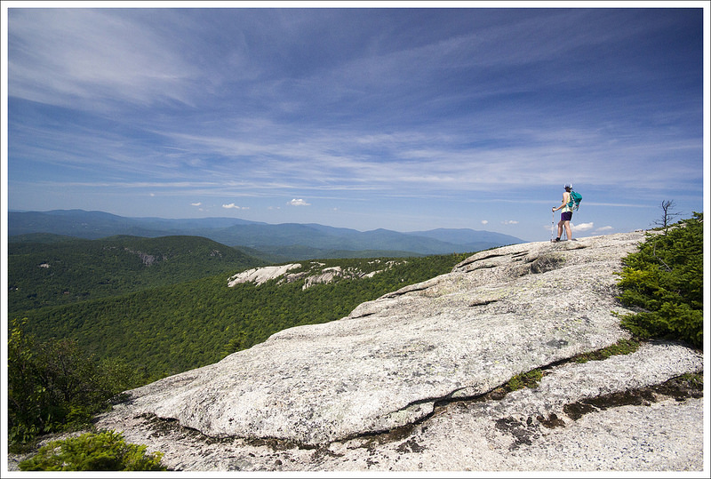
On a sunny summer day, we finally decided to give the hike a shot, and it turned out the hike was just about perfect. We hiked the loop counter-clockwise, reaching the Welch Ledges below the summit in less than an hour. The ledges are expansive, flat, and wide open. They provide a theater-like view of Mt. Tripyramid, the Sandwich Range, and the Mad River Valley.
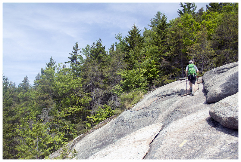
From the ledges, we climbed steeply uphill to the summit of Welch Mountain. From the ledges below, the climb to the summit looked like it would be steep, but it was easier than it looked. Most of the climb was over bare granite. We took lots of opportunities to look back and enjoy the views.
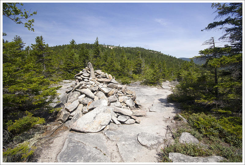
From the summit of Welch, we enjoyed a magnificent view Mt. Moosilauke, the Pemigewasset Valley, and the impressive cliffsides along Dickey Mountain. It looked like all of New Hampshire was rolling out beneath us. Reaching the summit of Dickey mountain required a steep climb down into a col between the two mountains. The low point was marked with a giant cairn.


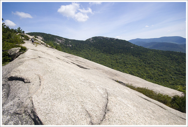
The climb up Dickey was a little steeper and required following yellow blazes and arrows carefully. At the top, we took a faint spur trail through the bushes to enjoy another spectacular view of Franconia Ridge. From there, we walked along the cliffsides we had seen from the summit of Welch Mountain. The view remained spectacular for much of the descent. Eventually, we dipped back into the forest for the remainder of the hike.
It was a great hike! It offered superb views for a reasonable amount of climbing. I would agree that it’s moderate and good for families – but only on a dry day. If the granite had been wet or icy, even these small peaks could be perilous.
Adam Says…
This hike is often recommended by people that we have talked to when exploring central New Hampshire and it is worth the hype. This may be one of my favorite below 4000 feet hikes in New Hampshire. If you can do this hike on a clear, dry day in late September, you will probably see fall foliage you will remember for a lifetime.
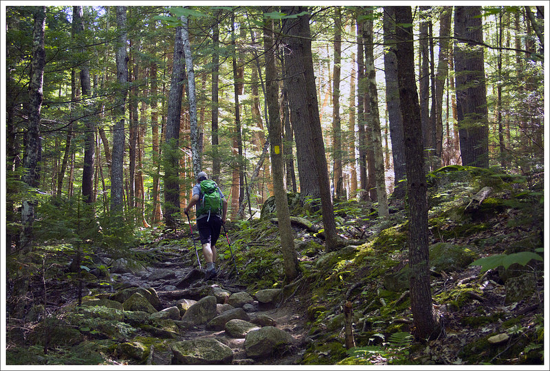
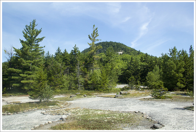
Just a few yards from the parking lot, the trail splits. The trail to the right is the one we chose, making a counter-clockwise loop of the Welch-Dickey trail, but you do have the option to do it the opposite direction. Both paths have a two mile climb to the summit of either Welch or Dickey Mountain and there is a half mile connector trail in between the two summits. The trail to the right started off with a rocky trail which is no surprise to us with all the hiking we have done in New England. The trail stays in the woods, climbing gradually through rocky steps until it opens up at about 1.4 miles to the Welch ledges. As you approach, you will see areas blocked off to protect the vegetation so stay on the actual trail. To the left, you will see the summit of Welch mountain looming above you but take some time to enjoy the dramatic views from the expansive open granite ledges. Many families will just go to this point and back for a beautiful hike fit for people of most ages/abilities. We spent quite a bit of time here thinking this could be the summit of Welch, but we were wrong.


Many of the blazes on Welch and Dickey are on open ledges, so look for yellow blazes painted on the rocks or small cairns to find your way. From the ledges, the trail takes a left, cuts into a wooded area before it climbs steeply and opens up into some of the largest rock faces we have hiked. The views are expansive all around you. The footing was fine, but we imagined this would feel very slick and dangerous after a recent rainstorm. It was hard take a few steps and not turn around and see the scenery behind you; the pictures we have don’t do the magnificence of the panoramic views proper justice. At 2.0 miles, we reached the 2605 foot summit crown of Welch Mountain. You will have gorgeous views of Waterville Valley below you.


The connector trail continues further and descends down the steep rock face of Welch on ledges that serve as steps. You will really want to secure your footing here as you are lowering your body down a steep section with nothing to grab onto in front of you. Take your time and lower yourself on all fours if that helps. The trail reaches bottom and then climbs back up as you approach Dickey Mountain. You will reach the 2734 foot summit at 2.5 miles and will be treated with views of Franconia Notch. Continue along the trail to complete the loop. Your hike down from Dickey is dramatic as you will be walking on the top of what feels like a bowl below you which gives you dramatic views. At about 3.2 miles, the trail finally goes back into the woods and you continue your descent along some rocky footing which eventually leads you back into more pleasant footing in the flatter woods. You reach your initial junction and the parking lot at 4.5 miles.


If you are planning to do this hike, account for some extra time. The views of this area will make you take your time to enjoy them and some of the climbing is tougher. While it was only 4.5 miles, it took us longer than normal just from the pure enjoyment of being here. This is a New England classic for a reason. The Presidential range in the White Mountains will always have a special place in my heart when I think of hiking in New Hampshire, but this will go down as one of my favorites in the state.


Trail Notes
- Distance – 4.5 miles
(Check out the stats from Map My Hike)*
- Elevation Change – 1650 ft
- Difficulty – 3. By New England standards, this is a solidly moderate hike. In Virginia, it would probably rate a 4.
- Trail Conditions – 4. The trail is expertly maintained, but the nature of New Hampshire terrain (rocks, roots, slick granite) will challenge anyone used to dirt trails.
- Views – 5. Amazing, spectacular, and panoramic (in multiple places)
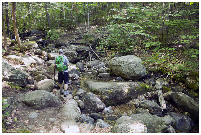
- Waterfalls/streams – 1. There is a stream, but it was nearly dry when we visited.
- Wildlife – 2. Lots of red squirrels and birds.
- Ease to Navigate – 4. The main loop is well-blazed and easy to follow. The spur to the view of Franconia Ridge is the only tricky part. It’s unblazed.
- Solitude – 1. This is an extremely popular trail. Expect to see many other hikers. We hiked early on a weekday, and still saw quite a few people.
Download a trail map (PDF)
Directions to trailhead: Parking coordinates: 43.904207, -71.588824. A parking permit is required for White Mountain National Forest hikes and you can purchase a permit at a green box in the lot (as of 2016 was $3 per day).
* MapMyHike is not necessarily accurate, as the GPS signal fades in and out – but it still provides some fun and interesting information.

Thanks! $5 now but still very easy. This was a great but hot hike. The Eddy day use area nearby provides swimming access in the mad river which was a perfect way to end the hot sticky day.
LikeLike
Please disregard the question I left earlier. You have the information I need clearly stated above. I failed to read.
LikeLike
We are planning this hike for next week. Do you know the parking rules/ regulations? We will only be in the area one day so self pay in the parking lot is fine but I do not want to have to drive around to obtain a pass at another location. Thanks!
LikeLike
We self-paid right there at the lot when we hiked. It was just a few bucks.
LikeLike