This 7.25 mile hike is a great choice for anyone who wants to experience Three Ridges’ spectacular views without having to complete the challenging 13+ mile loop. The route climbs moderately along the Appalachian Trail until you reach Hanging Rock – the best vista on Three Ridges mountain.
View the Full Album of Photos From This Hike
Christine Says…
Last fall, I went on a girls’ backpacking trip from Cole Mountain to Waynesboro. Near the end of the trip, we hiked up and over Three Ridges. While we were eating lunch and enjoying views on Hanging Rock, I thought ‘This spot is gorgeous and it would be a fantastic dayhike.‘
Many casual hikers take a pass on Three Ridges because the 13+ mile hike with more than 4,000 feet of climbing can be intimidating. The full traverse of the Three Ridges – MauHar loop has the deserved reputation for being one of the toughest hikes in the state. But 7.25 miles with under 2,000 feet of climbing – that’s right in the dayhike sweet spot.
In early June, I had a Saturday with absolutely zero obligations. Adam decided to stay home and work on some chores and projects around the house. I set out to hike from Reeds Gap to Hanging Rock. I was at the trailhead by 8:00 a.m. in hopes of beating the heat, humidity, and weekend backpacking crowds.
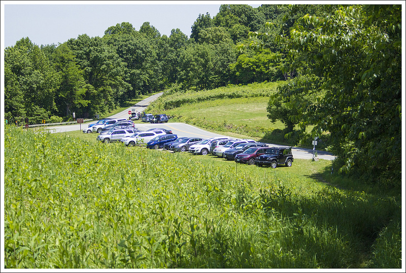
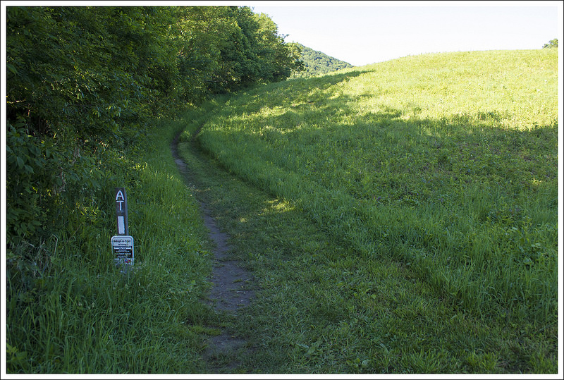
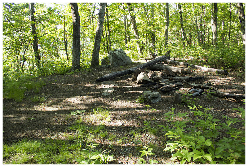
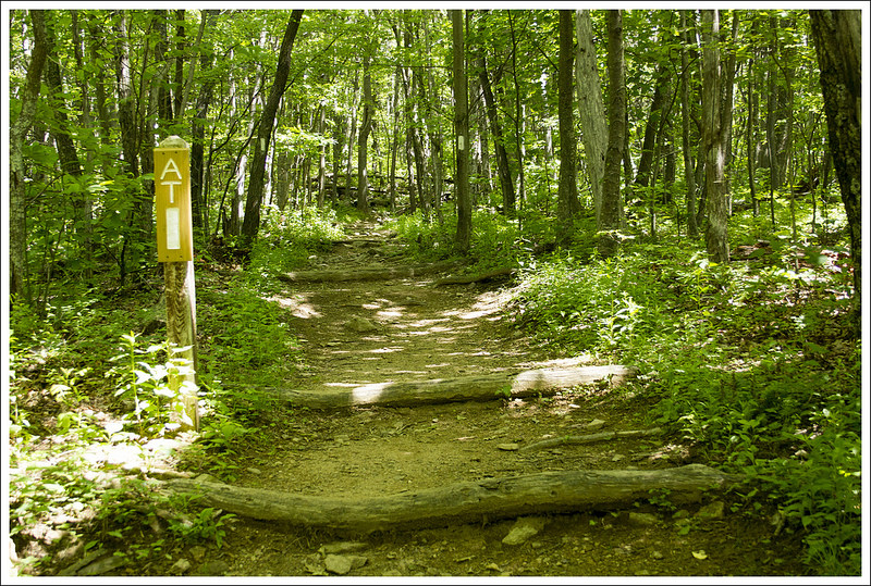
When I arrived, there were still a few spots in the Reeds Gap parking area. The lot fills quickly – especially on weekends. I started southbound on the Appalachian Trail, climbing gradually uphill across the edge of an open meadow. Wild hibiscus was blooming and butterflies were everywhere. When the trail first enters the woods, it’s flat and comprised of soft dirt. But within a couple tenths of a mile, the trail begins to ascend steadily up Meadow Mountain. Along the ridge of Meadow Mountain there are a couple small, dry campsites.
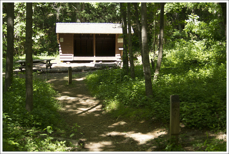
After a short ridge walk, the trail descends Meadow Mountain. At 1.6 miles, I reached a three way junction. The Appalachian Trail continues straight. To the right are a fire road leading back to the Blue Ridge Parkway and a spur trail leading to Maupin Field Shelter and the MauHar Trail. This area is well-marked with trail signs, blazes, and a kiosk describing the wilderness area. I decided to pass the shelter and continue on to Hanging Rock.

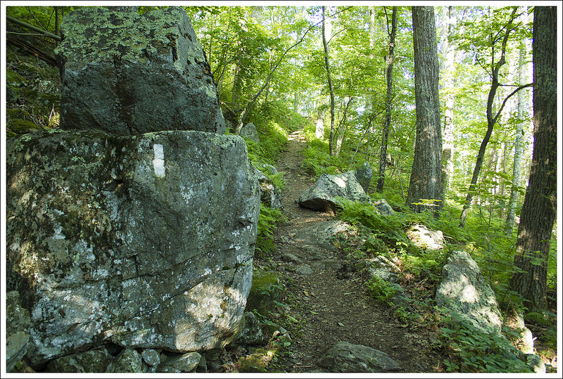
After passing the junction, the trail climbed steeply, but briefly, to the top of Bee Mountain at 2.2 miles. The trail becomes rockier along this stretch and remains so until the viewpoint. Along the top of Bee, there are several more dry campsites. After a short ridge walk, the trail descends Bee Mountain for .2 miles into a small saddle. This is where the climb up Three Ridges Mountain begins.
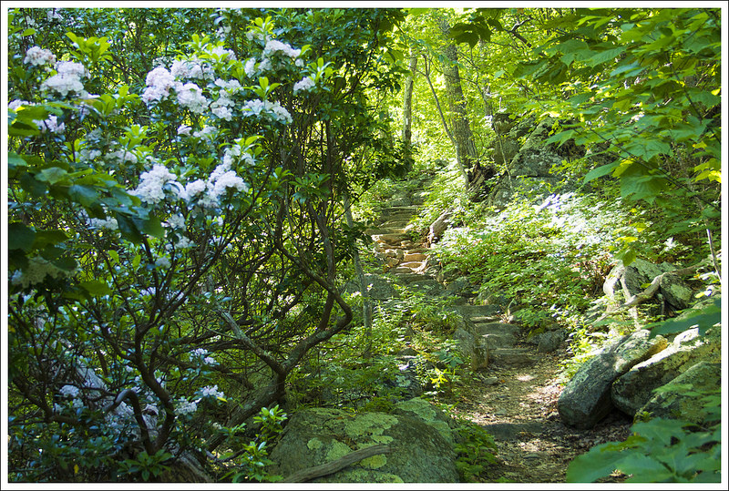
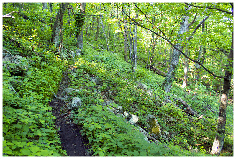
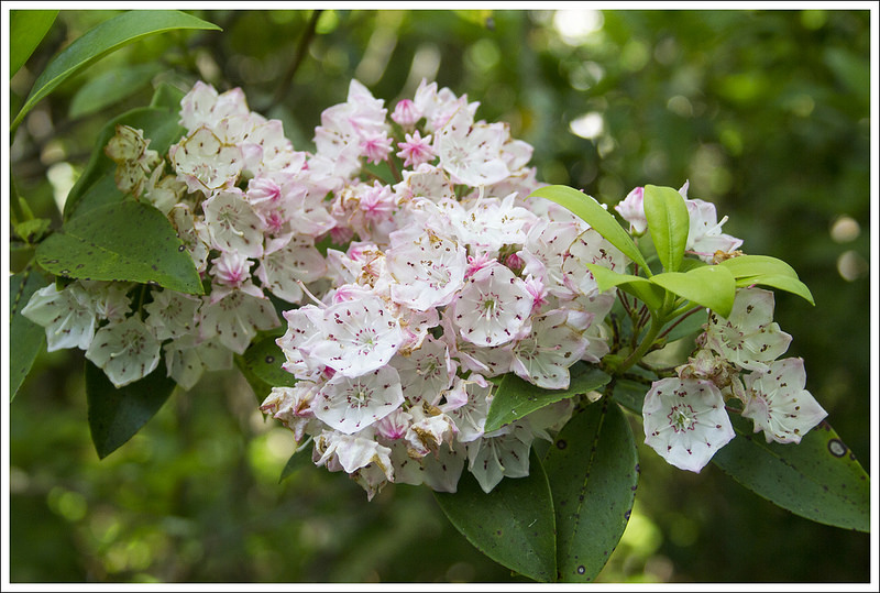
The climb continues gradually for 1.2 miles. I thought this stretch of trail was so beautiful. It was a classic example of why the Appalachian Trail is nicknamed ‘the green tunnel‘. There were lush ferns, blooming mountain laurel, thick trees, and green vines. The forest floor was carpeted with the bright purple petals from Catawba rhododendron.
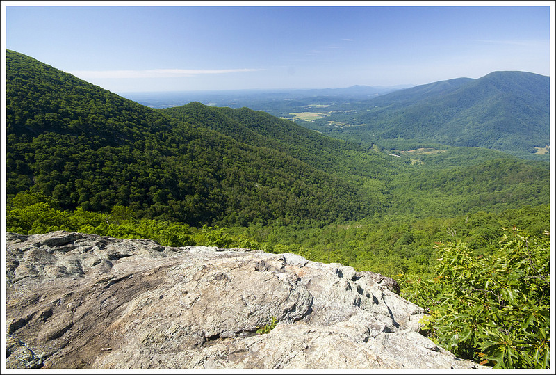
At 3.6 miles I reached the viewpoint at Hanging Rock. The view is on the right side of the trail and is accessed by following a small path through an opening in the trees. The actual high point of Three Ridges Mountain is another .8 mile south, but Hanging Rock is a perfect stopping point.
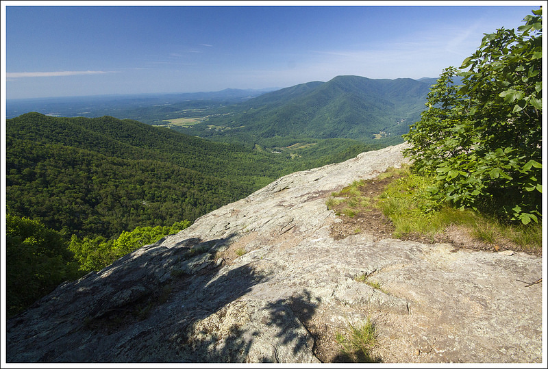
The outcropping at Hanging Rock is wide and spacious. The views include the southern slopes of Three Ridges, the Tye River Valley, and the Priest. The Priest is the large mountain on the other side of the valley. Even though this is a popular area, I magically had the viewpoint all to myself for almost forty minutes. Just as I was stowing my camera and getting ready to leave, northbound thruhiker Tengo Hambre arrived at the view. He didn’t have a camera and his phone was dead. I ended up taking a photo of him and emailing it to his wife. He agreed that the vista was breathtaking and worth remembering with a photo.
I hiked back the same way I came up. I stopped a while to chat with the Tidewater Appalachian Trail Club member who was doing trail maintenance. Because Three Ridges is designated wilderness, he has to use hand tools (gas-operated weed whackers are not allowed in wilderness!) I also stopped briefly at Maupin Field Shelter on my way back. I like to stop and pack out any trash I find. When I reached the parking lot, it was overflowing with cars and the day was sweltering. I had timed my walk perfectly and had a great day!
Trail Notes
- Distance – 7.25 miles roundtrip
(Check out the stats from Map My Hike)* - Elevation Change – 1942 ft.
- Difficulty – 3.5. This is a moderate hike with several climbs and descents.
- Trail Conditions – 3.5. The trail is well maintained, but it is rather rocky.
- Views – 5. Hanging Rock offers superb views of the southern slope of Three Ridges and a great look at The Priest across the valley.
- Streams/Waterfalls – 1. There are no scenic water features on this hike. But there is a water source at Maupin Field shelter.
- Wildlife – 1. The trail is heavily traveled, so you probably won’t see much wildlife.
- Ease to Navigate – 5. The trail is heavily blazed and signed.
- Solitude – 2. Three Ridges is one of the state’s most popular backpacking loops. It’s likely you’ll see many people along the way.
* MapMyHike is not necessarily accurate, as the GPS signal fades in and out – but it still provides some fun and interesting information.
Download a Trail Map (PDF)
Directions to trailhead: Located along the Blue Ridge Parkway. Park at Reeds Gap. Coordinates: 37.901451, -78.985310

Thanks for the info on this hike. Wondering how long it took you and maybe I will add an hour or two for my pace 😉
LikeLike
It took three hours, and that included a 20 minute break to enjoy the view. It’s a gorgeous hike!
LikeLike
looks amazing!!
LikeLike
Thank you for your wonderful website! I am looking for a moderate hike near Natural Chimneys campground for a group of teenage girls and your website has been so helpful! I can’t wait to do some of these hikes on my own (without 12 teenage girls :/)
LikeLike
Thanks for the visit, Hillary! Did you find a hike near Natural Chimneys?
LikeLike