This easy 5.1 mile hike takes you to the magnificent viewpoint at Blackrock Summit. Most people access the view by a .5 mile walk from Blackrock parking area, but this route lets you spend a little more time enjoying the beautiful Appalachian Trail.
View the Full Album of Photos From This Hike
Christine Says…
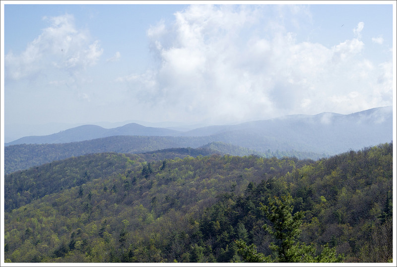
Most of the time, we opt to hike the shortest and most direct route to any nice viewpoint. However, in the case of Blackrock Summit, the traditional one-mile round trip route from the Blackrock parking area is not enough of a hike to make the drive into the park worthwhile. Without a doubt, Blackrock is one of the most expansive views in the park, and starting the hike at Brown Gap (a couple miles north) is one of the best ways to reach the vista!
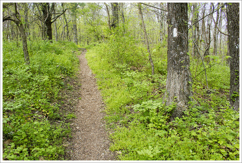
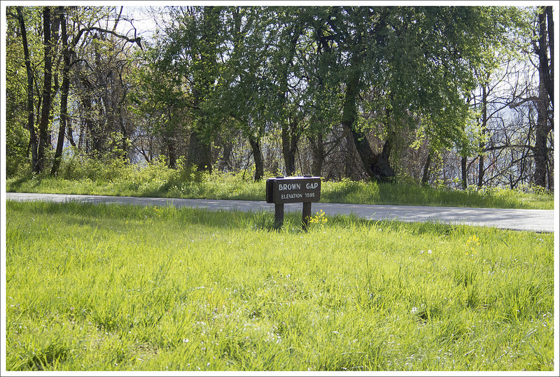
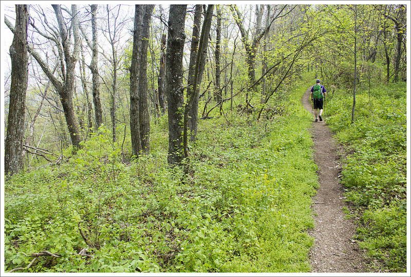
We set out on this hike on a particularly hot and humid late April morning. We parked at Brown Gap (near mile marker 83 on Skyline Drive). From there, we crossed the road and followed the Appalachian Trail south. The first three tenths of a mile ascend gently uphill before reaching a mostly flat ridgeline. Everything in the park was bright, spring green and the native pink azaleas were just starting to bloom. At .7 miles, we passed the Dundo Group Campground. The campground has water and restrooms (seasonally).
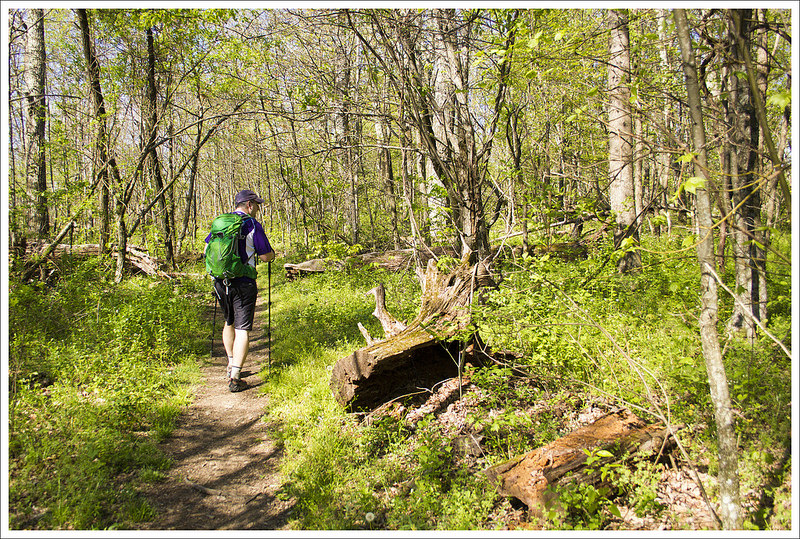
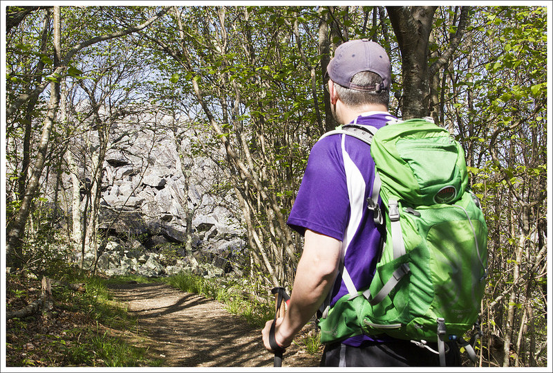
At 1.3 miles, we passed the parking area for Jones Run. Another tenth of a mile after that, we crossed Skyline Drive a second time, and began a gradual uphill climb toward Blackrock Summit. In April, the trees along this stretch of trail had not fully leafed out, so we were able to catch views of the valley to the west. At 1.9 miles into the hike, we passed Blackrock Parking area. After the parking area, the trail becomes a moderately steep uphill climb for .6 of a mile.
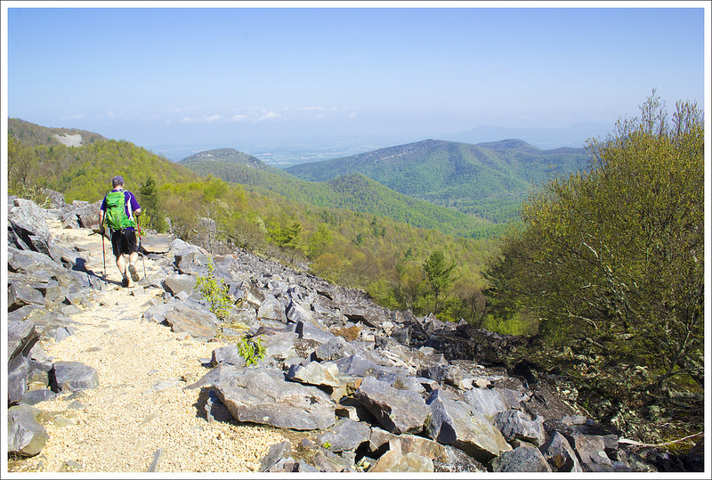
Near the top, the giant boulder pile comes into view through a tunnel of leaves. It’s impressive to see such a tall jumble of rocks! We took some time to climb up the pile for a loftier view. Even if you choose to skip the climb, the views from this summit are spectacular. The Appalachian Trail skirts the western edge of the summit. At the far end of the rock pile, we reached the spur to the Trayfoot trail. If you want even more views and a chance to explore some interesting rock formations, follow the spur downhill for a couple tenths of a mile. There are views in every direction and an interesting alley of boulders to pass through.
Once you’ve explored, head back the way you came for a hike of just over five miles. It’s really a great way to see this popular summit!
Adam Says…
On a clear day like we had, you just have to pick a hike with views. While we have done Blackrock many times, we decided to try a different approach that added a few miles and made it feel like we did something to earn the views. With very little elevation gain on this hike, it is an easy hike that most people could handle. This section of the AT is very well-maintained and traveled. We enjoyed walking through the tunnel of trees with just a small brown path dividing all the green around us.
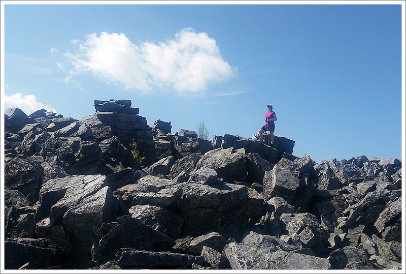
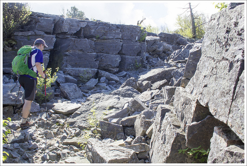
Christine did a great job describing the path and turns above. We didn’t really see anyone on the trail since we started the trail fairly early in the morning. When we arrived at the summit, we had it all to ourselves. The summit gives you the opportunity to climb around on the large pile of boulders if you prefer (but watch out for timber rattlesnakes) or you can enjoy taking a moment to enjoy the views from down below. Our favorite spot is to travel down the Trayfoot trail because you get panoramic views on both sides of the trail. We paused for a quick snack before heading back. On our way back, we saw several others that had parked at the closest parking lot, but we were glad we had added a few extra miles. If you have a clear day in the forecast and are looking for an easy hike with a big payoff in the southern section of Shenandoah National Park, put this on your list.
Trail Notes
- Distance – 5.1 miles roundtrip
(Check out the stats from Map My Hike)* - Elevation Change – 636 ft.
- Difficulty – 1.5. This was an easy hike with gentle climbs and descents.
- Trail Conditions – 4. The trail is smooth and well-maintained.
- Views – 5. Blackrock Summit is one of the nicest views in the park.
- Streams/Waterfalls – 0. There are no scenic water features on this hike. But there is an in-season source of drinking water at Dundo Group Camping.
- Wildlife – 3. We saw lots of birds, squirrels, and chipmunks along the walk.
- Ease to Navigate – 4. The trail is well marked and easy to follow.
- Solitude – 2. Blackrock is a popular viewpoint and can be accessed by a short .5 mile walk. You’ll likely see others.
* MapMyHike is not necessarily accurate, as the GPS signal fades in and out – but it still provides some fun and interesting information.
Download a Trail Map (PDF)
Directions to trailhead: Located in Shenandoah National Park (fees apply). The Brown Gap Parking lot is located around Mile Marker 83 in the Southern Section on Skyline Drive. Park in this lot. Cross the road and come to the cement marker marking the trail. Head south on the Appalachian Trail. GPS Coordinates: 38.240676, -78.710687

Hi Christine. We discovered your site as we were exploring information about Mt. Rogers. We were there a couple weeks back and in preparing our wordpress post we found you. It is going to be enjoyable following you and seeing the world through your eyes and words.
LikeLike
Thanks for the visit!
LikeLiked by 1 person
You are welcome. You have a great site and we enjoyed your post about Mt. Rogers.
LikeLike